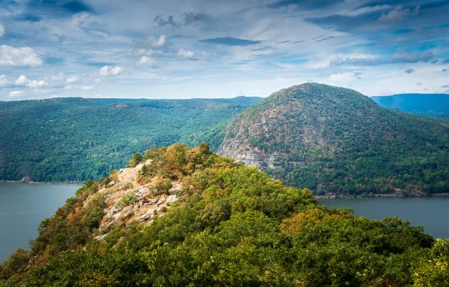
Breakneck Ridge is an incredibly popular hike so don't expect to get the trail to yourself. The steep rock scramble ascent will get your heart pumping quickly and you'll be rewarded with great views of the Hudson River. It's about a 3 mile loop, but all the action is in the first mile.
Breakneck Ridge is an incredibly popular hike so don't expect to get the trail to yourself. The steep rock scramble ascent will get your heart pumping quickly and you'll be rewarded with great views of the Hudson River. It's about a 3 mile loop, but all the action is in the first mile.
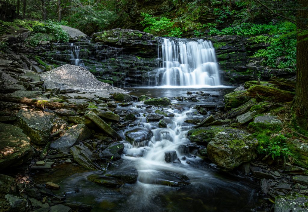
Ricketts Glen is a waterfall wonderland. This is a great loop hike with a huge reward/effort ratio which passes 21 named waterfalls over 4.5 miles of the Falls Trail network.
The Spizzle Creek Trail is an easy, flat trail with views of the Barnegat Bay and a bird observation blind making it a great place to spot osprey and wading birds attracted to this rich ecosystem.
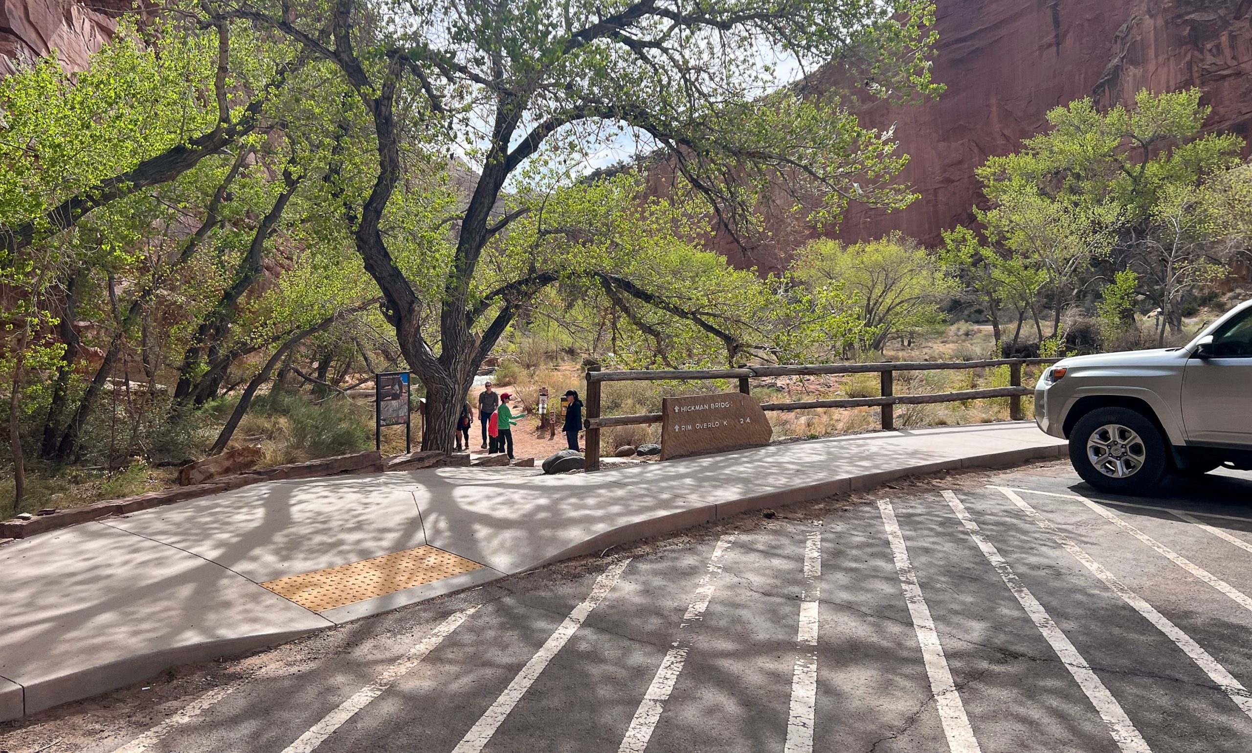
This popular and kid-friendly scenic hike passes under the 133-foot span of the impressive Hickman Natural Bridge, features views of Capitol Dome, Navajo Dome, and the Fremont Valley, and is an opportunity to experience and learn about the natural and cultural history of Capitol Reef National Park.
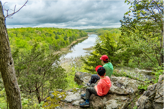
This out-and-back hike in Harriman State Park provides some great views and can be done as a day hike or a relatively easy and kid-friendly overnight backpacking trip.
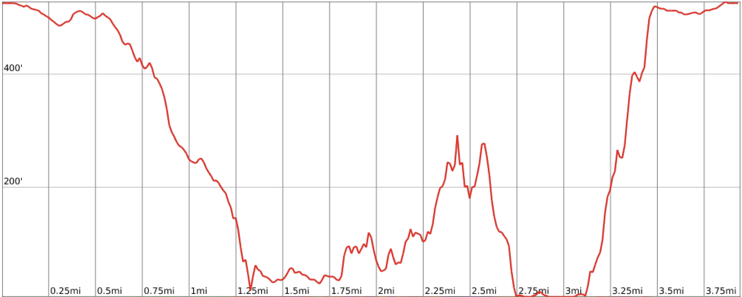
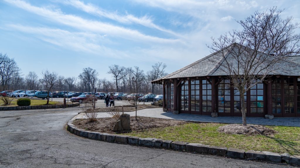
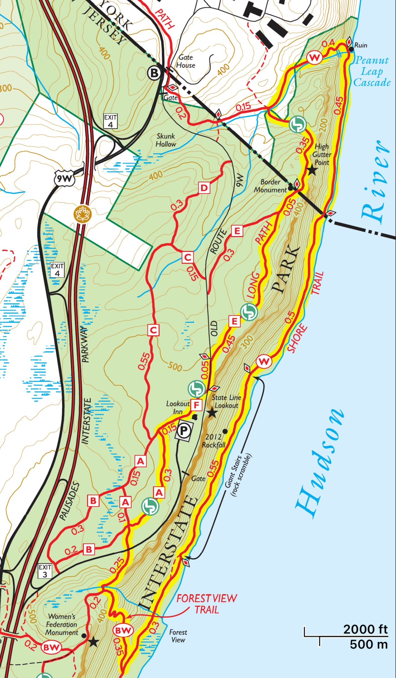
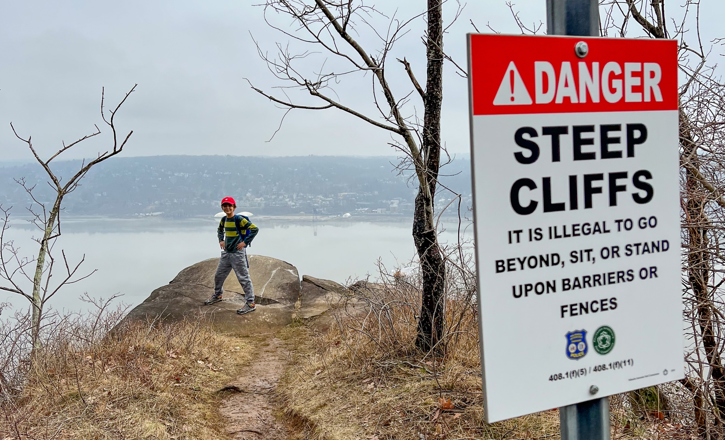
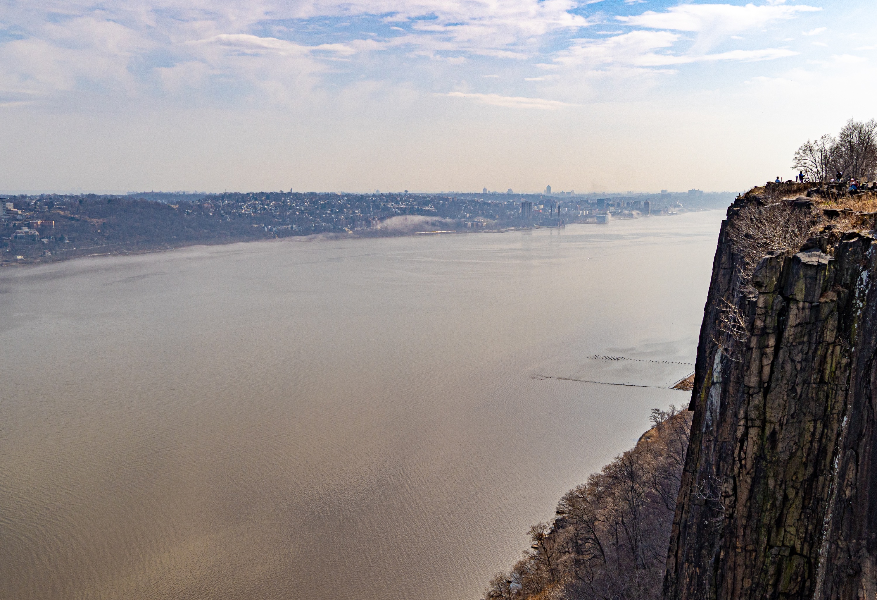
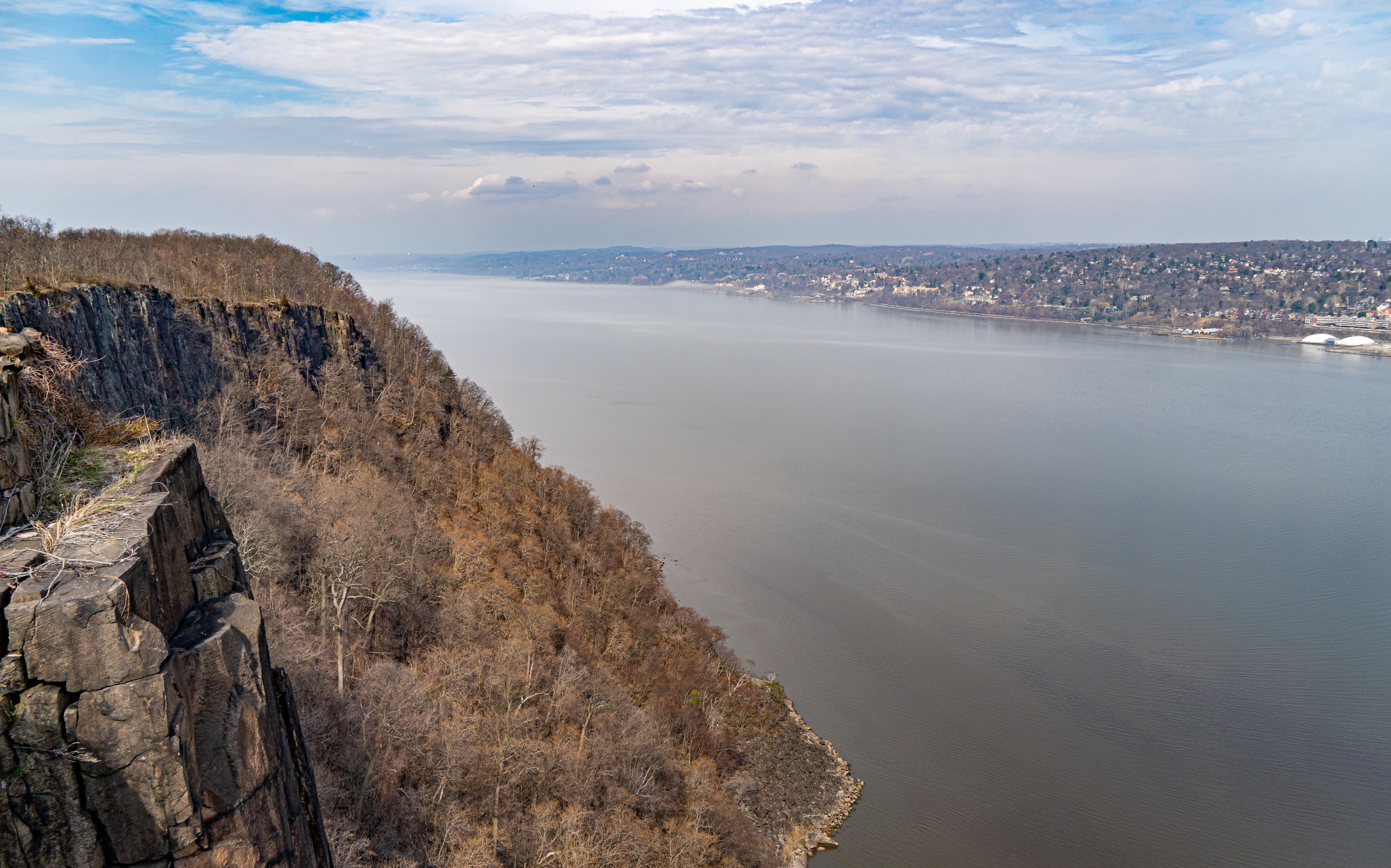
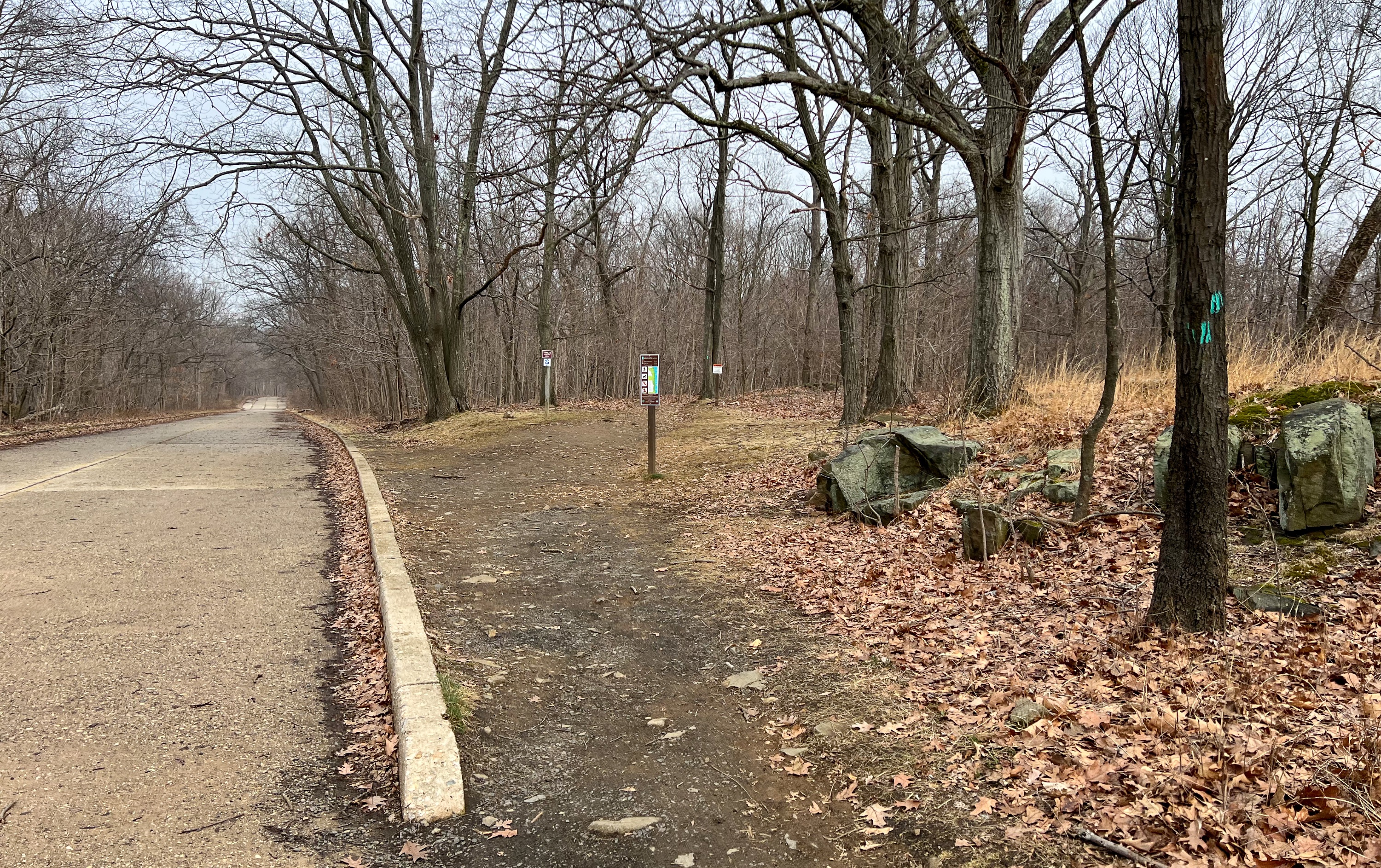
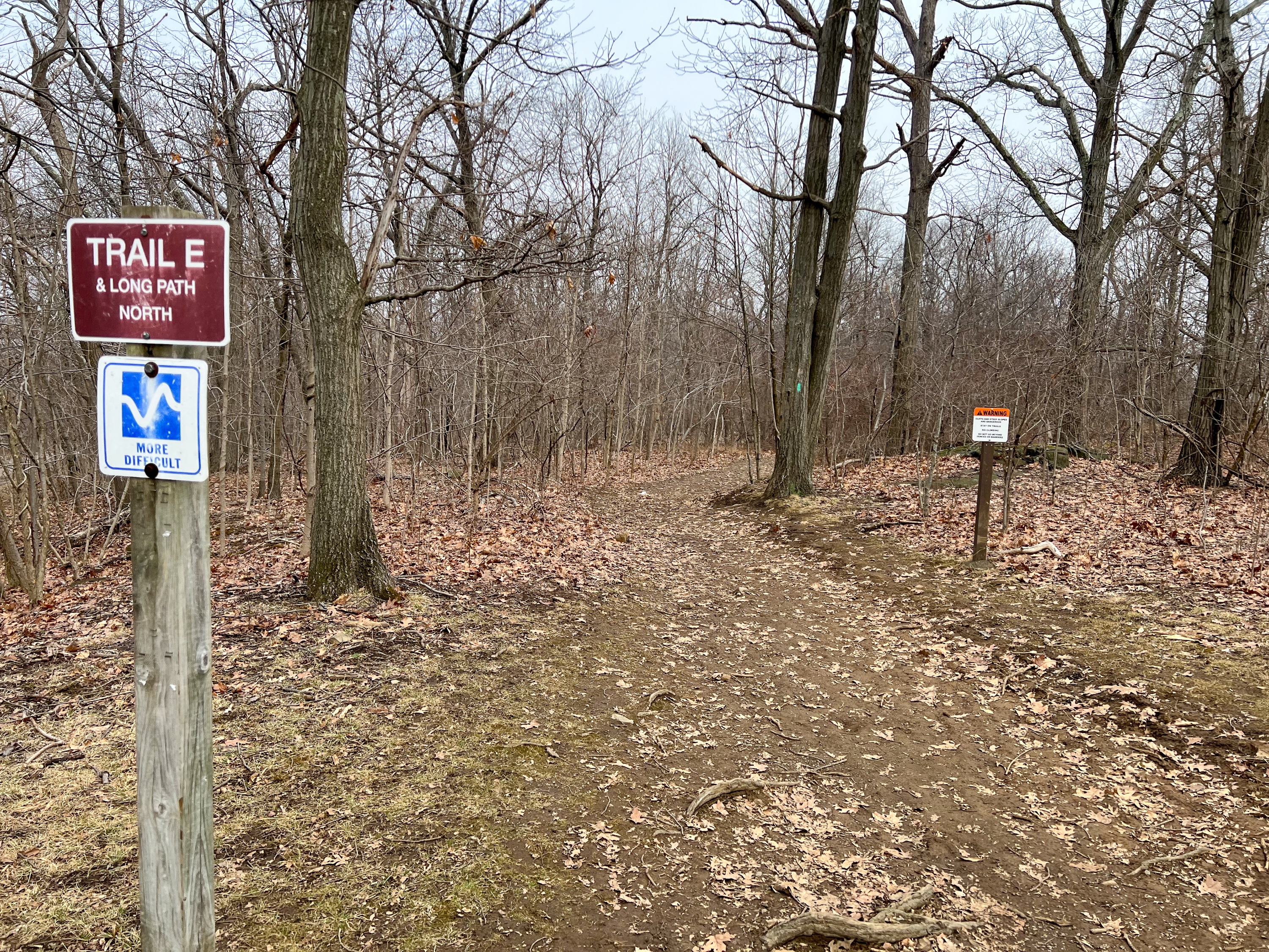
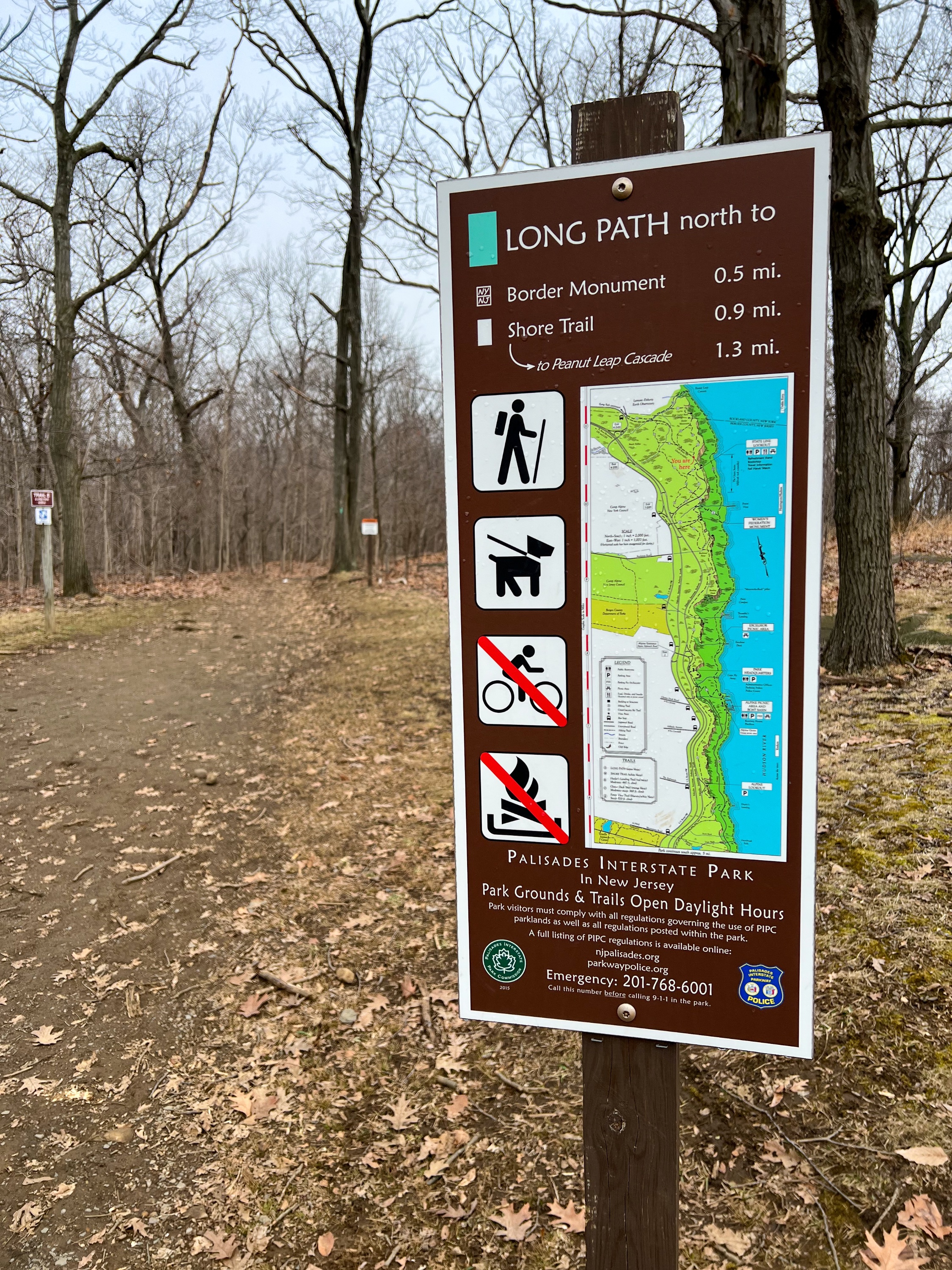
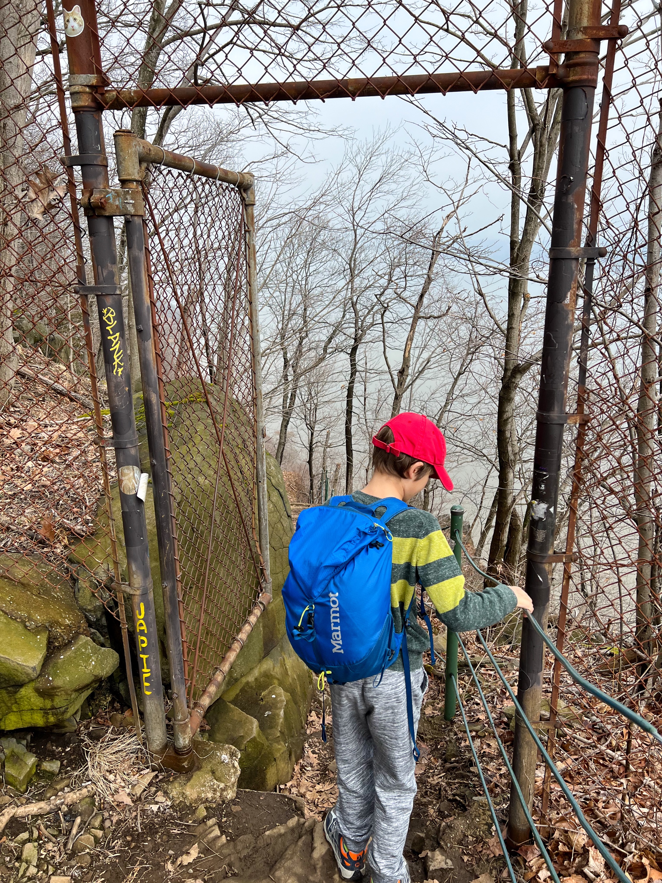
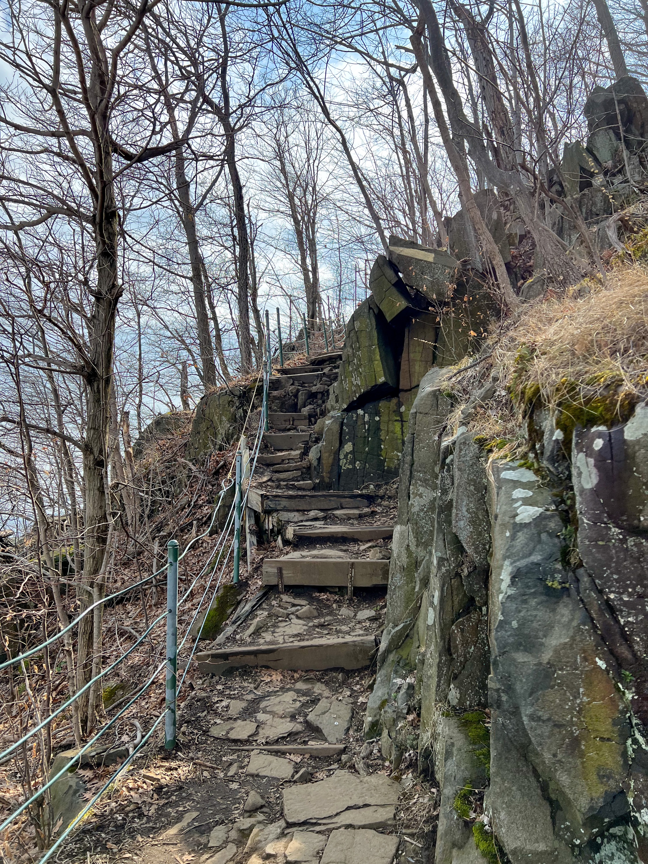
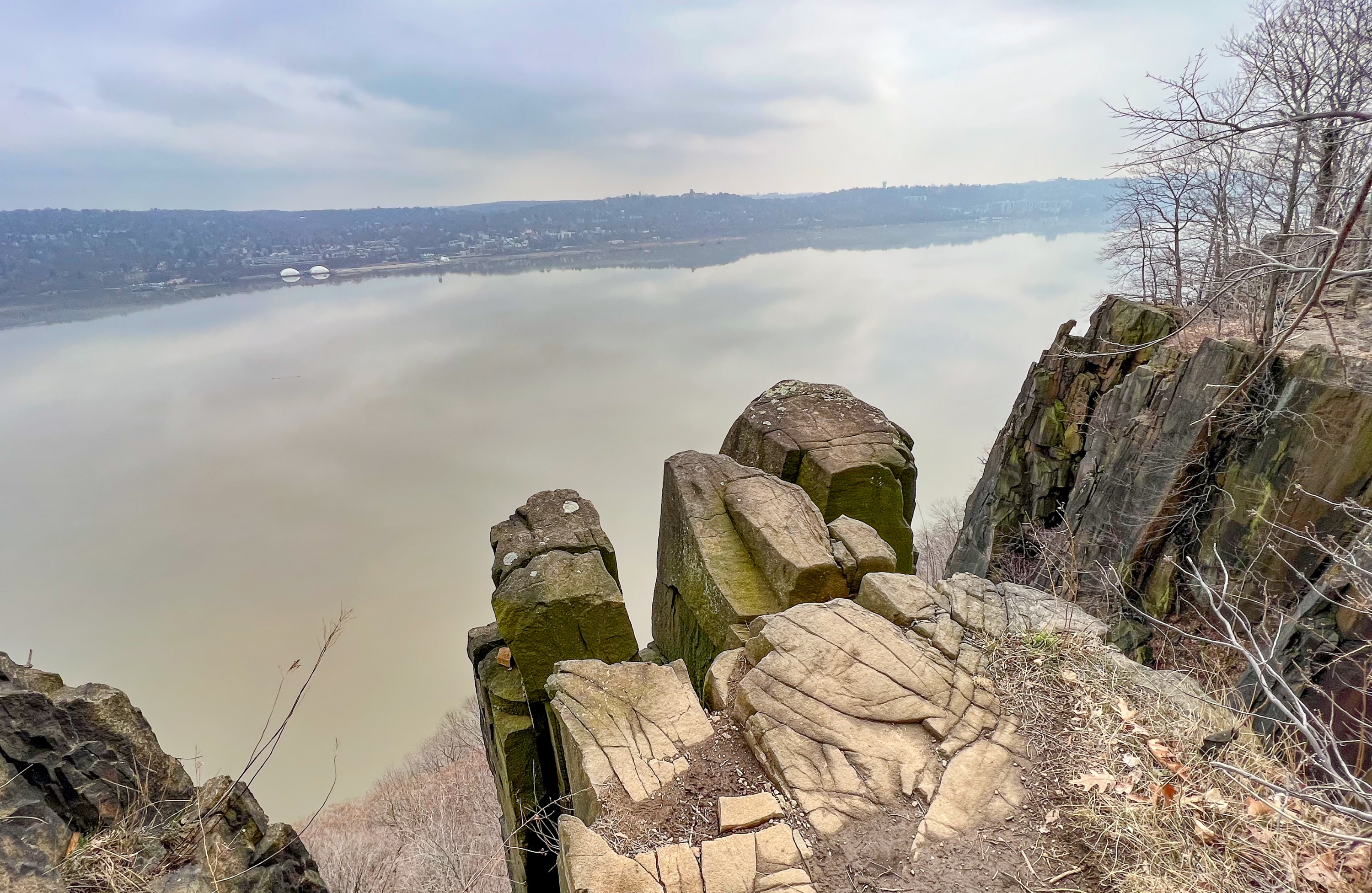
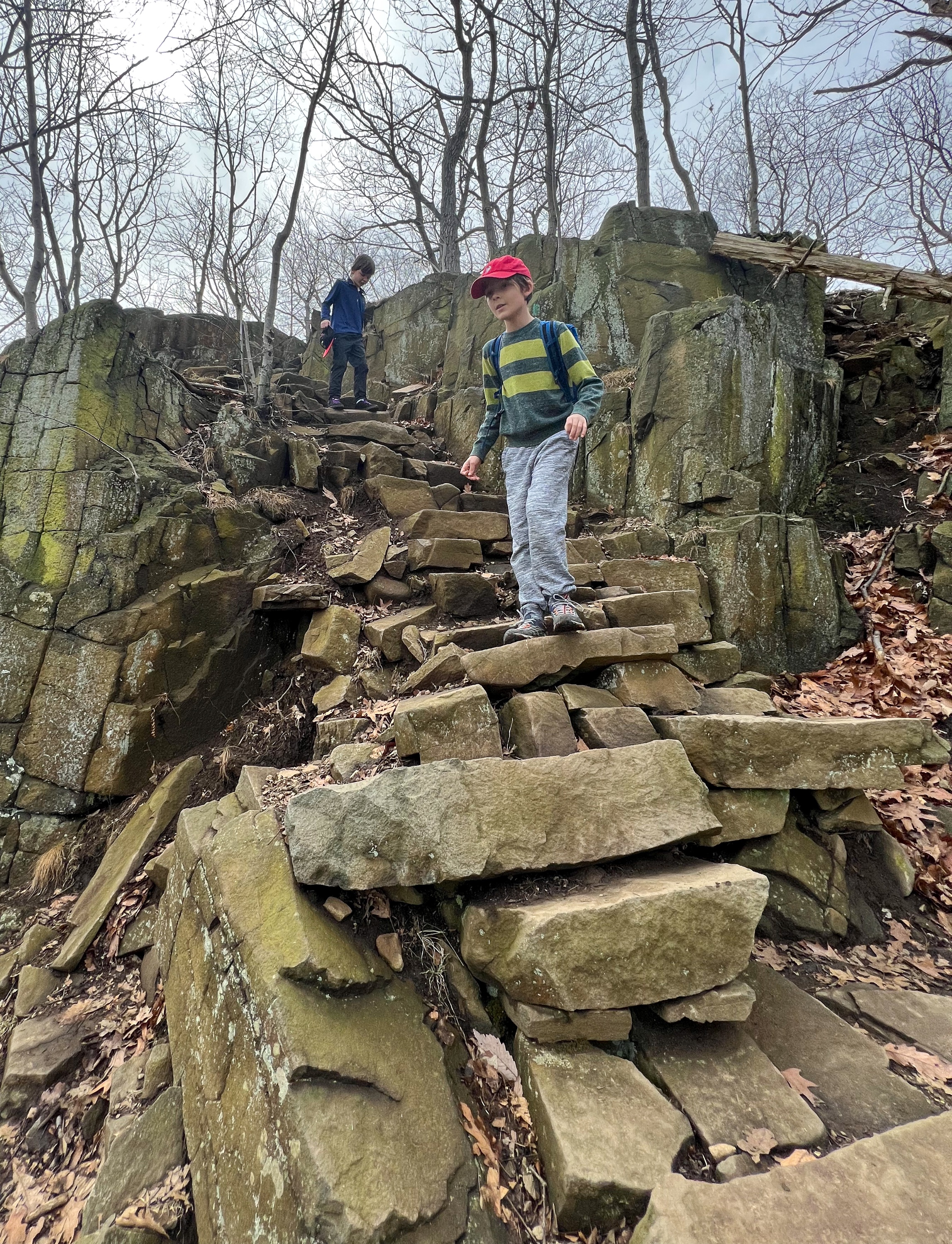
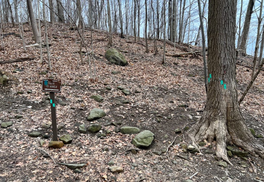
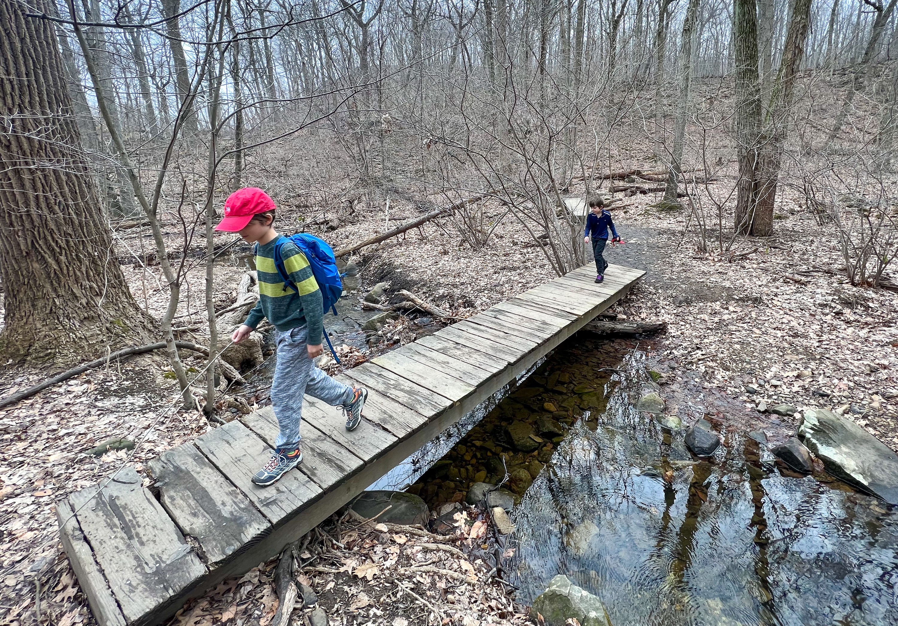
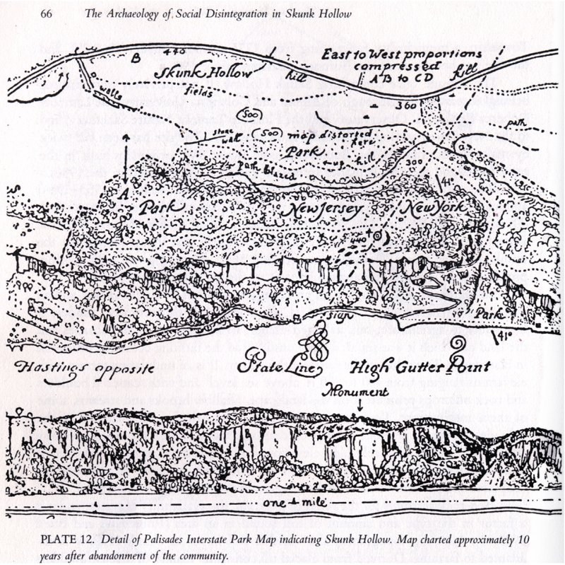
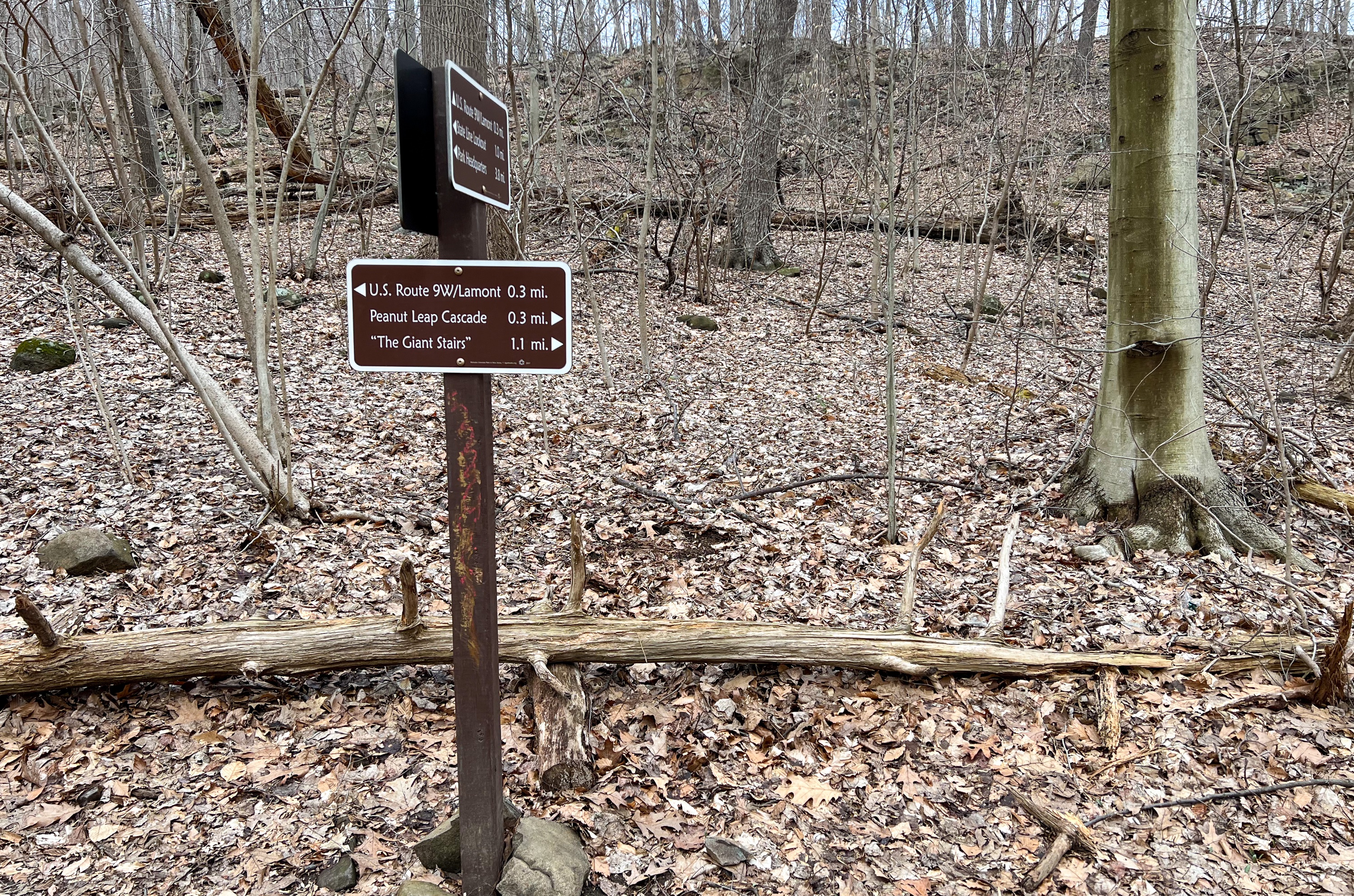
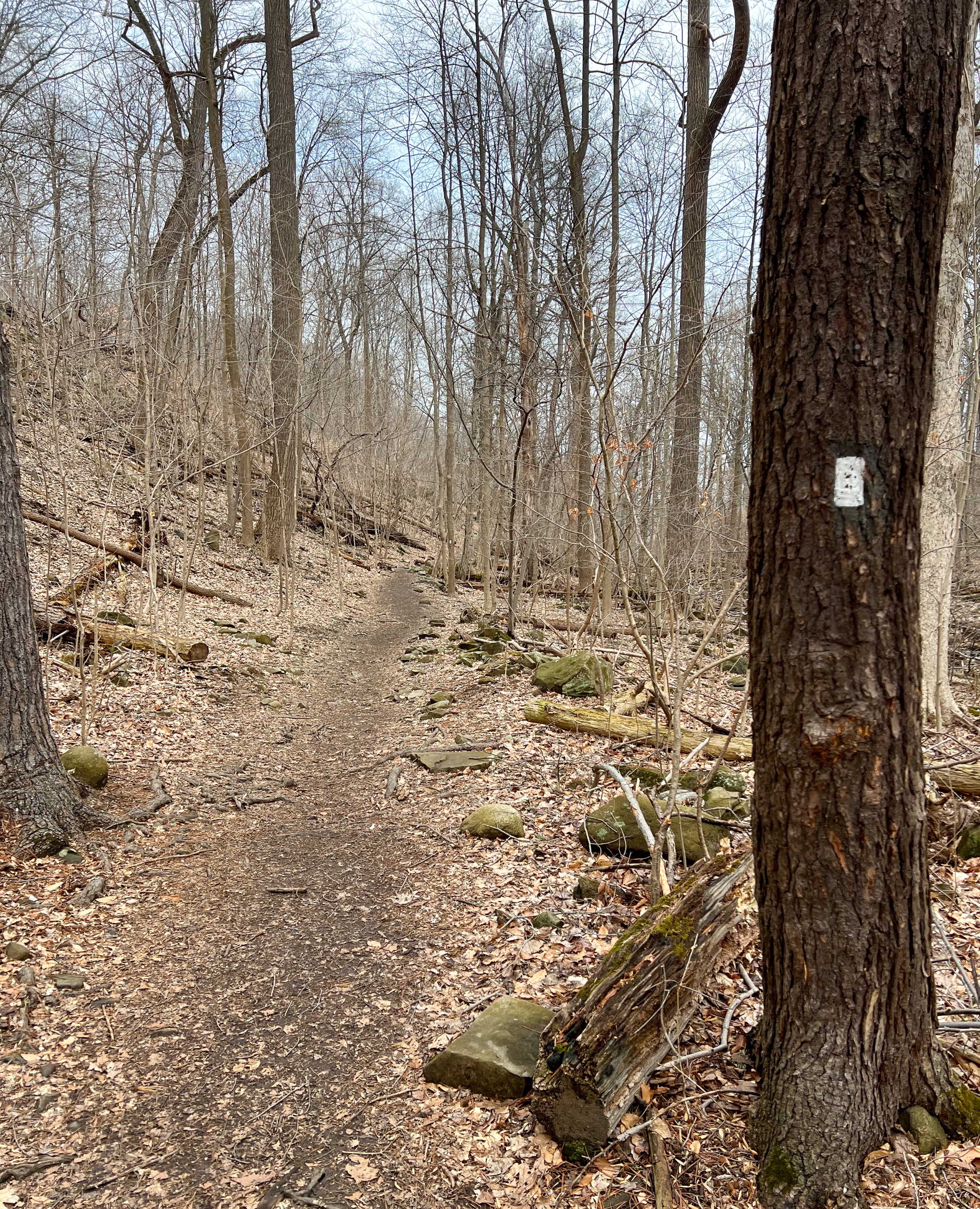
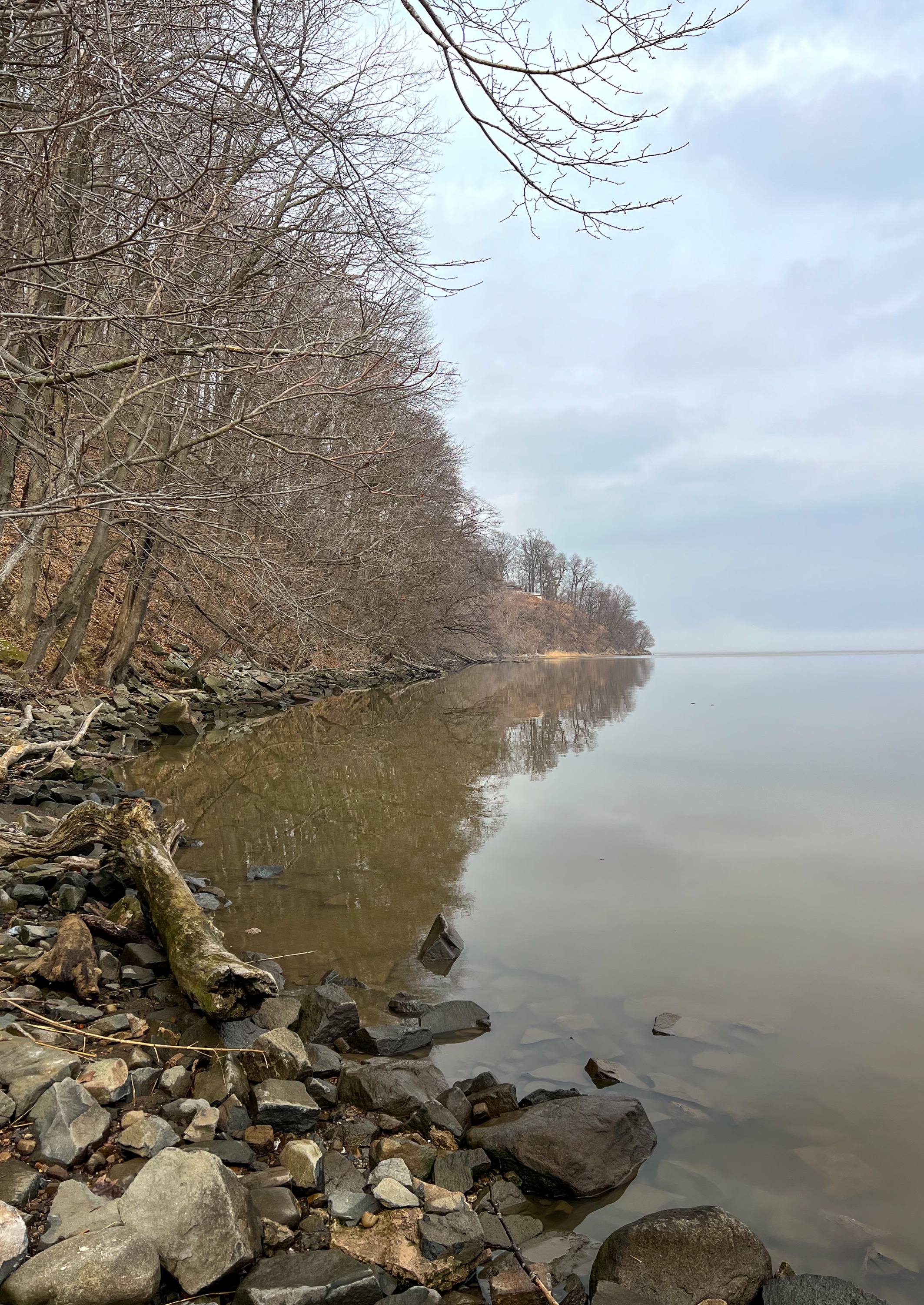
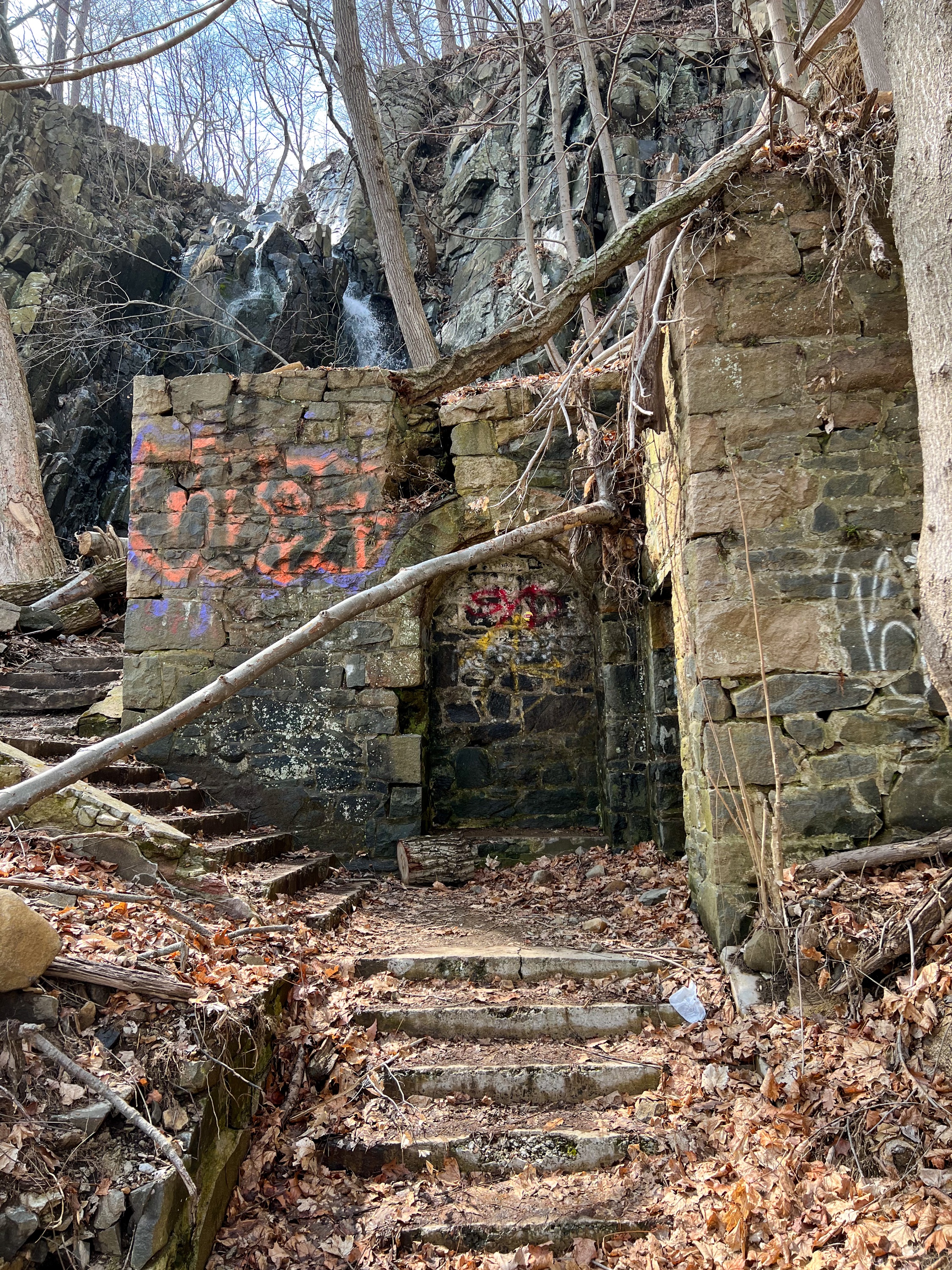
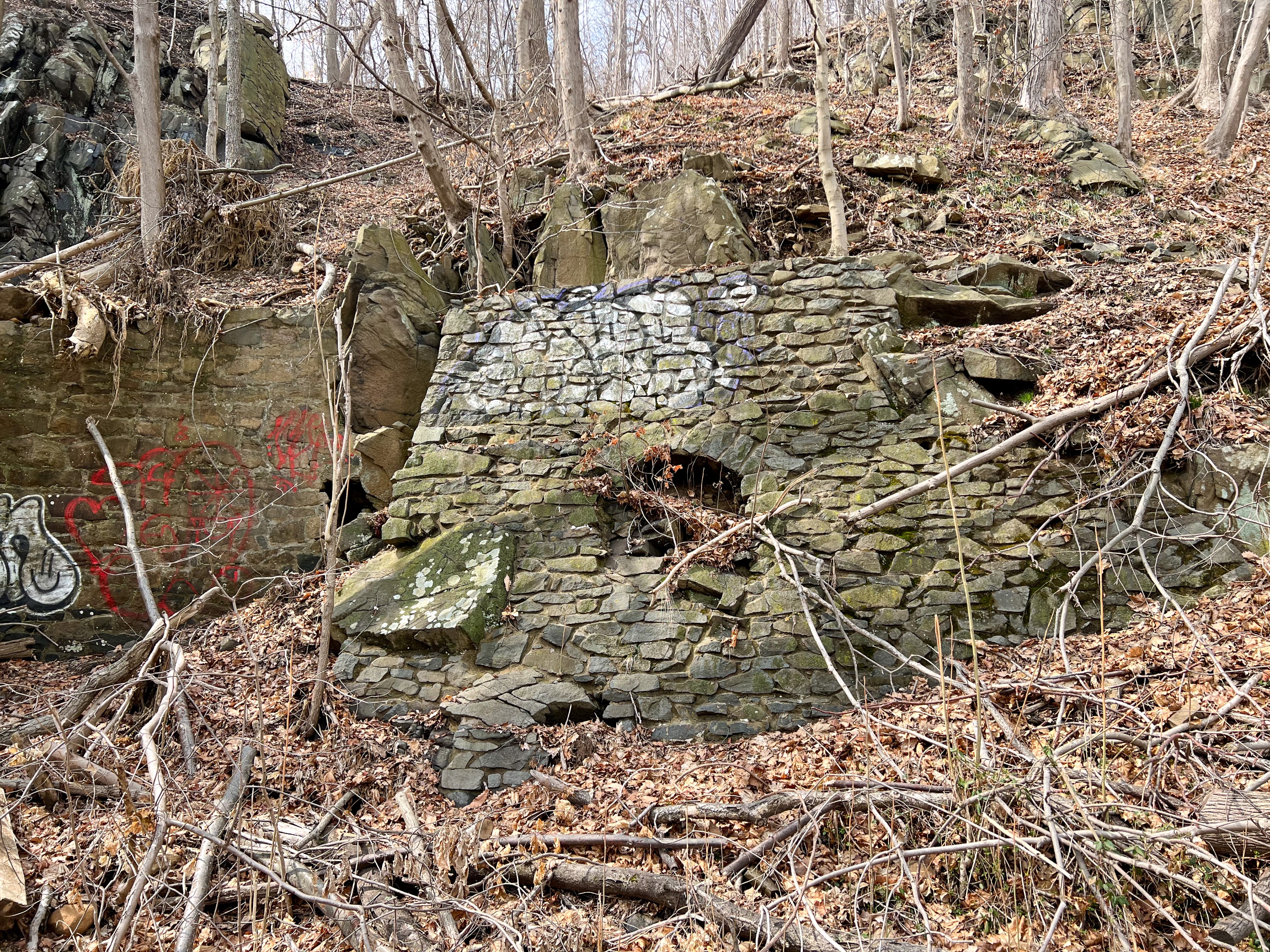
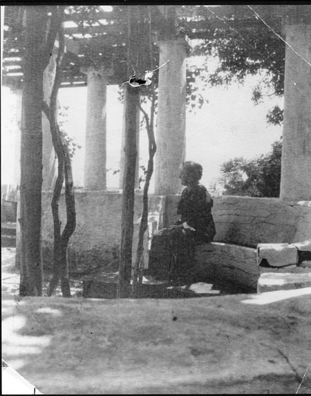
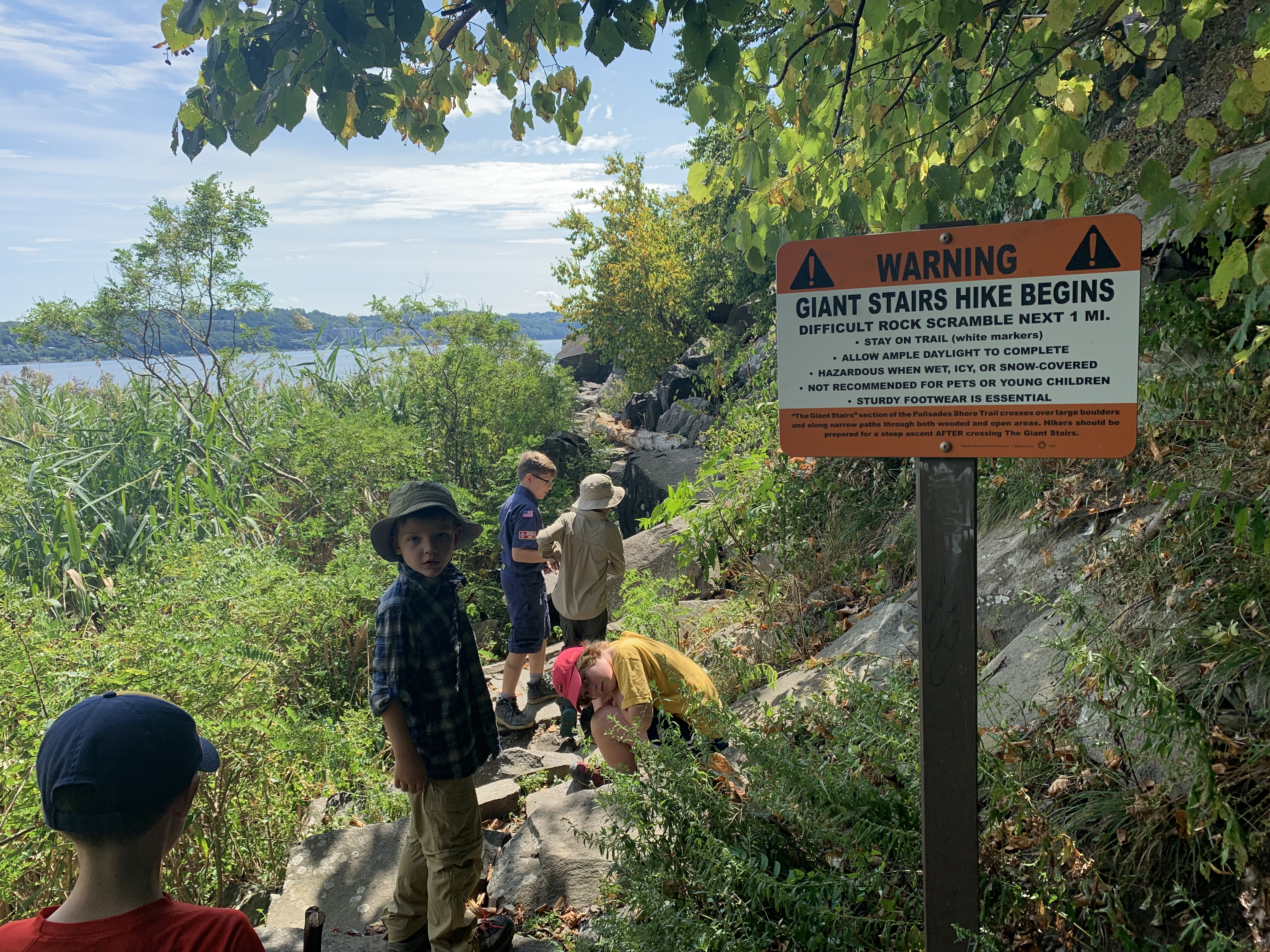
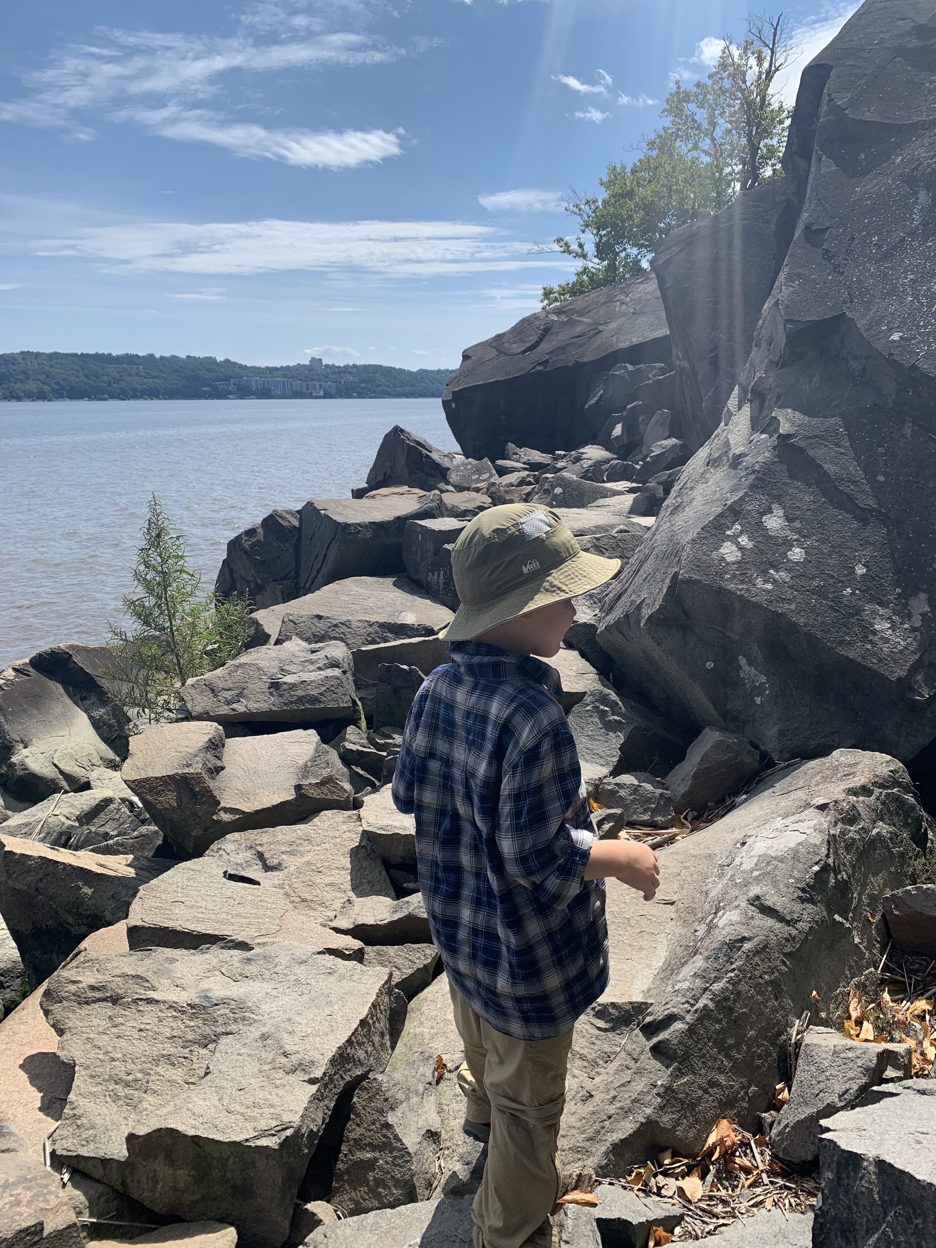
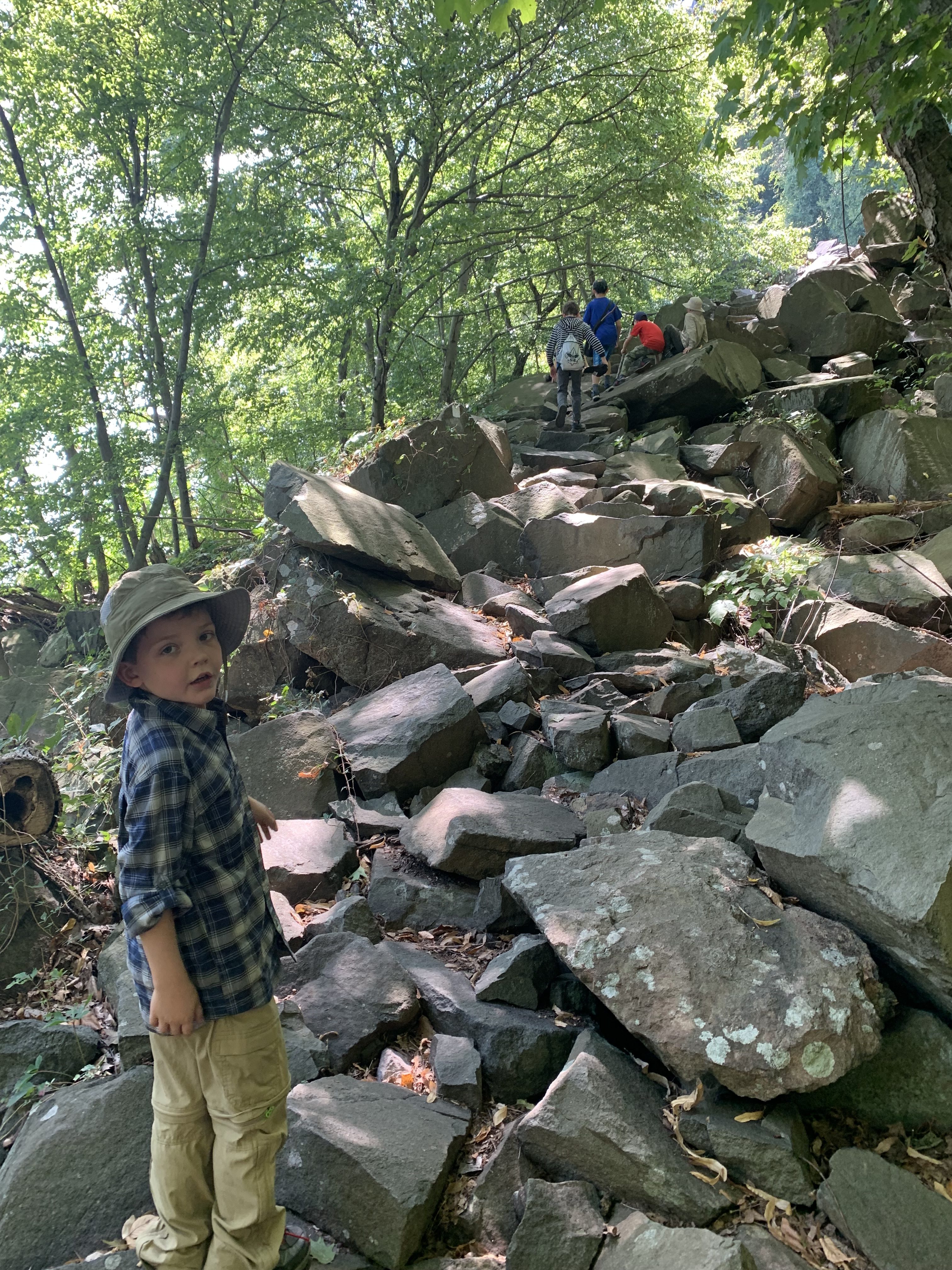
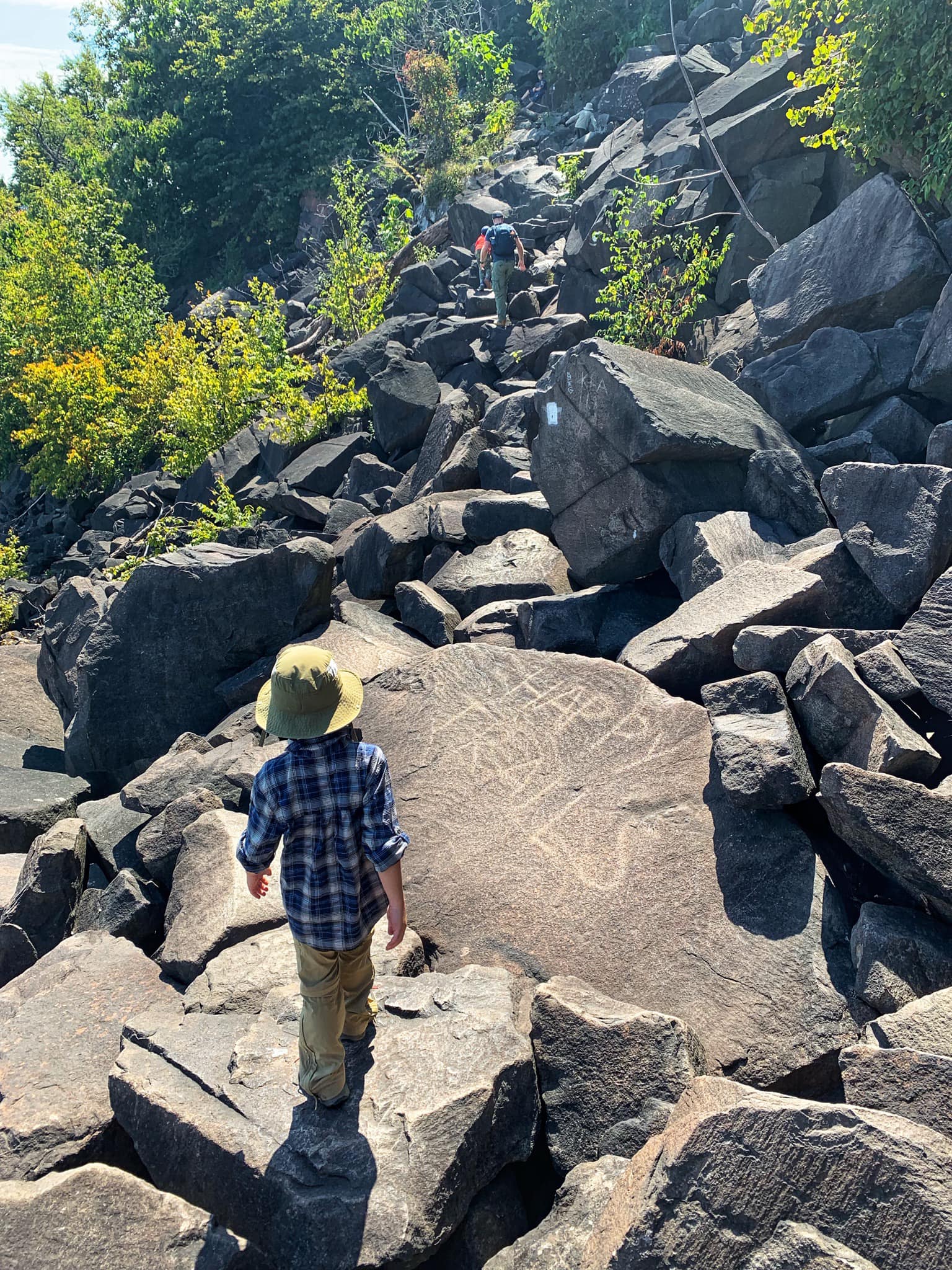
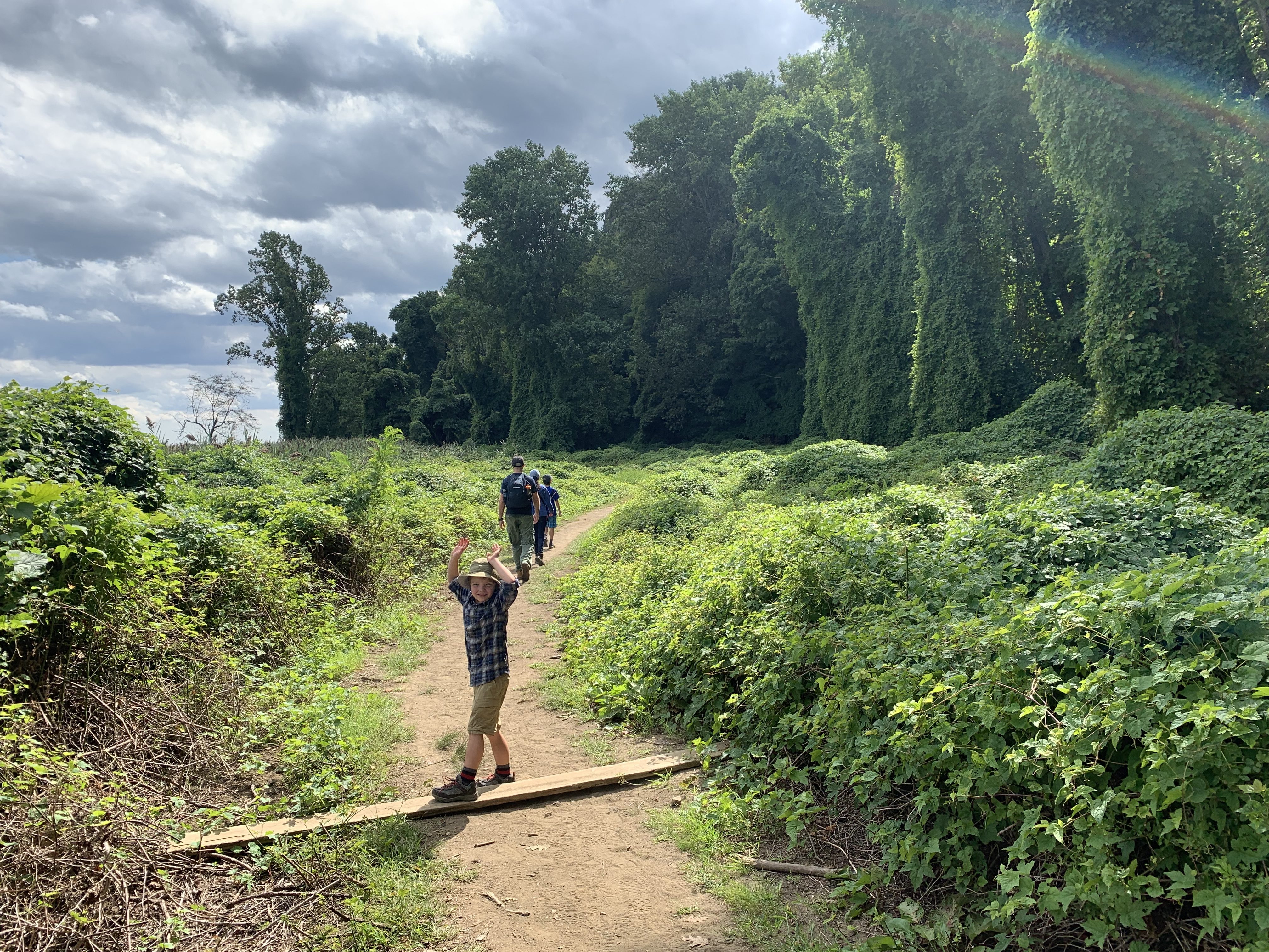
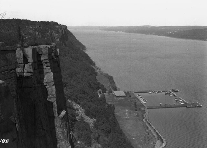
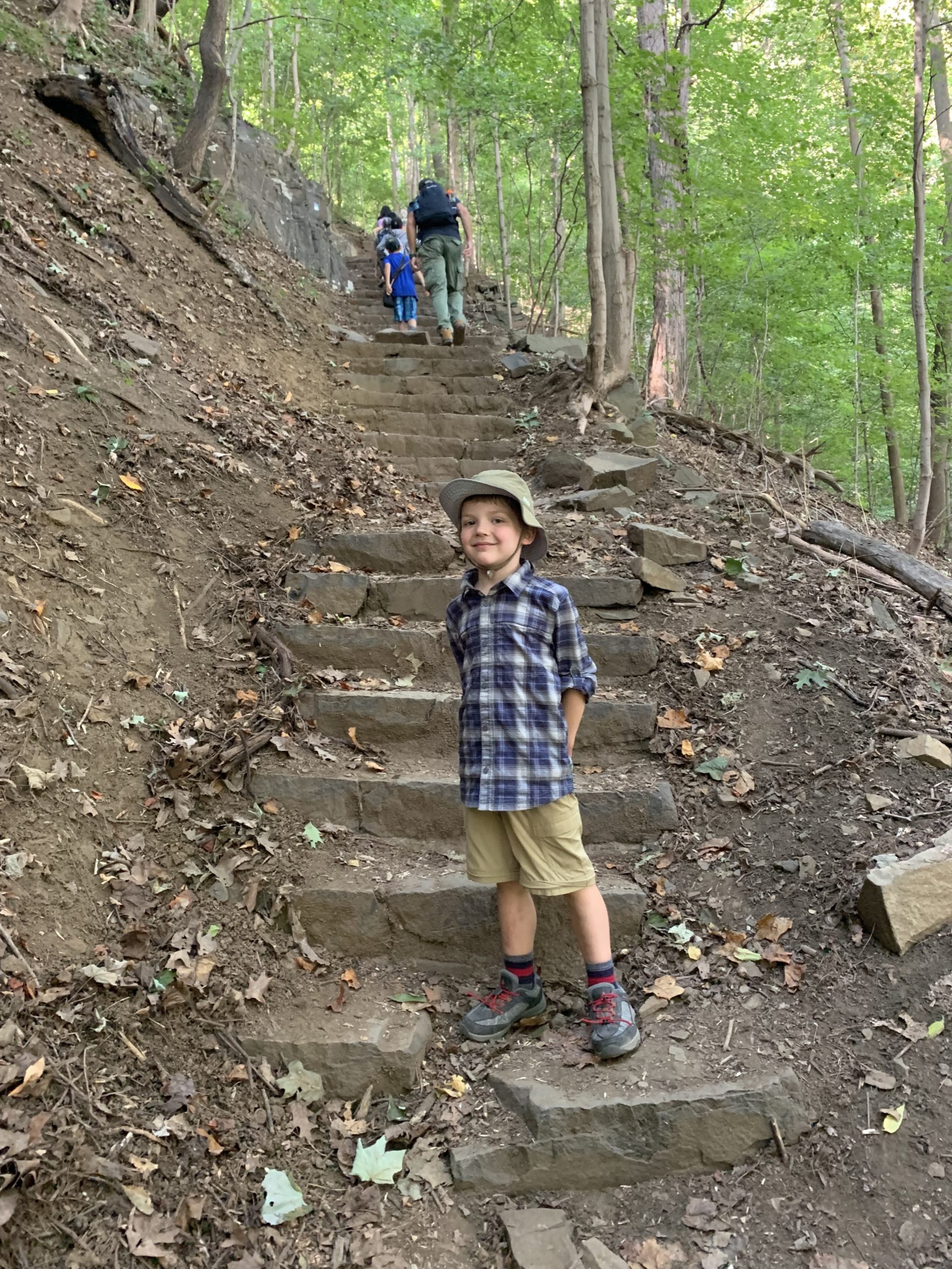
Overview: The Giant Stairs is a challenging 4.3 mile loop hike featuring views of the Hudson River that takes you down the Palisades to the shore of the Hudson River, past a cascade and ruins, across mile-long scramble over a boulder field, and up a steep ascent along a stone staircase. This hike includes a scramble over a large boulder field. We do not recommend doing this hike if the rocks are wet or covered in snow/ice. This trail makes the honorable mention list of best hiking trails in New Jersey. To find other great hikes, check out the whole list. Hike length: 4.3 miles Elevation gain: +1,290 feet Location: State Line Lookout, Palisades Interstate Park, Alpine, New Jersey (Bergen County) Giant Stairs Parking A free parking lot is available at State Line Lookout, which has an unnumbered exit off of the Palisades Interstate Parkway. Giant Stairs Trails MapHudson Palisades Trails (NY-NJ Trail Conference, print) Hudson Palisades Trails (NY-NJ Trail Conference, Avenza) Palisades Interstate Park Commission Trail MapGiant Stairs hike description Start at the Lookout Inn at the north end of the parking lot and head east to the edge of the cliff to Point Lookout for panoramic views over the Hudson River. Point Lookout After enjoying the view, begin the hike by following the paved Old Route 9W a little north of Point Lookout. There are several additional nice viewpoints along the way. After 0.05 miles, the aqua-blazed Long Path heads into the woods to the right. Stay on the Long Path headed north. In about half a mile, the Long Path turns right (east) at a green sign pointing towards the Shore Trail and Peanut Leap Falls. Boundary Monument Just ahead is the state line border monument also known as the Eastern Witness Monument. Most people walk by without paying much notice, but there's some interesting history behind the monument. On most hiking maps it’s called out simply as “Border Monument” or “State Line Monument.” But it has another name too. It’s one we only learned after we decided to find out a bit more about this artifact, which predates the creation of the Palisades Interstate Park Commission by some eighteen years: the “Eastern Witness Monument.” And, yes, we learned that it has a twin, too, a “Western Witness Monument,” which overlooks the Delaware River, almost fifty miles away. The two are known as “Witnesses” because neither is at the exact site it calls out. The Western Witness is “72¼ feet from … Tri State Rock,” while ours, the Eastern Witness, is “488 feet west from Station Rock.” Between these two points, Tri State Rock and Station Rock, runs the straight line that forms New Jersey’s northern border with New York. Tales of the Eastern Witness After passing the monument, the trail heads downhill and then turns left (north) to go through a gate in a fence. You're now in New York. The trail then descends on steep stone steps with cable railings to help. There are some nice views along the way. High Gutter Point Just beyond is “High Gutter Point,” with sweeping views of the Hudson River. To the north, the Tappan Zee Bridge and Hook Mountain - the northernmost point of the Palisades - are visible. Beyond this are more steep steps. At the bottom of the steps the trail turns left (west). Sign at the bottom of the stairs pointing towards the left Skunk Hollow In about 1/8 mile, the trail crosses a stream on two small footbridges. Here, you may notice skunk cabbage growing, especially near the stream. That may be the reason for the name "Skunk Hollow" which refers to the nearby area that was once home to a community of free Black families. Throughout most of the nineteenth century, a small community of free blacks existed along the New York/New Jersey state line about a mile south of Palisades. Known as Skunk Hollow, it was settled by former slaves and their descendents 60 years before slavery was abolished in New Jersey. The first known deed was to Jack Earnest, a former slave, who, on January 1, 1806, paid $87.50 for five acres and 30 square rods; in 1822 he purchased another six acres. Skunk Hollow: History of a 19th Century Community of Free African-Americans After you cross the stream turn right (east). A sign notes that Peanut Leap Cascade is just 0.3 miles away. This is the start of the white-blazed Shore Trail. Follow the Shore Trail to the river. Sections are rocky and the final descent is steep. Peanut Leap Cascade & Italian Garden Ruins At the base of the cliff is Peanut Leap Cascade. Depending on if it's rained recently, the "cascade" could be just a trickle of water or less. Enjoy this picturesque spot for a while, then continue south on the Shore Trail (white markers). Nearby are also ruins. The ruins are from a garden designed by the artist Mary Lawrence-Tonetti. Mary’s father, Henry Effingham Lawrence, a descendant of New York gentry going back to the 1600s, built the family’s summer retreat, “Cliffside,” at Snedens around the time of the Civil War. Mary was born in 1868. She and her siblings spent their summers at Cliffside, getting to know the area in the course of their childhood adventures, including the waterfall — what they called simply “the Cascade” — which was part of the family property, but left undeveloped.... Mary met and fell in love with a French sculptor, François Tonetti. They married in 1900. They lived in New York, where they also kept their sculpting studio, but still summered at Cliffside. It was around this same time that Mary designed her “Italian Gardens” at the Cascade. It was in part to protect the property from a proposed railroad (never built), as well as from the new Palisades Commission, which, the family feared, might take the property from them if it was not in use. She was assisted by prominent architect Charles McKim; their design echoed Mary’s teenage memories of the monastery on the Amalfi Coast. Along the riverbank they sited a pergola, its white pillars supporting a grape arbor..... Despite a fence around it, people still found their way onto the property by the Cascade. Vandals took their toll. In 1979, Anne T. Gugler and other members of the Tonetti family donated the Cascade property to the Palisades Interstate Park Commission..... Time continued to take its toll on the property, however; Hurricane Sandy toppled the last of the pergola’s pillars. But “the Cascade” remains a hauntingly beautiful site, worth even the hike back up all those railroad tie stairs. The Cascade This rocky shoreline is a great spot to take a break before you continue. The remains of a pergola still serve as great bench to rest on. For a shorter hike or if you want to skip the rock scramble up ahead, turn around and retrace your steps back uphill. Otherwise to continue the loop hike, head south from here along the river, partly through wooded areas. Giant Stairs Rock Scramble You'll pass a sign warning you about the "Giant Stairs" a quarter mile ahead and another warning sign where the Giant Stairs section begins. For about the next mile, you'll need to use your hands to scramble over a boulder field at the bottom of the Palisade cliffs called the Giant Stairs. Parts of the trail are exposed and other parts go through forested area. For about the next mile, you'll need to use your hands to scramble over large boulders, an area called the Giant Stairs. This talus field is made up of the parts of the mountain that have fallen from the Palisade cliffs over the years. Parts of the trail are exposed and other parts go through forested area. Boulder scramble along the Giant Stairs Past the rock scramble, the trail continues for about 0.3 miles. Forest View Meadow Past the rock scramble, the trail continues for about 0.3 miles through an area called Forest View. This area once featured a pavilion, restrooms, water fountains, picnic areas, boast docks, marina, and ball field, but in the 1960's the area was no longer maintained by the park and it has since become overgrown with weeds, vines, and poison ivy. If you look around, you might find some of the stone and timber ruins. View of Forest View from the summit of the Palisades, circa 1932. (Note ballfield visible just south of the boat basin.) A hike in the New Jersey Palisades could not feel any wilder, any more remote. Indeed, with the tall cliffs always looming overhead, the feeling is of no longer being in New Jersey at all, but somewhere Western, wild, canyon-like. Though still only a foot or two above sea level, the view of the Hudson is lost to a tangle of green meadow, alive with crickets and grasshoppers and still more butterflies. Several small trees — it’s impossible to tell what they are — each only a dozen feet tall or so, stick up like hairy sentinels above the meadow, each completely enmeshed in vines. And here, amid the bright sun and fragrant green growth and butterflies, lurks the first ghost of Forest View. For one of those vine-covered sentinels in the meadow is not a tree at all. It is instead the chain-link backstop from an overgrown ballfield..... Forest View was one of the first large “playground” areas built by the Palisades Interstate Park Commission in the decades after its creation in 1900 — a time when automobiles, while no longer a novelty, were not yet truly commonplace. As such, the area was built without a parking lot. Access to the facilities — the pavilion, restrooms, water fountains (with “city water”), ballfield — was meant to be by foot (three miles from the Yonkers Ferry landing, or down — and, at the end of the day, back up — the steep trail to Federation Park) or by boat. By “boat,” we mean excursion craft that, for the most part, left from New York or Yonkers and stopped at jetties by several of the picnic groves and campsites now also all but vanished along the Shore Trail: Quinn’s, Excelsior Dock, Twombly’s Landing, Forest View. By the early 1930s, as privately owned motor boats became more common, the marina was built, intended for weekend use. The Three Ghosts of Forest View You'll then reach the steep Forest View Trail marked with blue-and-white blazes. Follow the trail steeply uphill along a long stone staircase for an elevation gain of 520 feet. You might think this section should be referred to as the "Giant Stairs" but nope. Follow the trail up to its intersection with the aqua-blazed Long Path. Turn right (north) on the Long Path, cross the stream, and take the aqua trail back to the Lookout


 Refine Search


