Summary
For most hikers, AllTrails, Gaia GPS, and Avenza are all worthy hiking apps. But for those who like to explore or go off the beaten path, the best hiking app is Gaia GPS. I’ll explain below.
This isn’t meant to be a comprehensive review or comparison between the various hiking apps – they all have their pros and cons. But specifically for more experienced hikers who like to explore and who can read maps, I think Gaia GPS is the best. The reason? The detail it provides thanks to data from OpenStreetMap.
I’ll demonstrate with an example of a hike where I would have missed a really nice waterfall if I had relied on AllTrails. But first, a note about crowd-sourced maps.
Crowd-Sourced Data: a Double-Edged Sword
What I think gives Gaia GPS an edge for those who like to explore is that, thanks to its use of crowd-sourced maps for layers, it often features details and landmarks that other maps may not show. AllTrails also uses OpenStreetMap as a base layer, but in addition, it presents users with “curated” – or what AllTrails calls verified – routes, and I’ll explain why I consider that a negative.
While crowd-sourced maps may have more detail in some cases, sometimes certain details are deliberately excluded from curated maps because land managers may not want to attract hikers to particular areas for safety reasons, to reduce impact on the environment, or for other reasons.
There are other problems with crowd-sourced data.
The routes for All Trails hikes, for example, are uploaded by users. Some may consider this additional information a benefit as it could simplify trip planning, but I have found that its value is hit-or-miss and could lead to a sub-optimal hiking experience – or worse.
If a user follows a poor route, perhaps missing interesting viewpoints, and that user’s route becomes popular, other users of the app will blindly follow a route that may not be the best experience.
The consequences for following crowd-sourced routes could be worse than missing a viewpoint. Scott Fitterman, a New Jersey Search and Rescue (SAR) team member, explains the problem with these crowdsourced “curated” routes that appear on apps like AllTrails:
What people call a “trail” might be a combination of established blazed trails and unmarked trails or herd paths. Those unmarked trails that were easy to follow during the summer might be impossible to follow after the leaves fall in autumn. Tracks recorded on phones and watches can also be wildly inaccurate depending on signal strength, weather, where the device was kept while hiking, and app settings. Higher skill-level hikers might traverse dangerously steep terrain, putting you at risk for injury. Another hiker’s easy hike might be much more difficult to you. Hikers may even unwittingly cut across private property, putting you at risk as well.
As of 2021, the free version of GaiaGPS no longer lets you download offline maps to navigate without cell service. That requires a $39.99 annual premium subscription. For me, that’s 100% worth it, but it’s an important change from prior years that should be noted.
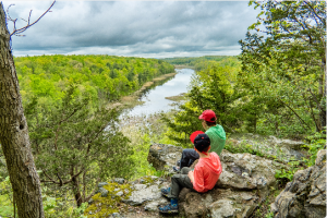
An example: Mount Minsi
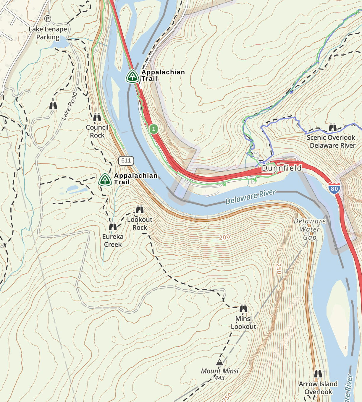
Mount Minsi is a popular hike in the Delaware Water Gap National Recreation Area. Most trail guides suggest a loop that follows the Appalachian Trail to the top and a woods road back down. Compare three maps of Mt. Minsi:
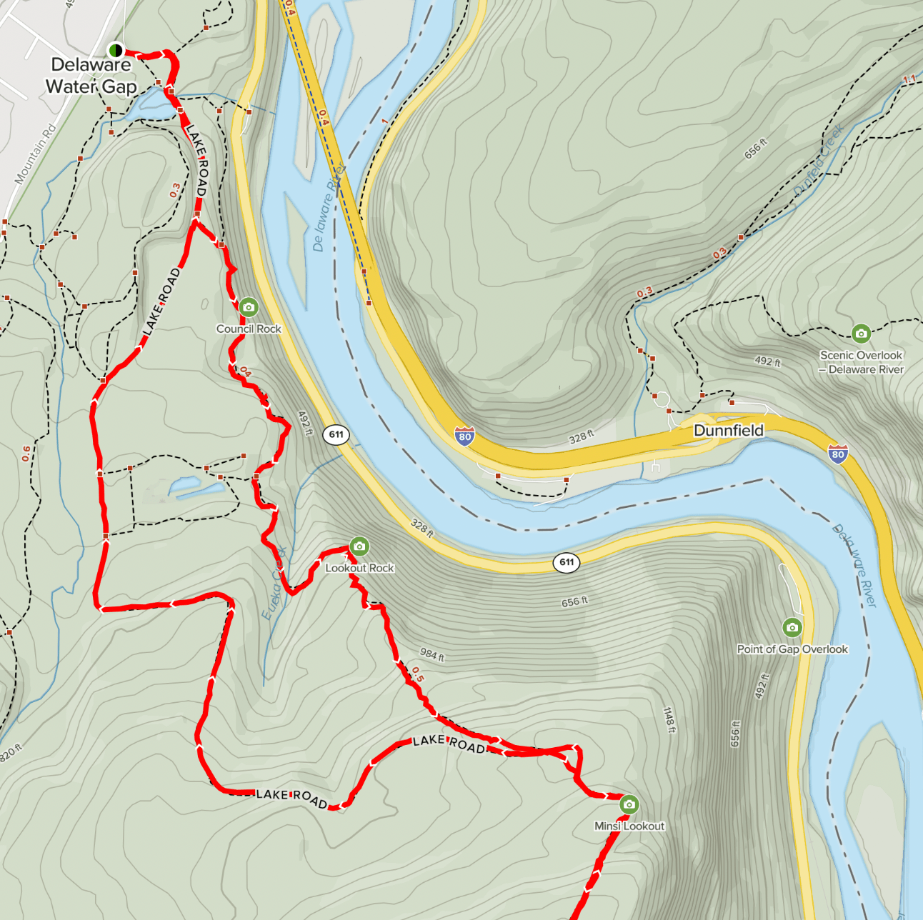
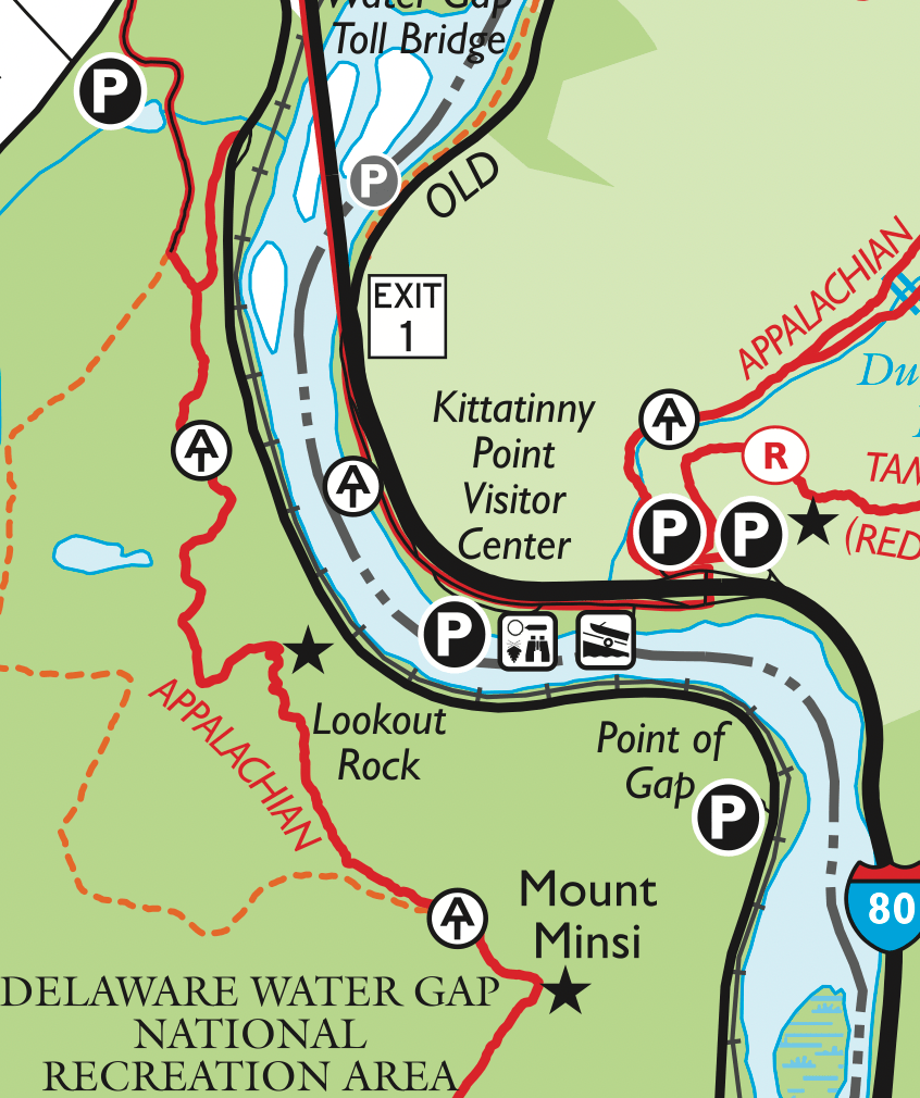
The AllTrails map (left) is shown with the “Mount Minsi via Appalachian Trail” hike in red, which is presumably the route people who use the app will follow.

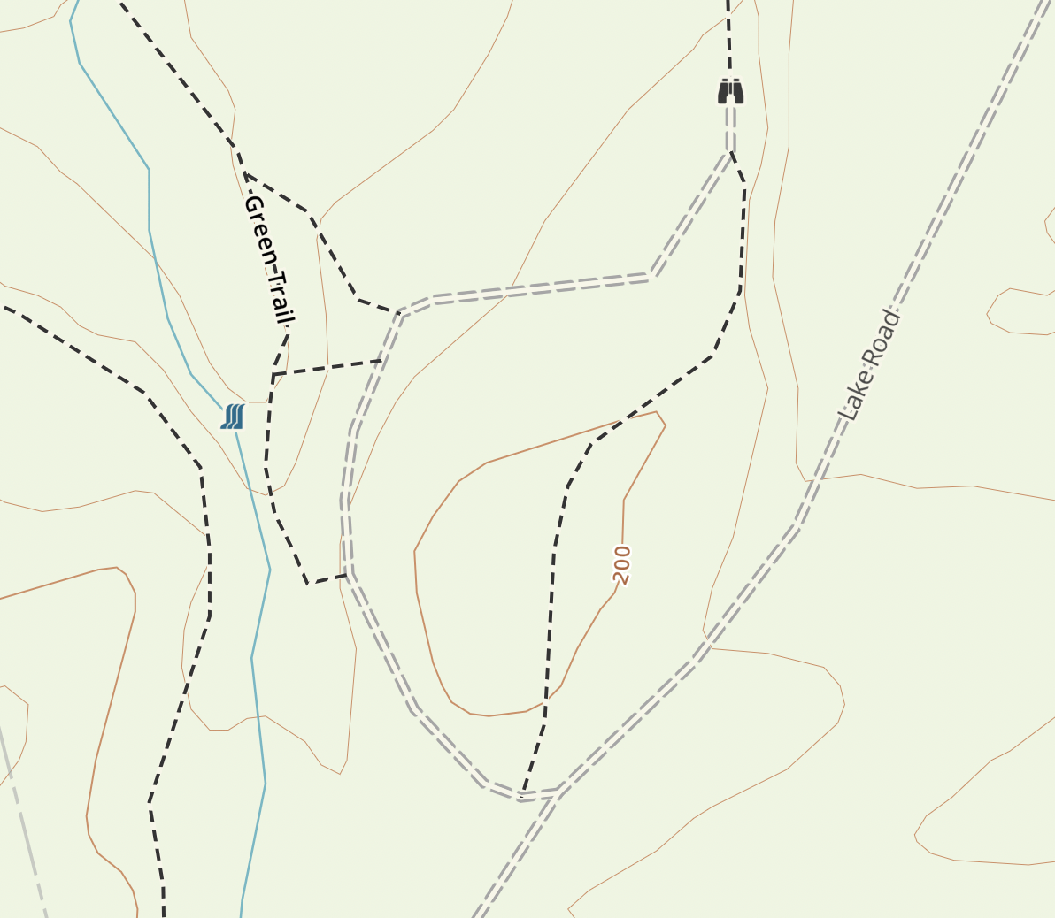
Kittatinny Trails map
The Avenza app shows the NY-NJ Trail Conference’s free Worthington State Forest Map, which is pretty sparse on detail, although what it lacks in detail it makes up for in clarity and easy of use. It is adapted from the 4-map Delaware Water Gap and Kittatinny Trails set, which adds contour lines and additional details (see sample on the right). As we’ll see, even the full map lacks some key features.
Note: to be fair to Avenza, it is as good or bad as the specific maps that you load onto it. I’m mainly comparing AllTrails to Gaia GPS but wanted to show a third app/map for further context. For those who hike in New Jersey and New York, the Avenza app paired with the official NY-NJ Trail Conference maps is a must-have gold standard. These maps show curated trails and features, are clear and well-designed, and are created by authoritative sources that can be trusted.
Finally, Gaia GPS is on the right.
The Similarities
All three maps show the Appalachian Trail and the woods road as well as key points of interest including Council Rock, Lookout Rock, Minsi Rock, and Table Rocks (although only the NYNJTC map labels it by name). AllTrails and Gaia GPS also label Eureka Creek as a point of interest.
You’ll have a great hike using any of these maps, but you could have a better hike.
The Differences
One difference became clear as I was returning downhill along the woods road (Lake Road).
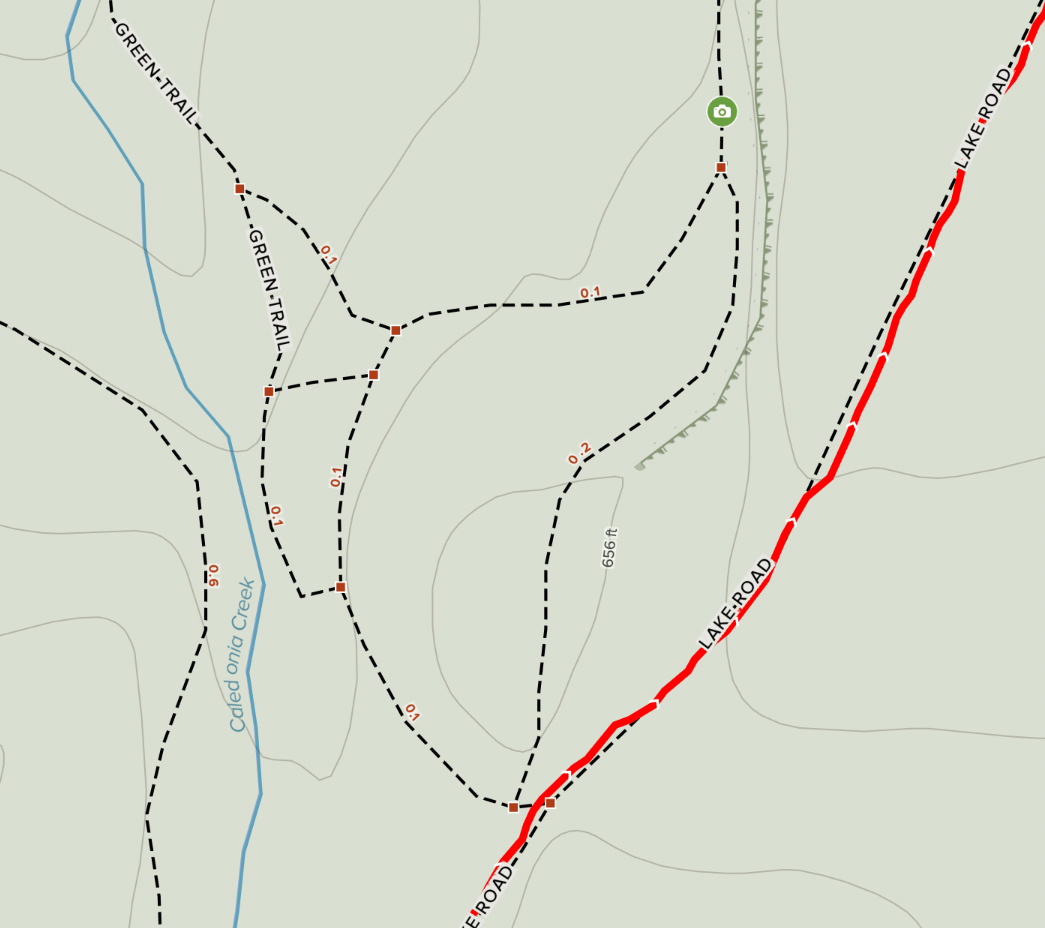
Do you see it? Both maps have “Table Rocks” labeled with icons (although not named). That alone would have made me consider exploring and returning via the other trails instead of the woods road route on AllTrails. Both maps also show Caledonia Creek, but only the Gaia GPS map indicates that there is a waterfall. That caught my attention, so I headed in that direction.
Why does Gaia GPS show the waterfall? I believe it’s because they pull data from OpenStreetMap, a community-driven mapping project (The OpenStreetMap for the area shows the waterfall). Note that AllTrails also relies on OSM, but the apps seem to incorporate and display different levels of detail.
The map on the left shows in red the GPS track for the route I ultimately took. For comparison, on the right is the Strava heat map for the same area.
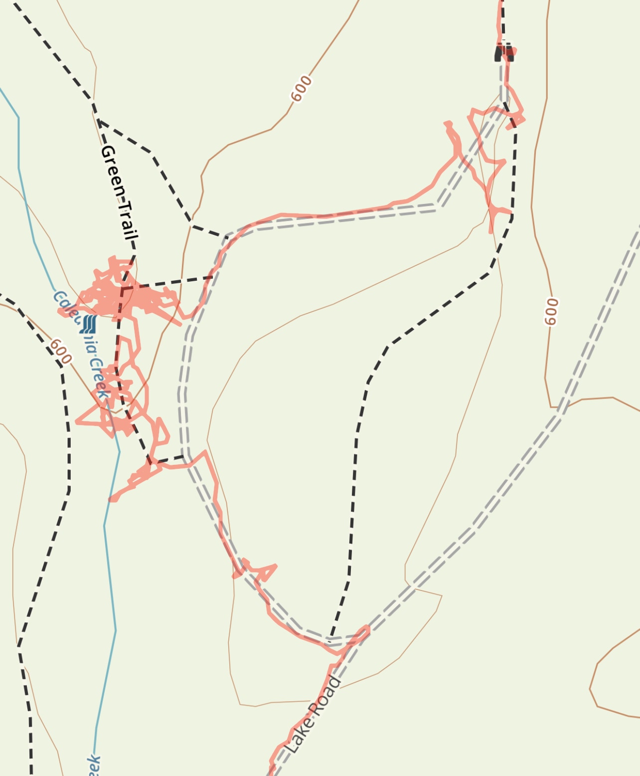
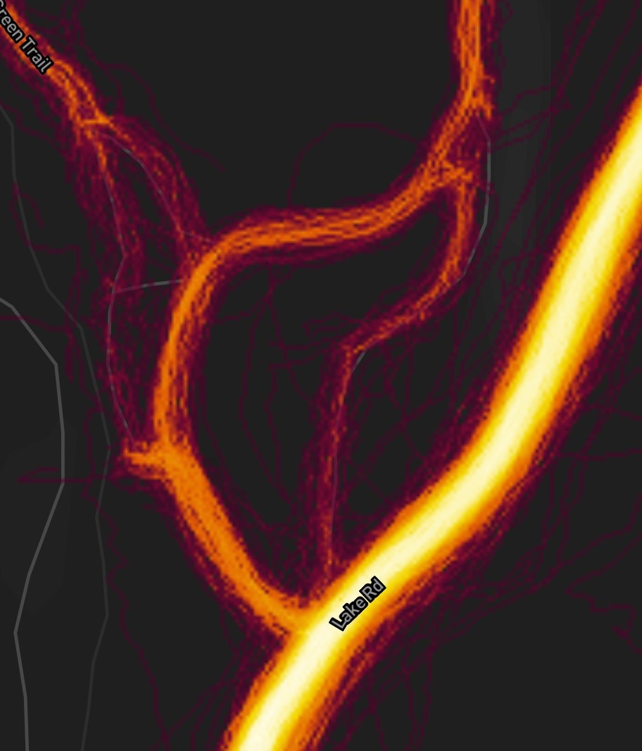
From the Strava data, you can see that the vast majority of hikers take Lake Road, a smaller number fork off to the woods road to the left, and some make it to the Green Trail, but then they appear to turn back towards the woods road.
This is the view of the creek just beyond the Green Trail, the point where most people turn around if they’ve even made it this far:
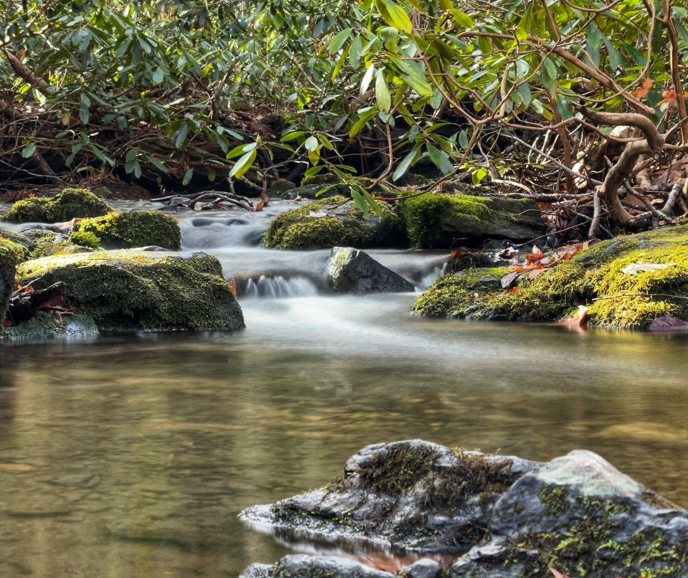
Very few go further north of here. That’s a shame, especially after coming this far.
You’ll notice from my route that I spent a bit of time along the creek. What did I find and what do most hikers miss? Cascades!
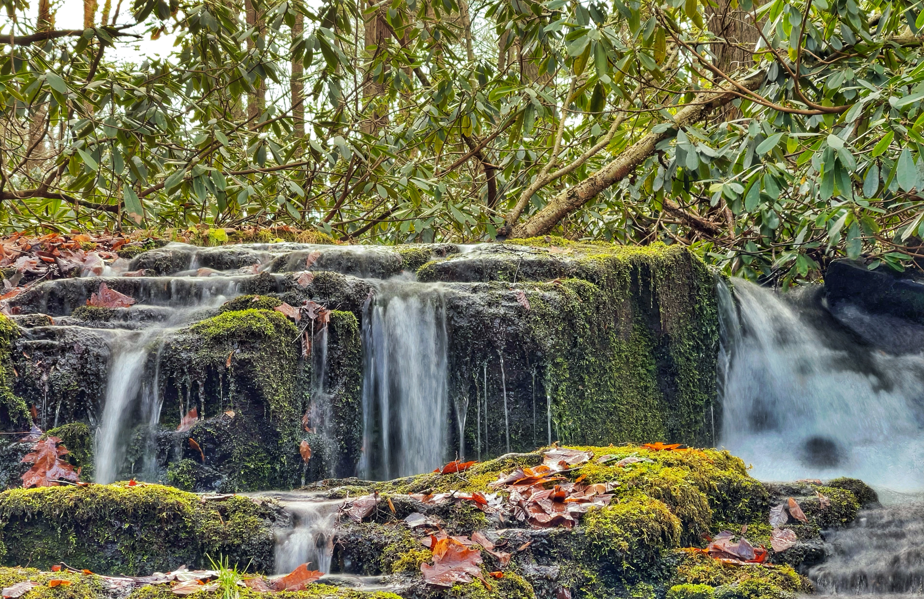
More cascades!
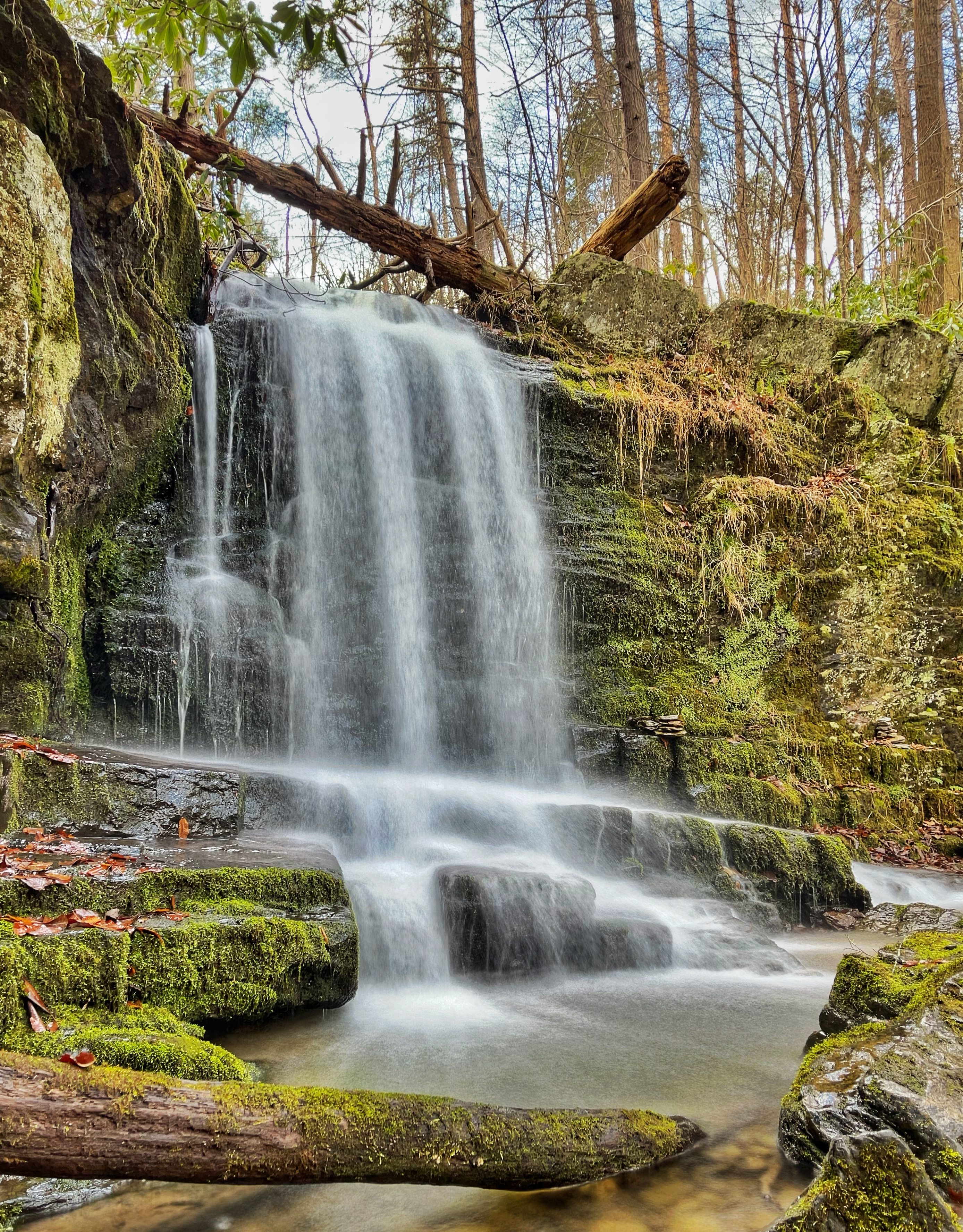
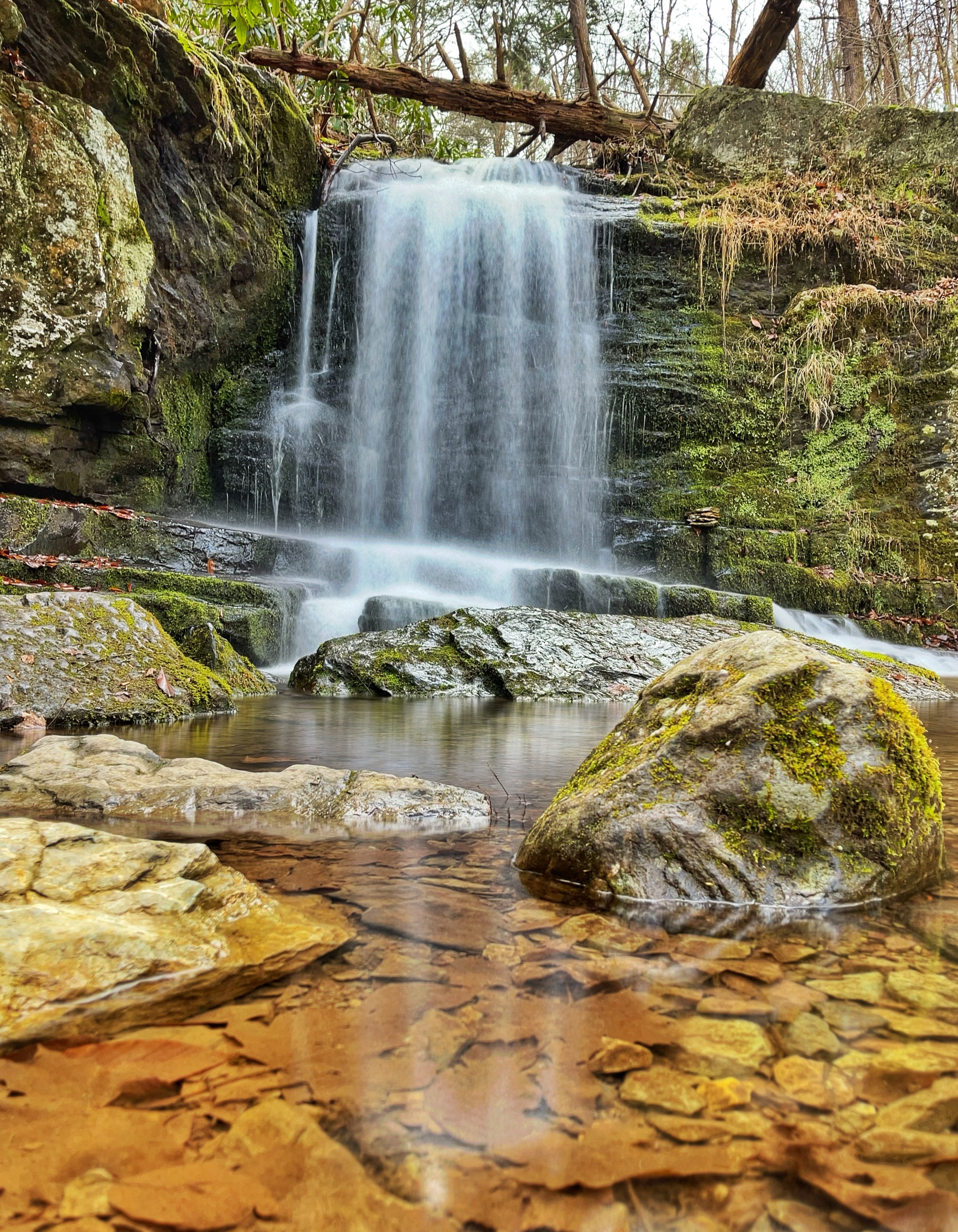
And a lovely waterfall.
Conclusion: Gaia GPS is the best hiking app
If it weren’t for Gaia GPS, I probably wouldn’t have explored the area around Caledonia Creek. I still would have had a great hike, but I would have missed some beautiful cascades and a waterfall that on their own would be the highlight of many other hikes.
For beginners, I strong recommend using curated, authoritative maps, but for those who like to explore or go off the beaten path and discover interesting places, the best hiking app is Gaia GPS.