About the John Muir Trail
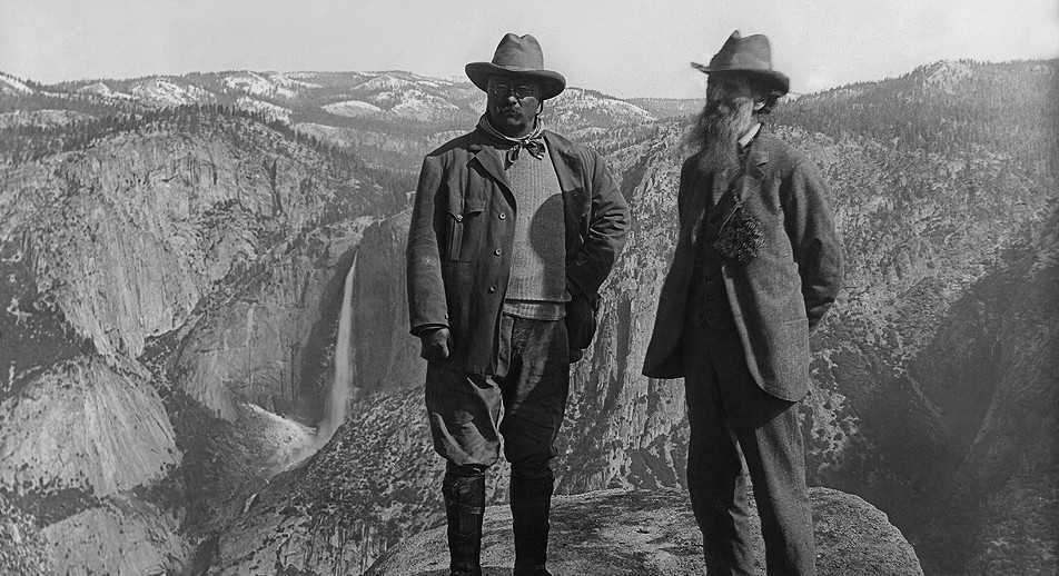
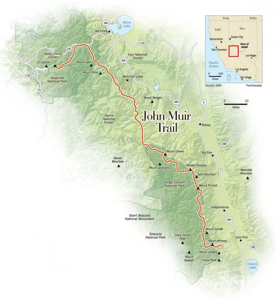
The Join Muir Trail (JMT) is a 211-mile trail through the Sierra Nevada mountains in California. The trail is named for the naturalist John Muir who co-founded the Sierra Club with the mission to explore and protect the wilderness of the Sierra Nevada.
The trail begins at the Happy Isles trailhead in Yosemite National Park, passes through Inyo National Forest and Sierra National Forest (including the Join Muir Wilderness and Ansel Adams Wilderness), Devils Postpile National Monument, and Kings Canyon National Park, and ends in Sequoia National Park on the summit of Mount Whitney – the highest point in the lower 48 states. It’s an additional 10.6 miles down from the summit along the Mount Whitney Trail to the nearest trailhead, Whitney Portal.
For 170 of the 211 miles, the JMT coincides with and follows the Pacific Crest Trail (PCT), a 2,653-mile trail from the US-Mexico border to the US-Canada border. The JMT deviates from the PCT in three spots: 1. between Yosemite Valley and Tuolumne Meadows, 2) Thousand Island Lake to Red’s Meadow and 3) Crab Tree Meadow to Mt. Whitney.
Why the John Muir Trail?
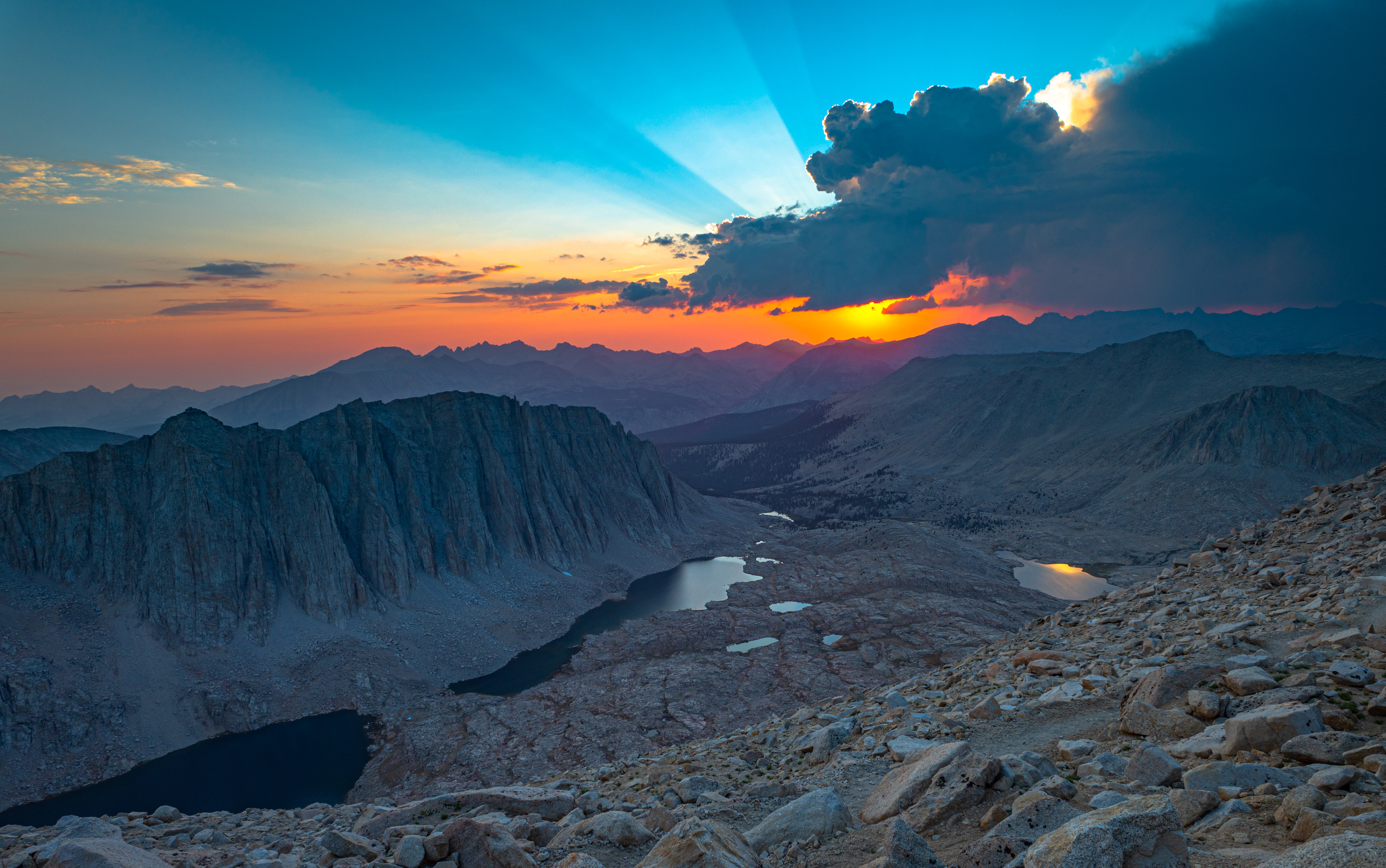
Over a series of summers, I had previously hiked Half Dome (three times) and backpacked in Yosemite National Park, hiked Mount Whitney, and hiked the Kearsarage Pass Trail in Inyo National Forest.
On the way down from our hike of Mount Whitney, I was passed by a backpacker who was heading towards Whitney Portal. I asked where she had started and she said Yosemite, and that she was finishing the John Muir Trail. This might have been one of the first times I learned that there was a trail connecting Yosemite and Mt. Whitney.
And that was all it took. Having hiked the start and end points of the JMT and with a glimpse of the spectacular scenery of sections in between, I knew that I wanted to hike the entire trail.
Hiking the John Muir Trail in 3 Sections
For most thru-hikers, the 220-mile walk from Happy Isles to Whitney Portal takes about 3 weeks, but with family and work constraints, I couldn’t do it all at once. So I planned to complete the trail* as a series of three section hikes over the next few years, which we did from 2019 to 2021.

* We skipped about a dozen miles of the JMT between Devils Postpile and Duck Pass. We heard this was one of the least interesting section, and given time constraints, decided to skip it.
Part 1 (2019): Reds Meadow to Yosemite Valley
- Start Trailhead: John Muir Trail North of Devils Postpile (AA10), Devils Postpile National Monument
- End Trailhead: Happy Isles, Yosemite National Park
- JMT miles: 0.0 to 56.9 (56.9 miles)
- Total trail miles: 56.9 miles
- Read the trip report for Part 1
In 2019, I hiked the first section of the JMT with my dad and the older of my two brothers (see the full trip report). We started at the Devils Postpile National Monument and went north-bound, ending at Happy Isles, the traditional starting point of the JMT (note: the historical starting point is actually about 2 miles west at the former LeConte Memorial Lodge – now the Yosemite Conservation Heritage Center).
We went north-bound for two reasons: 1) the permits from Inyo National Forest are much easier to get than those starting from Yosemite, which require winning a lottery; and 2) the trail is easier going northbound, with a net elevation drop, and avoiding the grueling hike out of Yosemite Valley with fully loaded packs.
In all, we covered about 57 miles over 4 days. Unfortunately, I came down with a sinus infection during the hike, but it was still a spectacular experience.
Read the full trip report for the John Muir Trail section from Reds Meadow to Yosemite Valley.
Part 2 (2020): Duck Pass to Bishop Pass
- Start Trailhead: Duck Pass Trailhead, Inyo National Forest
- End Trailhead: Bishop Pass Trailhead, South Lake, Bishop, CA
- JMT miles: 70.5 (Duck Pass Trail) to 136.9 (LeConte Canyon/Bishop Pass Trail junction) (66.4 miles)
- Total trail miles: 83 miles
- Read the trip report for Part 2.
Over 6 days in early August of 2020, my dad and I hiked a total of 83 miles as part 2 of our 3-section effort to hike the entire John Muir Trail. Starting from the Duck Pass Trailhead in Mammoth Lakes, we hiked 5.5 miles to the John Muir Trail, followed the JMT south for 66.4 miles (from mile 70.5 to 136.9), and hiked out via the 10.9-mile Bishop Pass Trail to South Lake in Bishop. Our hike took us through Inyo National Forest, Sierra National Forest, and Kings Canyon National Park.
Read the full trip report for the John Muir Trail section from Duck Pass to Bishop Pass.
Part 3 (2021): Bishop Pass to Mt. Whitney
- Start Trailhead: Bishop Pass Trailhead, South Lake, Bishop, CA
- End Trailhead: Whitney Portal, Lone Pine, CA
- JMT miles: 135.0 (LeConte Canyon/Bishop Pass Trail junction) to Mt. Whitney 211.0 (76.0 miles)
- Total trail miles: 93 miles
- Read the trip report for Part 3.
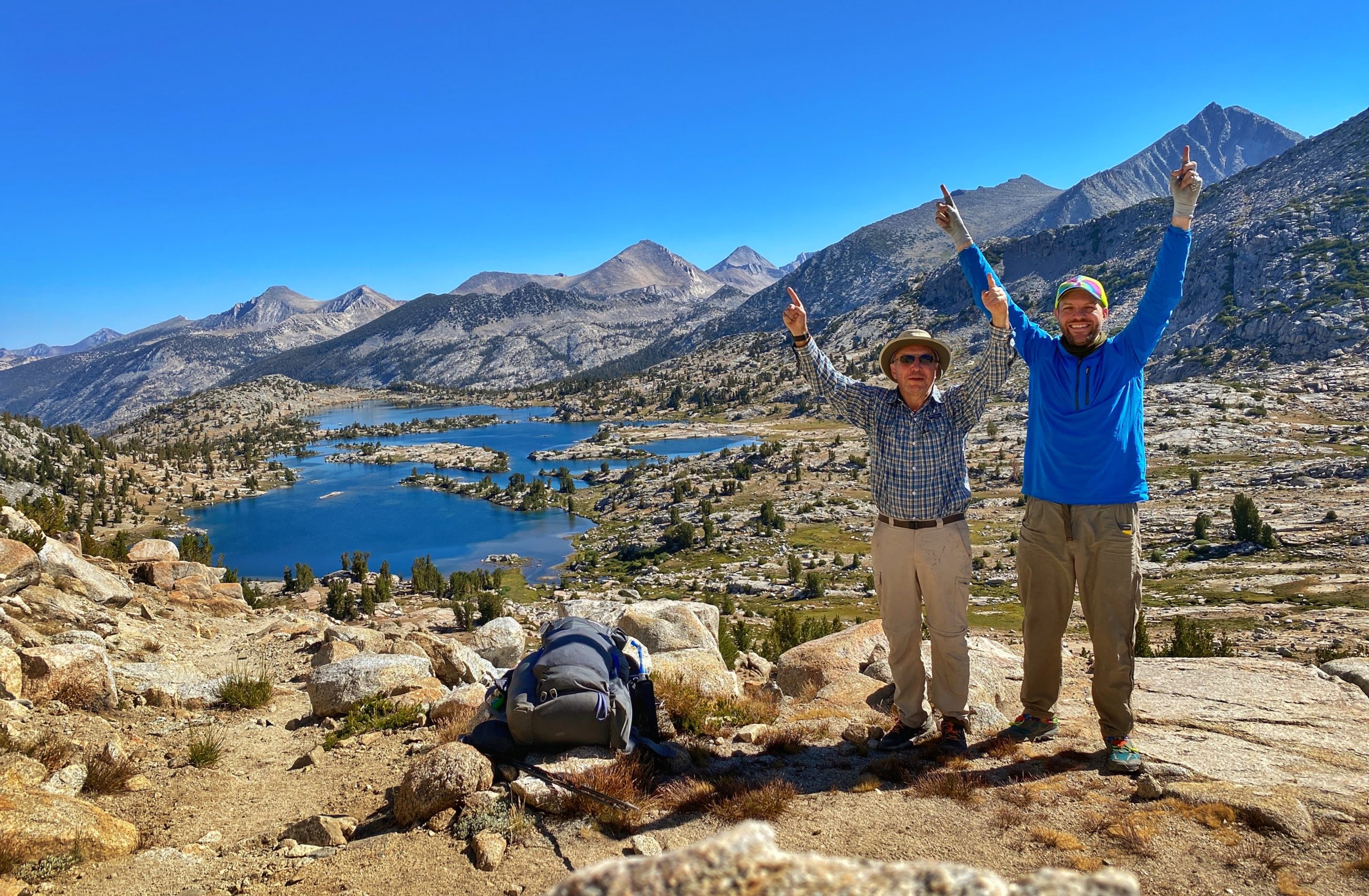
Over 7 days in August of 2021, my dad and a brother and I hiked about 93 miles as the final part of our 3-part section hike of the 220-mile John Muir Trail.
Starting from the South Lake Trailhead in Bishop, we 10.9 miles over the Bishop Pass Trail to the John Muir Trail, followed the JMT south for 73.5 miles (from mile 136.9 to 210.4), and hiked out via the 7.5-mile Mount Whitney Trail to Whitney Portal in Lone Pine.
Our hike took us through Inyo National Forest, Kings Canyon National Park, and Sequoia National Park in the John Muir Wilderness and Sequoia and Kings Canyon Wilderness.
Real the full trip report for the John Muir Trail section from Bishop Pass to Mt. Whitney.


