Breakneck Ridge Overview
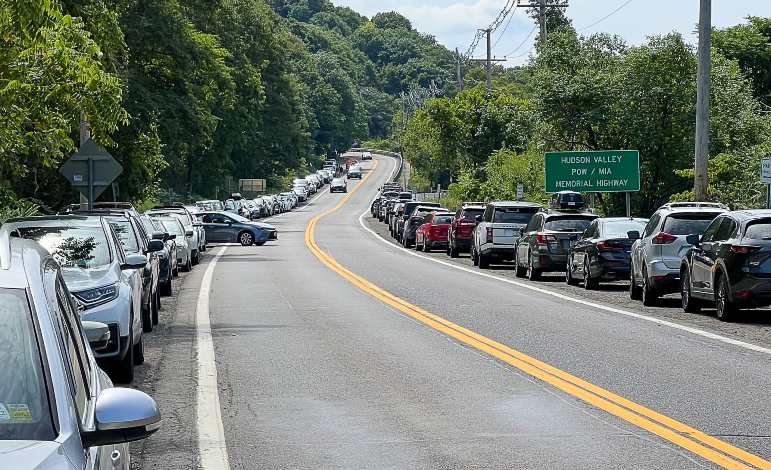
Breakneck Ridge is one of the most popular hikes on the east coast so don’t expect to get the trail to yourself. The steep rock scramble ascent will get your heart pumping quickly and you’ll be rewarded with great views of the Hudson River, but if it’s your first time hiking, this might not be the best choice. I highly recommend avoiding this hike when the trail is wet or icy as it is very steep.
There are several variations of this hike, but in all cases the most interesting part is the scramble up the first mile of the trail.
Hike length: 3.2 miles
Elevation gain: 1,440 feet
Location: Hudson Highlands State Park Preserve, Beacon, NY
Estimated reading time: 12 minutes
Breakneck Ridge Parking
Park on the shoulder of Route 9D. This is an extremely popular hike, so parking can be hard to find if you don’t arrive early or during off-peak days.
Parking address: Google maps link.
Breakneck Ridge Public Transportation
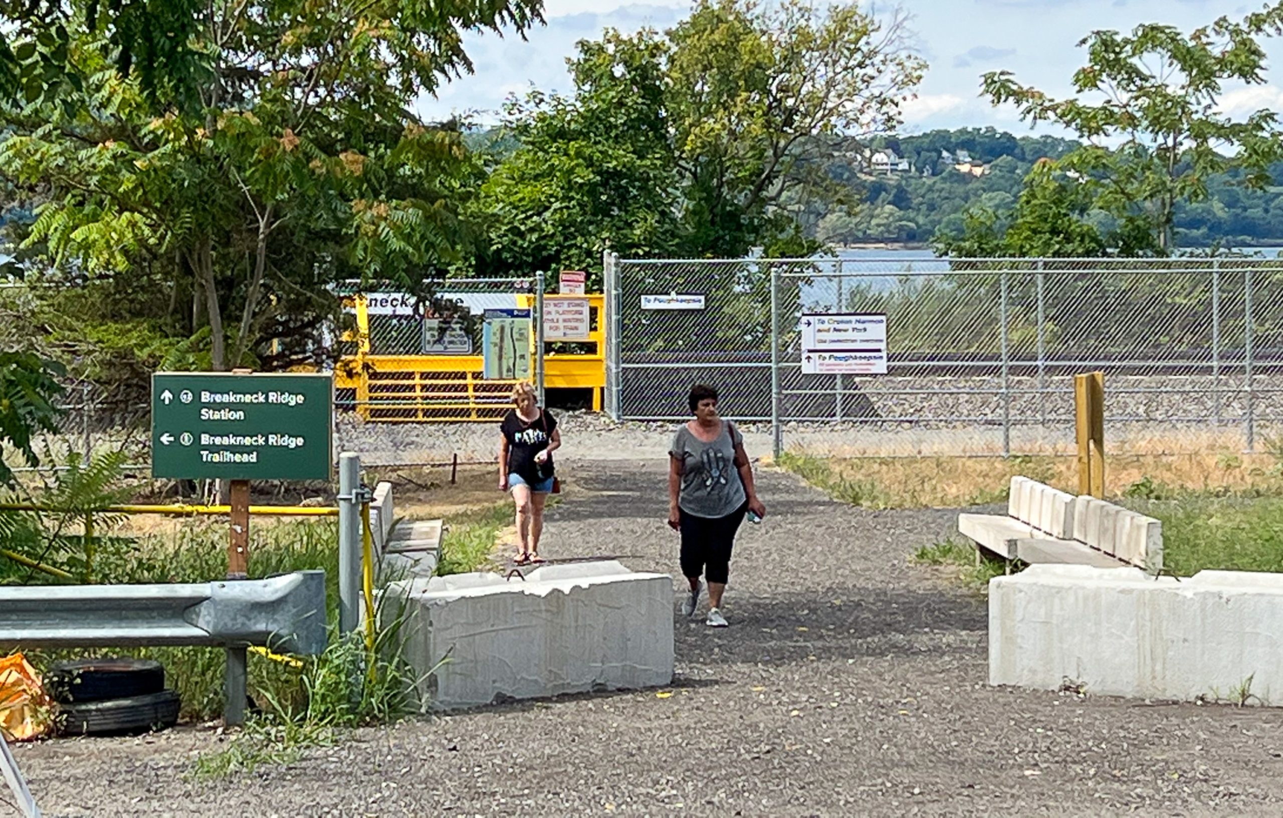
This trail is great for those who live car-free. On weekends and holidays, take the Metro-North Hudson Line from Grand Central Terminal to Breakneck Ridge Station.
Metro-North will make stops at Breakneck Ridge on weekends and holidays, with six northbound trains stopping at the station in the morning and five southbound trains in the evening.
MTA press release
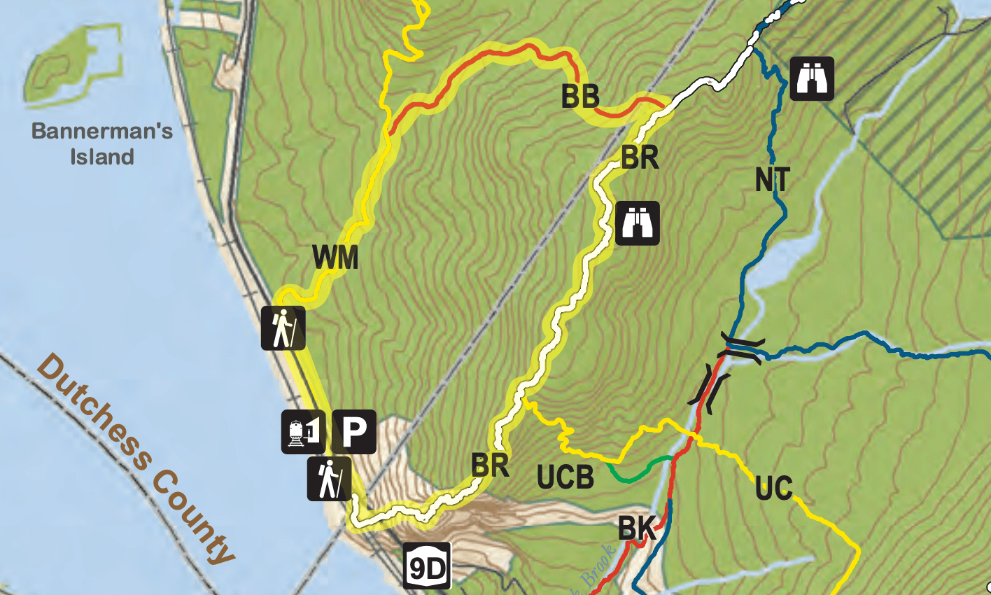
Breakneck Ridge Trail Map
- Hudson Highlands State Park Preserve North Trail Map – NY Parks
- East Hudson Trails – NY-NJ Trail Conference
Breakneck Ridge Trail Description
Adapted from the NY-NJ Trail Conference trail description.
Near the trailhead for the white-blazed Breakneck Ridge Trail are usually portable bathrooms, garbage cans, and often a tent with information staffed by New York-New Jersey Trail Conference volunteers.

Breakneck Ridge Trailhead
At the trailhead are maps with information on several variations of hikes that can be done – from shorter to longer hikes. If you don’t have a map, take a picture of the map at the trailhead or even better – use the QR codes to download the Avenza version of the trail map.
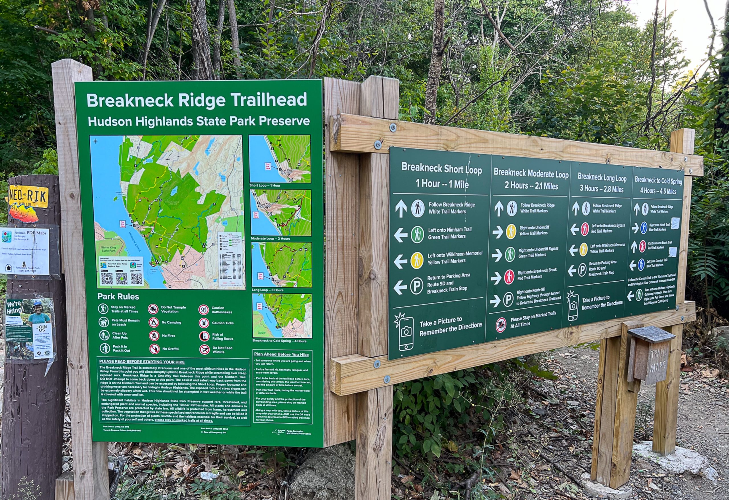
The Breakneck Ridge Trail starts on the west side of Route 9D, just north of the tunnel, and heads south.
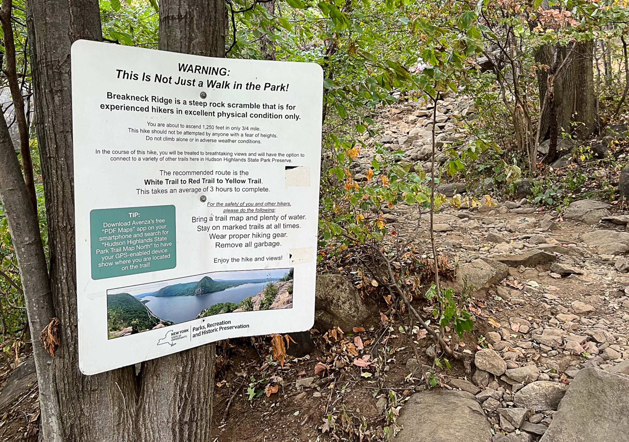
Several signs warn about the strenuous nature of the hike that’s ahead.

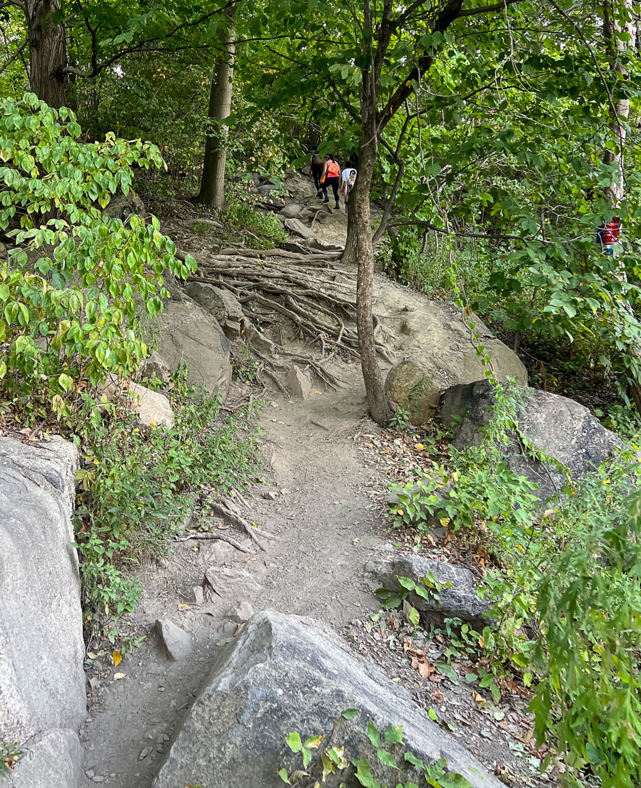
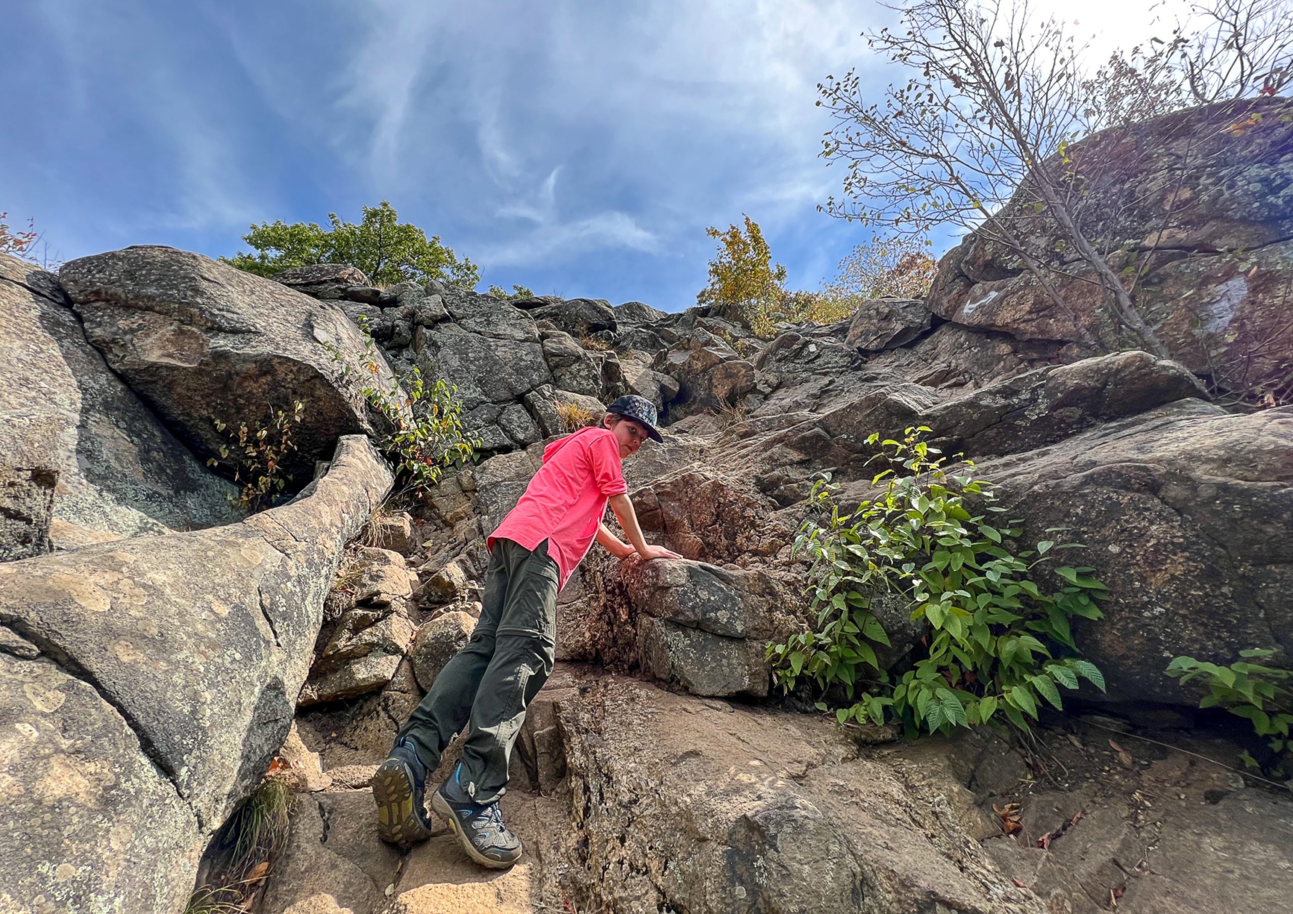
Follow the white-blazed trail as it steeply climbs the exposed rocky ridge.
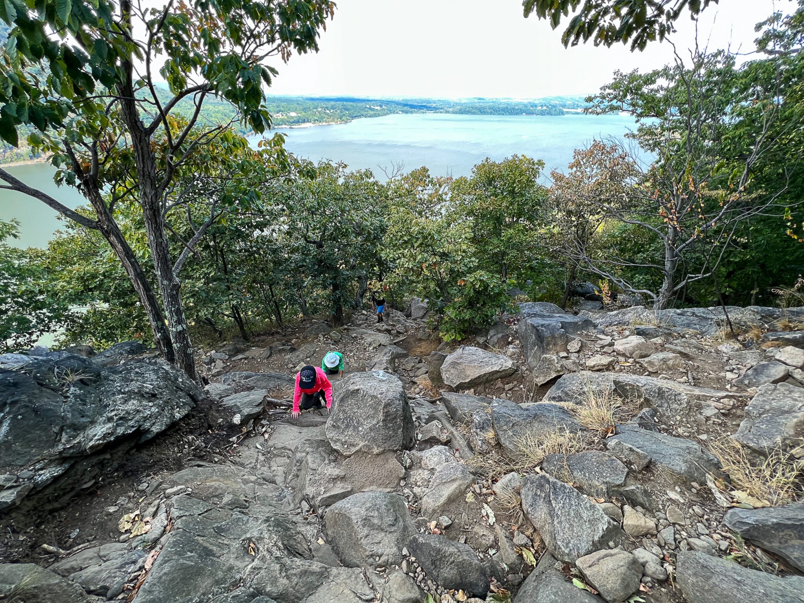


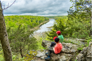
You’ll need to use your hands on some parts. Young kids may need a lift. In about a half hour, you’ll reach the first main viewpoint at a rock ledge with a flagpole.
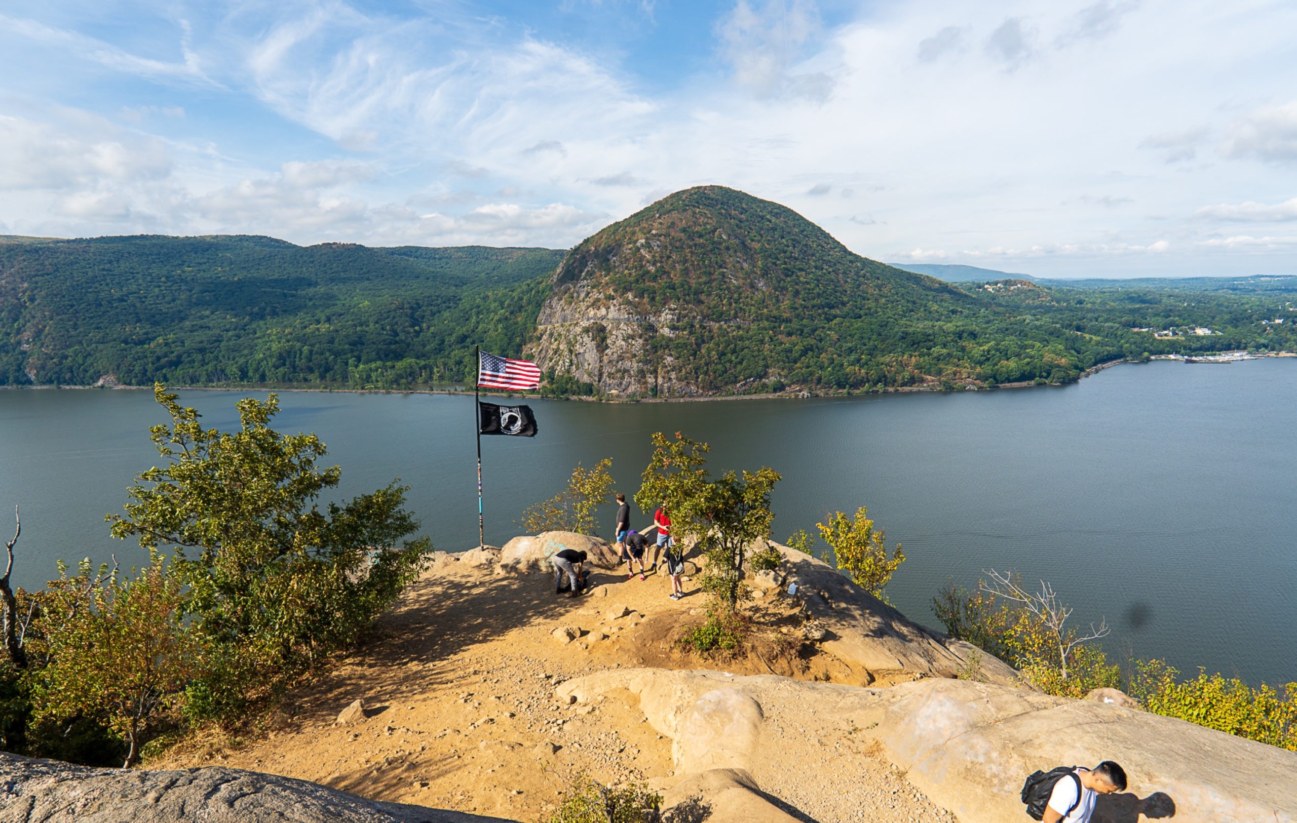
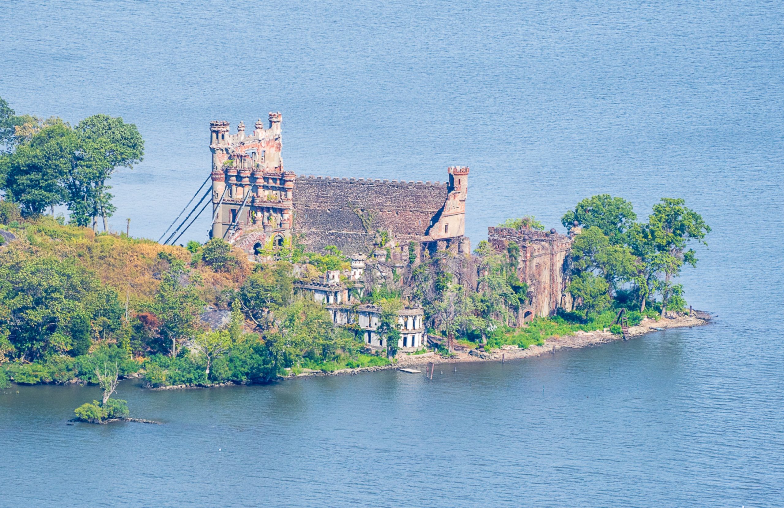
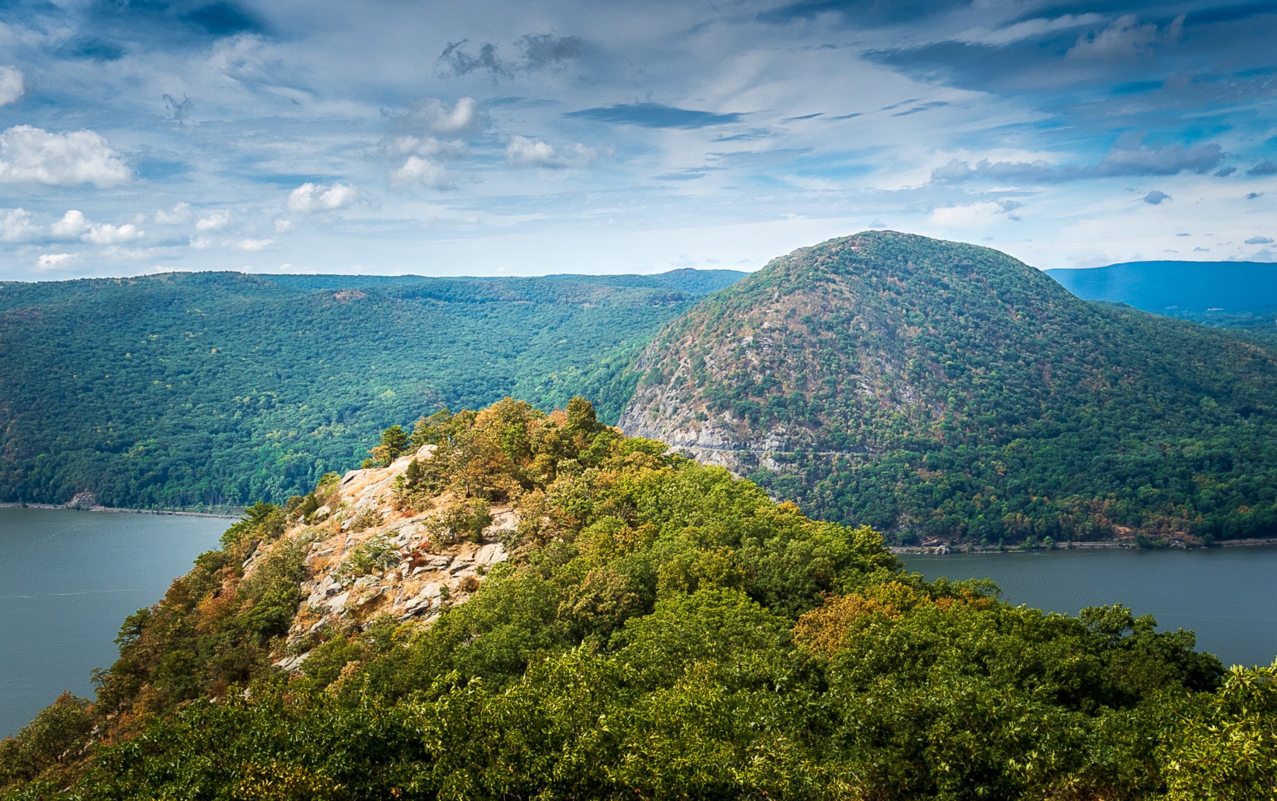
Straight ahead (west) across the Hudson River is Storm King Mountain. Off to the right (north) is Bannerman’s Castle on Pollopel Island.

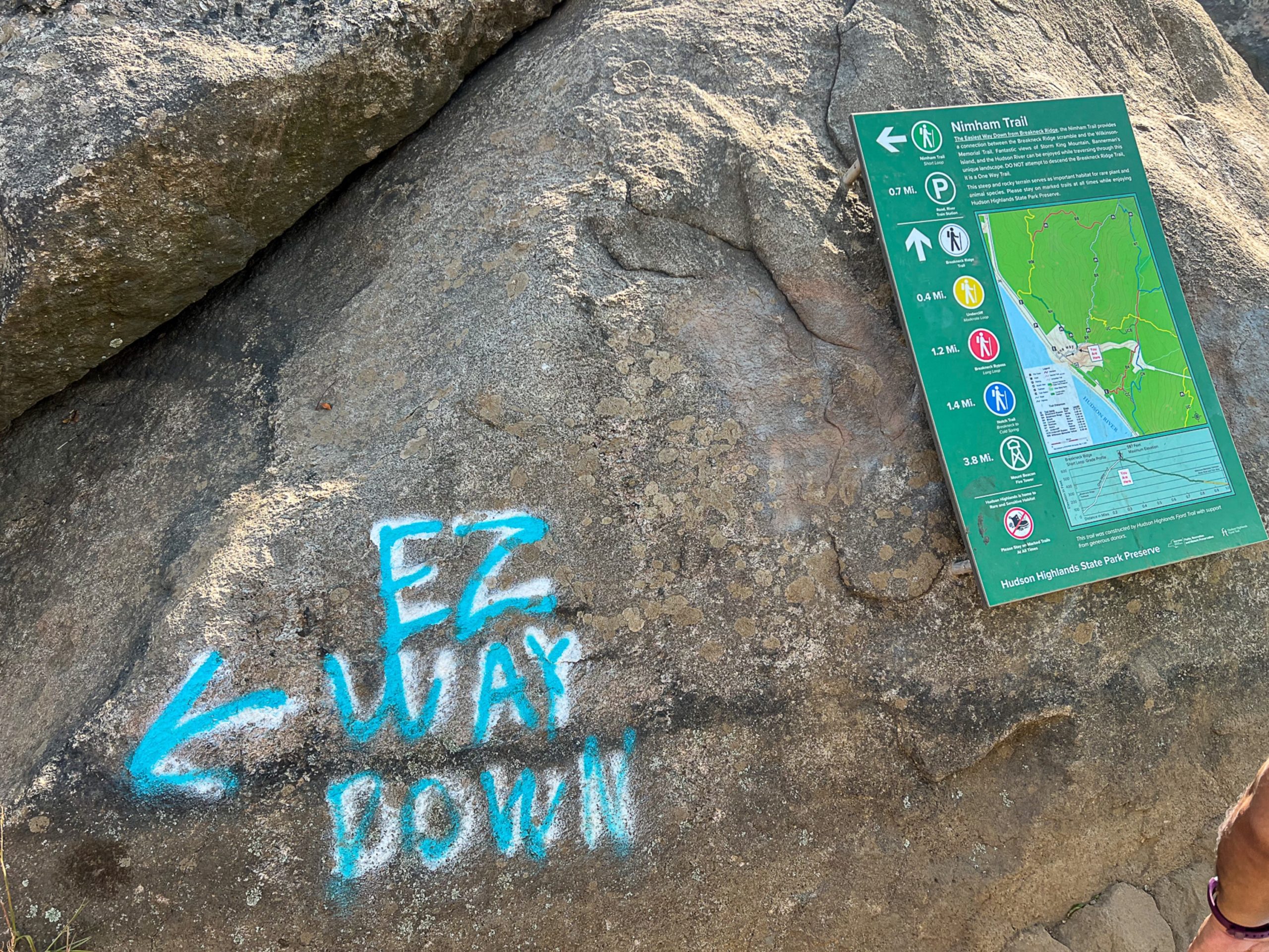
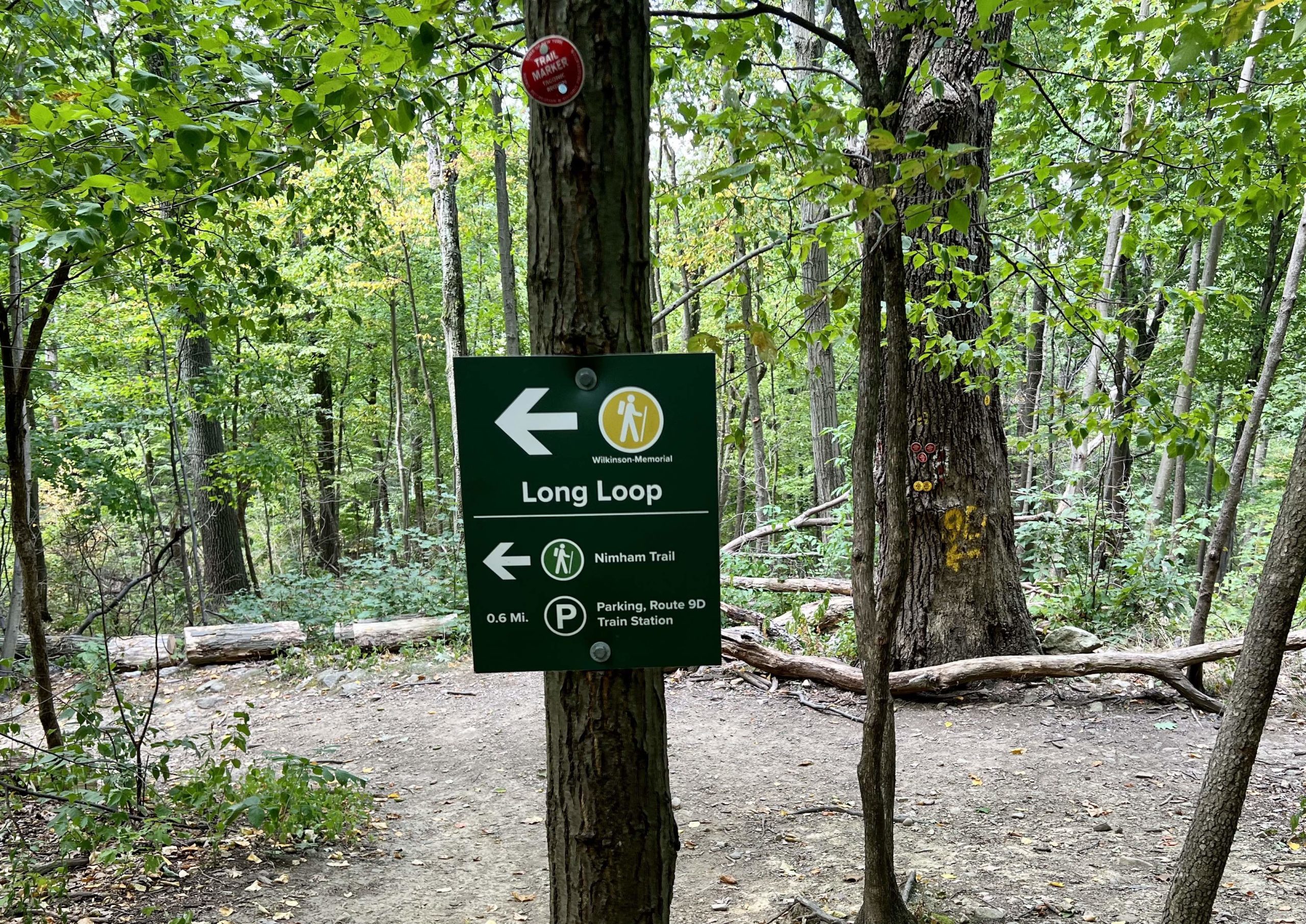
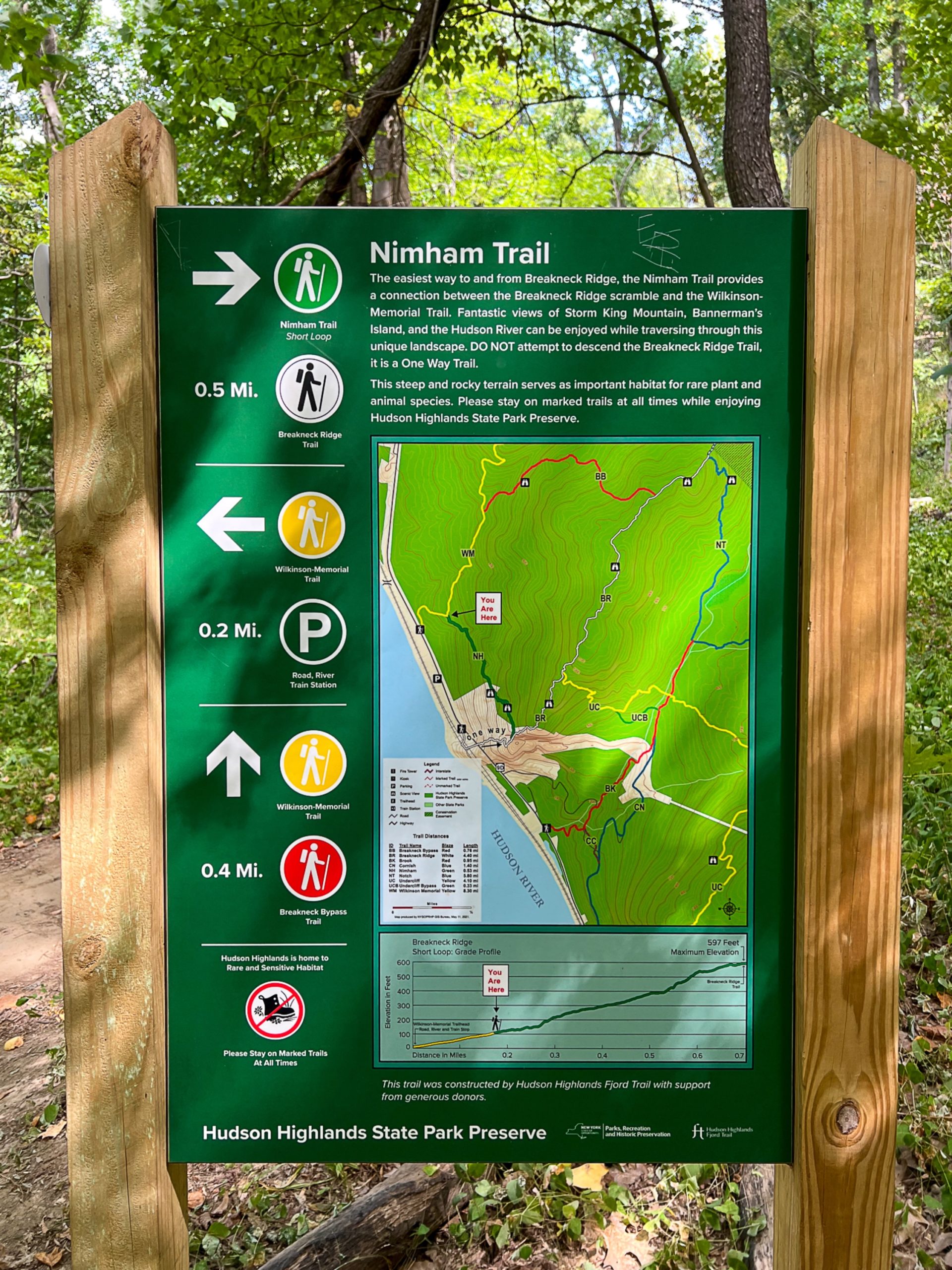
Nimham Trail Junction
About the Nimham Trail

“Akin to a name like Breakneck, the hike can be a challenge for those unfamiliar with the terrain, and for first responders assisting lost and injured adventurers on the trail.
According to data from the New York-New Jersey Trail Conference, many people choose the trail as their first foray into hiking and make it only to the iconic flagpole area of Breakneck, “the first false summit – then try to make their way back to the parking lot on Route 9D by descending off-trail, causing disturbance and vegetation loss as they walk through sensitive habitats.”
A new scenic trail – The Nimham Trail – opened [in 2021] as an alternative half-mile connector with over 500 stone stairs that were “carefully harvested from the slopes of Breakneck.”
The trail connector is named after Daniel Nimham, the last chief of the indigenous Wappinger people, whose ancestral lands, along with the Lenape and Munsee, include this area of the Hudson Highlands.
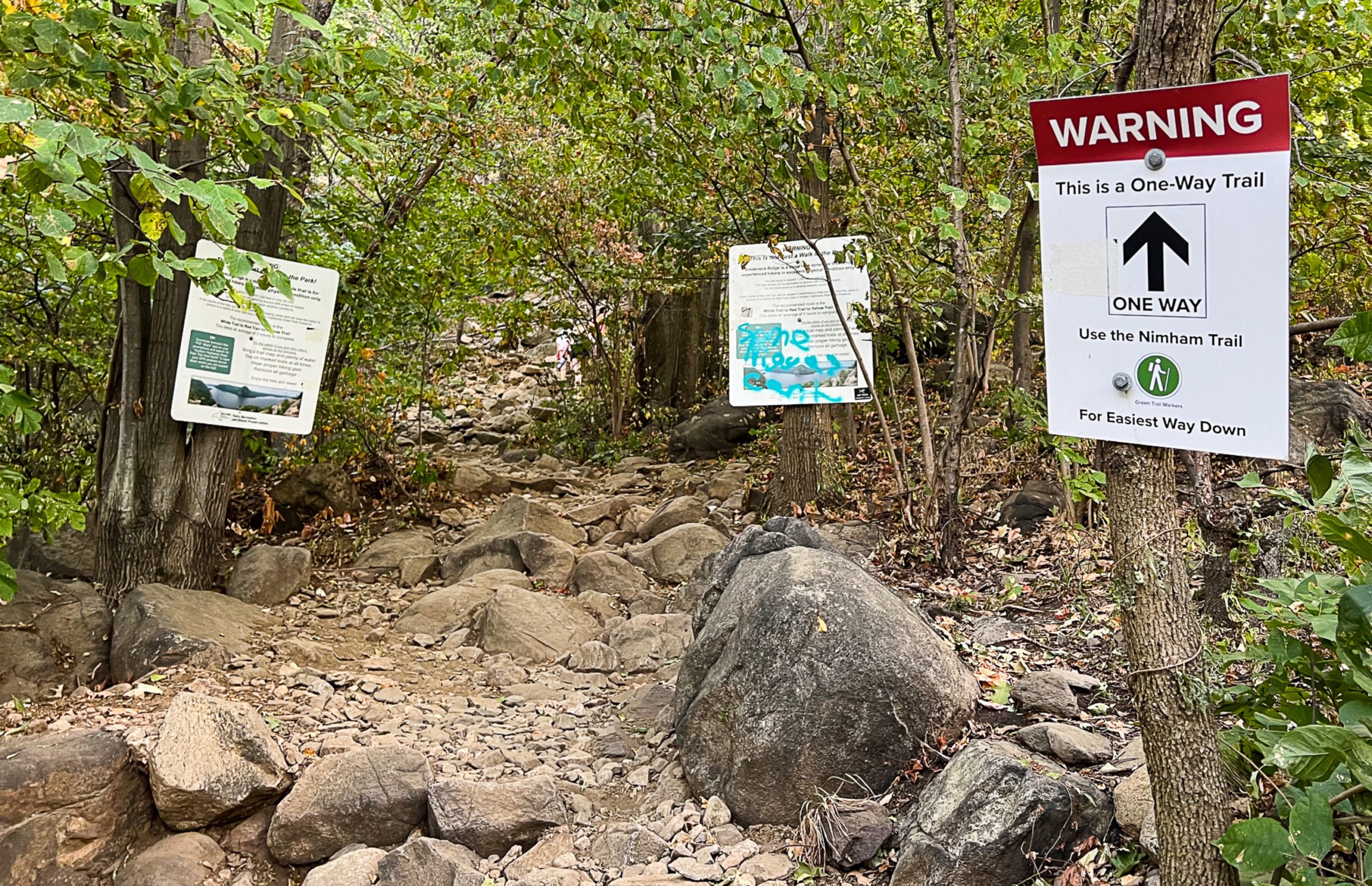
The ascent trail to Breakneck Ridge is currently one-way only: up! The Nimham connector offers two-way traffic to help manage trail congestion with a more gradual descent.
“This will alleviate overcrowding on the Breakneck Ridge Trail and give less experienced hikers a safer way to get back to trailheads on Route 9D,” said NYS State Parks Commissioner Erik Kulleseid.
HVNY
At this point, you’ve reached the junction with the recently-constructed Nimham Trail (it may not appear on some older maps). Since construction of this new trail, Breakneck Ridge has become a one-way uphill trail.
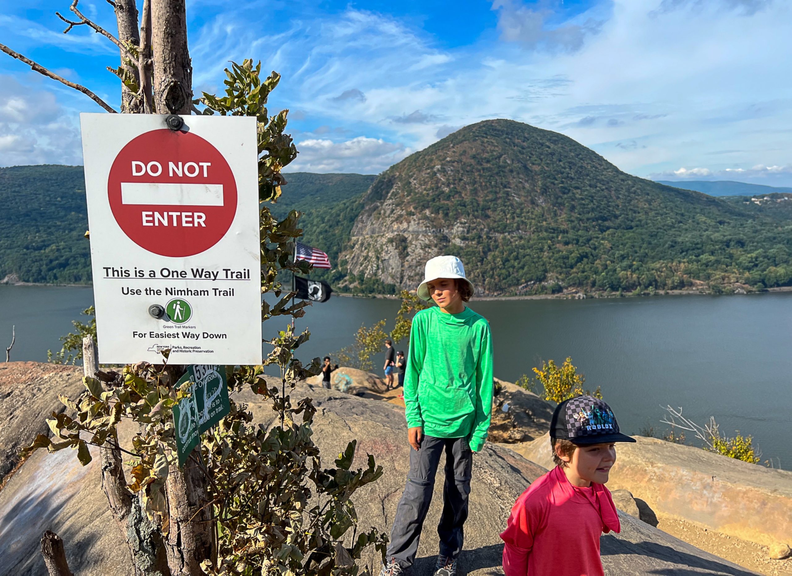
If you need to bail out on the hike at this point, turn left (north) and follow the green-blazed Nimham Trail downhill.
Ahead, the trail continues its steep ascent. At a junction, you’ll have the option to turn left for an easier route or right for a harder ascent.
The trail continues to climb steeply, passing more viewpoints.

Finally, you’ll come out on a rock outcrop with spectacular views over the river.

The trail now descends slightly. At the base of the descent, an easier alternative route goes off the left. After a very steep climb through pines, the alternative route joins, and trail reaches a south-facing viewpoint over the river.
Undercliff Trail Junction
The then descends steeply and, after climbing a little, reaches a junction with the yellow-blazed Undercliff Trail, which begins on the right. You’re now about 0.85 miles from the trailhead.

The trail now climbs a little more, then levels off, with some minor ups and downs.
The trail levels off, continuing through forest.
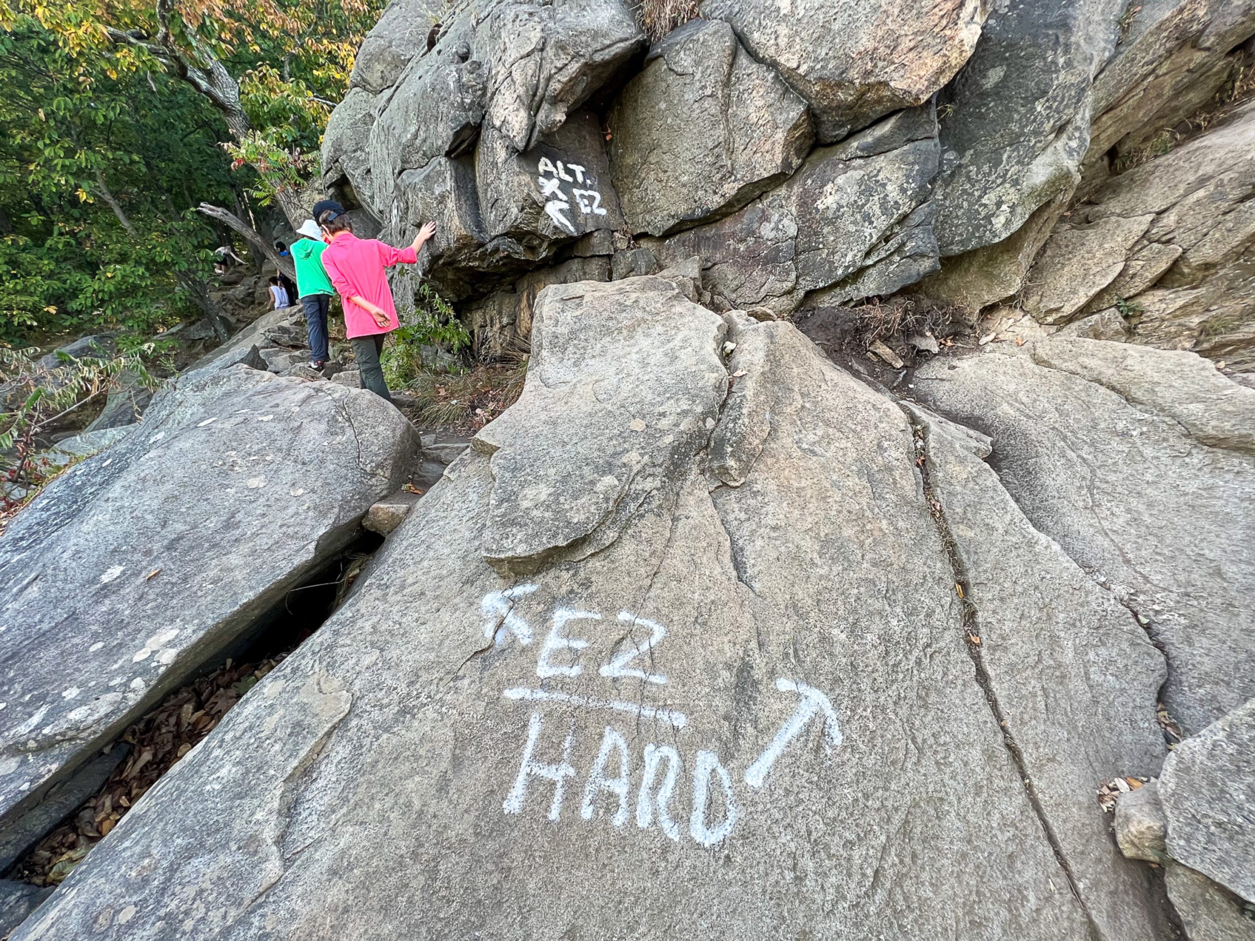
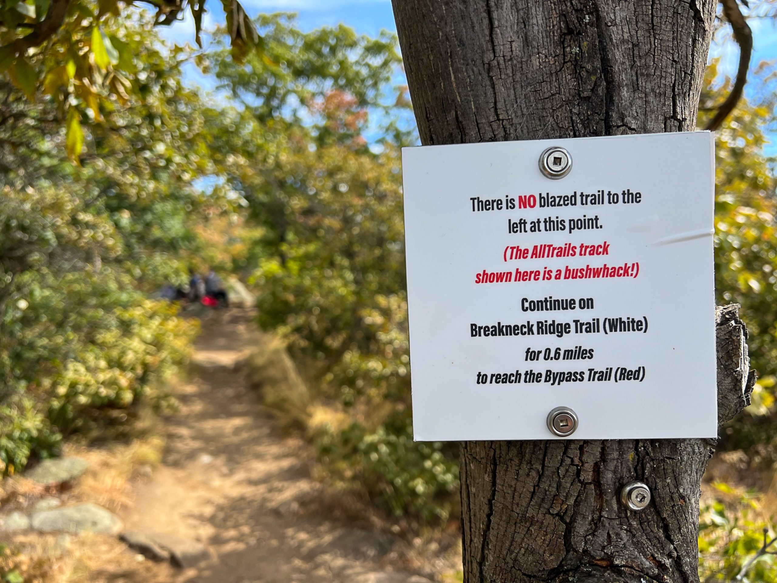
AllTrails Bushwhacks
Soon, you’ll pass two signs – about 0.4 miles apart – indicating where people have created herd paths off to the left of the trail, caused by many people following crowd-sourced tracks shown on AllTrails. These are not blazed trails and you should continue straight until you reach the actual blazed trail.

Breakneck Bypass Trail
About 0.85 miles beyond the Undercliff Trail junction, you’ll reach a junction with the red-blazed Breakneck Bypass Trail marked by a sign pointing left towards the “Long Loop” and a triple red blaze on a boulder saying “To 9D”

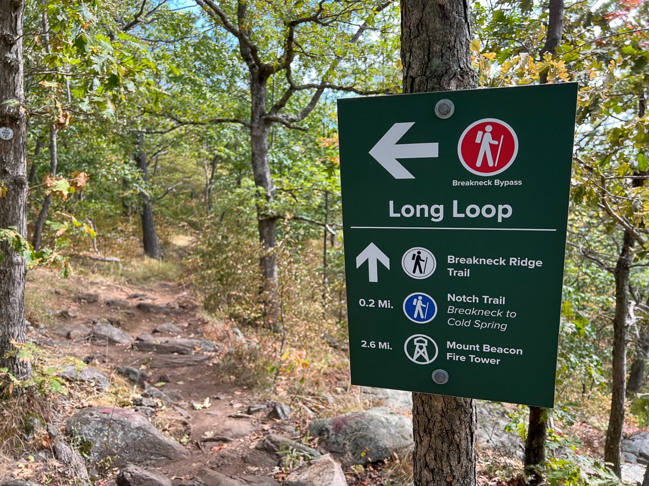
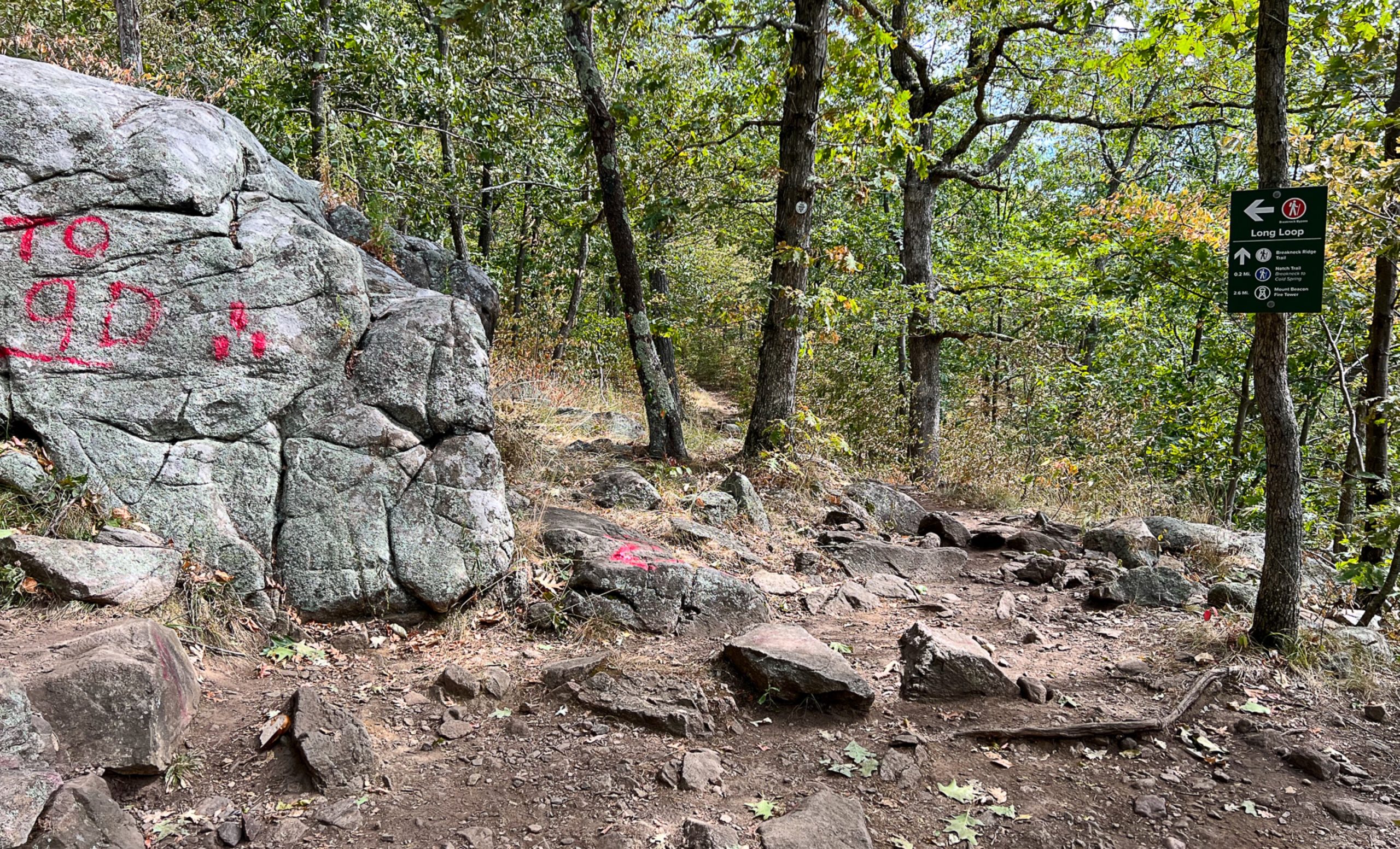
Turn left and follow the red blazes for the Breakneck Bypass Trail up a small rise.
As you descend from the rise, watch carefully for a sharp left turn in the trail after 100 feet. The trail continues to descend along eroded trails.
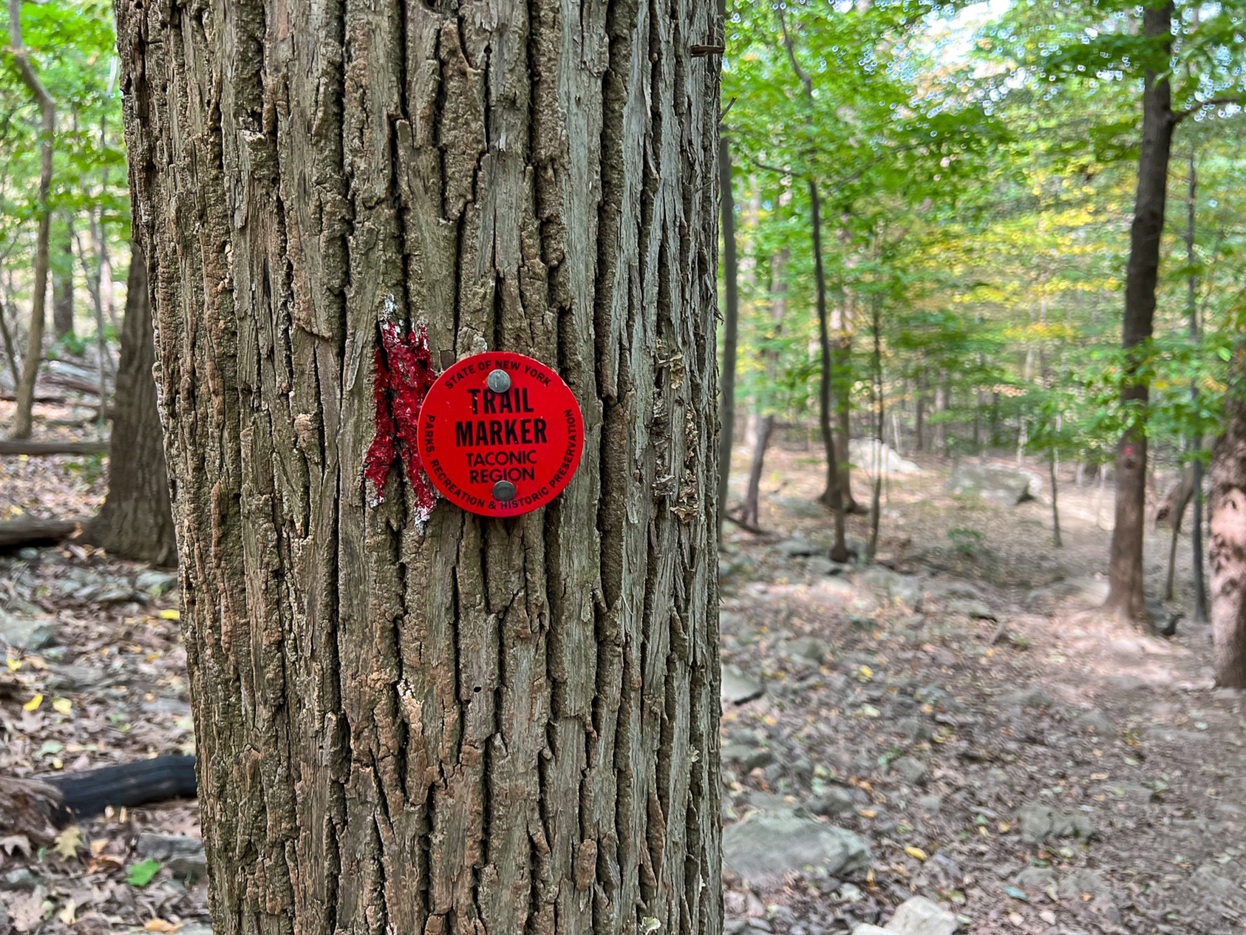
Wilkinson Memorial Trail
After 0.95 miles, the Breakneck Bypass Trail ends at a junction with the yellow-blazed Wilkinson Memorial Trail.
Turn left and follow the Wilkinson Memorial Trail downhill. After about a half mile, the trail reaches the other junction with the Nimham Trail.
Nimham Trailhead
If you were interested in an easier ascent to the viewpoints of Breakneck Ridge, you would take the Nimham Trail from here, but we will continue downhill.
Continue to follow the yellow blazes to the end of the Wilkinson-Memorial Trailhead at Route 9D.

Turn left on Route 9D and find your car along the parking area.