Ricketts Glen Overview
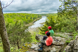
Ricketts Glen is a waterfall wonderland. This is a great loop hike with a huge reward/effort ratio which passes 21 named waterfalls over 4.5 miles of the Falls Trail network, in addition to multiple cascades. As an alternative, the hike can be trimmed down to about 3.5 miles while still seeing 18 waterfalls.
Hike Length: 4.5 miles
Elevation gain: +750 feet
Location: Ricketts Glen State Park, PA
Parking:
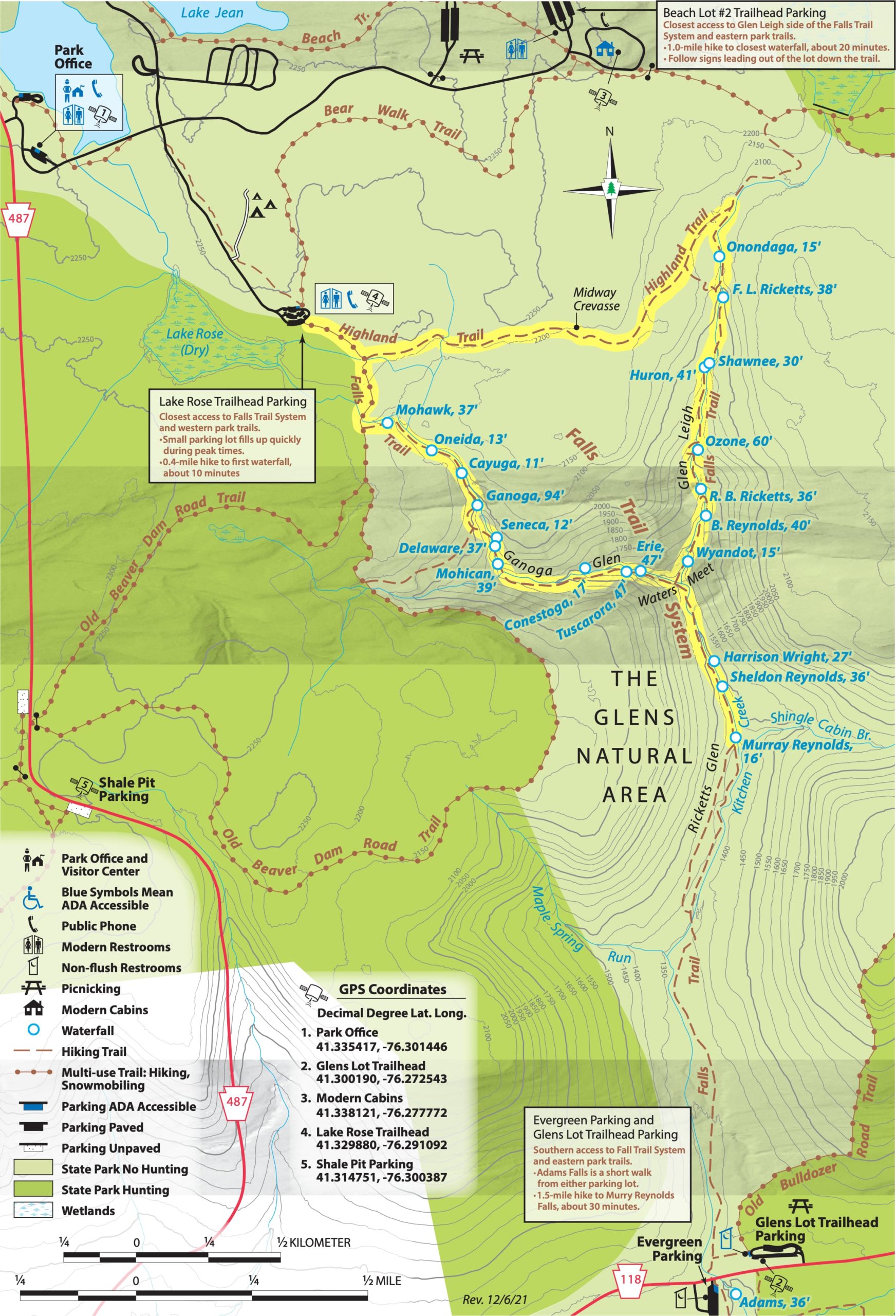
The best parking lot is the Lake Rose trailhead parking area. This is the lot nearest to the Falls Trail system, so get there early because it fills up first. If Lake Rose is full, park at Beach Lot #2.
Ricketts Glen Maps
- Ricketts Glen State Park Map (PDF)
- Glens Natural Area Enlargement Map (PDF)
- Ricketts Glen State Park Recreational Guide (PDF)
History of Glens Natural Area
In 1868, Colonel R. Bruce Ricketts bought land in northeast Pennsylvania to timber it. Fishermen exploring the lower reaches of Kitchen Creek discovered waterfalls. Explorations revealed that two branches of Kitchen Creek cut through deep gorges in a series of waterfalls, then united at Waters Meet and flowed through a glen among giant pines, hemlocks, and oaks. Colonel Ricketts built trails to the area of the waterfalls, which came to be known as the Glens Natural Area.
A member of the Wyoming Historical and Geological Society, Colonel Ricketts named many of the waterfalls after American Indian tribes. He also named waterfalls for his friends and family.
The lower glen came to be called Ricketts Glen. Many of the magnificent trees in this area are over 300 years old. Diameters of almost four feet are common and many trees tower to 100 feet in height. Southern and northern hardwood species meet here, creating an extensive variety of trees.
The Glens became a registered National Natural Landmark in 1969. In 1993, it became a State Park Natural Area and will be protected and maintained in a natural state.
Ricketts Glen hike description
Overview
If you want to see the most waterfalls in the park with the least amount of walking, this is the way to do it. Starting at the Lake Rose trailhead parking area, we recommend following this “loop” of the Falls Trail system, which follows the two branches of the Kitchen Creek – Ganoga Glens and Glen Leigh as well as follows Kitchen Creek a short distance south of the confluence of the two branches at Waters Meet:
- Go downhill along the Ganoga Glen side of the Falls Trail up to Waters Meet junction. This section passes 10 named waterfalls.
- Optional: take a short out-and-back detour south along Rickets Glen south to see 3 waterfalls, and then return back to the junction.
- Go uphill along the Glen Leigh side of the Falls Trail which passes 8 more named waterfalls.
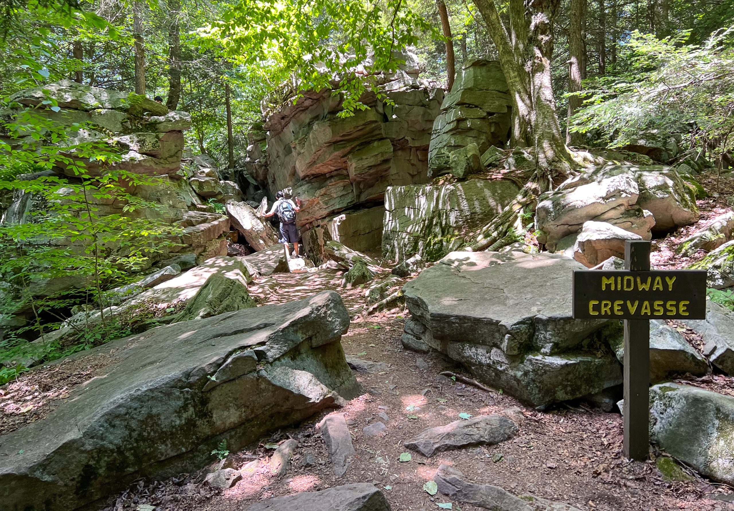
- Finally, follow the relatively flat Highland Trail back towards the parking area, passing the Midway Crevasse.
Ganoga Glen (1.2 miles)
Start from the Lake Rose trailhead parking area – and get there early because as the lot closest to the Falls Trail system, it fills up first. If Lake Rose is full, park at Beach Lot #2.
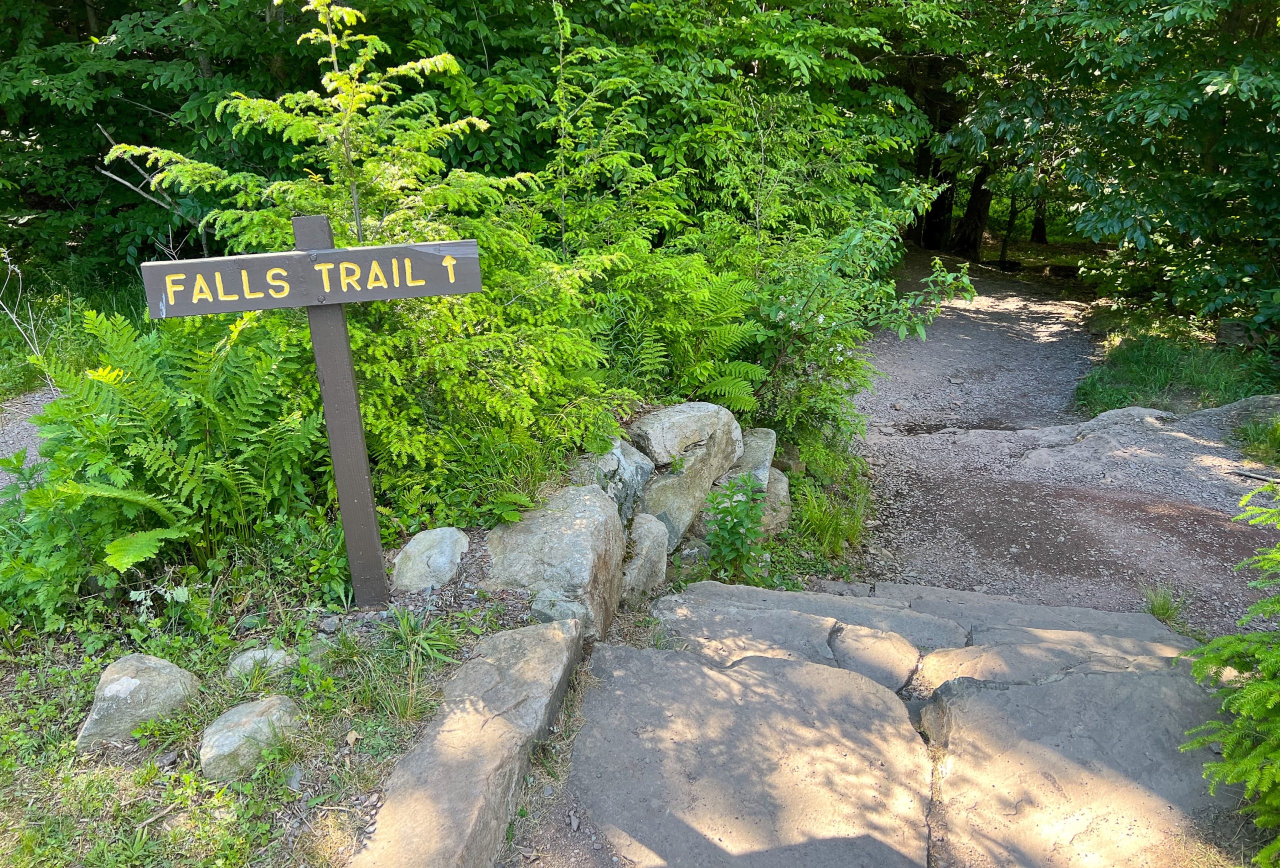
From the parking lot, look for the trailhead with the “Falls Trail” sign.
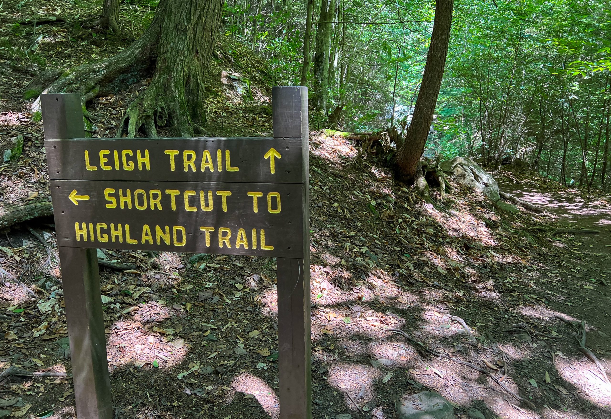
A short distance ahead, you’ll soon reach a junction. Stay to the right to follow the Ganoga Glen branch of the Kitchen Creek. (If you’d rather do the loop in the reverse, clockwise direction, turn left to follow the Highland Trail.)
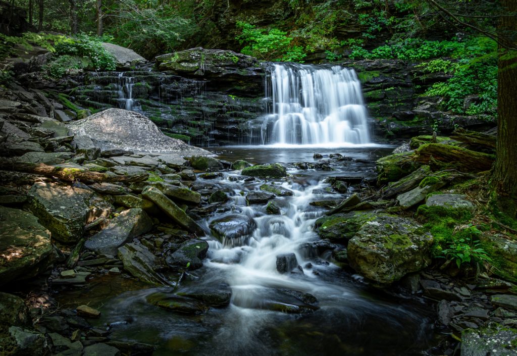
From the trailhead, it’s a 0.4 mile and about 10 minute walk to the first waterfall, Mohawk Falls (37′). You’ll next pass Oneida Falls (13′) and then Cayuga Falls.
Cayuga Falls (11′)
Ganoga Falls (94′)
Next is Ganoga Falls, which at 94 feet tall is the tallest waterfall in the park.
Meaning of “Ganoga”
The name Ganoga was suggested by Pennsylvania senator Charles R. Buckalew; it is an Iroquoian word which Buckalew said meant “water on the mountain” in the Seneca language. Donehoo’s A History of the Indian Villages and Place Names in Pennsylvania identifies it as a Cayuga language word meaning “place of floating oil” and the name of a Cayuga village in New York.
Wikipedia
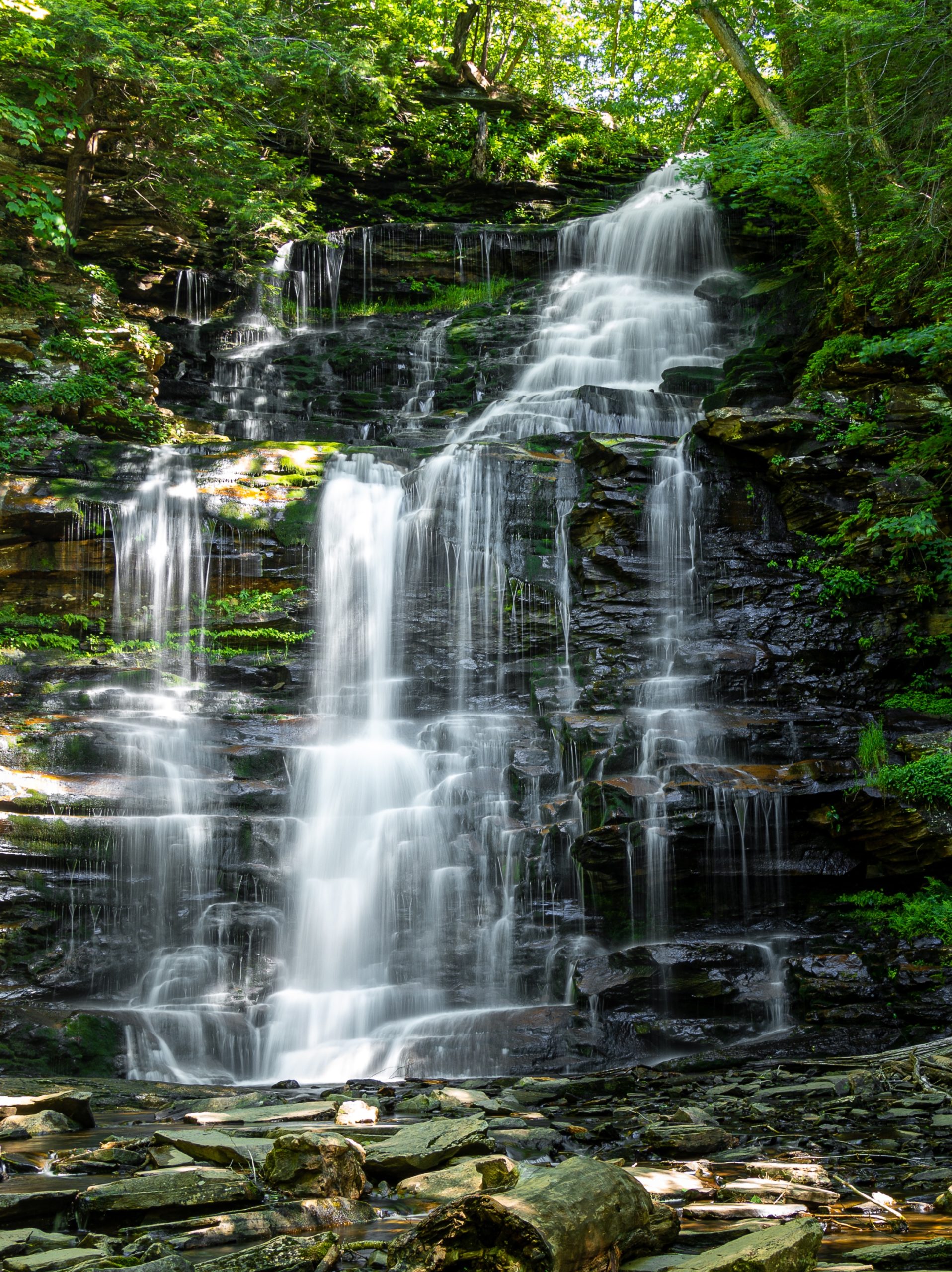
The trail continues to parallel the stream, passing Seneca (12′), Delaware (37′), Mohican (39′), Conestoga (17′), Tuscarona (47′), and Erie (47′) Falls.

Waters Meet
After Erie Falls, you’ll reach Waters Meet – the confluence of the Ganoga Glen and Glen Leigh branches. A bridge crosses Ganoga Glen, but if you want to take a detour to see 3 additional falls along Ricketts Glen, continue straight past the bridge.
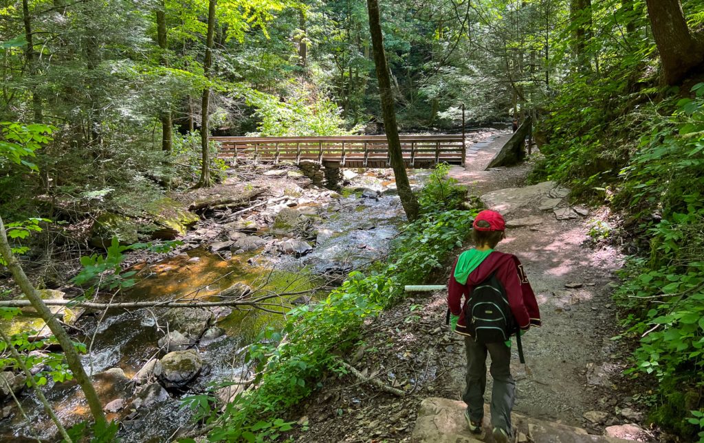
At the base of the bridge is a large rock with a plaque noting the Registered National Landmark designation of The Glens Natural Area.

Ricketts Glen (1.0 mile out-and-back)
Heading south from Waters Meet, you’ll walk about a half mile along Kitchen Creek to see three waterfalls, then turn around and return to Water Meets to continue the main loop. The first waterfall you’ll reach is the picturesque Harrison Wright Falls.
Harrison Wright (27′)
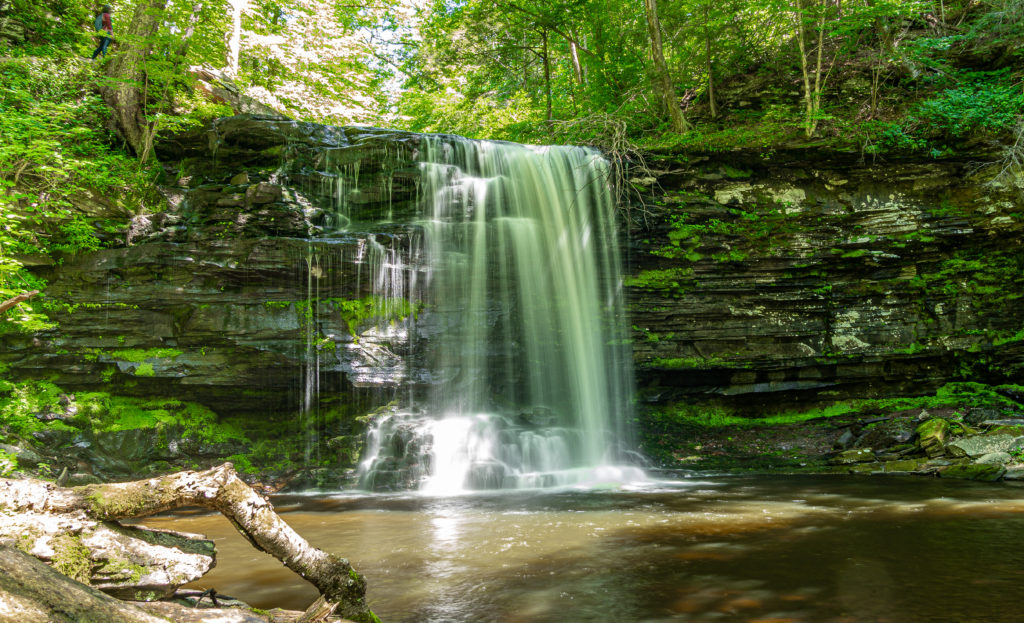
Continuing south, you’ll pass Sheldon Reynolds (36′) and then Murray Reynolds (16′) Falls. Now turn around and head back to Waters Meet.
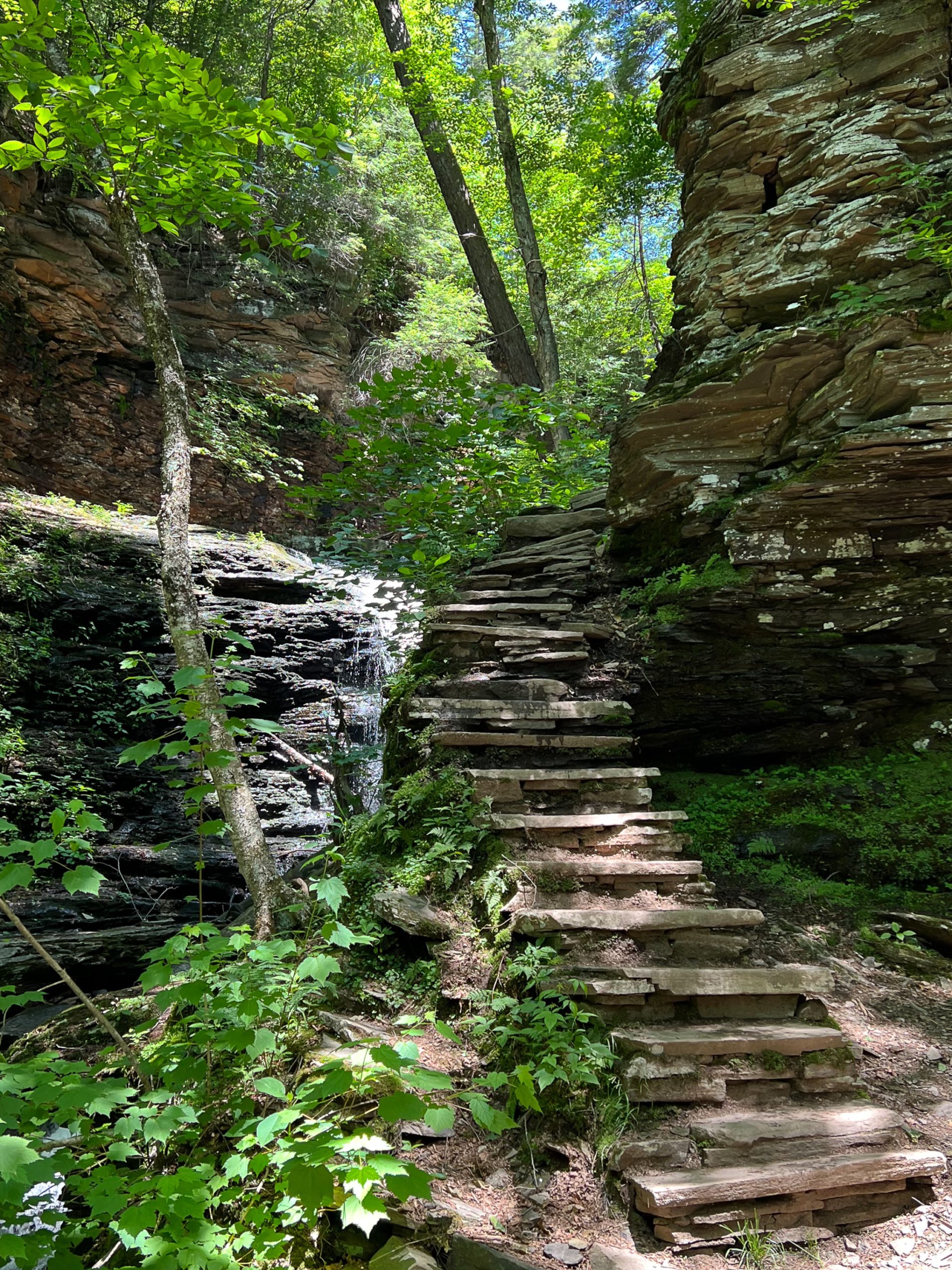
Glen Leigh (1.0 mile)
Cross the bridge at Waters Meet to begin walking uphill along the Glen Leigh branch of Kitchen Creek. First you’ll pass Wyandot Falls (15′) followed by B. Reynolds (40′), R. B. Ricketts (36′) and then Ozone Falls.
Ozone (60′)
The Wilkes-Barre Ozone hiking club used the Ricketts’ stone house as the base for their excursions. The club gave its name to Ozone Falls.
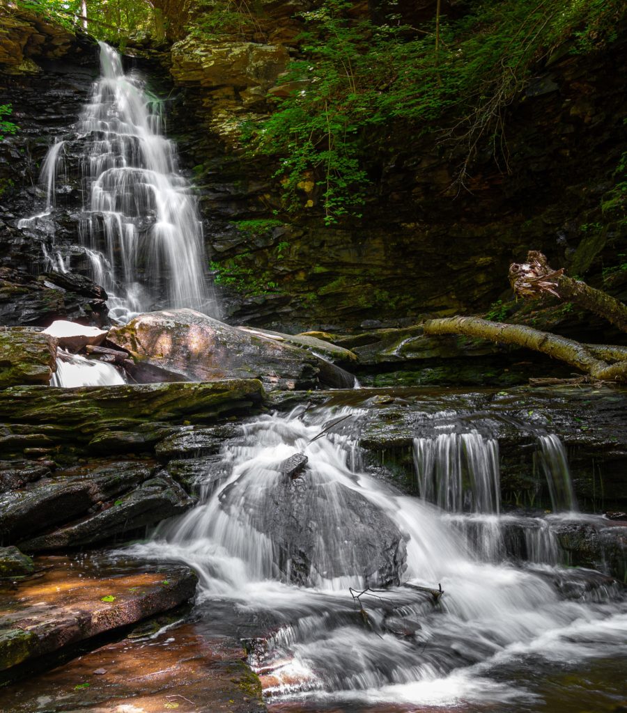
The trail continues to climb as it follows the stream, passing Huron (41′), Shawnee (30′), and F. L. Ricketts (38′) Falls.
Near the end of the trail is a junction with a shortcut to the Highland Trail. You can turn left here if you’re exhausted, but you’ll miss the last falls on the loop, Onondaga (15′) Falls.
Continue straight and pass the last falls along the Glen Leigh, Onondaga Falls, which is named for the Onondaga Tribe that lived in central New York.
Highland Trail (1.0 mile)
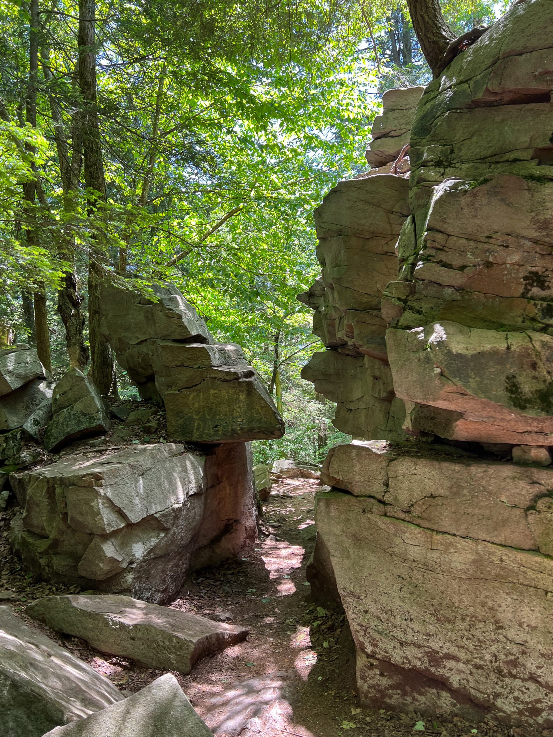
Midway Crevasse
The trail cuts across the top of the Falls Trail System and crosses through Midway Crevasse, a narrow passageway between large blocks of Pocono sandstone conglomerates that were deposited throughout this area by glacial movements. Continental glaciers buried this land under hundreds of feet of ice at least three times in the last one million years. This trail makes an excellent area for geological study groups.
From here, it’s about a half mile further back to the parking lot