There are lots of apps that hikers use. After years of experimenting with many of them, I think that these are the best hiking apps for planning hikes, navigating on trail, learning skills, photography, and staying safe.
Best Hiking Apps for Maps & Navigating
1. Avenza + NY/NJ Trail Conference Maps – best combo for NJ/NY hikers!
Avenza Maps is an app that displays maps offline – even when you don’t have an internet connection – and uses your phone’s GPS to show your location on the map in realtime. Avenza has a huge database of maps – some free and some are paid – that you can search for and download before you head out. For New Jersey and New York hikers, this is one of the best hiking apps and is indispensable when paired with New York-New Jersey Trail Conference maps.
I own both paper and digital versions of these maps and I consider them the best investment local hikers can make (even if you have a map on your phone, you should always carry a paper map). These maps are designed by the people who build and maintain the trails and are hands-down the best maps with the most useful information for route-planning and for identifying viewpoints and landmarks.
Avenza is not my favorite app for navigating – GaiaGPS is – but for New Jersey and New York hikers, it’s invaluable thanks to the NY-NJ Trail Conference maps.
NY-NJ Trail Conference offers dozens of free maps including Ramapo Valley Reservation, Ramapo Mountain State Forest, Ringwood State Park, and Bear Mountain. The paid maps also provide elevation contours, mileage between waypoints, and more – and I highly recommend buying them – but even the free maps are great.
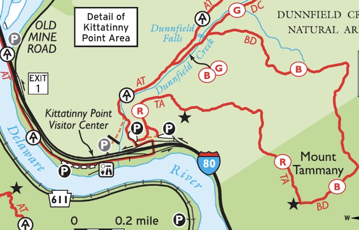
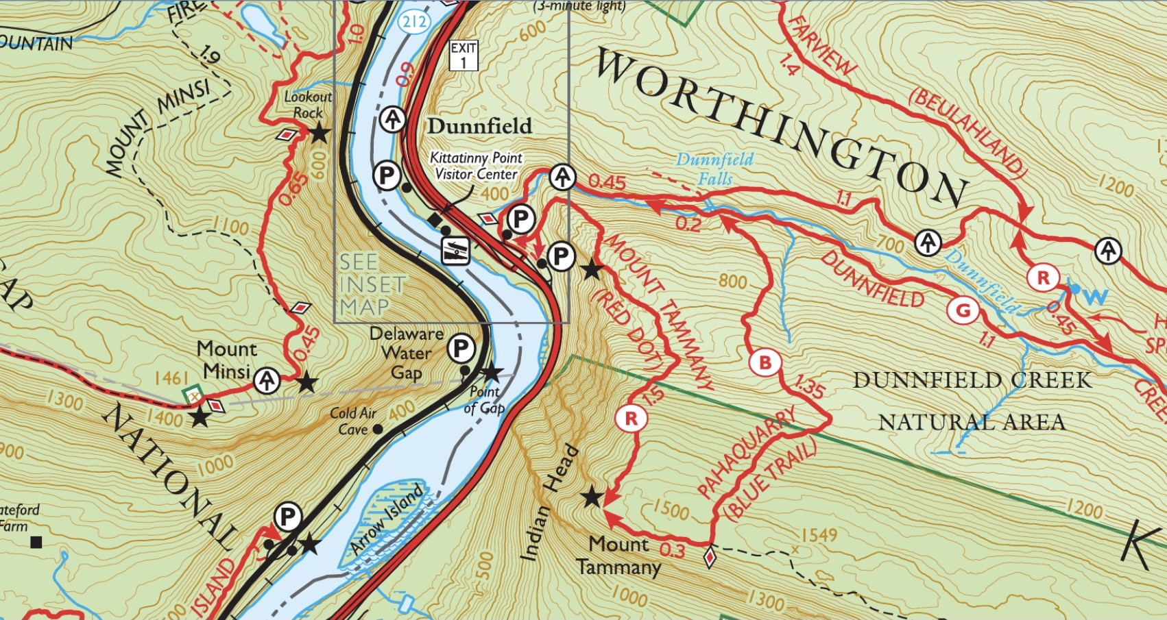
This page has the full list of free and paid Trail Conference maps, which can also be found on the Trail Conference’s map page on AvenzaMaps.com.
2. GaiaGPS
When I’m on the trail, this is the app I use the most – it’s the best for route finding. Like AvenzaMaps, GaiaGPS displays maps and shows your location on them in realtime using your phone’s GPS. Unfortunately, the free version of the app requires an internet connection – it doesn’t let you download offline maps. You’ll have to pay for a premium subscription to download maps, but I think it’s worth it. It includes multiple different maps, including National Geographic maps for many popular parks.
While Avenza also shows your location on the map, I find that GaiaGPS is much more intuitive for navigating, with a pointer showing your direction using the built in compass and usually with much higher level of detail than other apps. I wrote a separate post comparing GaiaGPS with the super popular AllTrails and Avenza.
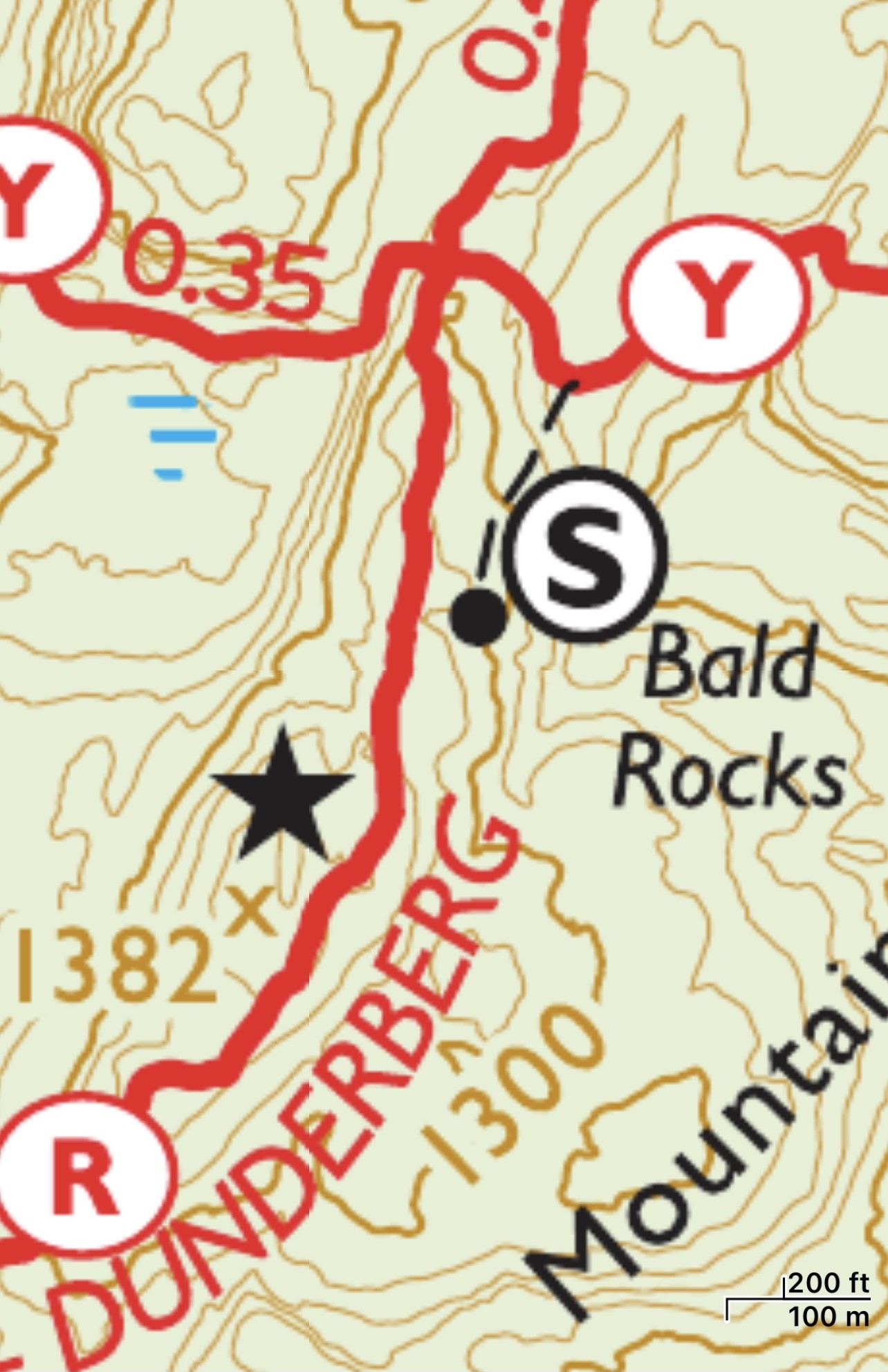
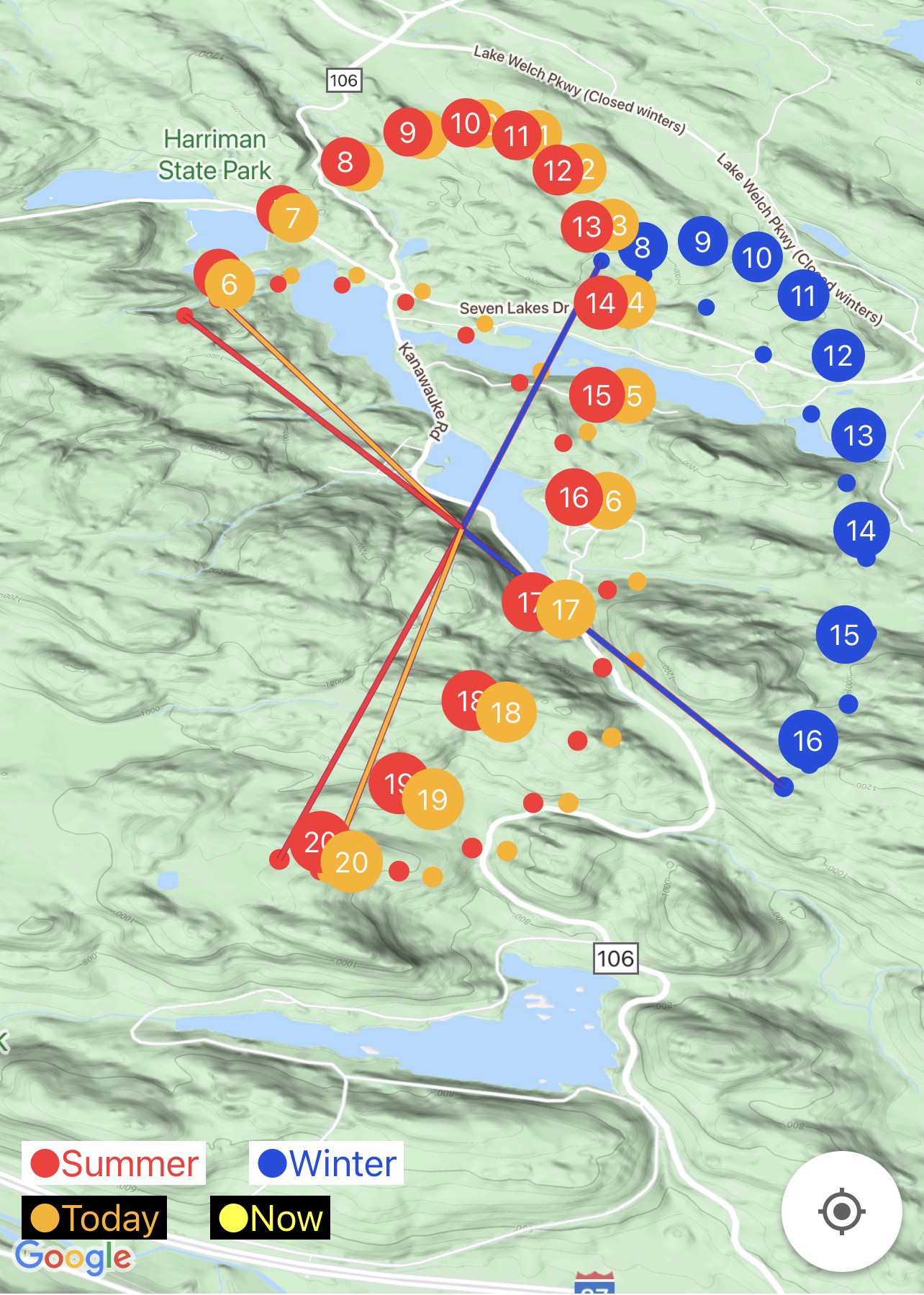
For better or worse, GaiaGPS’s maps are crowd-sourced, so it will display unofficial trails and paths that often don’t appear on official maps. I think it’s very valuable information. For example, below is the Bald Rocks Shelter area in Harriman State Park shown in both GaiaGPS (left) and in the NY-NJ Trail Conference map on Avenza (right). While it’s obvious from the GaiaGPS map, from the NY-NJ Trail Conference map it’s not obvious that you can easily access the shelter from the Ramapo-Dunderberg Trail to the west.
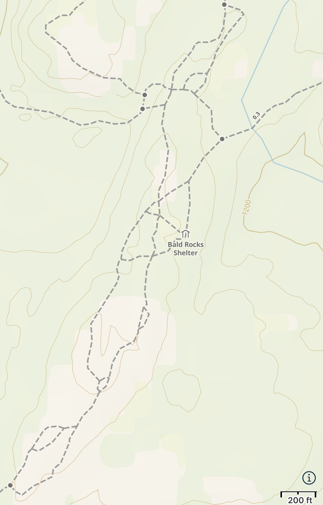
Note – I’m not encouraging off-trail travel or using unofficial trails. It’s important to stay on trail to reduce erosion and damage to plants. But when you’re lost and notice an obvious path, it’s very helpful to see where you are relative to those paths.
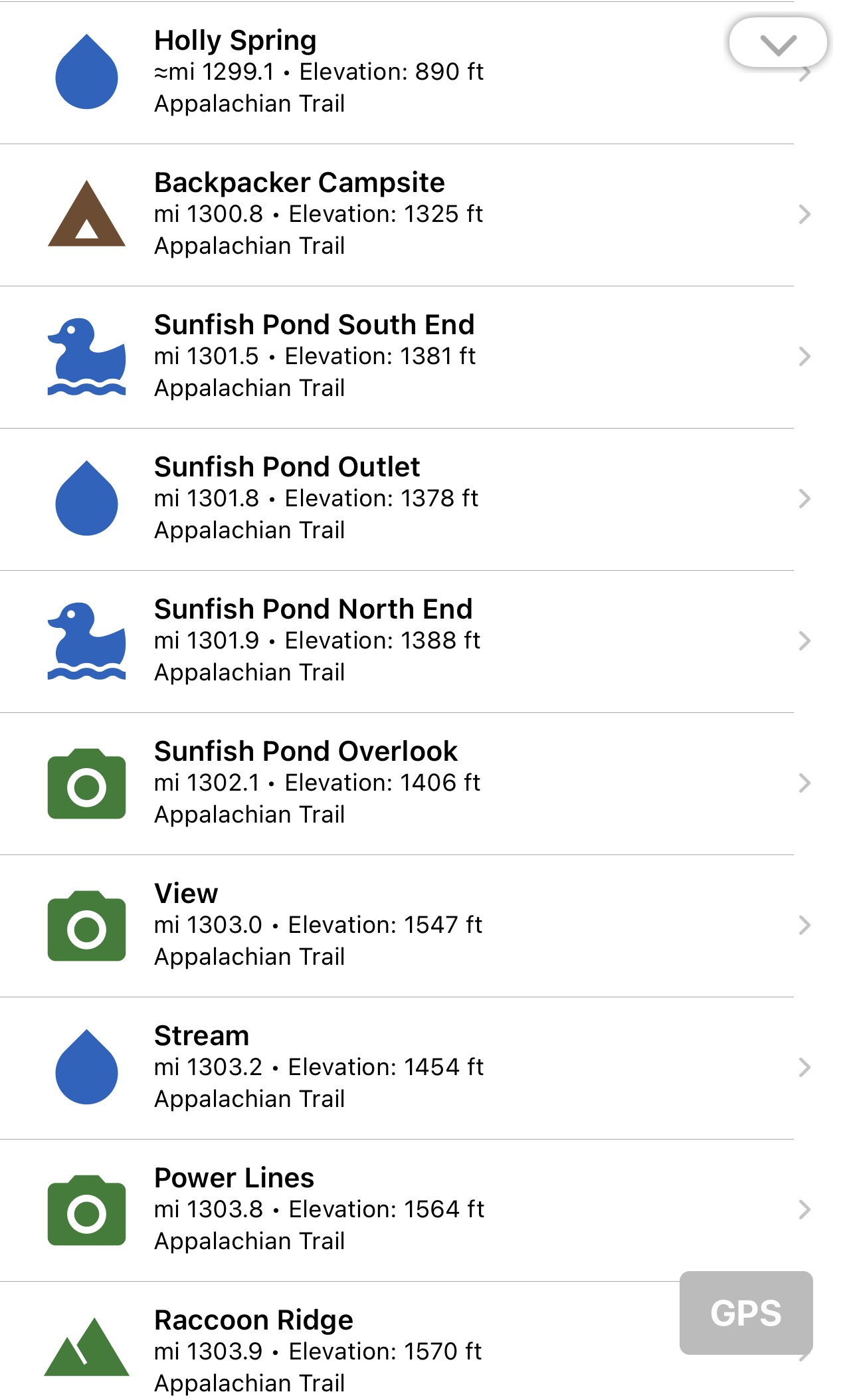
3. FarOut Guides (formerly Guthook)
FarOut Guides until not too long ago had the much cooler name Guthook. If you’re hiking all or part of the big 3 long distance trails in the United States – the Appalachian Trail, Pacific Crest Trail, or Continental Divide Trail – or dozens of other major trails, FarOut Guides Guthook is a must-have app. In the northeast, there are also guides for Acadia National Park, Long Trail, White Mountain National Forest, and Mid State Trail.
For New Jerseyans and New Yorkers section-hiking or day hiking the Appalachian Trail, Guthook is easily the best hiking app and provides really good detailed information on the location of water sources, camp sites, view points, and more.
Best Hiking Apps for Planning & Skills
4. AllTrails
Like Avenza Maps and GaiaGPS, AllTrails is a navigation app, but I rarely use it and never for navigating. It’s on this list because – especially if you’re new to hiking – it’s a good resource to discover hike ideas.
My suggestion is after using AllTrails to find a hike in a general area, search online for trail guides or pull out a NY-NJ Trail Conference map to plan your route and then use Avenza or GaiaGPS on-trail to find your way. It sometimes looks like AllTrails shows the route of whoever hiked that particular area first, and it might not be the best route – just the one that the crowd decided to follow.
5. Reddit
Reddit has thousands of online communities, but I like it specifically for one reason – the /r/Ultralight subreddit, which is a great resource for both beginner and advanced backpackers. With 500,000+ members as of May 2022, they call themselves “the largest online Ultralight Backcountry Backpacking community.”
Even if you’re not aiming for a sub-10 pound base weight (generally what most people consider “ultralight”) the philosophy of packing lighter to make hiking more enjoyable and even give you the ability to carry “luxury” items will make everyone’s backpacking experience better.
On the forum you’ll find gear reviews, trip ideas, food recommendations, first aid and maintenance advice, and more – all focused on ultralight backpacking. It’s also a great place to do a “shakedown request” (when you share your lighterpack.com gear list and ask others to criticize it and help you dial in your base weight.)
6. Facebook
Like Reddit, Facebook can be a great resource for hikers, especially for specific geographies or trails. A few groups I’m a member of include:
State/regional. These are general interest hiking groups for people in a given geography. I’m a member of Hike New Jersey, where people share hike photos, go for hike ideas, or ask and answer questions about New Jersey parks and hikes and even New York, Pennsylvania, and other nearby places that people go. What’s the most challenging hike? what time does the parking lot fill up? are examples of common questions asked in the group. These kinds of groups can have thousands of people of varying skill levels and you can almost certainly find one – or many – for your state or area.
Hiking groups. These are typically smaller groups of people who organize hikes together, usually in a particular geography, with certain types of hikers or skill levels, often led by a particular member. I’m a member of West Milford 13ers Hiking Group – a group led by Don Weise that organizes hikes generally within a reasonable driving distance of West Milford. The group hikes at a moderately fast pace. There are groups for various age groups, for singles, for people who hike slow, fast, etc. Group hikes are a great way to meet other hikers and discover new trails.
Trail-specific. Many popular trails and parks have groups specific to those trails where people ask and share very specific questions and information regarding those trails. I was a member of John Muir Trail Hikers 2021 since I did a section of the JMT in 2021. The group has over 7,000 members. I’ve also joined Hiking the Batona Trail, a group with 3,500 members about the Batona Trail in the New Jersey Pine Barrens which I hope to hike some day.
Topic-specific. These are groups focused on specific hiking-related topics. There are pretty broad topic groups like Ultralight Backpacking with over 45,000 members to very specific groups like Backcountry Meal Planning for Thru Hikers and Let’s Get TP Out of the Backcountry (almost 800 members).
Best Hiking Apps for Learning
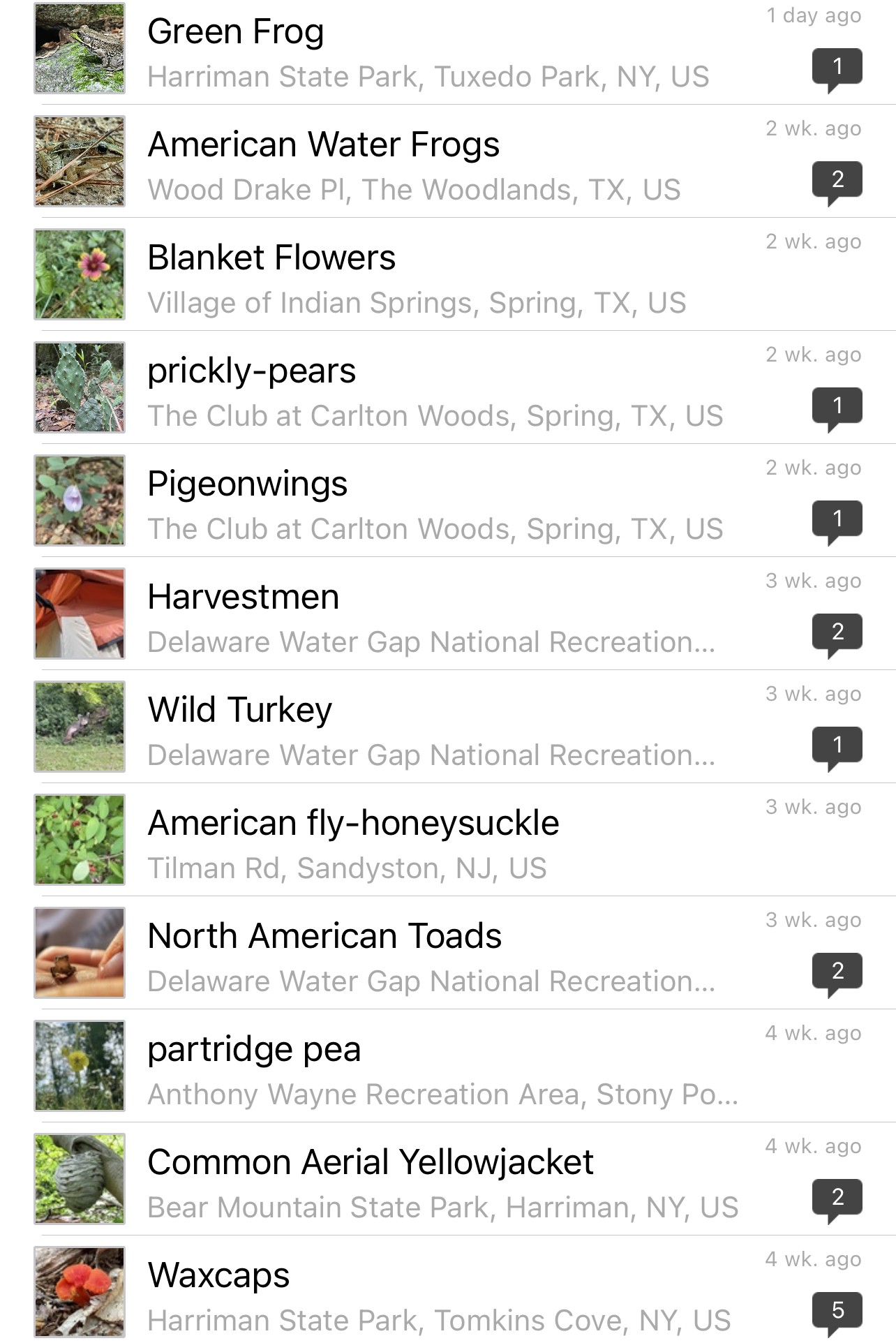
7. iNaturalist
I’m not a botanist or zoologist, but one of the things I love about hiking is seeing interesting plants and wildlife. With the iNaturalist app, you can upload photos of what you saw and the app will do its best to visually identify whatever is in the photo, taking into account the location where you took it. You can make an educated guess as to what you saw, but the best part is that there is an entire community of people who can review your photos and comment with their recommended identification. Sometimes it matches my guess, but often it doesn’t! It’s a great way to learn.
8. Sky Guide
This one’s just plain fun (and it costs $2.99). If you’re night hiking or camping and staying up late to watch the stars, open up the Sky Guide app and point it in any direction in the sky. The app will identify stars, planets, satellites, and constellations you’re looking at. It’ll even show the location of the Milky Way.

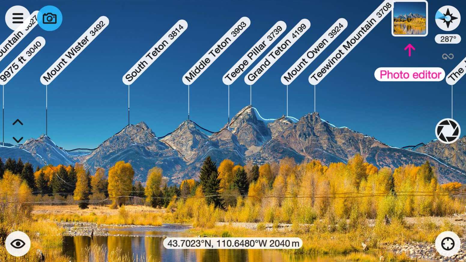
9. Peak Finder
You’re on a big hike surrounded by beautiful mountains. Don’t you wish you knew what you were looking at? Open up the Peak Finder app and point your camera at the mountains and you’ll see why this is one of the best hiking apps there is. The app will overlay labels of what you’re looking at on your screen and you can sound smart to your friends by pointing out the various peaks.
10. Sun’s Path
If you’re a backpacker who likes to look for prime camp sites (great sunrise/sunset views) or just want to know where and when the sun will rise and set, this is the app for you.
Best Hiking Apps for Photography
Some people want to experience hikes rather than document them. But if you enjoy photography, these apps will help you make the most of it.
11. Snapseed
This is my favorite photo editing app – and it’s 100% free. Imagine: You’re at an amazing viewpoint and you take a photo with your phone. It looks flat and nothing like what you were actually looking at. Never fear – the free Snapseed app will punch up that photo in no time. It’s not quite a photoshop or Lightroom replacement, but bump up the Ambiance, play with the HDR tool, and get the clouds and hills to pop by adding some Structure, and voila.

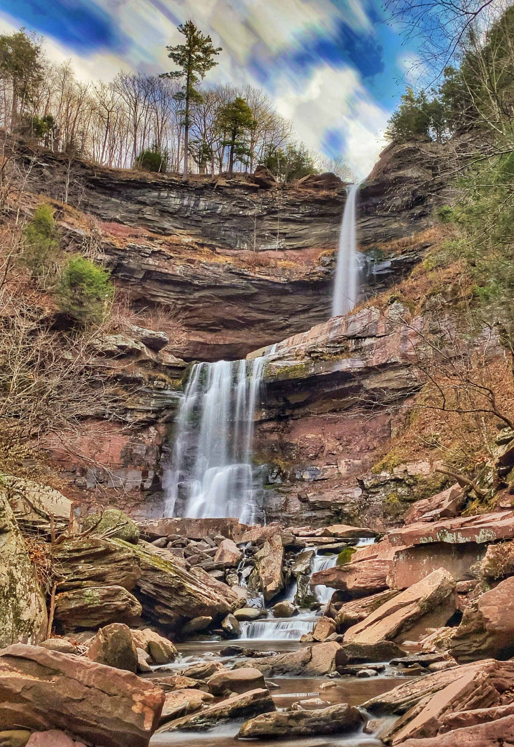
12. ProCam + Pocket Tripod Pro
Have you ever seen those cool waterfall photos where it looks like the water is made of glass or fluffy cotton candy? That was done with long exposure photography and often with expensive cameras. But you can replicate that look with an iPhone and the ProCam app. The app has lots of features, but the one I use is the long exposure to get those beautiful shots of cascades and waterfalls. Use the “motion blur” setting with 4, 8, 15, and 30 second options. You’ll need to make sure your phone is perfectly still or else the shot will come out blurry – I use the Pocket Tripod Pro.
13. Photo Timer+
Whether you’re hiking alone with no one else to take a picture of you or you’re with others and want to take a group shot, you have two main options (other than a selfie): set up your camera and use a remote bluetooth camera shutter or set a timer to take the photo.
This free, no-frills photo timer app will start a timer, take one or multiple shots, and play a sound if you want to let you know when it’s taking the photo. You’ll need to set up your phone somewhere, so this is a great app to pair with the Pocket Tripod Pro.
14. Instagram
You’ve taken and edited your photos of the great outdoors. In addition to this website, Instagram is where I share my better photos with the world.
15. 500px
If the good stuff goes on Instagram, the great stuff goes on 500px.com. I keep a curated selection of my favorite photos on my 500px account.
Best Hiking Apps for Safety
16. Somewear
While the device has a dedicated button to send a distress signal to emergency response crews, the use of text messaging and other features requires pairing the device with your phone and using the Somewear app.
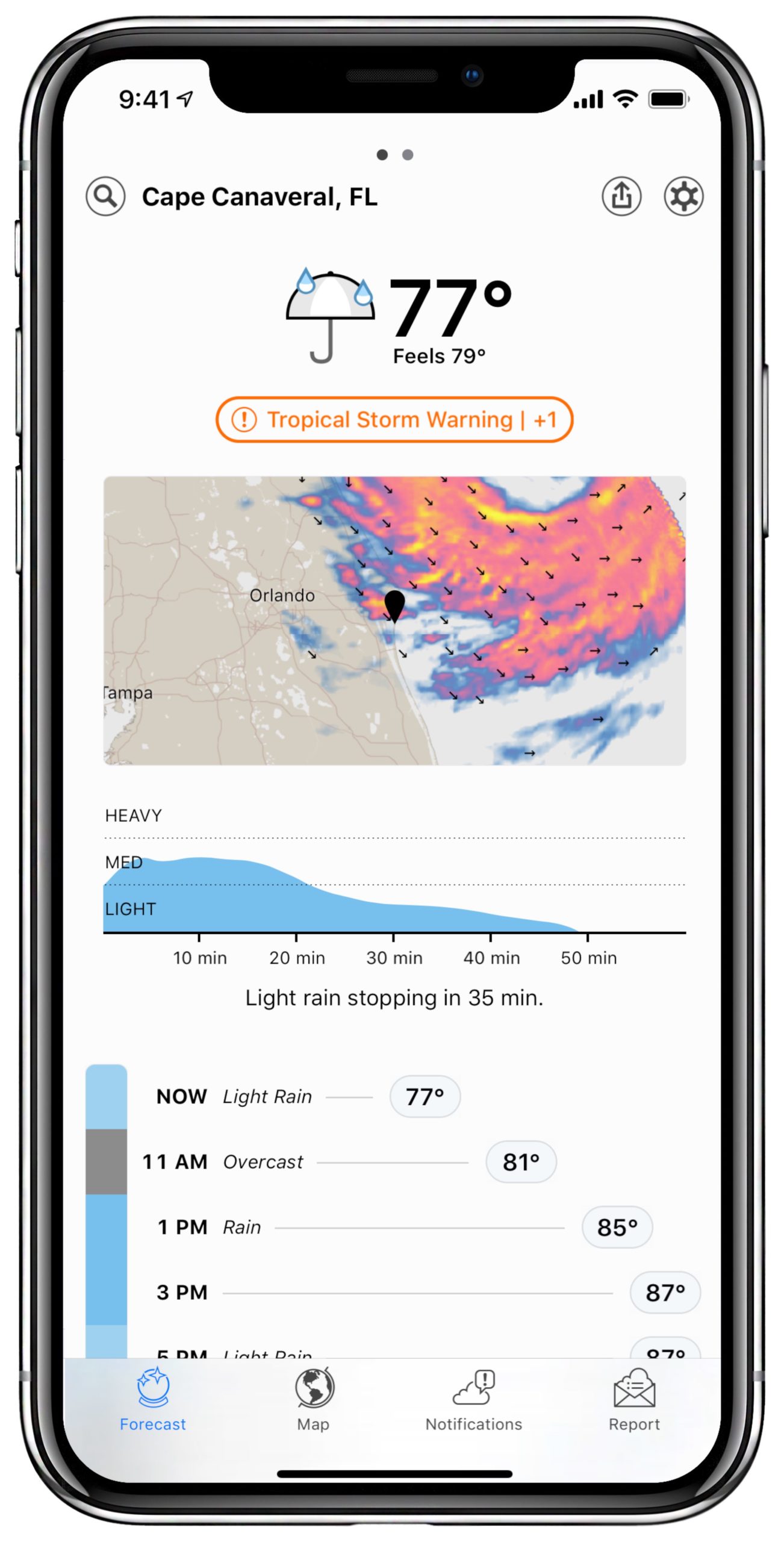
17. Dark Sky
If I know I’ll be in a remote area without cell phone reception, I carry a satellite communicator made by Somewear Labs, the Somewear Global Hotspot. The device pairs with your phone and lets you send and receive text messages, get a weather forecast, and deploy an SOS signal in case of emergency to get help from Search and Rescue.
Dary Sky is a hyperlocal weather forecasting app that forecasts precipitation down to the minute over the next hour. When you’re on the trail, it’s especially helpful to know exactly when bad weather is about to hit so you can quickly set up your tent or find a place to take shelter.
Regardless of the weather forecast, always be prepared. Carry a rain jacket – even if there forecast doesn’t call for rain – and/or clothes to stay warm in the winter.