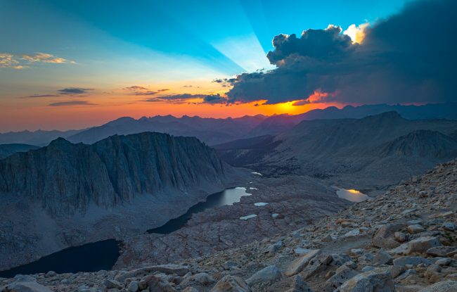
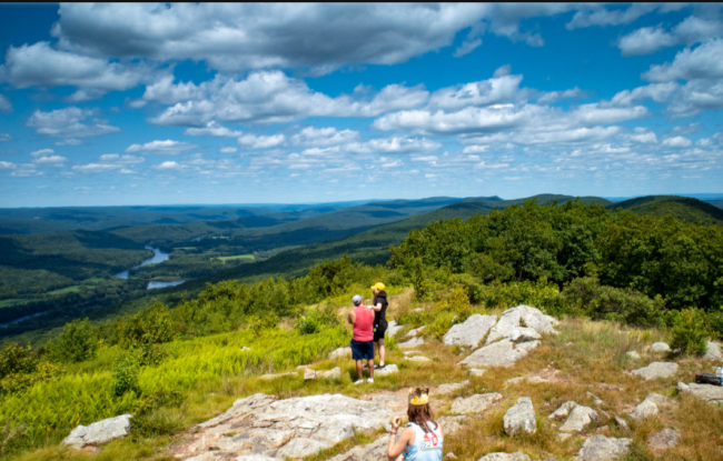
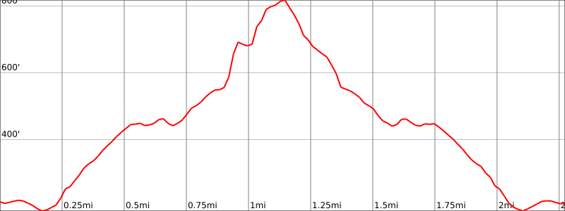
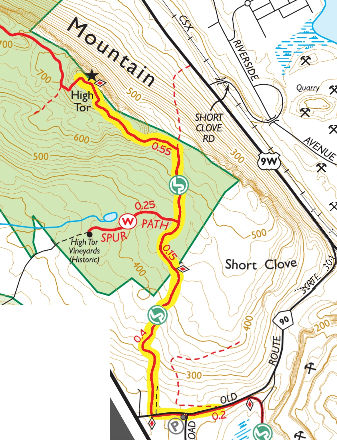
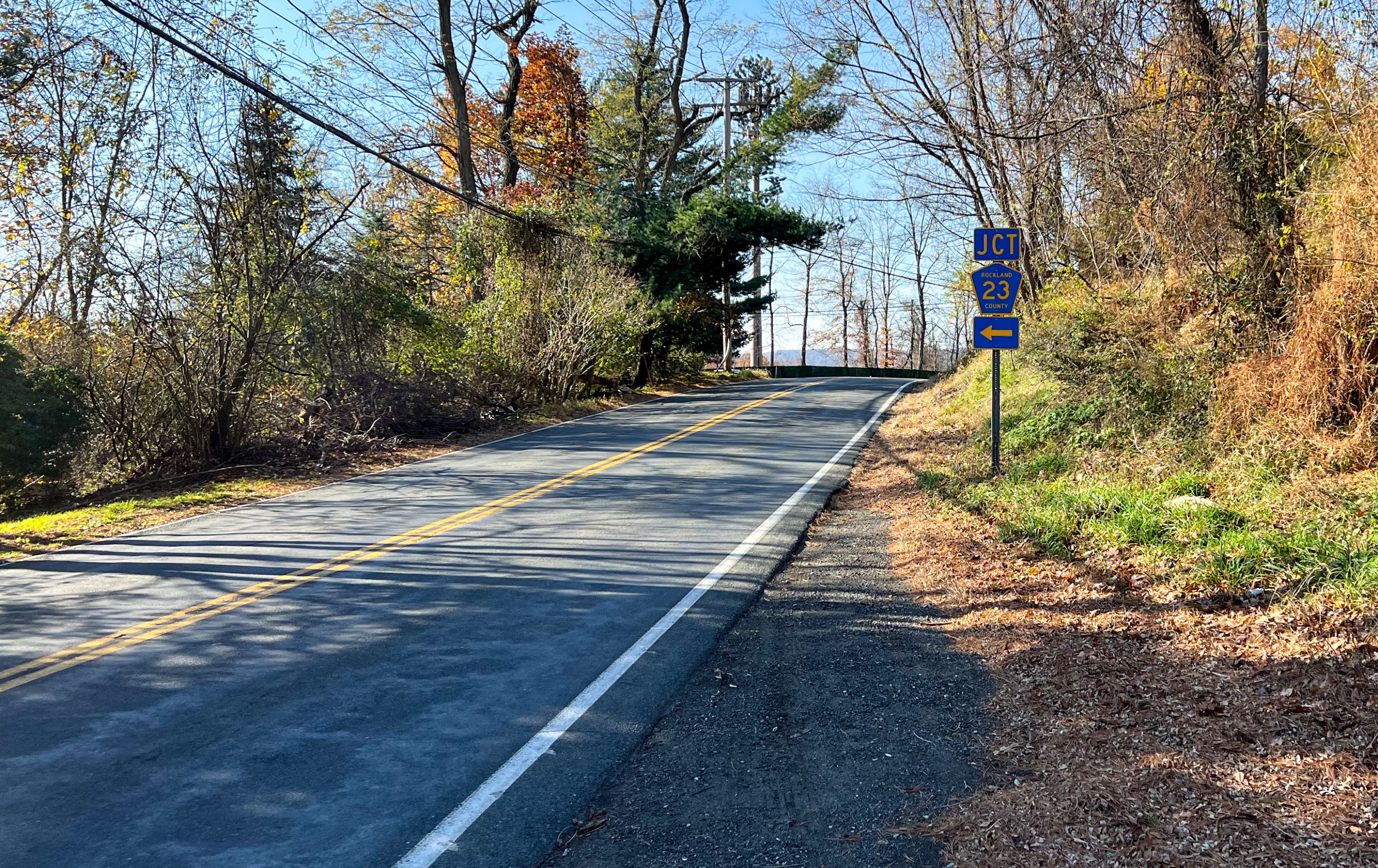
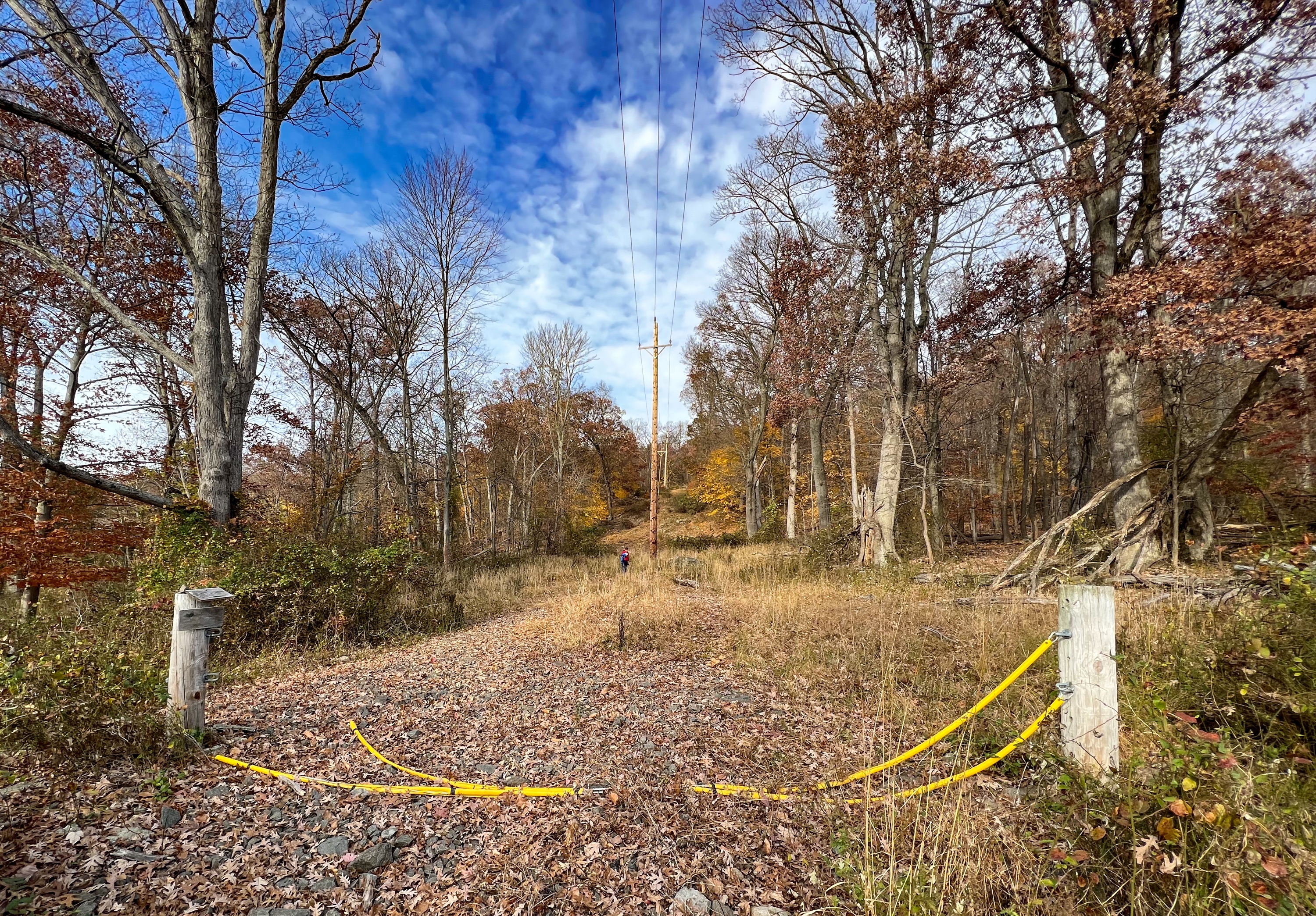
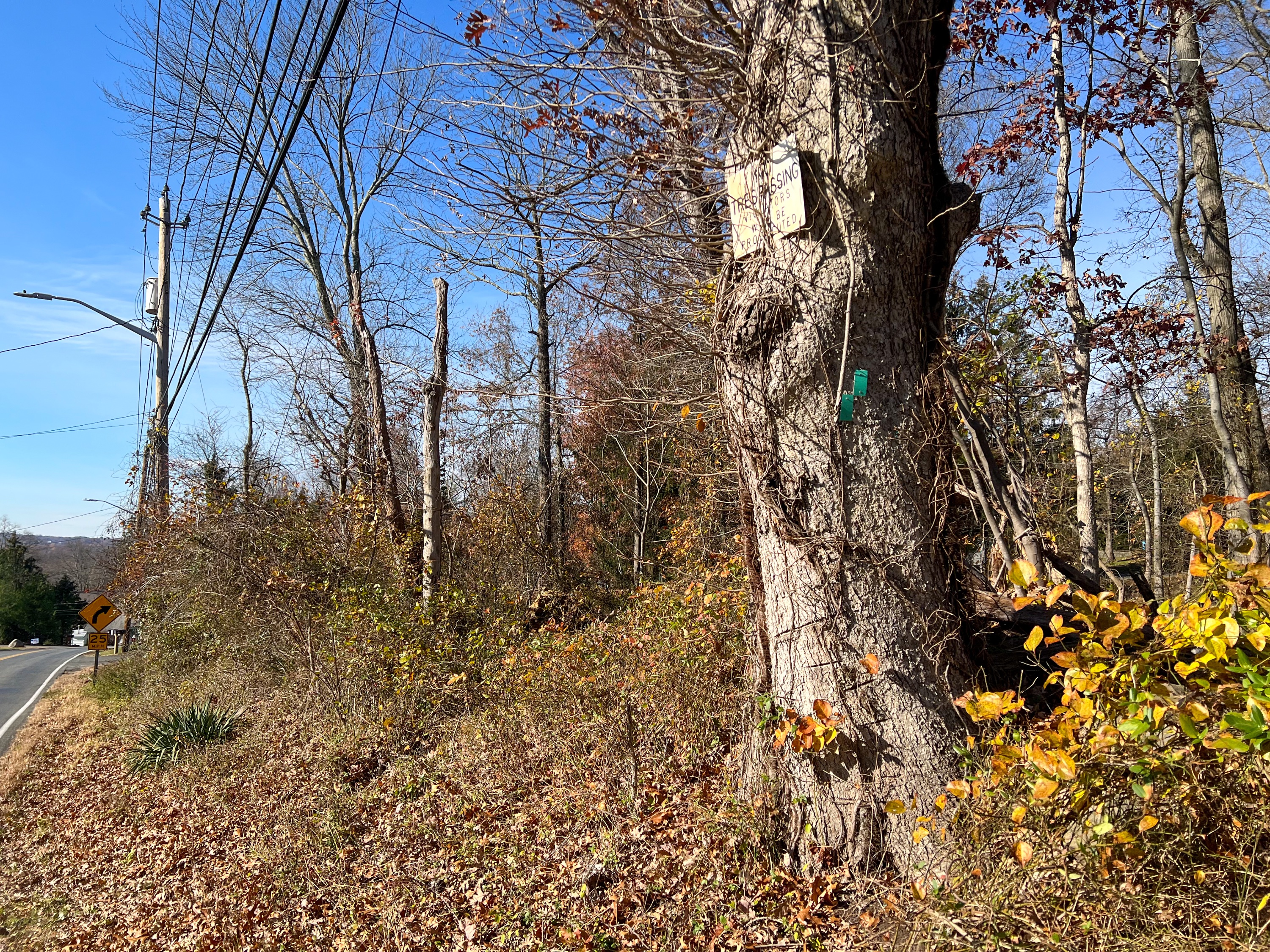
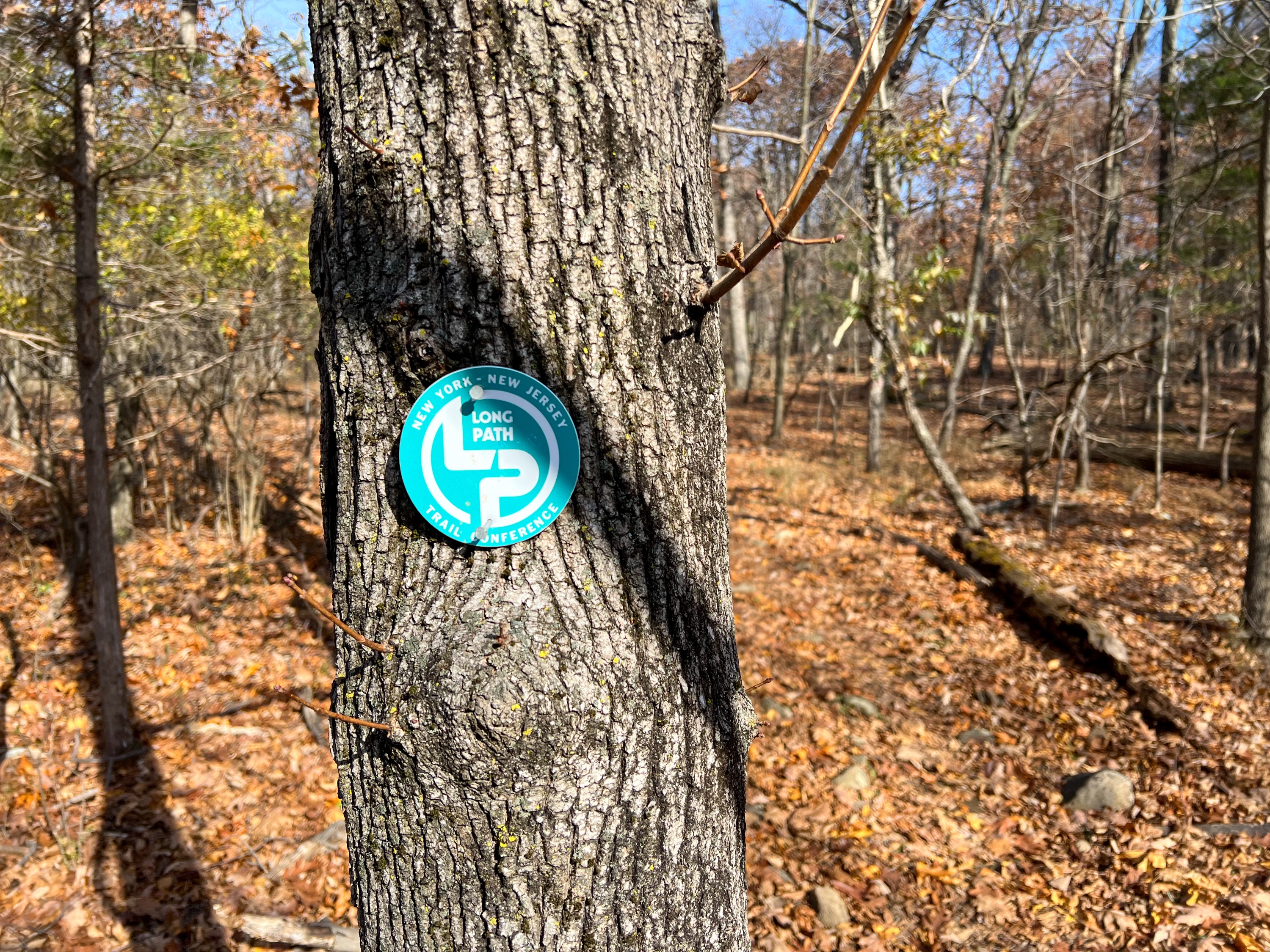
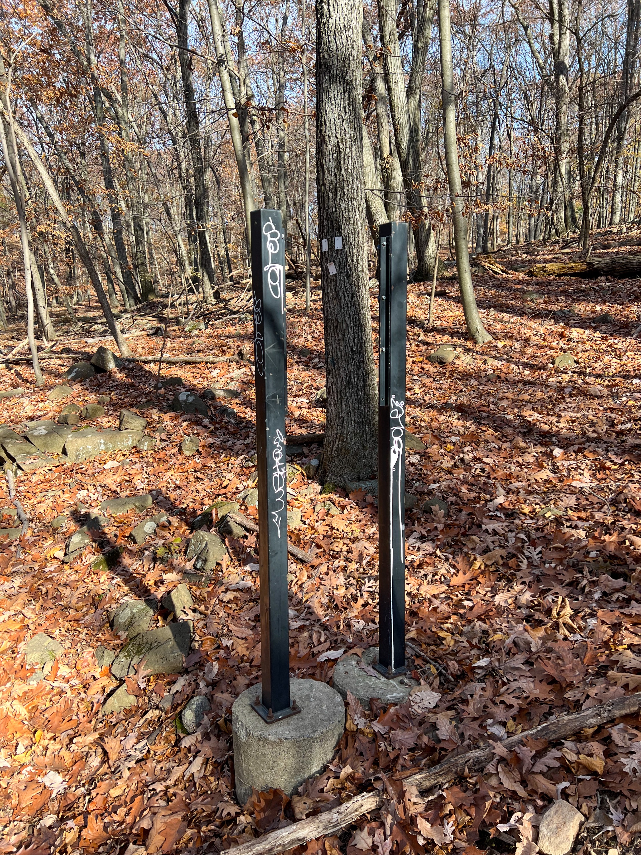
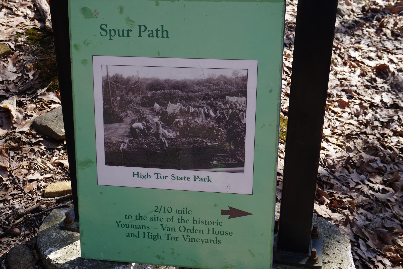
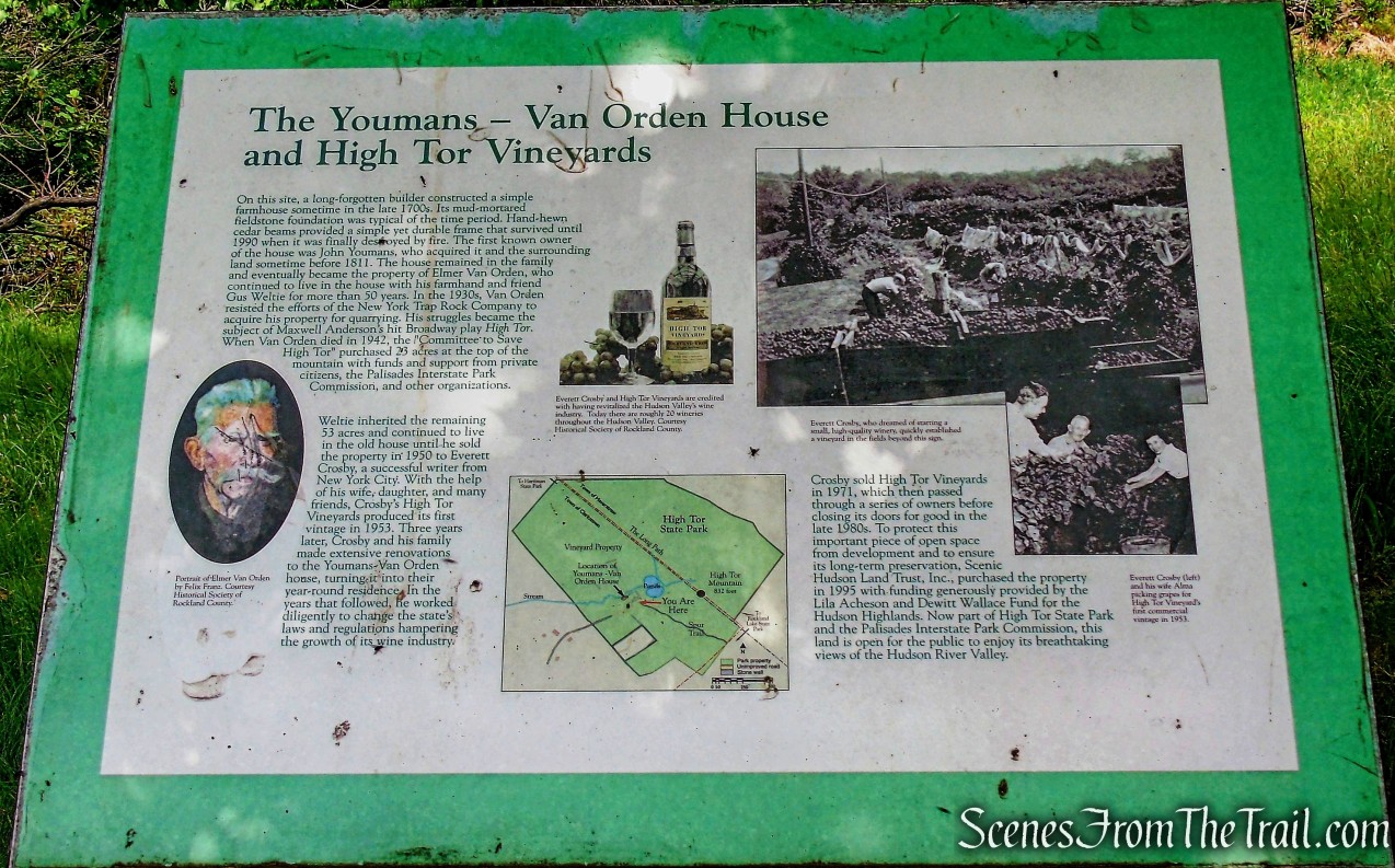
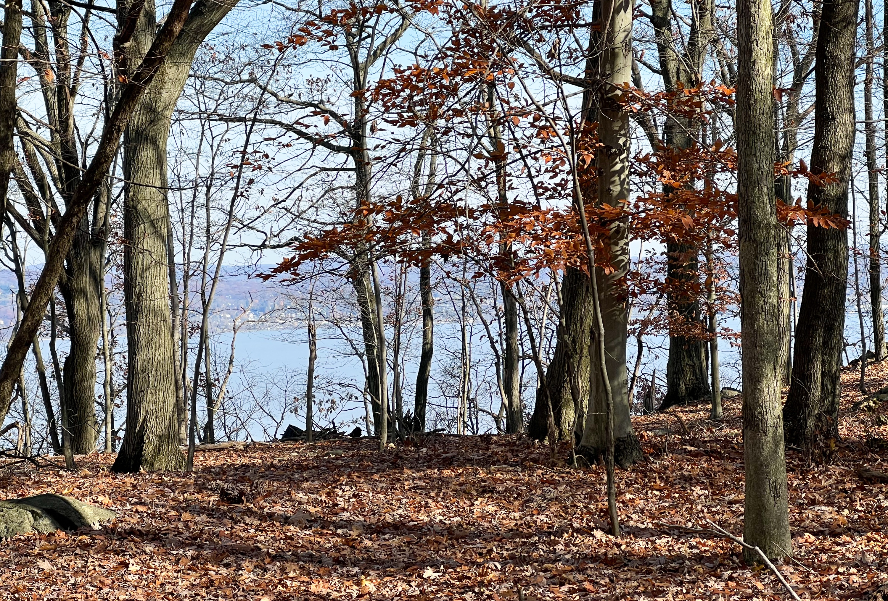
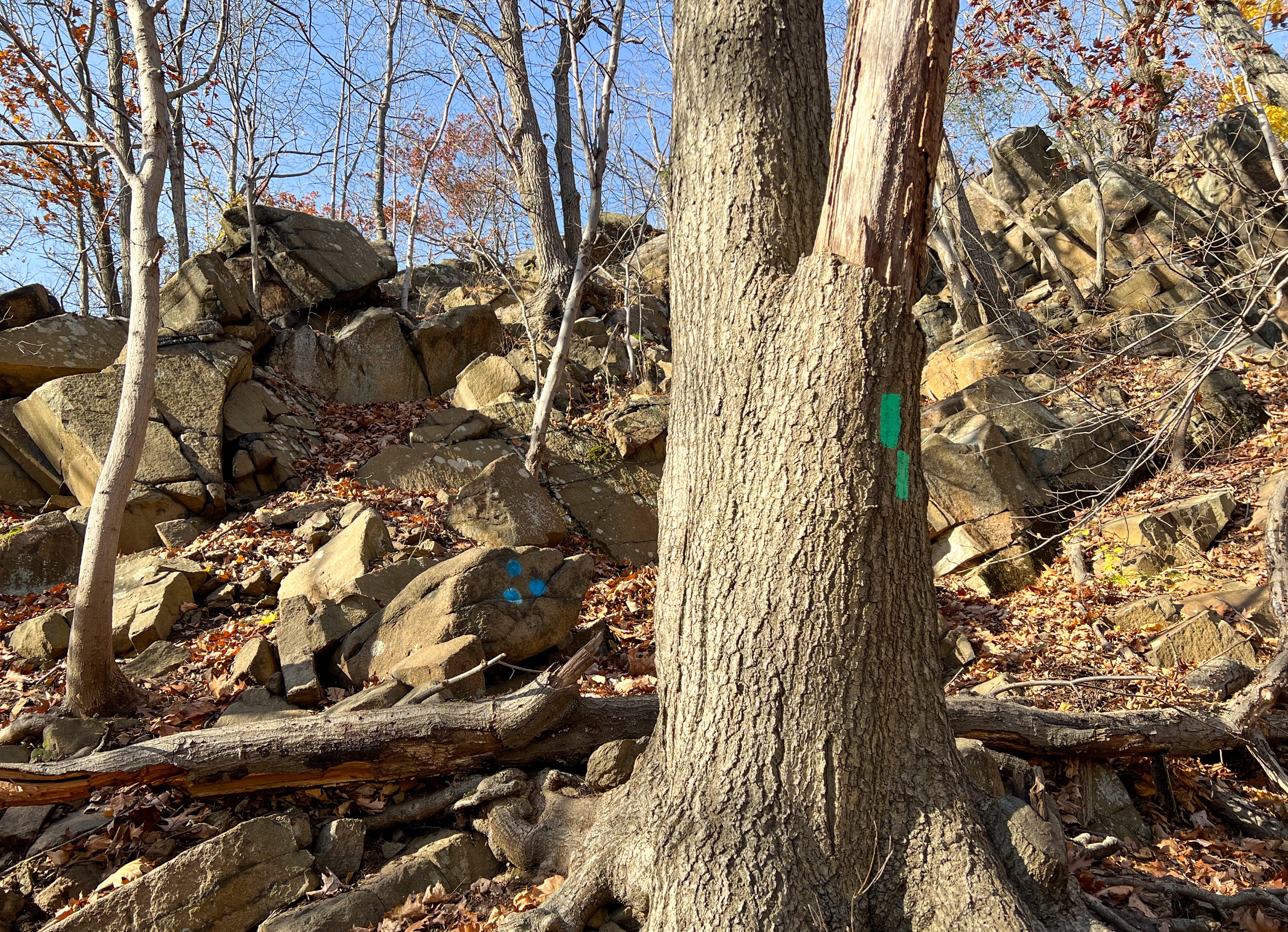
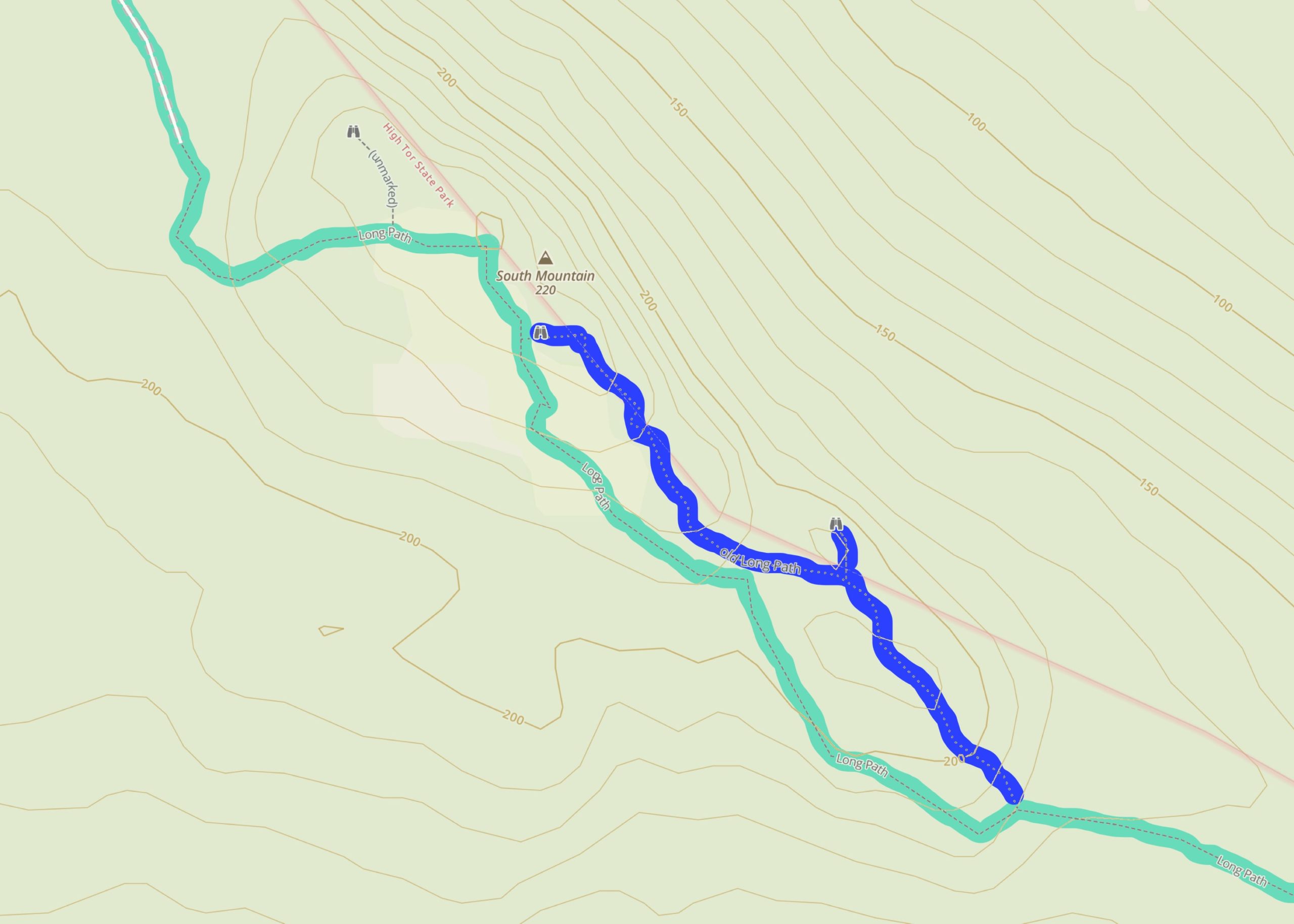
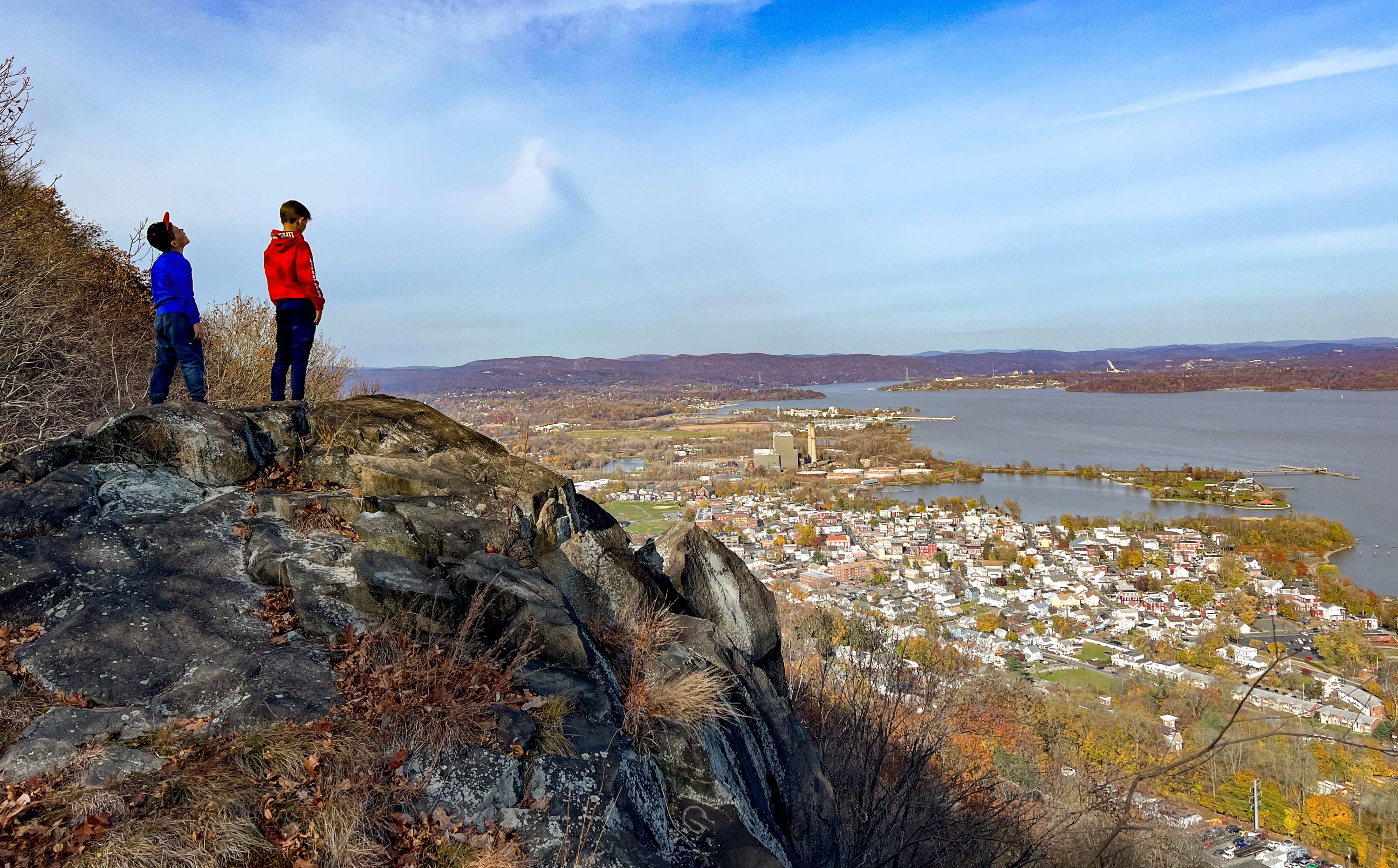
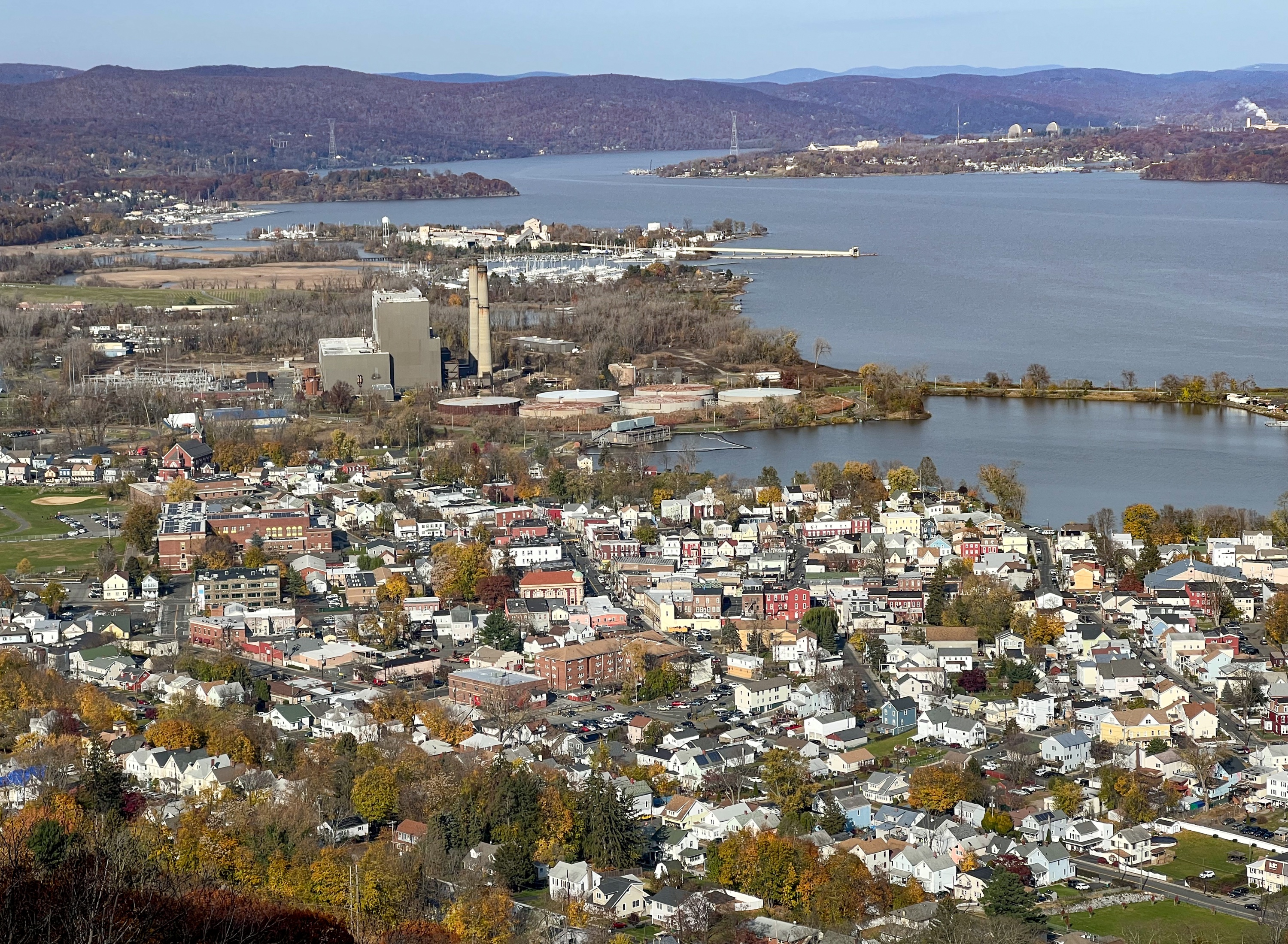
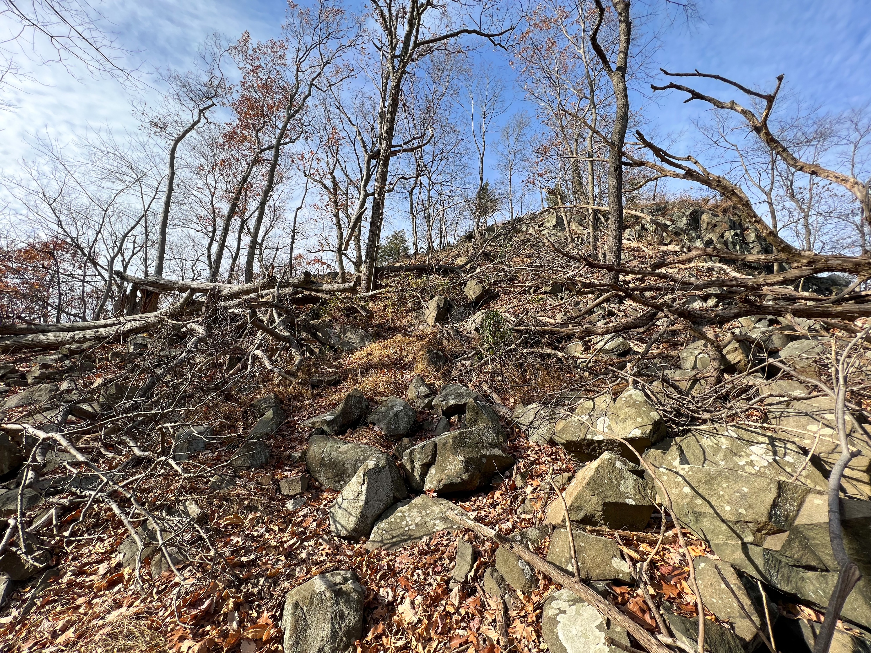
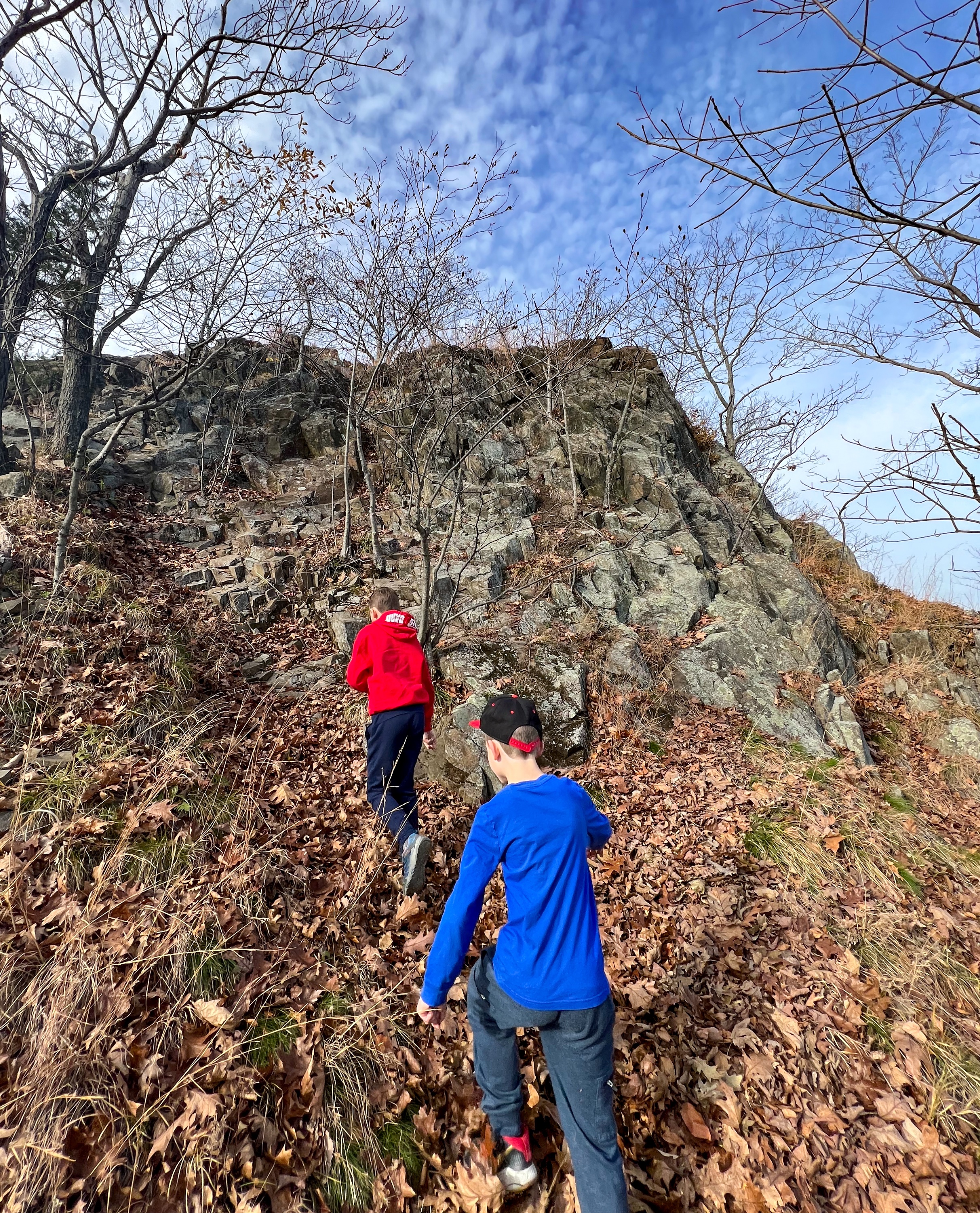
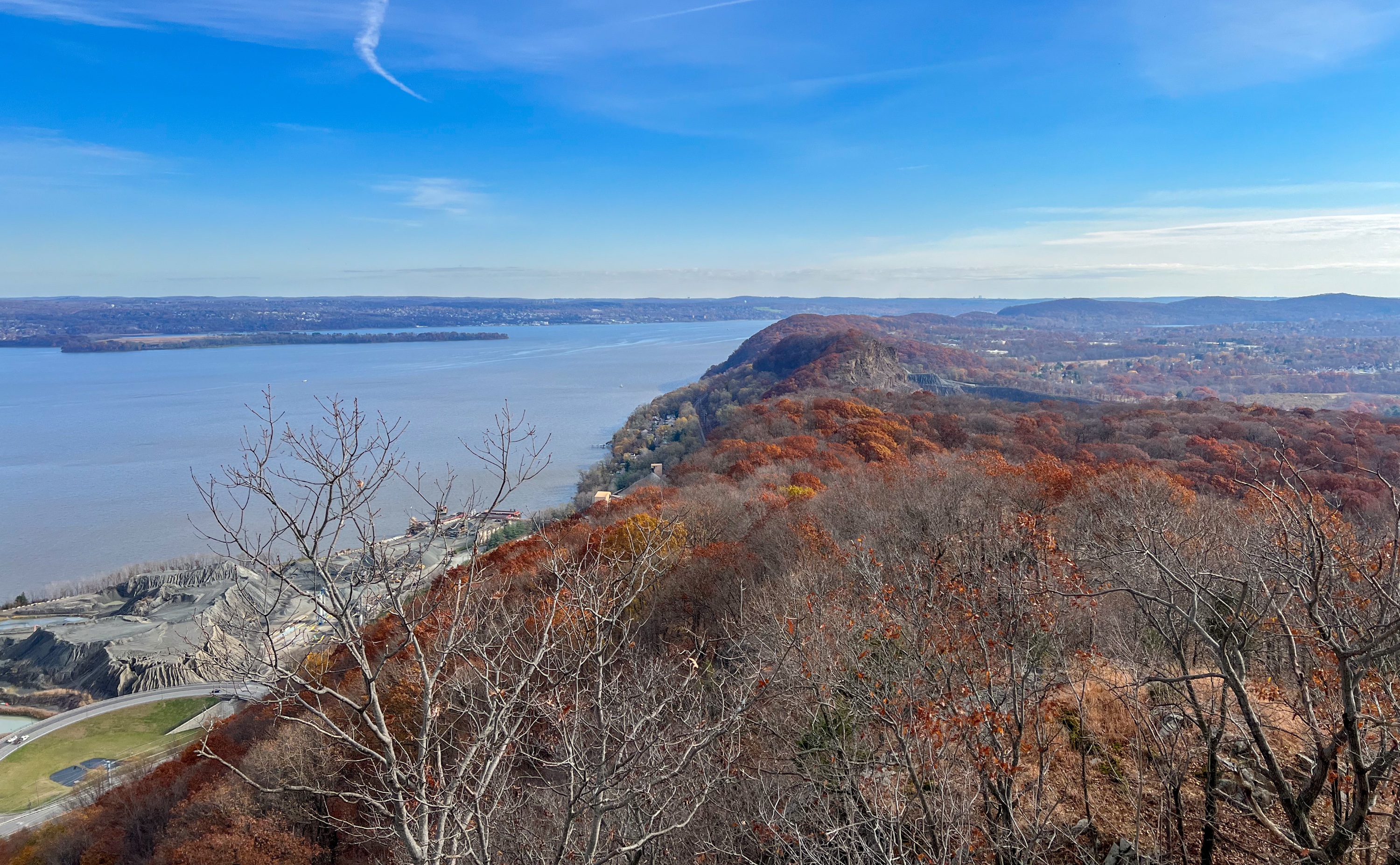
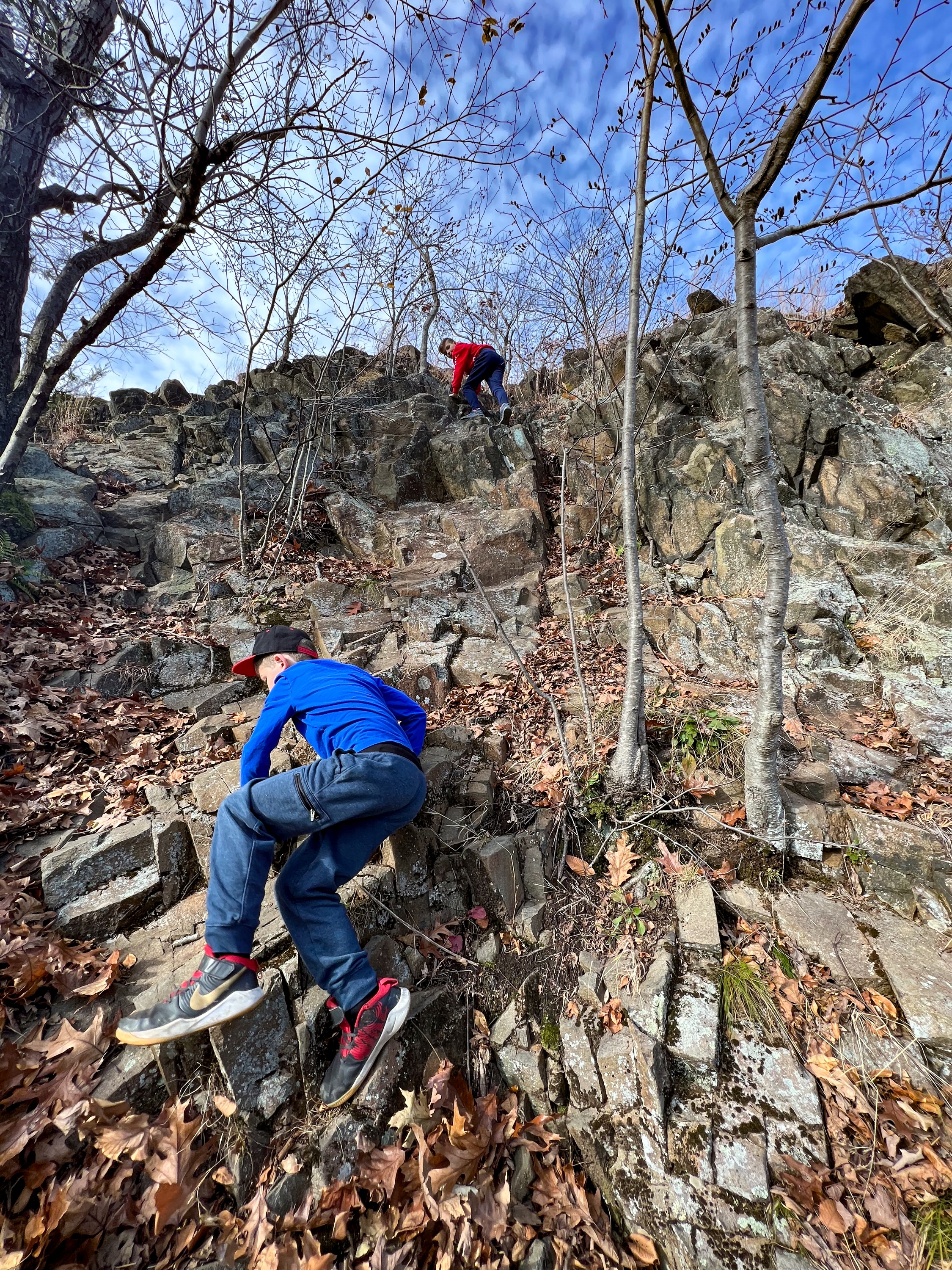
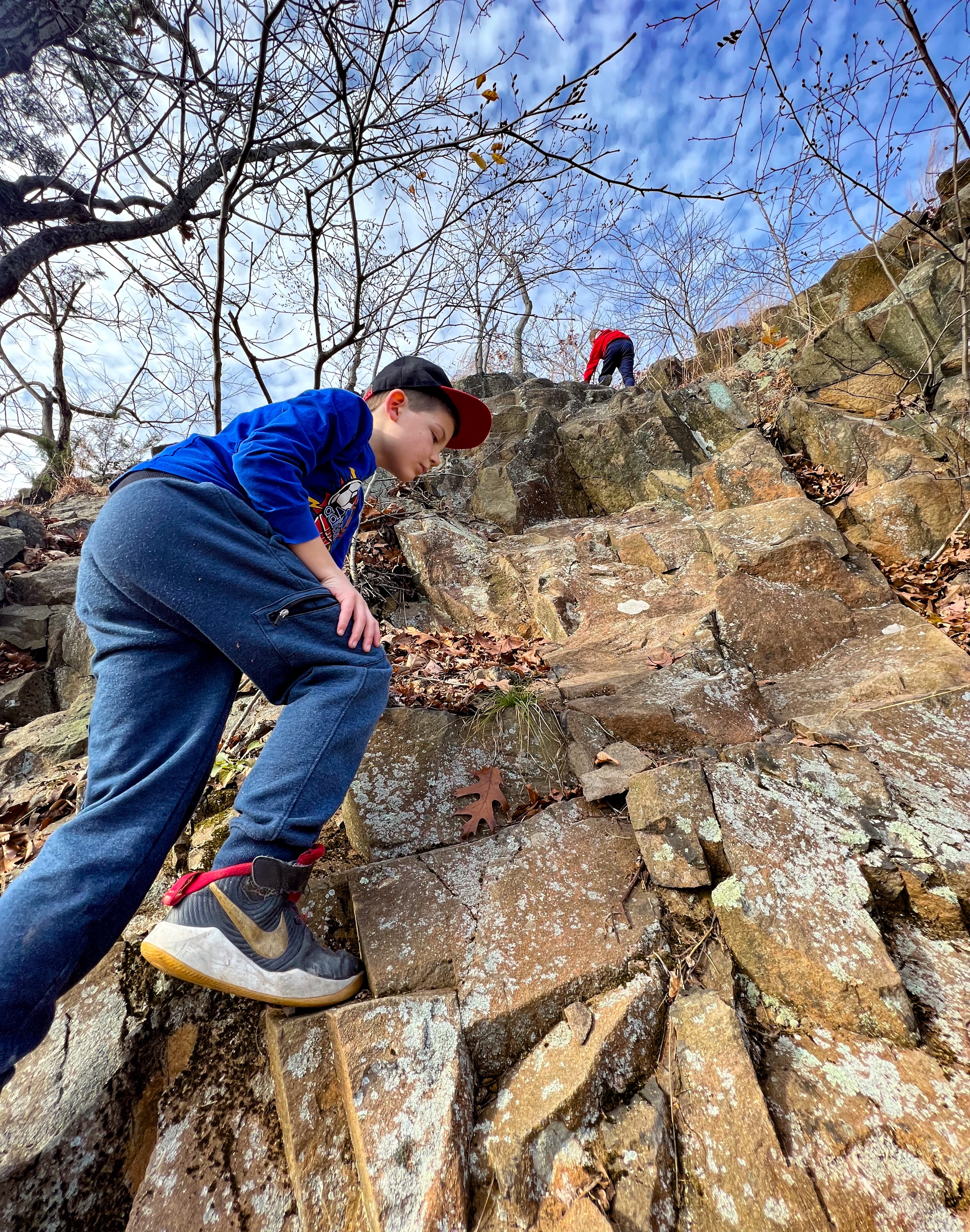
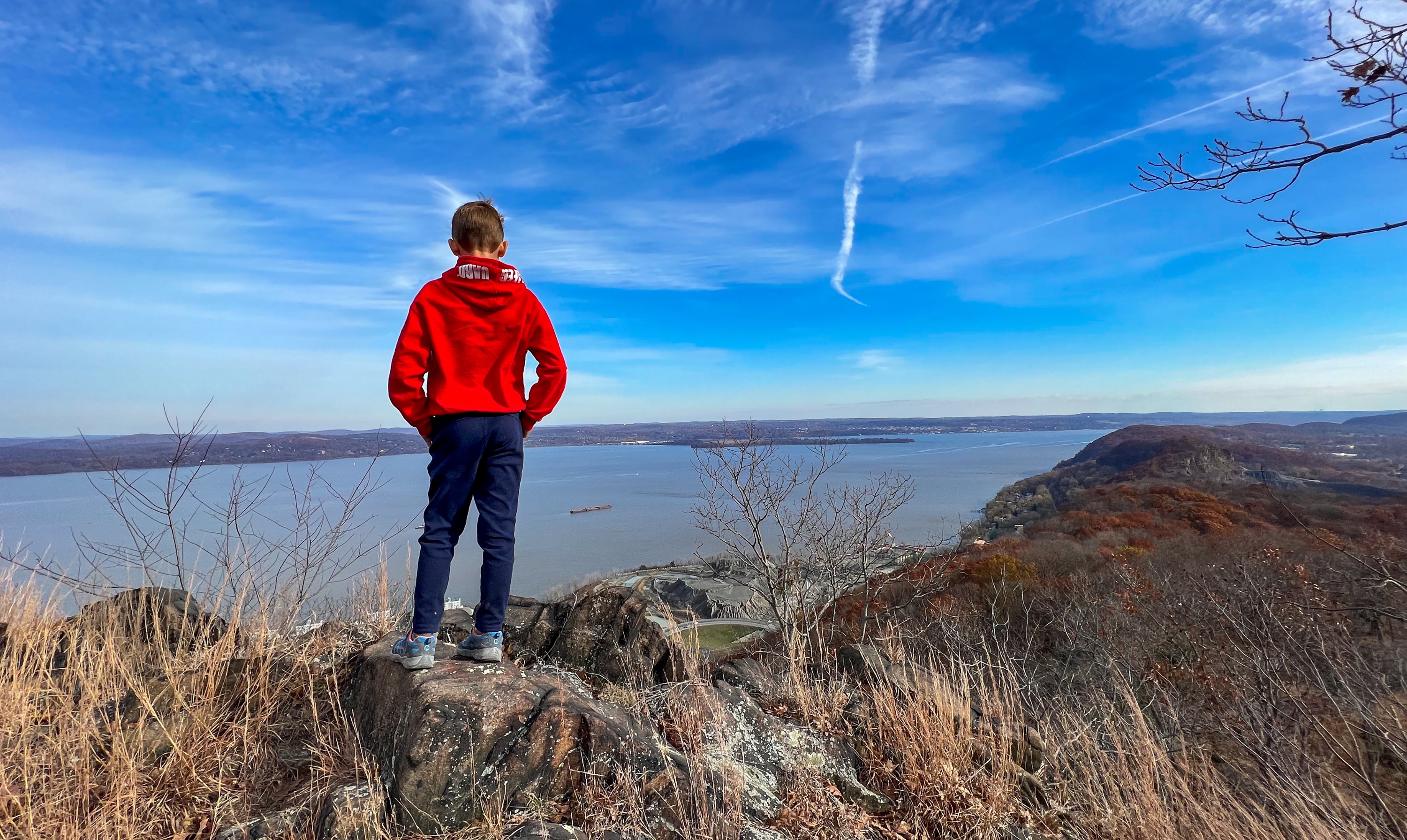
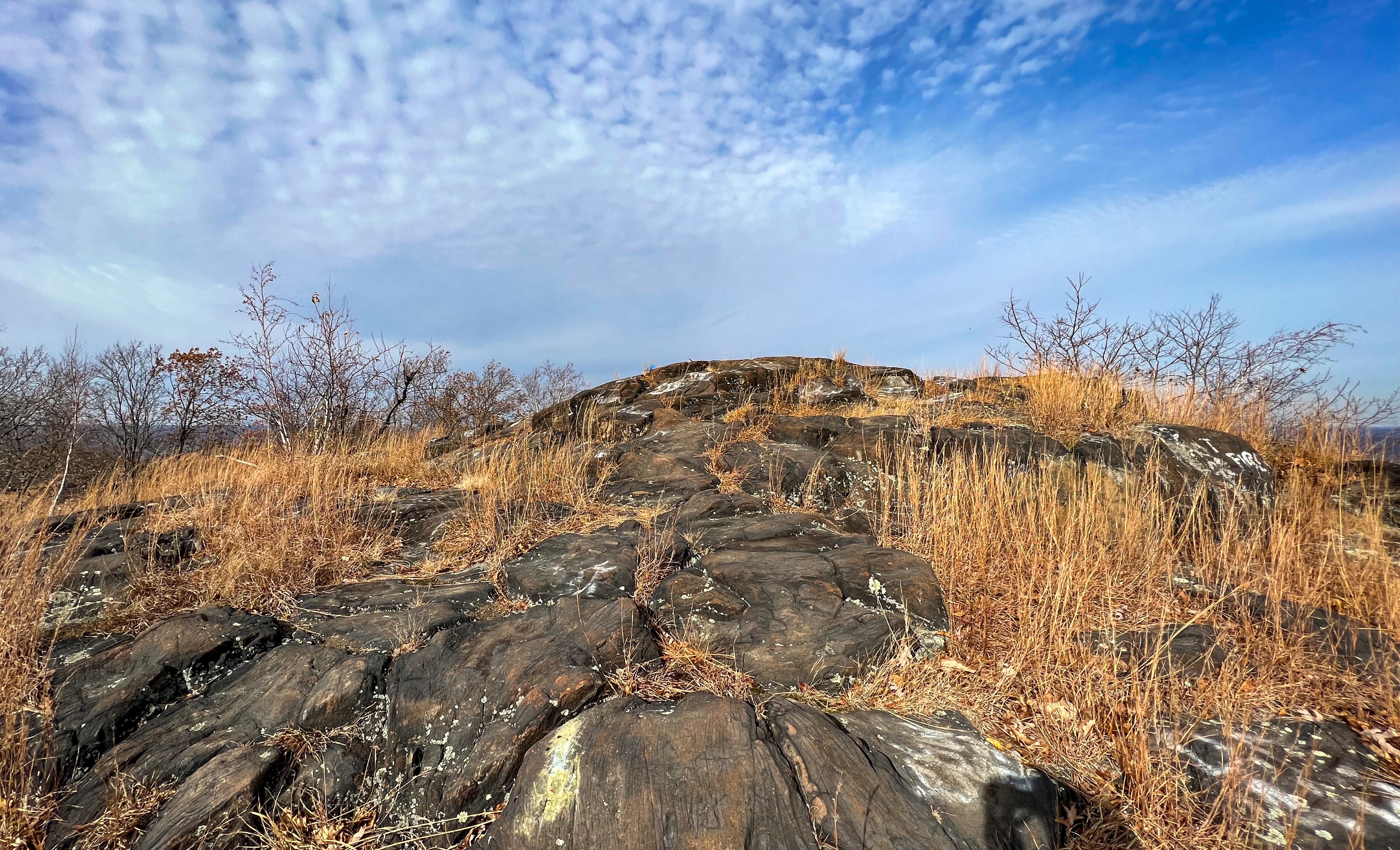
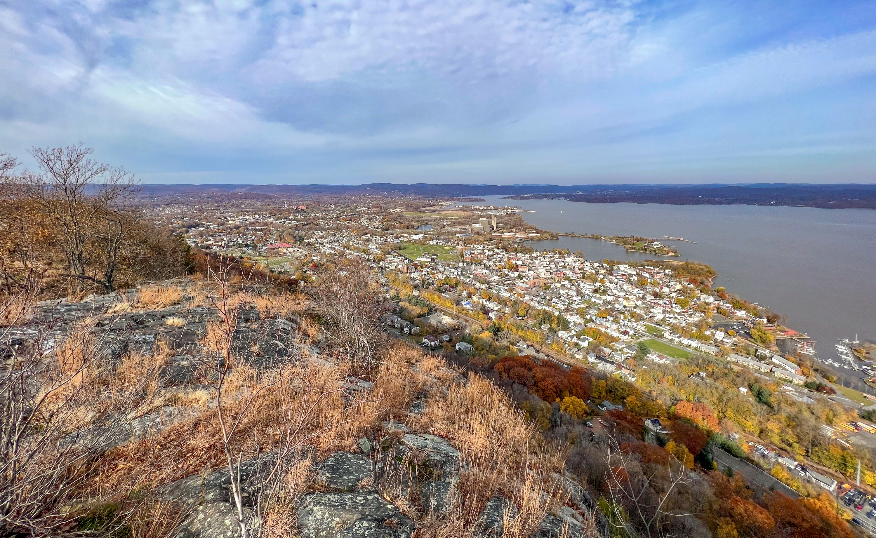
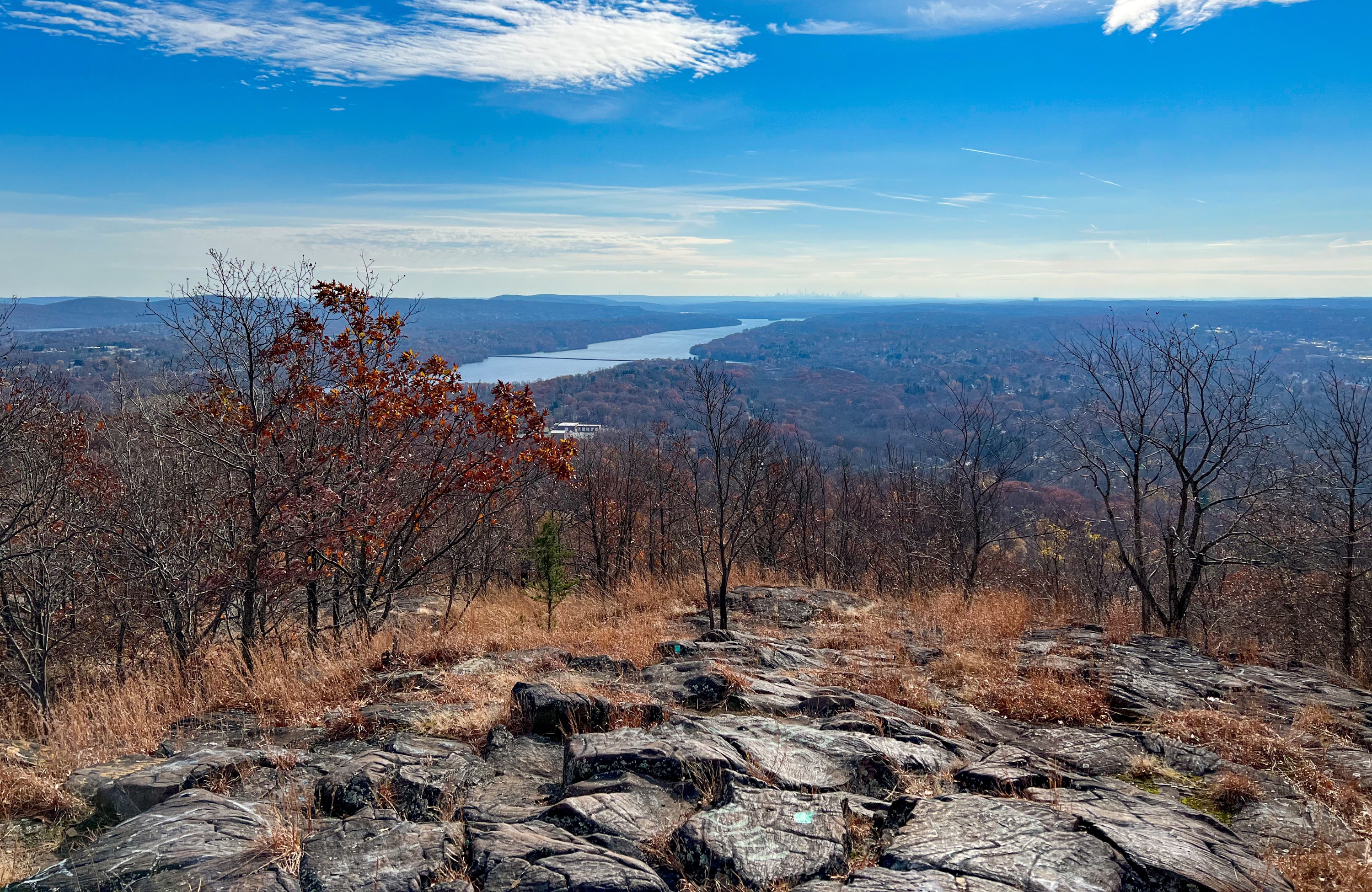
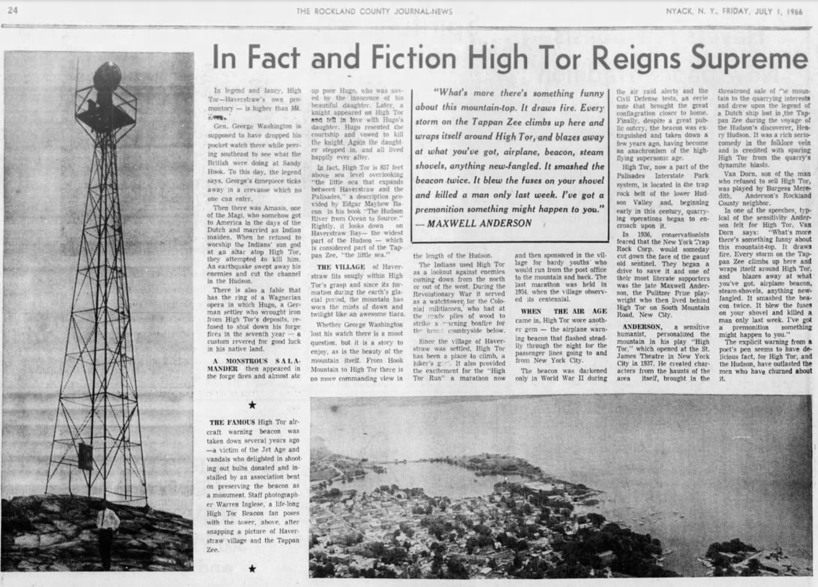
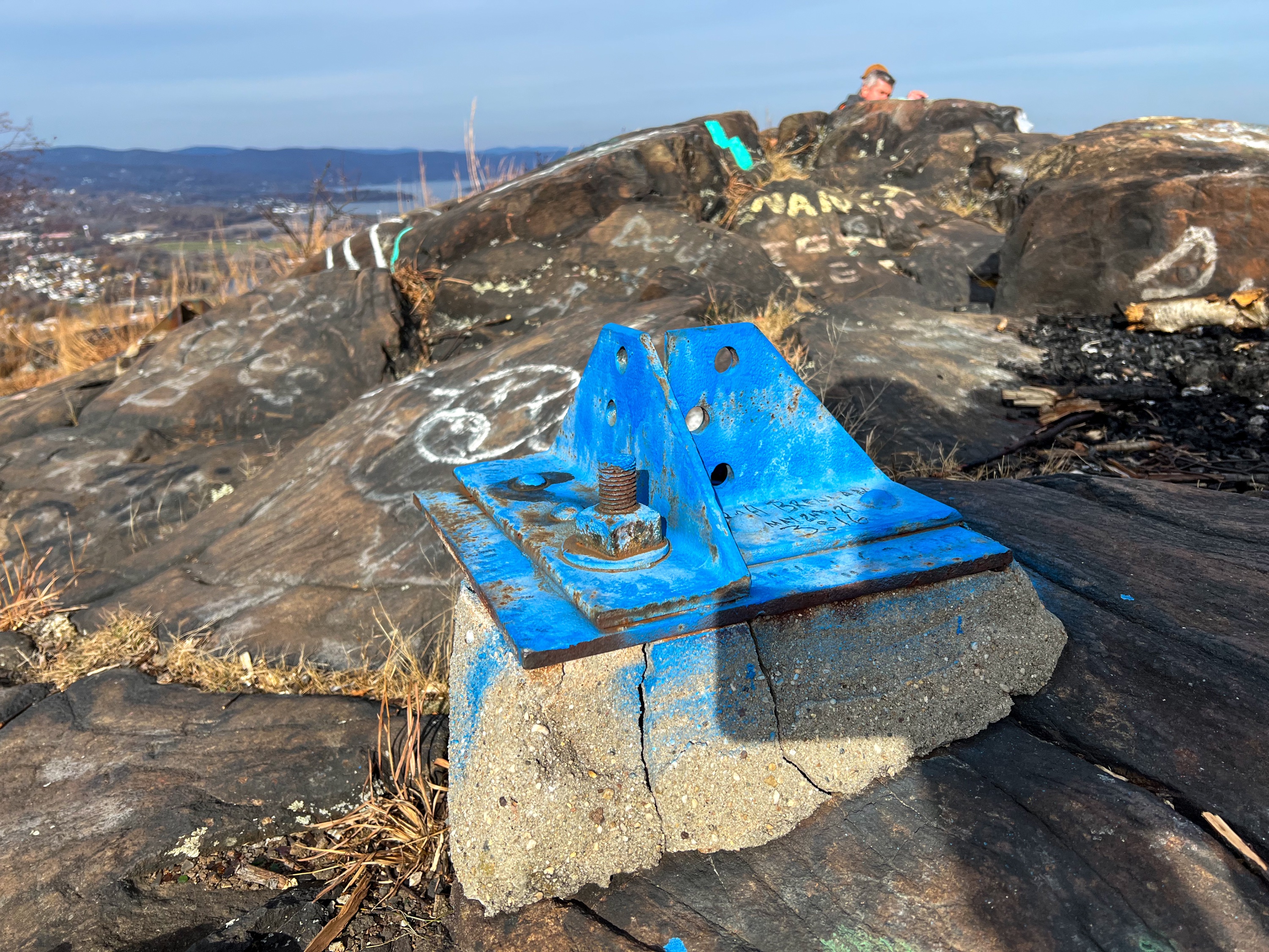
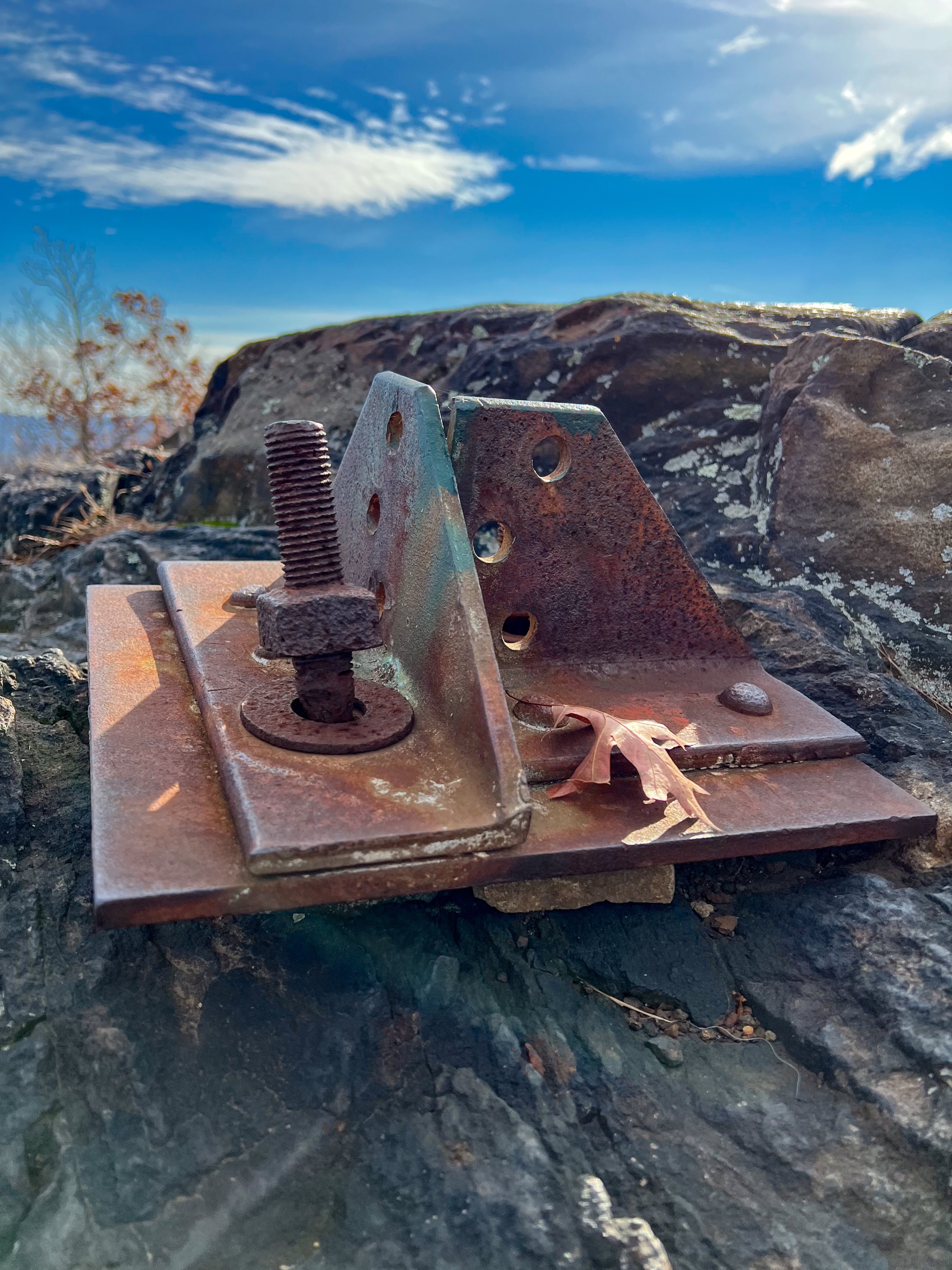
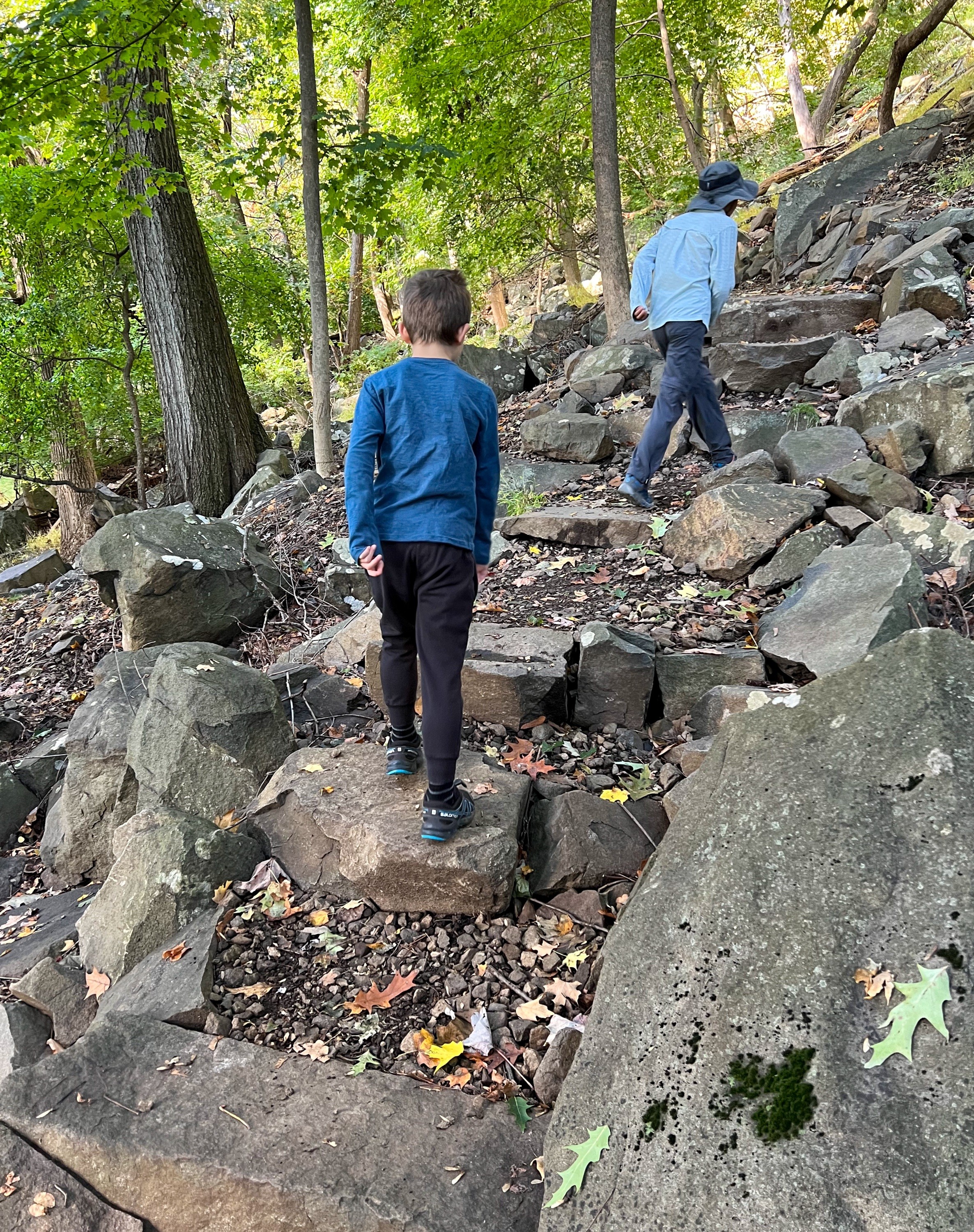
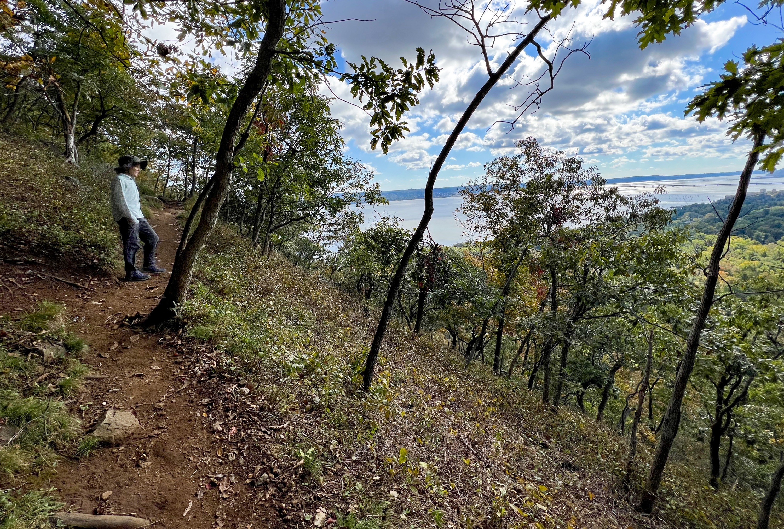
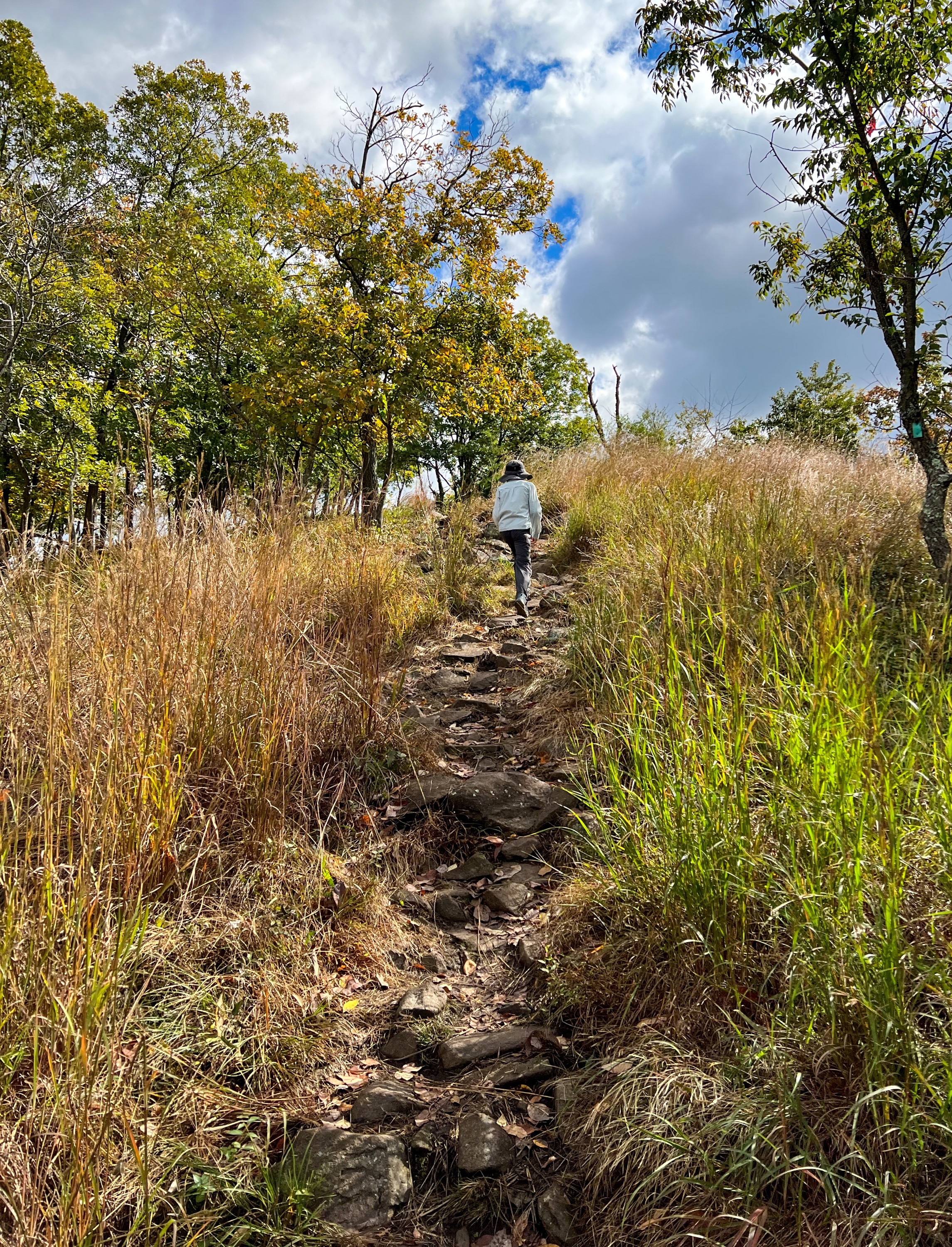
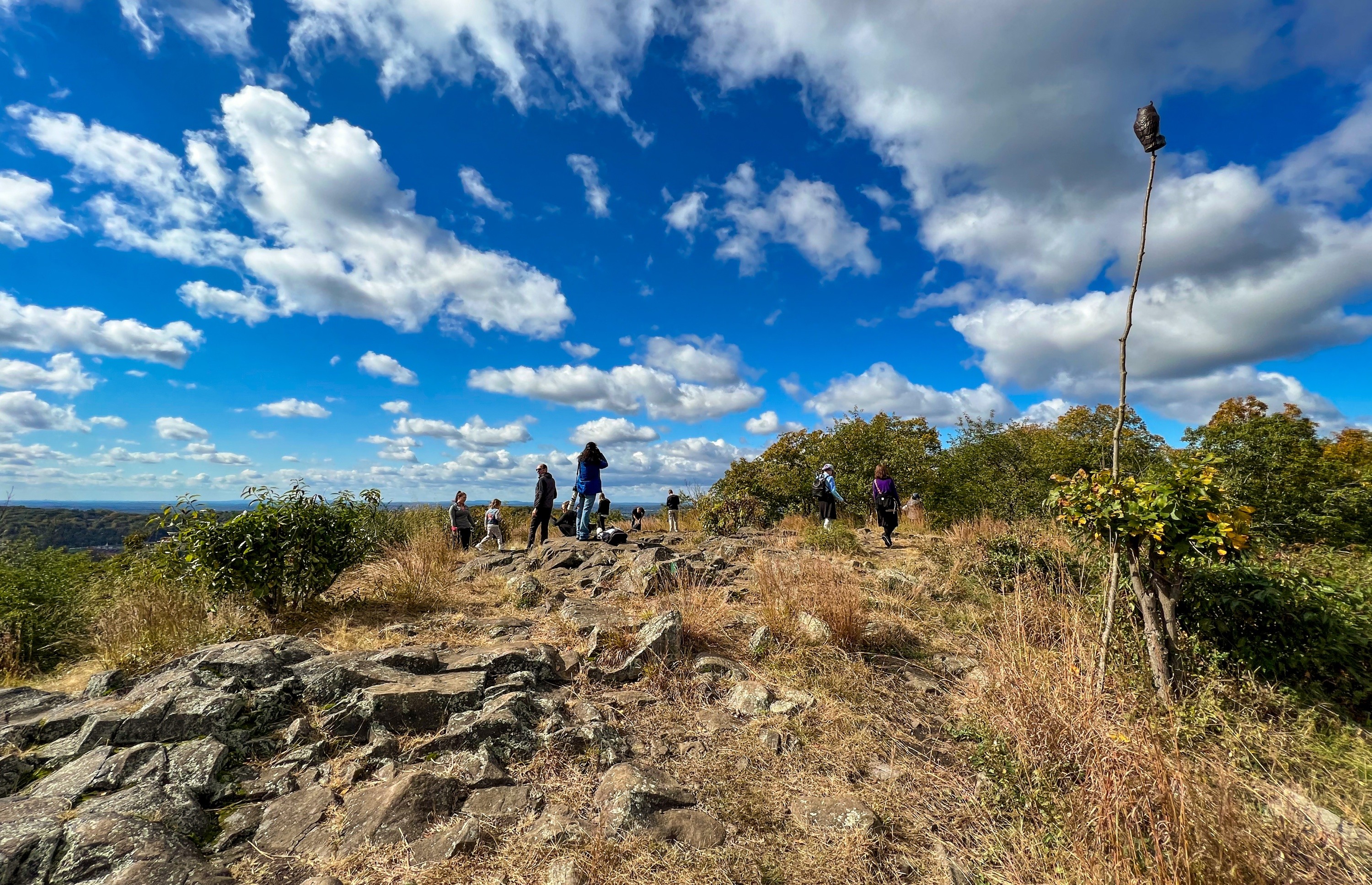
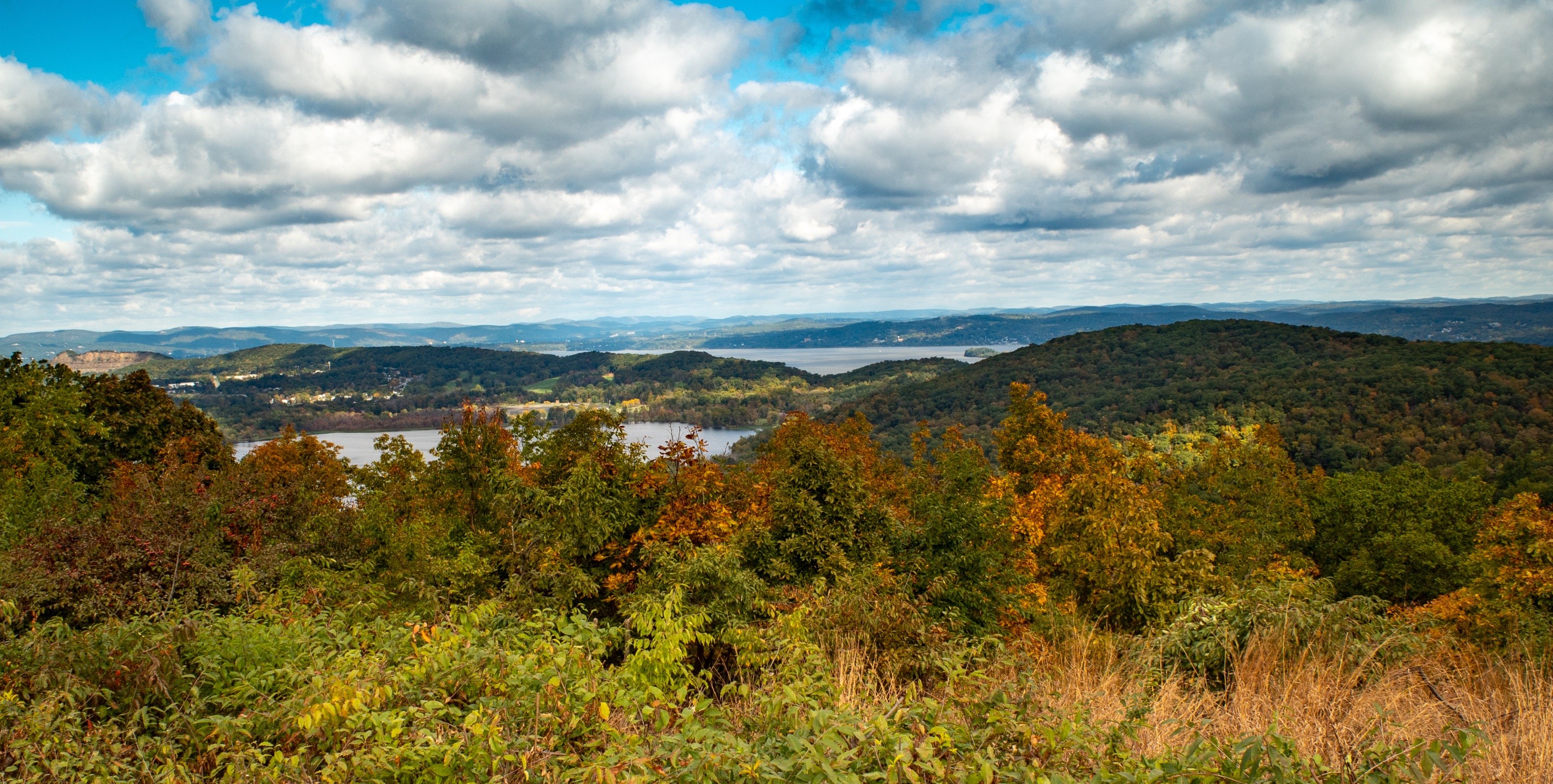
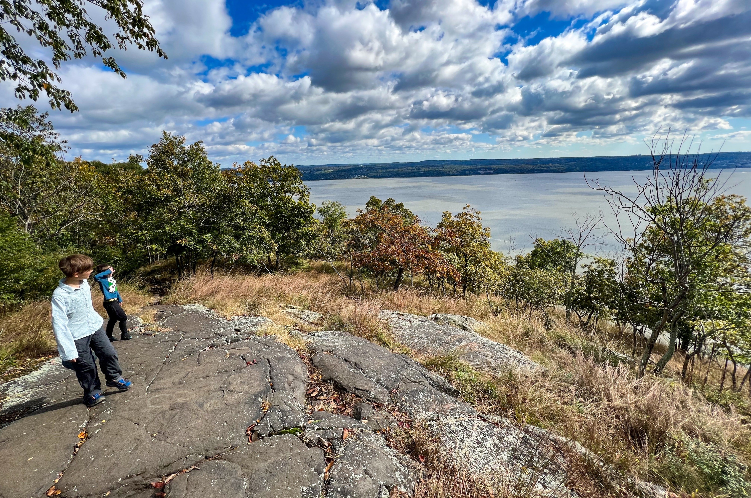
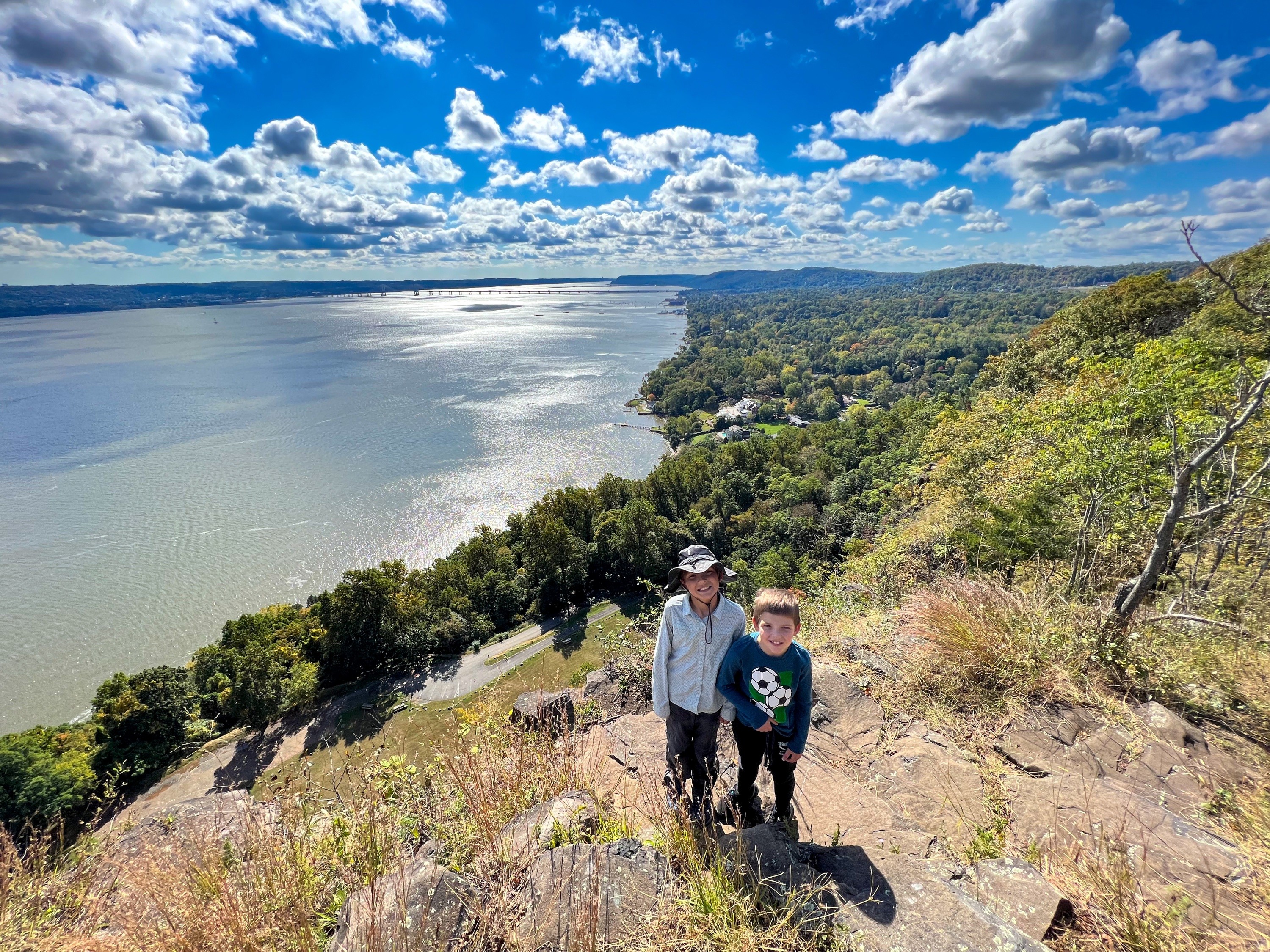
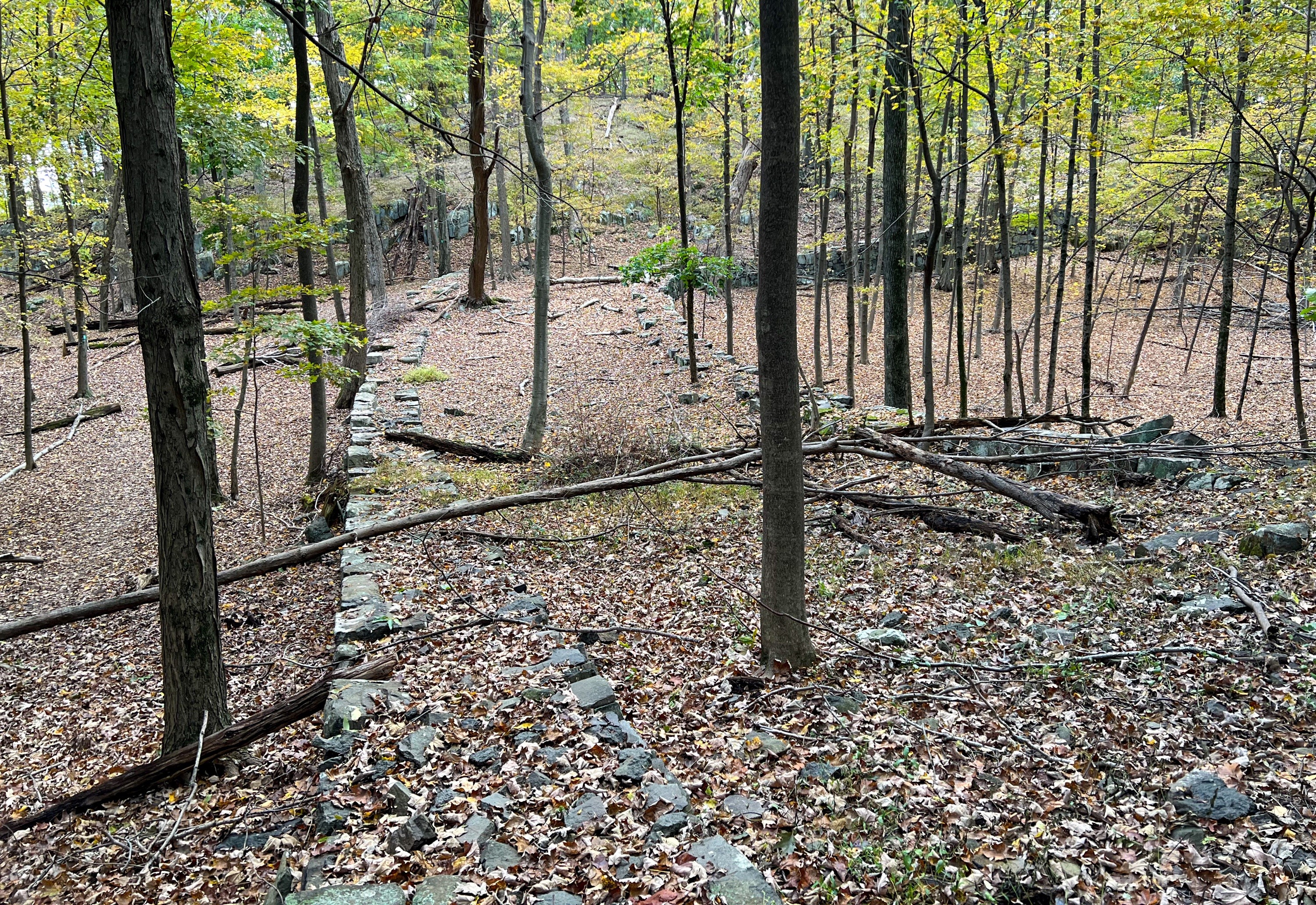
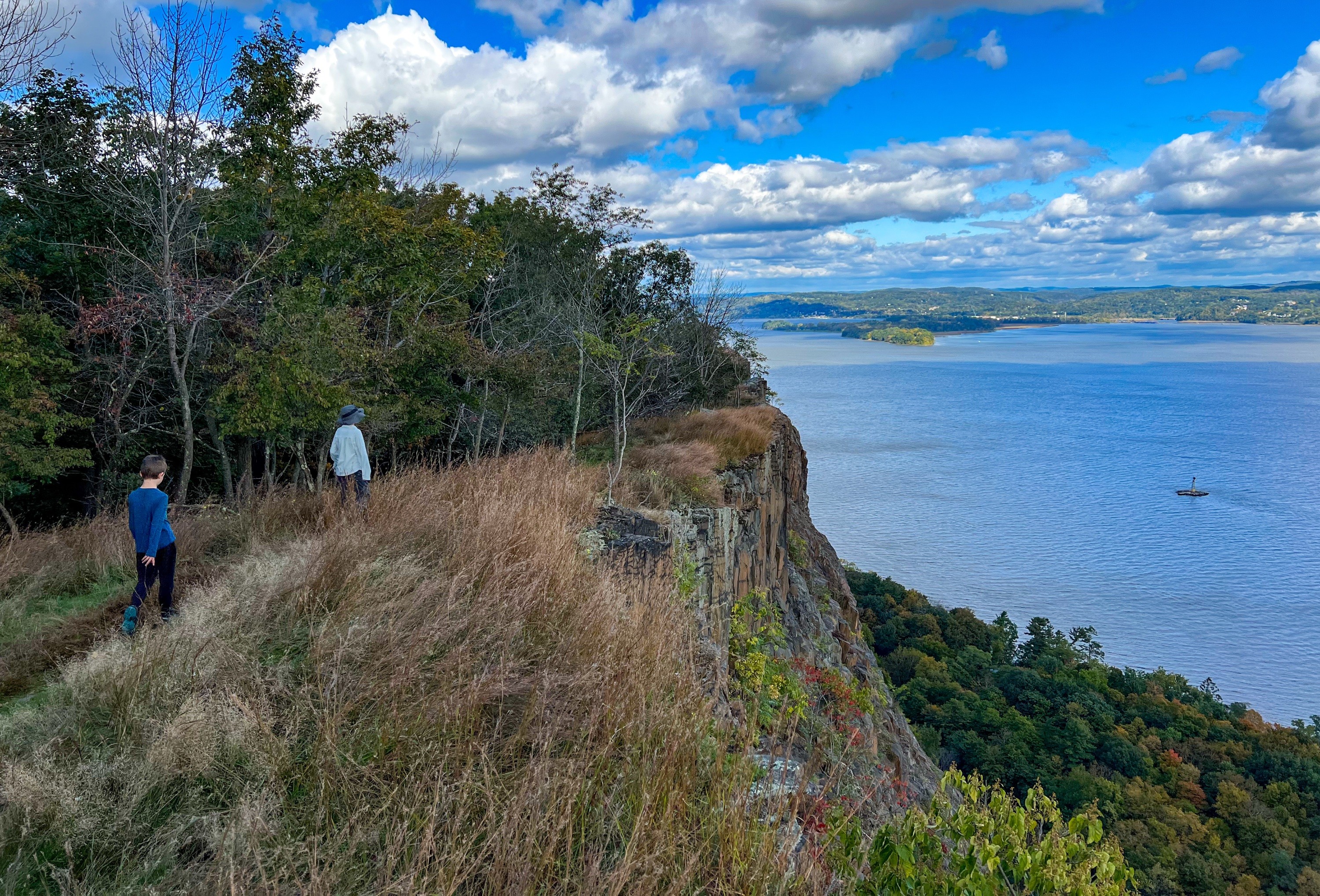
High Tor Hike Overview A short, moderate hike to the tallest point along the Hudson Palisades offering panoramic views from the High Tor summit and an optional fun rock scramble. Due to its prominence above the surrounding area, the summit of High Tor has been used for centuries as a strategic lookout and beacon location. Length: 2.2 miles Elevation gain: +740' Location: High Tor State Park, New City, New York High Tor Parking There is parking for several cars on the shoulder of the road at 330 Haverstraw Road, New City, NY High Tor Trail Map Hudson Palisades Trails Map #112 (and #111) - NY-NJ Trail Conference High Tor State Park trails map - NY State Parks (Note - the map does not show the Long Path section outside of the park) High Tor Summit Area Map Hike description From the parking pullout, walk west along Haverstraw Road (Rt 90). The Long Path follows Rt 90 here and you may notice some aqua blazes on telephone poles. Walk past Ridge Road (Rt 23), and a short distance beyond you'll see a power line cut. You could turn right here, but the official Long Path turns right just beyond here - about 0.2 miles from the parking area - marked by two aqua blazes on a tree. If you follow the aqua blazes, you'll first need to navigate a somewhat wet area. To avoid this, you could follow the power line cut, and then make a left to rejoin the trail. The trail now climbs consistently, crossing a small stream. Continue to follow the aqua Long Path blazes uphill. Spur Path to High Tor Vineyards After climbing for about a half mile, the trail levels off and reaches a junction with a white-blazed spur path, which leads to the historic Youmans - Van Orden House and High Tor Vineyards (we will not turn onto the spur path). A post, with the sign unfortunately missing, is at the junction. I found a photo of the sign that was previously here on Agile Trekker: Spur Path sign (from Agile Trekker) If you were to follow the white blazes slightly downhill for a quarter mile, you'll reach the ruins of the Youmans-Van Orden House. We did not follow the spur trail, but a sign at the end of the spur trail provides some historic background for those who want to explore. Photo from Scenes from the Trail: Photo from Scenes from the Trail We will continue to follow the aqua blazes uphill. In about a quarter mile, you'll reach the crest of the ridge. You can get your first glimpse of the Hudson River from here. Here, an unmarked woods road continues straight downhill, but we will make a left to continue to follow the the aqua-blazed Long Path, which continues to climb. Long Path Splits - Blue or Aqua After about another 0.2 miles, you'll reach a junction where the trail splits and you have a choice to make - the blue or aqua route? The old Long Path goes to the right, marked by blue blazes, while the current route of the Long Path heads to the left. The point at which the Long Path splits - old (blue - right and up a talus slope) and new path (aqua - left) The map below shows the two trails. Detail of old (blue) and current (aqua) Long Path routes. Note the extra viewpoint reached by the blue trail. Blue Route Three blue blazes on a rock mark the start of the old Long Path route, which follows a steeper route over a talus slope that includes rock scrambling, but which also offers more viewpoints that you can't reach via the aqua trail. Aqua Route Alternative, you could follow the current aqua-blazed Long Path route heads to the left. This route is less steep and misses a few viewpoints, but both routes rejoin and take you to the main viewpoint at High Tor. We opted to follow the blue route for the most part on the way to High Tor, and then returned via the aqua route. Note that if you follow the blue route, the trail is not very well-marked. I highly suggest carrying a GPS-enabled map of the area (I used GaiaGPS, which shows both trails) and being comfortable with route-finding. We first reached a rock outcrop with views over Haverstraw. The trail descends into a saddle and then begin a relatively steep climb. At the top of the climb are some views of the river and a quarry to the south. Keep going, and now the trail will follow a very steep rocky route that will require using your hands to scramble up. This was the most fun part for our kids. Following this climb, you're treated to more views of the river to the east and Lake DeForest to the south. In the distance you can see the New York City skyline on a clear day. Continue to follow the trail north and you'll soon see a big rock outcrop. You've now reach the 832-foot High Tor summit - the highest peak of the Hudson Palisades - with panoramic views in all directions. To the north and east are views of Haverstraw and the Hudson River. View of Haverstraw and the Hudson River from High Tor To the south are views of Lake DeForest, a reservoir, and the New York City skyline. Lake DeForest Lake DeForest and NYC Skyline After you enjoy a break here, retrace your steps back to the car. History of High Tor as a strategic observation and beacon site High Tor is on the ancestral lands of the Munsee Lenape people. "The Indians used High Tor as a lookout against enemies coming down from the north or out of the west." Journal-News, July 1, 1966 It was on High Tor, according to legend, that the local Lenape tribespeople first spied a ship full of Dutchmen coming up the river in 1609. Judith Richardson During the American Revolution, High Tor was used as a signal point, with troops setting fires when they spotted British troops heading up the Hudson. The summit also had an air beacon, described in 1932 by the US Army Corps of Engineers as "a tall steel structure supporting a revolving aerial light as we as two flight lights." The airplane warning beacon that flashed steadily through the night for the passenger lines going to and from New York City...The beacon was darkened only in World War II during the air raid alerts and the Civil Defense tests" Journal-News, July 1, 1966 A July 1, 1966 story in the The Rockland County Journal-News about High Tor includes a photo of the air beacon. A January 1957 New York Times story was titled "High Tor's Beacon to Glow No More" however the next month, another story is titled "High Tor Beacon Flashes Again; Civil Air Patrol Will Maintain it." In 1962, the beacon appears again in the New York Times in a story titled "Threat to Beacon On High Tor Stirs Haverstraw Again; Light Darkened by Vandals". An August 14, 1963 a headline in the Journal-News announces "Knell Tolled for High Tor Beacon Light." A 1966 story notes that "Finally, despite a great public outcry, the beacon was extinguished and taken down a few years ago, having become an anachronism of the high-flying supersonic age." By 1964, the air beacon was gone, however the four steel and concrete footings for the air beacon still remain.
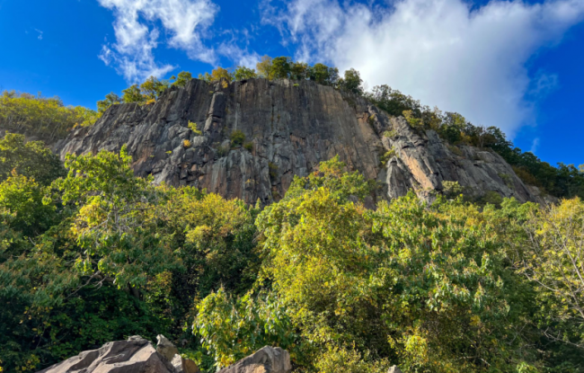
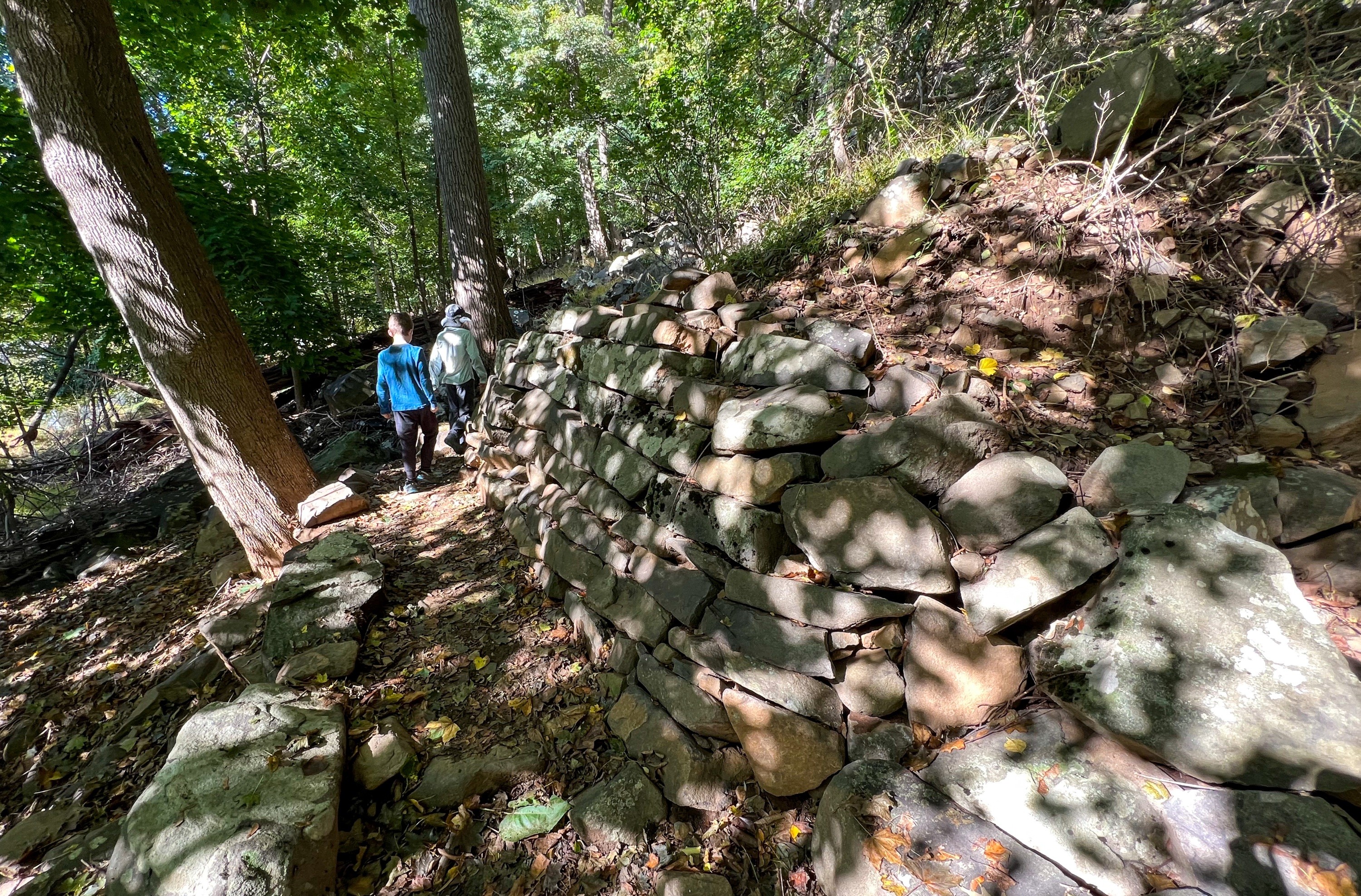
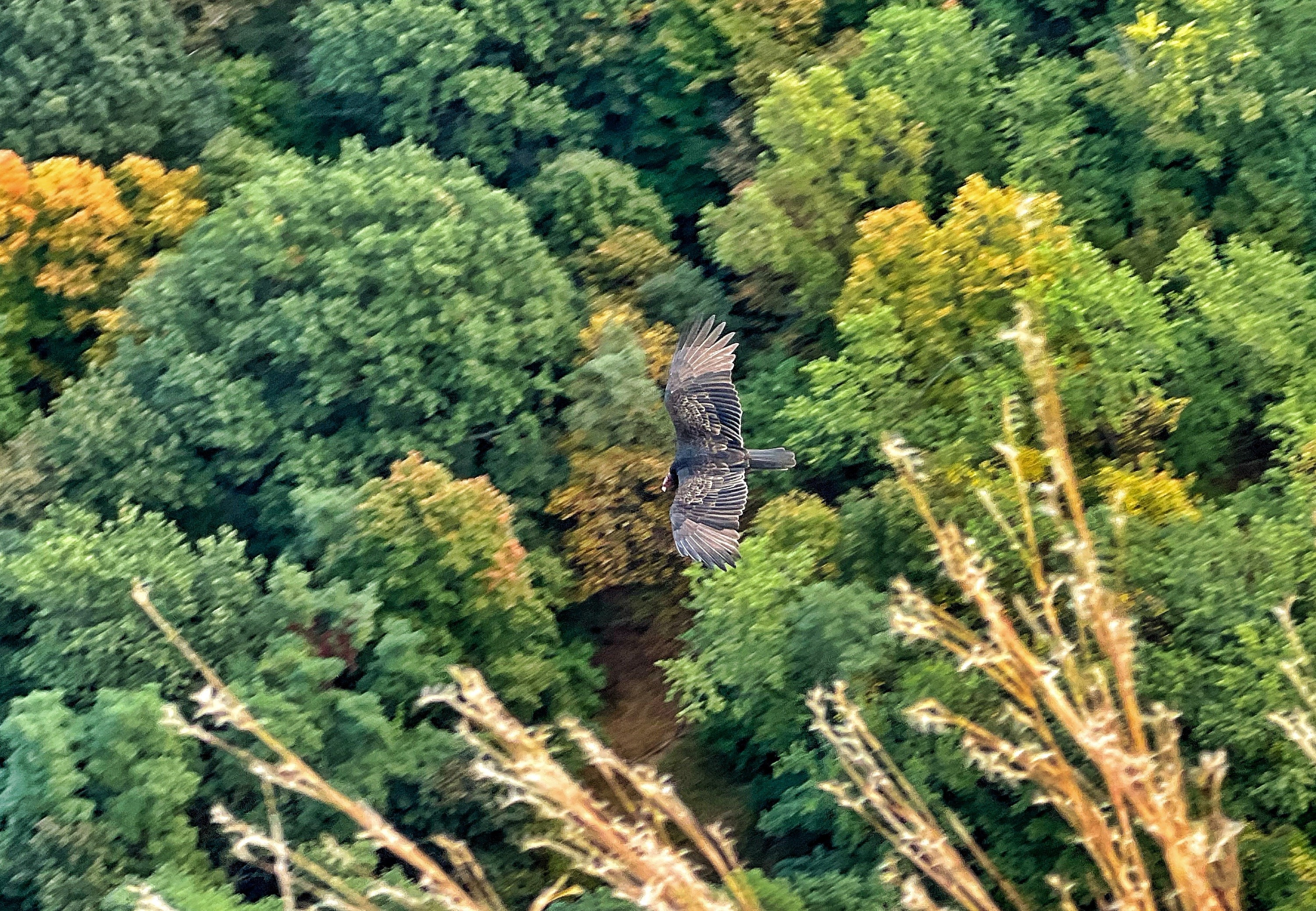
Raccoon Ridge is an exposed ridge offering one of the best viewpoints in New Jersey, with panoramic views of the Delaware River and the Kittatinny Mountains
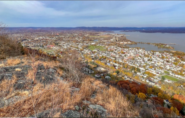
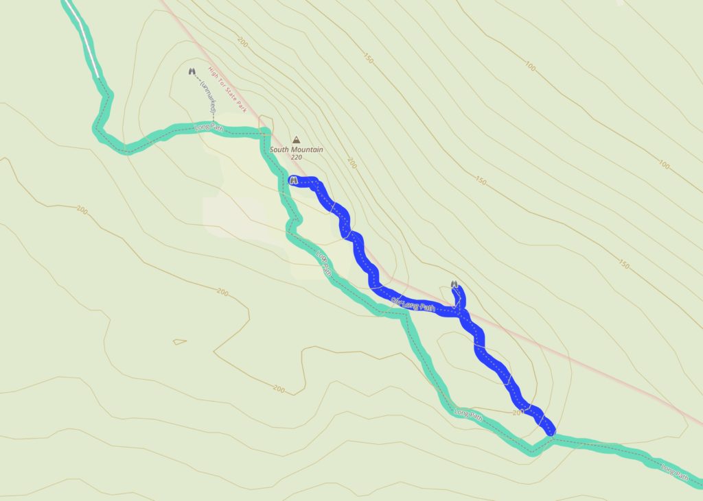
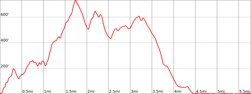
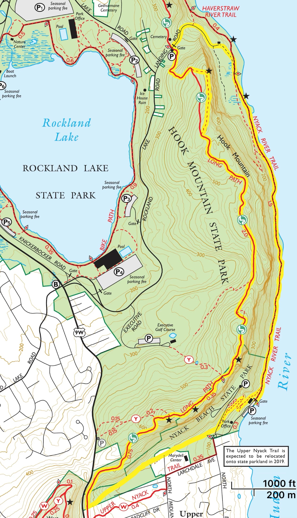
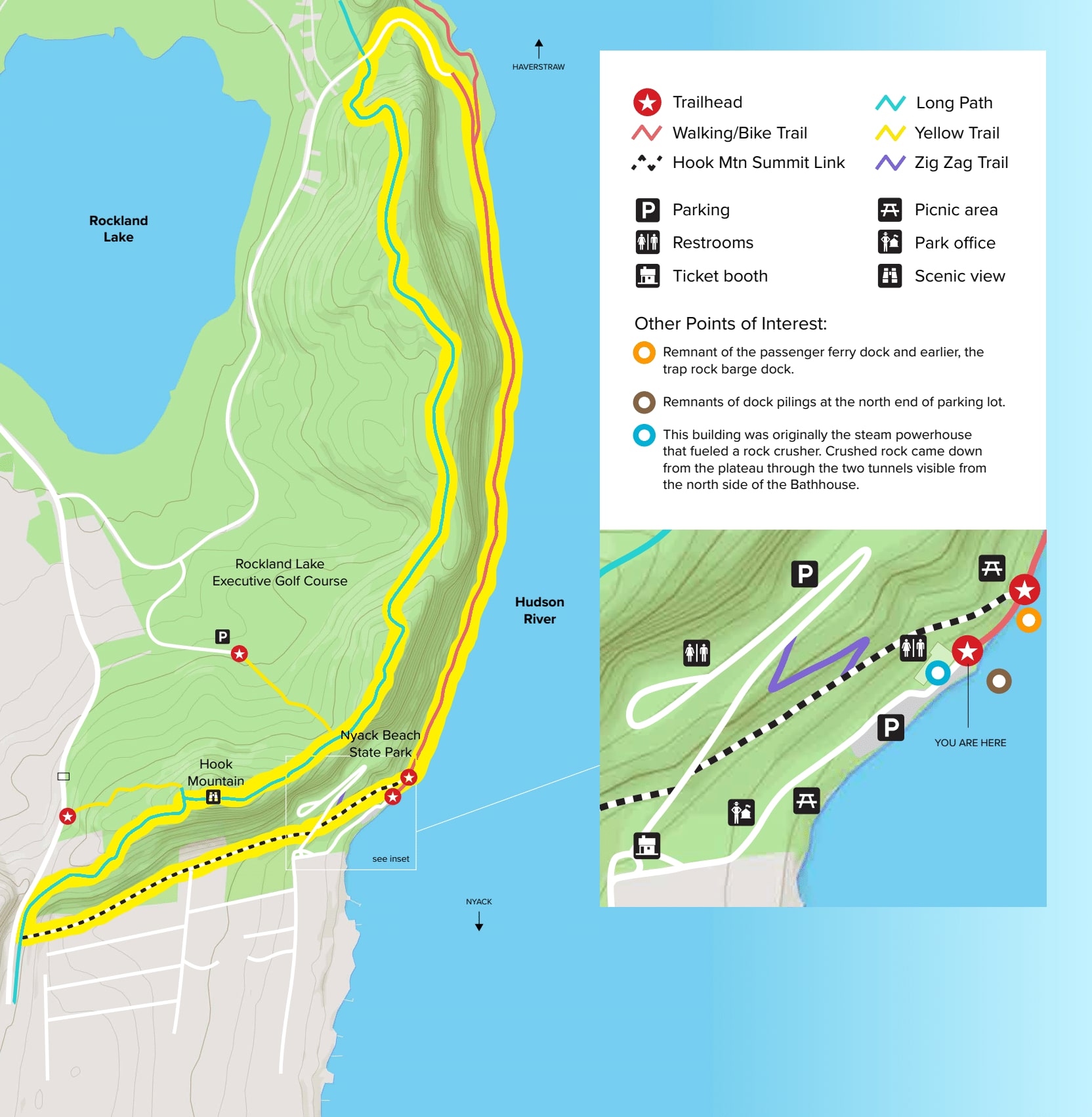
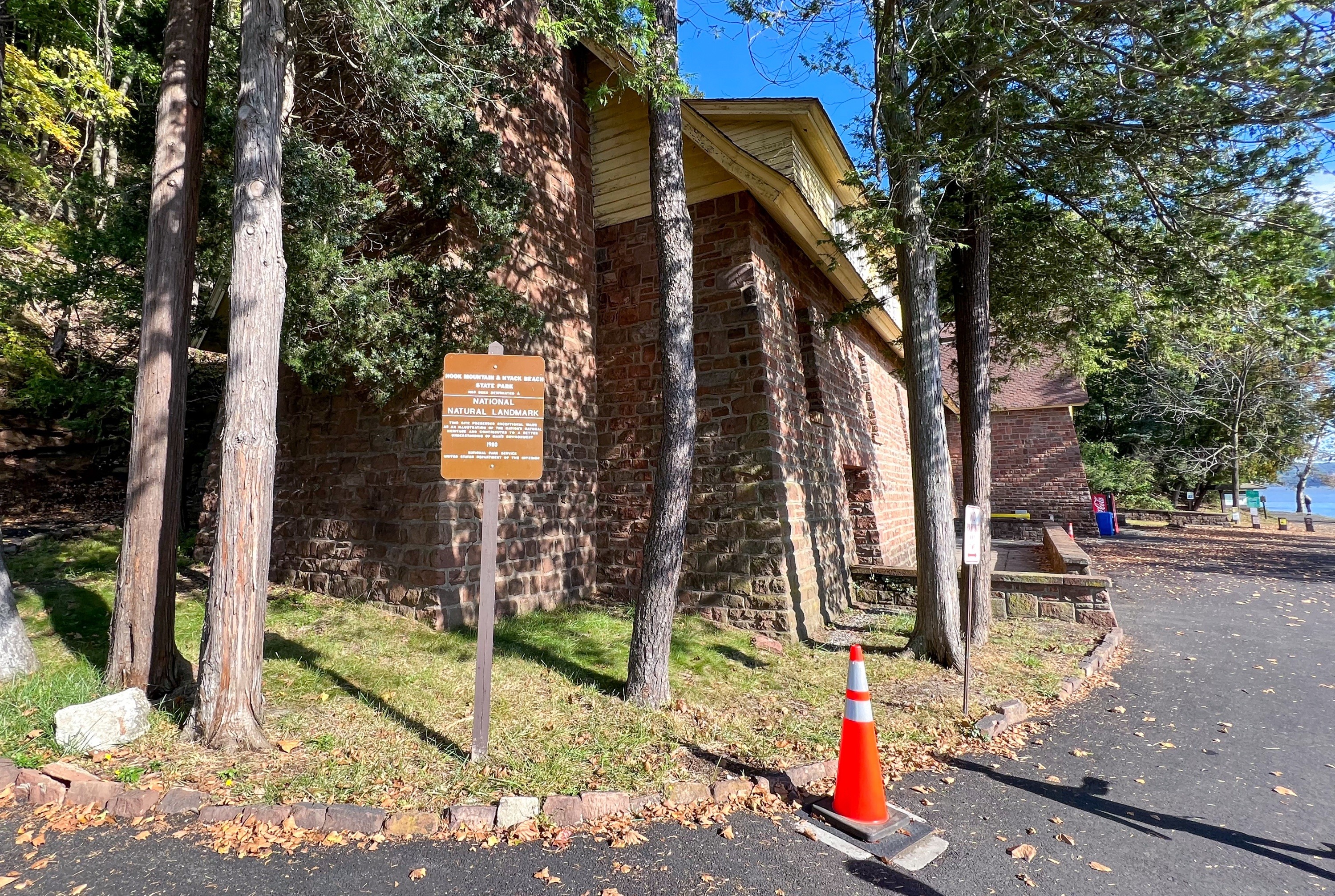
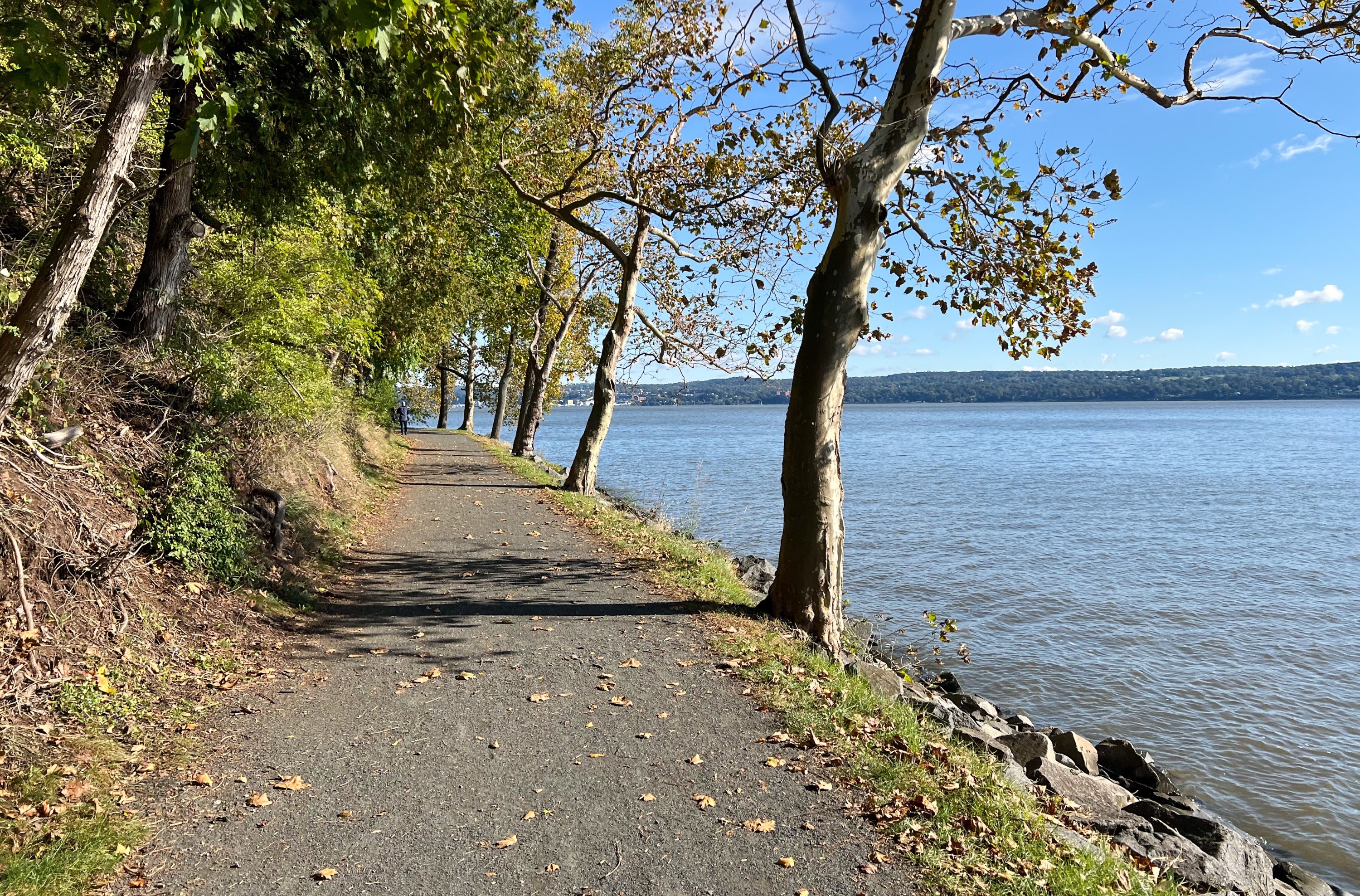
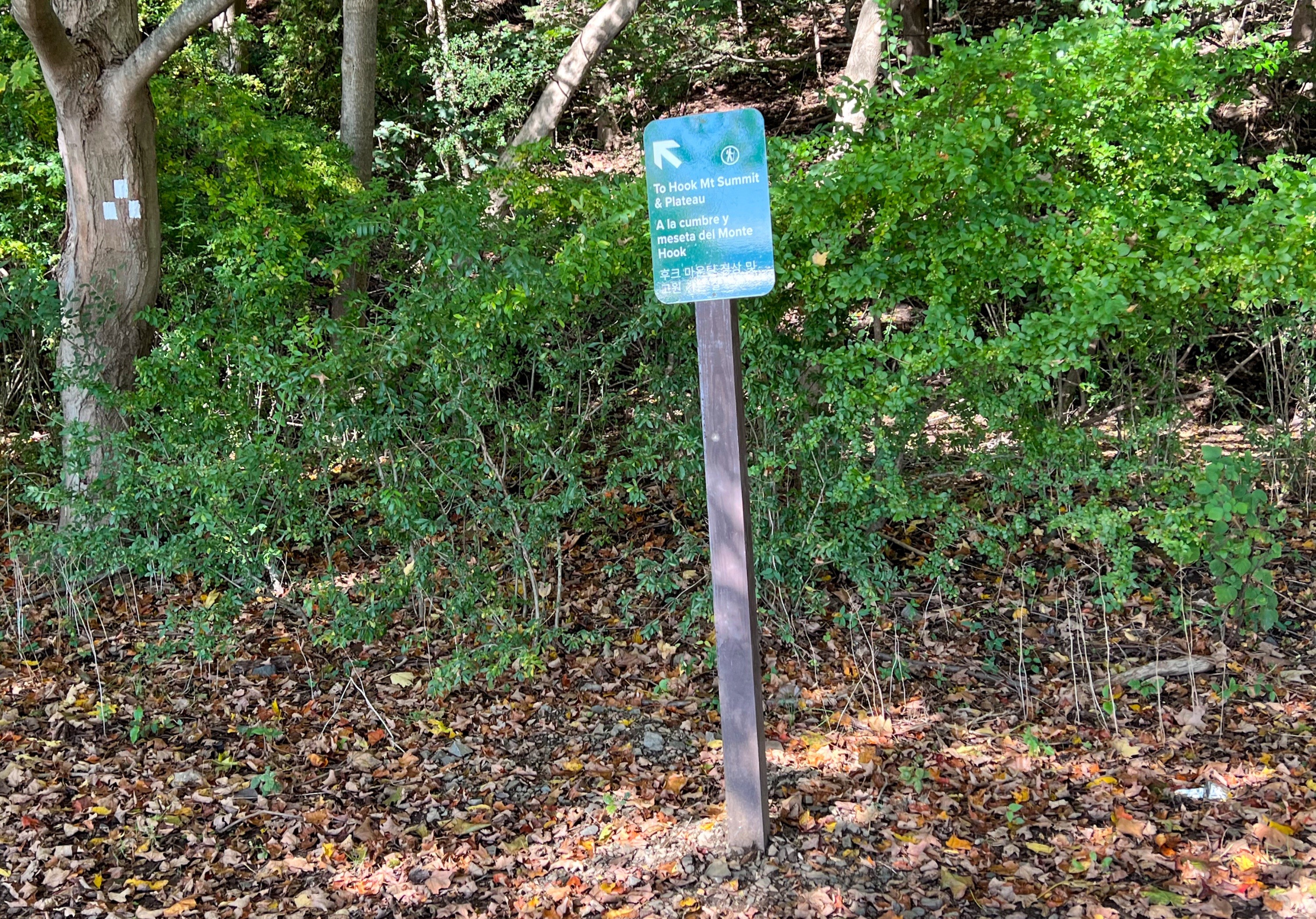
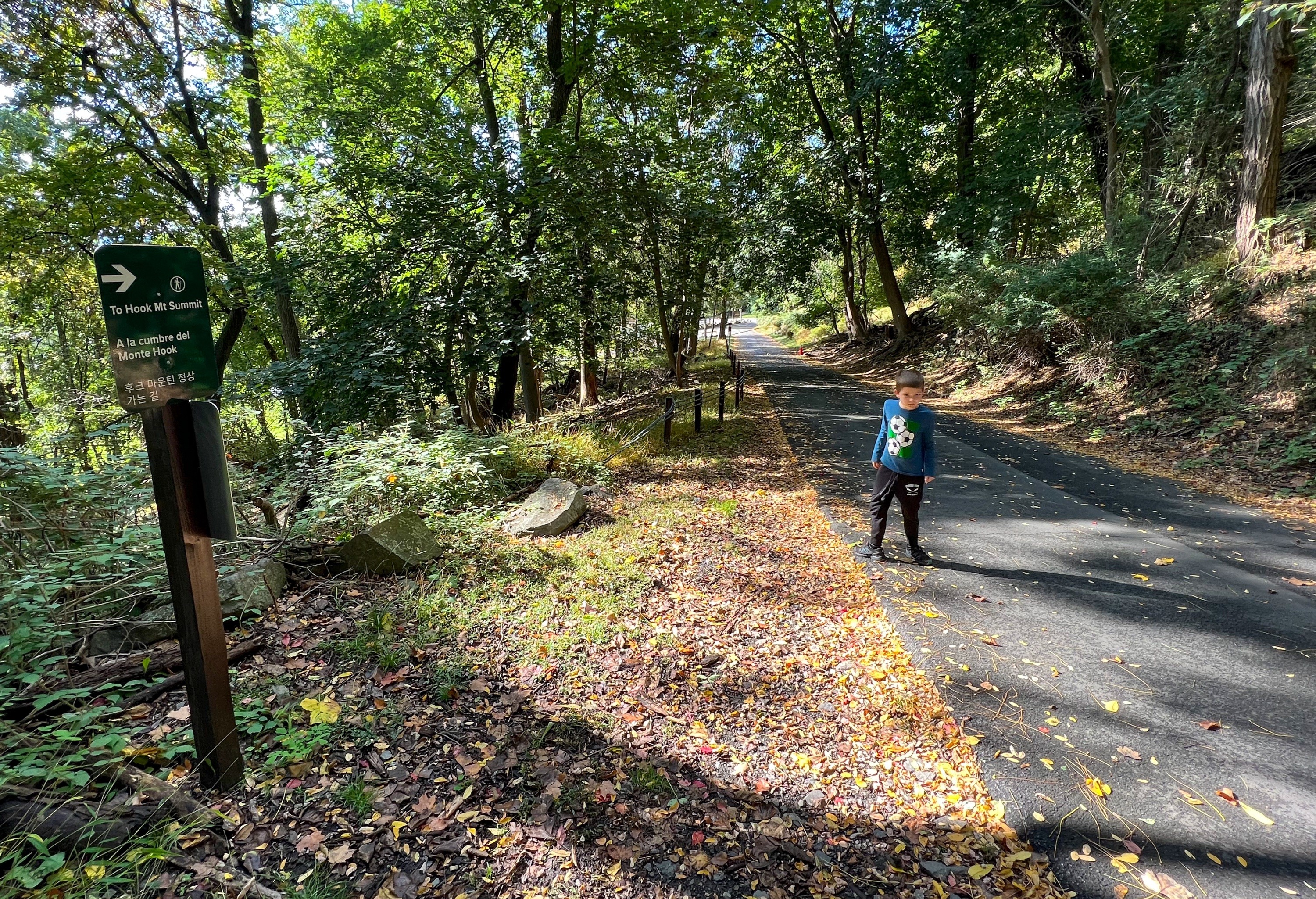
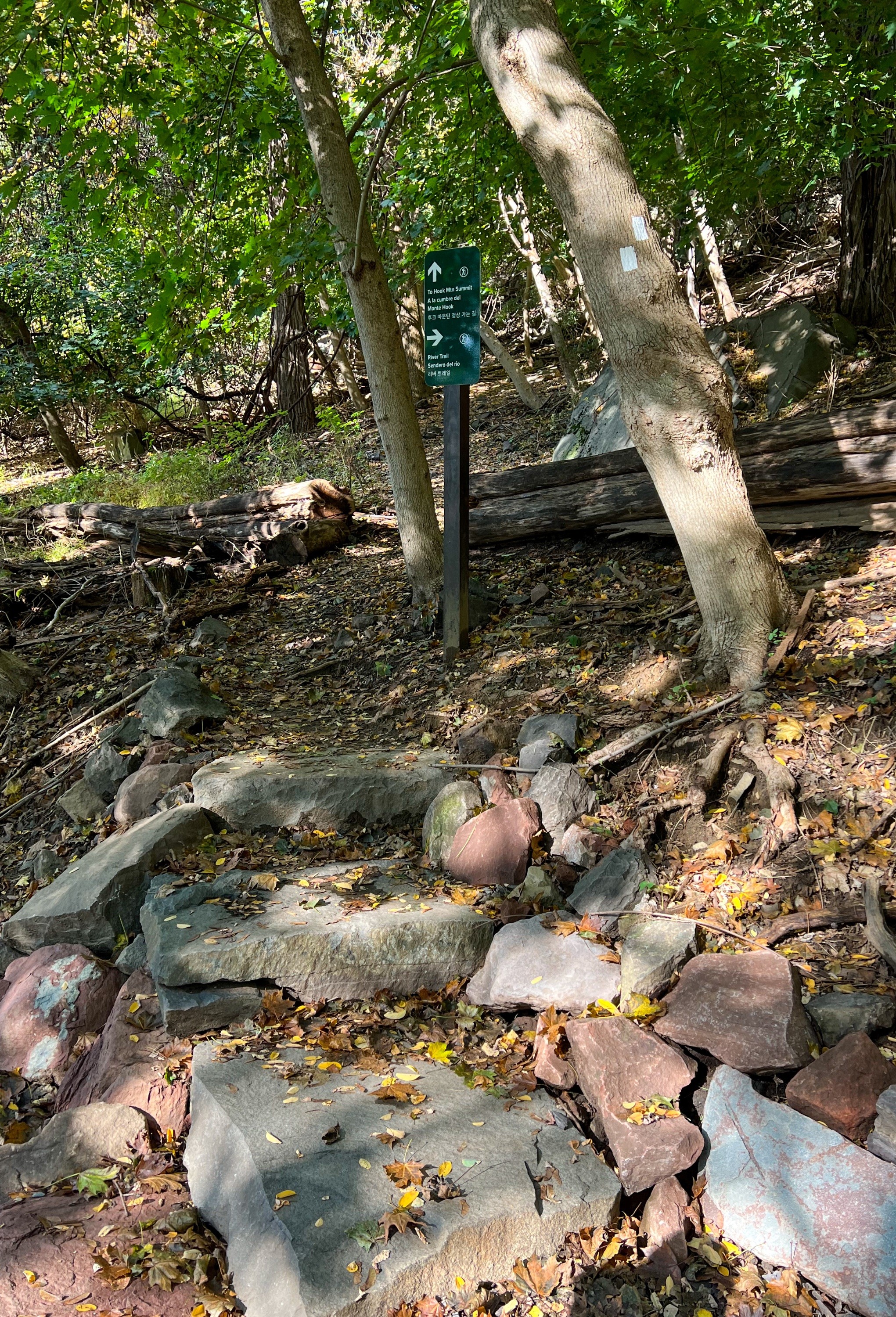
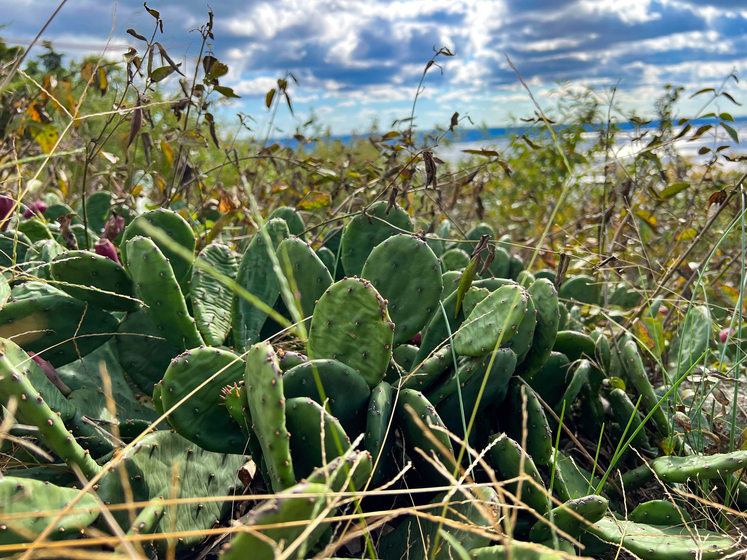
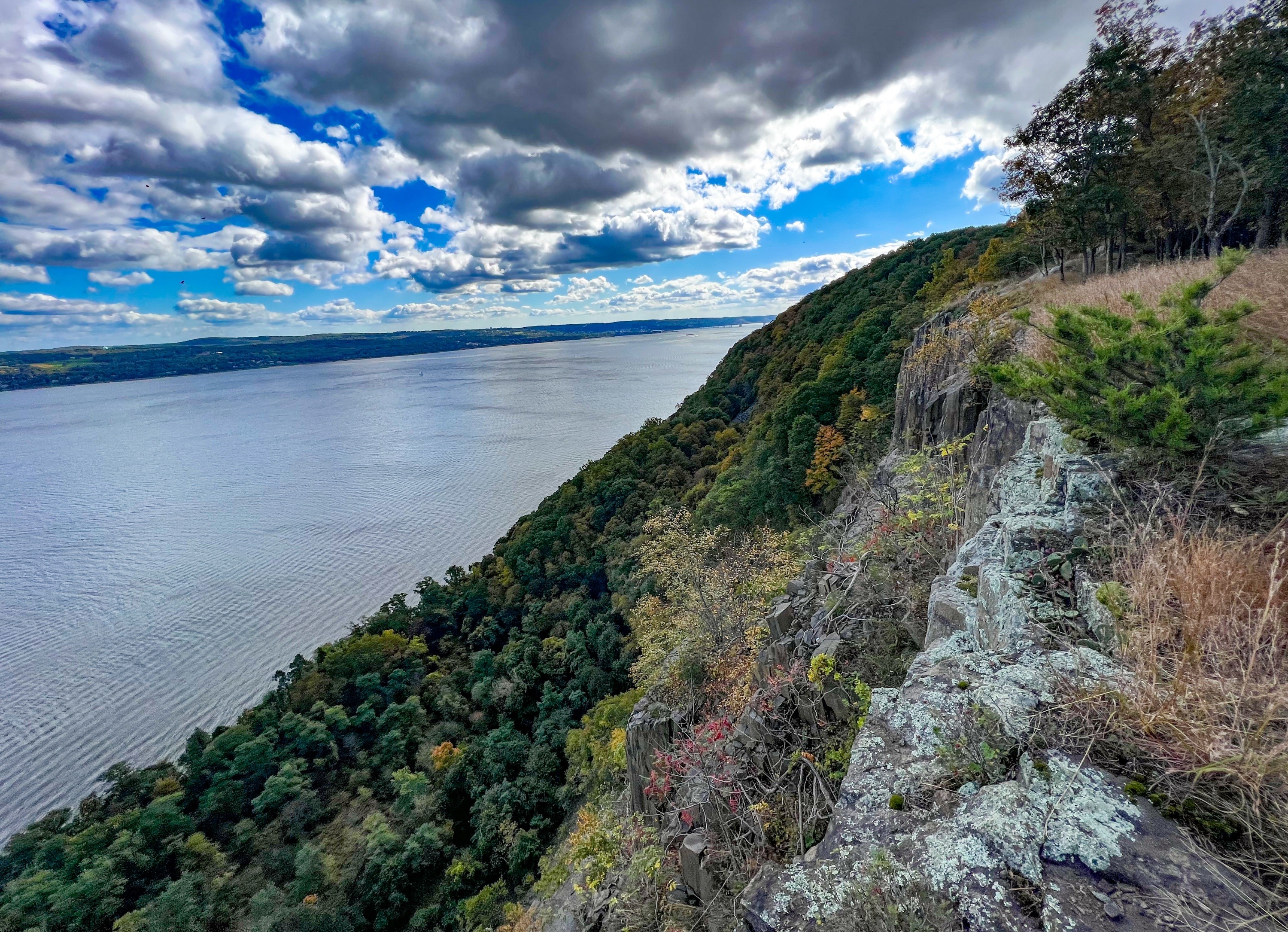
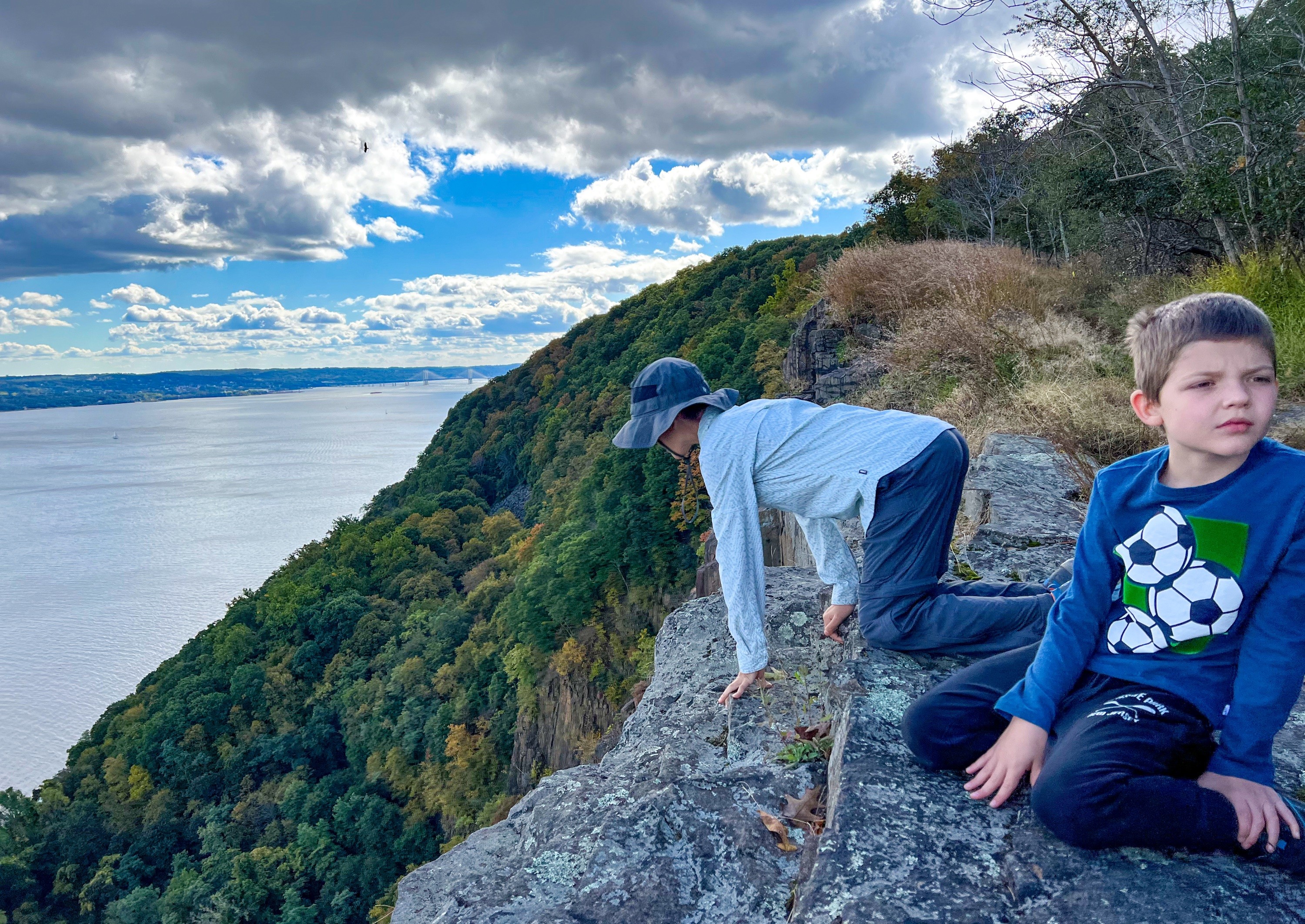
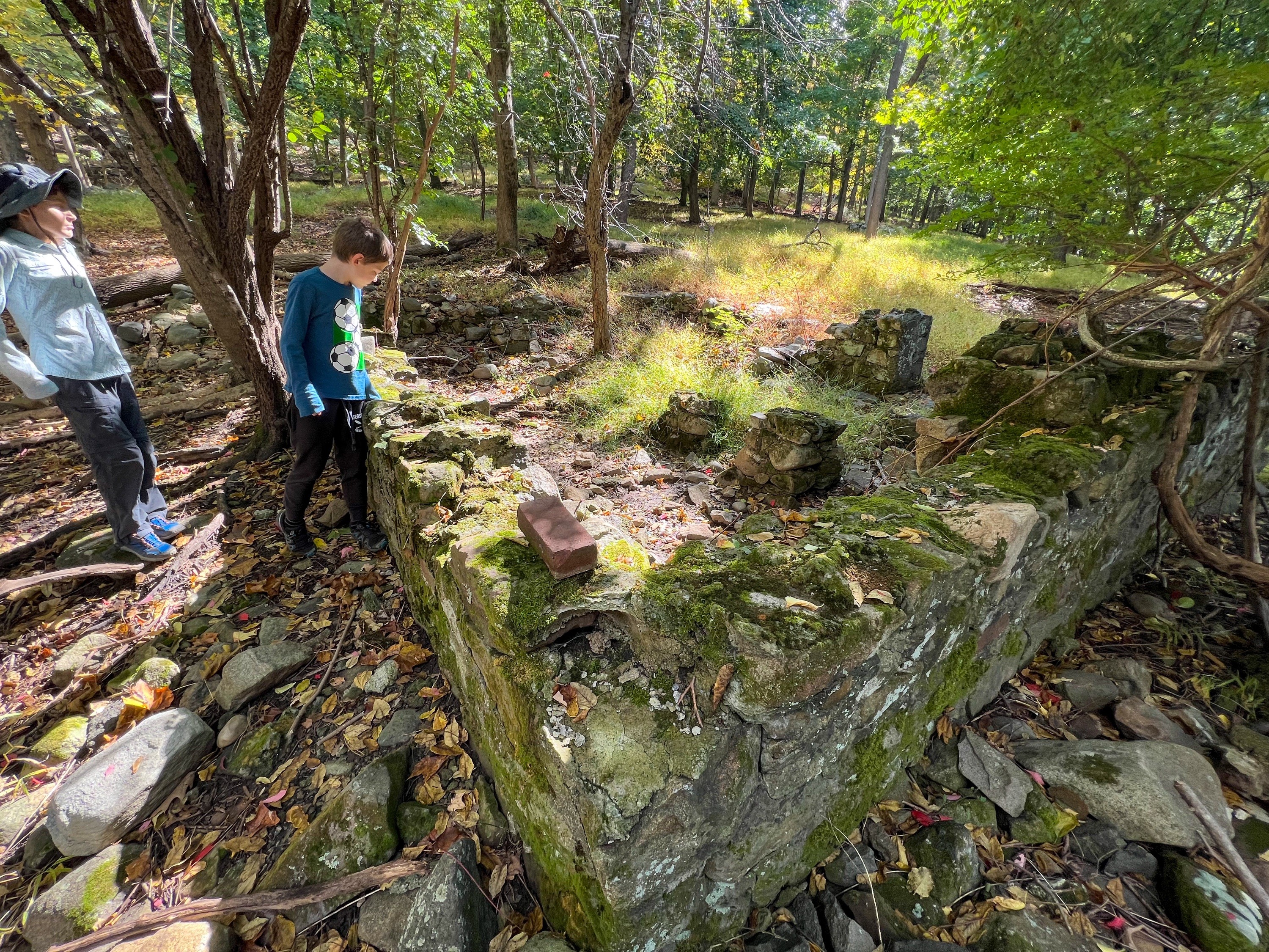
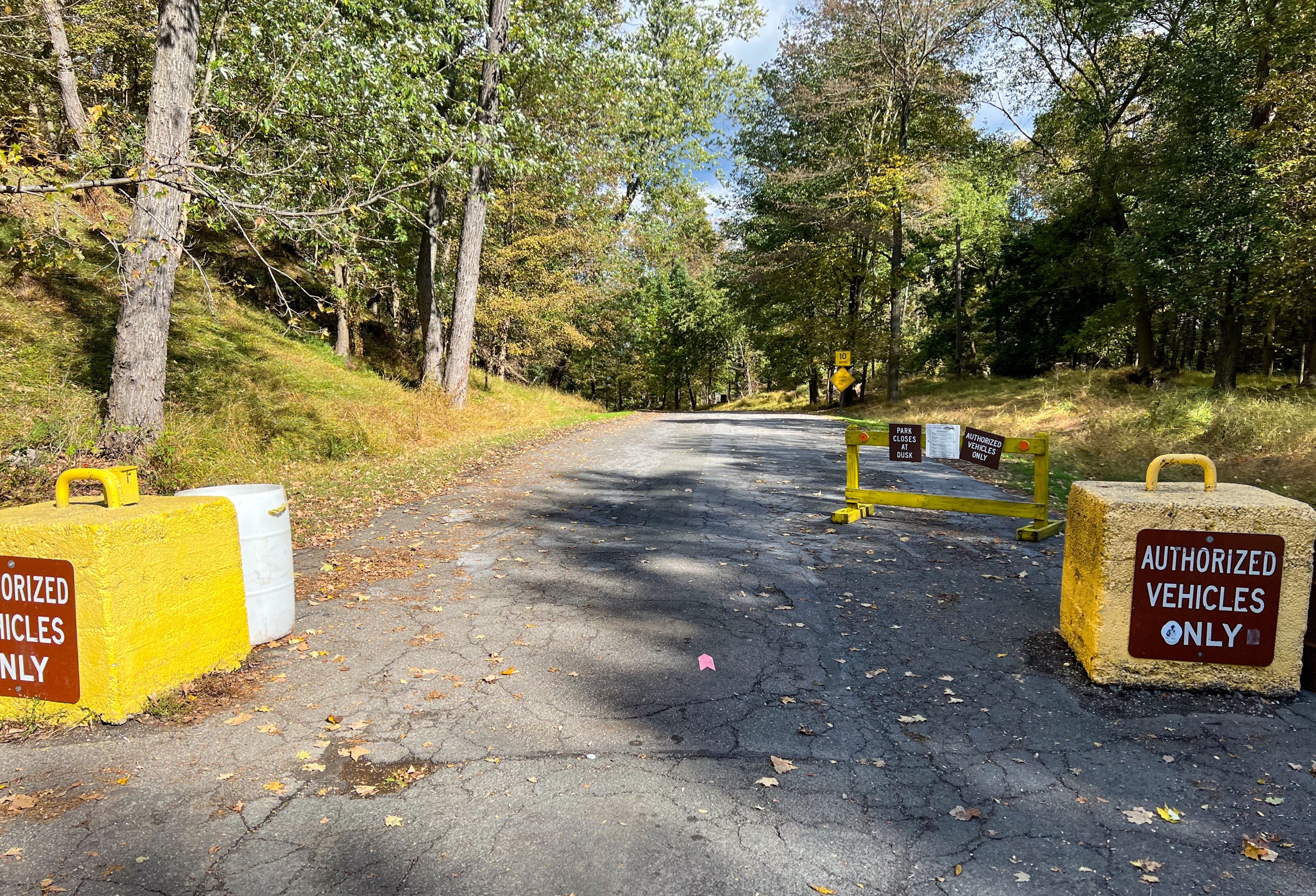
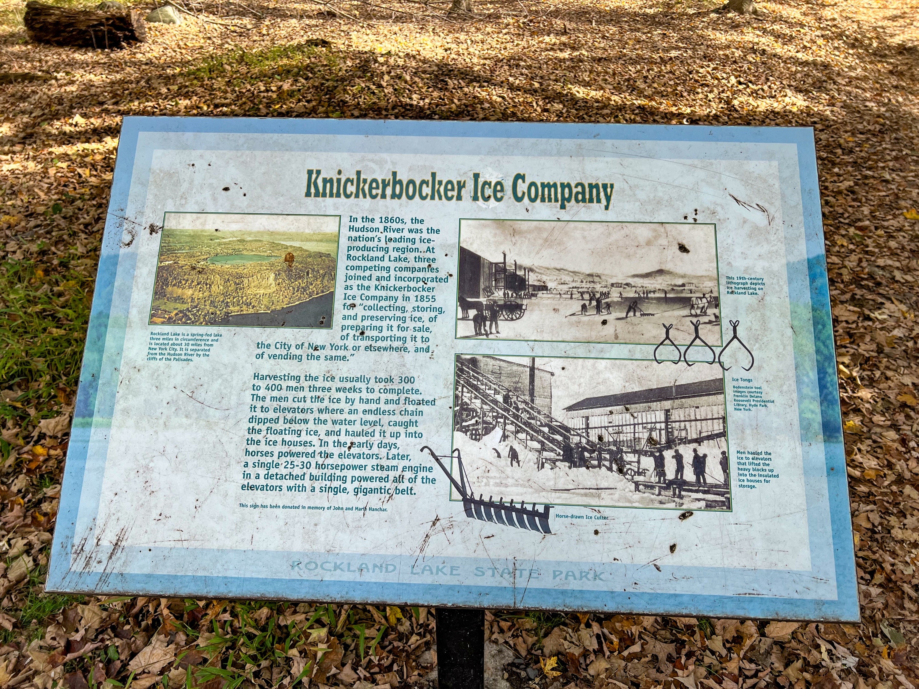
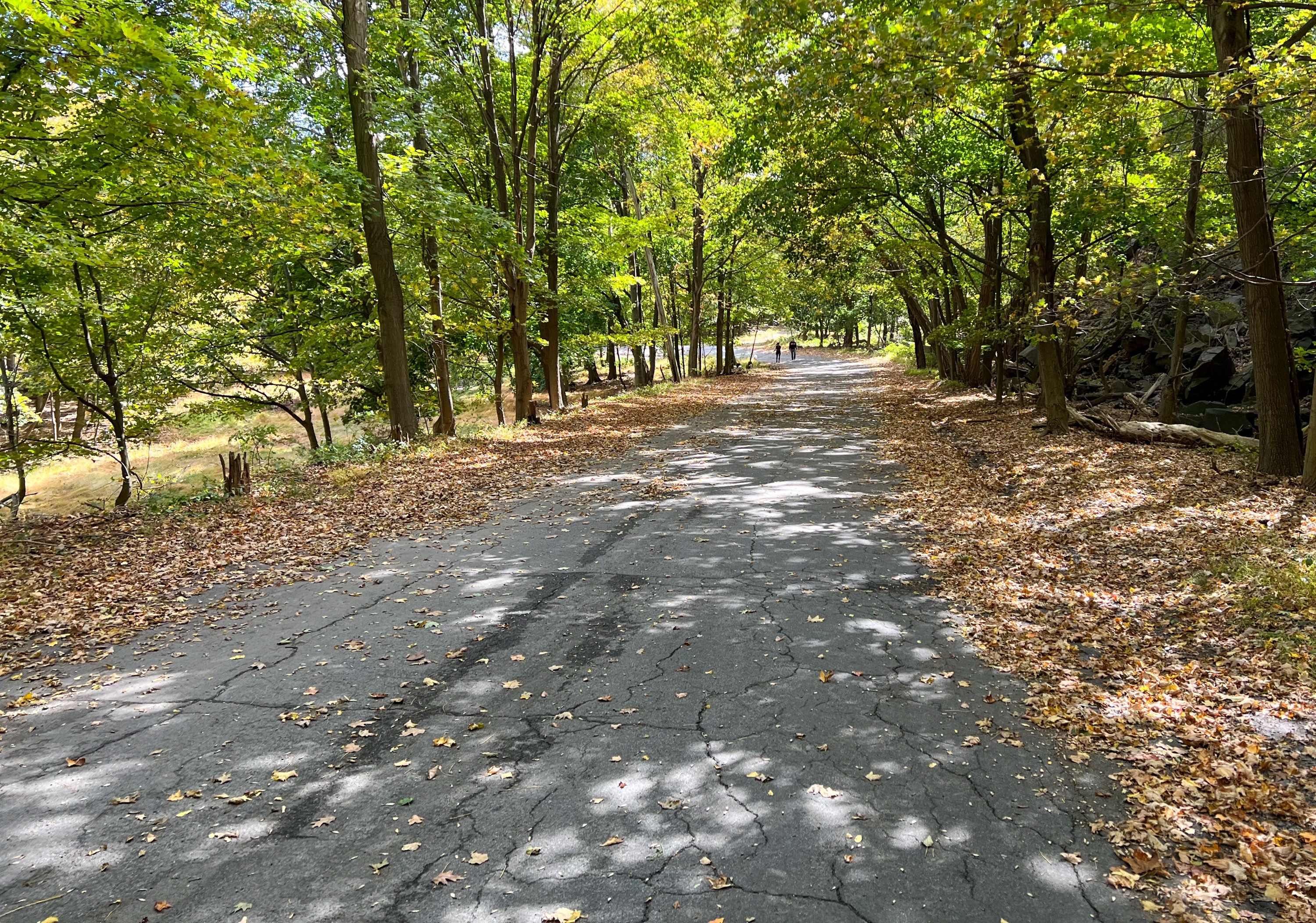
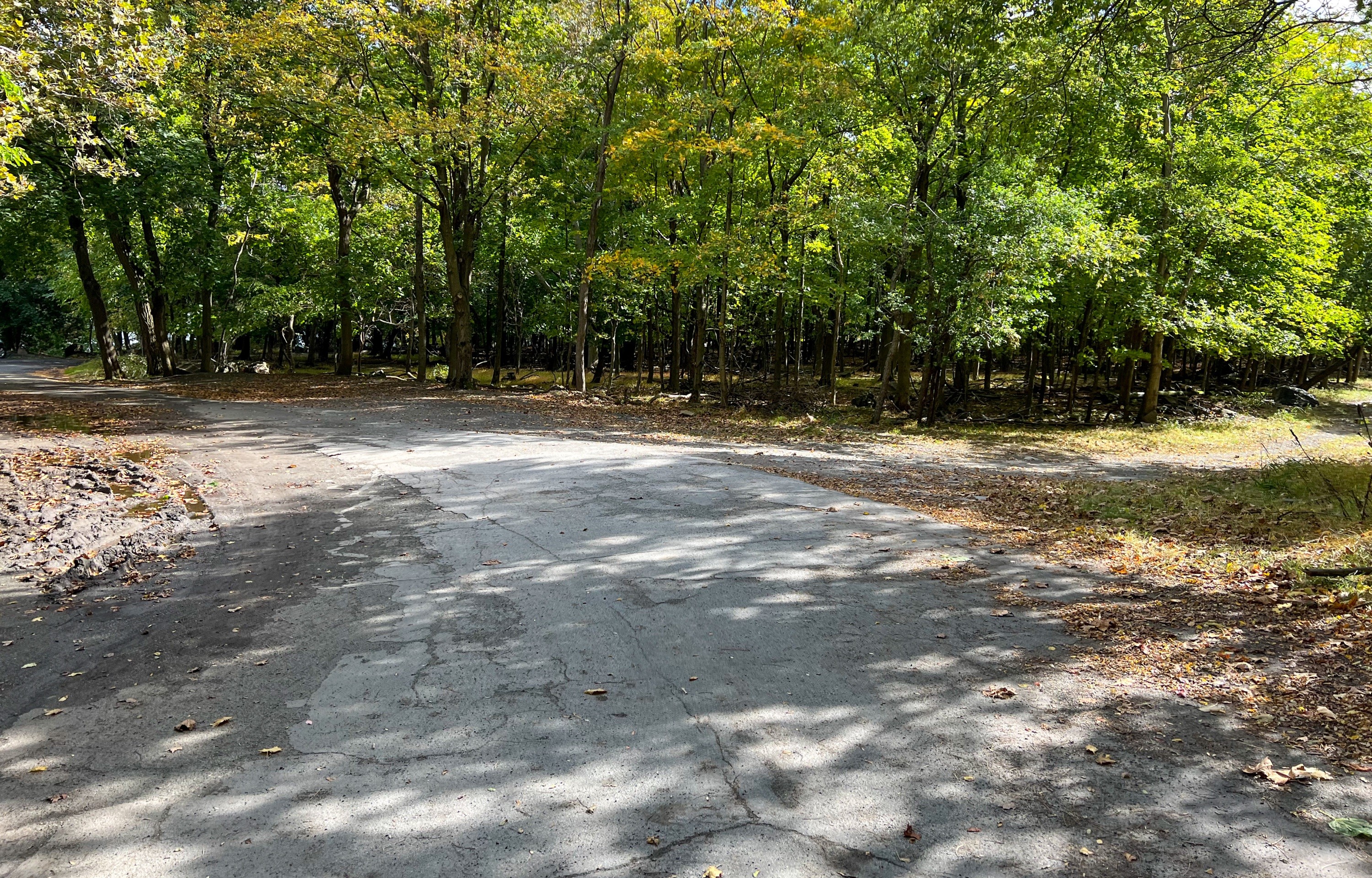
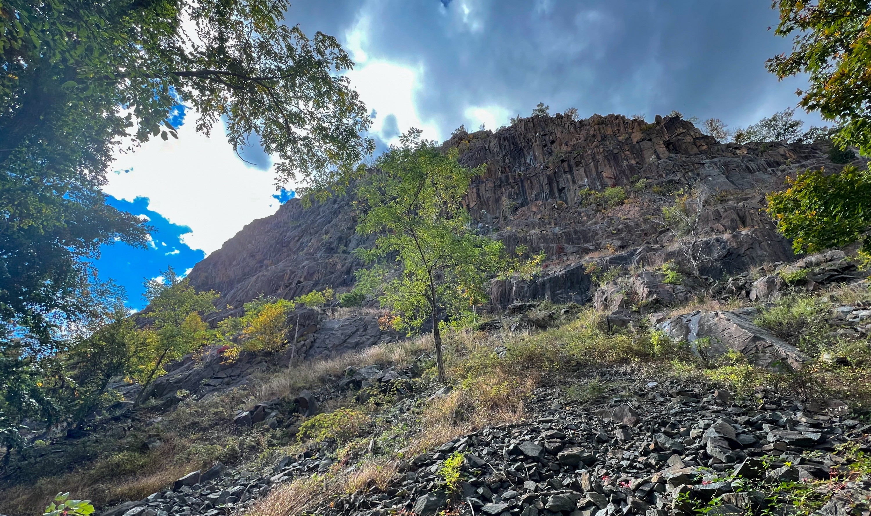
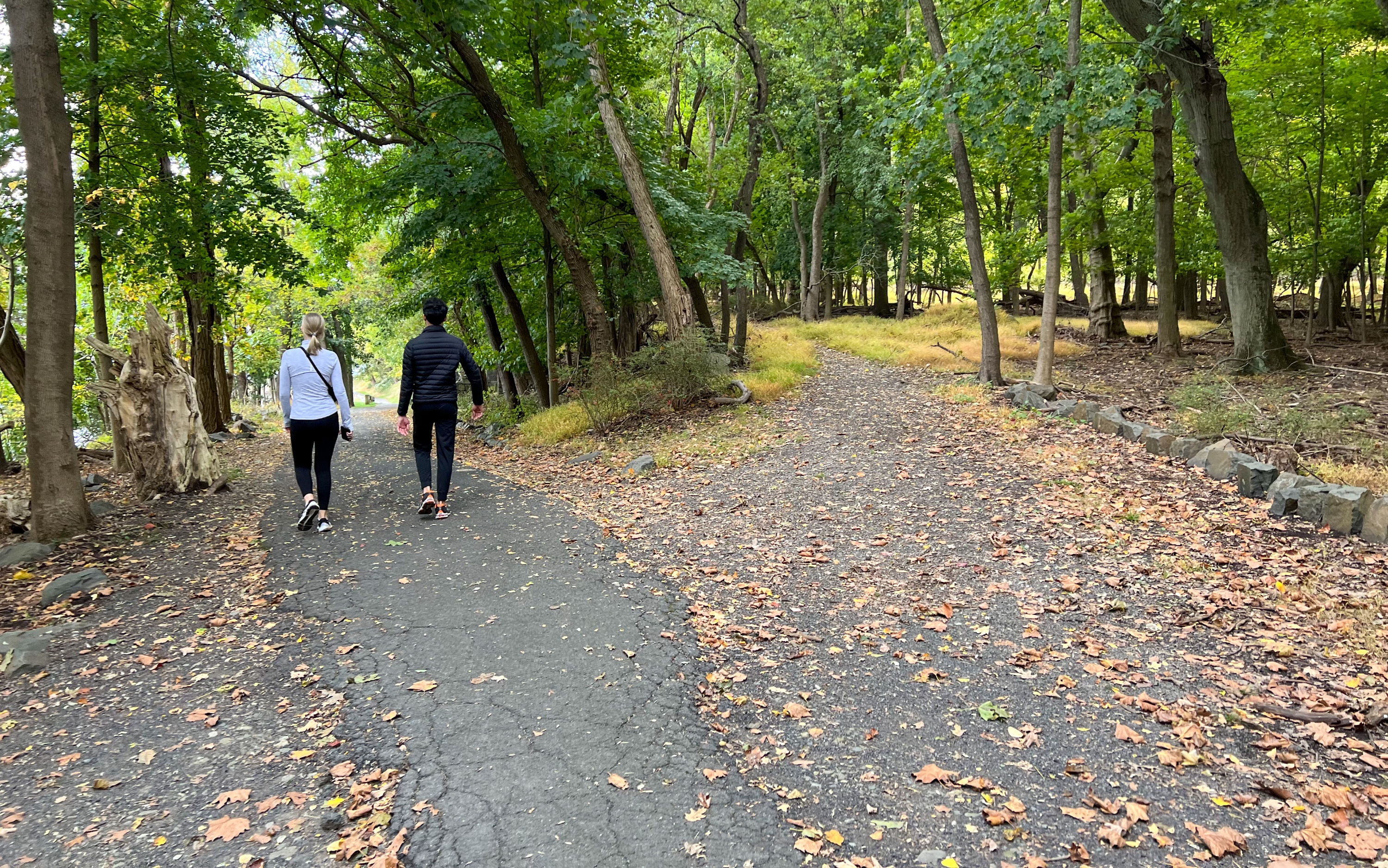
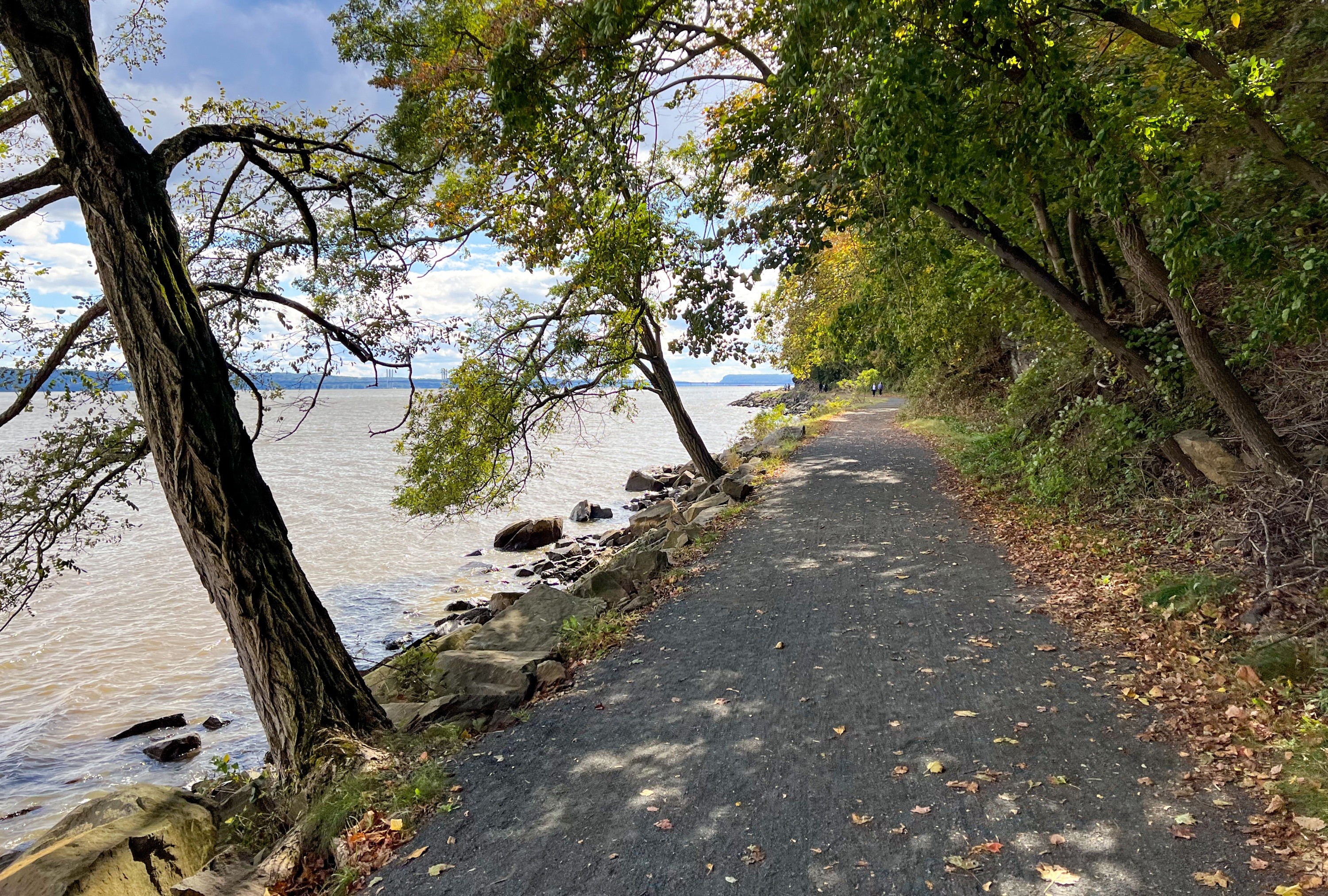
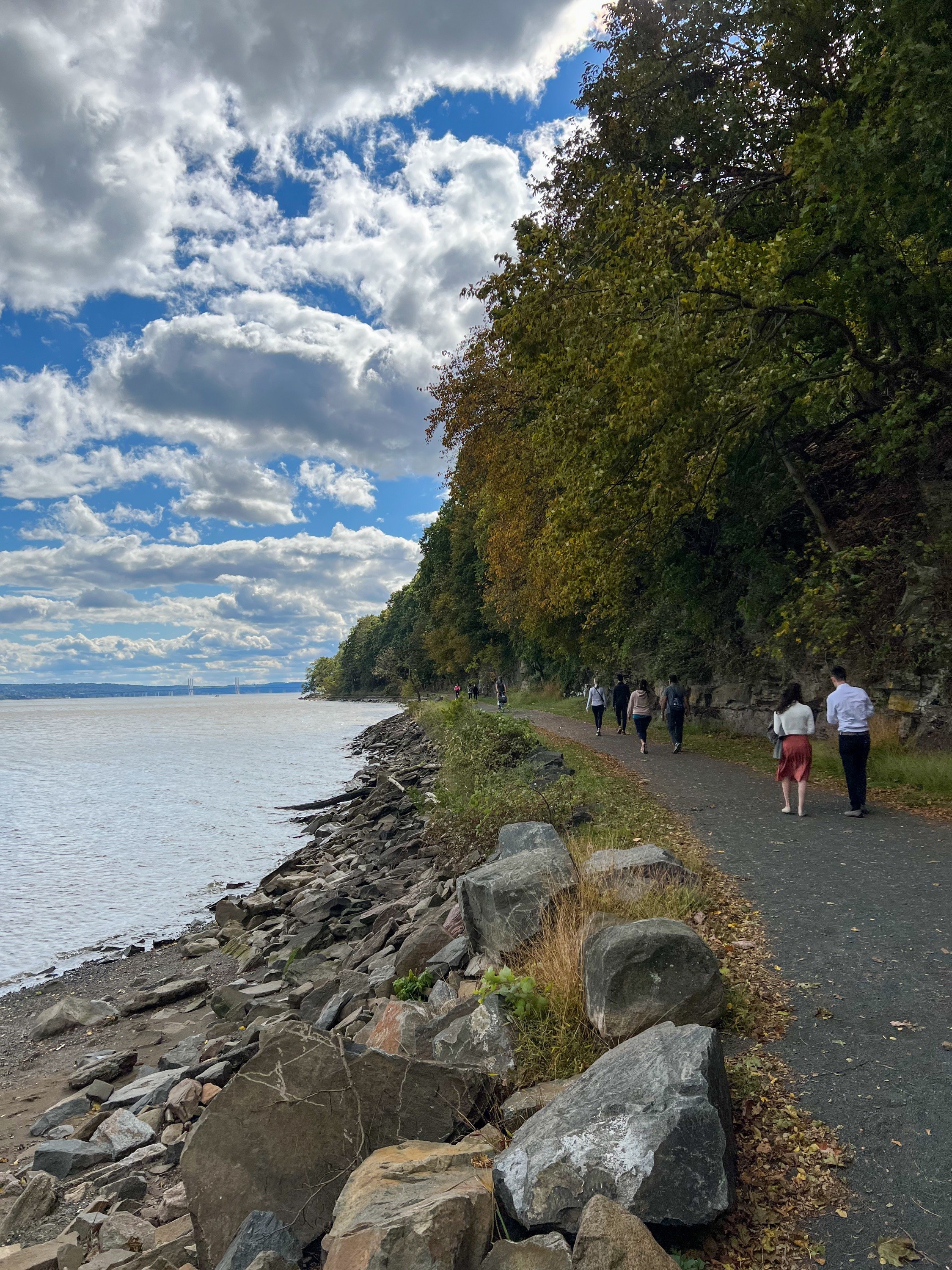
Hook Mountain and Nyack Beach Hike Overview This Hook Mountain and Nyack Beach loop uses a newly-constructed link trail to reach the Long Path which climbs Hook Mountain and offers multiple spectacular views of the Hudson River from atop the Palisade cliffs before returning along the Nyack River Trail. Length: 5.8 miles Elevation gain: +1,385' Location: Hook Mountain State Park and Nyack Beach State Park, Upper Nyack, New York 4 State Parks The area lies within a system of four connected State Parks that cover nearly 2,000 acres of public land: Hook Mountain, Nyack Beach, Rockland Lake, Haverstraw Beach. The parks are linked by trails and function as one big park system. About Hook Mountain Hook Mountain is the site of a 676-acre undeveloped park stretching through almost seven miles of waterfront and cliff slopes. At 730 feet, its summit offers spectacular views of Rockland Lake and the Hudson River valley. It is also a prime location for watching various types of hawks: sharp-shinned, Cooper's, Northern Goshawks, Red-shouldered, Broad-winged, Red-tailed. The Audubon Society estimates that an average of more than 12,000 hawks fly by Hook Mountain each Fall. - Palisades Parks Conservancy About Nyack Beach Nyack Beach State Park's 61 acres along the Hudson provides access to the river and its exceptional estuary ecosystem. Access the trail to the Hook Mountain summit directly from the River Trail. History Pre-colonial: This land is the ancestral homeland of Lenape people, who were the principal inhabitants for centuries. Colonization: Dutch colonists called the area "Tappan Zee" ("Tappan" after the local tribe of Lenape, and the Dutch for 'sea') 1800-1900s: The rock that forms the Palisades was quarried to help build New York City 1900-1911: The newly-formed Palisades Interstate Park Commission bought the land and created recreational areas for swimming, sports, and picnics along the Hudson River. Geology The massive wall of dark rock that towers over the plateau and trail is called the Palisades Sill. About 200 million years ago, magma rose up and cooled between sedimentary rock layers. Over time that softer rock eroded and exposed the harder rock that you see today. Along the river trail look for outcrops of red and grey rock. These rocks were sand and mud when dinosaurs roamed this area. About the New Upper Nyack Trail In the shadow of Hook Mountain, the Upper Nyack Trail has been an important connection from Nyack Beach State Park to the Long Path for many years. It is a utilitarian trail that facilitates a great 6-mile loop hike: over Hook Mountain on the Long Path into Rockland Lake State Park and returning to Nyack Beach on the River Trail...The old Upper Nyack Trail, while useful, ran through some wet, dark areas and included a road walk. Thanks to the work of Trail Conference volunteers, the experience is now even more enjoyable. The rerouted Upper Nyack Trail, opened to the public in June [2021], was several years in the making. Its creation was made possible by the purchase of 30 acres of undeveloped land from the Marydell Faith and Life Center. Adjacent to Nyack Beach and Hook Mountain state parks, this parcel would have been coveted for residential development; its purchase by the Trust for Public Land in 2017 was a significant win for conservation in Rockland County.... Soon after the sale, work on the new trail began: A route for the trail was scouted, mapped, and proposed for approval by the leadership of the Long Distance Trails Crew to the Palisades Interstate Park Commission, who assumed management of the land once it was incorporated into Hook Mountain State Park. The approval took into consideration the access and safety of the route while ensuring no ecological or archeological resources would be affected. The construction of the trail, along and through a steep talus slope of boulders eroded from Hook Mountain, was taken on by the skilled and dedicated volunteers of the Long Distance Trails Crew...Construction began in 2019. Though less than a mile in length, the technical work required to build a safe, sustainable route through such challenging conditions took almost 2 years to complete. The crew, which generally works Friday, Saturday, and Sunday every other week from early spring to early winter, put in 7,341 volunteer hours (and hundreds of gallons of sweat, as well as a little blood) into the project.... To create this trail, large boulders (up to 1,000 pounds each) had to be moved, manually, using rock bars and a high line. These boulders were moved into low spots and drainage channels to form stepping stones. In other places, rocks were placed along the route to level it, then smaller rocks were wedged into gaps around it. Then crush—literally gravel-sized rocks manually crushed by crew members from larger rocks—was used to fill in the smaller gaps. The footbed was then finished by covering the rocks and crush with dirt that was dug up nearby and carried in buckets to the trail. NY-NJ Trail Conference Trail Walker, Fall 2021 Hook Mountain & Nyack Beach Parking Park at the Nyack Beach State Park parking area. Address: 698 N Broadway, Nyack, NY 10960. There is an $8/vehicle entry fee. Parking area at Nyack Beach State Park Hook Mountain Map Hudson Palisades Trails Map #110 - NY-NJ Trail Conference Hook Mountain and Nyack Beach Hike description From the parking area head north, past the restrooms and vending machine on your left. Pass a kiosk and then follow the walking/bike trail a short distance north. On your left, look for a green sign pointing towards "Hook Mt Summit & Plateau." A tree with three white blazes marks the start of the new Upper Nyack Trail. Follow this trail as it heads uphill. You'll reach a sign at a junction pointing towards the Hook Mountain Summit and the Plateau. Head left towards the Hook Mountain Summit. Continue a bit further and you'll reach a paved road. Walk downhill along the road a short distance and look for the entrance to the trail on your right. When we visited, it was marked with an orange cone. Look for the two white blazes indicating where the trail leaves the road and continues into the woods. This next section of the trail took several years of hard, manual labor to construct by trail volunteers and it is an impressive feat. Notice how easily the trail traverses this very rocky, steep section with large boulders all around you. A description of the work involved is at the top of this page. This trail ends at a beautifully built stone staircase. You've now reached the teal-blazed Long Path. Turn right and follow the Long Path as it climbs steadily up Hook Mountain. You'll start to get some really nice partial views along the way as you gain elevation. Eventually you'll reach the first major viewpoint at a clearing that's often used for bird watching. This is a great spot to stop for a break and enjoy the incredible views of the Hudson River and Rockland Lake. This area - and all along Hook Mountain - is full of prickly pear cactus - the sun exposure and steep inclines provide the dry soils and sunny weather the cactus likes. Continue along the trail, which offers a multitude of viewpoints along the way. Some of the views are particularly dramatic as the trail hugs the edge of the cliff. https://www.youtube.com/watch?v=g5HkxGdlbko Keep going. You guessed it - more views. Not far beyond this point is a US Army Corps survey marker along the trail. The trail now reenters the woods for a while. Eventually you'll see a large stone wall along your left side, which appears to be one side of an old road built through the area. Just beyond here, look for the trail to fork at a spot that may be marked with a rock pile. The Long Path continues to the left, but we'll take the unmaintained footpath to the right which soon exits the woods as you reach the cliff. The trail now follows the edge of the cliff for a few hundred feet. This was my favorite part of the trail and I'm not sure why the Long Path isn't routed this way, but I wouldn't miss this section. https://www.youtube.com/watch?v=LVvVZYW_rVc You're likely to see a lot of birds riding the thermal currents here. From here, take the unmarked trail downhill back towards the Long Path. The trail now descends and you'll pass the foundation and remnants of an old building. The trail continues to descend and soon reaches Landing Road. Turn right onto the road and walk a short distance. You'll pass a gate indicating that access is for authorized vehicles only. Just beyond the gate on your right is a sign from Rockland Lake State Park with information on how the lake and Hudson River played a key role in ice production in the 1860s. Follow the road downhill. At a fork with a less maintained trail, stay left, but if you do take a few steps to the right at this fork, you can get a nice view of the cliffs that you were just on top of. Keep going Stay left here Keep following the paved path as it descends and eventually joins up with the Nyack River Trail along the riverfront. You'll follow the river trail for 1.5 miles back to the parking area.
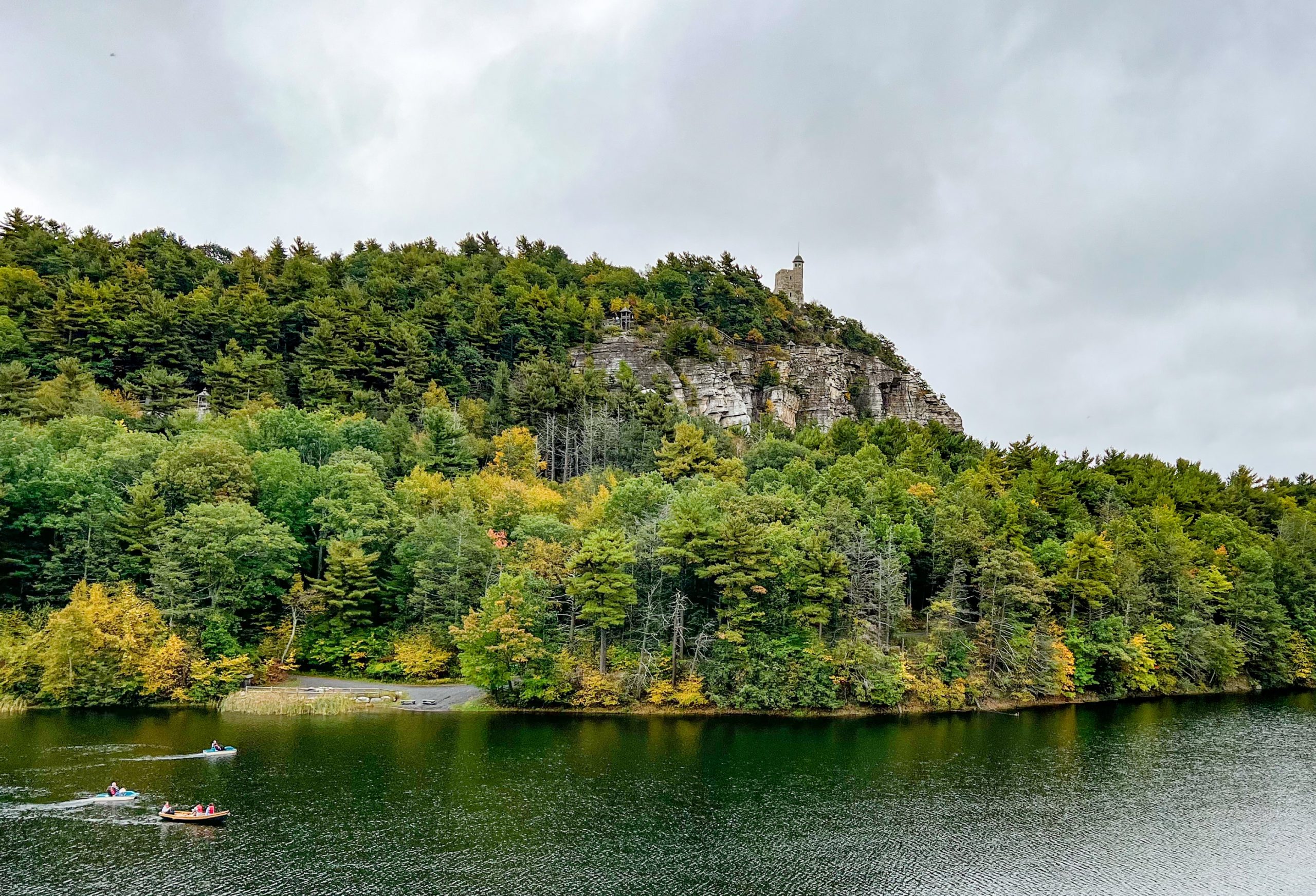
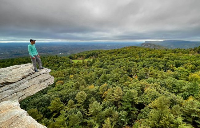
Eagle Cliff and Copes Lookout is an easy hike along mostly flat, level paths with spectacular views of Mohonk Lake, cliffs, and the Shawangunk Ridge - it's what makes Mohonk Mountain House so special.
Bear Hill Preserve is an easy, kid-friendly hike to a dramatic cliff with panoramic views and the less well-known Grapefruit Squeeze - a relatively deep crevice of fallen boulders to explore that's worth a visit on its own merits.
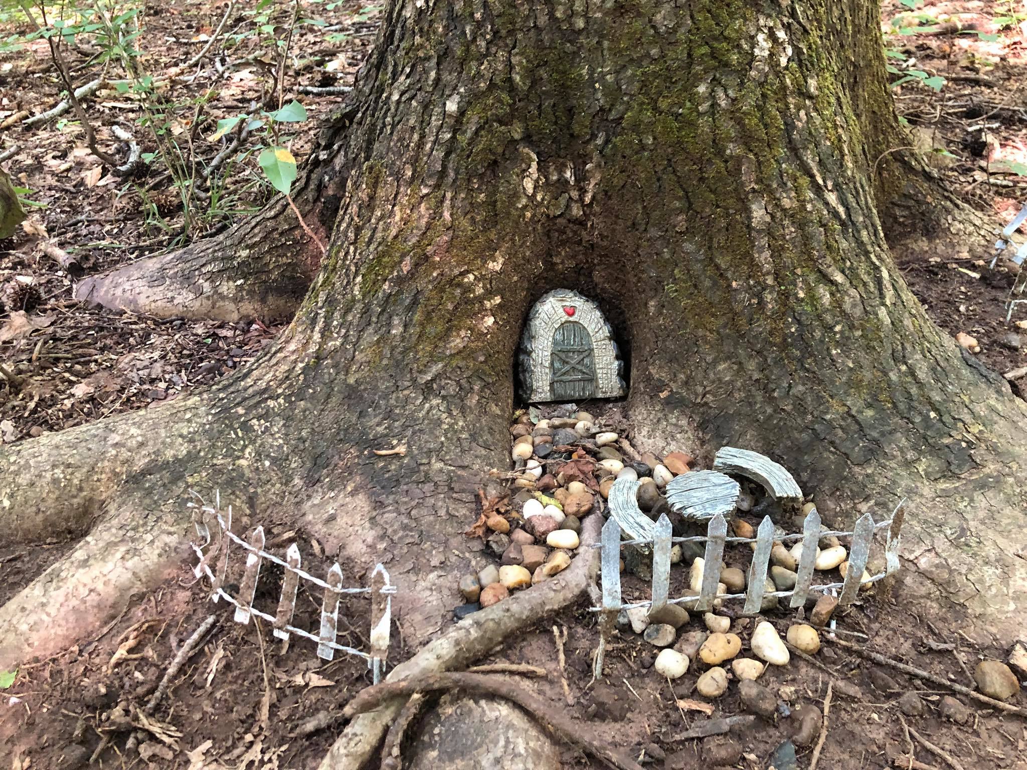
A great way to get the little ones out and exploring nature, the Fairy Trail is an easy half mile path inhabited by fairies who have built homes along the trail.
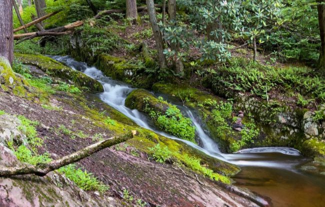
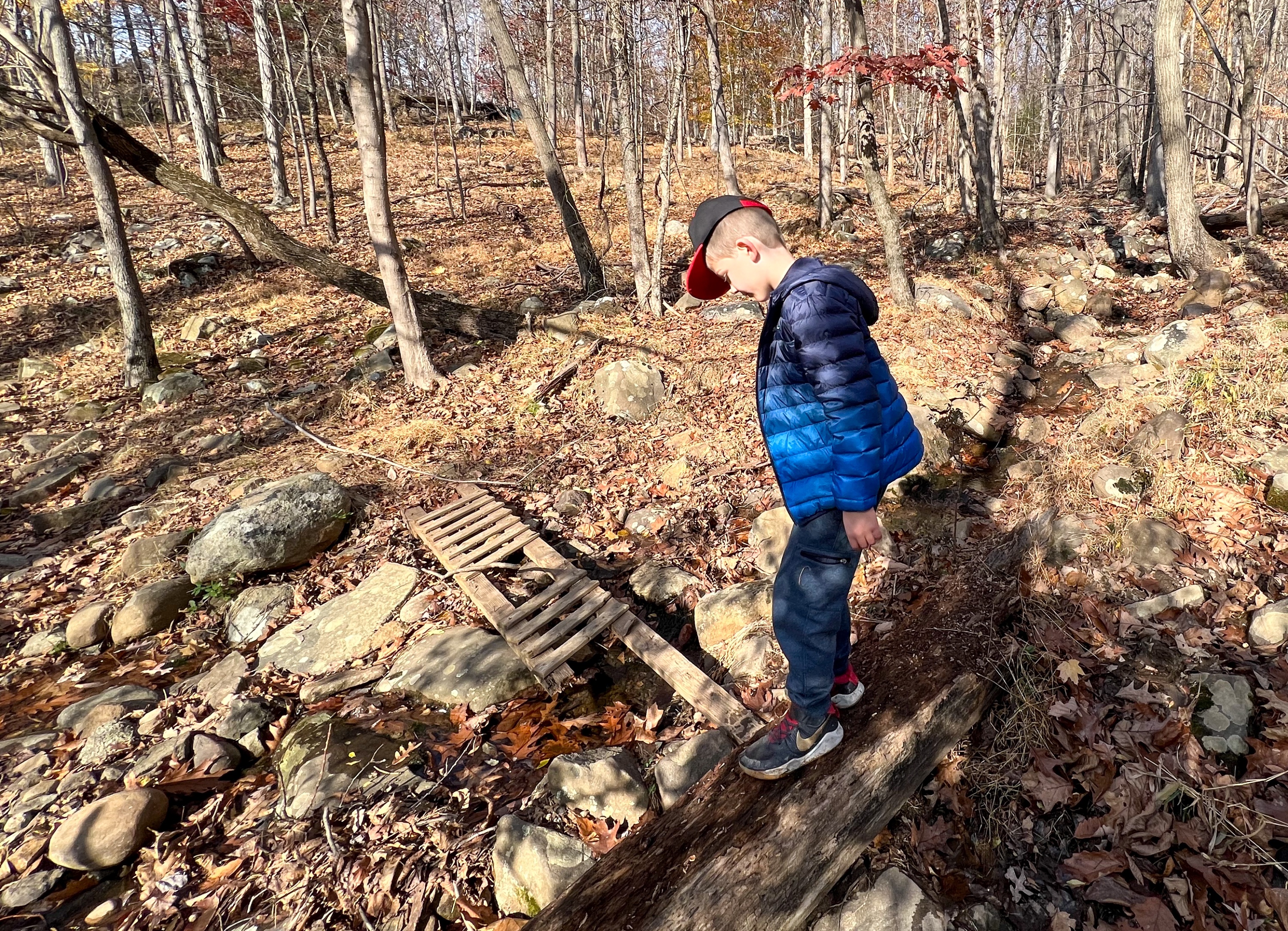
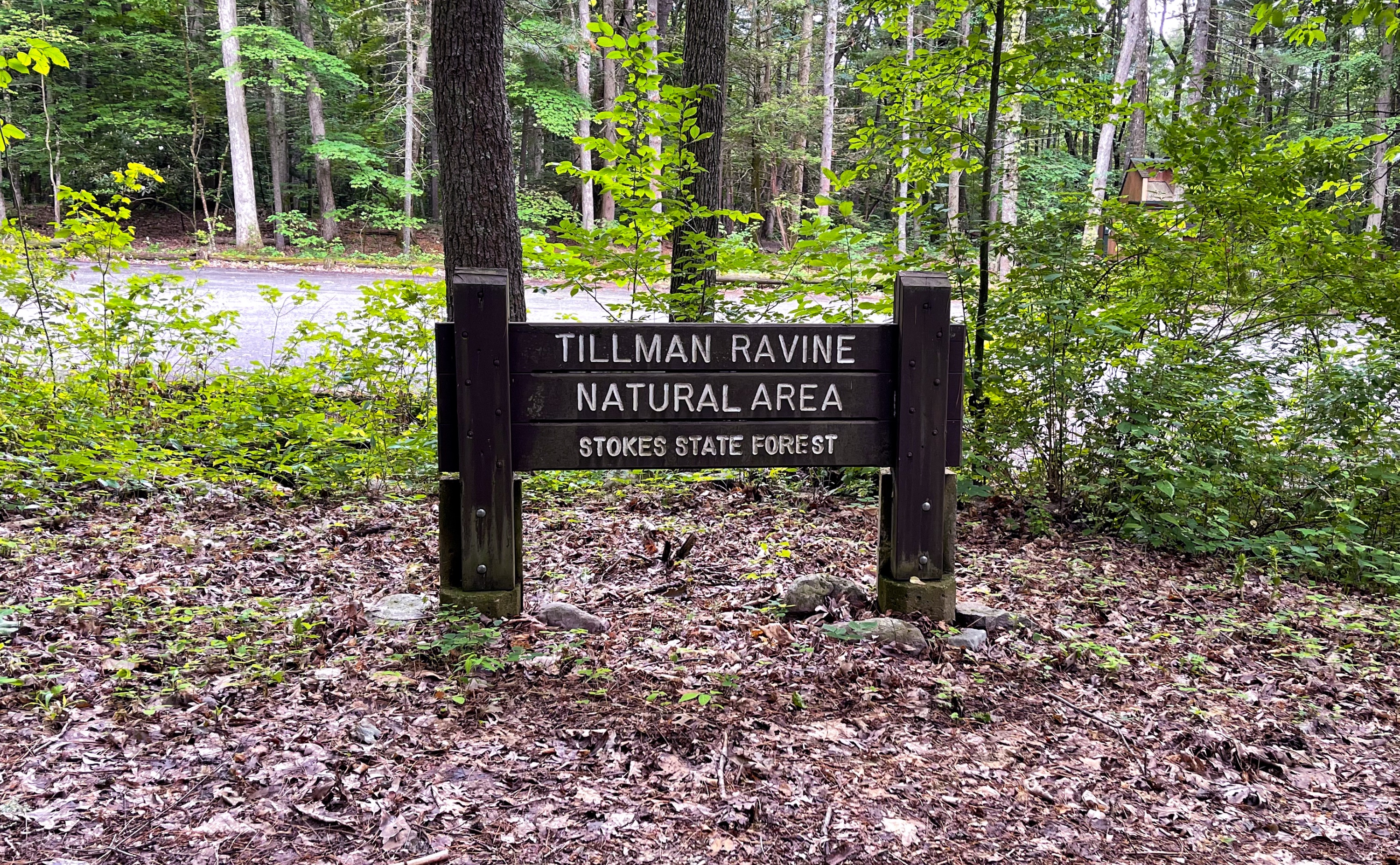
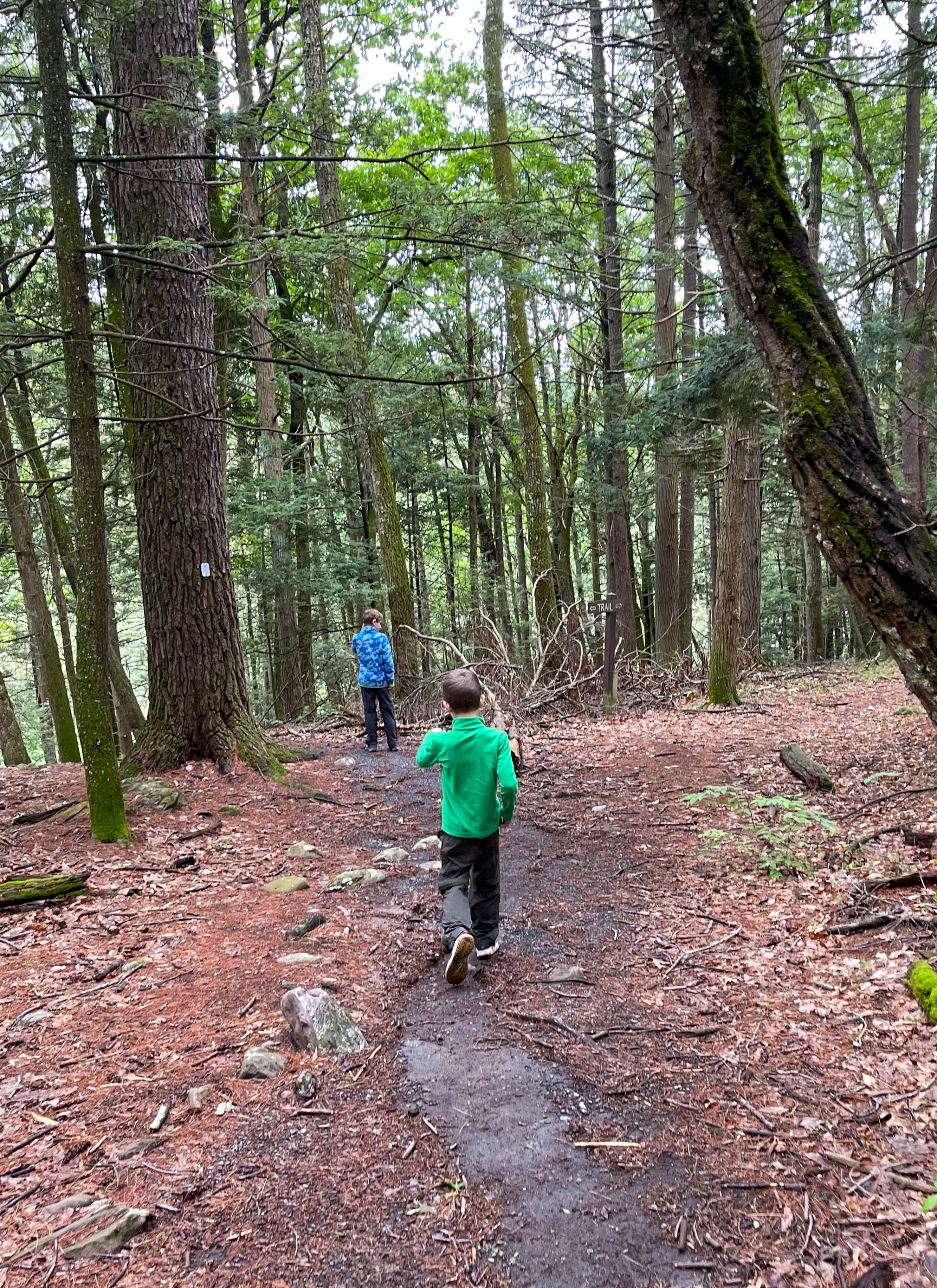
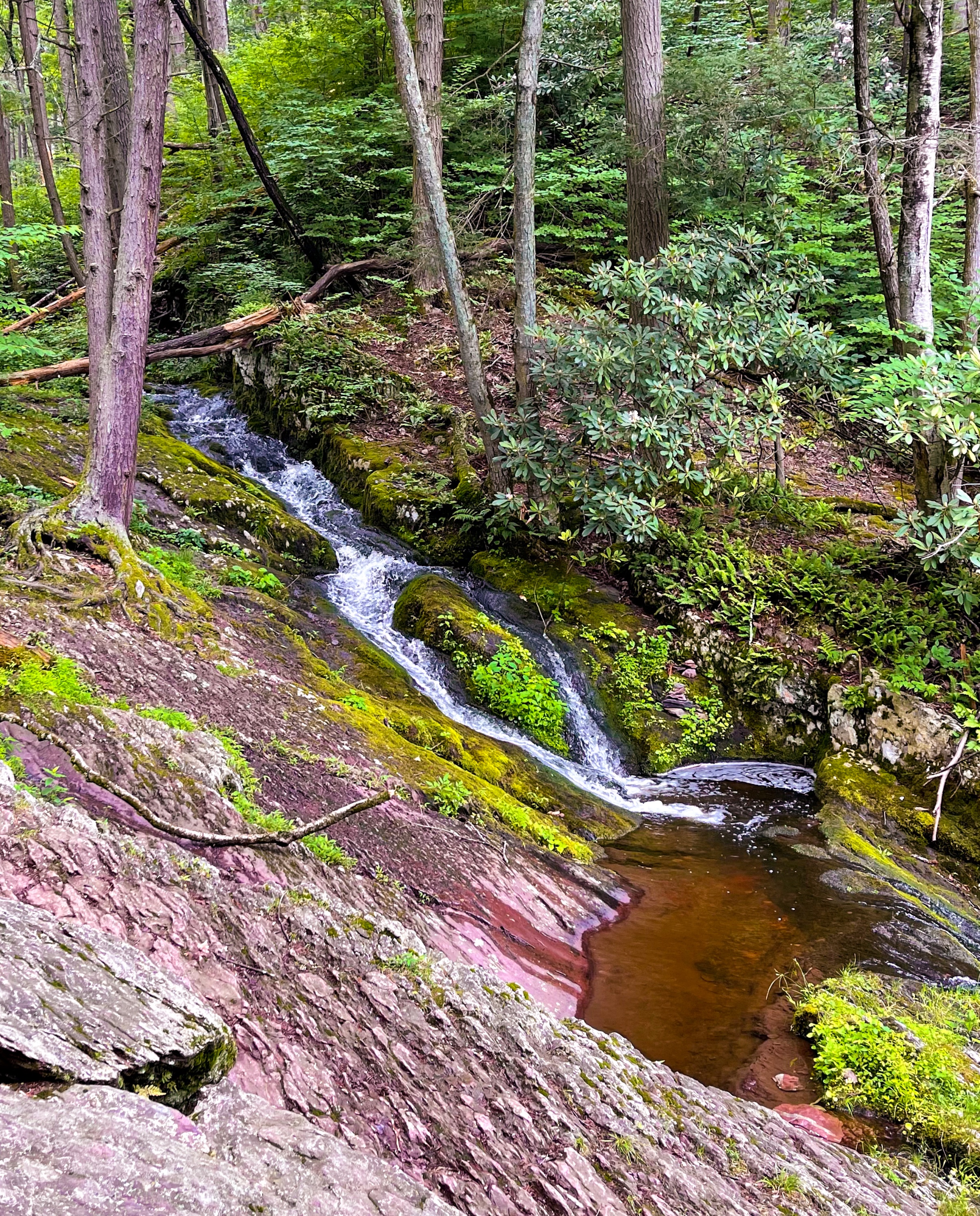
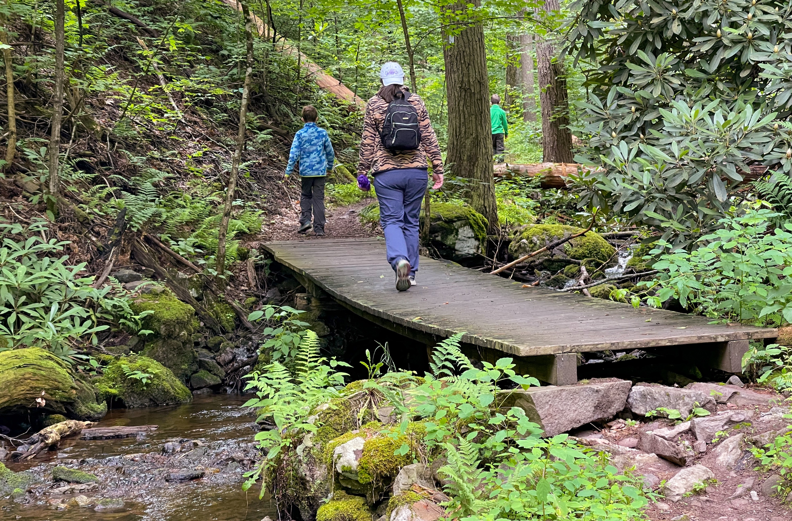
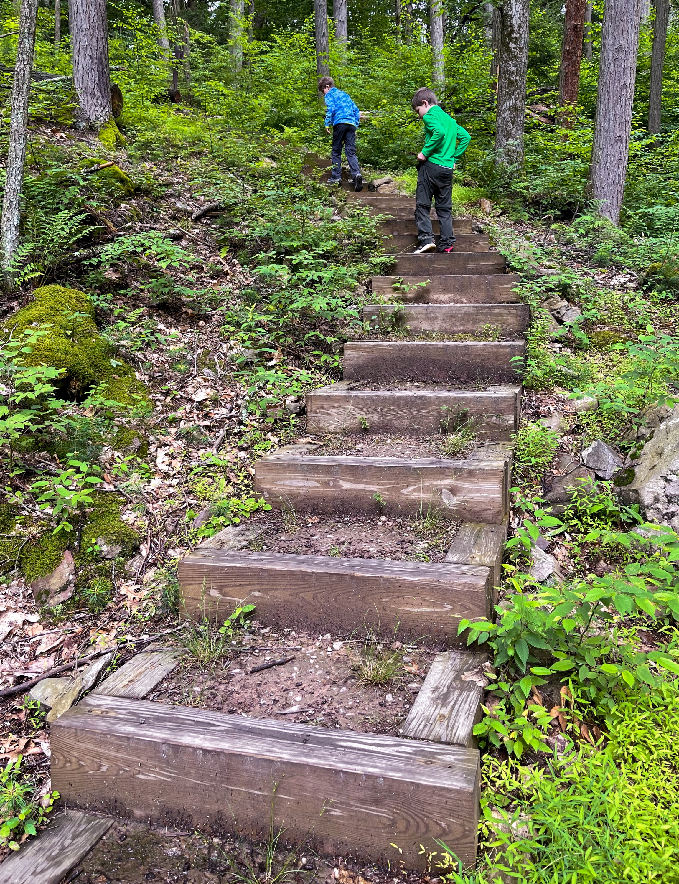
Tillman Ravine Overview Tillman Ravine is a short but steep kid-friendly trail along a forested creek ravine that features the interesting swirling "Tea Cup" structure at the bottom of a cascade. The area features a mature hemlock grove and an abundance of mountain laurel and rhododendron. Vehicle access to Tillman Ravine is restricted from December 15 to April 15, or when conditions are hazardous due to weather. Parking during these months is available at the pull off next to the 4H camp. Tillman Ravine Trail is a short 1 mile looped trail that goes between ridge and ravine and along Tillman Brook, which flows from a spring in the Kittatinny Mountains to the east. The ravine is a narrow red shale and sandstone gorge set among tall hemlock trees. The forested hillsides are thick with hemlock and tulip poplar, with rhododendron and ferns blanketing the ground. Length: Approximately 1.5 miles Location: Tillman Ravine Natural Area, Stokes State Forest, Branchville, Sussex County, New Jersey Tillman Ravine Parking Park in the lower parking area for Tillman Ravine Natural Area along Dimon Road (Google maps link). You could also park in the upper lot, for a slightly longer hike. There are restrooms at both the upper and lower parking areas. Tillman Ravine Map Delaware Water Gap & Kittatinny Trails Map #122 - NY-NJ Trail Conference (best option) Stokes State Forest South web map (NY-NJ Trail Conference free pdf) NJ Parks & Forests - Stokes State Forest Trail mapTillman Ravine Trail description This trail guide describes a "Figure-8" loop from the lower parking area, to the Tea Cup, along Tillman Brook, and back to the lower parking area. From the parking area, look for the trail entrance to the left of the restrooms and enter the woods, following the white-blazed Tillman Ravine Trail. The trail descends into the ravine, and about 250 feet ahead you'll reach a sign pointing left towards the "Tea Cup" and the start of the green-blazed (and mis-spelled) Cemetery Trail. Head left to check out the Tea Cup, an interesting swirling feature at the bottom of a cascade. Tea Cup This structure is a pothole, formed by the swirling motion of sand and rock carried by rapidly moving water. This motion deepens and enlarges the pothole, giving it a circular shape and smooth walls. Eventually, the motion will erode the front wall of the pothole, as in the semi-circle formation just below the Teacup. Natural Areas Inventory: Tillman Ravine, Montclair State University The Tea Cup This is the most interesting part of the trail, with several cascades through a lush forest. From here, follow the white blazes north. You'll pass through a crevice in a rock. Crevice through rock As you continue north, the trail parallels and crisscrosses Tillman Brook several times on wooden footbridges. You'll pass a sign pointing towards the Upper Route and Lower Route. Continue straight. Eventually you'll reach a set of wooden stairs. At the top of the stairs, the trail reaches a junction. Take a left to follow the white blazes towards the south and when you reach another junction, turn left again. Continue to follow the white blazes and where the trail forks again, stay right to complete the figure 8 loop and head back to the lower parking area.


 Refine Search


