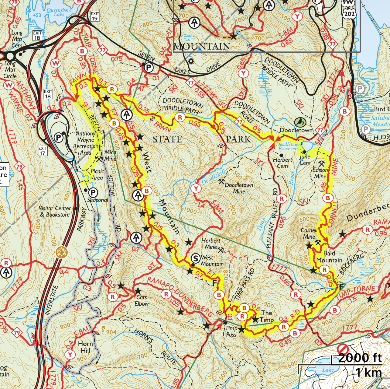
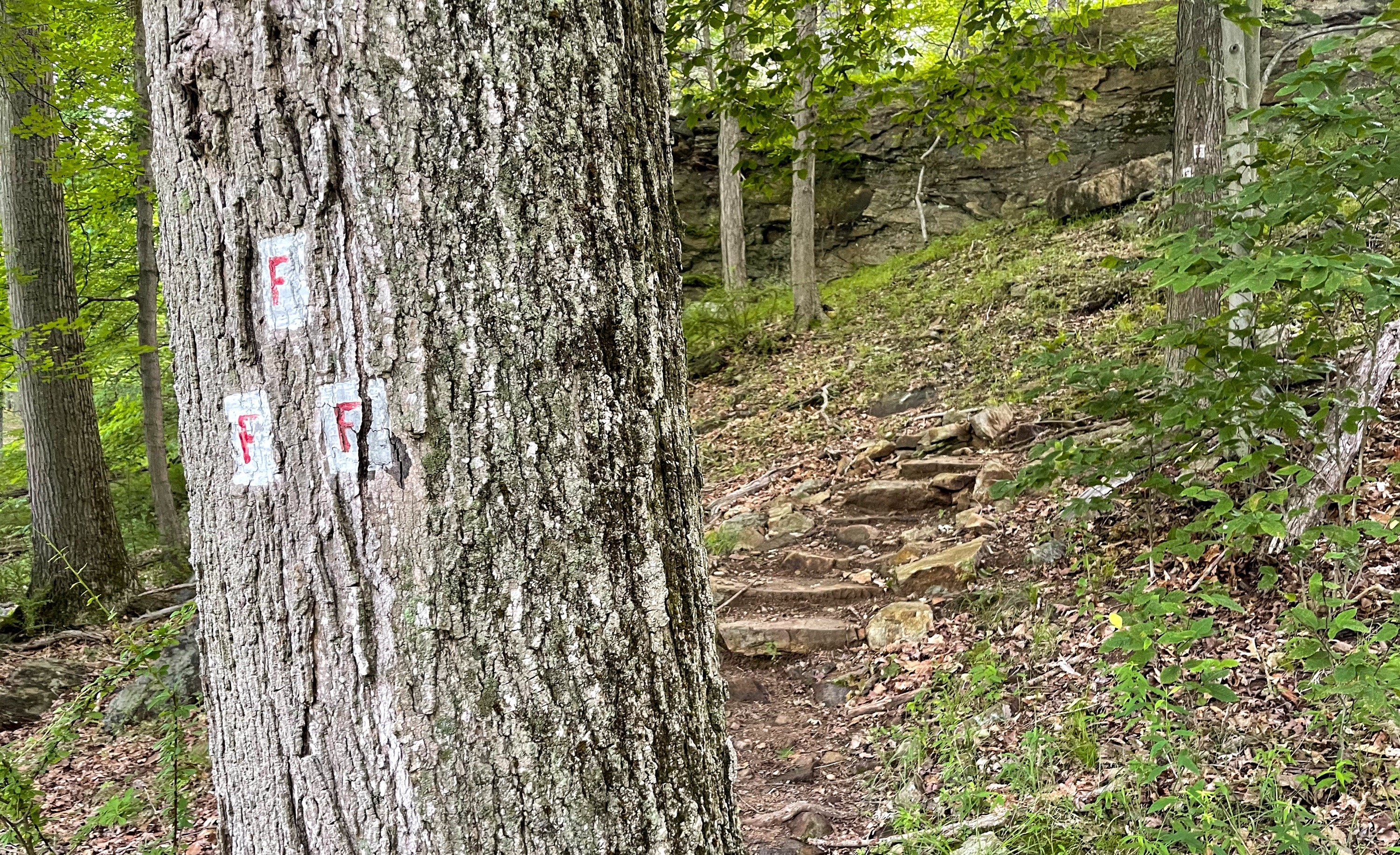
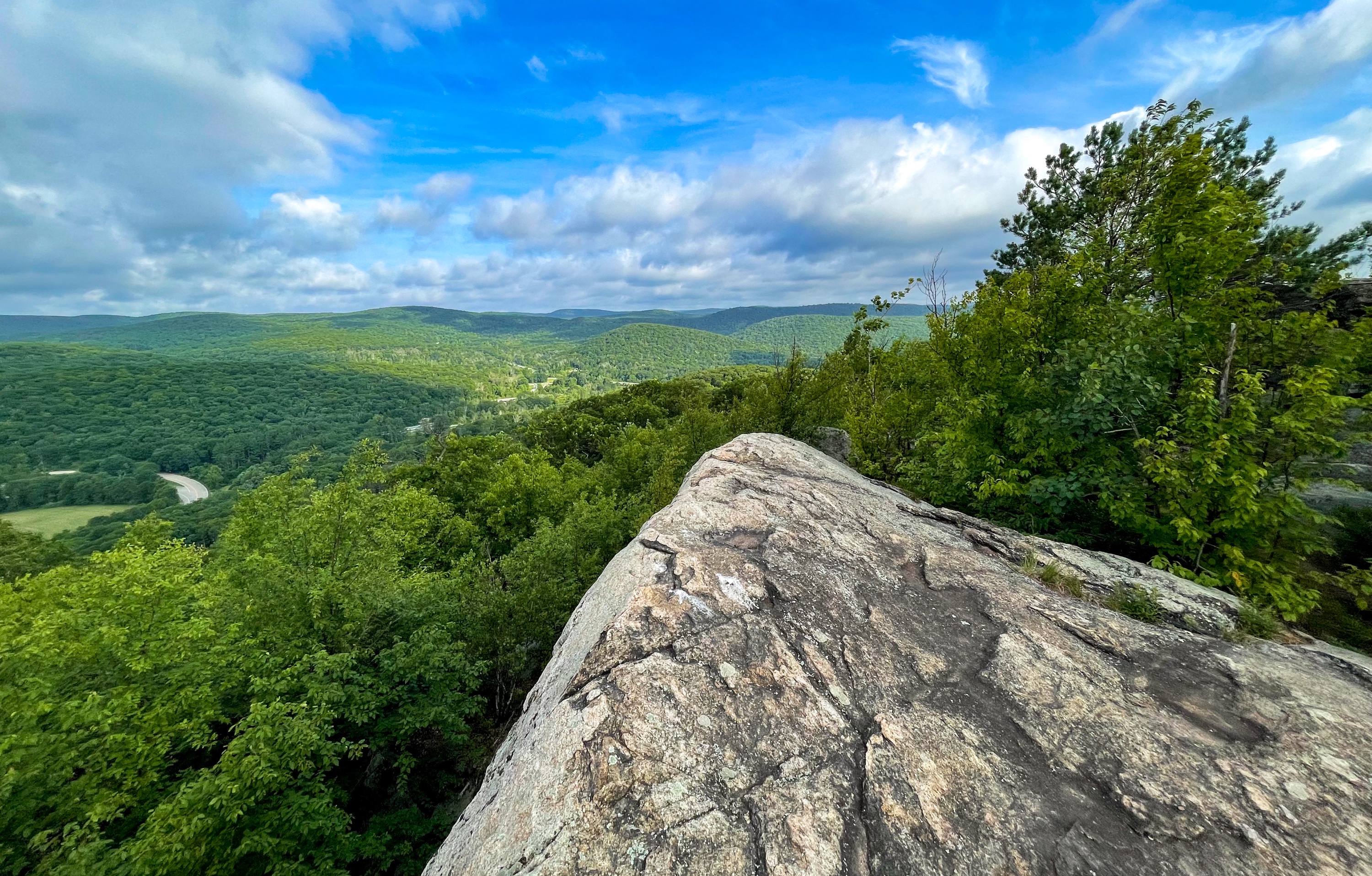
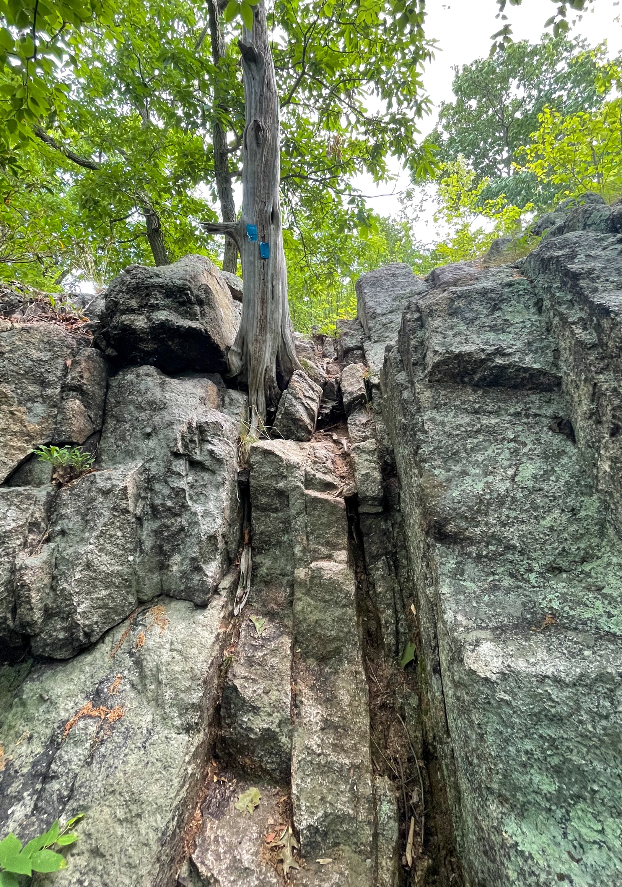
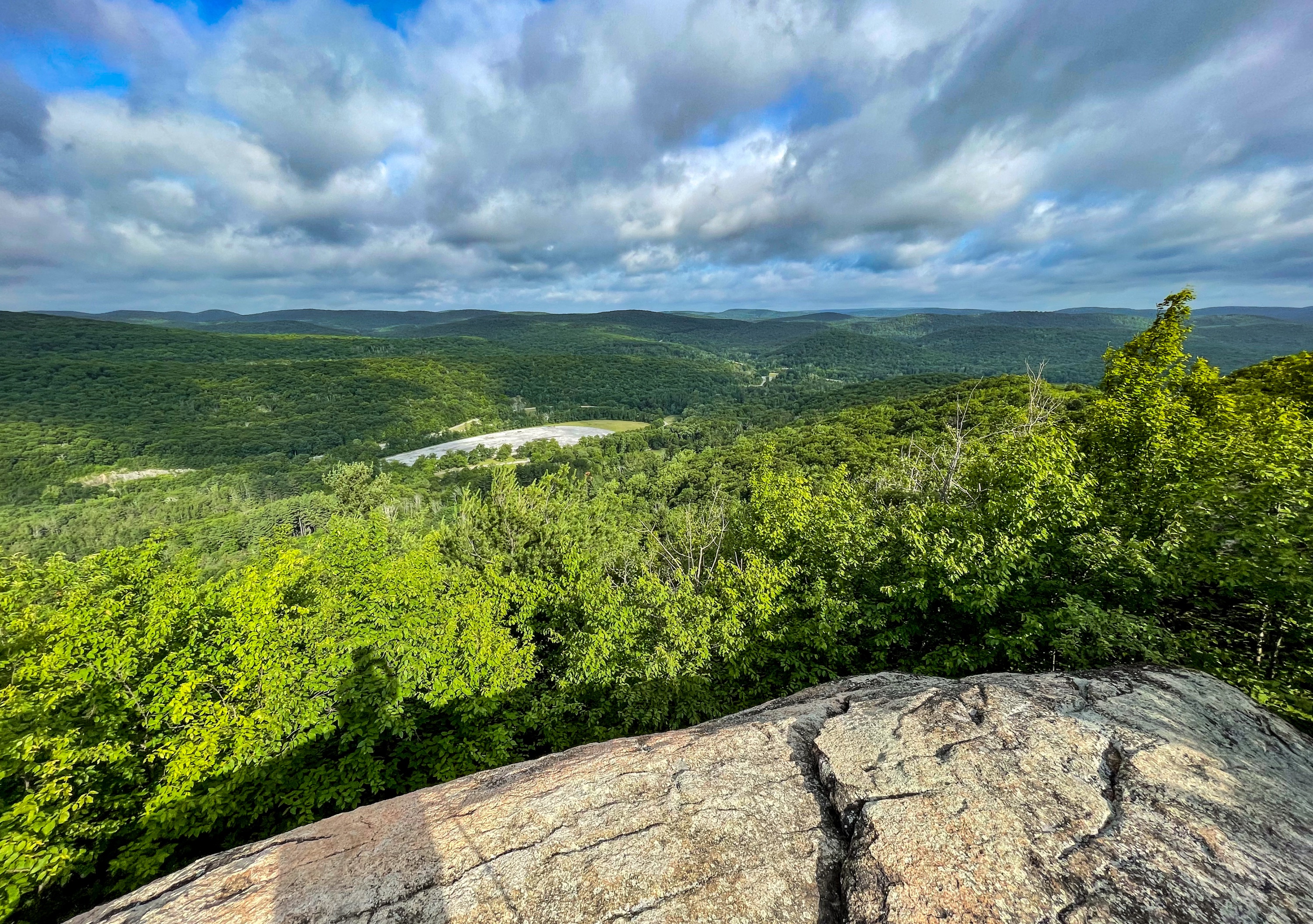
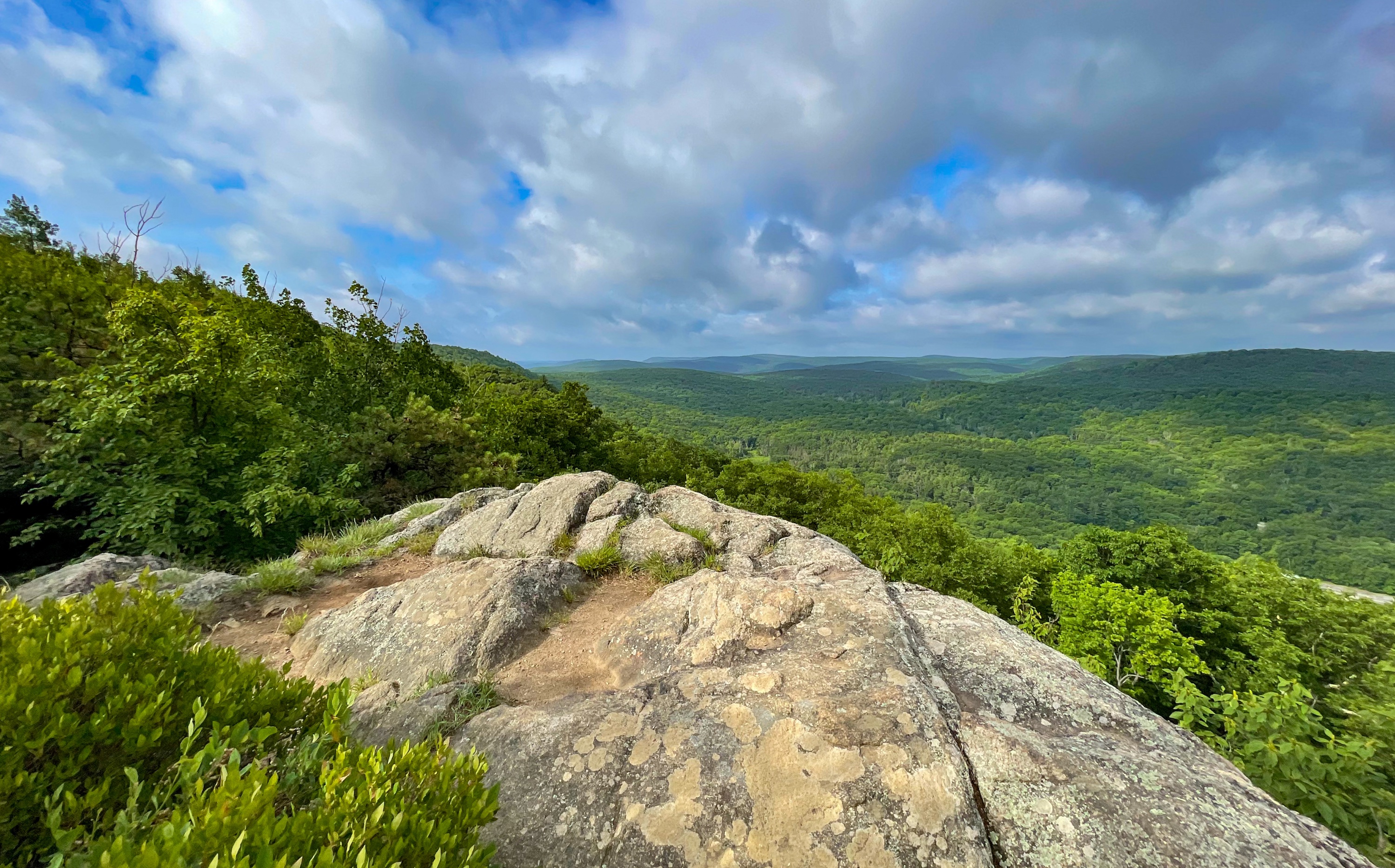
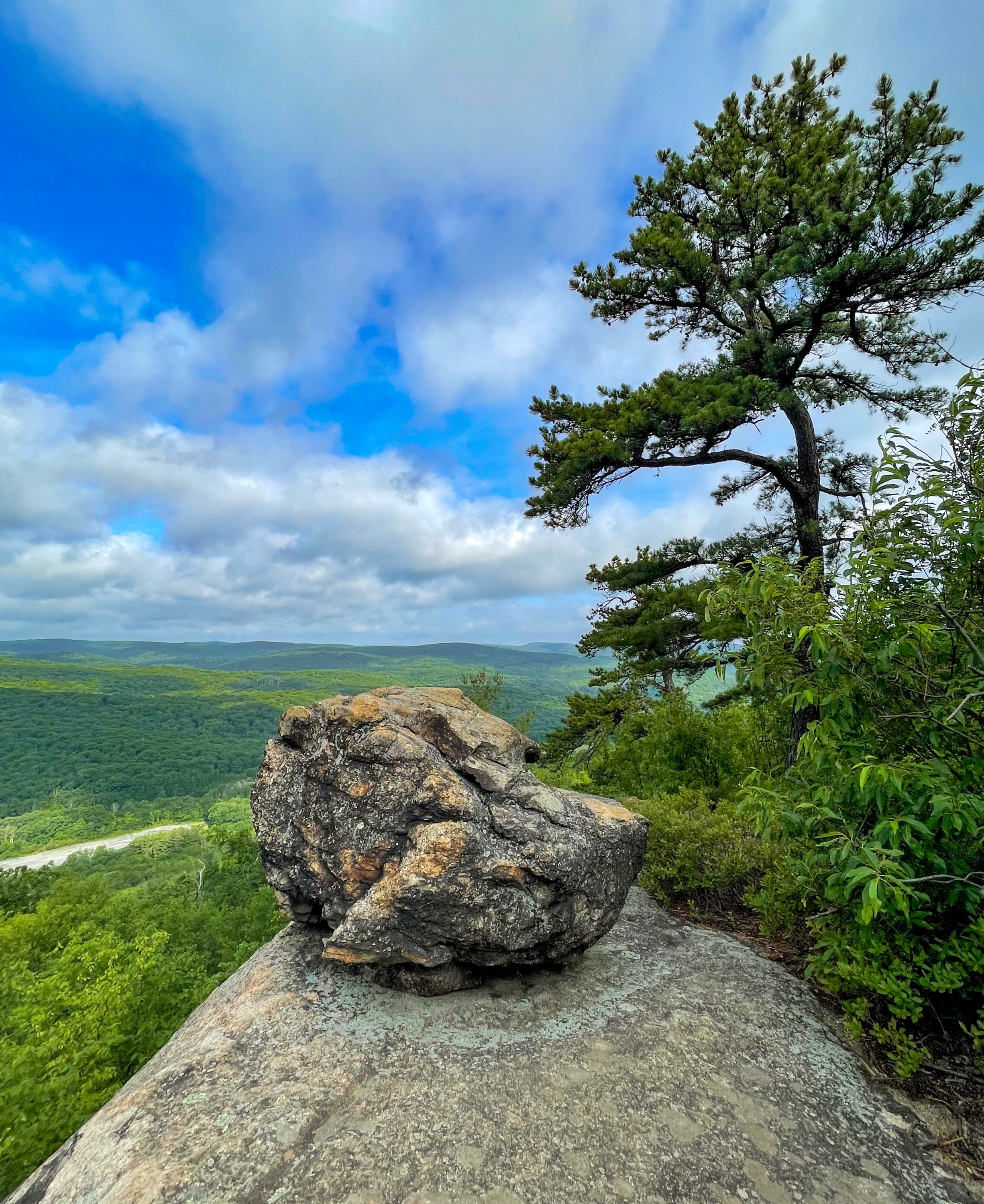
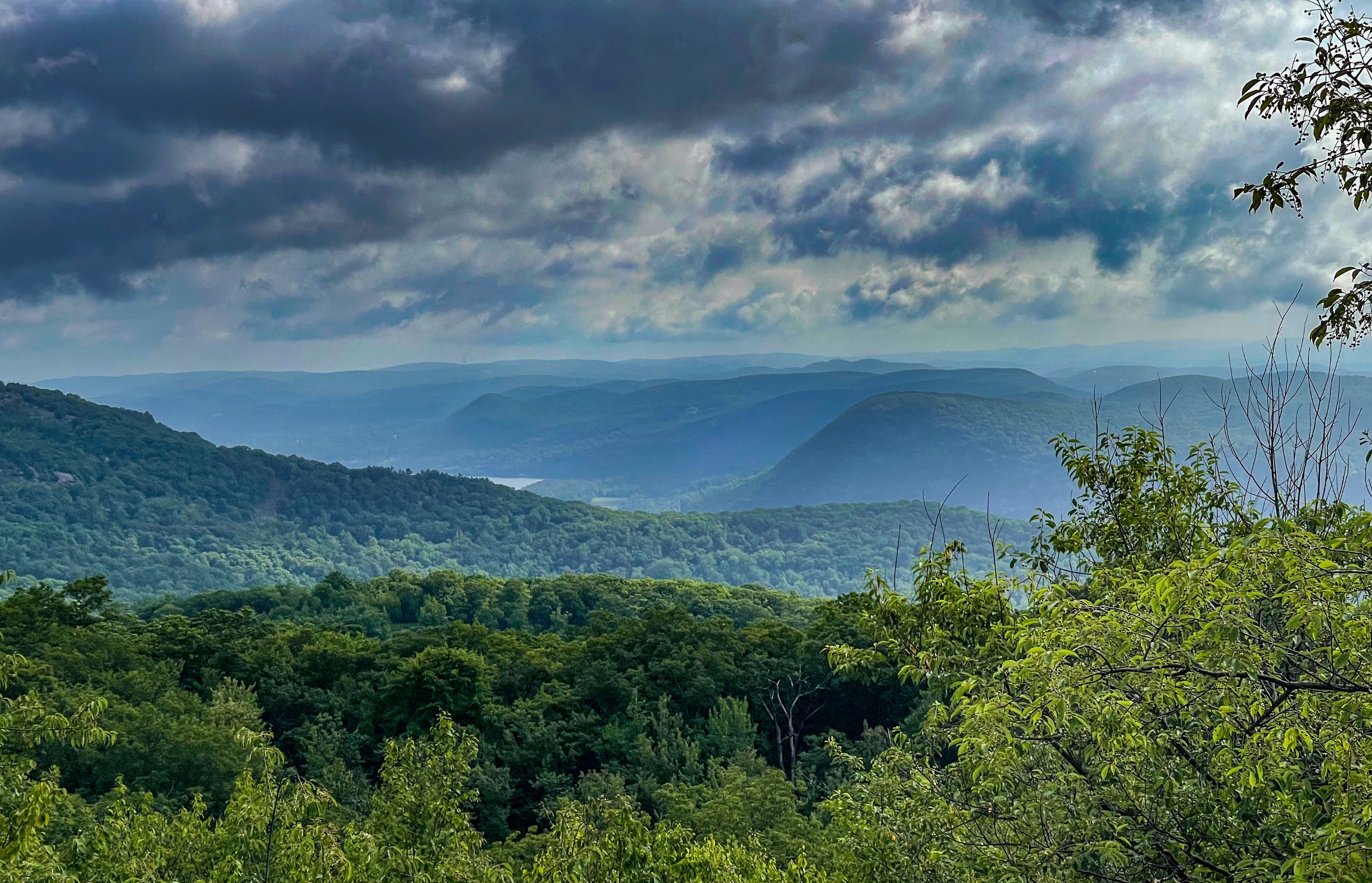
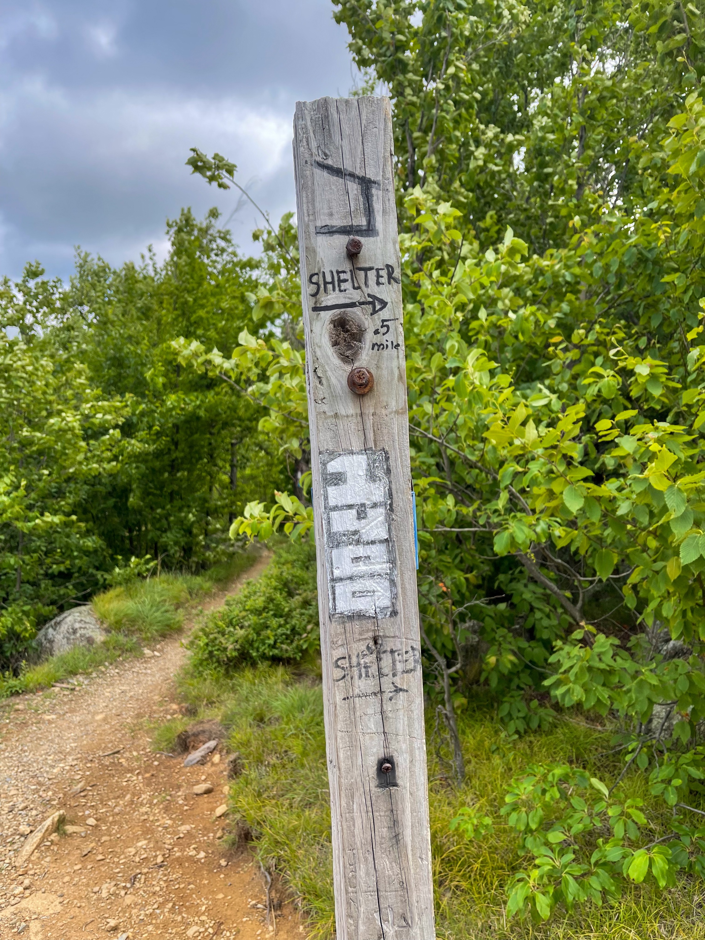
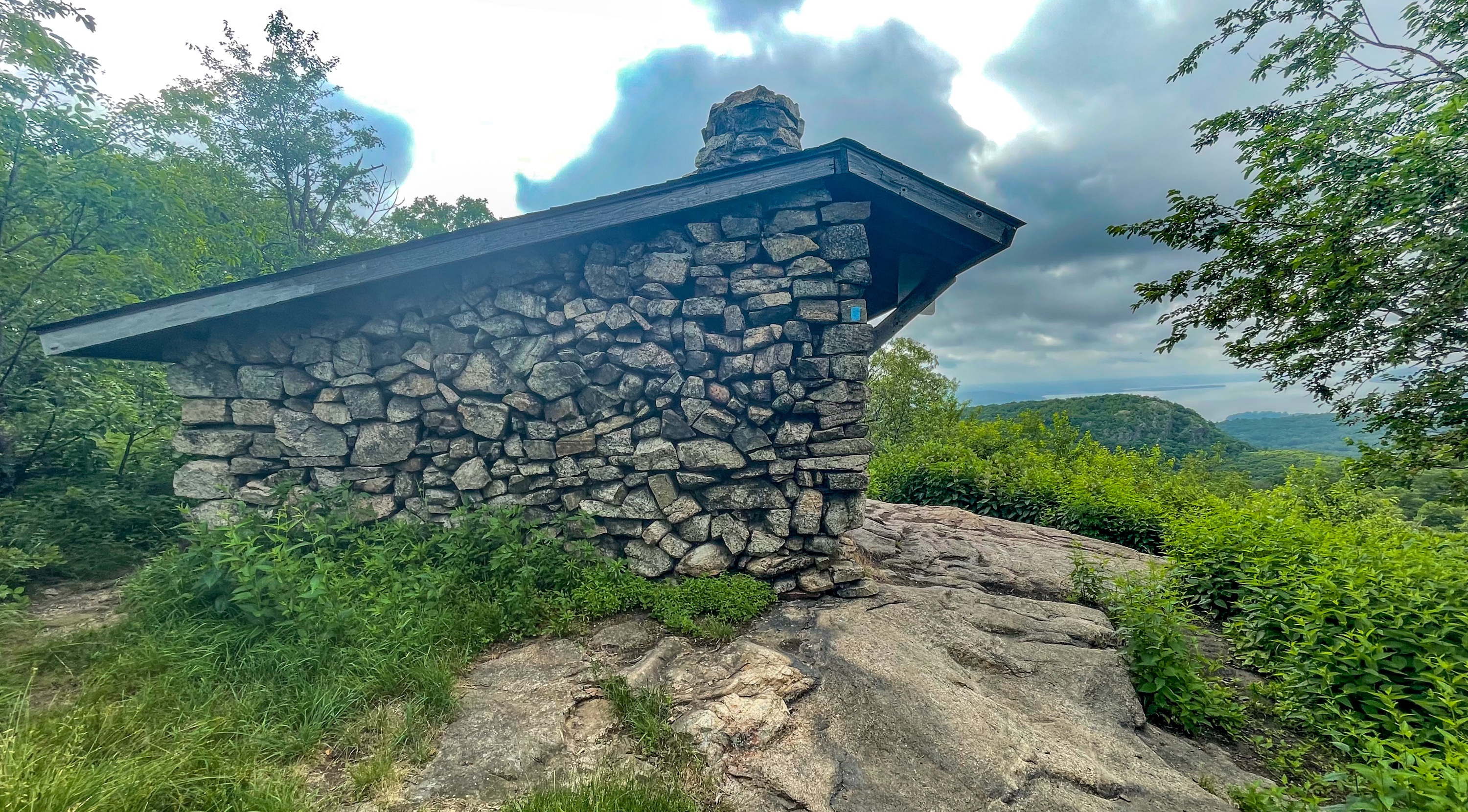
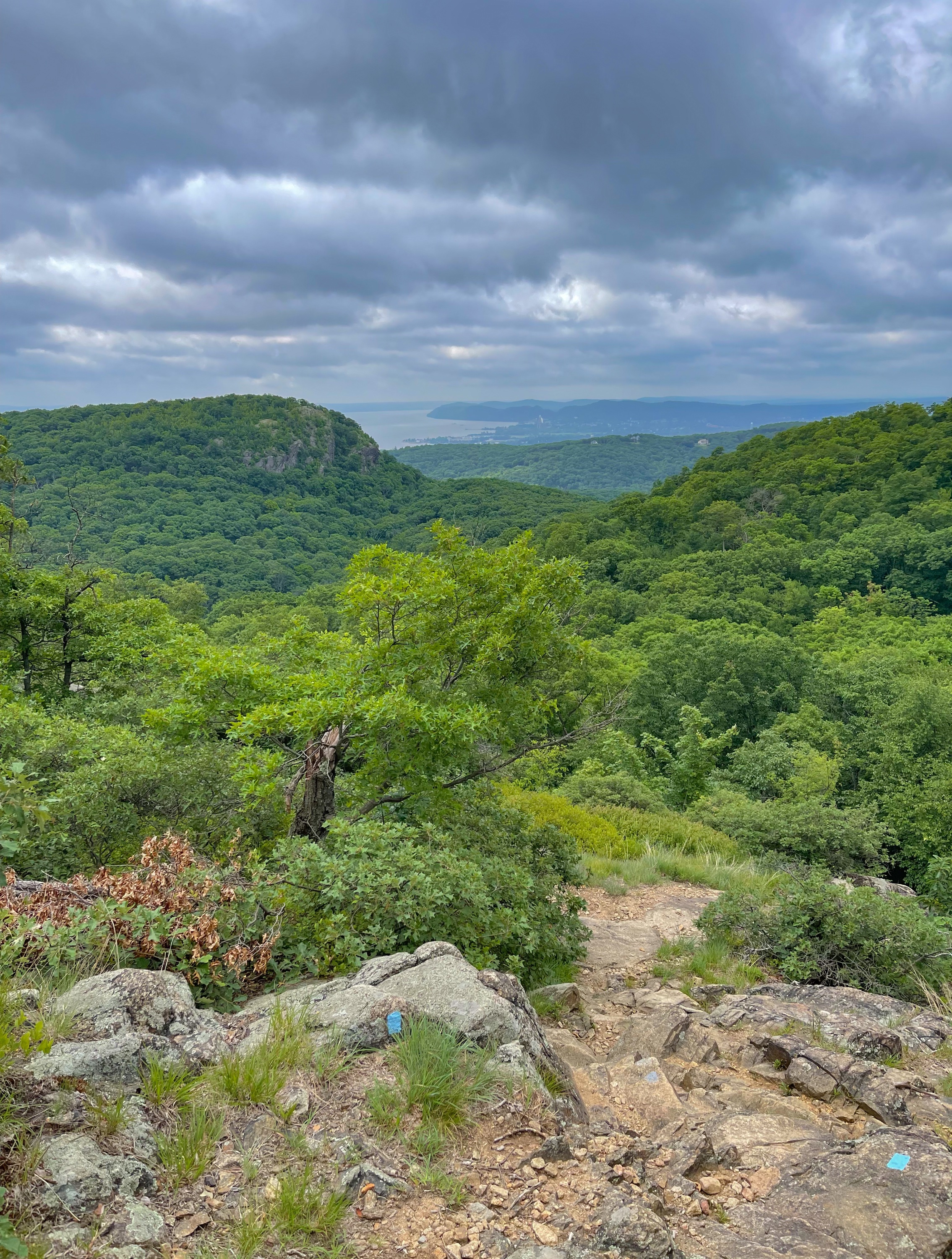
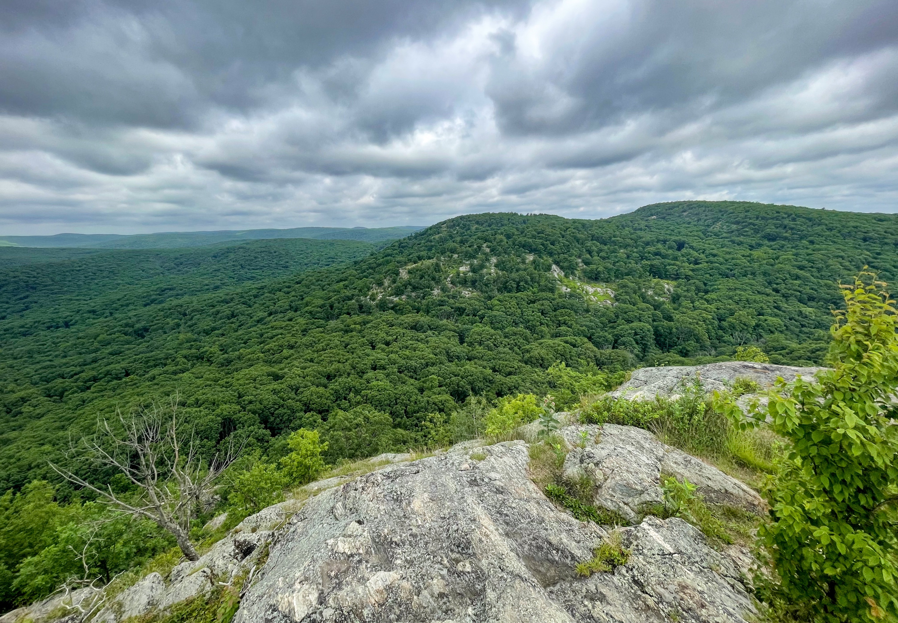
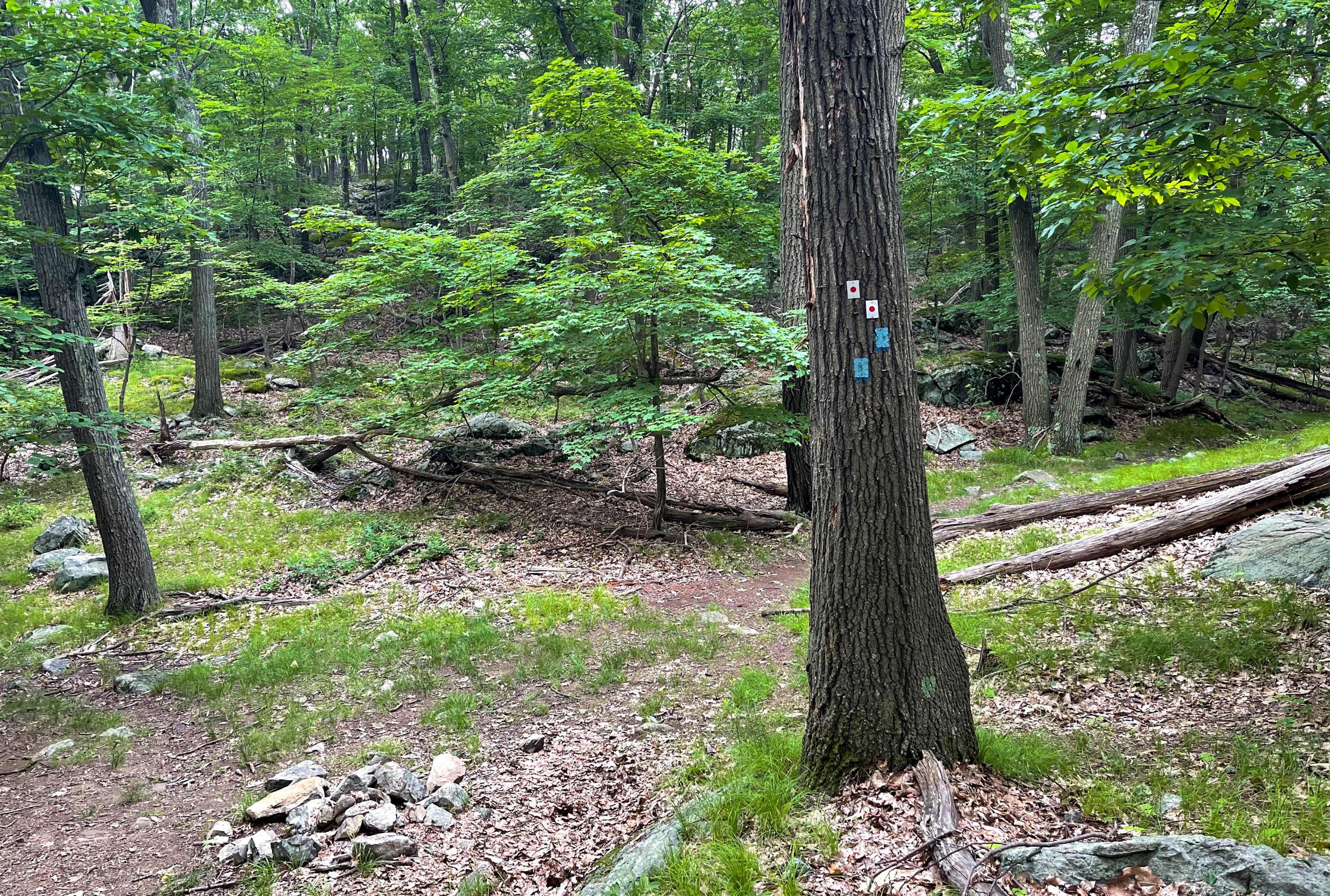
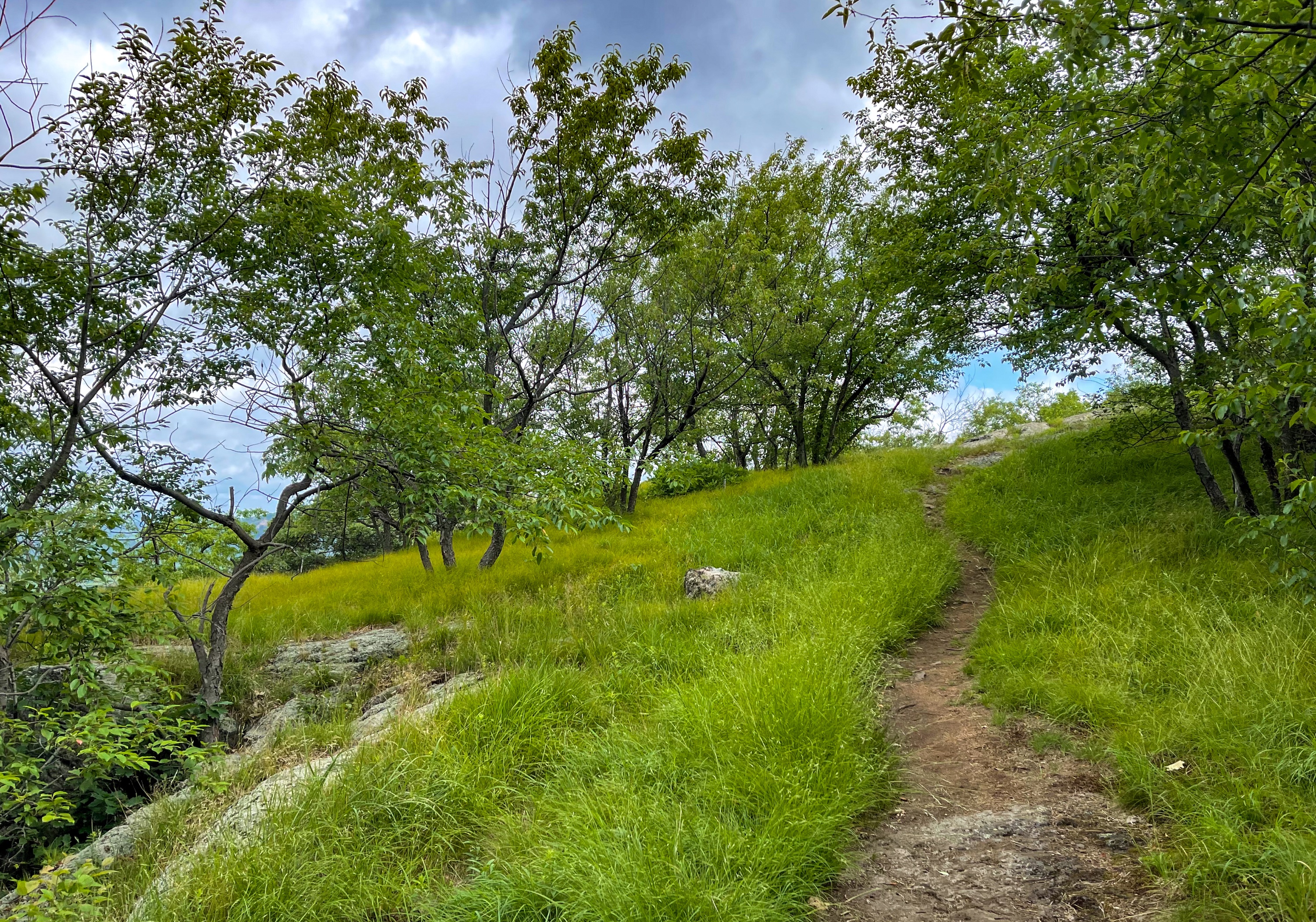
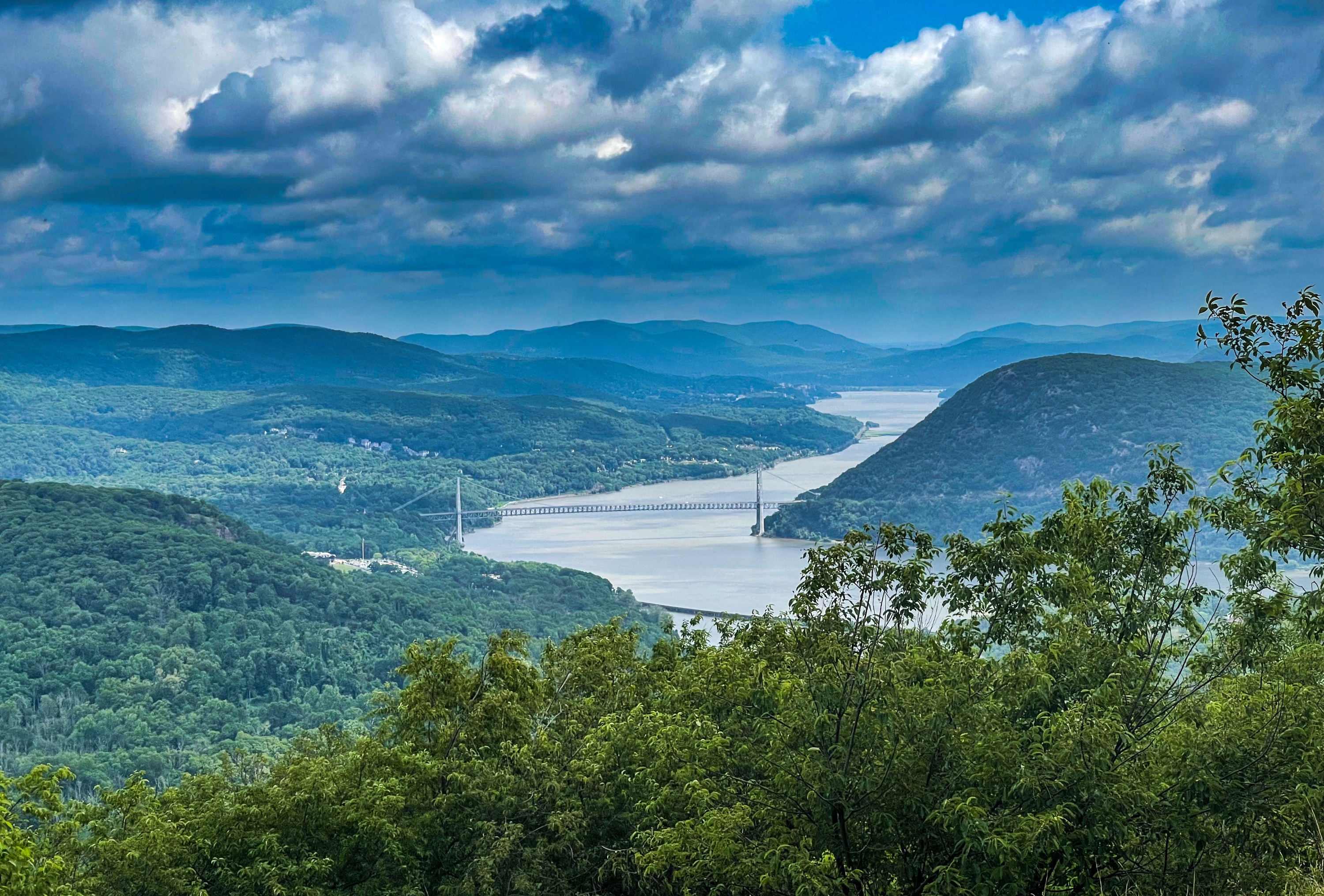
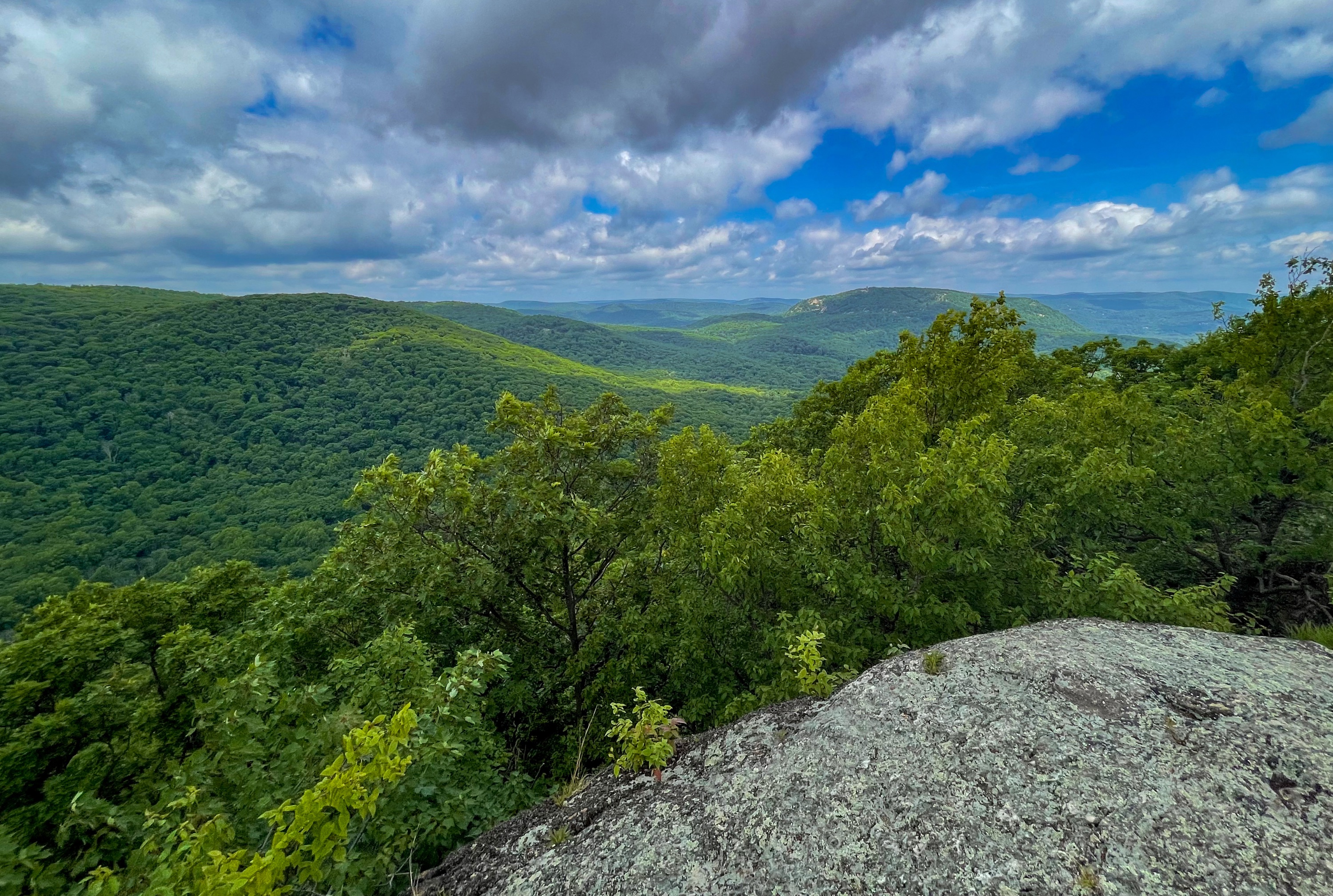
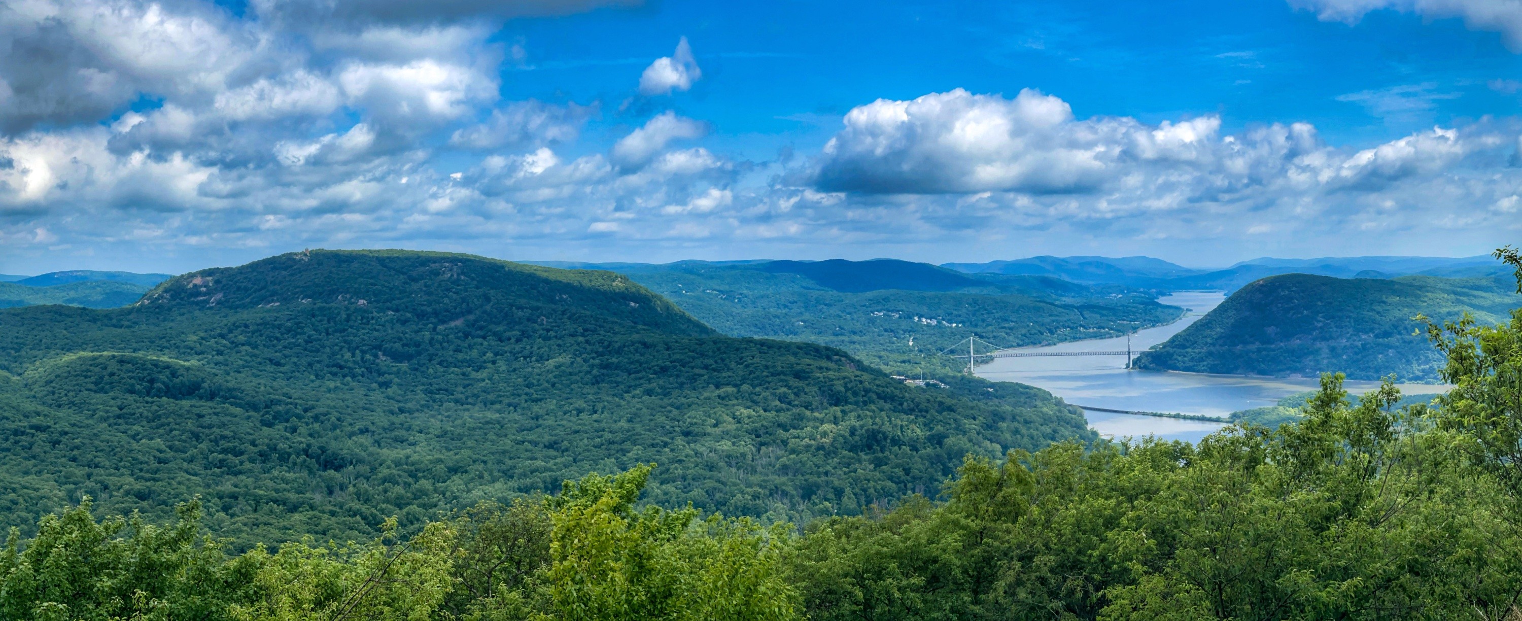
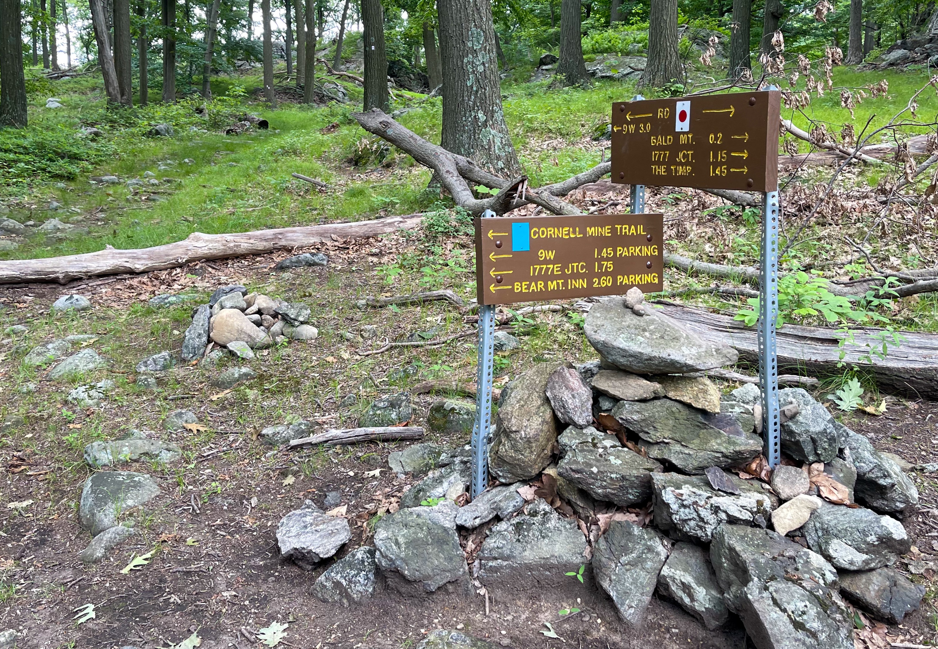
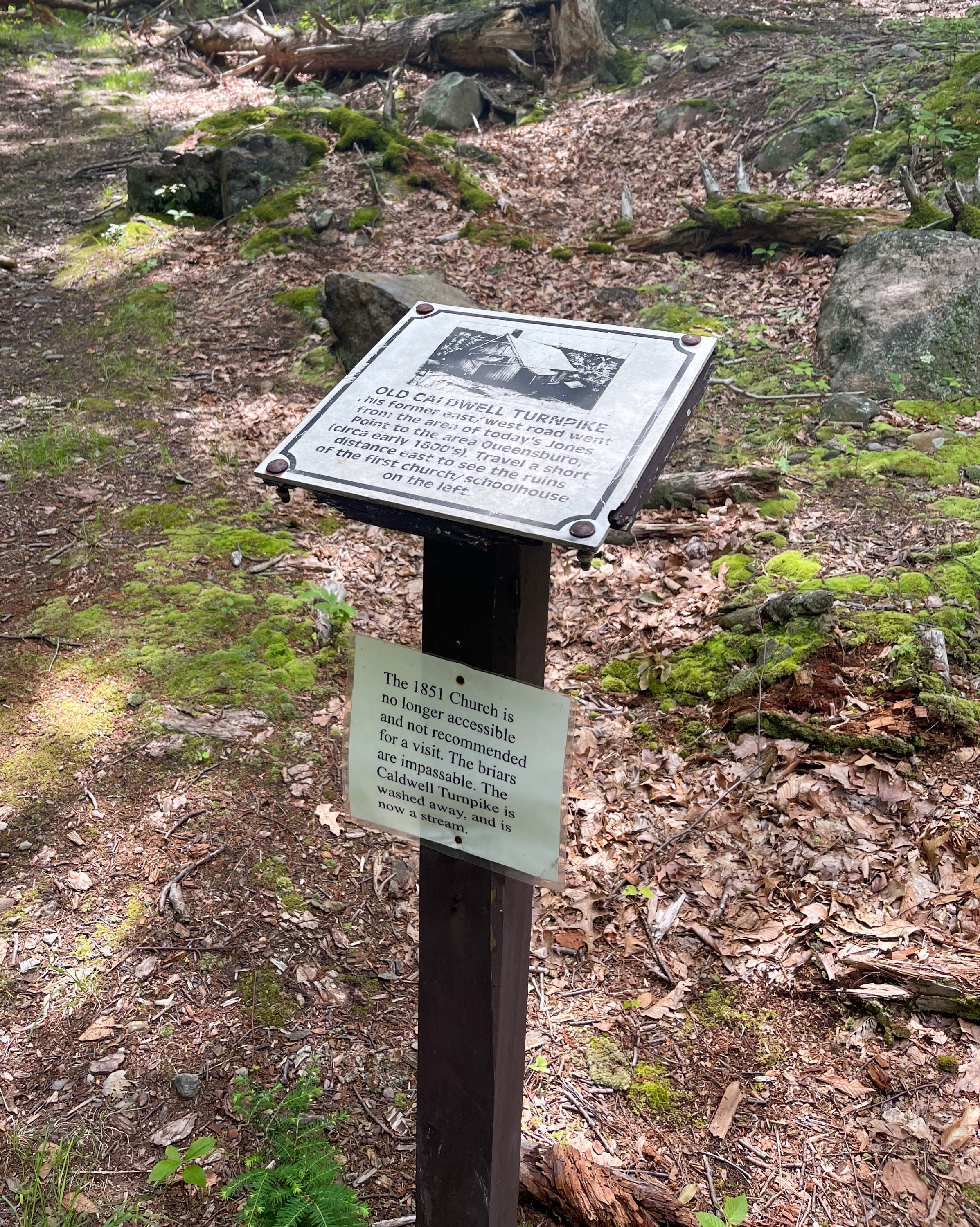
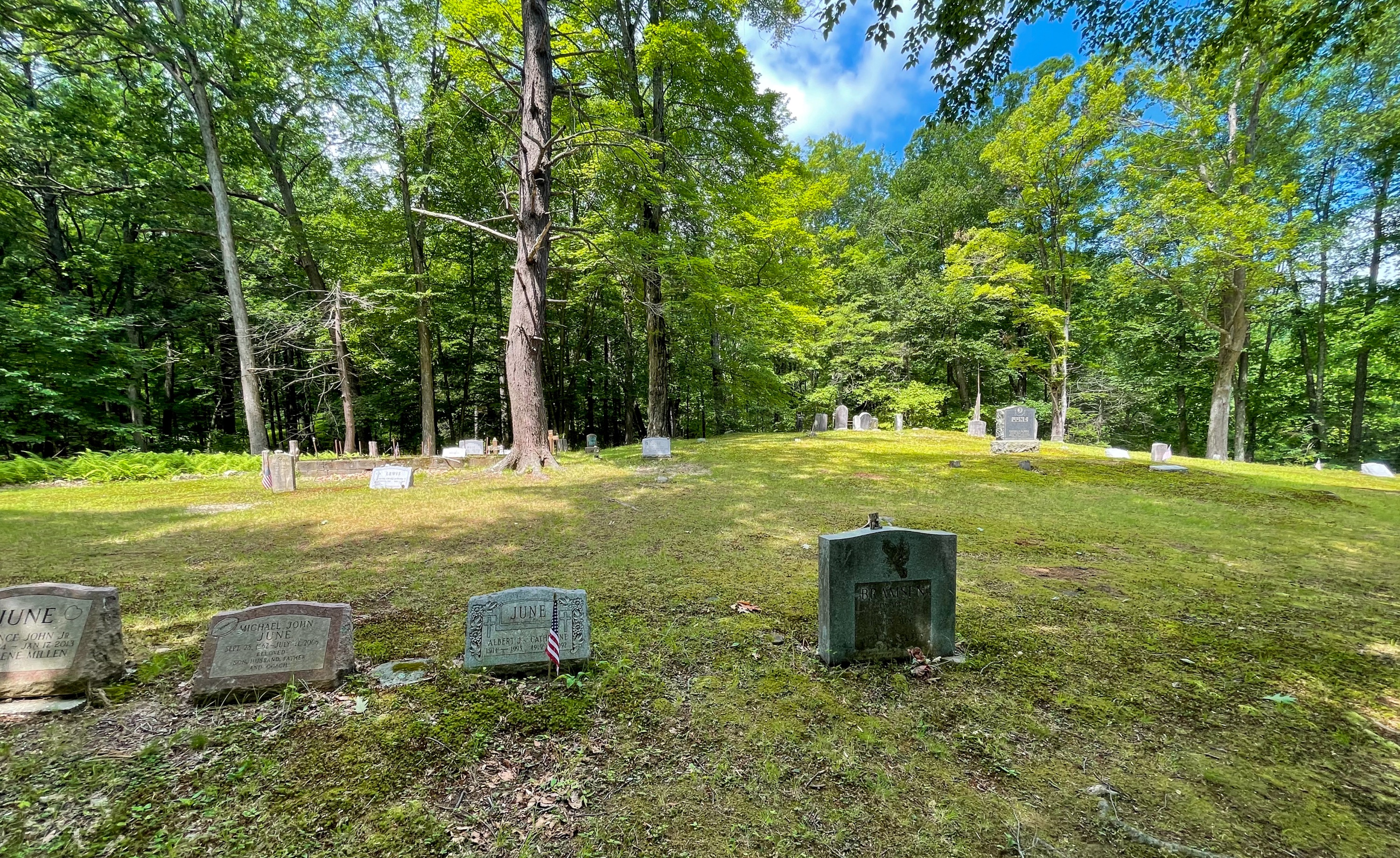
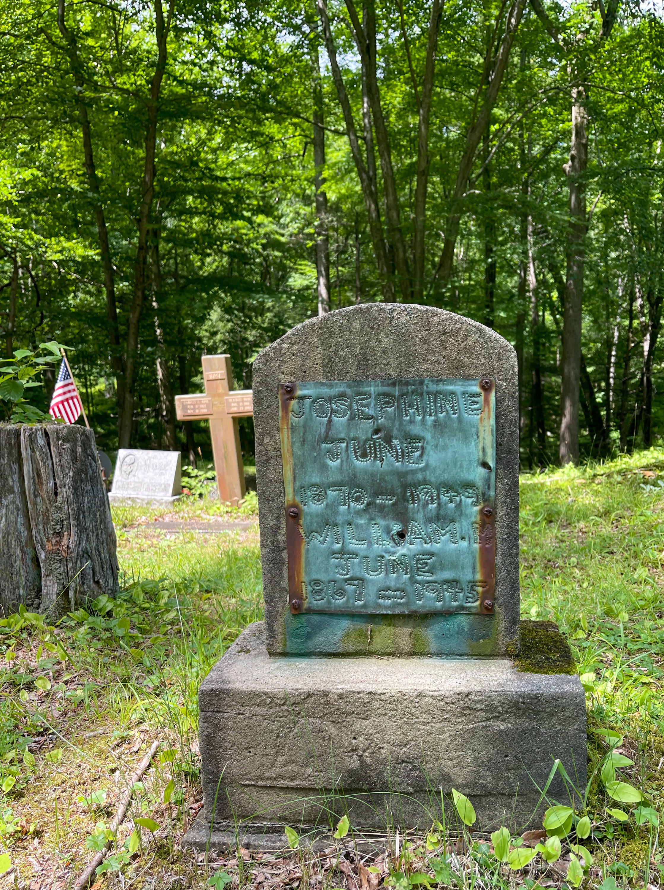
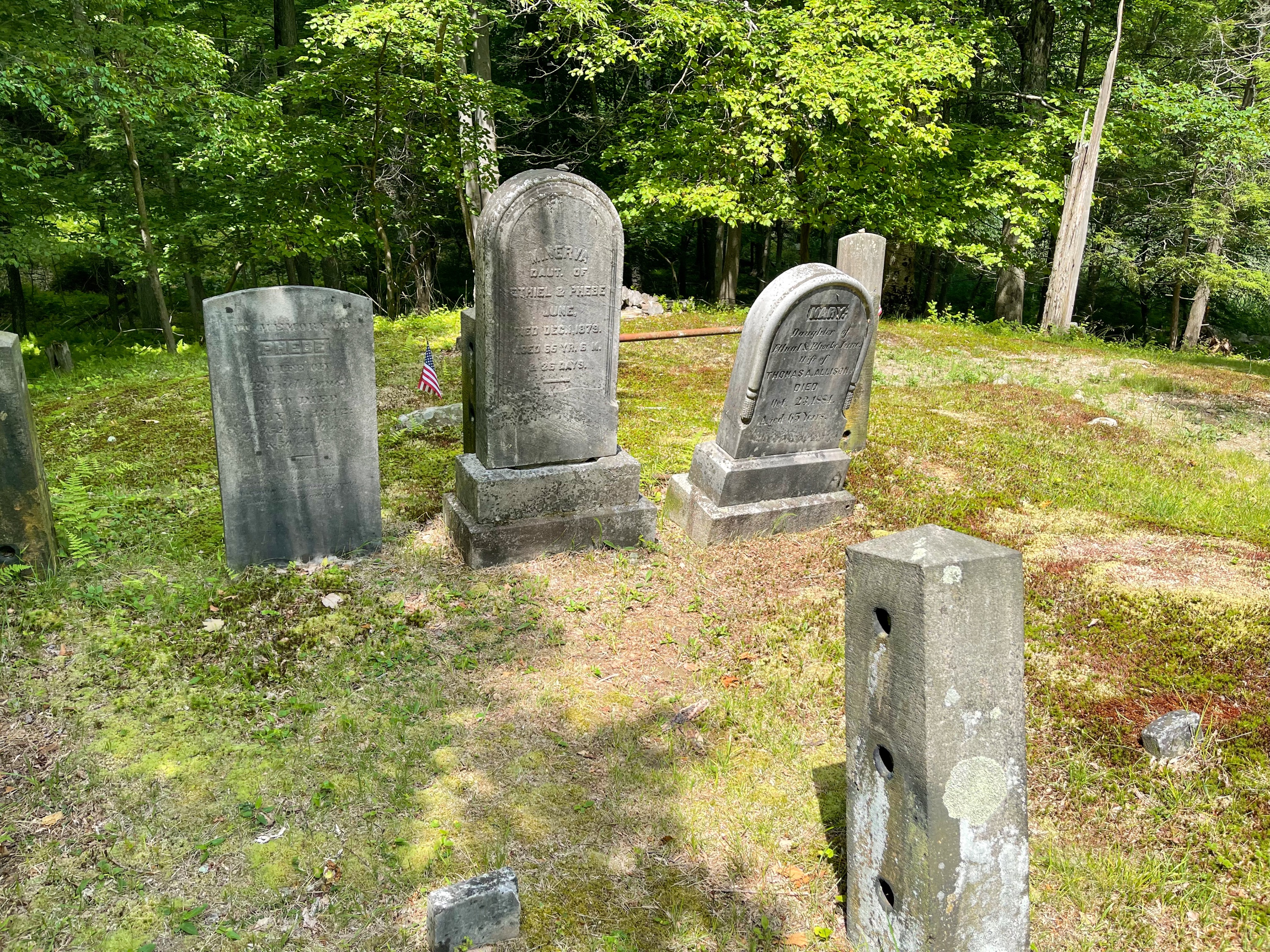
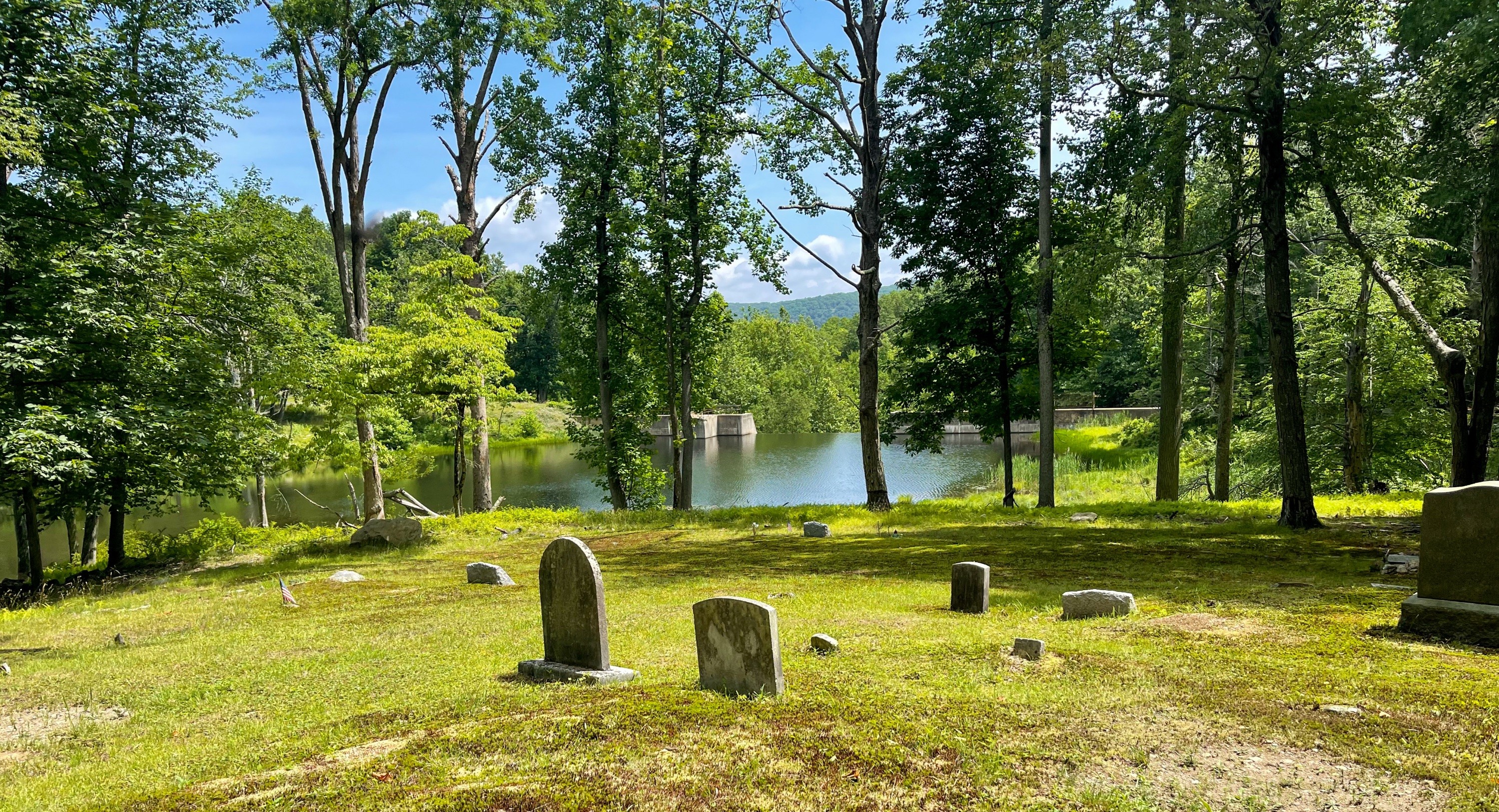
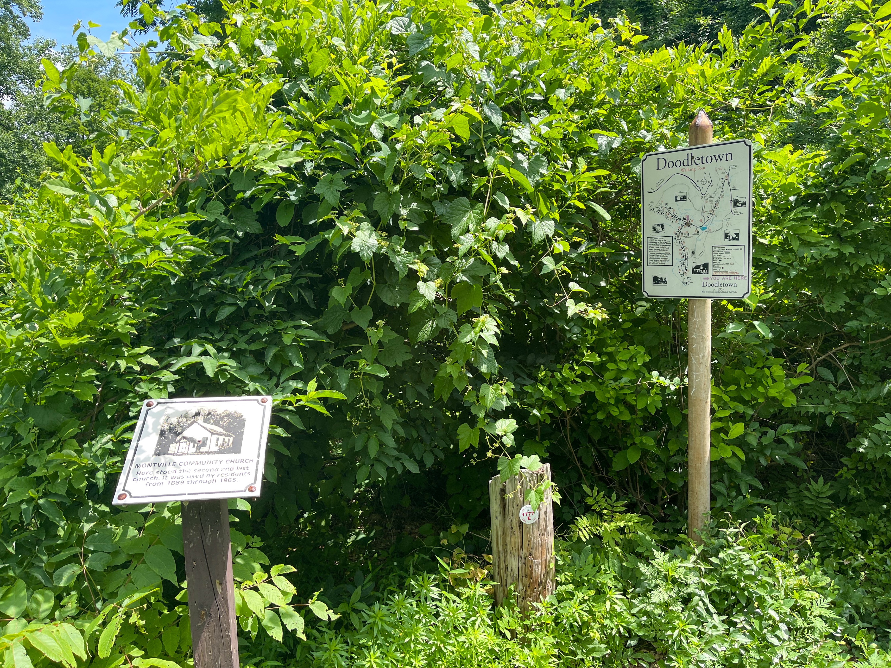
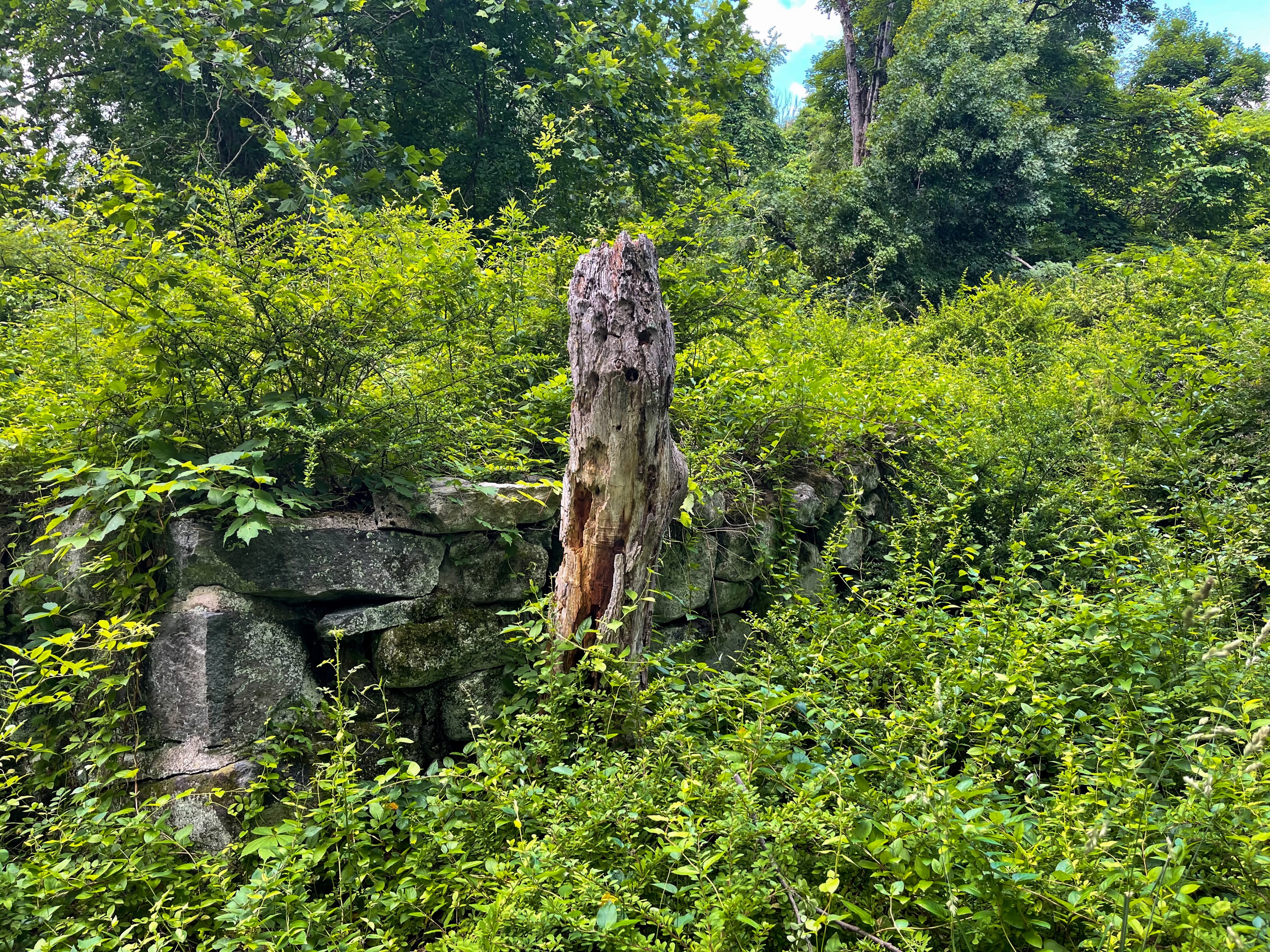
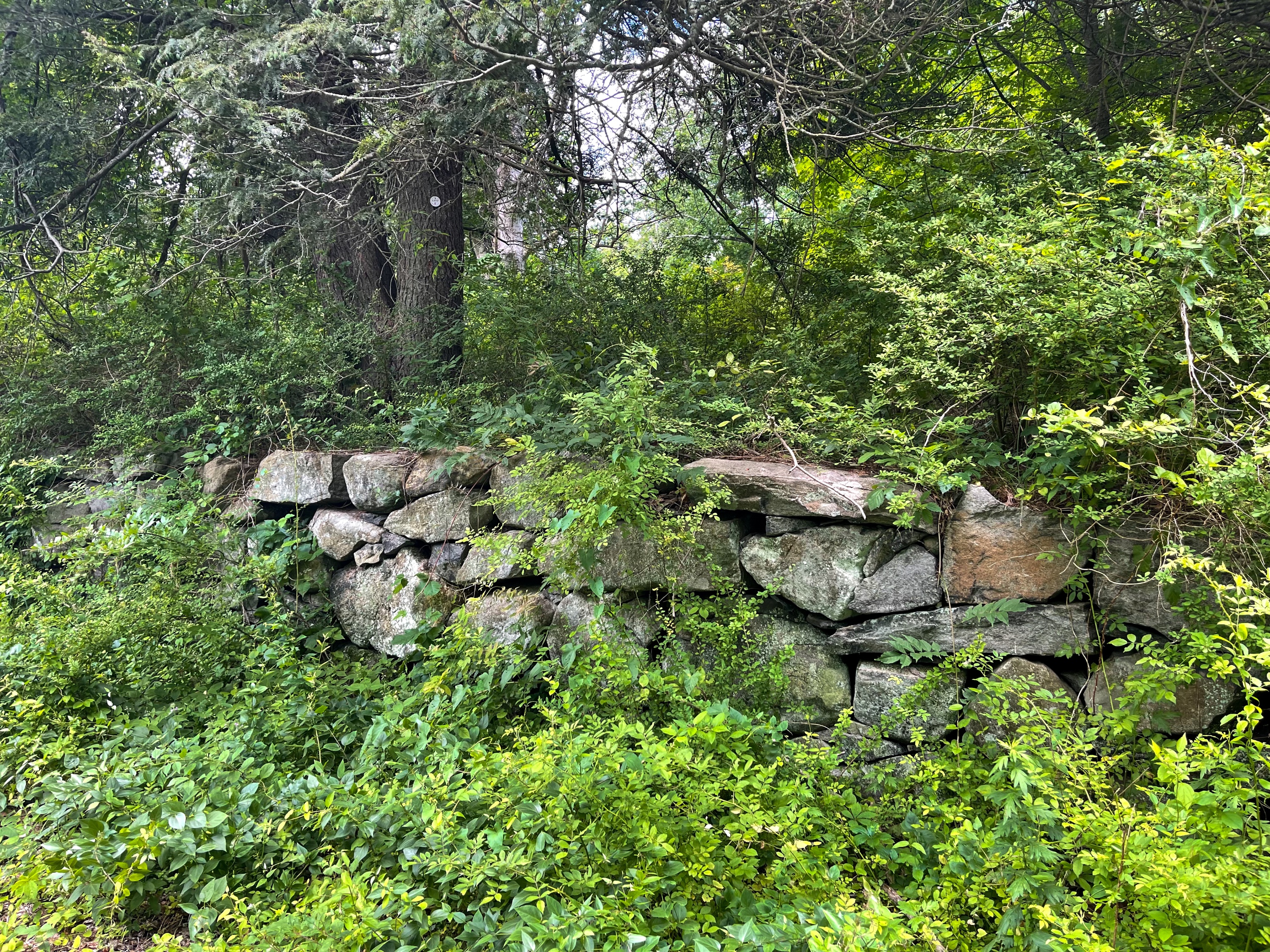
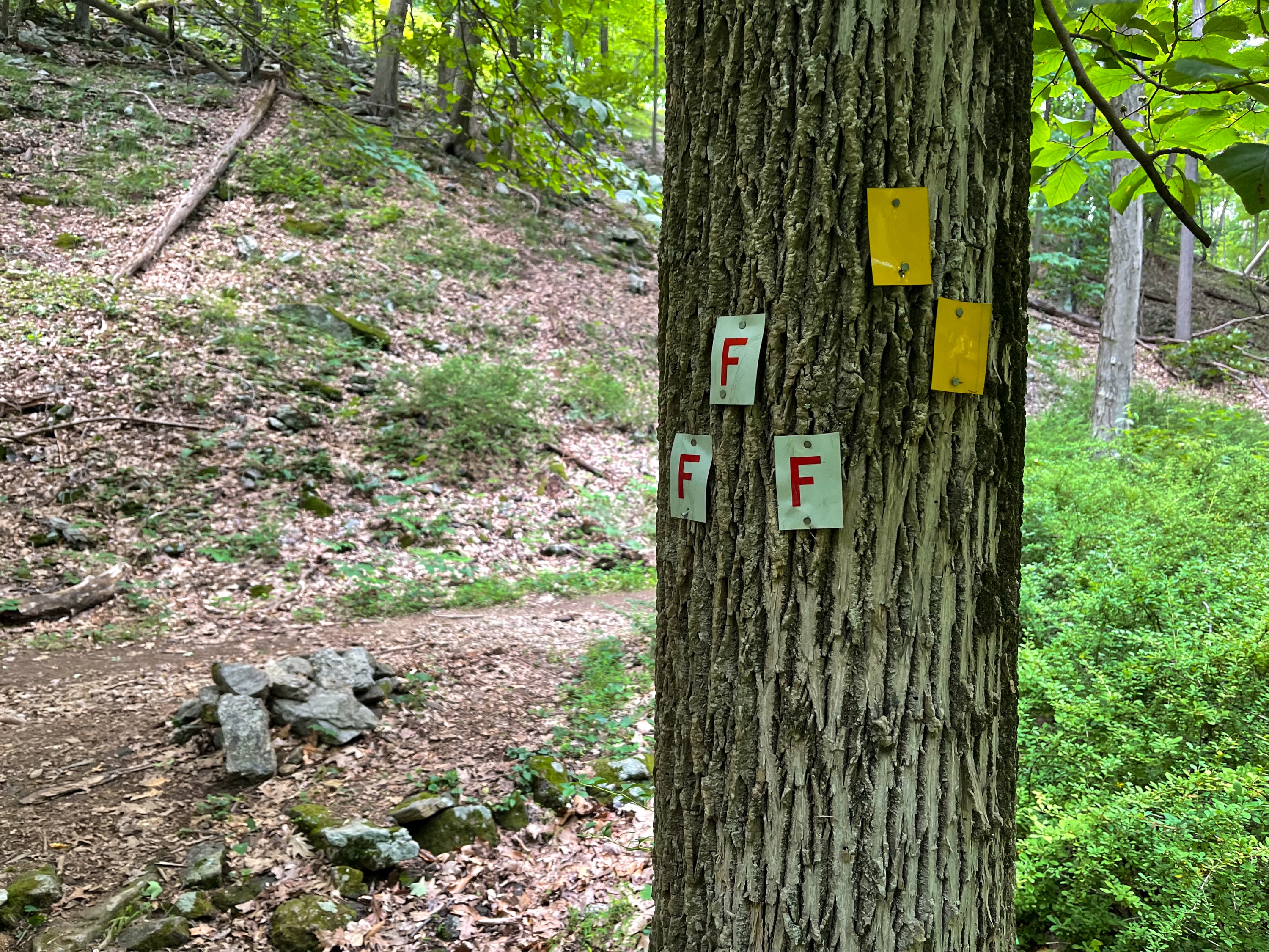
Overview This loop of northern Harriman State Park is jam-packed with views and history, featuring West Mountain, The Timp, Bald Mountain and the historic hamlet of Doodletown and June Cemetery. Length: 9.7 miles Elevation gain: +2,670 feet Location: Harriman State Park Parking: Park in the Anthony Wayne Recreation Area, located off of Exit 17 on the Palisades Interstate Parkway. Park Park near the north end of the lot.(Google maps link). Anthony Wayne Recreation Area Seasonal parking lot MapsHarriman-Bear Mountain Trails Map - NY-NJ Trail Conference (print) Harriman-Bear Mountain Trails Map - NY-NJ Trail Conference (Avenza) Trail map Trail description From the main parking lot, head north and look for the white blazed Anthony Wayne Trail, which you'll follow uphill to the junction with Beechy Bottom Road. If you parked at the seasonal lot, pass the gate and follow the unmarked trail north until you reach Beechy Bottom Road, which you'll follow until you reach the junction with the Anthony Wayne Trail and the start of the Fawn Trail. Fawn Trail At this junction, the triple red-"F"-on-white blazes marks the start of the Fawn Trail, which we'll follow uphill for 0.3 miles at which point we reach a junction with the blue-blazed Timp-Torne Trail. Here, make a right. West Mountain Now follow the blue blazes as you reach the first of what will be a number of great viewpoints along West Mountain. Viewpoint on West Mountain Bear Mountain is visible from this panoramic viewpoint, as is the parking area. The trail continues and eventually follows a crevice in the rock. Crevice The trail now intersects and is co-aligned with the white-blazed Appalachian Trail. Follow the white and blue blazes a short distance later to another viewpoint from the west side of the ridge of the mountain. Another viewpoint is just ahead. And just beyond that, another one. West Mountain And then - yeah, you guessed it - another one. Finally, there's no more viewpoints. Just kidding, there's another one of course. This viewpoint is at a junction where the Appalachian Trail splits away. Note the signpost - located at the 1,400 mile mark of the Appalachian Trail - which points towards the West Mountain Shelter. Sign post pointing towards the West Mountain shelter Here, we leave the Appalachian Trail and continue to follow the blue-blazed Timp-Torne Trail. After 0.15 miles, you reach a junction with the yellow-blazed Suffern-Bear Mountain Trail and for the next 0.3 miles the trail is co-blazed blue and yellow. The trail co-blazed blue and yellow You'll soon reach a south-facing viewpoint. West Mountain Shelter At a junction a short distance ahead, the yellow trail splits off to the left. We will continue to follow the blue blazes. Just ahead you'll reach the West Mountain Shelter, a great spot to camp if you're backpacking. The views from here of the Hudson River and the Timp prominently on the left are spectacular. Continue to follow the blue blazes as the trail begins to descend, with additional views of the Timp ahead of you. After a descent, the trail reaches a junction with the red-dot-on-white blazed Ramapo-Dundenberg Trail. The blue and red trails are now co-aligned. A short distance ahead is a really cool rock/tree combination in which the tree has somehow managed to grow around a pointy rock blocking it's skyward trajectory. Nature finds a way! The Timp About 0.8 miles ahead, you'll reach the summit of The Timp, featuring spectacular panoramic views. This is a great spot for a break. Views from The Timp A short distance later, the trail splits, and we will stay left to continue on the red-dot-on-white blazed Ramapo-Dunderberg Trail. Trails split. Stay left here. In 0.3 miles you'll reach the junction with the 1777 trail marked with a rock cairn. Continue straight on the red-blazed R-D trail. The trail climbs and eventually passes a viewpoint to the west. Continue along the R-D trail as it makes a final climb up Bald Mountain through a grassy partial clearing. Approaching the summit of Bald Mountain Bald Mountain At the summit of Bald Mountain, enjoy panoramic views of Bear Mountain, Anthony's Nose, the Bear Mountain Bridge and Hudson River, and Harriman State Park. Views from Bald Mountain This is another great spot to take a break and enjoy the view. When you're ready, return to the trail, which makes a sharp 180 degree turn and begins a steep descent downhill. In about a quarter mile, you'll reach a junction with the blue-blazed Cornell Mine Trail, marked by a rock pile and signage. Make a left and follow the blue blazes as the trail continues downhill. After nearly a mile, look for an unmarked old woods road on your left. Take this trail a short distance until it ends at another unmarked woods road. Near this junction is a sign for the Old Caldwell Turnpike. Rather than turn left or right onto the woods road, we'll bushwhack a short distance straight ahead into the woods, heading generally in the direction of the small lake, but slightly towards the left. You'll descend and cross on some rocks a small stream, Timp Brook, that feeds into the lake. June Cemetary Head uphill from the stream and you'll reach the Second June Cemetary. This is private property, so please be respectful. From here, follow the woods road - Doodletown Road - towards the west. Doodletown Soon the 1777 Trail will co-align with Doodletown Road, parts of which are still asphalt. The 1777 Trail is the route British forces took for an attack on Fort Montgomery and Fort Clinton. Doodletown Road, still with much of the original asphalt About Doodletown Doodletown is the site of a former hamlet in a picturesque valley which was inhabited at least since 1762, when Ethiel June arrived from Connecticut. Until World War I, only 75 people lived in Doodletown. Between 1917 and 1945, the population of Doodletown increased to about 300. Gradually, the Park bought many of the Doodletown homes. In 1962, the remaining private holdings were condemned and, by 1965, the hamlet was completely vacated. All buildings have been demolished, but some foundations remain, and interpretive signs have been installed. For a description of the various sites in Doodletown (including a detailed map showing their location), see Doodletown: Hiking Through History in a Vanished Hamlet on the Hudson, by Elizabeth "Perk" Stalter (updated ed. 2017). NY-NJ Trail Conference Harriman Bear Mountain Trails Map Photos of Doodletown We will follow the 1777 Trail as it forks left off of Doodletown Road and a short distance ahead reaches a junction with a confusing jumble of blazes on a tree. Here, stay on the 1777 Trail. After a half mile, the 1777 Trail reaches a junction with the yellow-blazed Suffern-Bear Mountain Trail. Make a left and follow the yellow blazes south. Soon, you'll cross a creek on a small footbridge. Just ahead you'll reach a junction marking the beginning of the red-F-on-white blazed Fawn Trail. Follow the Fawn Trail west (to the right) for 0.9 miles. The trail co-aligns with the Doodletown Bridle Path part of the way. The trail intersects the Appalachian Trail, but we will continue to follow the Fawn Trail. In 0.3 miles, you'll reach a junction with the Timp-Torne Trail, which we previously turned onto to begin the loop. Continue to follow the Fawn Trail downhill for another 0.3 miles to reach Beechy Bottom Road. From here, depending on where you parked, either continue straight, or turn left and return the way you came back to the parking lot.
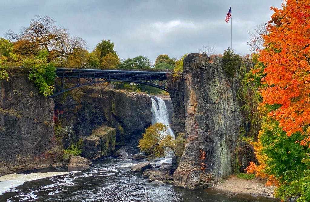
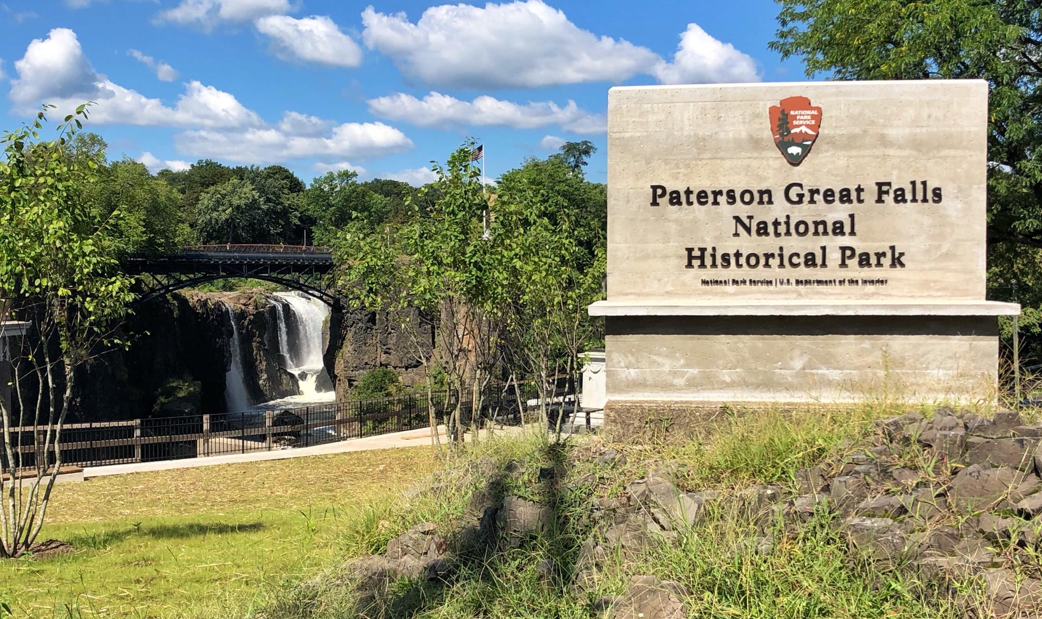
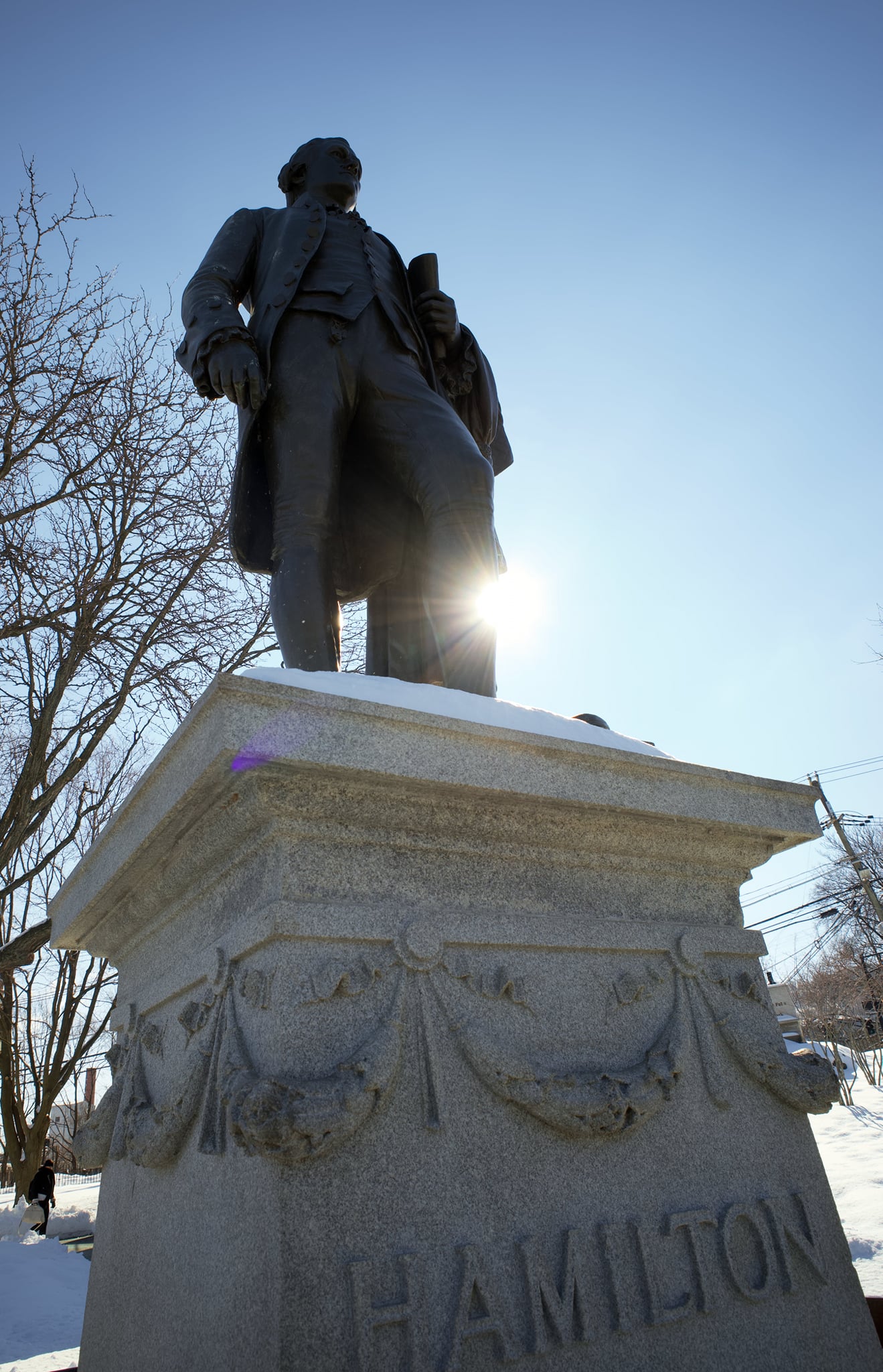
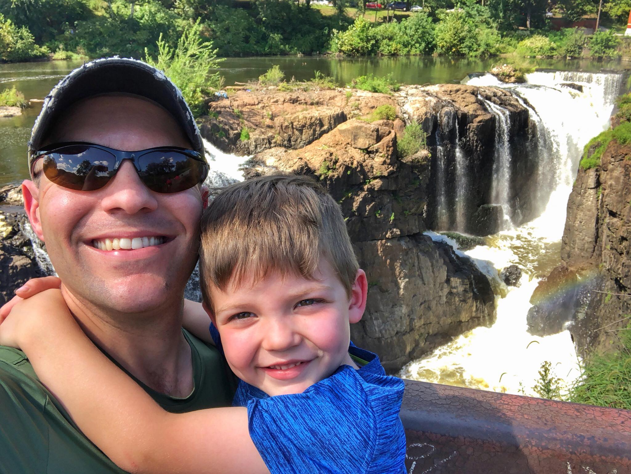
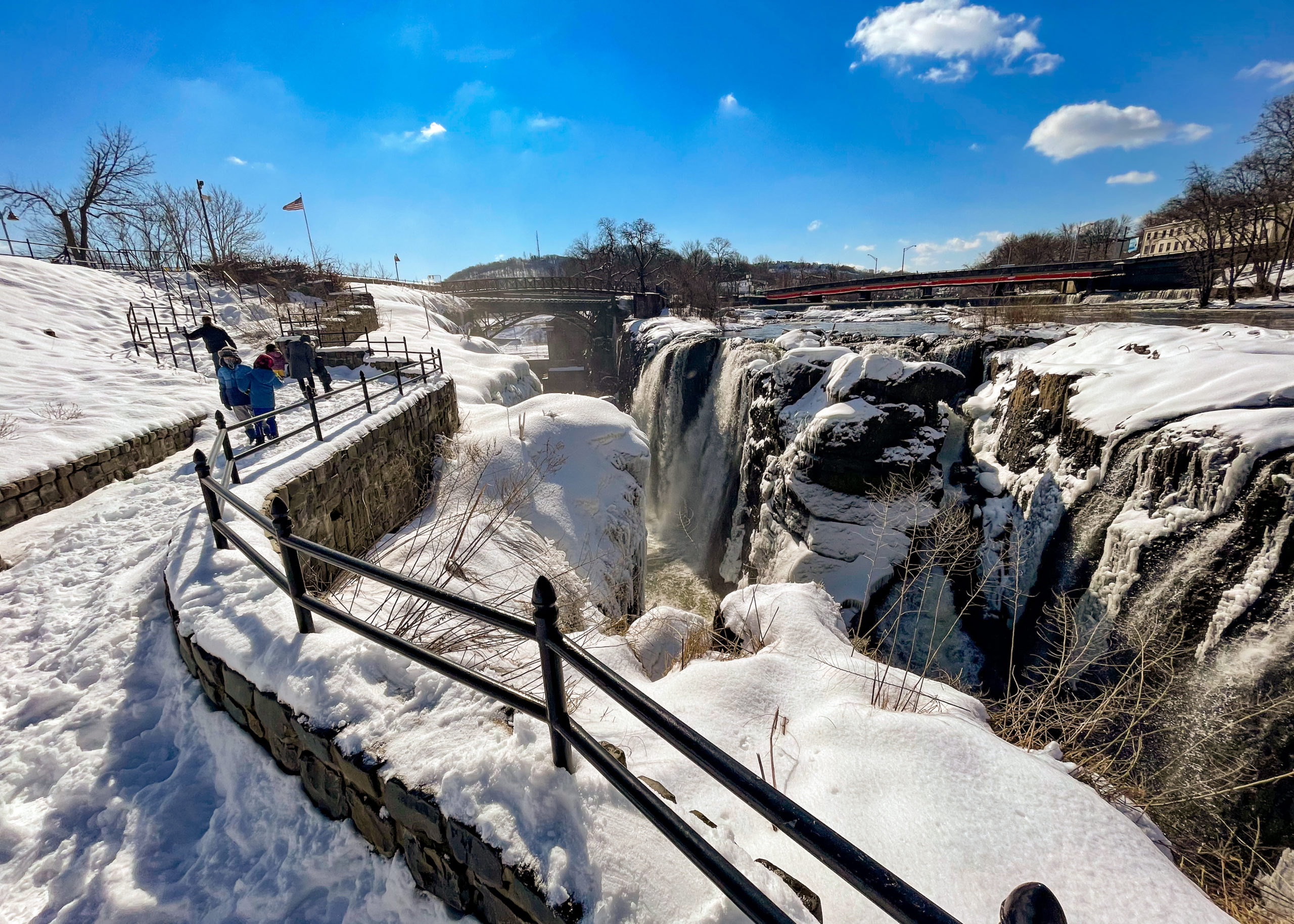
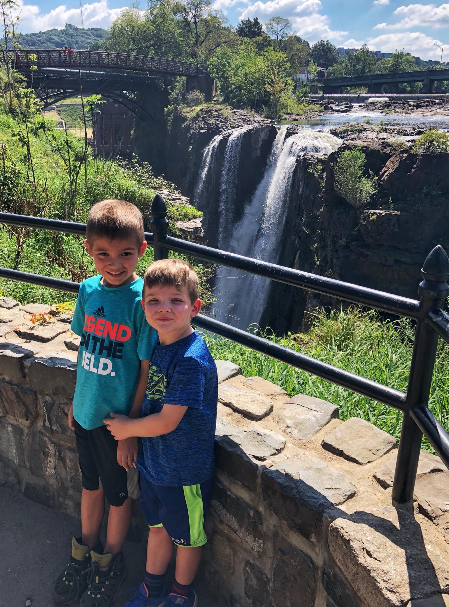
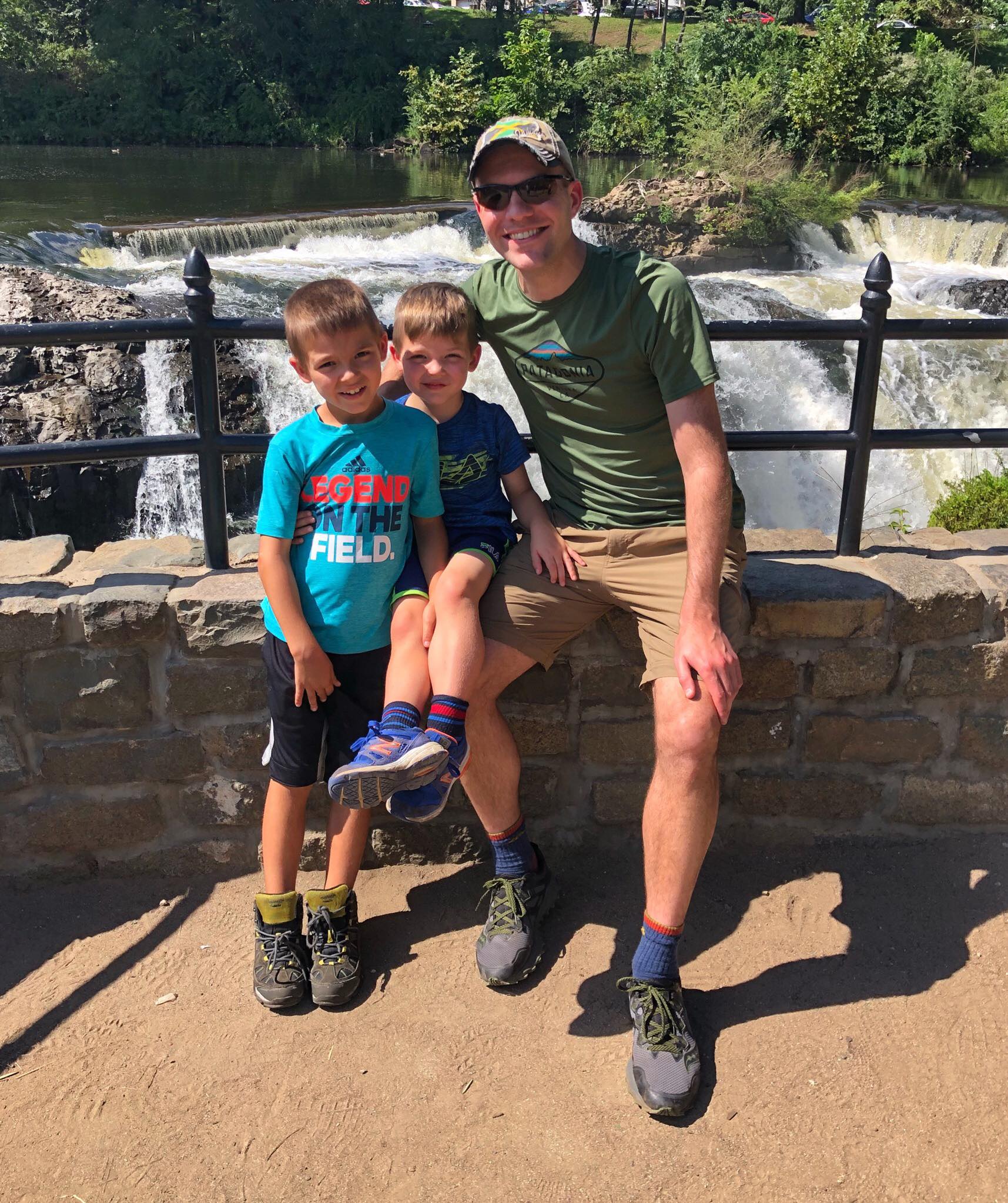
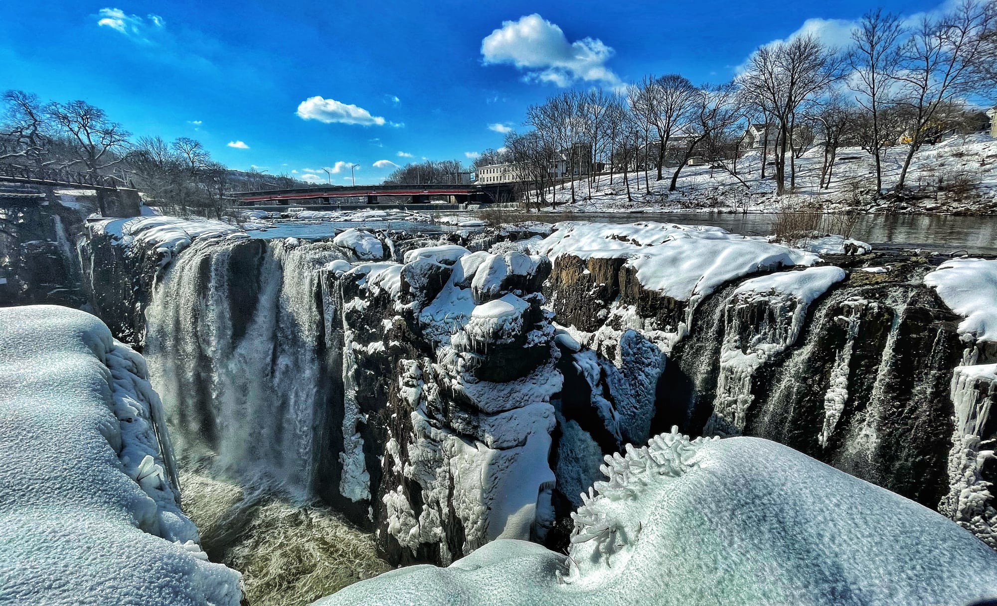
Overview Paterson Great Falls National Historical Park is centered around the Great Falls of the Passaic River - a truly spectacular and unexpected natural wonder in the middle of an urban city that is also rich with history. Harnessing the 77-foot high, 300-foot wide falls to power the country’s first hydropower system, Paterson, New Jersey became the birthplace of the American Industrial Revolution. As of October 2021, due to safety considerations there is an indefinite closure of the footbridge that crosses the Passaic River, and you will not be able to walk from Overlook Park to the Viewing Platform via the footbridge. In addition, the sidewalk along Wayne Avenue is closed due to reconstruction of the roadway. For the moment, to see the views from Overlook Park and Mary Ellen Kramer Park, you will need to drive between the two locations. Paterson Great Falls Area Map Paterson Falls area map Paterson Great Falls Parking There are two main areas to park when visiting the Paterson Great Falls National Historical Park. Overlook Park parking area: The largest parking area is at Overlook Park, located at 72 McBride Avenue Extension. From here, you can view the falls from a distance from Overlook Park. If the lot is full, an overflow lot immediately next to it is sometimes available on weekends just 50 yards down the street. Maple Street: To see the falls up close, you will need to head to the viewing platform at Mary Ellen Kramer Park. Typically it's a short walk from Overlook Park over the footbridge, but as of late 2021, the bridge is closed due to safety concerns. There is some limited parking available on Maple Street near Hinchlife Stadium. Use 160 Maple Street as the address in Google maps. History of the the Great Falls of the Passaic River 1761 etching. "A view of the falls on the Passaick, or second river, in the province of New Jersey...sketch'd on the spot by his excellency, Governor Pownal; painted & engraved by Paul Sandby." Library of Congress William Guy Wall, Falls of the Passaic, ca. 1820. Brooklyn Museum The story of the Great Falls begins about 200 million years ago at the close of the Triassic Period. What is now Paterson was then just a speck of land in the middle of a vast supercontinent known as Pangaea. When the supercontinent fractured, the Earth's crust began to shift and magma rose to the surface. Part of Paterson sites on a ridge formed by this magma flow. The Great Falls itself formed at the end of the last Ice Age, about 12,000 years ago. As the final, massive ice sheet known as the Wisconsin glacier began to recede, it left behind a trail of debris that forced the Passaic River to change its course. The water wound its way into this valley, where it spilled into the chasm and became the Great Falls. Before the arrival of the Europeans, the area around the Falls was homeland for the Lenni Lenape Indians, who were drawn by the rich game and fishing around the Great Falls. Even after the first Dutch missionaries and trapped visited the Great Falls, the region was still sparsely settled. When Hamilton founded Paterson in 1792 there were only 10 houses here. By the late 19th century, Paterson was the fastest growing city on the East Coast. Visiting the Great Falls Descriptions below are largely taken from the excellent Mill Mile self-guided tour app. Paterson Great Falls National Historical Park Welcome Center The Welcome Center, located at 65 McBride Ave Ext., has a museum, gift shop, and restrooms. As of September 2021, the Welcome Center remains temporarily closed due to the COVID-19 pandemic. Portable toilets available at Overlook Park parking lot at 72 McBride Avenue. They will be unlocked from 9:00AM - 4:30PM, staff permitting. For the latest status updates, visit the park website. Alexander Hamilton statue Overlook Park Alexander Hamilton Statue A bronze statue of Alexander Hamilton rightly takes a place of honor here. Hamilton was born on a small Caribbean island, the child of a father who deserted the family and a mother who died when he was 12 years old. After writing an article about a devastating hurricane for the island's newspaper, local merchants recognized Hamilton's potential and raised money to send him to New Jersey for a formal education. He rose quickly to become George Washington's most trusted aide in the Revolutionary War. In July 1778, a young Alexander Hamilton visited the Great Falls with General Washington, French general Lafayette, and other officers of the Continental Army. Hamilton would return to the Great Falls again as Secretary of the Treasury. No natural wonder would have a greater impact on our nation's history. As the nation's first Treasury Secretary, Hamilton was concerned that America remained largely dependent on England for virtually all manufactured goods, including military supplies. Hamilton chose to implement a new economic vision for America at the Great Falls. He founded Paterson to create an economy that required not slavery but freedom, that rewarded not social status but hard work, and that promoted not discrimination against some but opportunities for all. Great Falls. Credit: photo by Victor Castro Great Falls Viewing Lawn From the parking lot, take the steps down to the lawn that lets you get up close to the Passaic River, where you can enjoy views of the river from below. Alternatively, similarly impressive views are available from the top of Overlook Park. Here you can look up the gorge to see water from the Great Falls crashing onto the rocks below. This view has inspired many famous painters over the centuries. View of the Falls and Passaic River from the lawn below the parking area View of the falls from near the parking area S.U.M. Hydropower Plant Paterson was a whole new city planned from the start to stimulate industry and innovation through power. Recognizing the high startup cost of constructing and powering a factory, Hamilton created the Society for the Establishment of Urban Manufacturers (New Jersey's first corporation), and secured large investments to purchase land around the Falls and finance a complex hydropower system centered on a system of power canals called raceways. The S.U.M. investors would make their money by renting mill sites and selling power to manufacturers, sometimes building new factories to rent them out. If a fledgeling manufacturer could not afford rent but had a promising ideas, Hamilton's charter gave the S.U.M. the opportunity to accept stock in the startup manufacturing company instead of rent. The Great Falls in the winter with the S.U.M. plant on the left The hydroelectric plant was designed as a way to end the mills' reliance on water from the raceways. Thomas Edison's Electric Company drew up plans for a 4849 kilowatt energy facility. Great Falls. Credit: photo by Victor Castro In 1914, the S.U.M. built the hydroelectric plant you see just to the left of the Falls. Replacing the waterwheels that had powered industry, this was one of the country's first hydroelectric plants. It operated from 1914 to 1969, using about half the water necessary for the raceways to generate the same power. Today the refurbished plant provides clean, renewable energy for thousands of homes. Great Falls Bridge From this footbridge, you can witness the extraordinary power of the Great Falls. As the poet Williams Carlos Williams wrote: “The river comes pouring in above the city and crashes from the edge of the gorge in a recoil of spray and rainbow mists.” View from the foot bridge Note that as of October 2021, the bridge has been indefinitely closed due to safety issues. In addition, the sidewalk of the Wayne Avenue Bridge is closed for reconstruction of the roadway. To travel between sections of the park, visitors will need to drive. Mary Ellen Kramer Park During their visit in 1778, Alexander Hamilton, the Marquis de Lafayette, and General George Washington rested here under a tree and had a picnic lunch of of cold ham, tongue, and biscuit. They enjoyed the view of the waterfall and the surrounding landscape of forest and farmland. Today, you can see the edge of the chasm, just several feet from the roaring waters, and feel the same heavy mist rising from underneath the Falls that inspired Hamilton more than 200 years ago. This park is named after Mary Ellen Kramer, preservation activist and wife of former Paterson mayor Pat Kramer. In the 1970s, she launched the campaign to protect and restore the Great Falls Historic District. Dedicated as Mary Ellen Kramer Park in 1975, this area has remained important to the development of the historic district and the City of Paterson for more than 200 years, from Hamilton's visits here as first Secretary of the Treasury, to its use as an early public park in the 1800s, to the National Park designation in 2011. Great Falls Viewing Platform The most dramatic views of the Falls are from the viewing platform in Mary Ellen Kramer Park. Views of Paterson Falls in the summer and winter from the viewing platform Hinchliffe Stadium Paterson's Hinchliffe Stadium, named after a former mayor of the city, is one of the three remaining stadiums in the nation that hosted Negro League baseball. The 10,000-seat structure was built at the start of the Great Depression with public funds and served as a way for residents living in a city dependent on industry to enjoy themselves during the economic turmoil that harshly affected the middle class. Hinchliffe was home field to the New York Black Yankees, New York Cubans, and Newark Eagles of the Negro leagues, and served as a recreational playing grounds for baseball games organized by mill workers. The stadium was also a venue for high school athletics, boxing, midget car racing, and entertainment, including one of Duke Ellington's last performances. Recent efforts have been put into restoring the stadium's deteriorating state. Hinchliffe Stadium became a National Historical Landmark in March 2013, and a Paterson historic landmark in May 2013, ensuring that the structure would not be in danger of being torn down, and it would be preserved for future generations. On December 19, 2014, President Obama signed legislation that allowed Hinchliffe Stadium to be added to the Paterson Great Falls National Historical Park. A $94 million renovation of the stadium broke ground in 2021. Mural at Hinchliffe Stadium by David Thompson honoring Alexander Hamilton
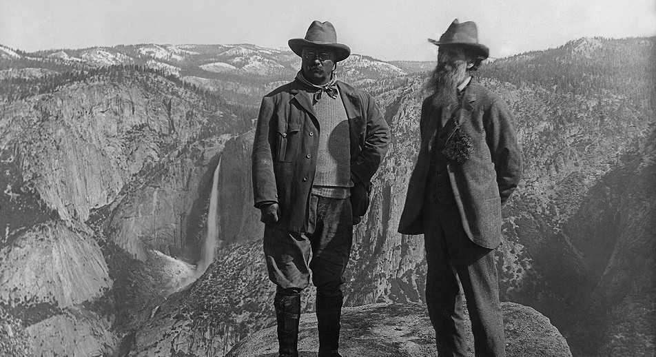
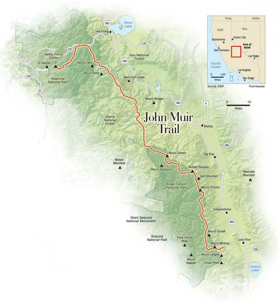
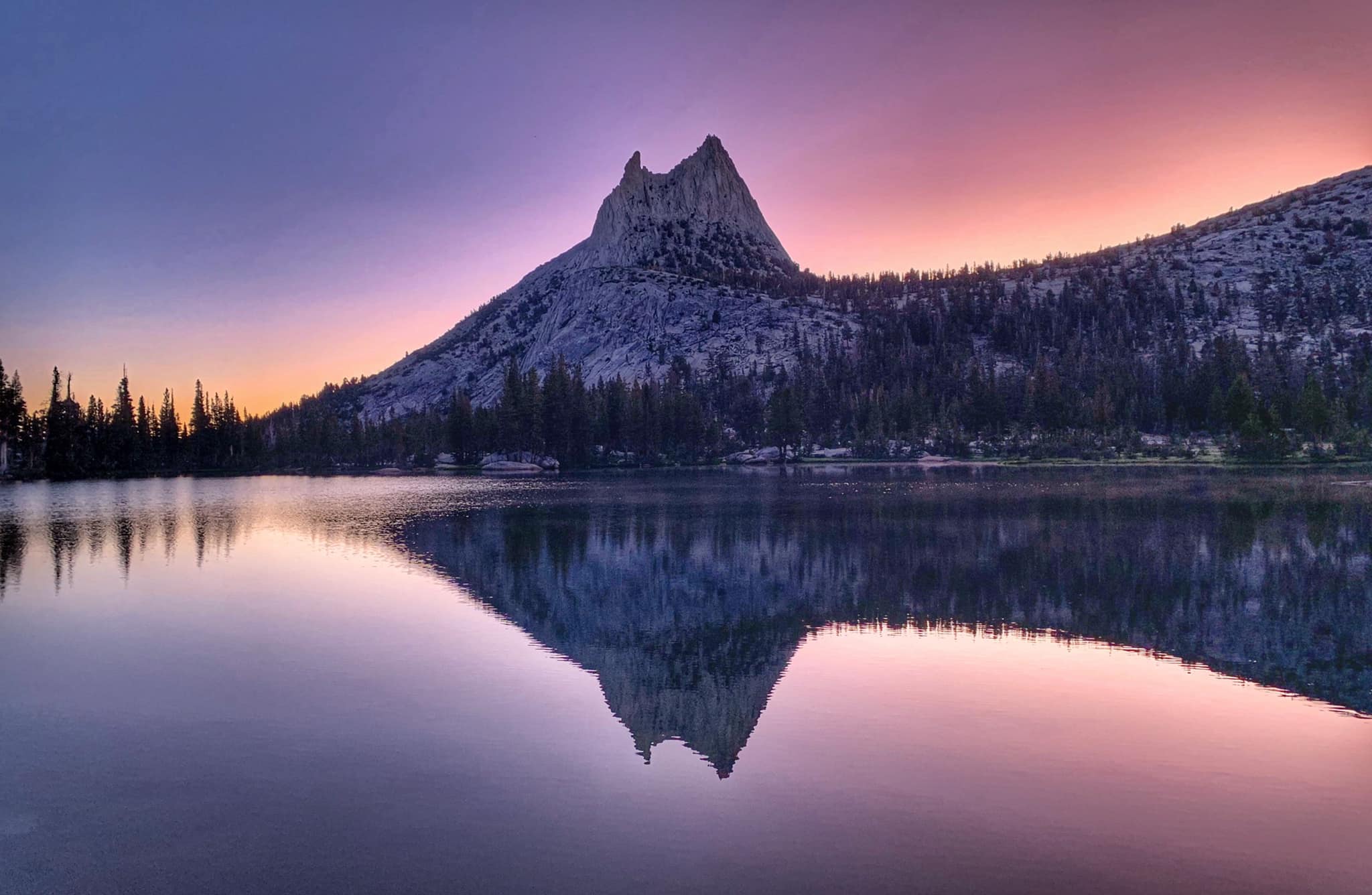
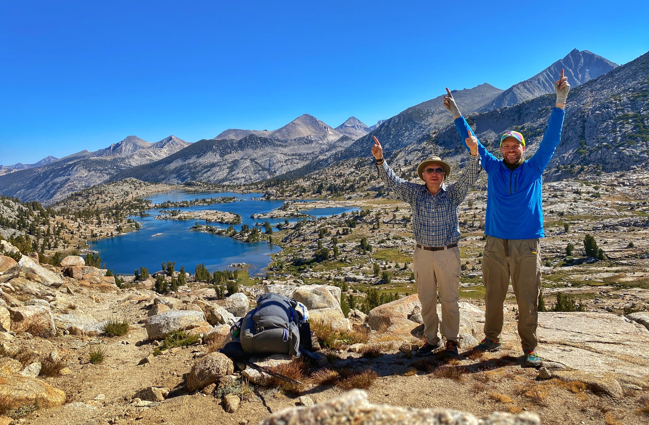
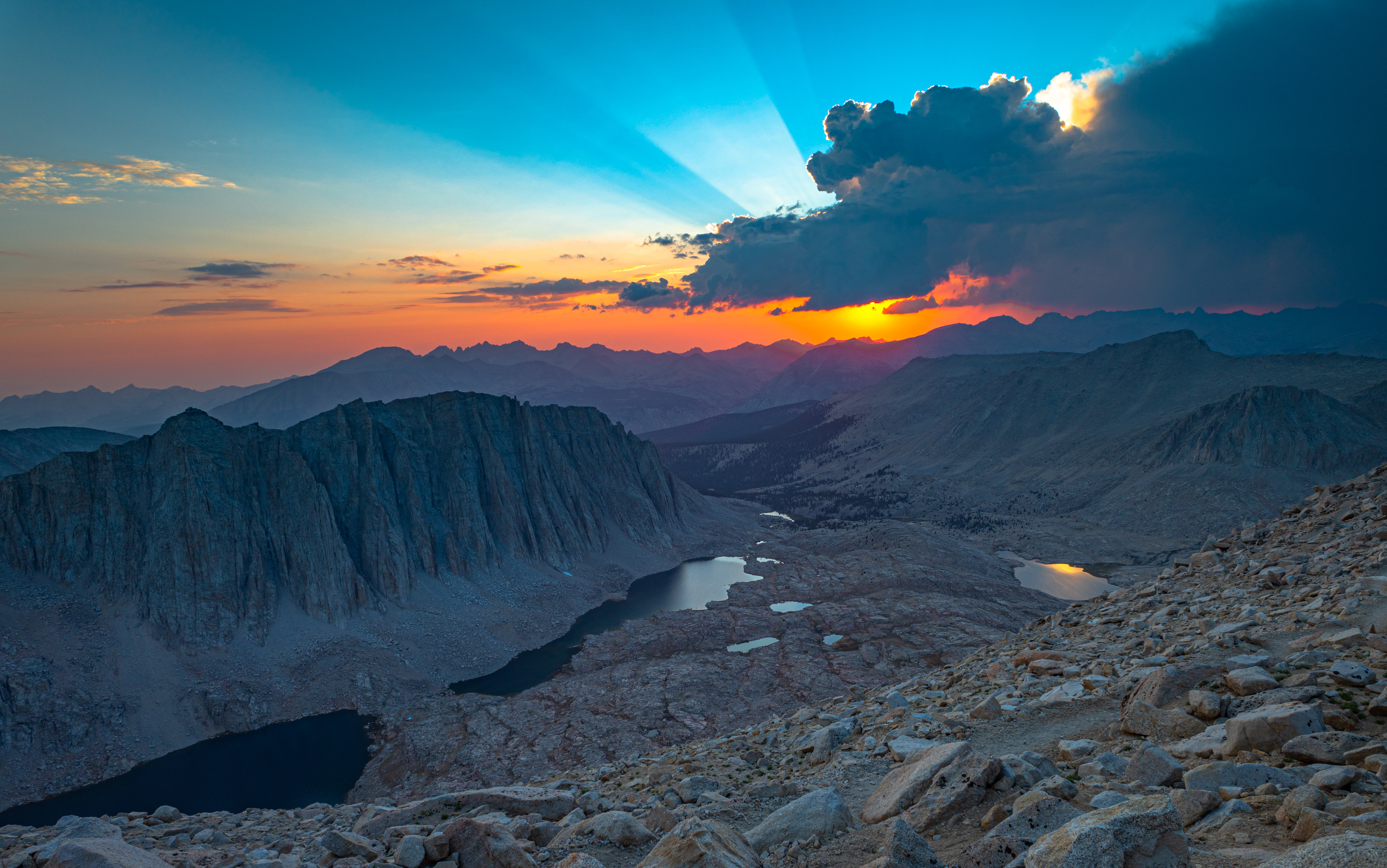
About the John Muir Trail President Teddy Roosevelt & John Muir at Yosemite The Join Muir Trail (JMT) is a 211-mile trail through the Sierra Nevada mountains in California. The trail is named for the naturalist John Muir who co-founded the Sierra Club with the mission to explore and protect the wilderness of the Sierra Nevada. The trail begins at the Happy Isles trailhead in Yosemite National Park, passes through Inyo National Forest and Sierra National Forest (including the Join Muir Wilderness and Ansel Adams Wilderness), Devils Postpile National Monument, and Kings Canyon National Park, and ends in Sequoia National Park on the summit of Mount Whitney - the highest point in the lower 48 states. It's an additional 10.6 miles down from the summit along the Mount Whitney Trail to the nearest trailhead, Whitney Portal. For 170 of the 211 miles, the JMT coincides with and follows the Pacific Crest Trail (PCT), a 2,653-mile trail from the US-Mexico border to the US-Canada border. The JMT deviates from the PCT in three spots: 1. between Yosemite Valley and Tuolumne Meadows, 2) Thousand Island Lake to Red's Meadow and 3) Crab Tree Meadow to Mt. Whitney. John Muir Trail overview map Why the John Muir Trail? Over a series of summers, I had previously hiked Half Dome (three times) and backpacked in Yosemite National Park, hiked Mount Whitney, and hiked the Kearsarage Pass Trail in Inyo National Forest. On the way down from our hike of Mount Whitney, I was passed by a backpacker who was heading towards Whitney Portal. I asked where she had started and she said Yosemite, and that she was finishing the John Muir Trail. This might have been one of the first times I learned that there was a trail connecting Yosemite and Mt. Whitney. And that was all it took. Having hiked the start and end points of the JMT and with a glimpse of the spectacular scenery of sections in between, I knew that I wanted to hike the entire trail. Hiking the John Muir Trail in 3 Sections For most thru-hikers, the 220-mile walk from Happy Isles to Whitney Portal takes about 3 weeks, but with family and work constraints, I couldn't do it all at once. So I planned to complete the trail* as a series of three section hikes over the next few years, which we did from 2019 to 2021. * We skipped about a dozen miles of the JMT between Devils Postpile and Duck Pass. We heard this was one of the least interesting section, and given time constraints, decided to skip it. Part 1 (2019): Reds Meadow to Yosemite Valley Lower Cathedral Lake & Cathedral Peak at dawn Start Trailhead: John Muir Trail North of Devils Postpile (AA10), Devils Postpile National Monument End Trailhead: Happy Isles, Yosemite National Park JMT miles: 0.0 to 56.9 (56.9 miles) Total trail miles: 56.9 miles Read the trip report for Part 1 In 2019, I hiked the first section of the JMT with my dad and the older of my two brothers (see the full trip report). We started at the Devils Postpile National Monument and went north-bound, ending at Happy Isles, the traditional starting point of the JMT (note: the historical starting point is actually about 2 miles west at the former LeConte Memorial Lodge – now the Yosemite Conservation Heritage Center). We went north-bound for two reasons: 1) the permits from Inyo National Forest are much easier to get than those starting from Yosemite, which require winning a lottery; and 2) the trail is easier going northbound, with a net elevation drop, and avoiding the grueling hike out of Yosemite Valley with fully loaded packs. In all, we covered about 57 miles over 4 days. Unfortunately, I came down with a sinus infection during the hike, but it was still a spectacular experience. Read the full trip report for the John Muir Trail section from Reds Meadow to Yosemite Valley. Part 2 (2020): Duck Pass to Bishop Pass View from Selden Pass Start Trailhead: Duck Pass Trailhead, Inyo National Forest End Trailhead: Bishop Pass Trailhead, South Lake, Bishop, CA JMT miles: 70.5 (Duck Pass Trail) to 136.9 (LeConte Canyon/Bishop Pass Trail junction) (66.4 miles) Total trail miles: 83 miles Read the trip report for Part 2. Over 6 days in early August of 2020, my dad and I hiked a total of 83 miles as part 2 of our 3-section effort to hike the entire John Muir Trail. Starting from the Duck Pass Trailhead in Mammoth Lakes, we hiked 5.5 miles to the John Muir Trail, followed the JMT south for 66.4 miles (from mile 70.5 to 136.9), and hiked out via the 10.9-mile Bishop Pass Trail to South Lake in Bishop. Our hike took us through Inyo National Forest, Sierra National Forest, and Kings Canyon National Park. Read the full trip report for the John Muir Trail section from Duck Pass to Bishop Pass. Part 3 (2021): Bishop Pass to Mt. Whitney Sunset from Mt. Whitney Start Trailhead: Bishop Pass Trailhead, South Lake, Bishop, CA End Trailhead: Whitney Portal, Lone Pine, CA JMT miles: 135.0 (LeConte Canyon/Bishop Pass Trail junction) to Mt. Whitney 211.0 (76.0 miles) Total trail miles: 93 miles Read the trip report for Part 3. Over 7 days in August of 2021, my dad and a brother and I hiked about 93 miles as the final part of our 3-part section hike of the 220-mile John Muir Trail. Starting from the South Lake Trailhead in Bishop, we 10.9 miles over the Bishop Pass Trail to the John Muir Trail, followed the JMT south for 73.5 miles (from mile 136.9 to 210.4), and hiked out via the 7.5-mile Mount Whitney Trail to Whitney Portal in Lone Pine. Our hike took us through Inyo National Forest, Kings Canyon National Park, and Sequoia National Park in the John Muir Wilderness and Sequoia and Kings Canyon Wilderness. Real the full trip report for the John Muir Trail section from Bishop Pass to Mt. Whitney.


 Refine Search


