Overview
The Doris Duke Trail is a relatively new lollipop loop trail through a less-visited northern section of Sterling Forest. This a nice hike if you’re looking for a bit more solitude than other trails in the park. The loop offers several views of the surrounding mountains, passes a marsh with a beaver lodge, and offers plenty of opportunities for spotting wildlife.
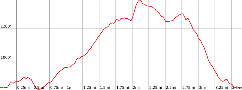
Hike Length: 3.7 miles
Elevation gain: +785 feet
Location: Sterling Forest State Park, Tuxedo, Orange County, NY
About Sterling Forest State Park
The park comprises almost 22,000 acres of nearly pristine natural refuge amidst one of the nation’s most densely populated areas. This unbroken deep-forest habitat is important for the survival of many resident and migratory species, including black bear, a variety of hawks and songbirds and many rare invertebrates and plants.
About the Doris Duke Wildlife Sanctuary and Doris Duke Trail
Construction on the Doris Duke Trail began in 2013 as part of the Sterling Forest Back Country Trails program, a partnership between the New York-New Jersey Trail Conference and the New York State Office of Parks, Recreation, and Historic Preservation, which supports crews educated and supervised by the trail conference’s professional trail builders…
The trail itself is a model of modern sustainable trail-building techniques, showcasing bench-cut construction, stepping-stone crossings, rock stairs and other structures to harden the tread. For much of its length – where sustainable – no extensive work beyond brush removal was necessary at all: There are simply blazes on trees to keep hikers on track.
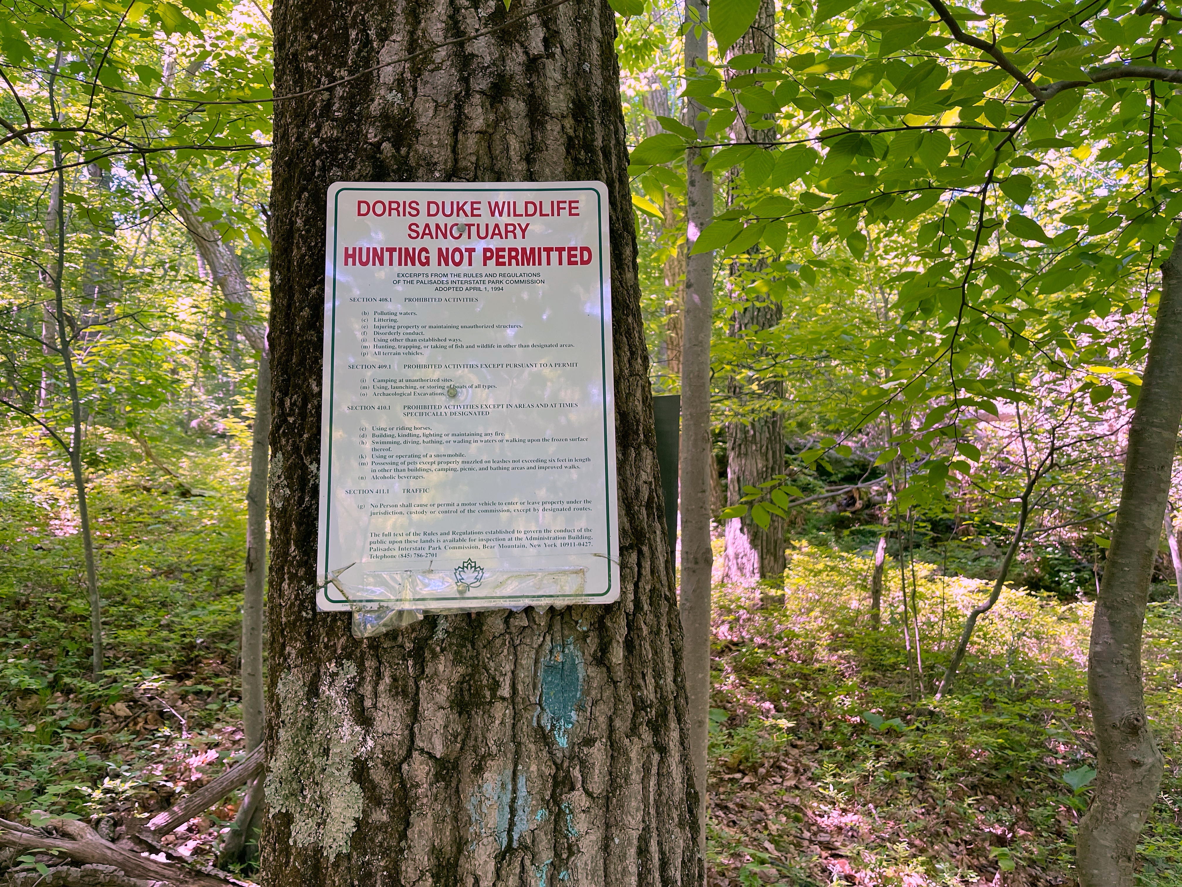
The Doris Duke Trail includes a section of the historic Allis Trail, which connects to the Appalachian Trail along the Sterling Ridge and, when the weather is agreeable, offers views of the New York City skyline. It traverses the 1,400-acre Doris Duke Wildlife Sanctuary, which was established through a $5 million donation from the Doris Duke Charitable Foundation during the fight to preserve Sterling Forest. Located in the northern end of the park and encompassing a portion of the Appalachian Trail Corridor, this no-hunting zone is a haven for many resident and migratory species, including rare invertebrates and plants.
Poughkeepsie Journal
Parking
Park in the parking lot off of Benjamin Meadow Road, just north of the junction with NY 17A as the road bends. There is a sign for the trailhead on the side of the road. A nearby GPS Address is: 22 Benjamin Meadow Road, Tuxedo Park, NY 10987


Maps
- Sterling Forest State Park (NY State Parks)
- NY-NJ Trail Conference Sterling Forest Trails (Trail Map #100) – print
- NY-NJ Trail Conference Sterling Forest Trails (Trail Map #100) – Avenza
- National Geographic – Harriman, Bear Mountain, Sterling Forest State Parks Map

Trail Description
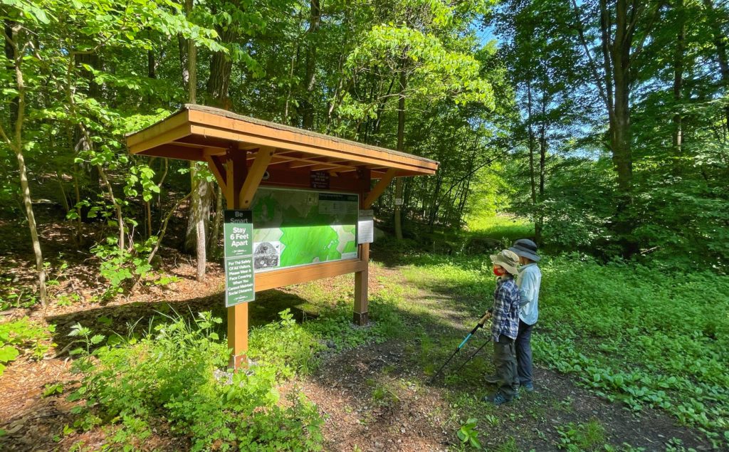
The Doris Duke Trail begins to the right of the kiosk at the end of the parking lot.
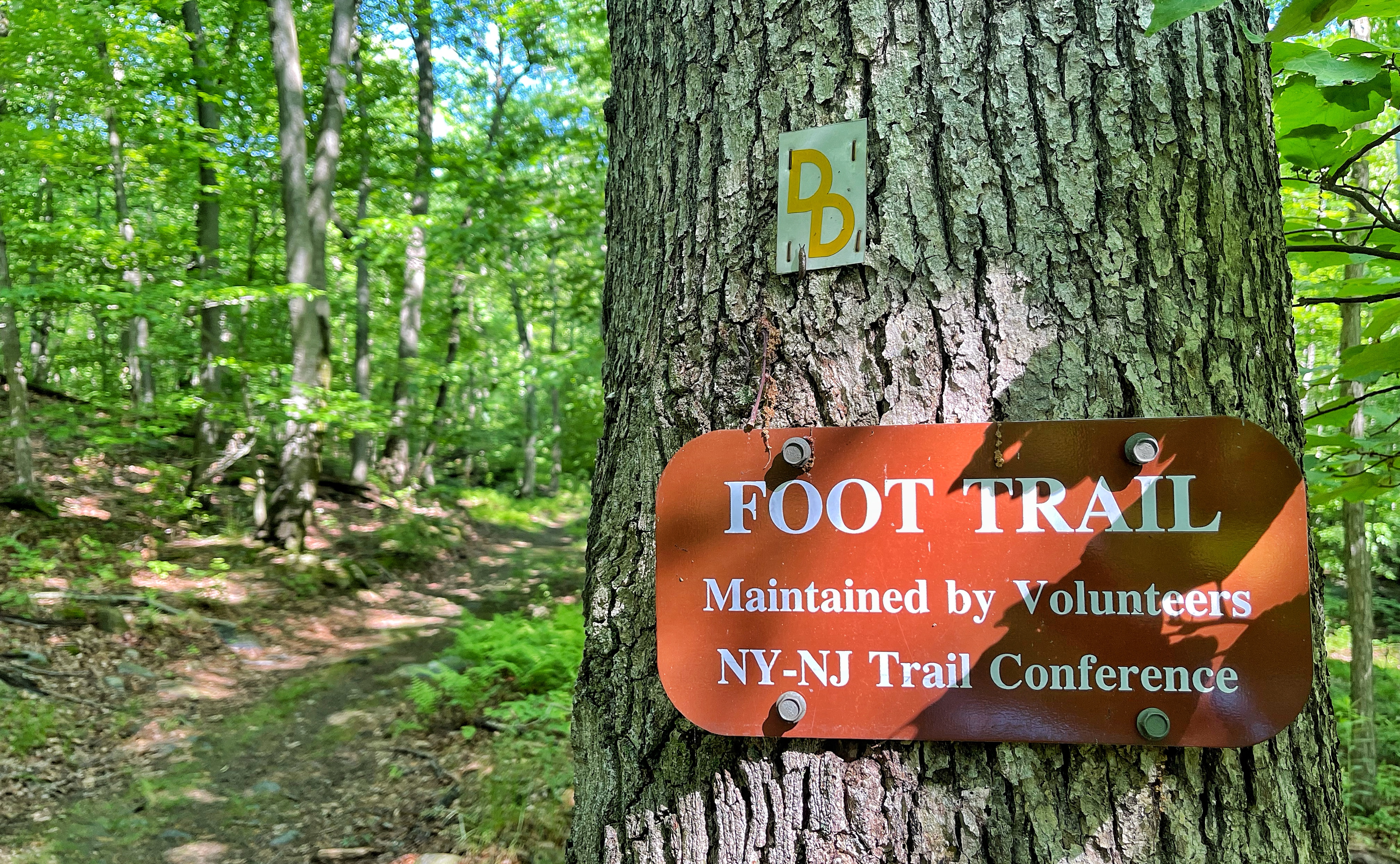
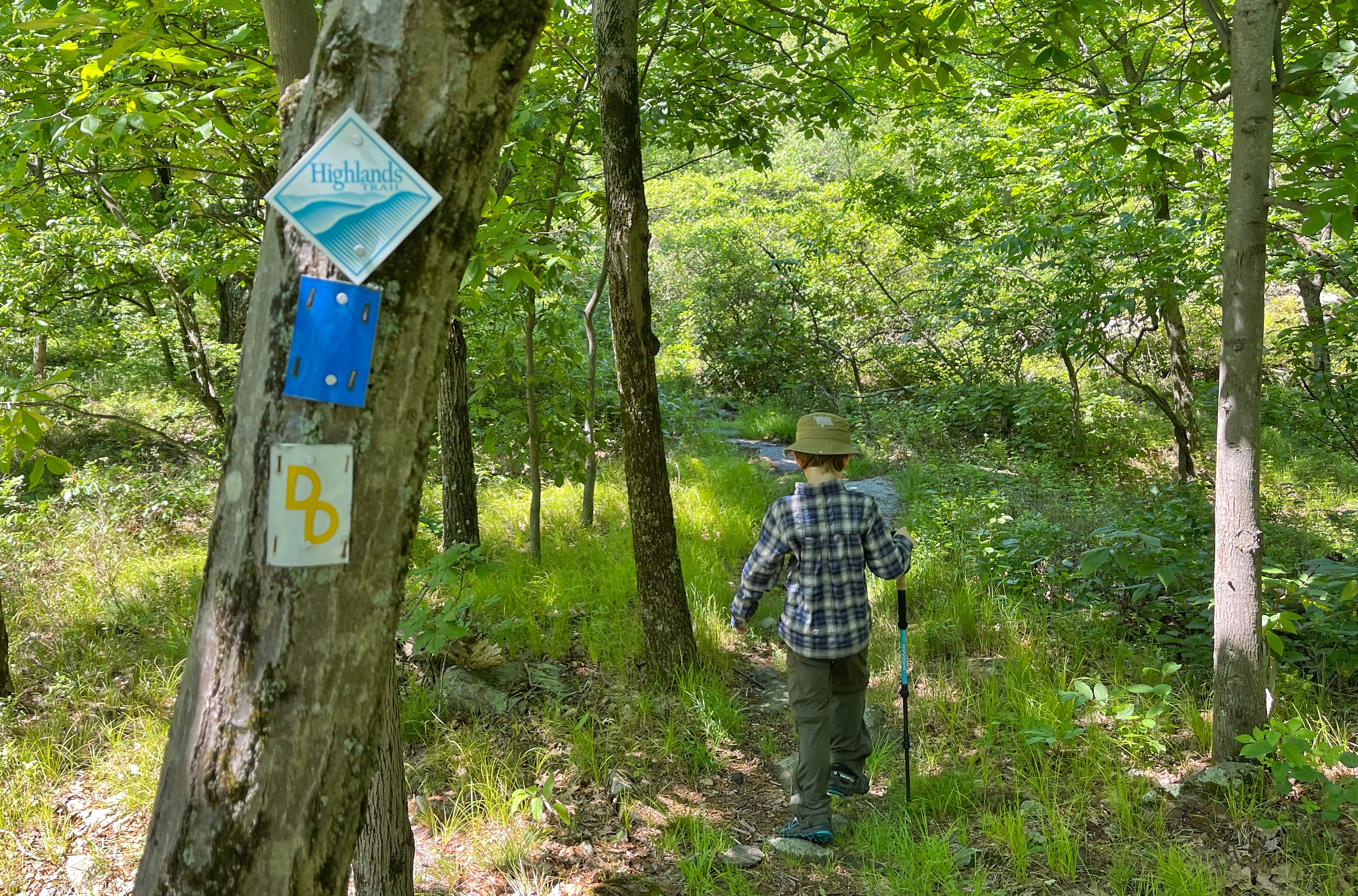
The trail is blazed with yellow “DD” (Doris Duke) trail markers.
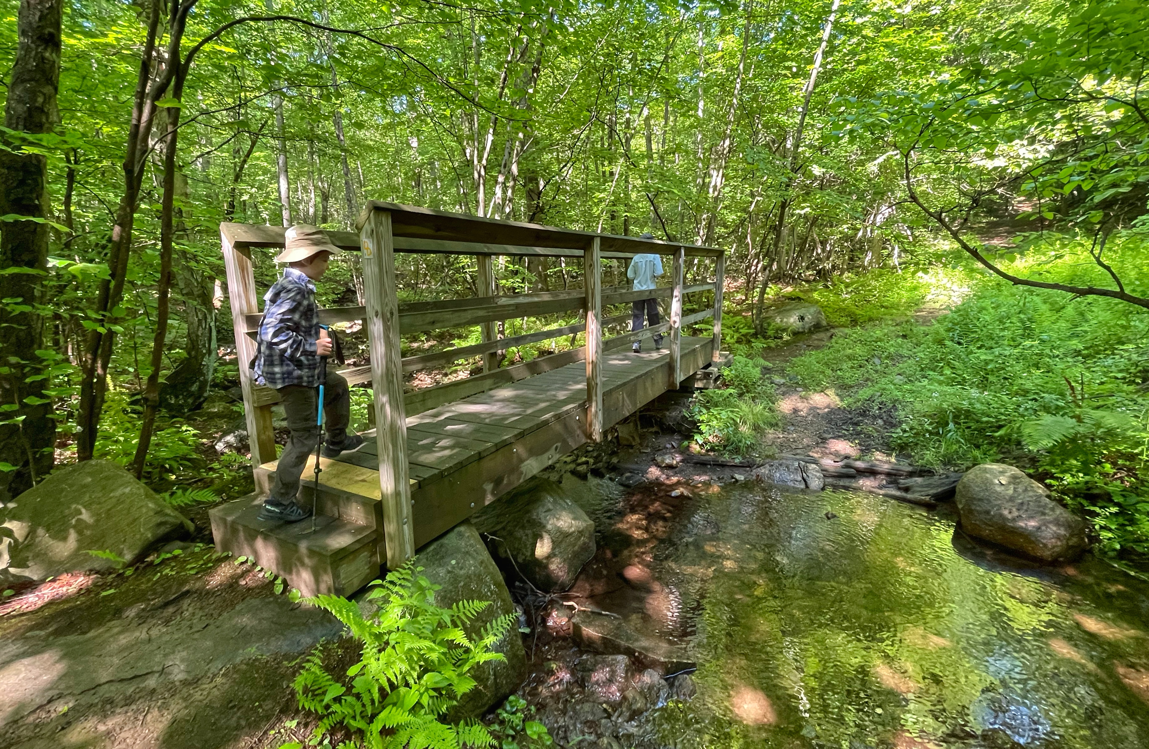
Head straight as the trail gently rises and soon crosses a stream on a footbridge.
A total of 0.15 miles from the trailhead, ahead you’ll reach a junction for the main part of the loop.
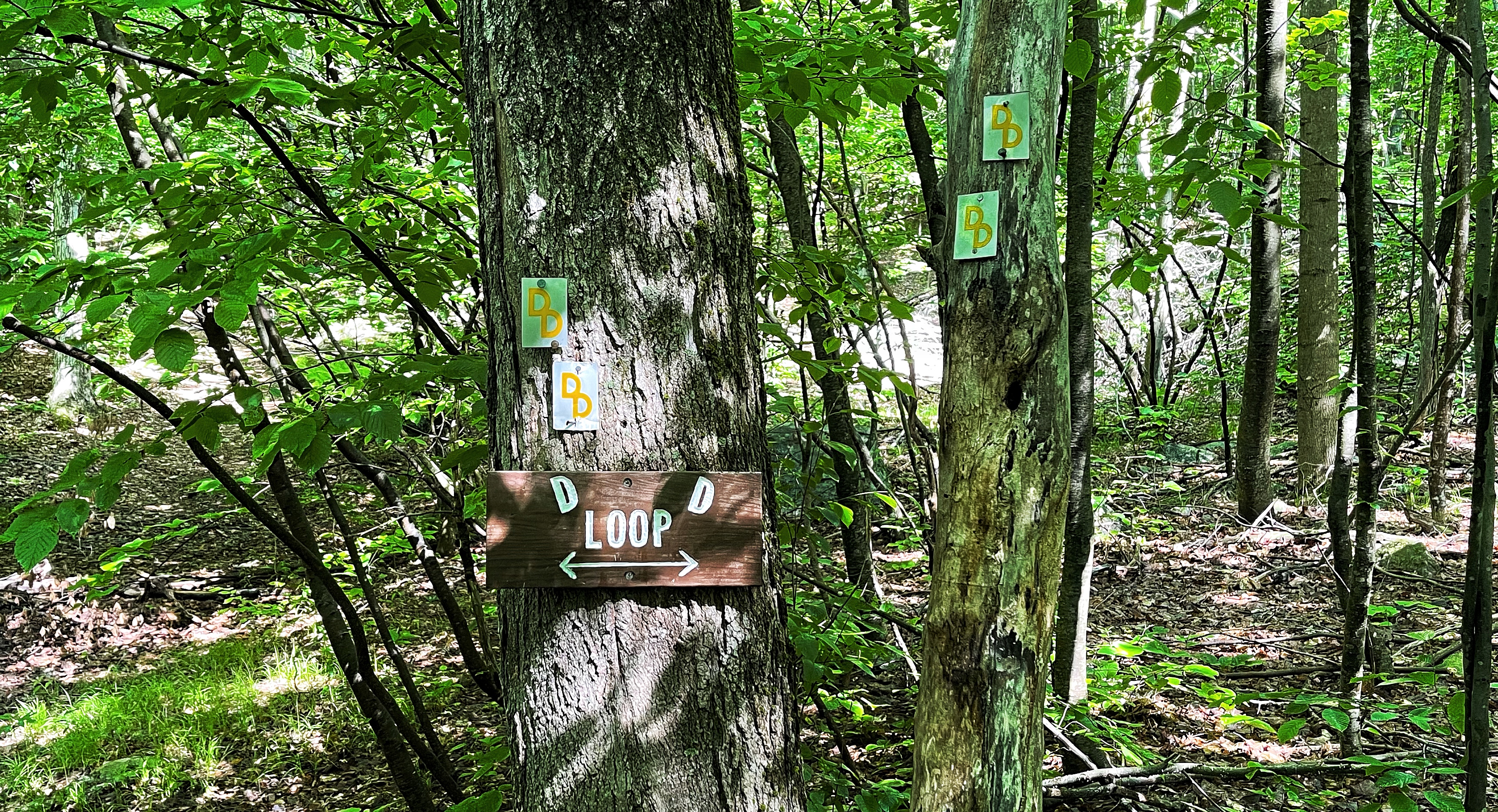
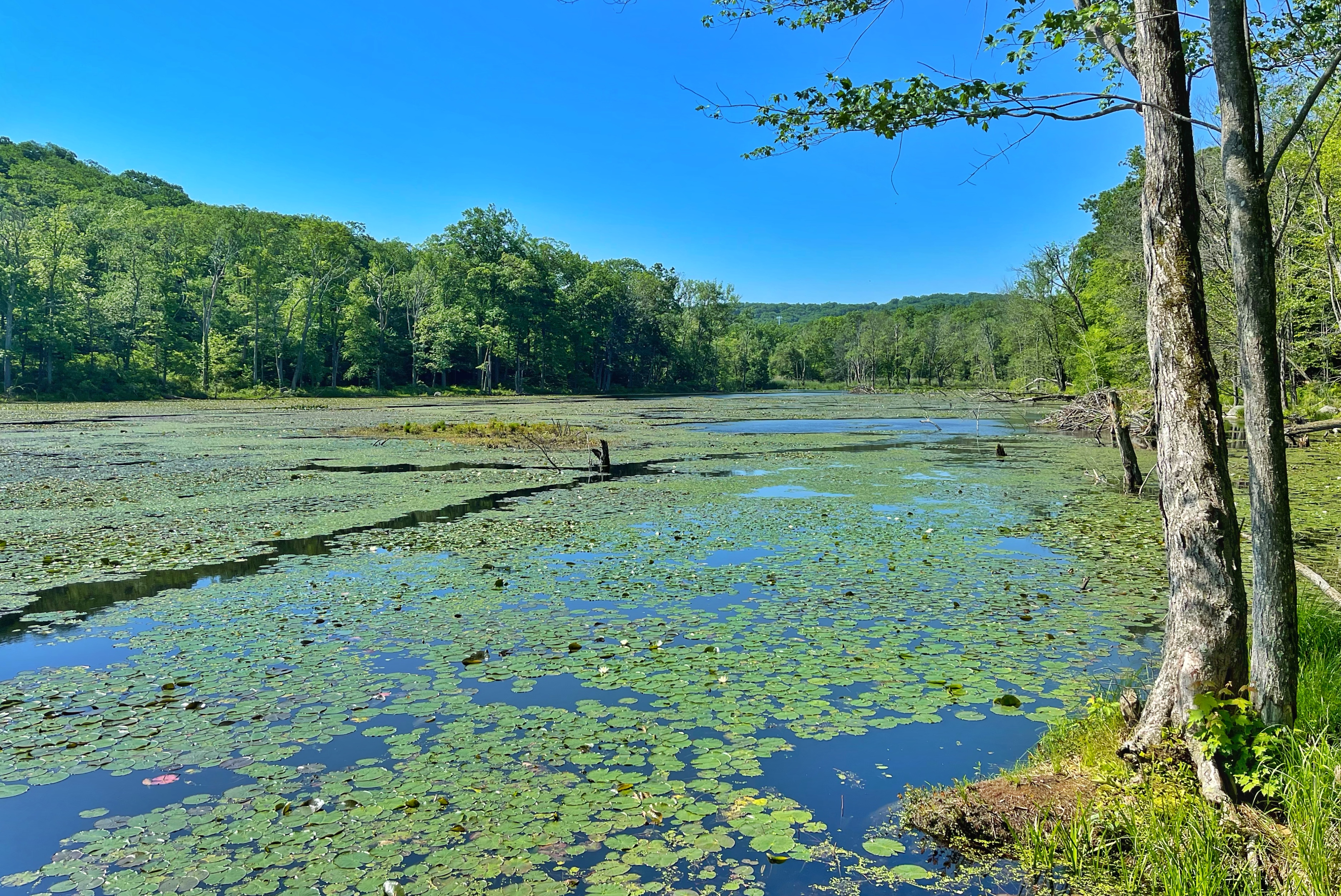
You can turn left or right to follow the Doris Duke Trail in a loop and return to this same point at the end of the loop. We’ll turn right. The trail rises a bit, passes steep cliffs on the left, and then descends to skirt the side of a wide marsh.


The trail now begins a consistent ascent as it gains about 400 feet over the next mile. The trail finally reaches a clearing marked with a post in a rock cairn.
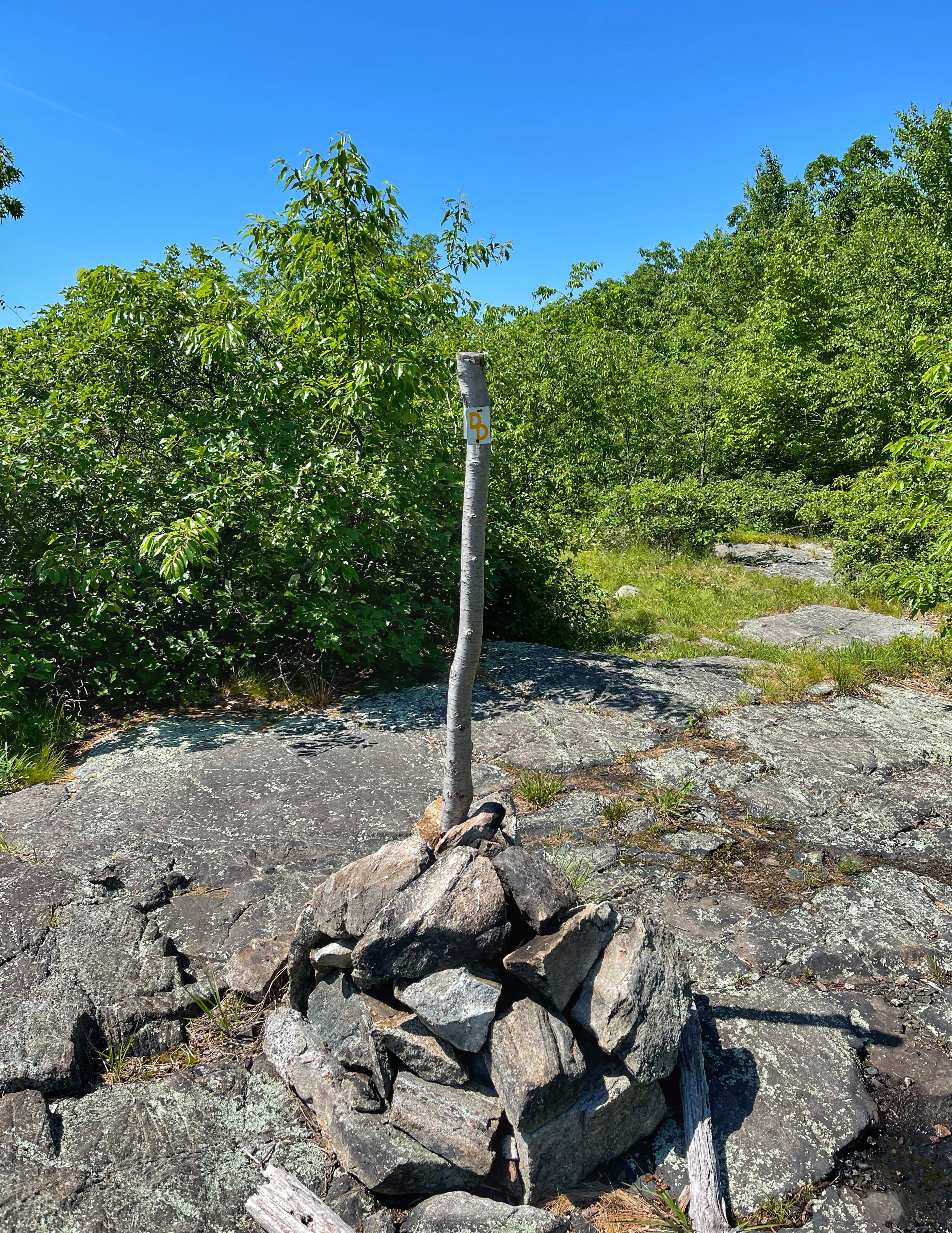
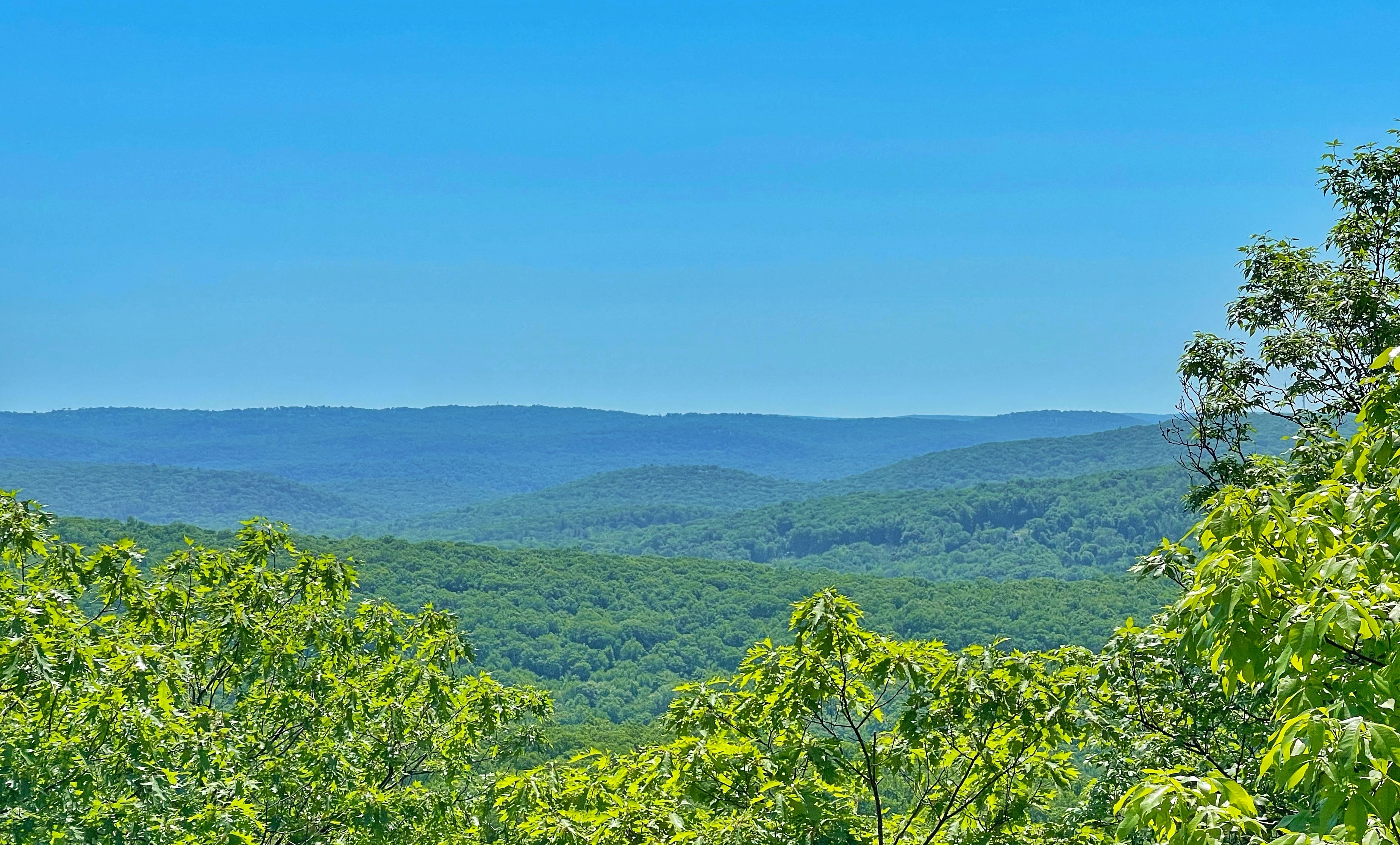
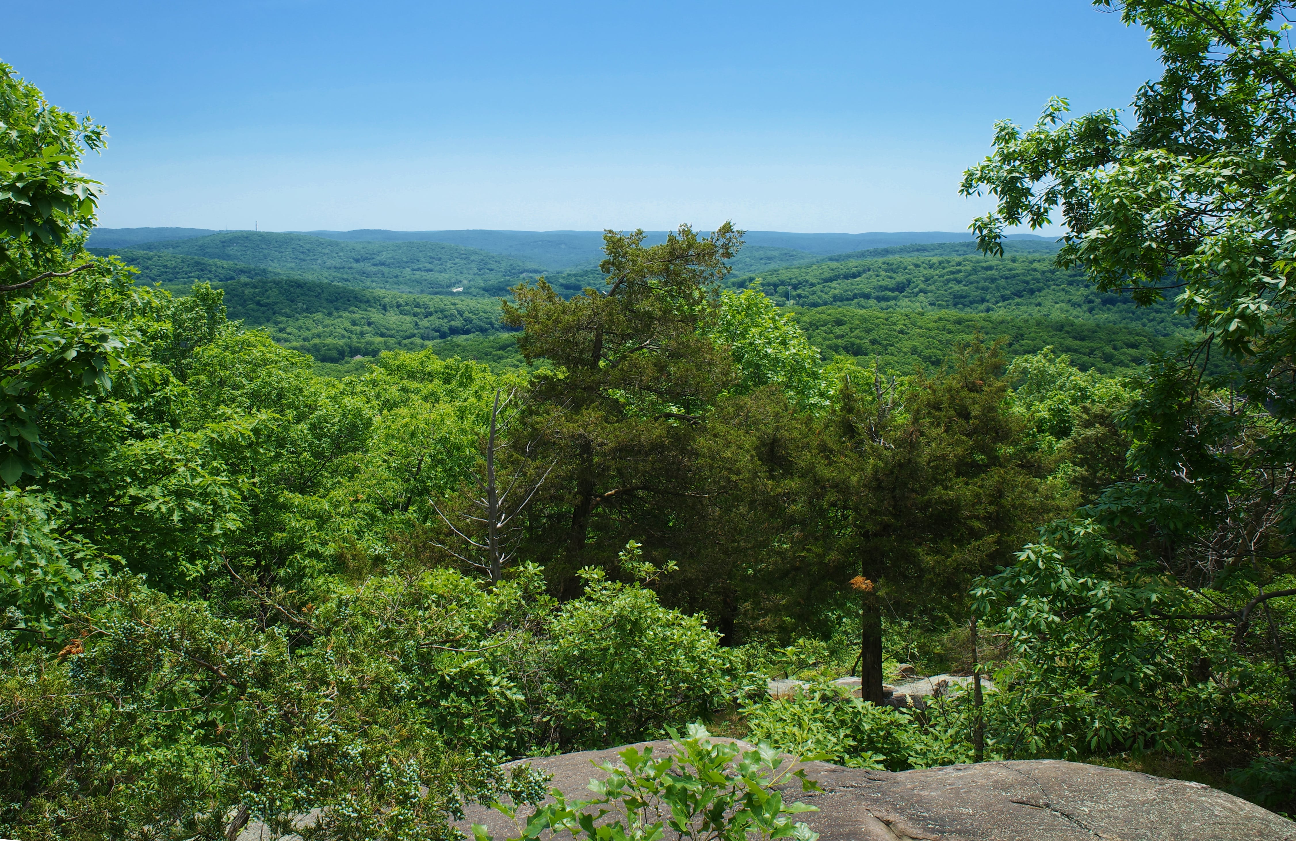
From here, there are partial views to the southeast.
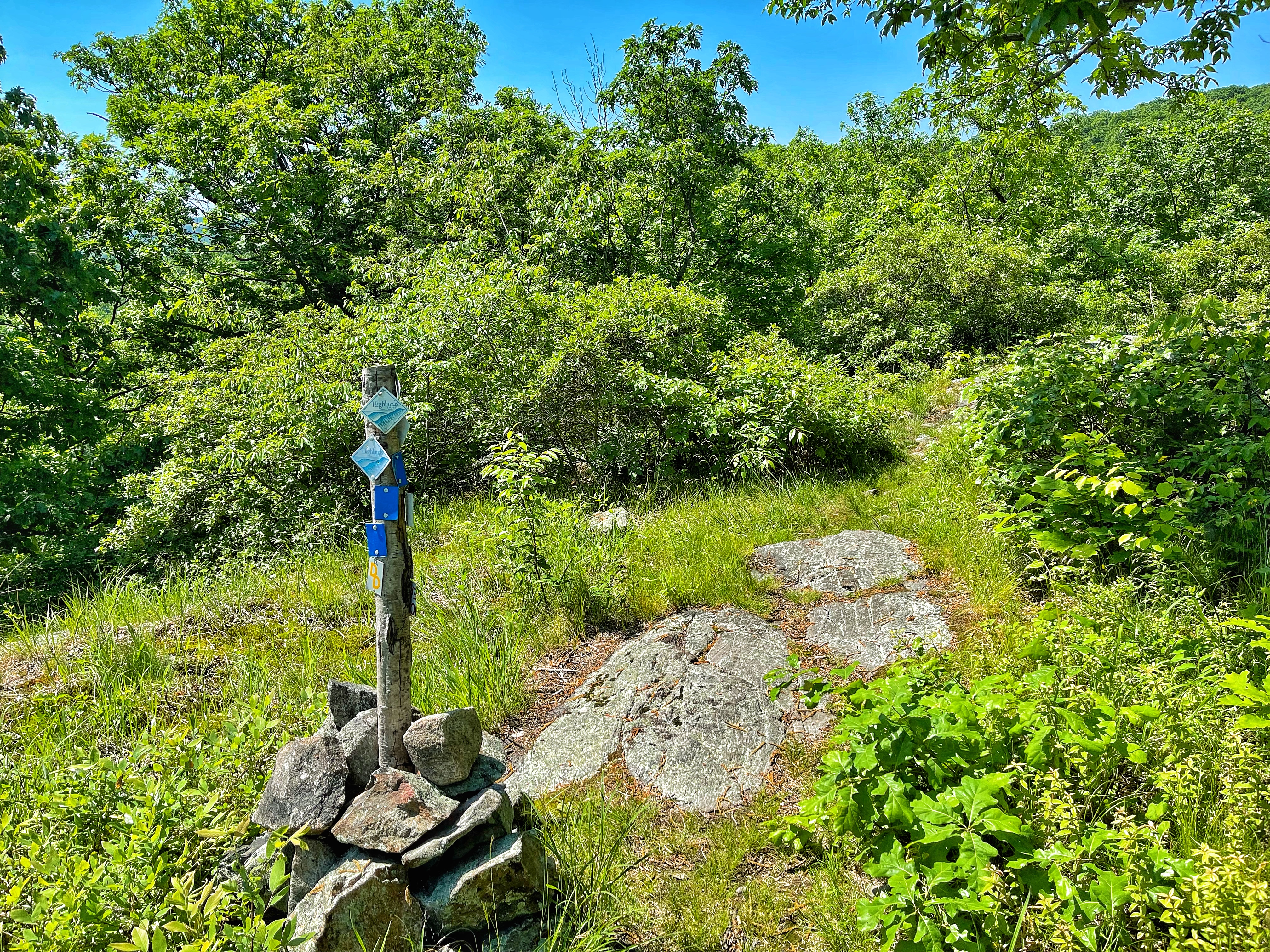
Just a few steps further from here is a junction with the Allis Trail and Highlands Trail marked with a post.
At this junction, you could make a right to follow the Allis and Highlands Trails north for a quarter mile to a junction with the Appalachian Trail and another viewpoint.
We will continue straight as the Doris Duke Trail is now co-aligned with the teal diamond blazed Highlands Trail and the blue-blazed Allis Trail.
The trail continues to rise as it reaches the true summit of the mountain. While maps don’t indicate a viewpoint along this section near the summit, if you turn and look back along the steep incline, you’ll get a nice view of the mountains to the northeast.
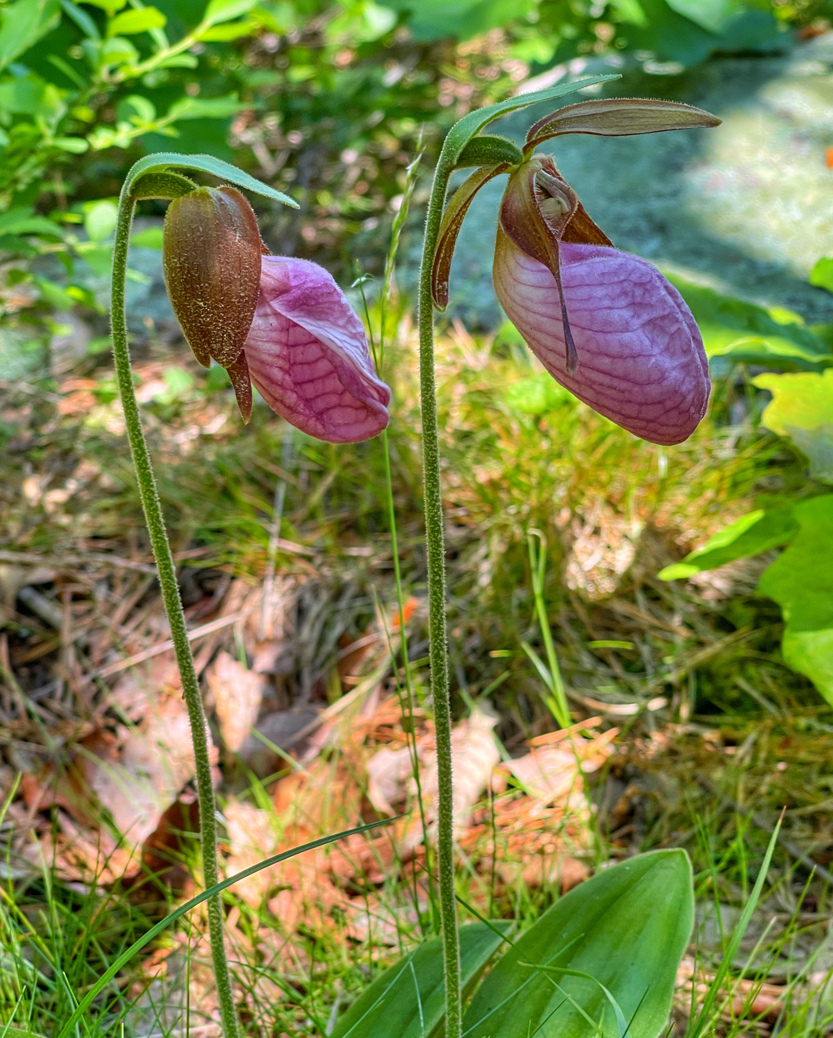
We spotted some pink lady’s slippers along this section – a native orchid.
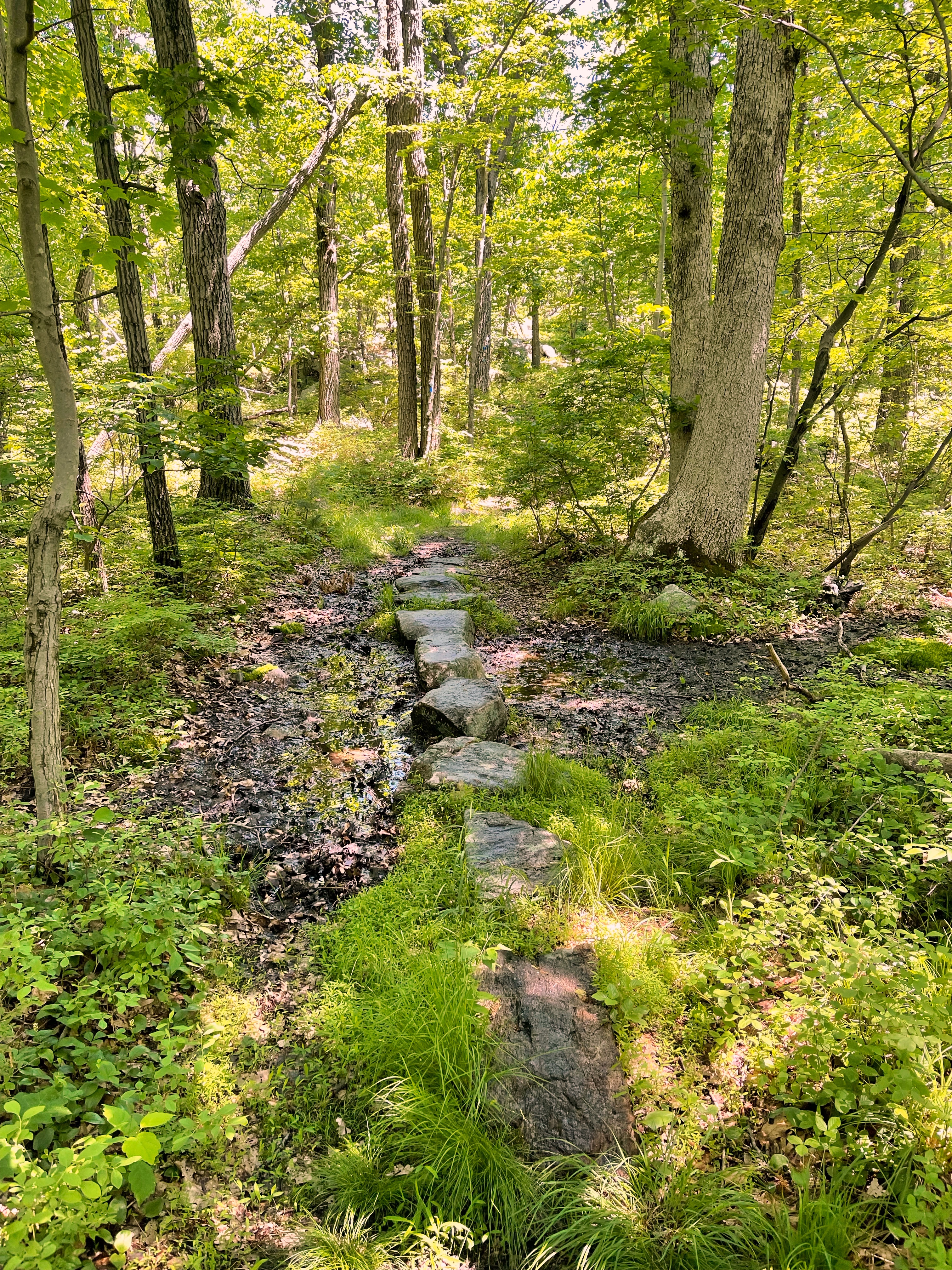
The trail continues to descend gradually and crosses an old woods road which might look like a muddy stream. Some stones have been placed here to cross this area.
A short distance later is a junction where the Doris Duke Trail makes a sharp left as the Highlands and Allis Trails continue straight. Although there is a double DD blaze indicating a left turn in advance, the actual junction is not particularly well-marked, so pay attention.
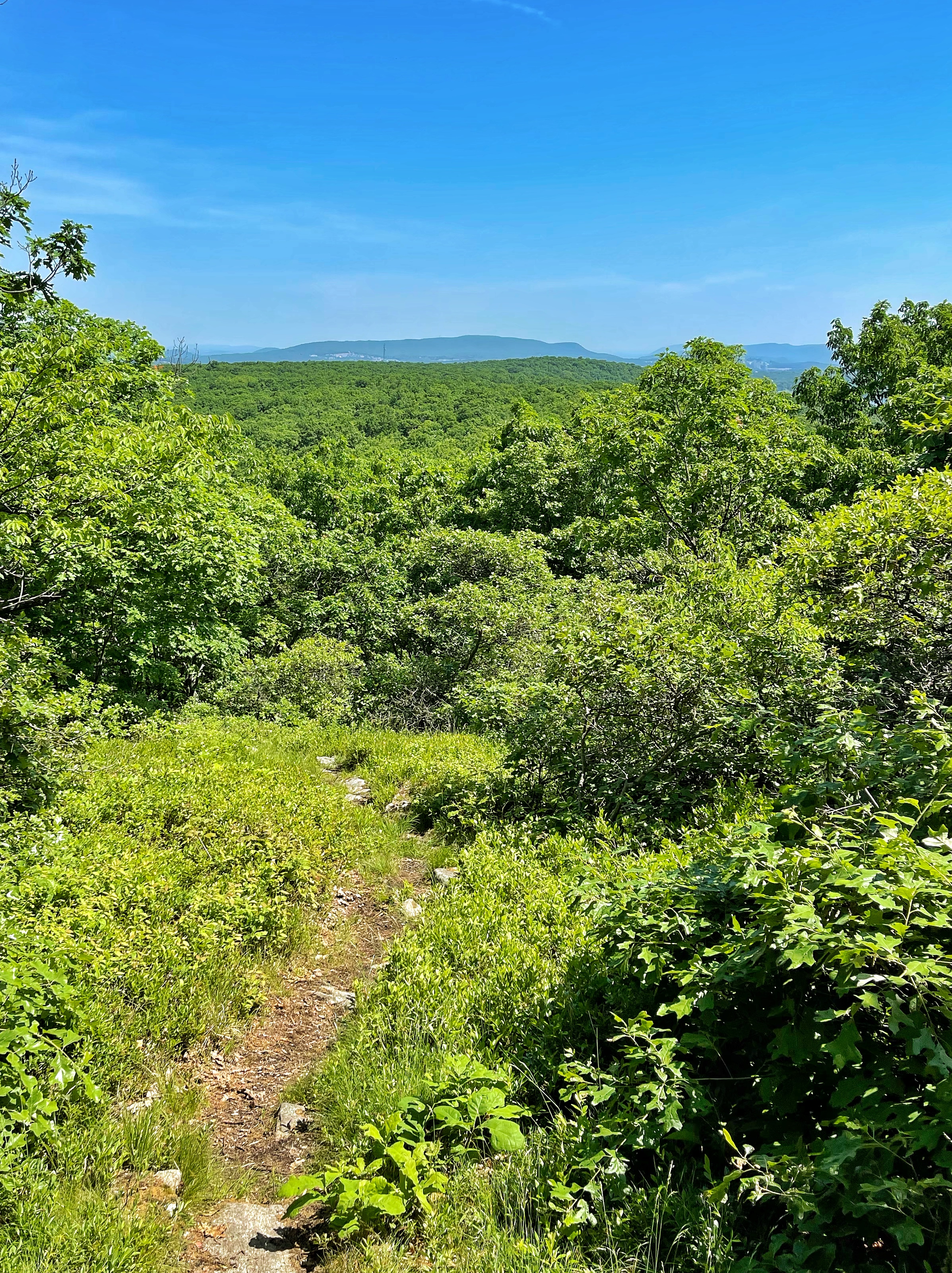
Turn left at the junction as the trail. A short distance ahead you’ll reach a partial clearing with views to the south.
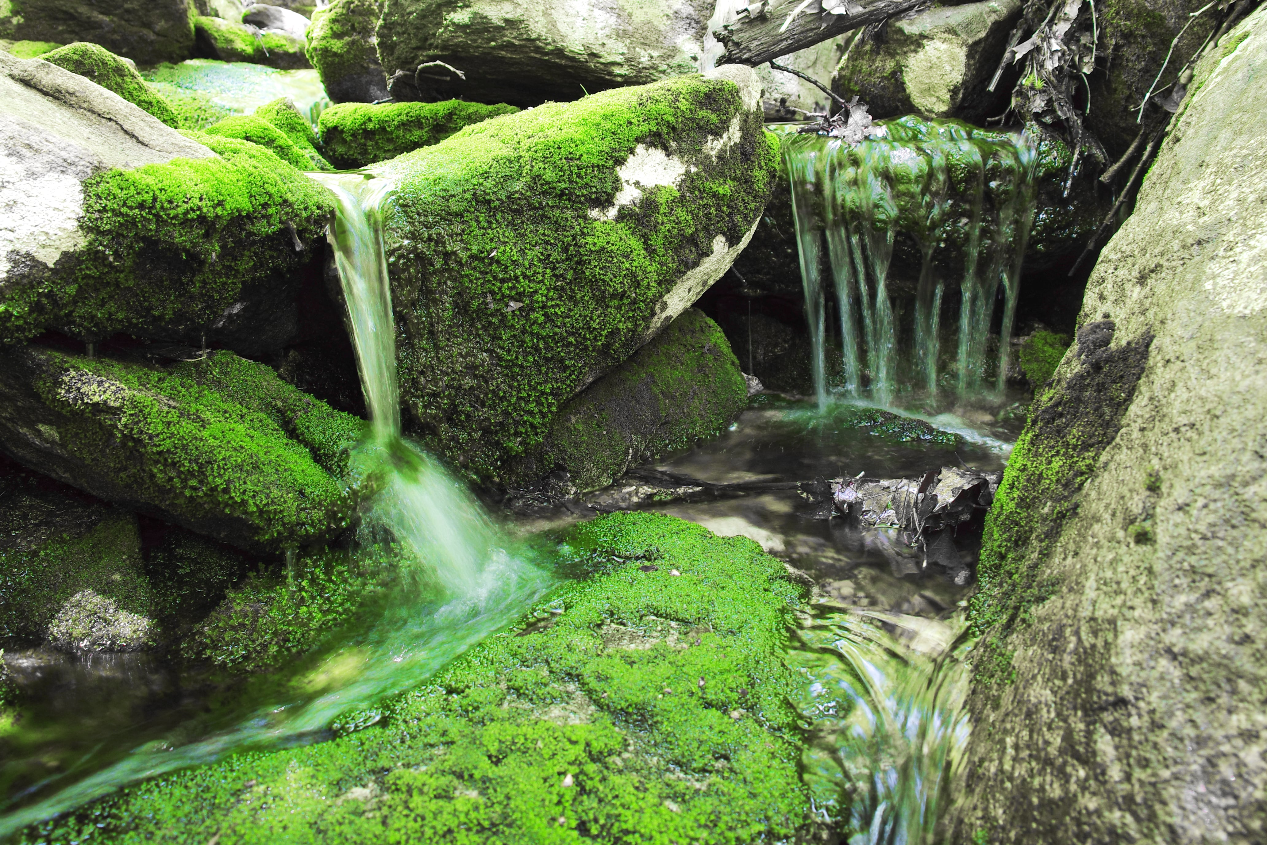
The trail now descends more steeply, skirts some small cascades, and then crosses a creek.
It eventually joins an old woods road and then returns to the original loop junction where we had initially turned right.


Make a right at the junction to follow the spur section of the Doris Duke Trail. You’ll again cross the footbridge you crossed at the start of the hike and then reach the parking lot.


