High Tor Hike Overview
A short, moderate hike to the tallest point along the Hudson Palisades offering panoramic views from the High Tor summit and an optional fun rock scramble. Due to its prominence above the surrounding area, the summit of High Tor has been used for centuries as a strategic lookout and beacon location.
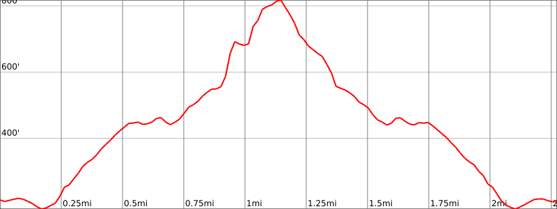
Length: 2.2 miles
Elevation gain: +740′
Location: High Tor State Park, New City, New York
High Tor Parking
There is parking for several cars on the shoulder of the road at 330 Haverstraw Road, New City, NY

High Tor Trail Map
- Hudson Palisades Trails Map #112 (and #111) – NY-NJ Trail Conference
- High Tor State Park trails map – NY State Parks (Note – the map does not show the Long Path section outside of the park)
Hike description
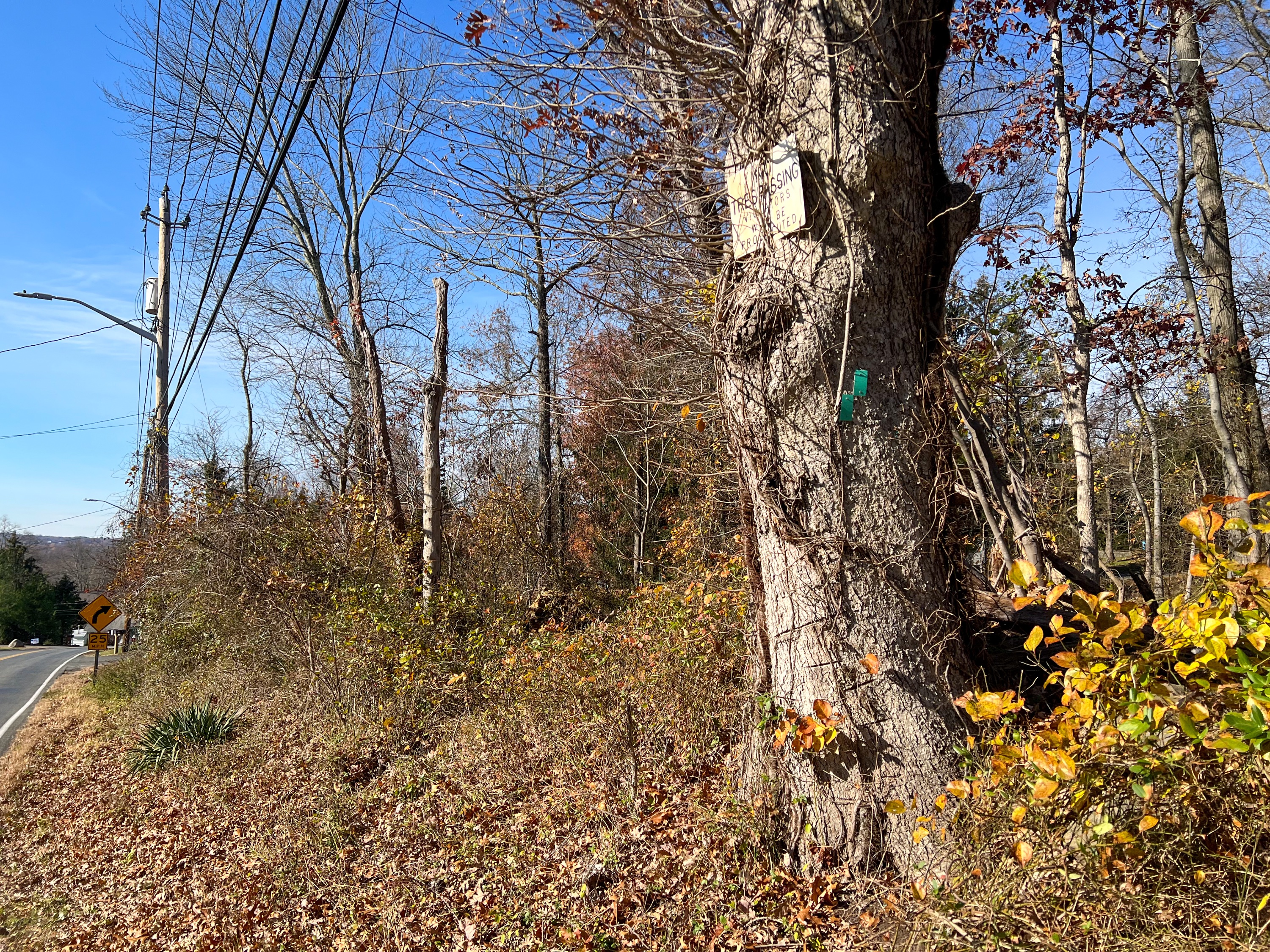
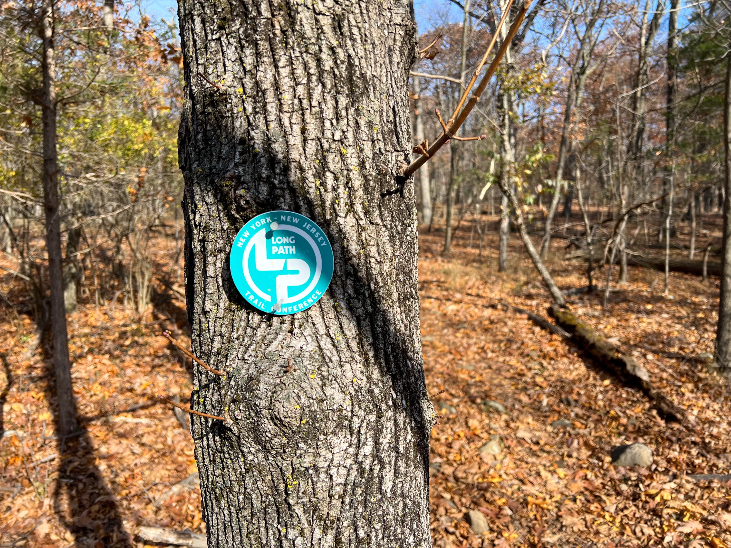
From the parking pullout, walk west along Haverstraw Road (Rt 90). The Long Path follows Rt 90 here and you may notice some aqua blazes on telephone poles.
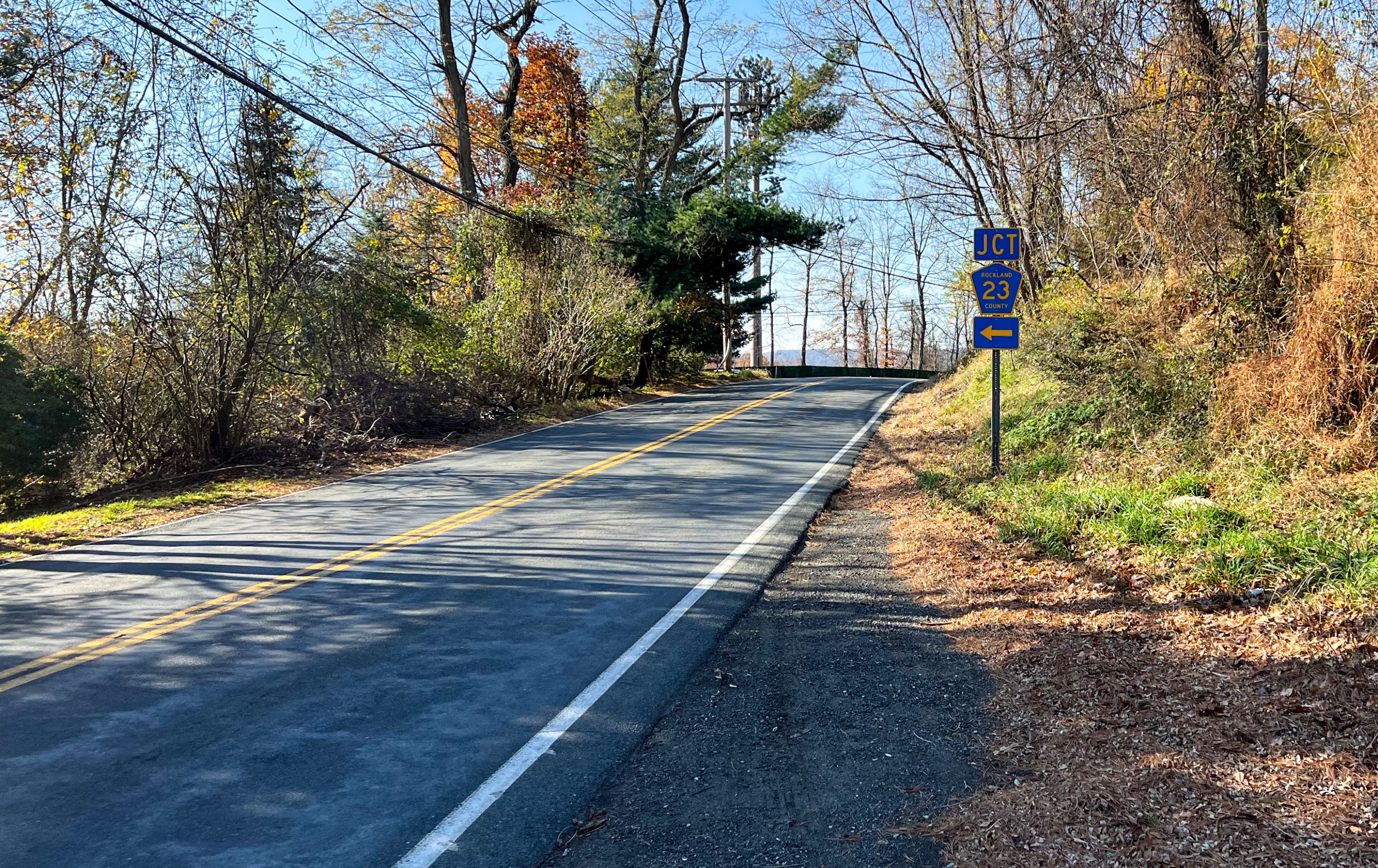
Walk past Ridge Road (Rt 23), and a short distance beyond you’ll see a power line cut.
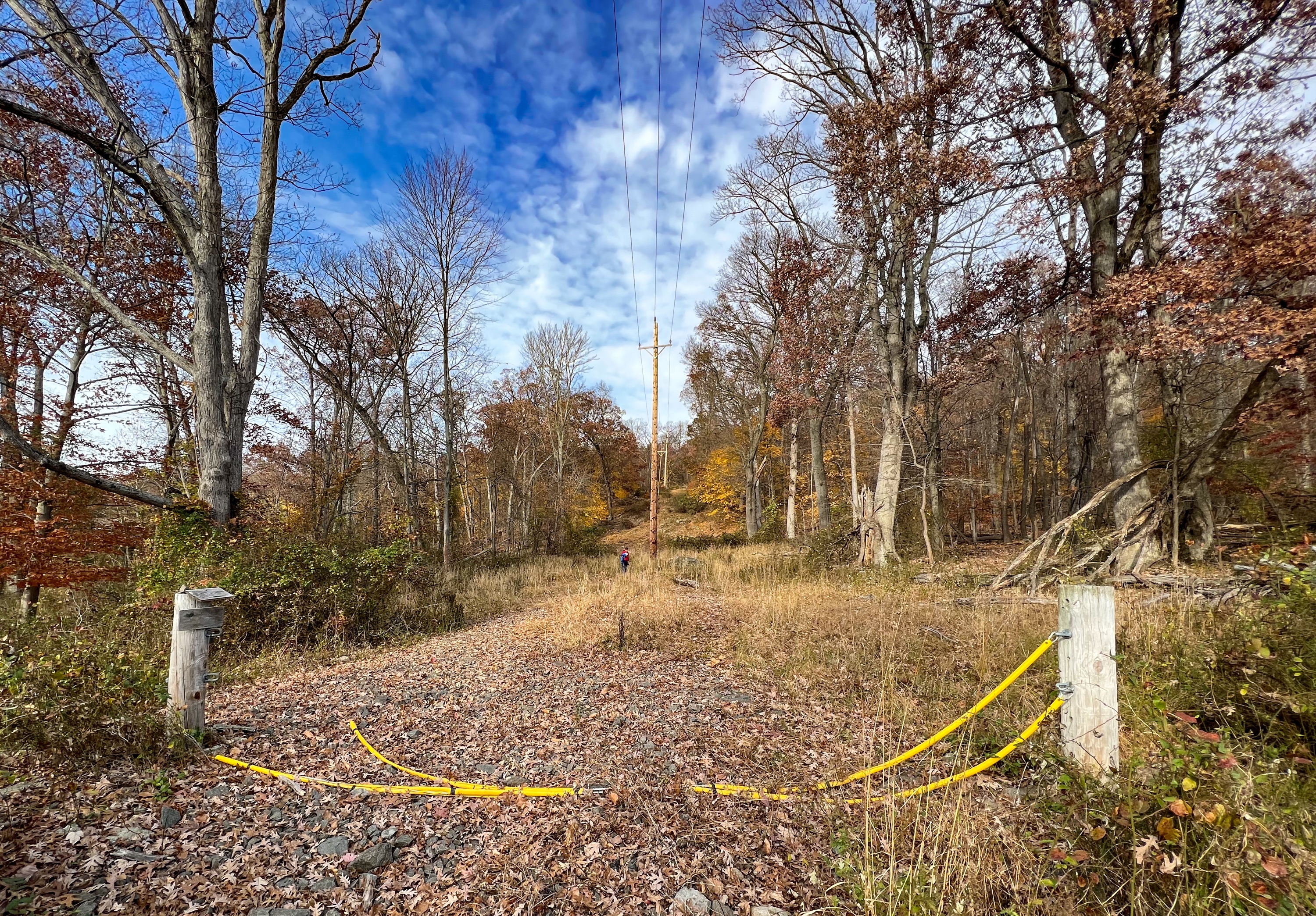
You could turn right here, but the official Long Path turns right just beyond here – about 0.2 miles from the parking area – marked by two aqua blazes on a tree.
If you follow the aqua blazes, you’ll first need to navigate a somewhat wet area. To avoid this, you could follow the power line cut, and then make a left to rejoin the trail.
The trail now climbs consistently, crossing a small stream.
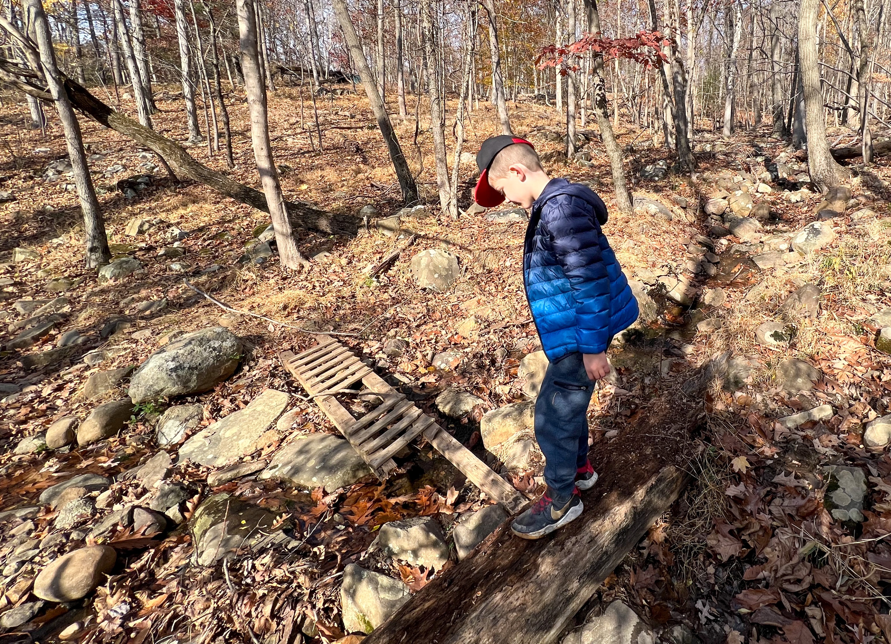
Continue to follow the aqua Long Path blazes uphill.

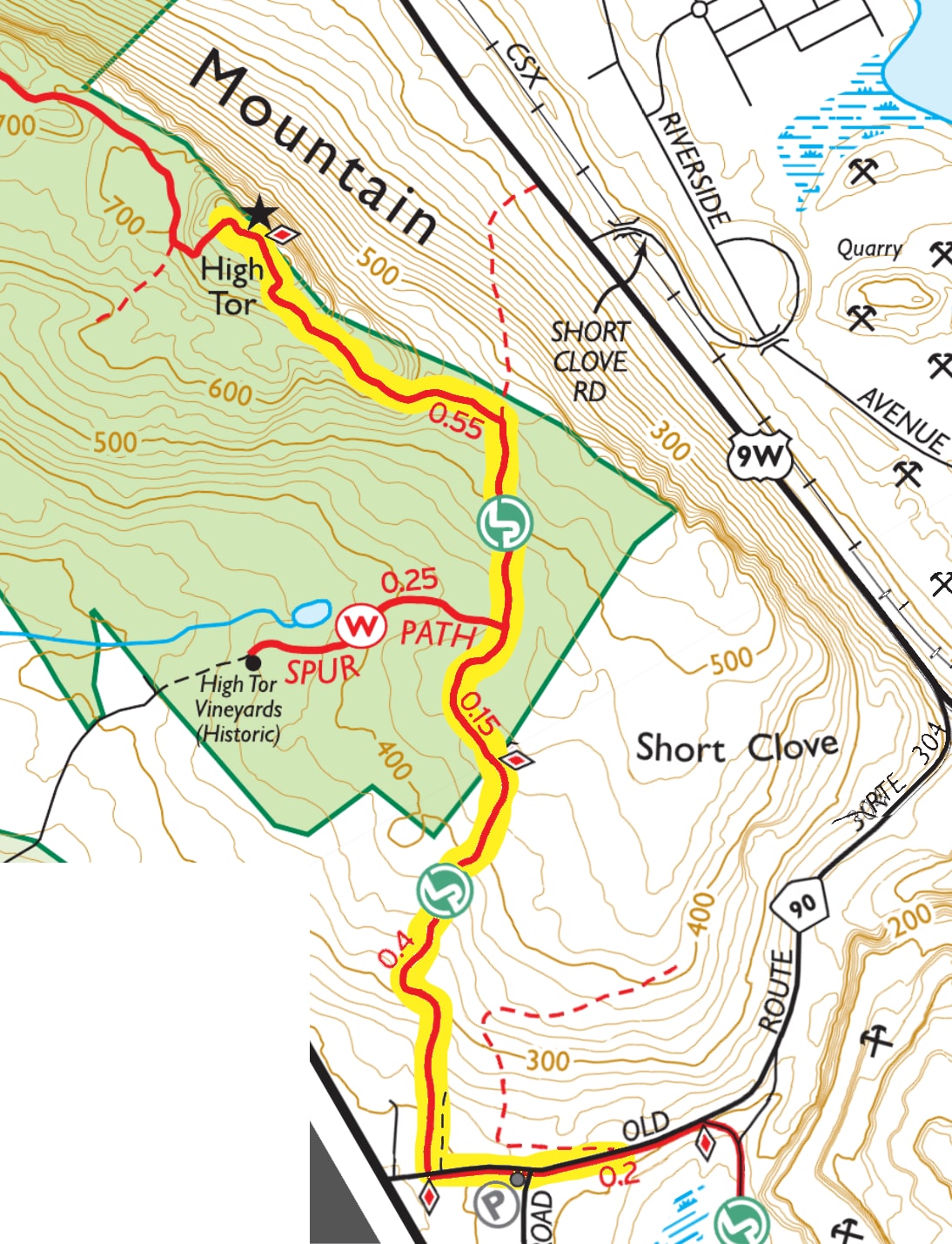
Spur Path to High Tor Vineyards
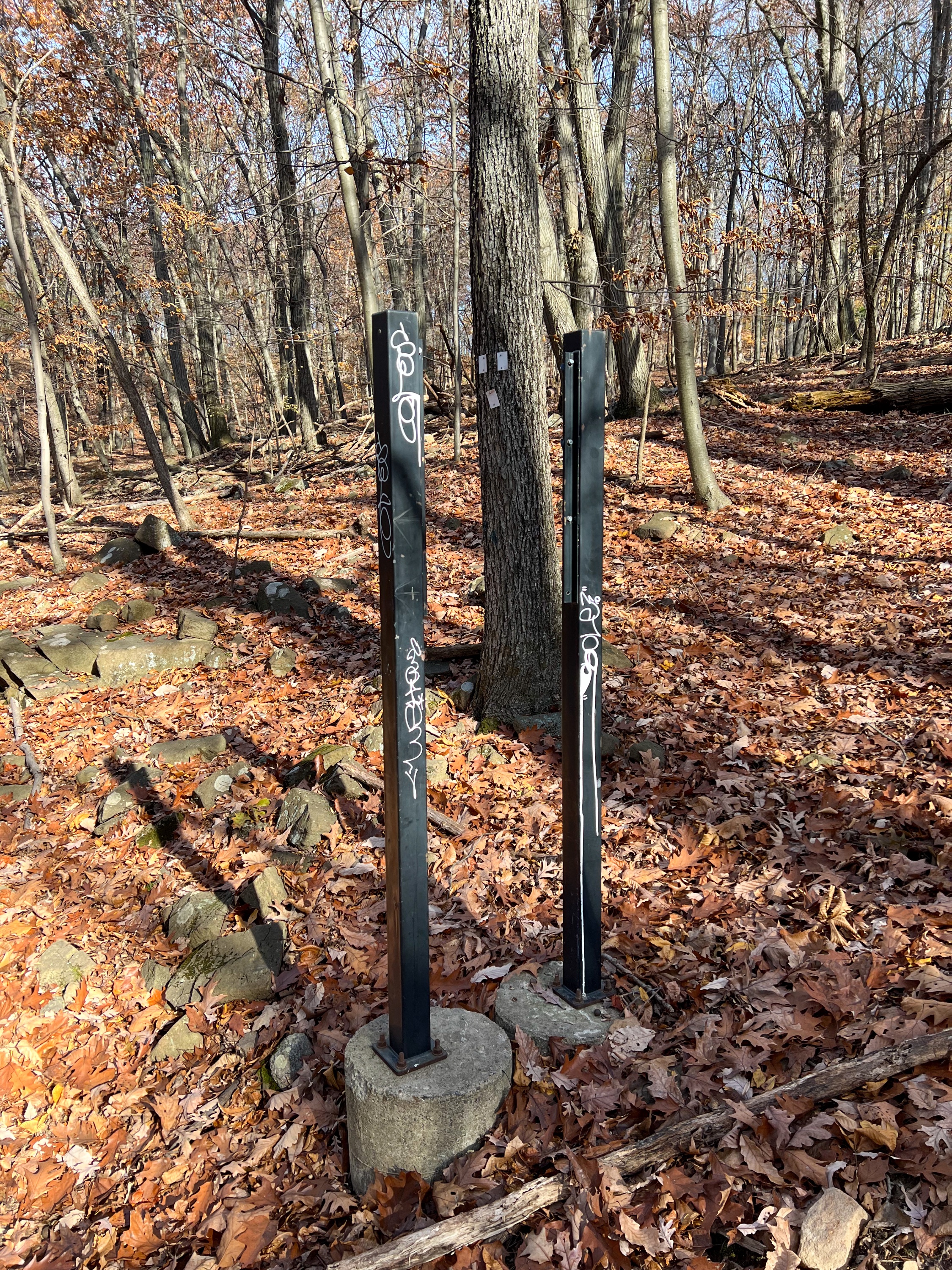
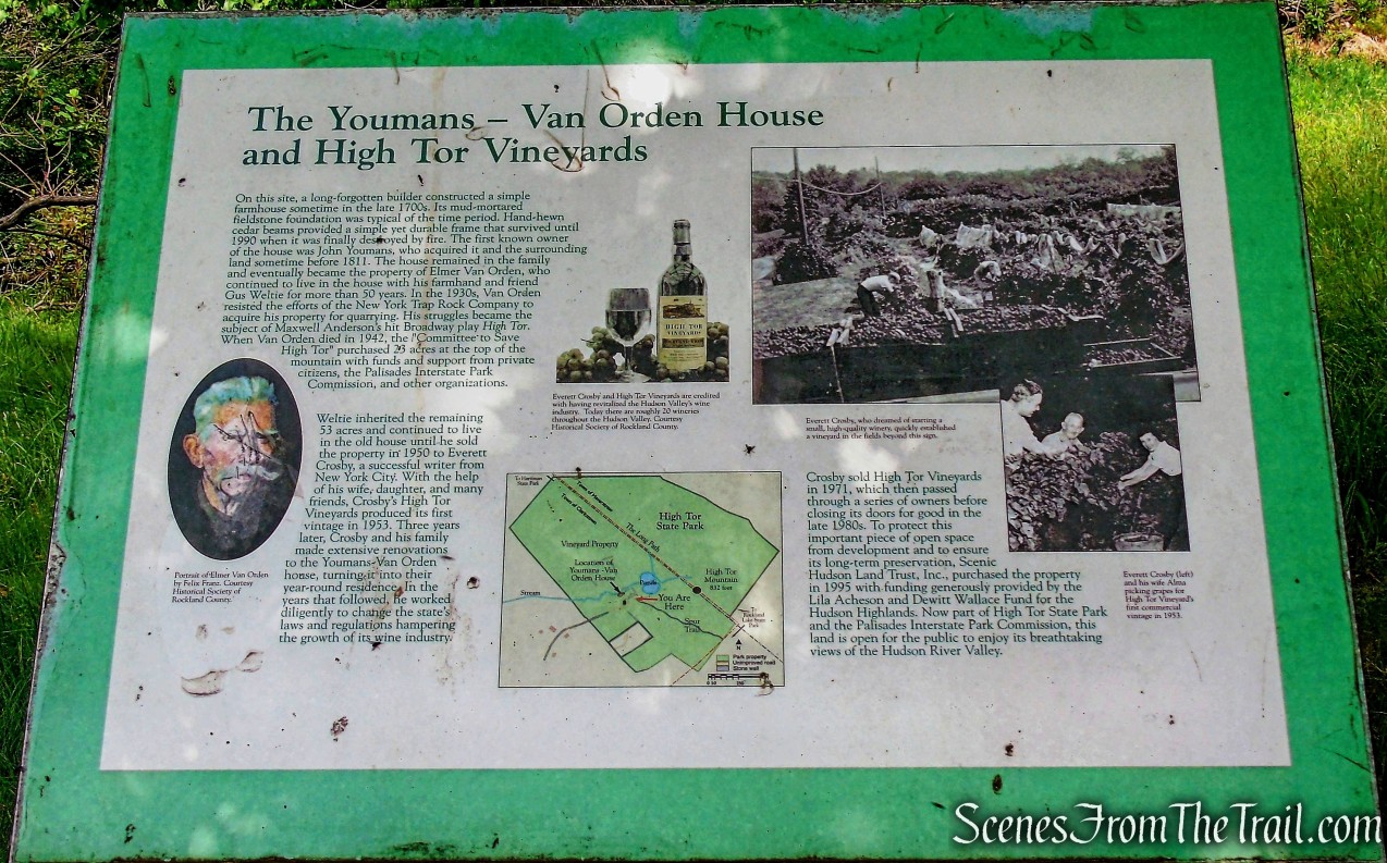
After climbing for about a half mile, the trail levels off and reaches a junction with a white-blazed spur path, which leads to the historic Youmans – Van Orden House and High Tor Vineyards (we will not turn onto the spur path). A post, with the sign unfortunately missing, is at the junction.
I found a photo of the sign that was previously here on Agile Trekker:
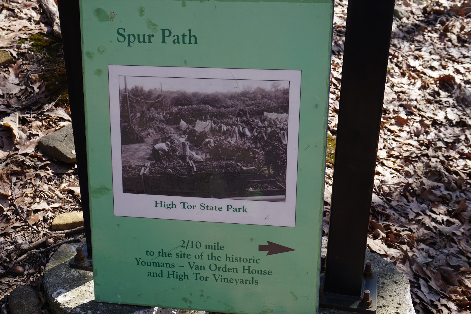
If you were to follow the white blazes slightly downhill for a quarter mile, you’ll reach the ruins of the Youmans-Van Orden House. We did not follow the spur trail, but a sign at the end of the spur trail provides some historic background for those who want to explore. Photo from Scenes from the Trail:
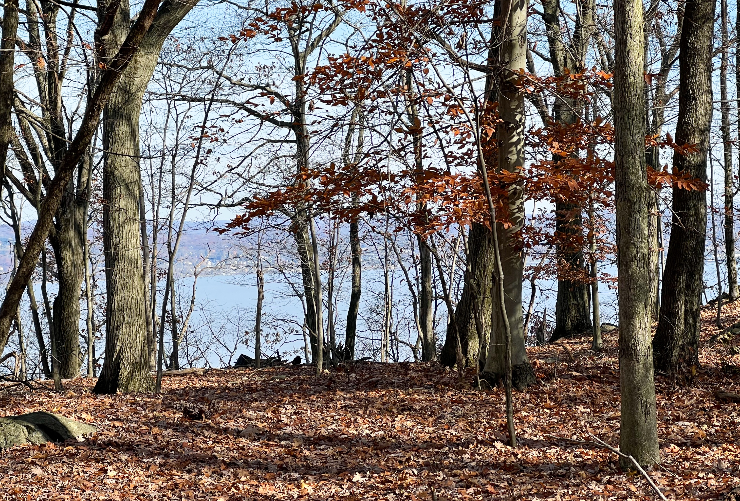
We will continue to follow the aqua blazes uphill. In about a quarter mile, you’ll reach the crest of the ridge. You can get your first glimpse of the Hudson River from here.
Here, an unmarked woods road continues straight downhill, but we will make a left to continue to follow the the aqua-blazed Long Path, which continues to climb.
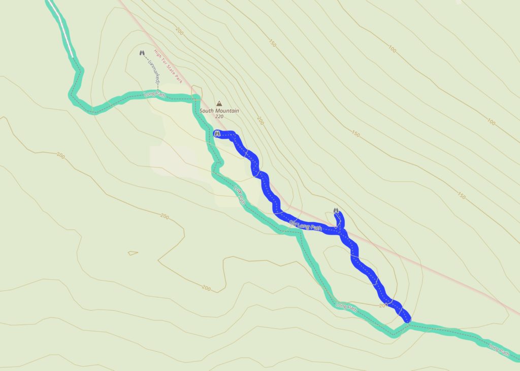
Long Path Splits – Blue or Aqua
After about another 0.2 miles, you’ll reach a junction where the trail splits and you have a choice to make – the blue or aqua route?
The old Long Path goes to the right, marked by blue blazes, while the current route of the Long Path heads to the left.
The map below shows the two trails.
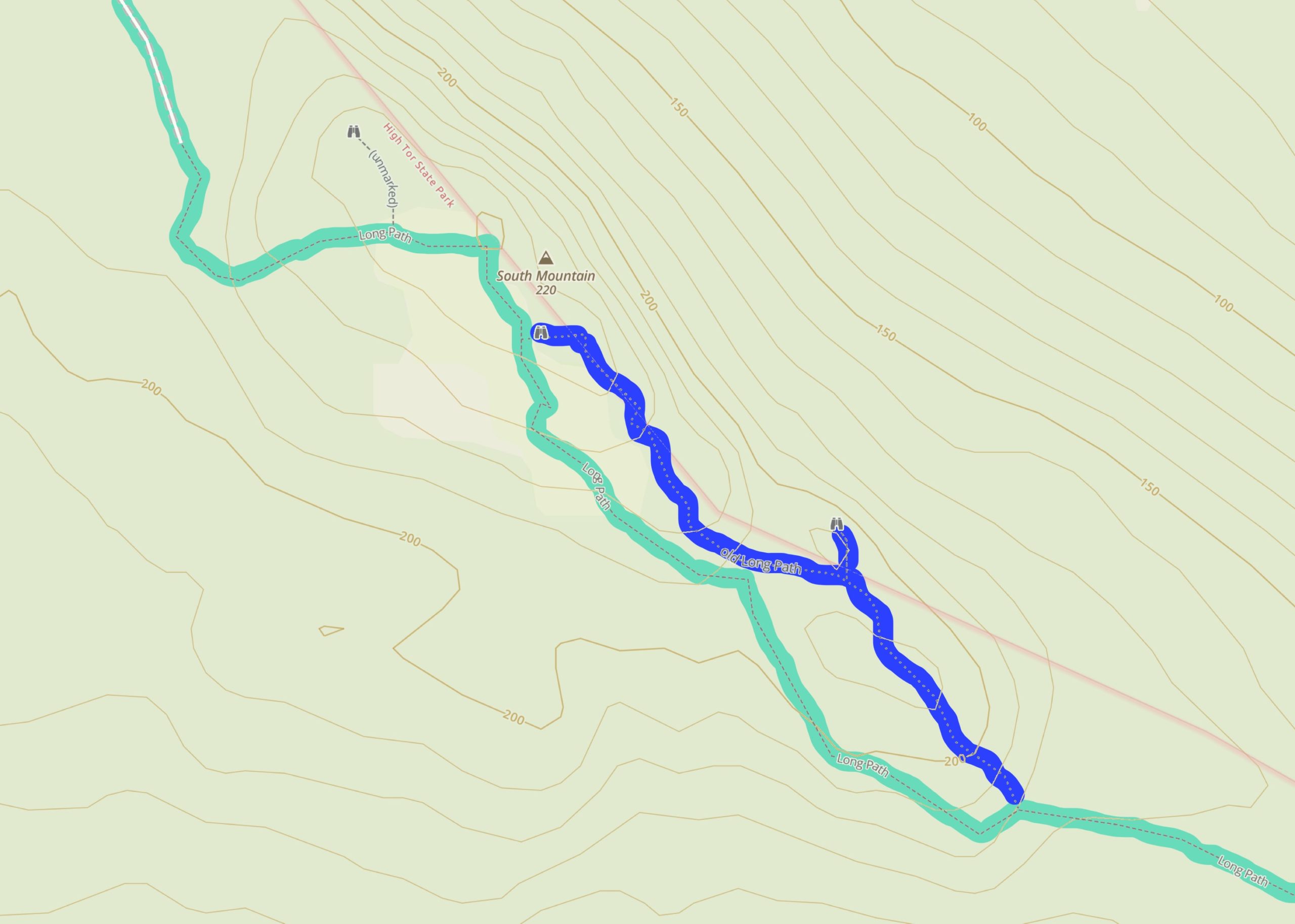
Blue Route
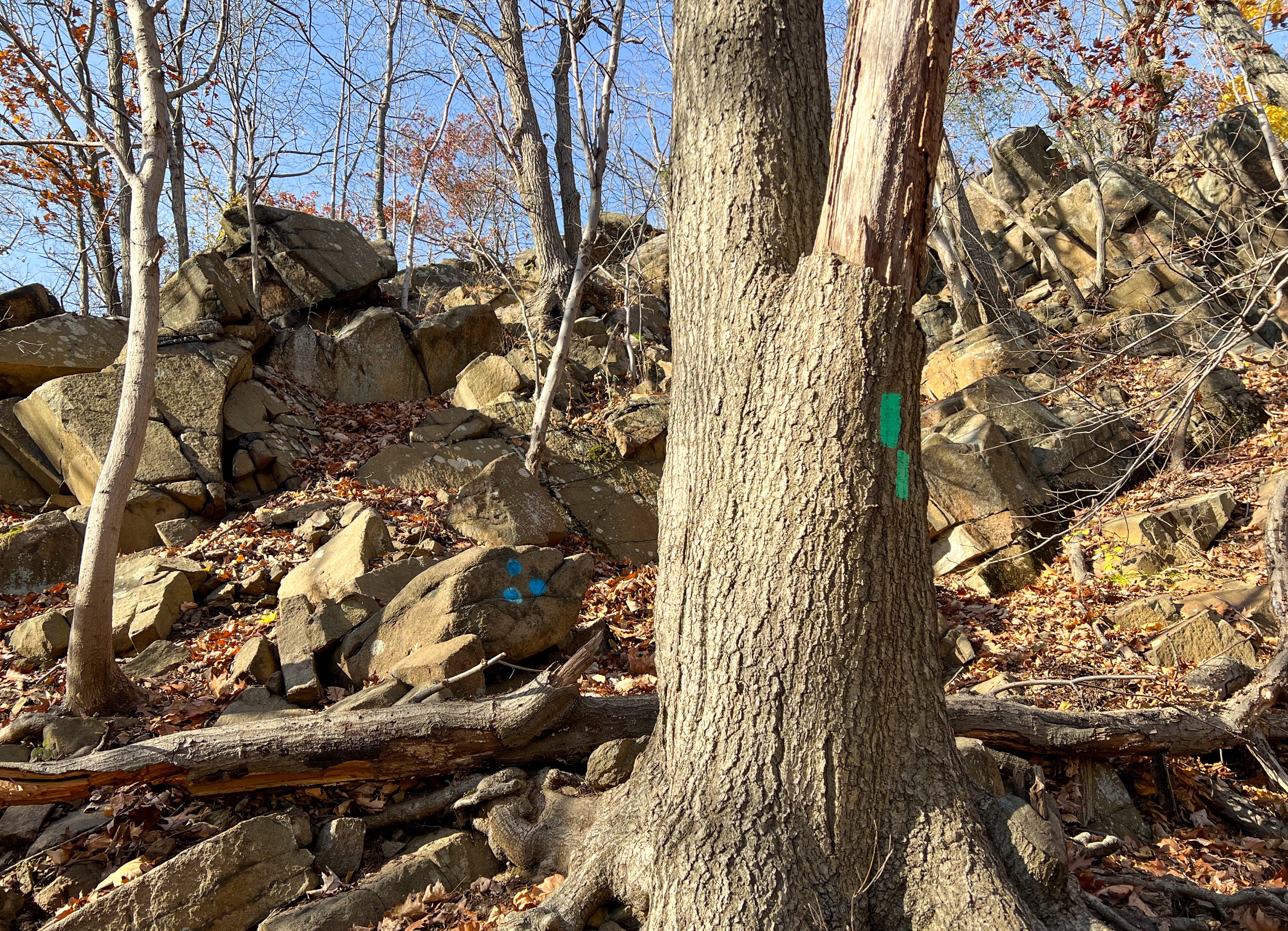
Three blue blazes on a rock mark the start of the old Long Path route, which follows a steeper route over a talus slope that includes rock scrambling, but which also offers more viewpoints that you can’t reach via the aqua trail.
Aqua Route
Alternative, you could follow the current aqua-blazed Long Path route heads to the left. This route is less steep and misses a few viewpoints, but both routes rejoin and take you to the main viewpoint at High Tor.
We opted to follow the blue route for the most part on the way to High Tor, and then returned via the aqua route.
Note that if you follow the blue route, the trail is not very well-marked. I highly suggest carrying a GPS-enabled map of the area (I used GaiaGPS, which shows both trails) and being comfortable with route-finding.
We first reached a rock outcrop with views over Haverstraw.
The trail descends into a saddle and then begin a relatively steep climb. At the top of the climb are some views of the river and a quarry to the south.
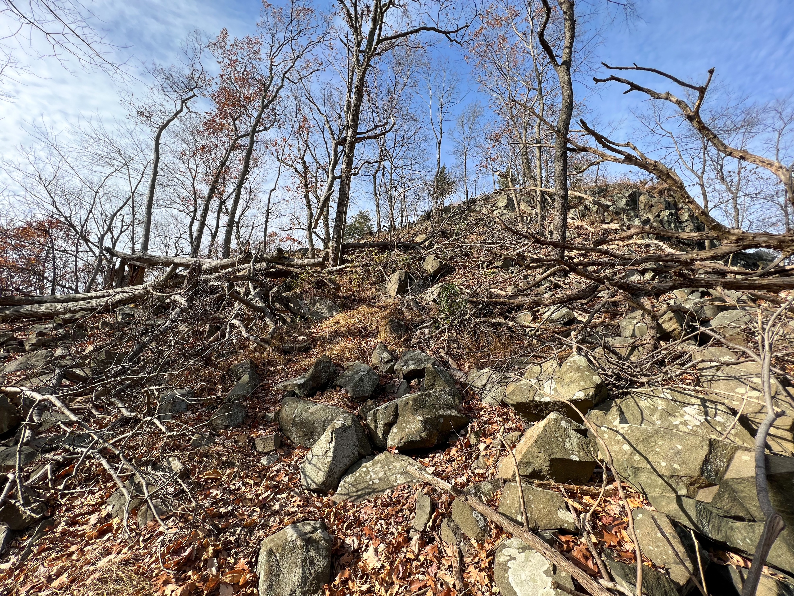
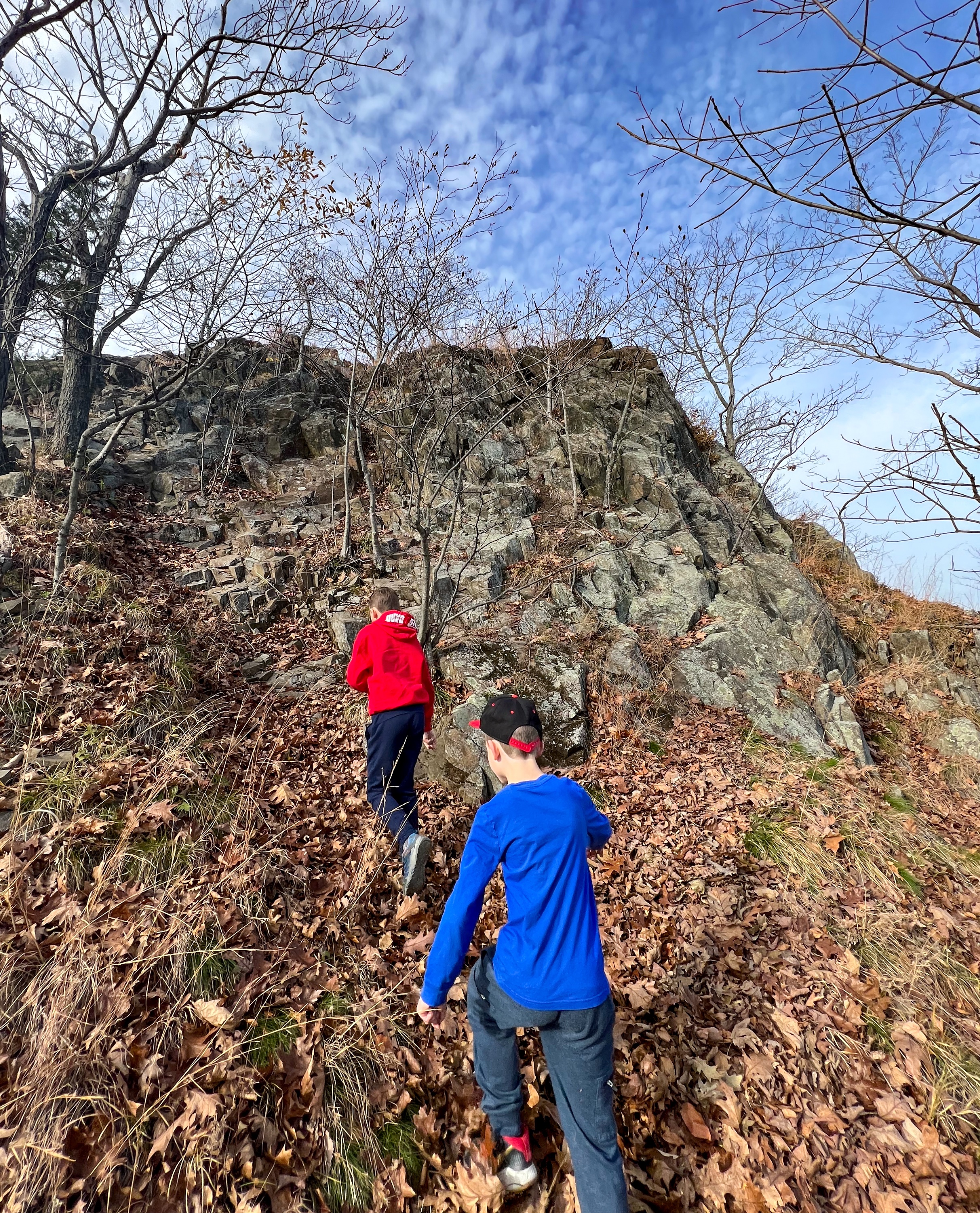
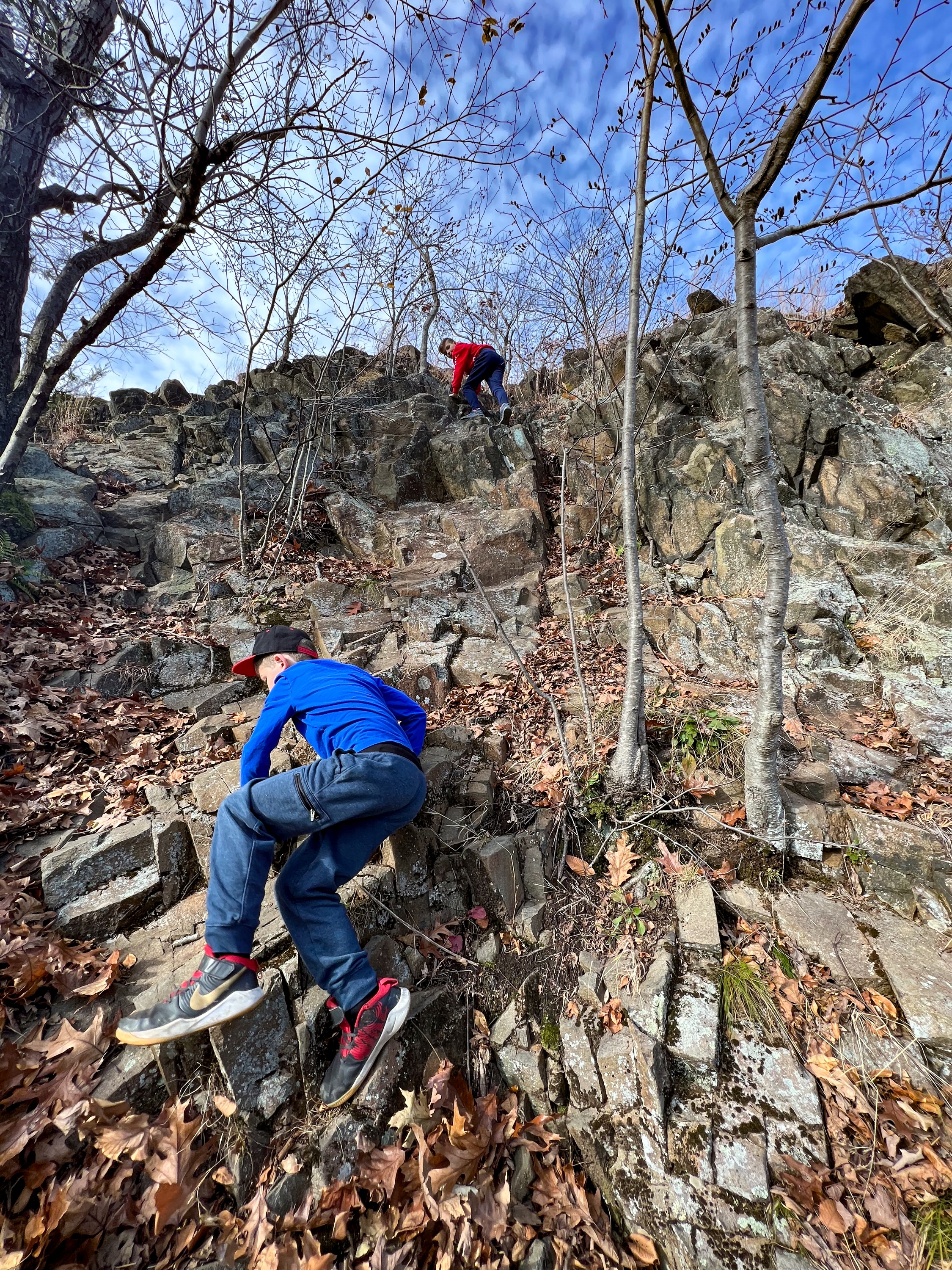
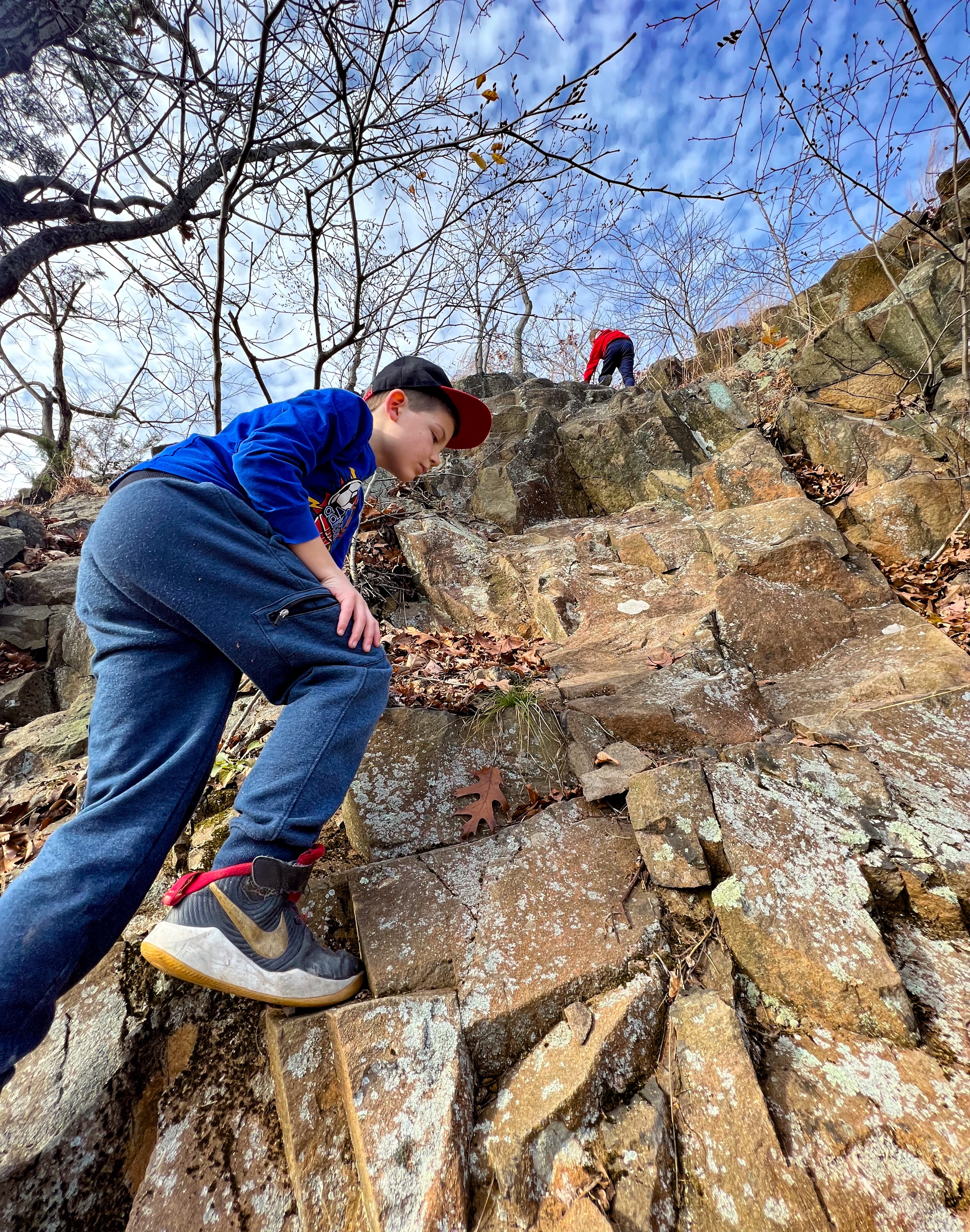
Keep going, and now the trail will follow a very steep rocky route that will require using your hands to scramble up. This was the most fun part for our kids.
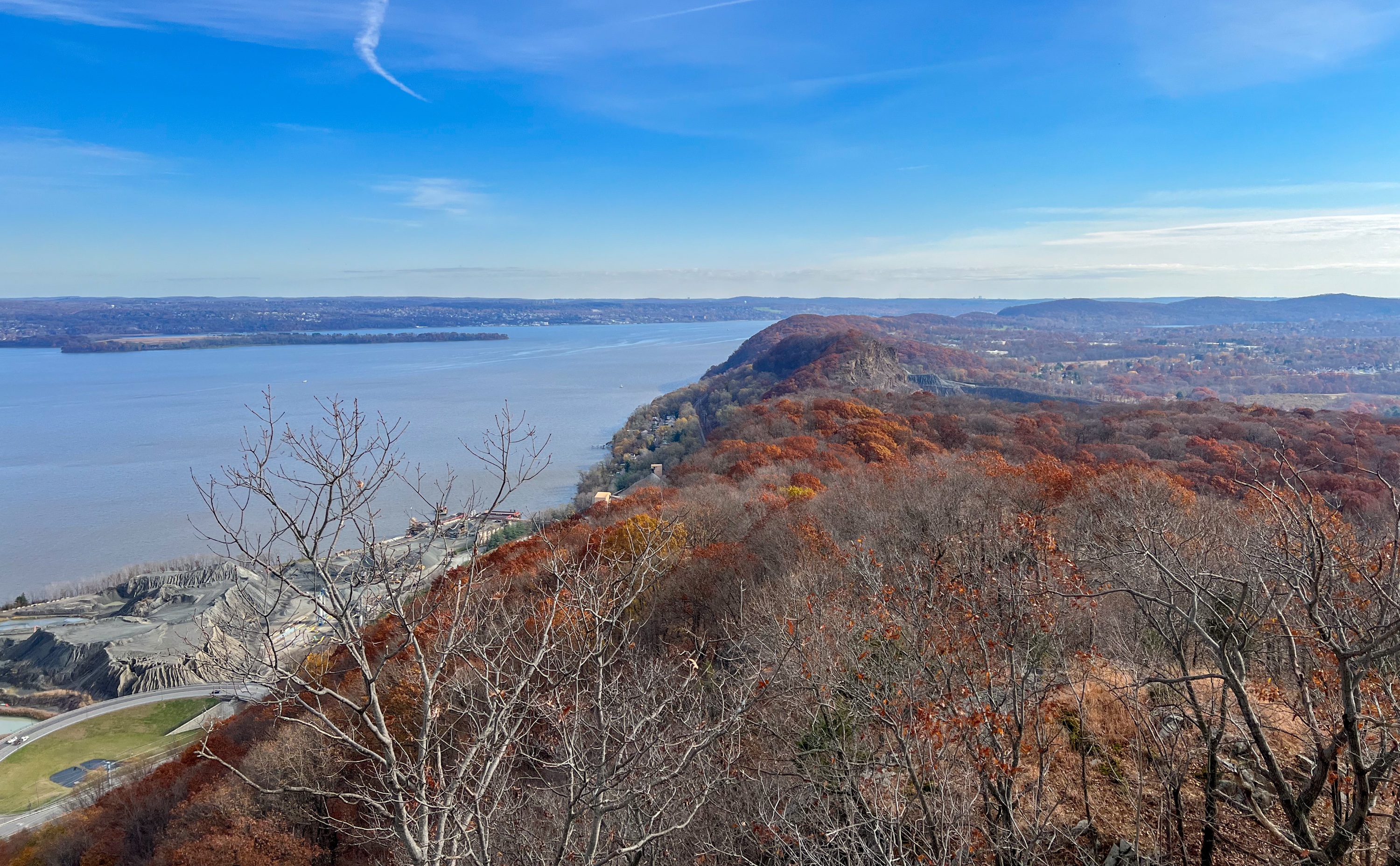
Following this climb, you’re treated to more views of the river to the east and Lake DeForest to the south. In the distance you can see the New York City skyline on a clear day.

Continue to follow the trail north and you’ll soon see a big rock outcrop.
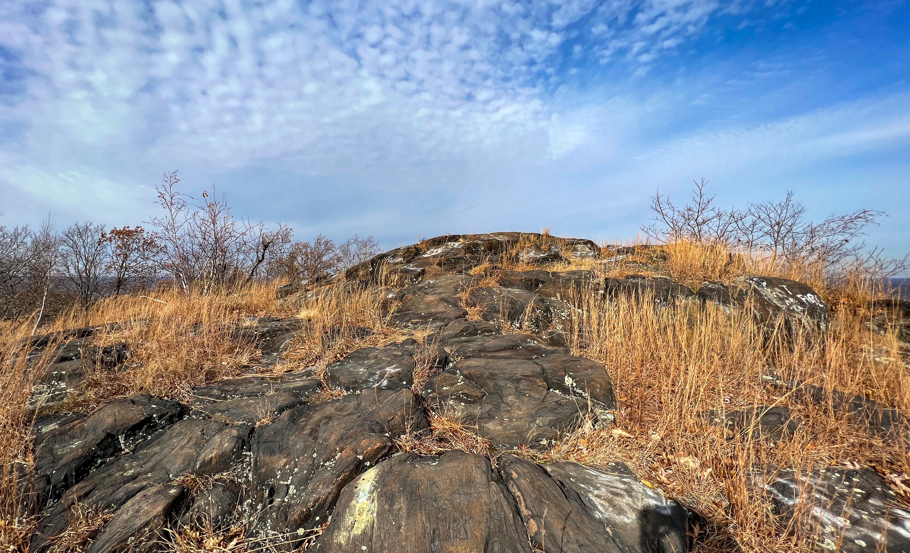
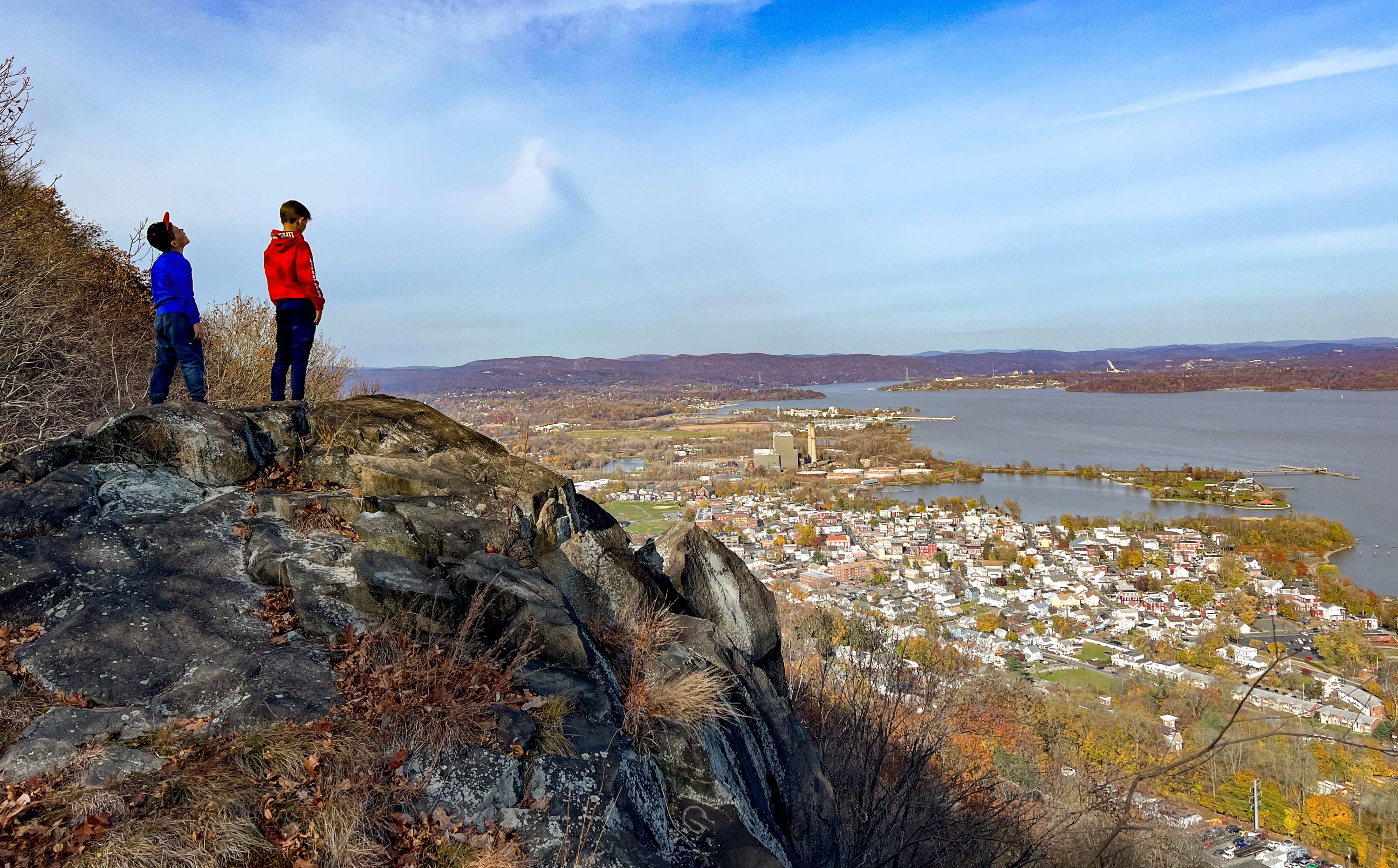
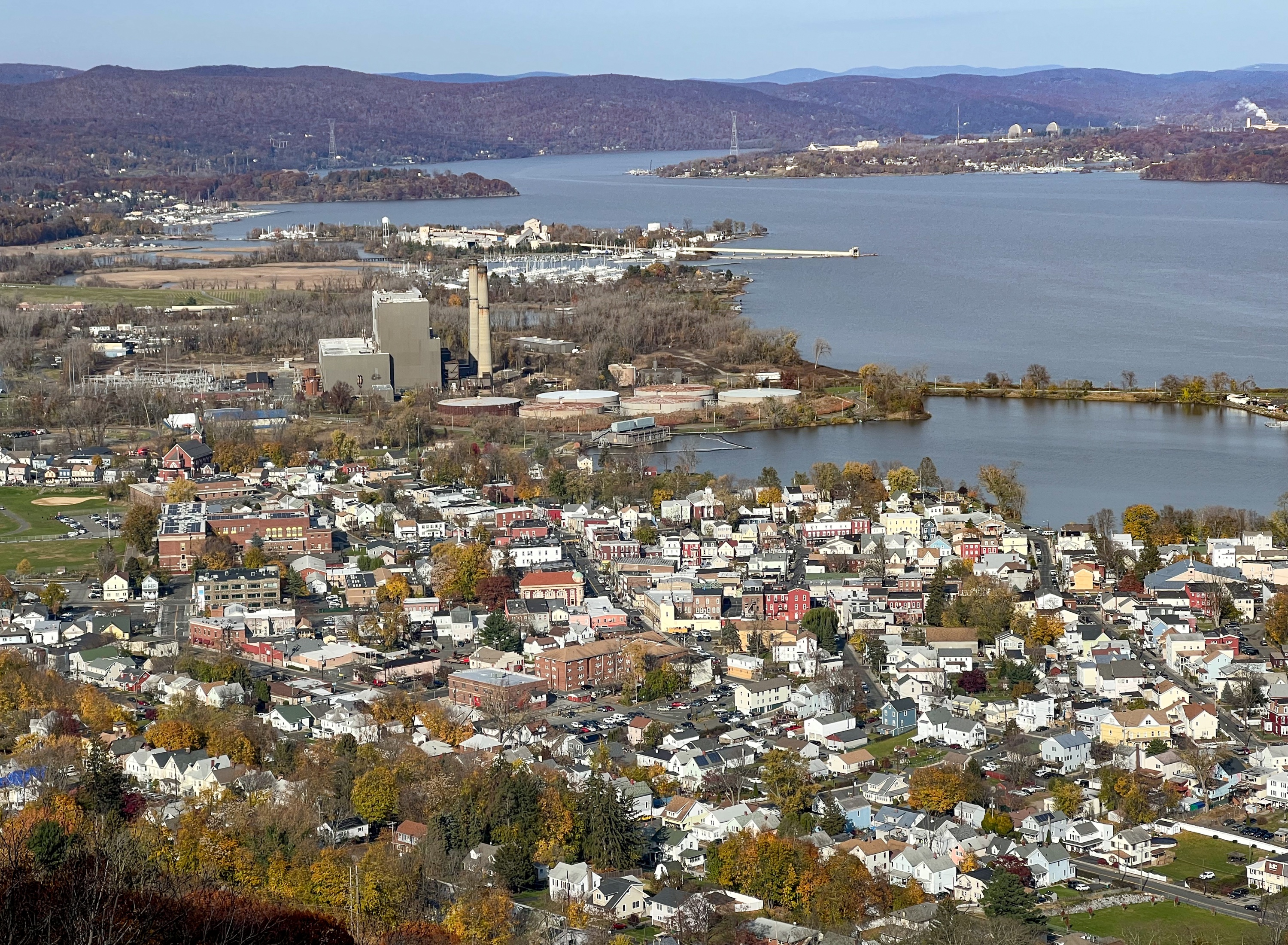
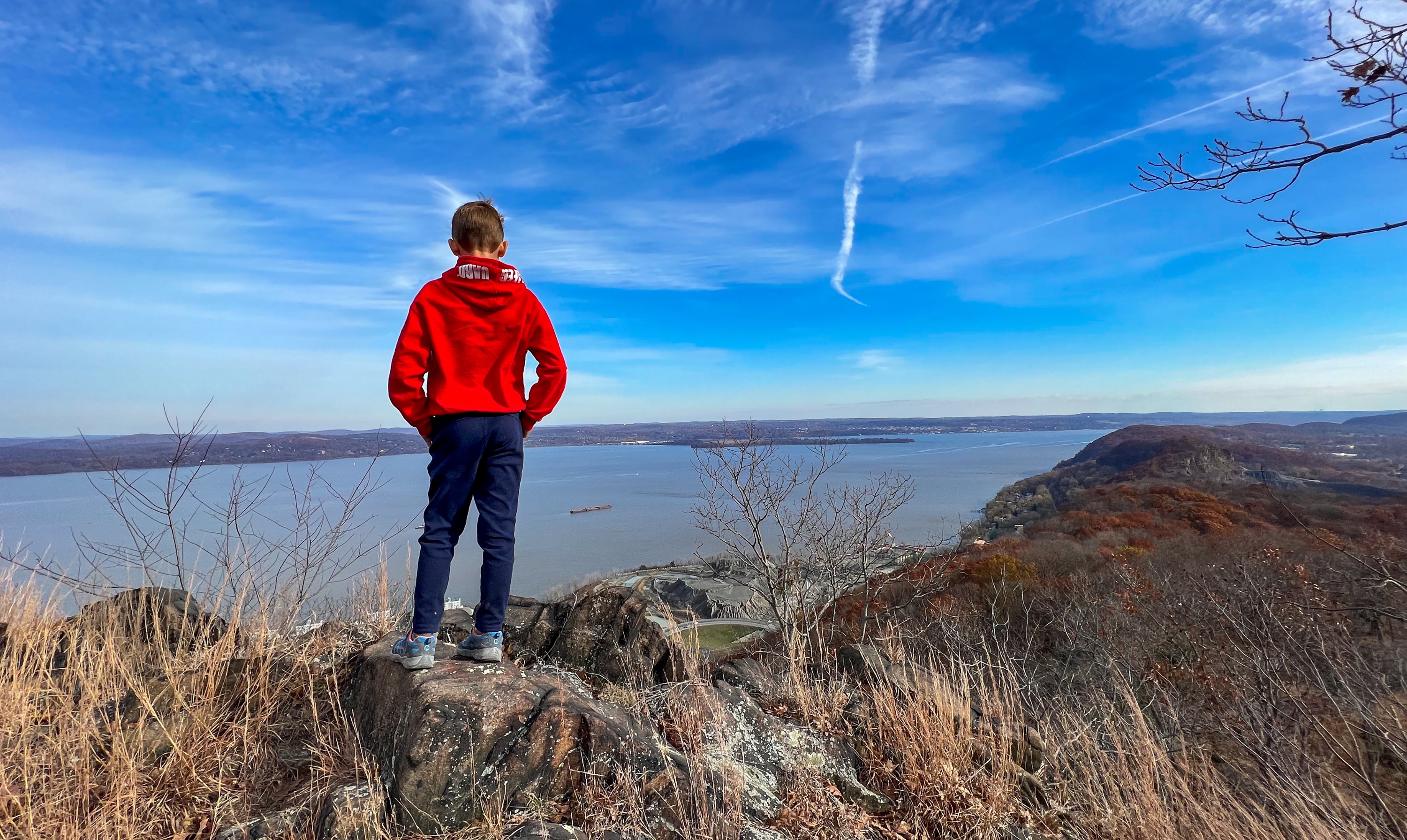
You’ve now reach the 832-foot High Tor summit – the highest peak of the Hudson Palisades – with panoramic views in all directions. To the north and east are views of Haverstraw and the Hudson River.
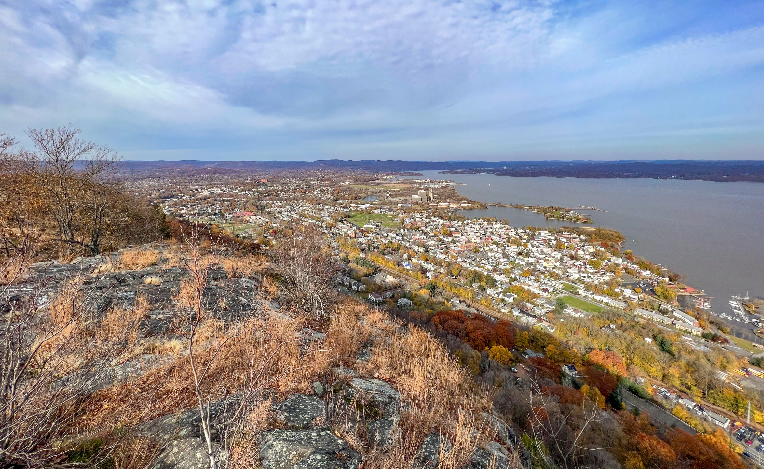
To the south are views of Lake DeForest, a reservoir, and the New York City skyline.
-
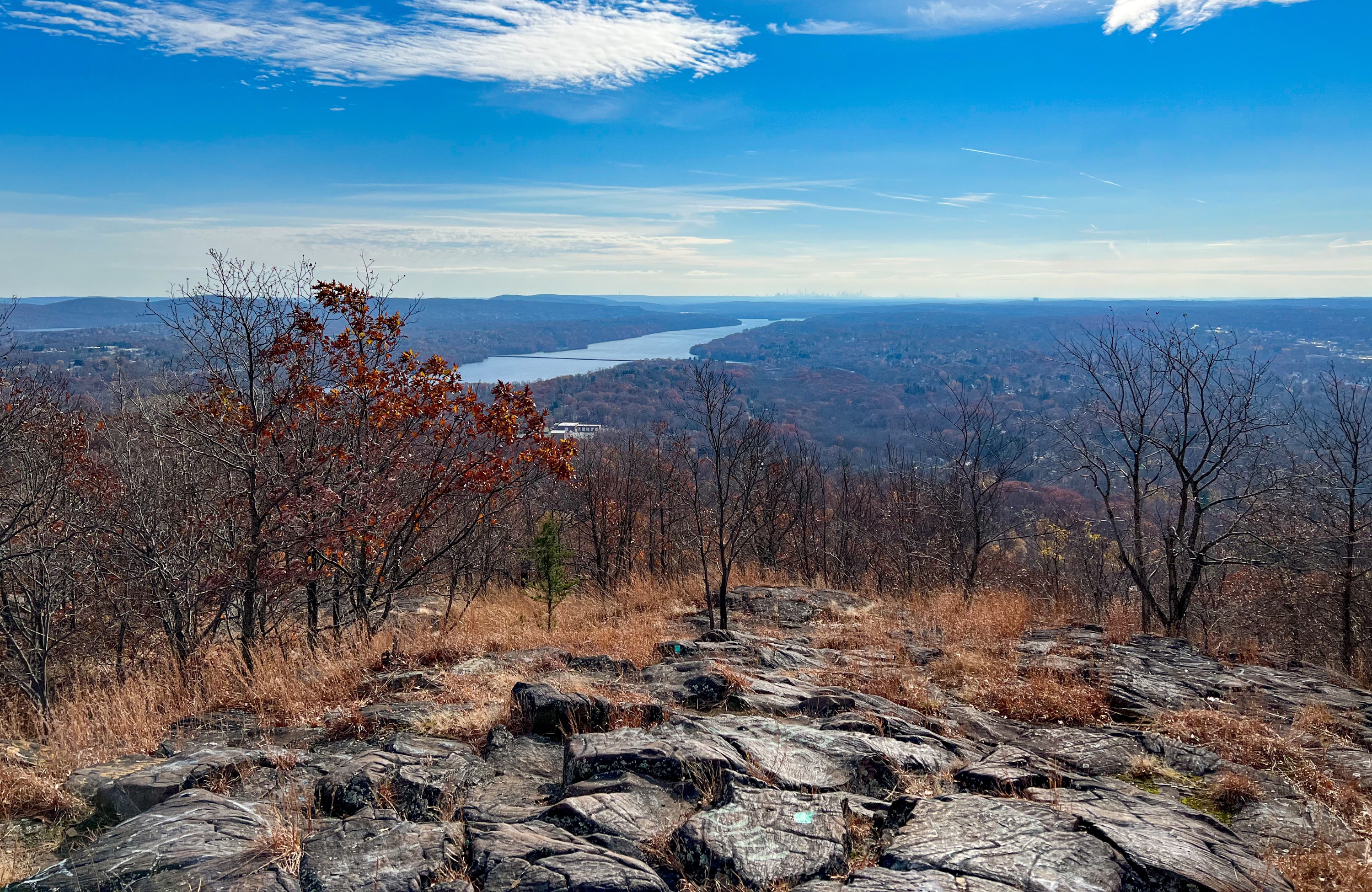
Lake DeForest -

Lake DeForest and NYC Skyline
After you enjoy a break here, retrace your steps back to the car.
History of High Tor as a strategic observation and beacon site
High Tor is on the ancestral lands of the Munsee Lenape people.
“The Indians used High Tor as a lookout against enemies coming down from the north or out of the west.”
Journal-News, July 1, 1966
It was on High Tor, according to legend, that the local Lenape tribespeople first spied a ship full of Dutchmen coming up the river in 1609.
Judith Richardson
During the American Revolution, High Tor was used as a signal point, with troops setting fires when they spotted British troops heading up the Hudson.
The summit also had an air beacon, described in 1932 by the US Army Corps of Engineers as “a tall steel structure supporting a revolving aerial light as we as two flight lights.”
The airplane warning beacon that flashed steadily through the night for the passenger lines going to and from New York City…The beacon was darkened only in World War II during the air raid alerts and the Civil Defense tests”
Journal-News, July 1, 1966
A July 1, 1966 story in the The Rockland County Journal-News about High Tor includes a photo of the air beacon.
A January 1957 New York Times story was titled “High Tor’s Beacon to Glow No More” however the next month, another story is titled “High Tor Beacon Flashes Again; Civil Air Patrol Will Maintain it.” In 1962, the beacon appears again in the New York Times in a story titled “Threat to Beacon On High Tor Stirs Haverstraw Again; Light Darkened by Vandals“. An August 14, 1963 a headline in the Journal-News announces “Knell Tolled for High Tor Beacon Light.”
A 1966 story notes that “Finally, despite a great public outcry, the beacon was extinguished and taken down a few years ago, having become an anachronism of the high-flying supersonic age.”
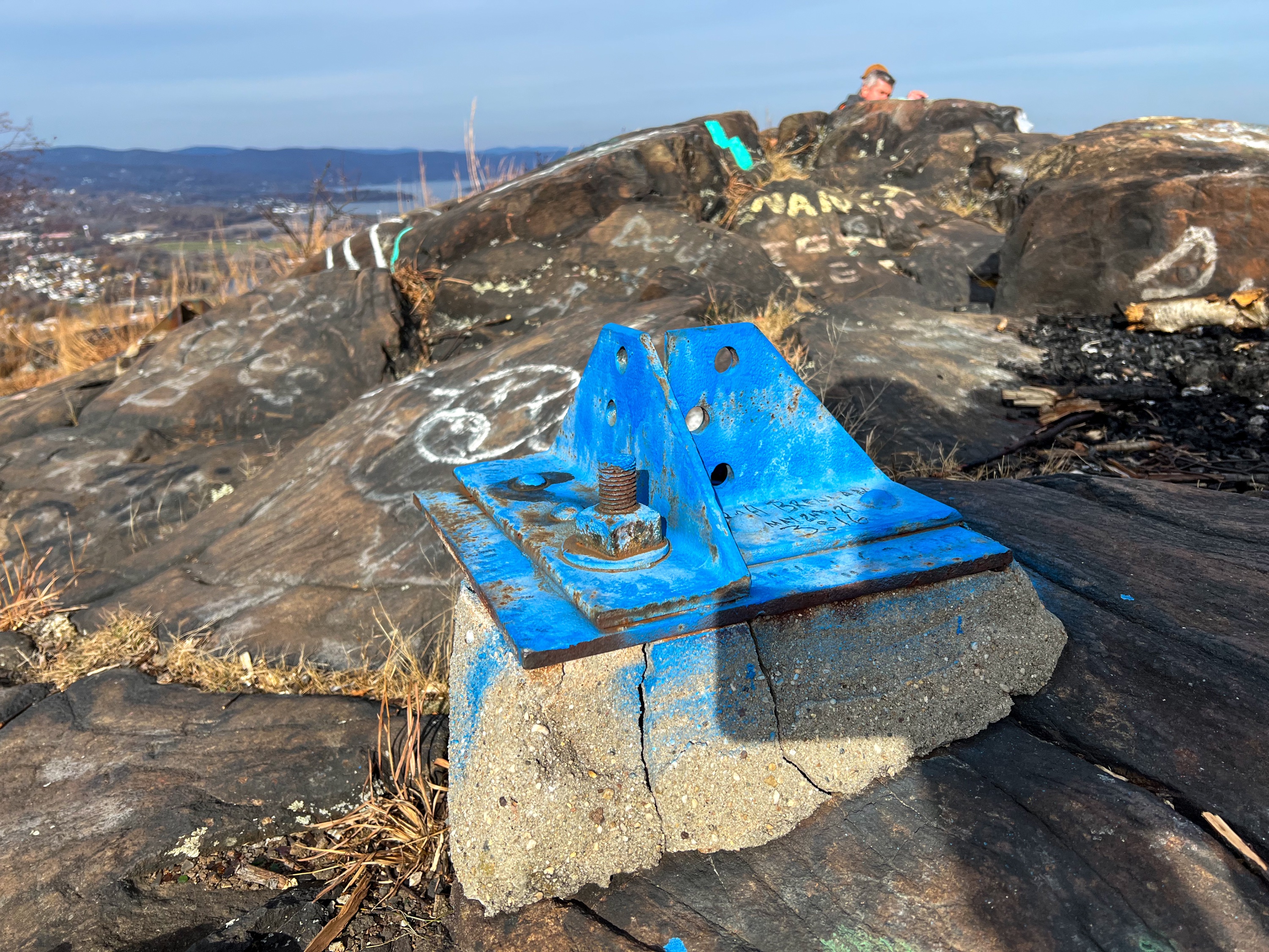
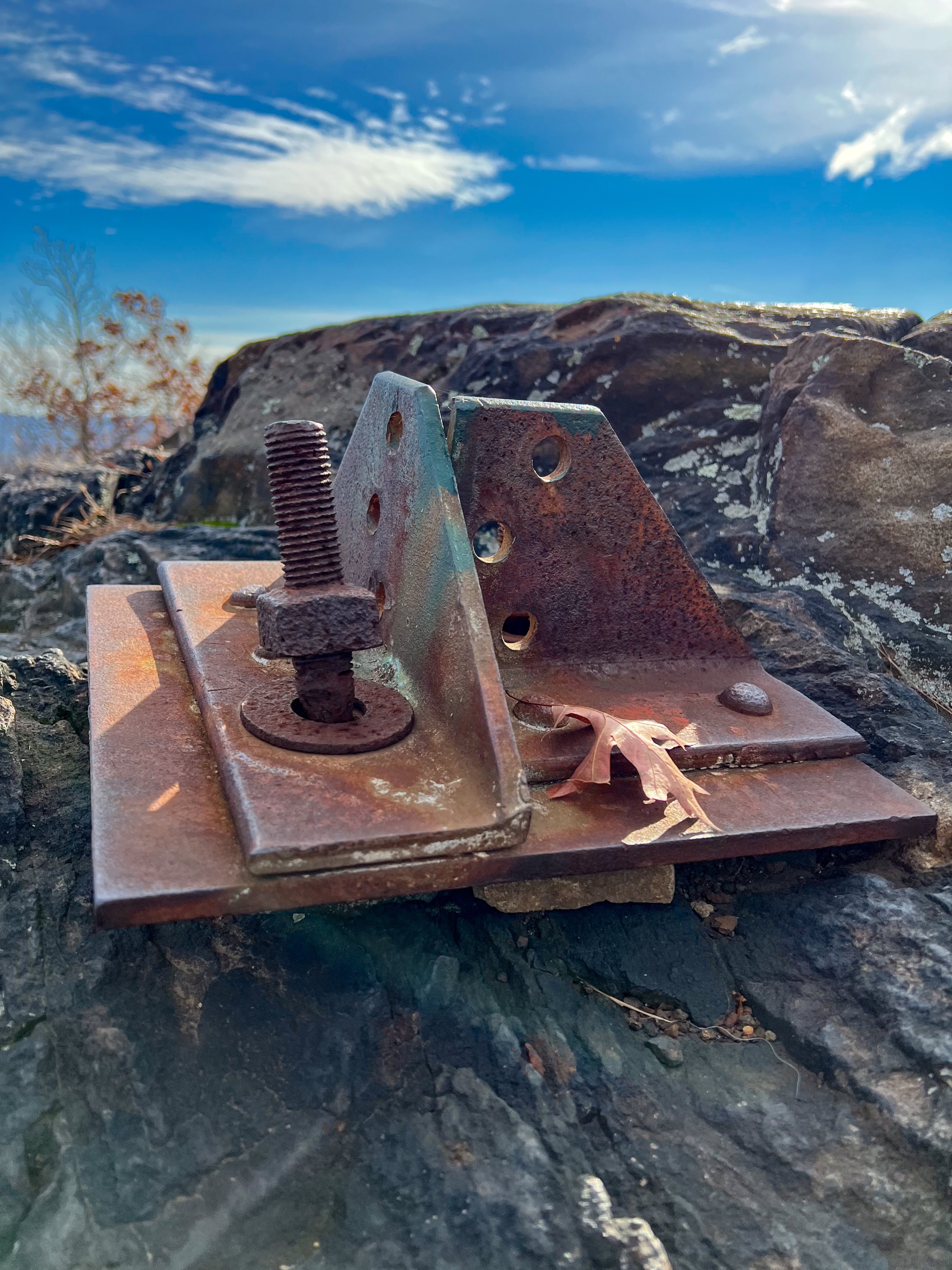
By 1964, the air beacon was gone, however the four steel and concrete footings for the air beacon still remain.