Overview
One of the best hikes in New Jersey – this out-and-back hike visits two of the top destinations along the Appalachian Trail – Raccoon Ridge and Sunfish Pond. It offers multiple great ridgeline views, including panoramic vistas from Raccoon Ridge, and turns around at the beautiful glacial lake Sunfish pond – a great spot for to rest for a break before turning around.
Hike Length: 8.7 miles
Elevation Gain: 1,520 feet

Location: Delaware Water Gap National Recreation Area, Worthington State Forest, Hardwick Twp, NJ
Nearby hikes: Appalachian Trail (Delaware Water Gap), Mt. Tammany and Sunfish Pond loop, Garvey Springs & Douglas Loop
Parking for Sunfish Pond and Raccoon Ridge
Park and leave your car on the shoulder where Camp Road (Camp Mohican Road) intersects the Appalachian Trail. The road ends at the Mohican Outdoor Center, so if you reached it, you’ve gone too far.
Sunfish Pond and Raccoon Ridge Trail Maps
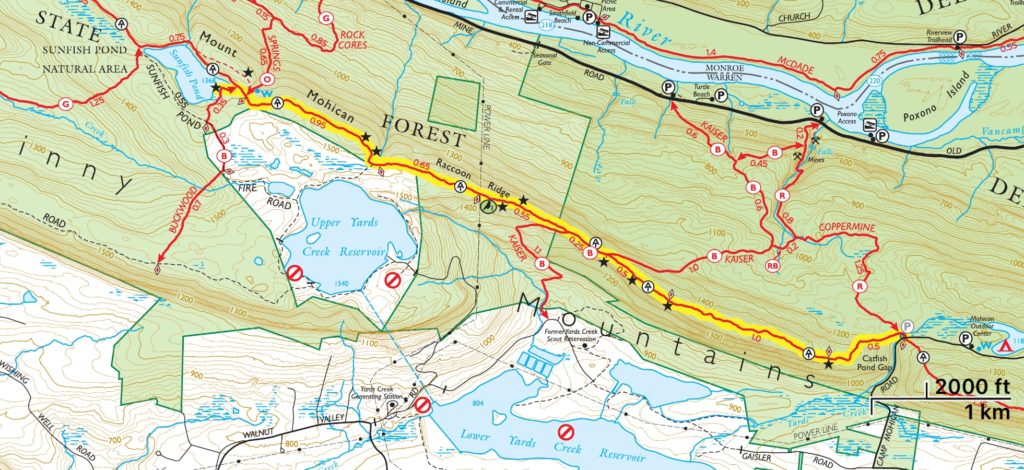
- Worthington State Forest (NY-NJ Trail Conference map) – Shows Raccoon Ridge and Sunfish Pond on the map but does not go all the way north to Camp Road.
- Delaware Water Gap & Kittatinny Trails Map – NY-NJ Trail Conference print map
- Delaware Water Gap & Kittatinny Trails Map – NY-NJ Trail Conference Avenza map
Sunfish Pond and Raccoon Ridge Trail description
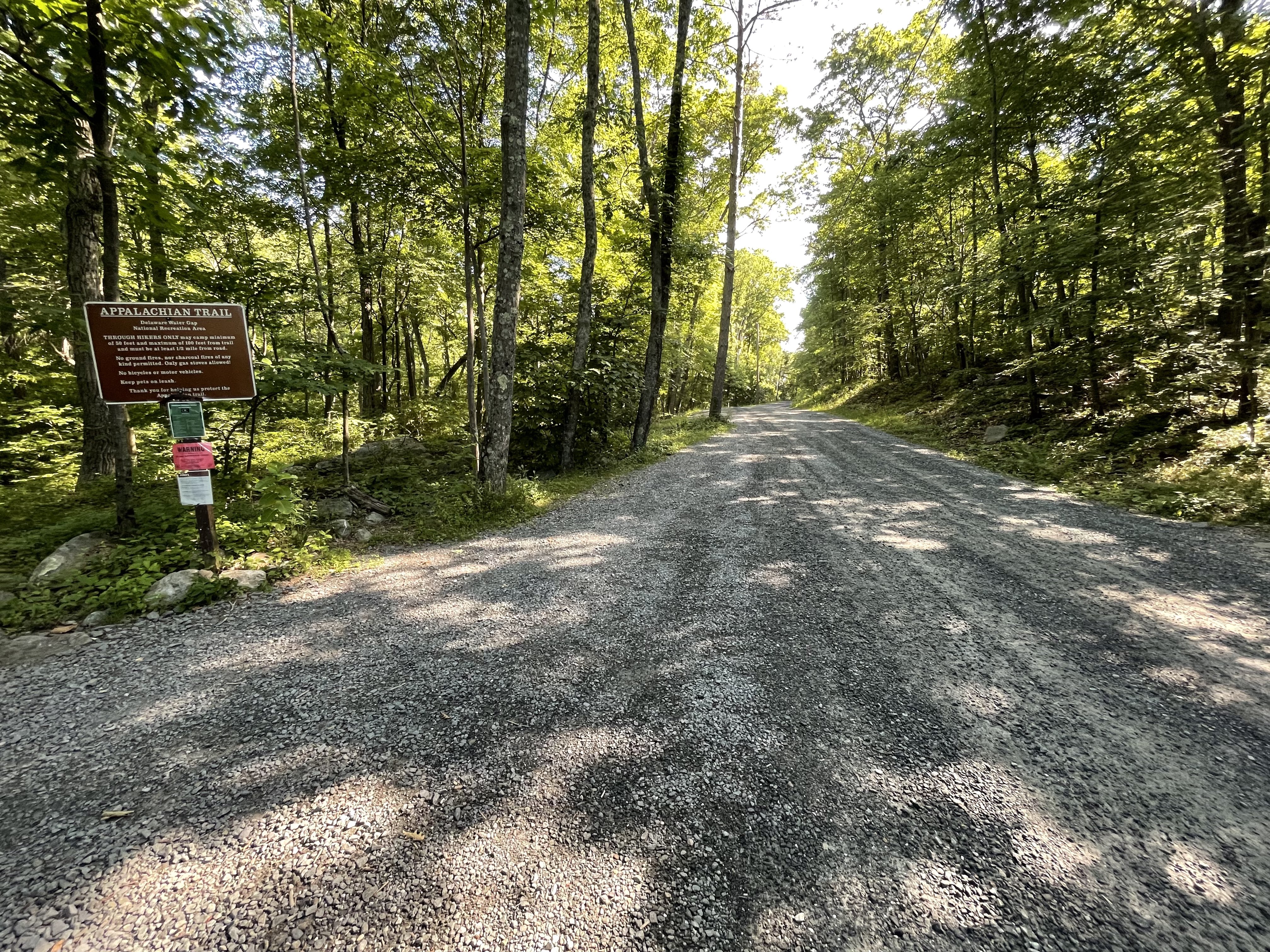
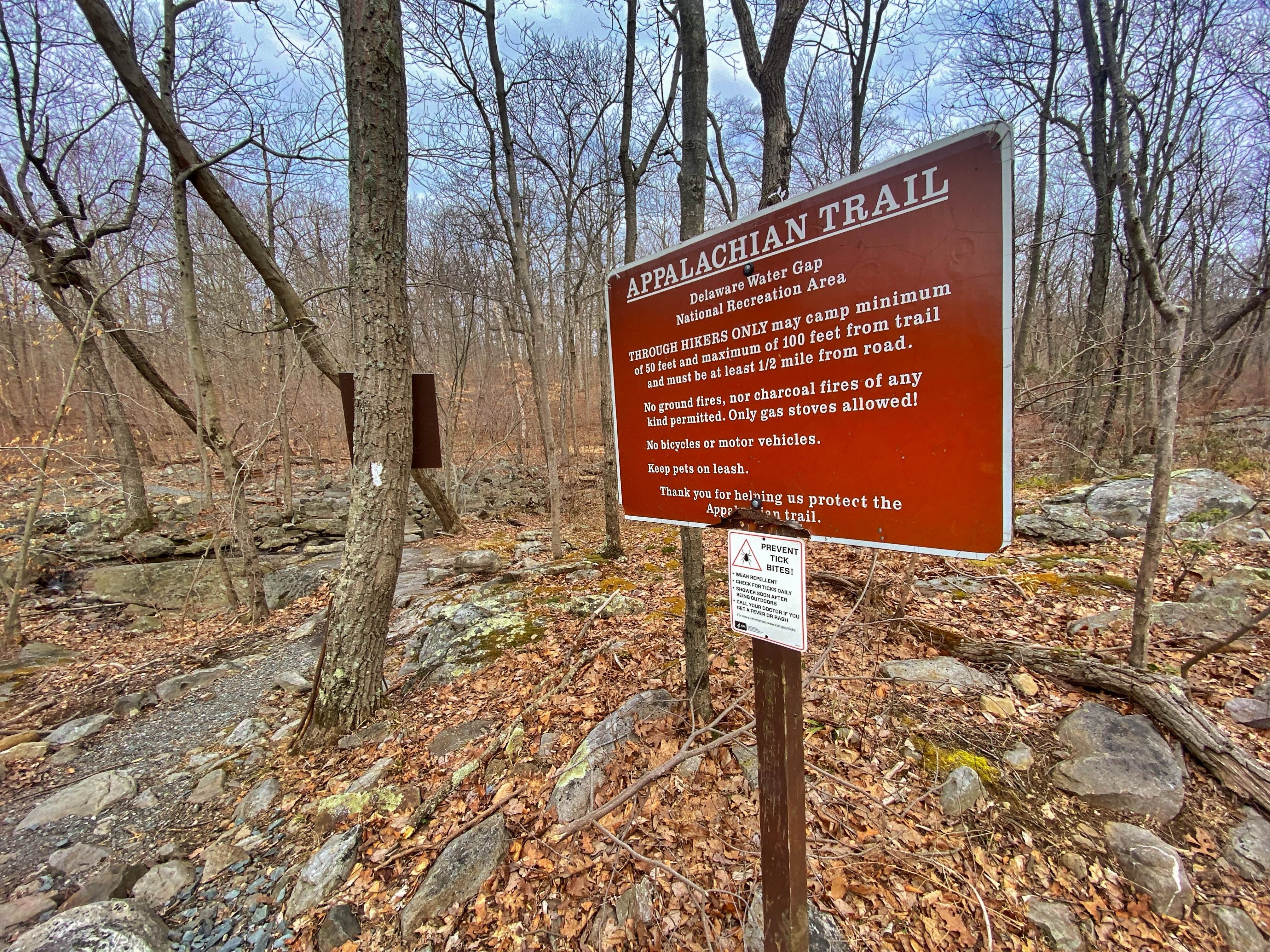
Starting from Camp Road (formerly Mohican Road), look for the sign on the south side of the road for the Appalachian Trail.
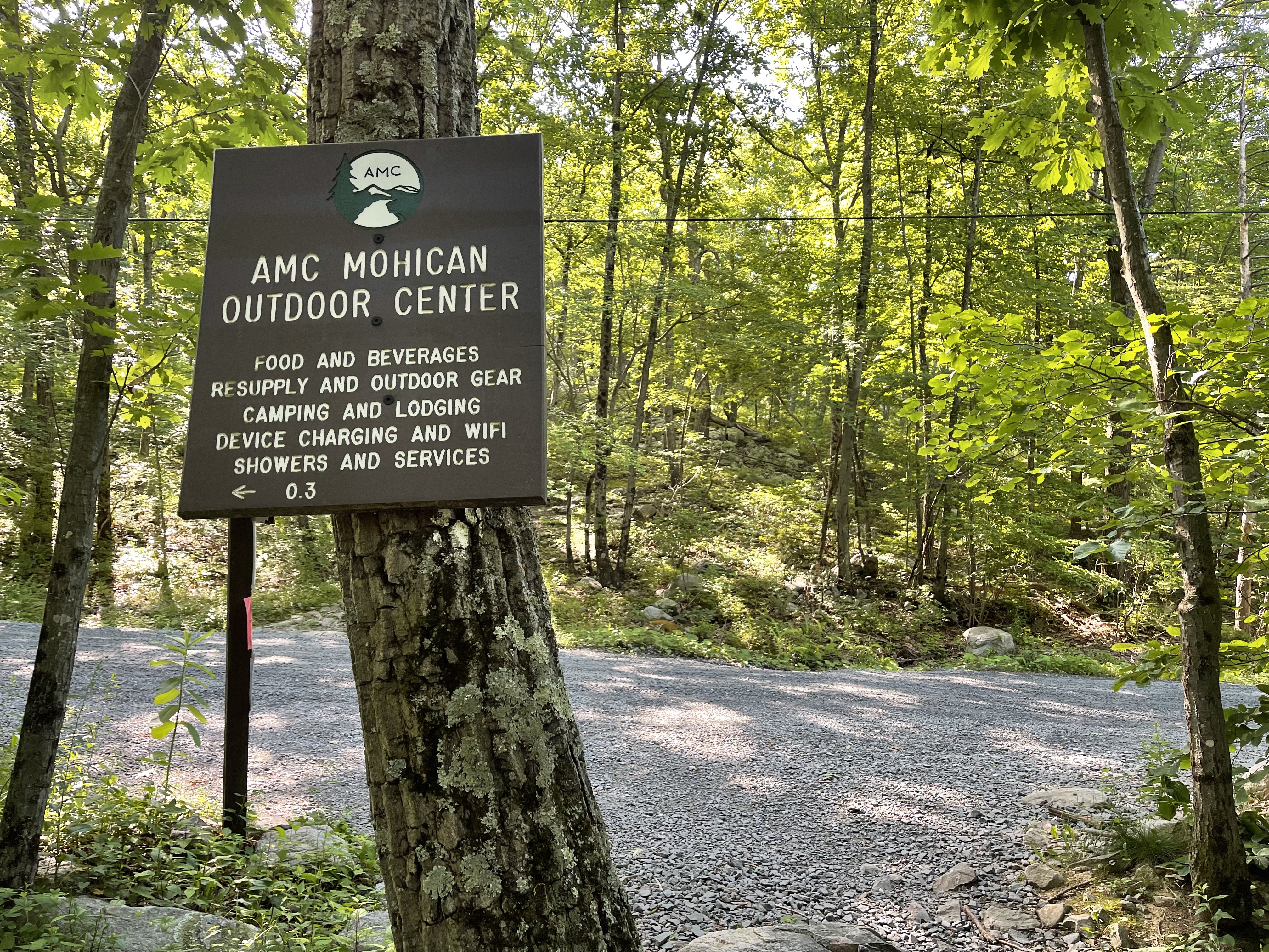
Immediately as you enter, you’ll reach a footbridge that crosses over Yards Creek. If you turn around, you’ll see a sign on a tree that points hikers to the nearby for the AMC Mohican Outdoor Center – just 0.3 miles up the road, and a great stop for backpackers that offers food, wifi, showers, and more.
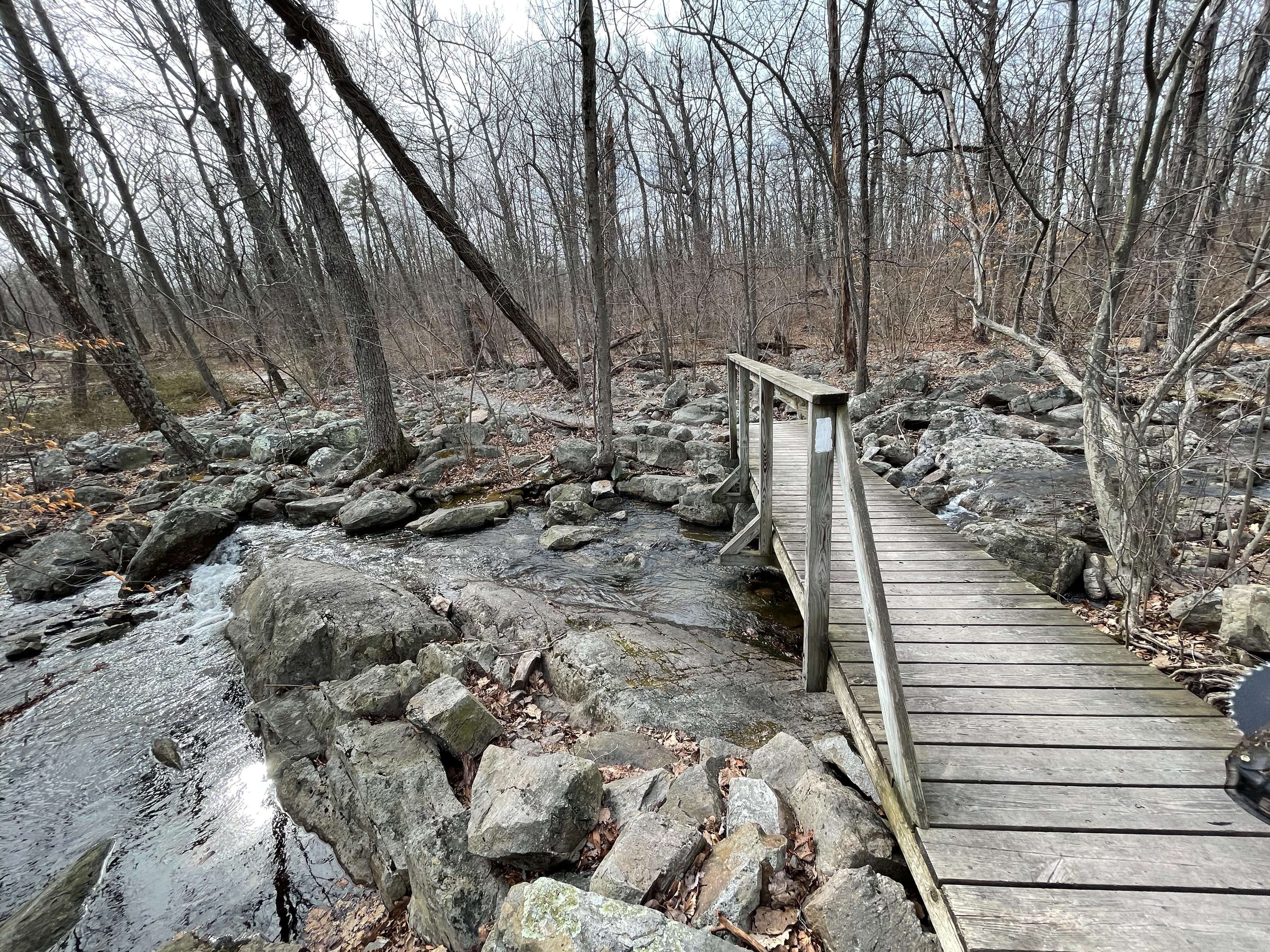
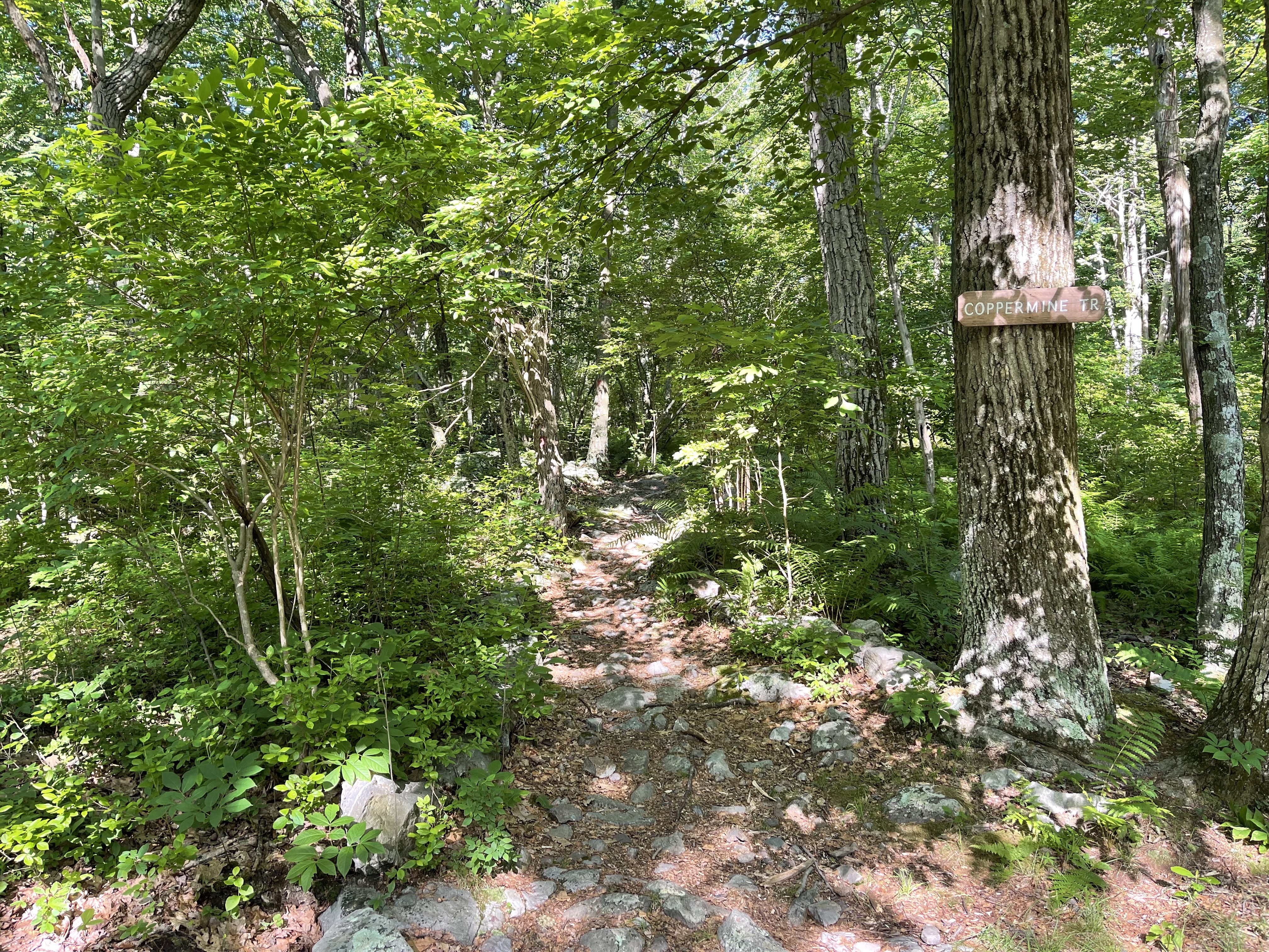
You’ll almost immediately reach a junction with the Coppermine Trail on the right.
Just beyond, the trail ascends along an exposed section of rock.

About a half mile in, look on your left for an opening that looks suitable as a tent site. Continue through the bushes and descend slightly to get your first ridgeline view of Kittatinny Valley below.

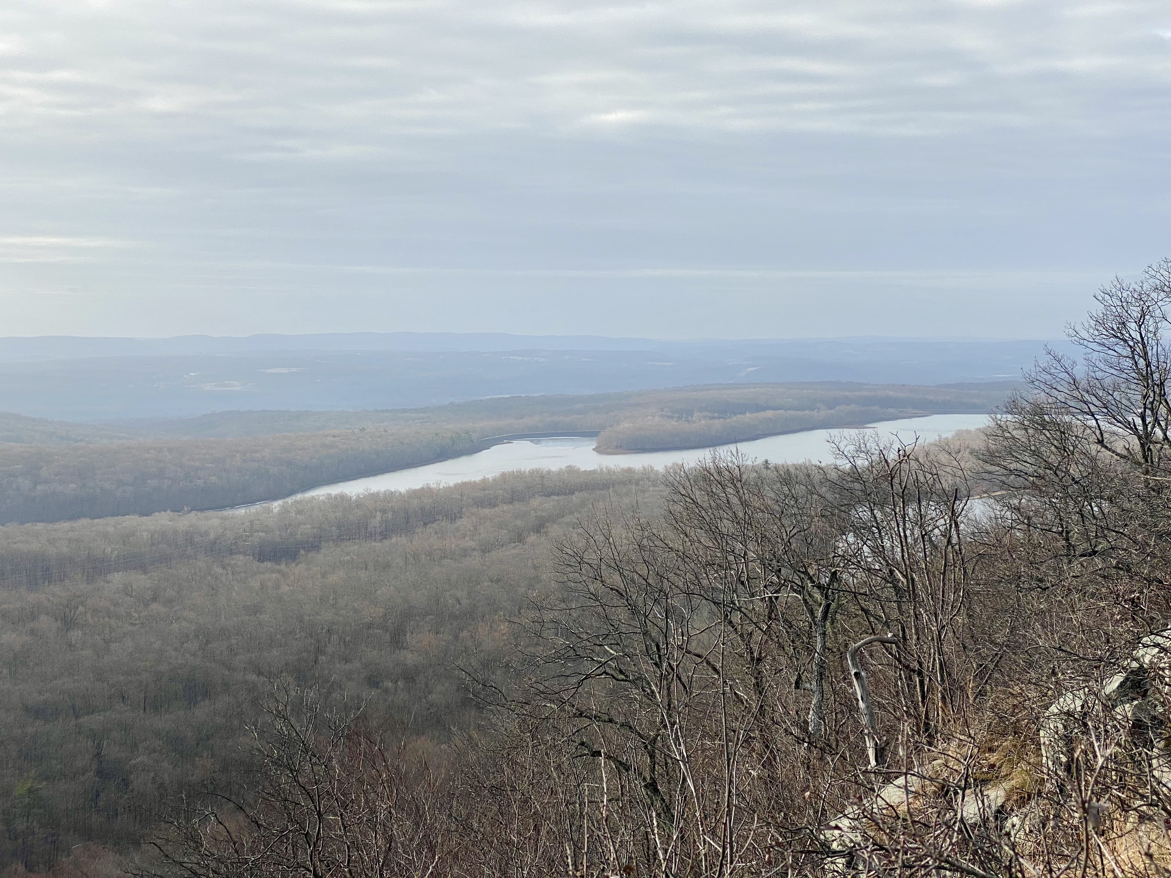
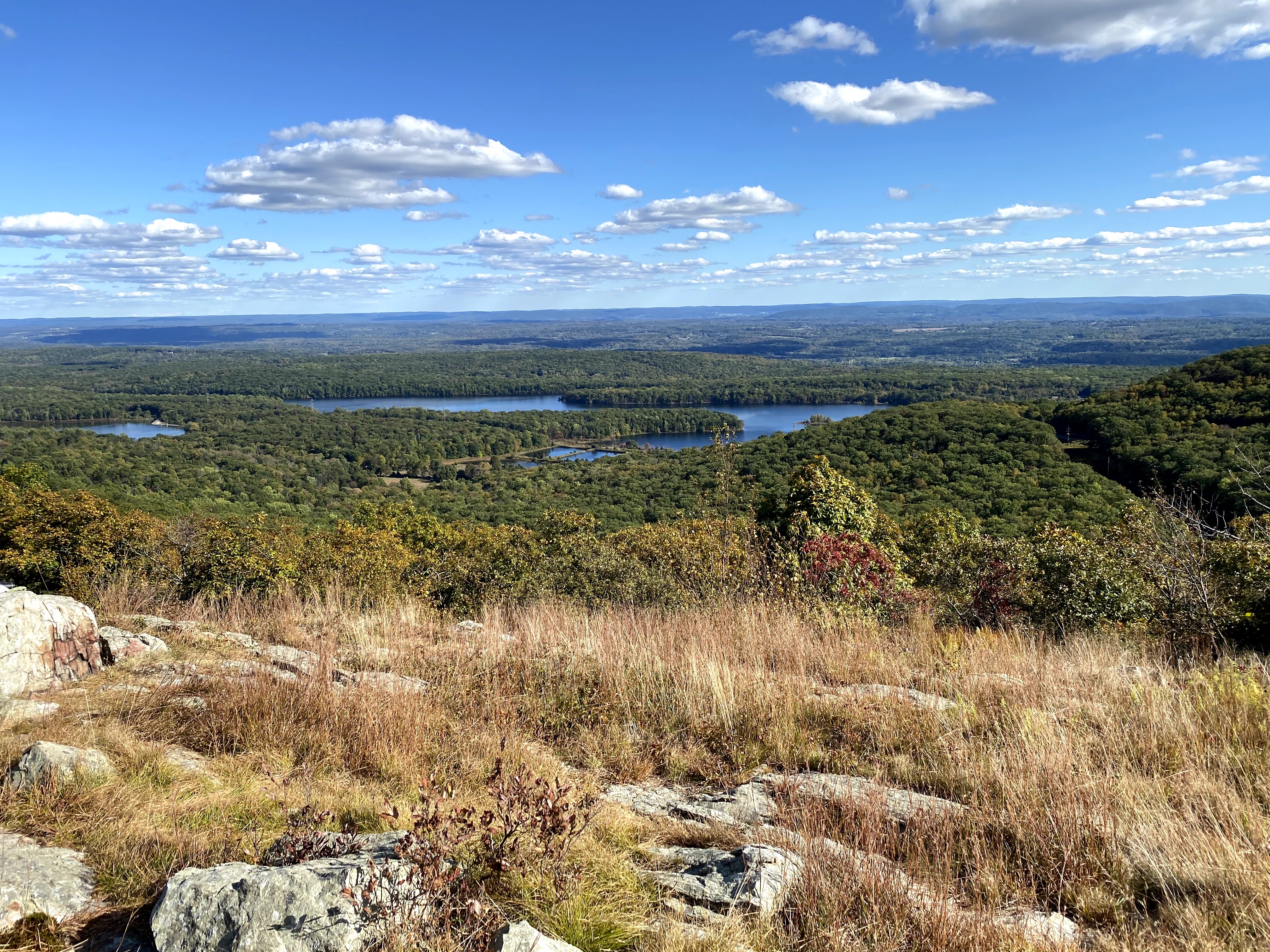
At about 1.5 miles, you’ll cross open rocks with views to the east over Lower Yards Creek Reservoir
At 2 miles, you’ll reach the first junction on your right (west) with the blue-blazed Kaiser Trail, an old mining road. If you were to take the Kaiser Trail from here, you would descend on the west side of Kittatinny Mountain and could make a loop back to your starting point by connecting with the Coppermine Trail.
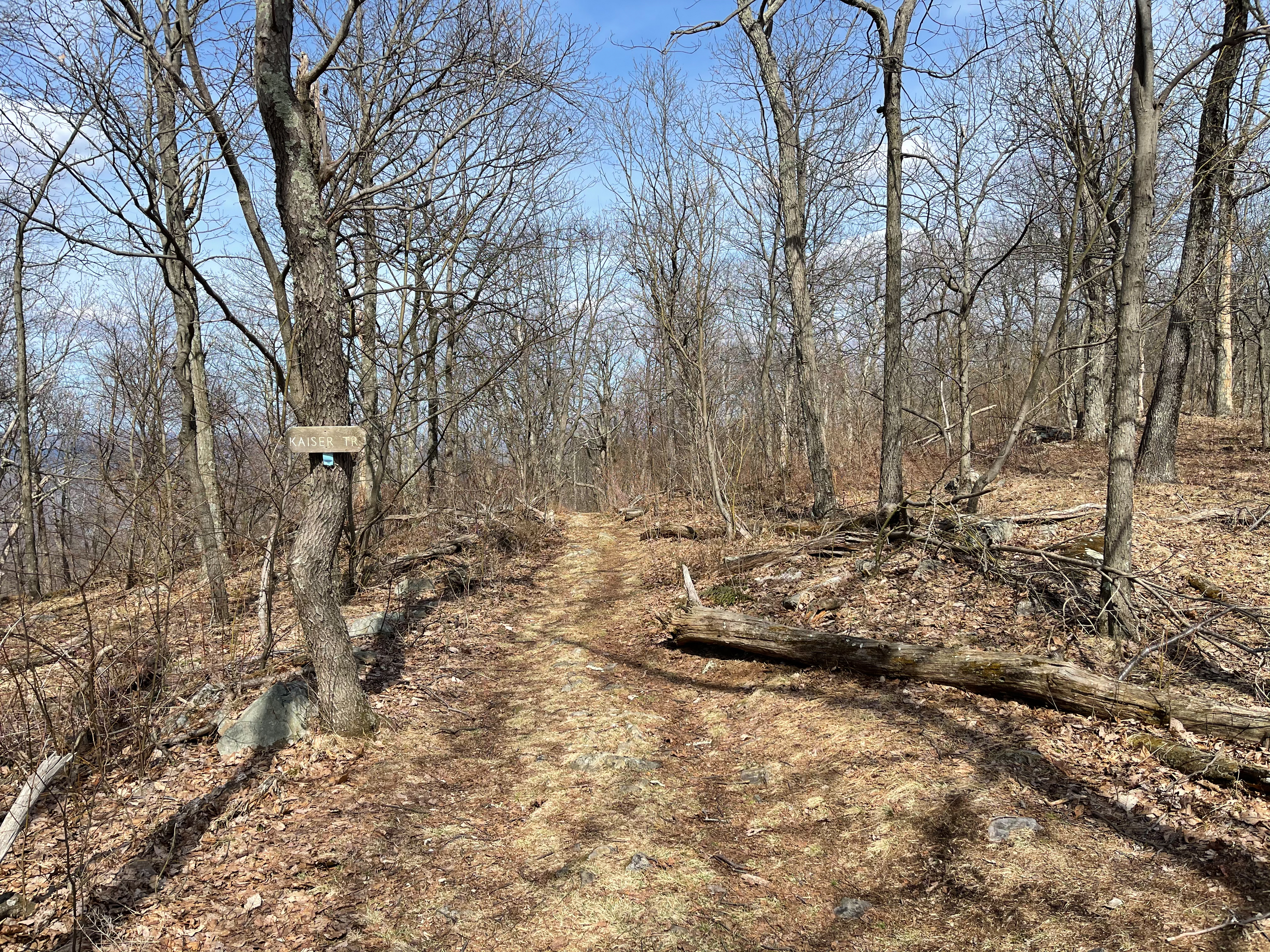
A quarter mile further, you’ll reach the next junction with the Kaiser Trail, which now splits off to the right (east). Following the Kaiser Trail east from here will lead you to private property – the Yards Creek Generation Station. A small hiker lot is available, though you’ll need to register with security to gain access to the property.

At 2.4 miles, a sign marks the boundary between the Delaware Water Gap National Recreation Area and Worthington State Forest

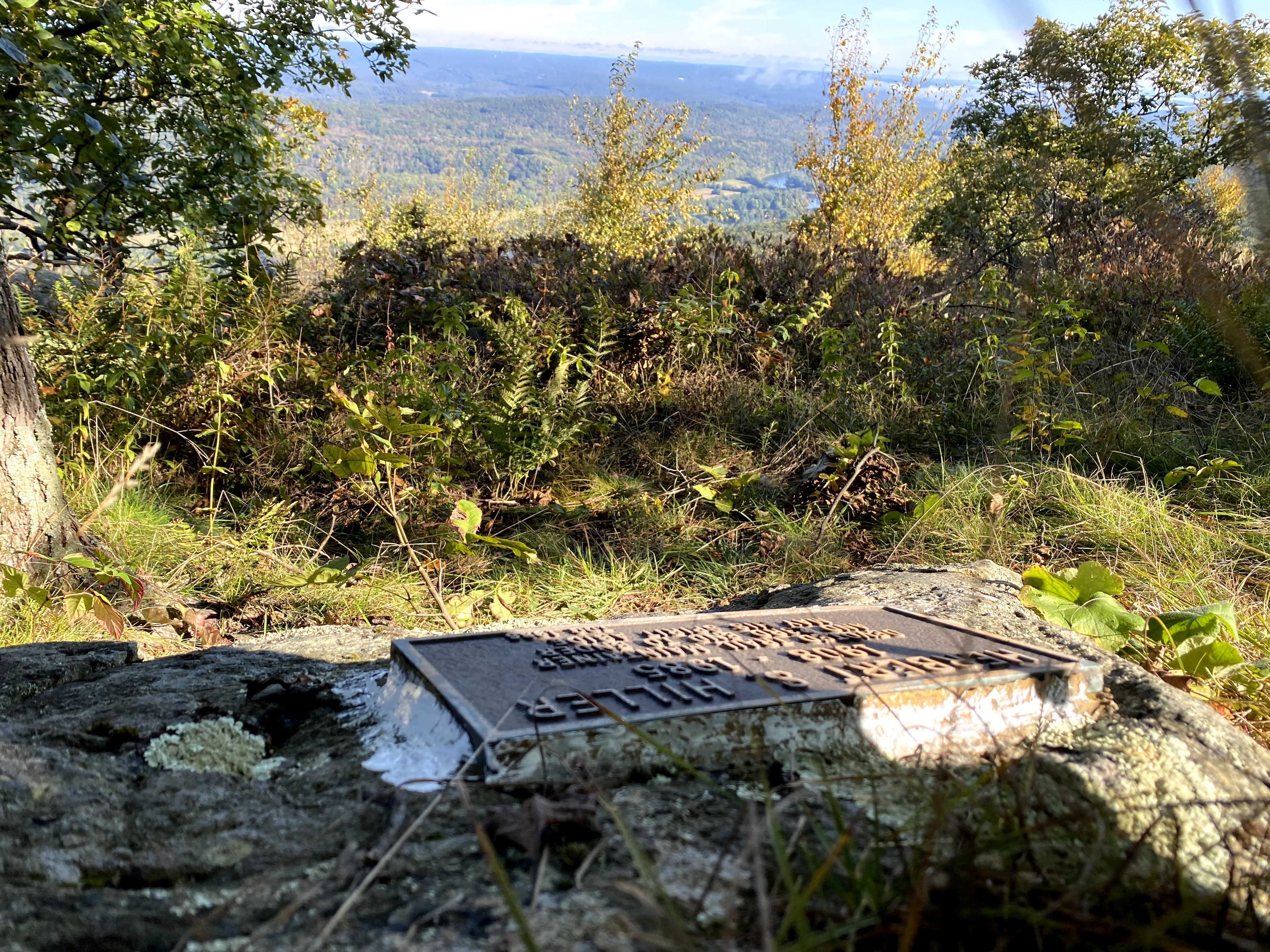
At 2.75 miles, just before reaching Raccoon Ridge, to the right side of the trail is a plaque in memory of Herbert S. Hiller, a trail maintainer and the 23rd Appalachian Trail 2000 miler. The spot has a partial view of the Delaware River to the west.
-
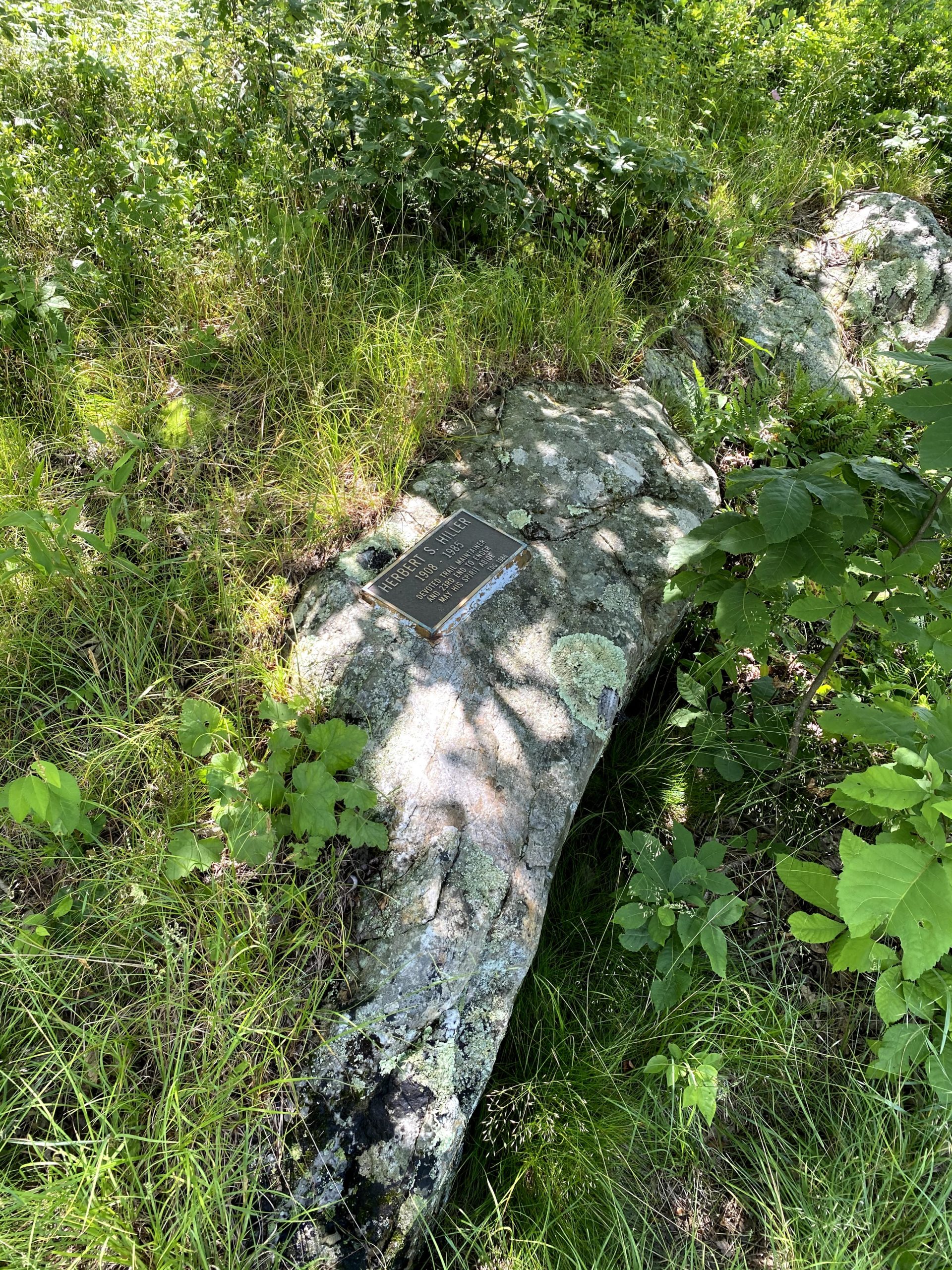
Herbert S. Hiller plaque -
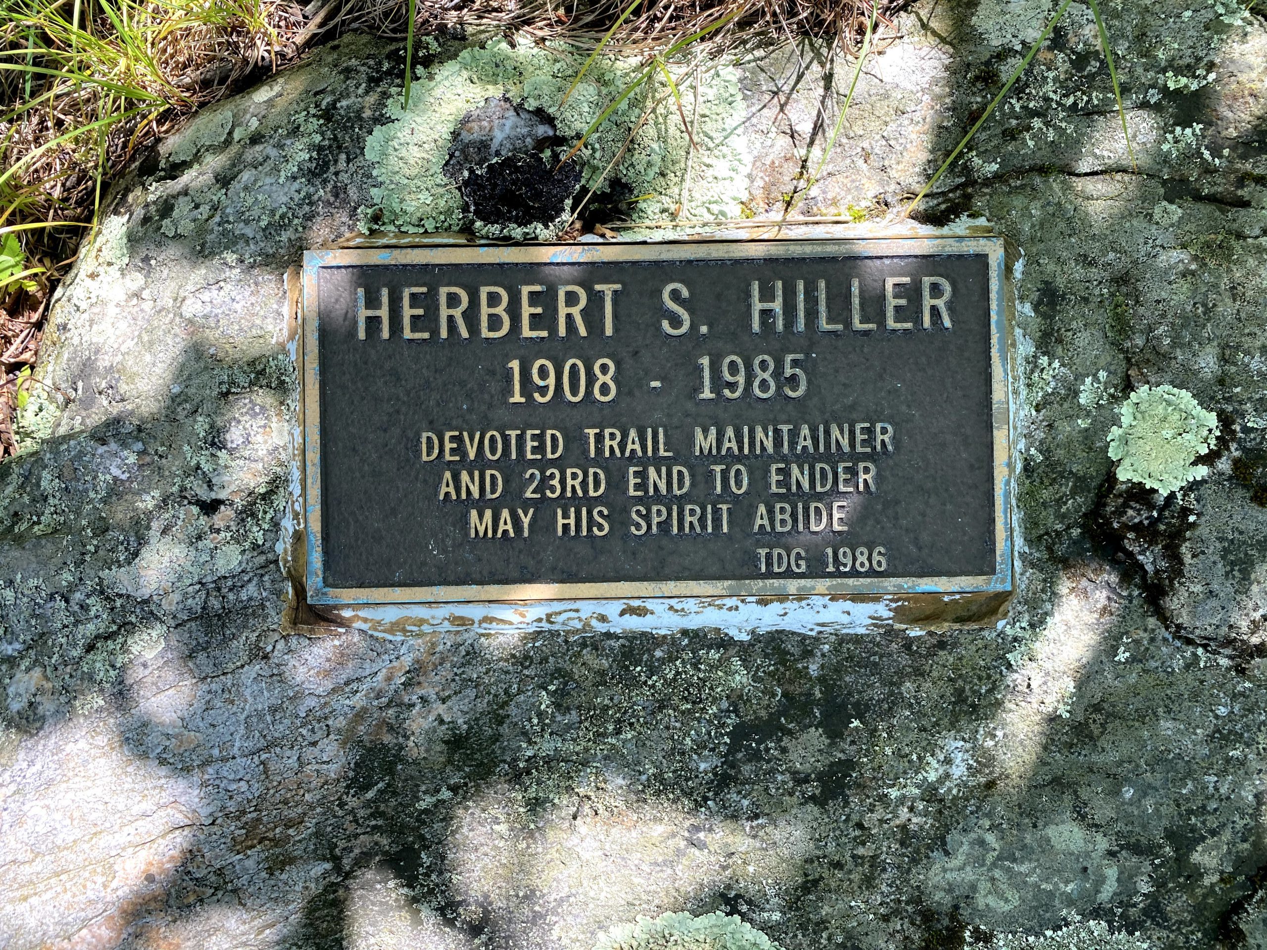
Herbert S. Hiller plaque -
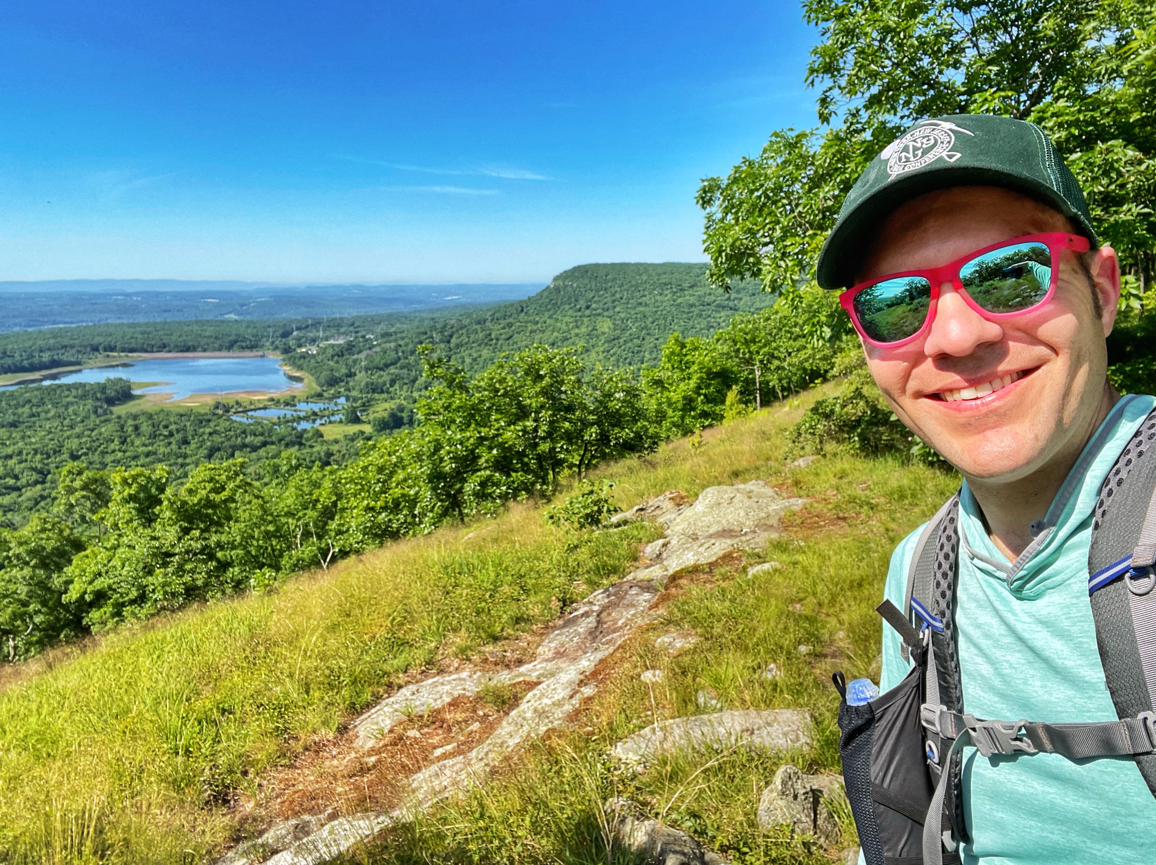
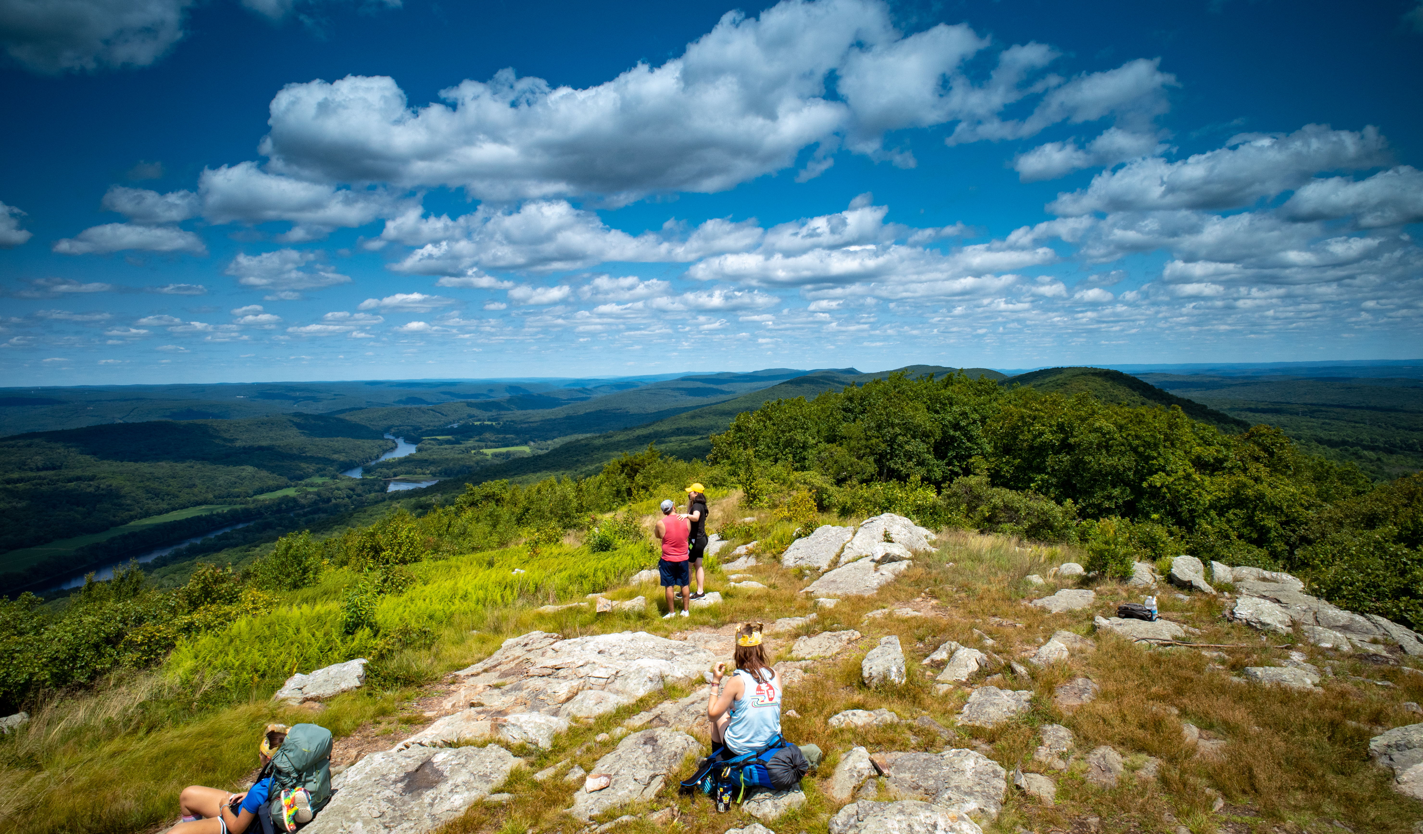
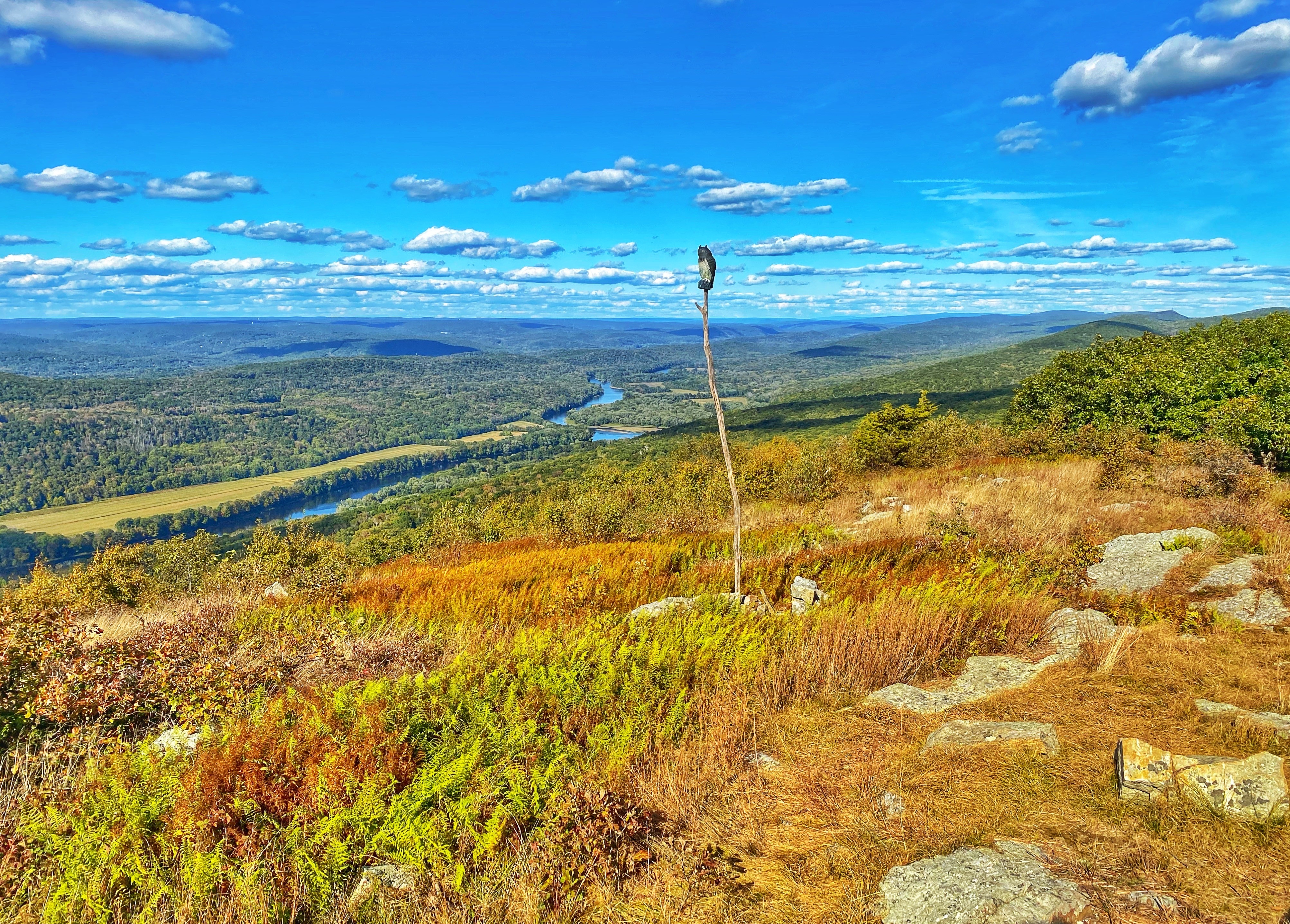
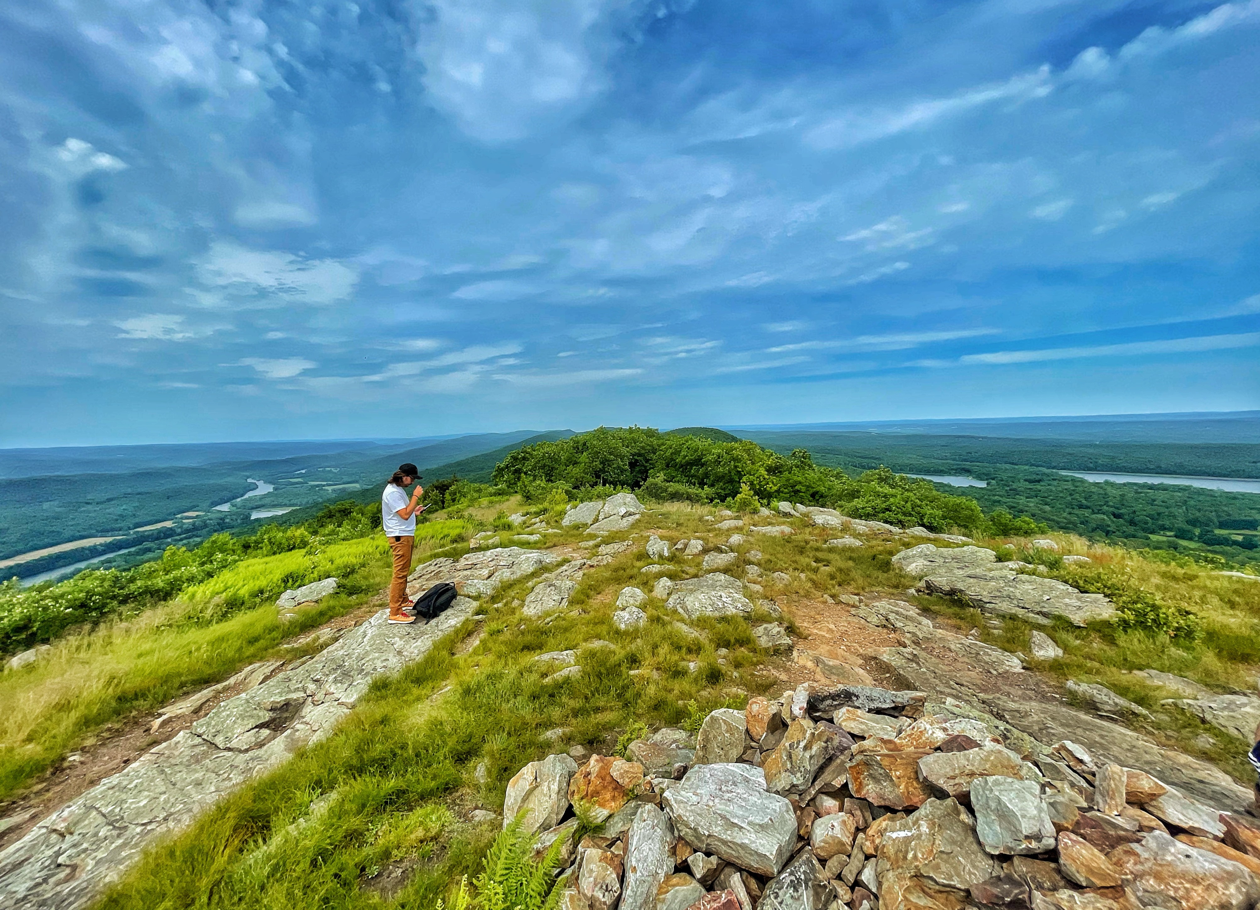
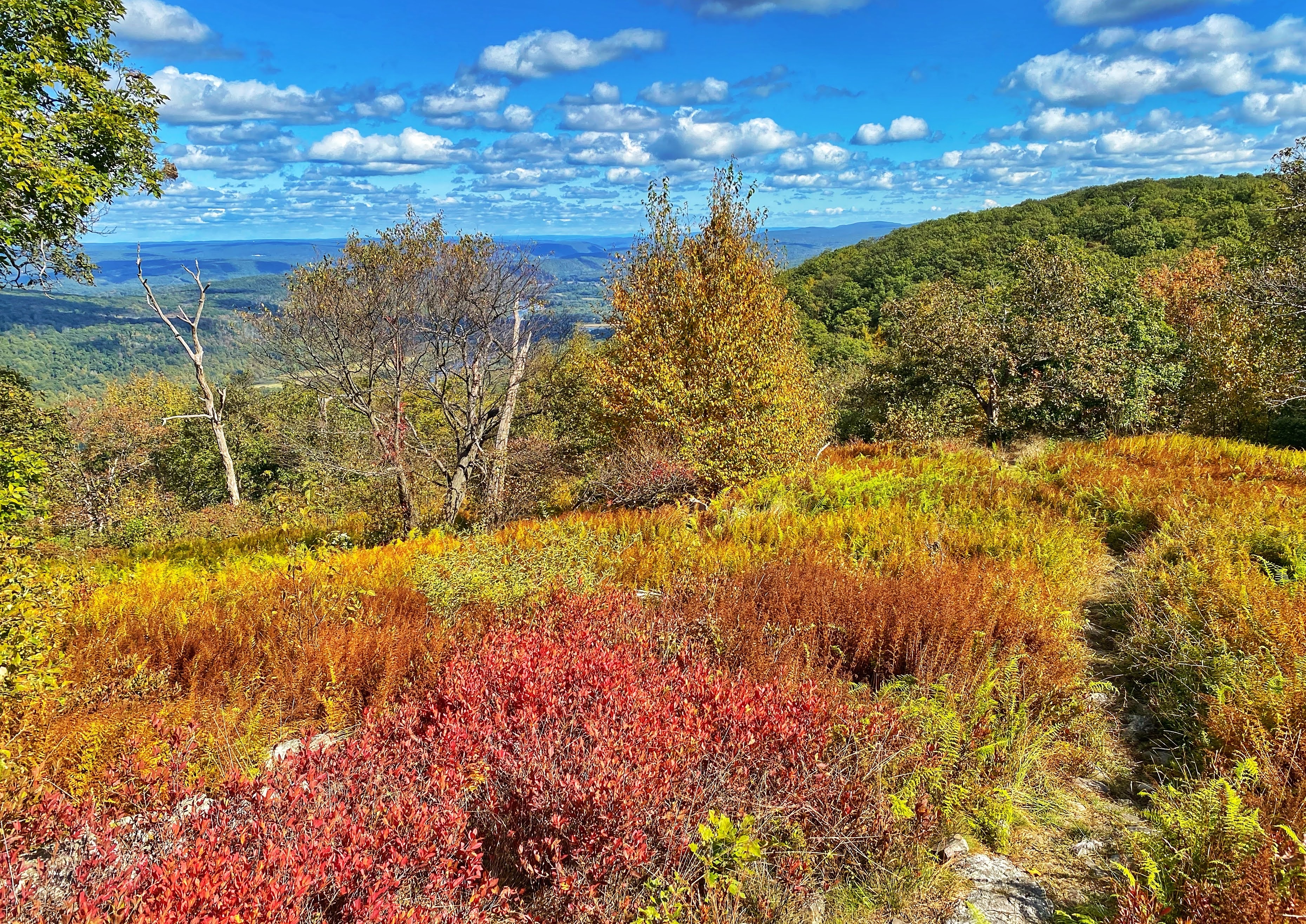
At 2.8 miles you’ll reach Raccoon Ridge, a clearing with a pile of rocks offering panoramic views in all directions. Lower Yards Creek Reservoir is to the east and the Delaware River and the Pocono Mountains are to the west. This is a popular spot for watching migrating birds.
-
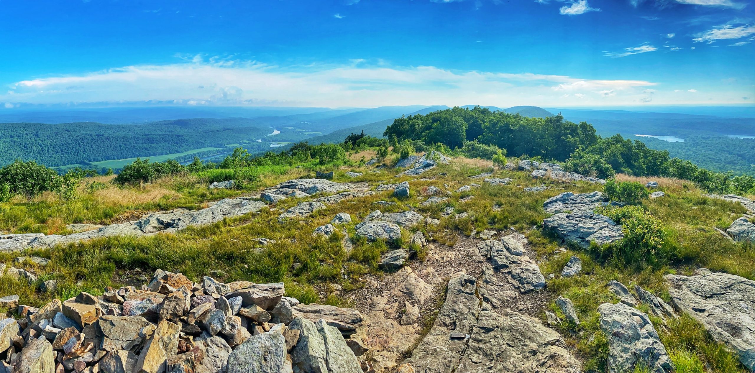
Raccoon Ridge -
-
-
-
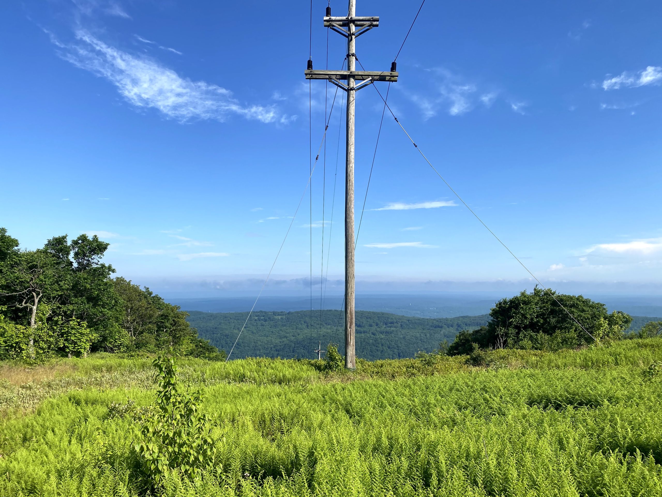
Just beyond Raccoon Ridge, at 2.9 miles you’ll cross a power line cut.
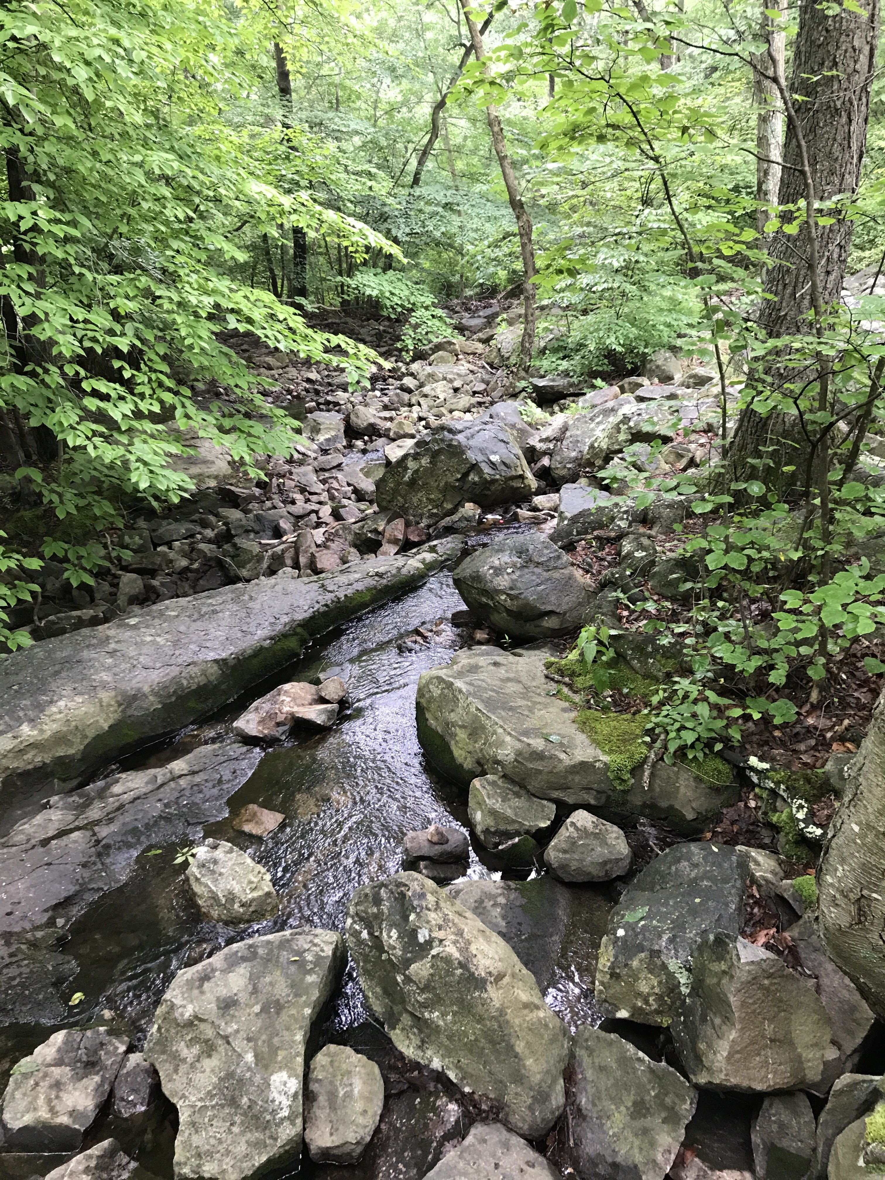
From here, the trail mainly descends until it reaches a low point where rocks have been placed to help navigate the wet wet, soggy ground.

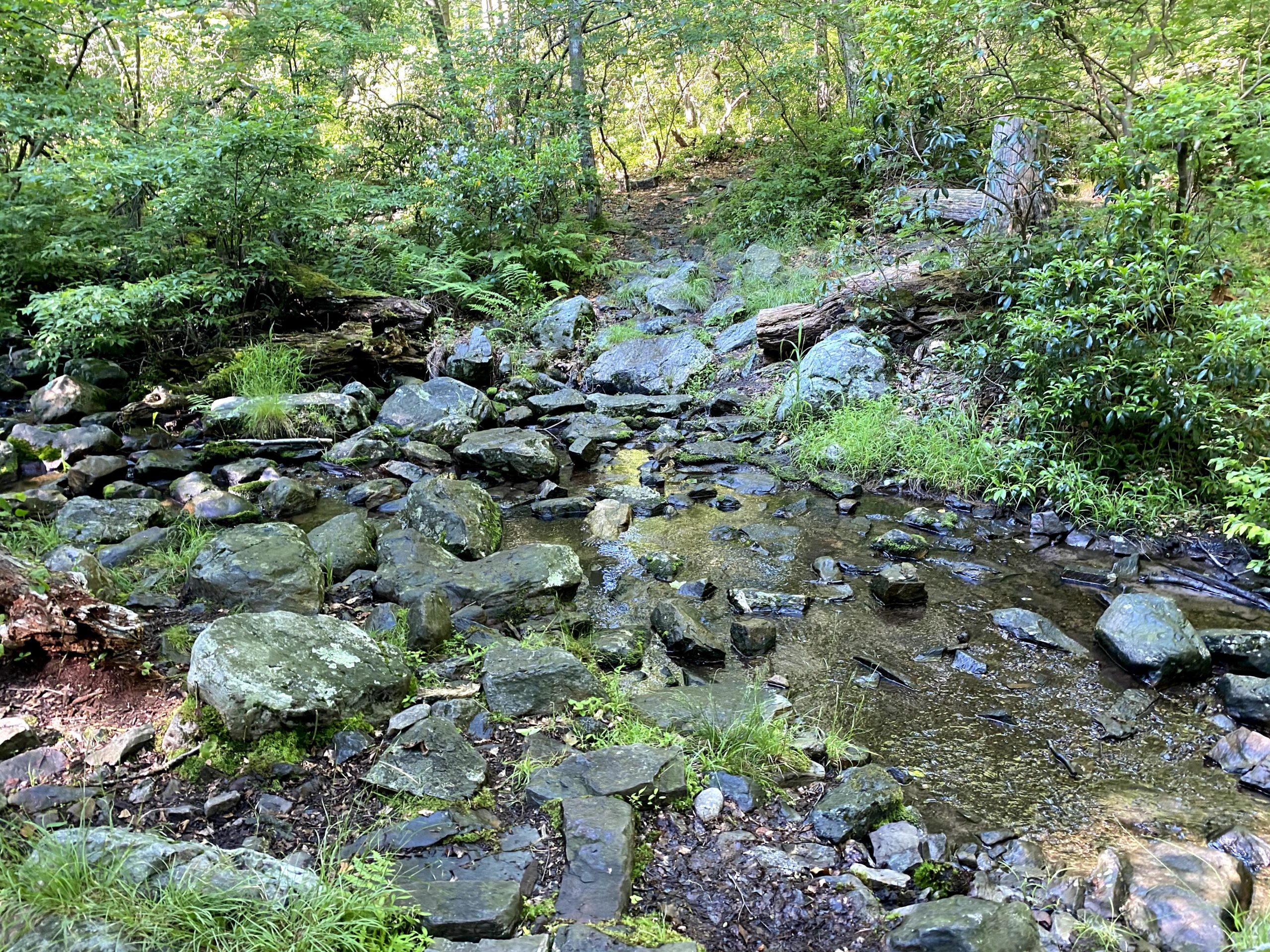
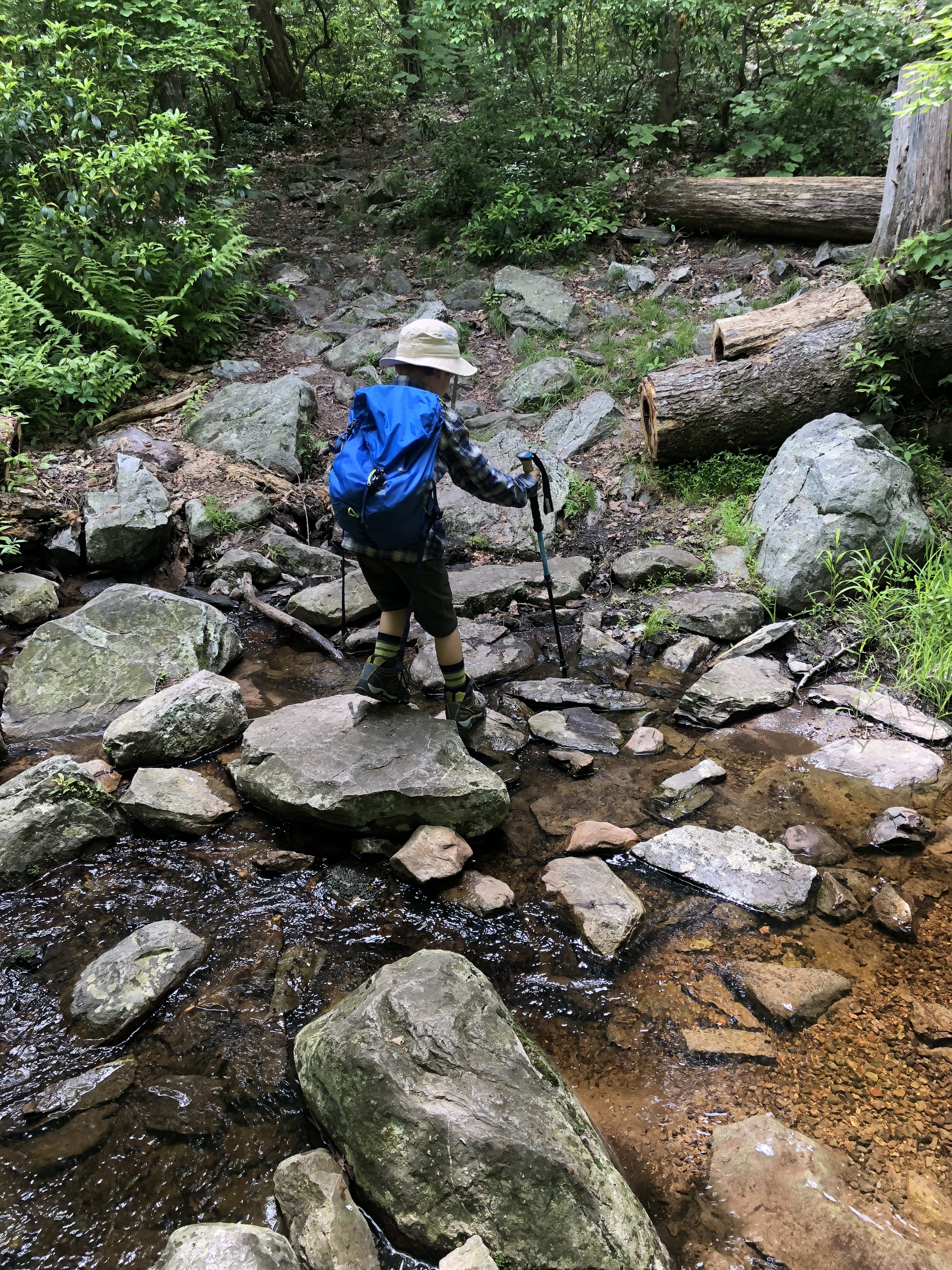
Immediately beyond, at 3.4 miles, you’ll cross a brook. This is a good spot to refill (and treat) your water.
-
Brook (outlet of Upper Yards Reservoir) -
Just beyond the brook, the trail begins to climb and soon reaches an opening with views of the Delaware River.


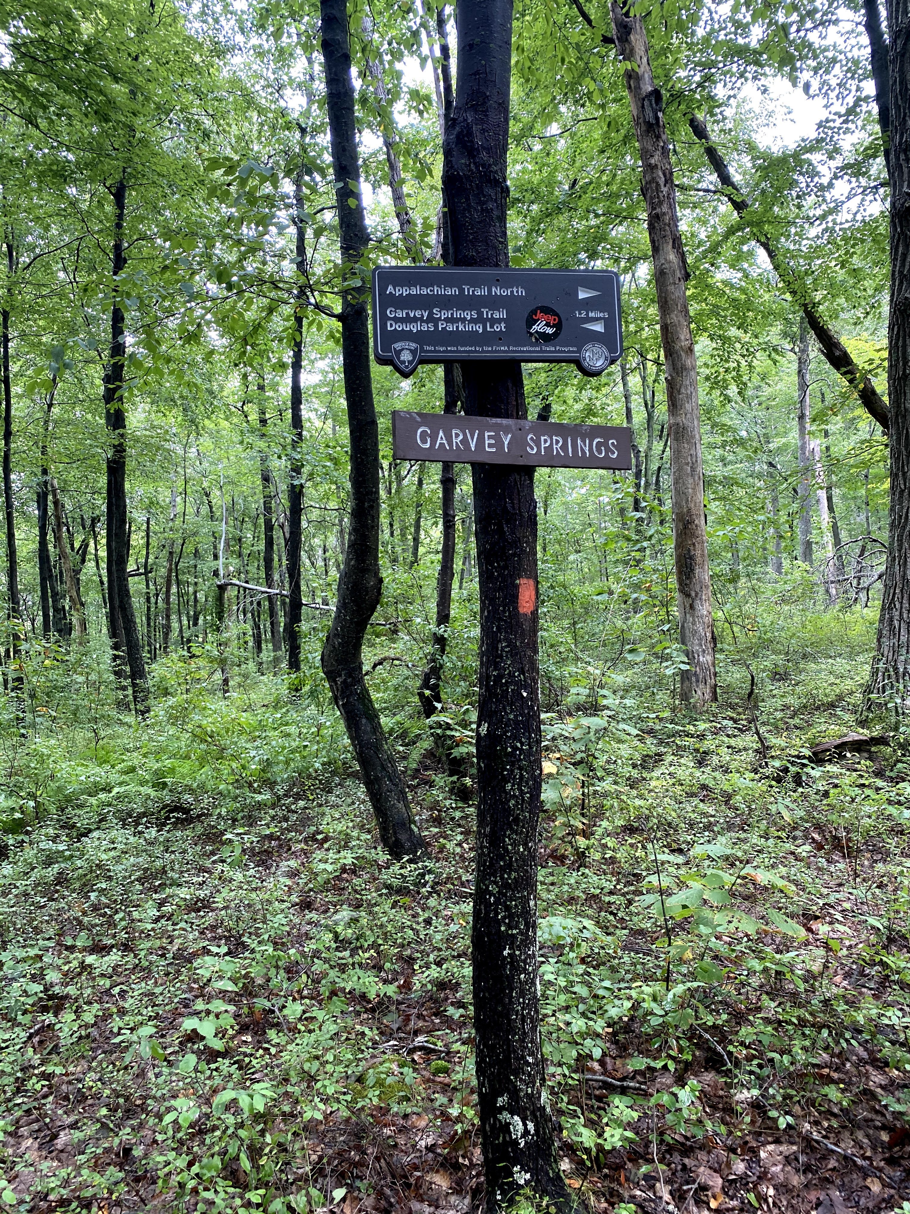
About 3/4 of a mile later, you’ll reach the junction with the orange-blazed Garvey Springs Trail. which leads down the west side of the mountain steeply downhill.
A short distance ahead you’ll reach the blue-blazed Buckwood Trail on your left (formerly the Turquoise Trail).
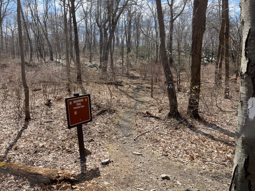
At this junction, you could continue straight a very short distance to reach Sunfish Pond, but for the best viewing spot, make a left onto the Buckwood Trail. Follow the trail uphill a short distance – less than a tenth of a mile – to a rocky outcrop overlooking the lake.
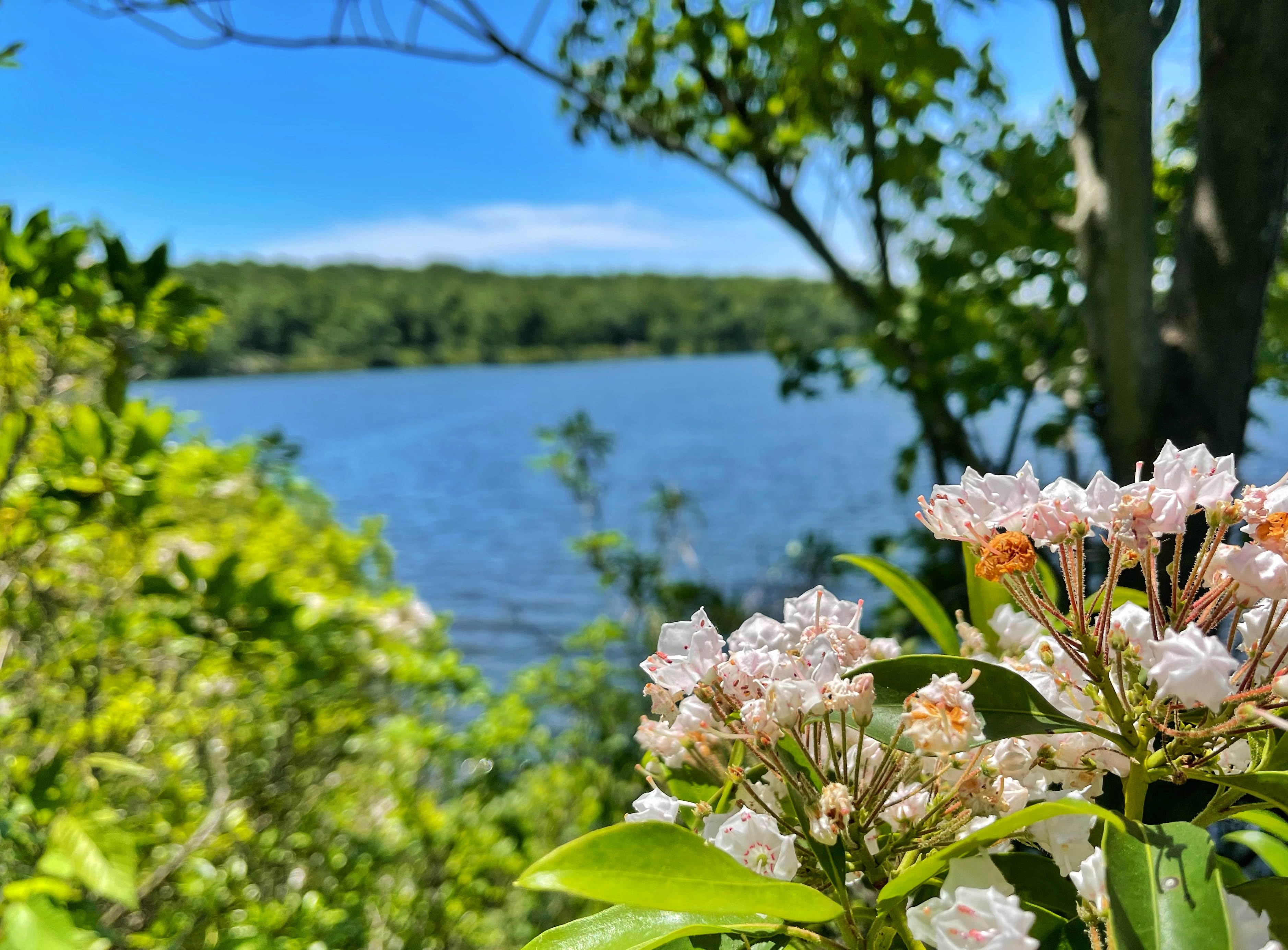
You’ve now gone about 4.4 miles and reached Sunfish Pond, a beautiful glacial lake atop the mountain with a storied history. Take a break here and enjoy the view. You could do a loop around the lake to extend your hike a bit further, or turn around and retrace your steps back to Camp Road.
-
-
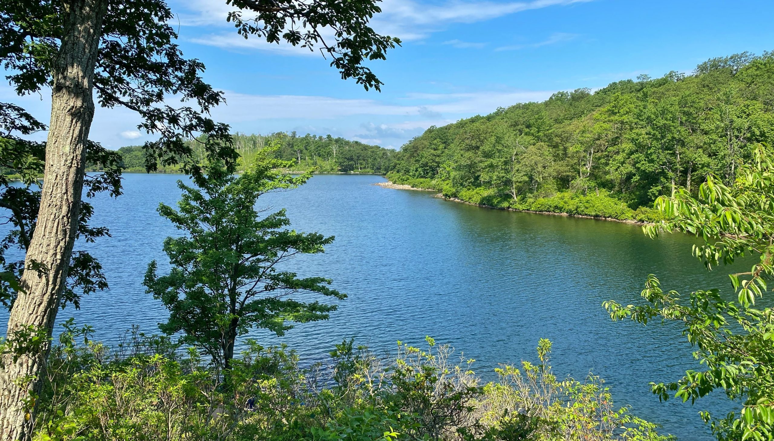
Sunfish Pond – View from a rise a few hundred feet east along the Turquoise-blazed Buckwood Trail -


