Hike Overview
This loop combines the best view in the state at the top of Mt. Tammany, a panoramic view of a unique glacial lake – Sunfish Pond, a relatively remote walk along a ridgeline fire road, a busy section of the Appalachian Trail, and a green, cascading creek.
Hike length: 10.9 miles
Elevation gain: 1,739 feet

Location: Delaware Water Gap National Recreation Area, Worthington State Forest, Hardwick Twp, NJ
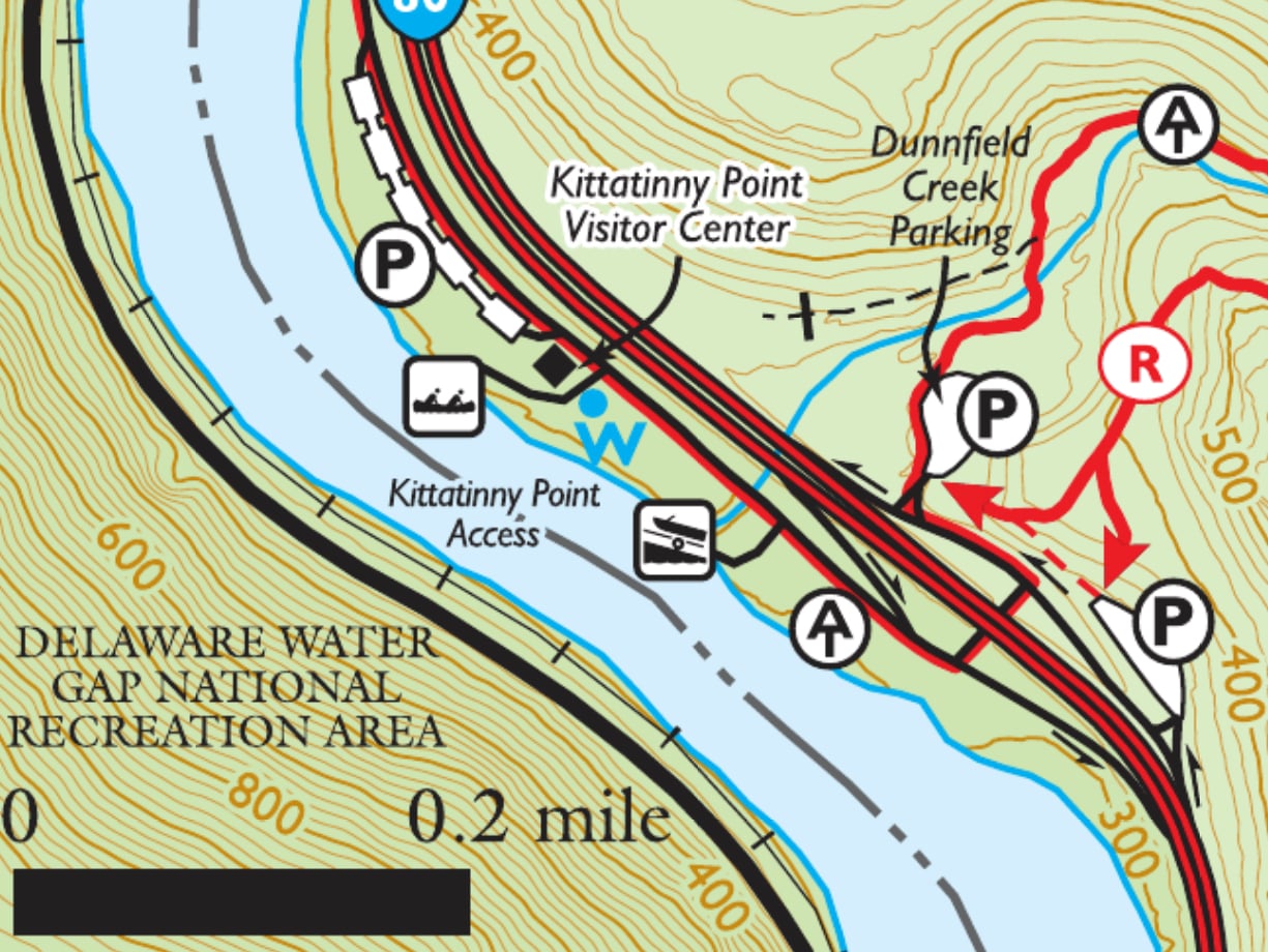
Parking: Park and leave your car at the Dunnfield Creek parking lot (get there early; it fills up quickly). As shown in the map below, there are two parking lots on the east side of I-80 and both provide access to the Red dot trail. Note that there is a one-way road connecting the first lot to the second one. If you drive through the first parking lot, you will not be able to return to it easily without returning to I-80 and making a big loop, so if you find a spot there, it’s a good idea to take it.
Trail Map
- Delaware Water Gap & Kittatinny Trails Map (NY-NJ Trail Conference, print)
- Delaware Water Gap & Kittatinny Trails Map (NY-NJ Trail Conference, Avenza)
- Worthington State Forest (NY-NJ Trail Conference map)
- Worthington State Forest (NJ Parks and Forests)

Trail Description
This description provides an overview of the loop in a counterclockwise direction. The trail begins at the Dunnfield Creek parking lot off of I-80.
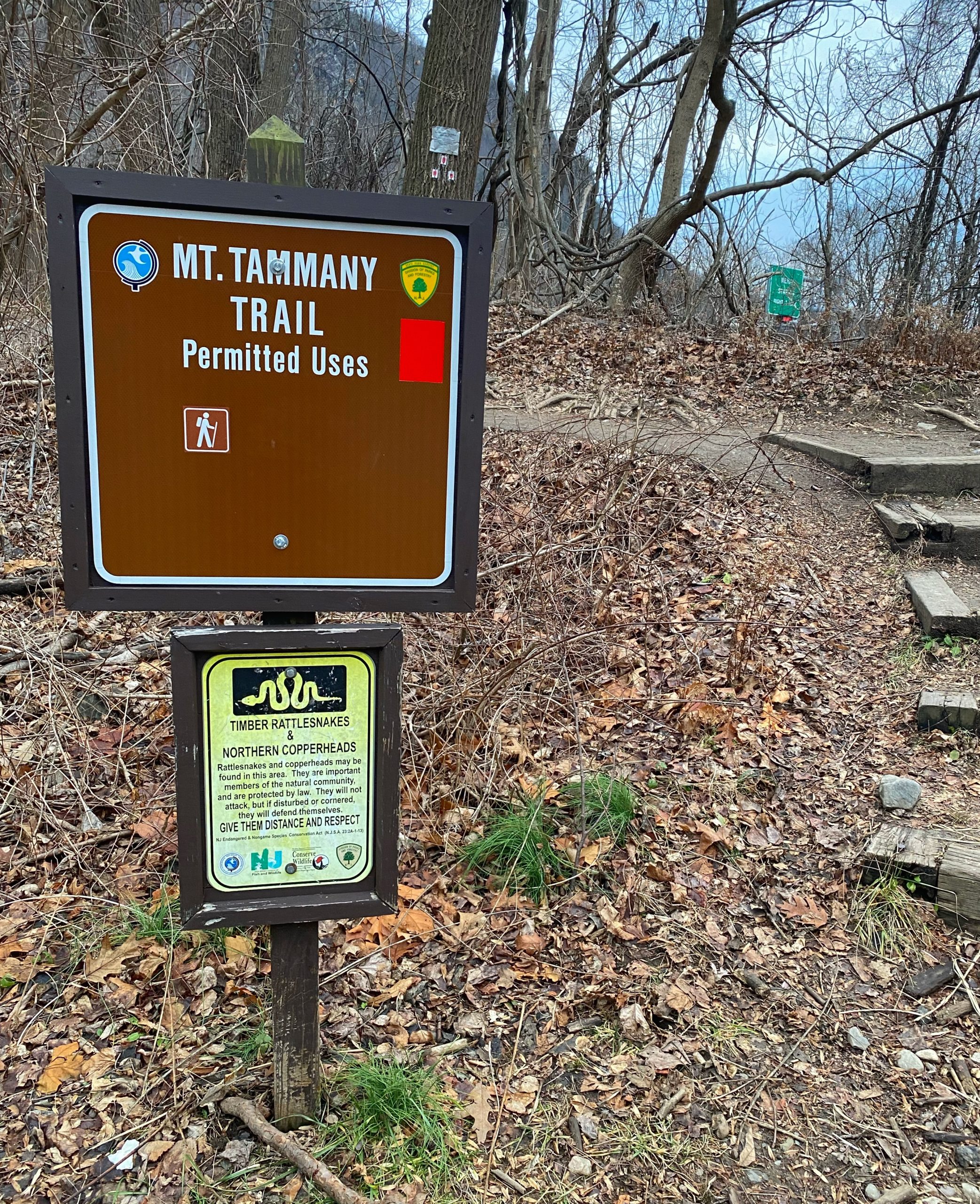
Mt. Tammany Trail
At the southern end, near the entrance to the parking lot is the trailhead for the Mt. Tammany Trail. The trail is blazed white with red dots.
The trail goes uphill steeply for 1.5 miles. Much of the trail is rocky.

After a few hundred feet, you’ll reach the first view of the Delaware River as it winds around Mt. Minsi on the Pennsylvania side of the river.

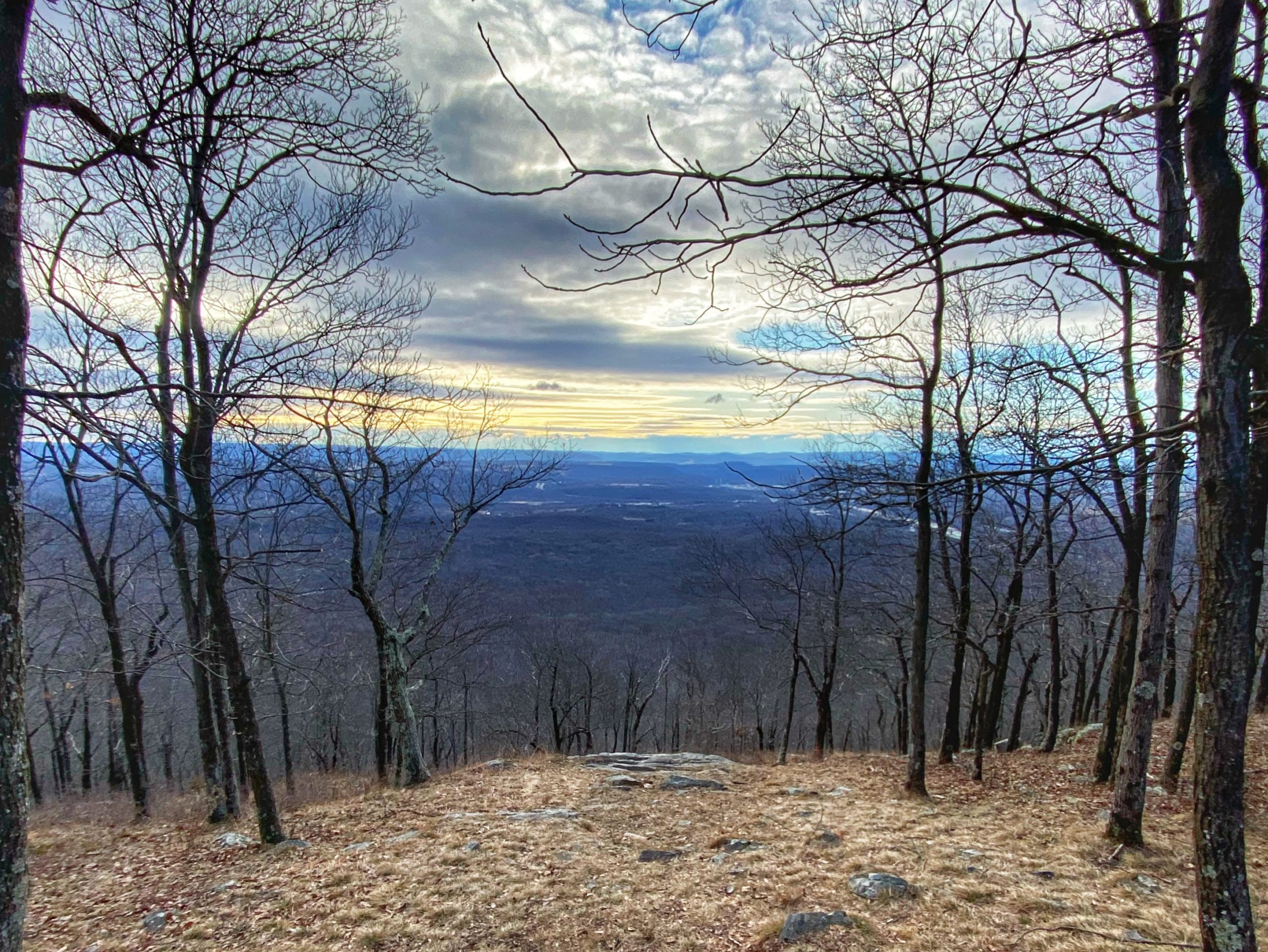
Mt. Tammany Summit
The Mt. Tammany Trail ends at the top of Mount Tammany. To your right will be an opening that provides one of the greatest views in the state. You’ll need to carefully scramble down the rocks for about 100 feet to get the best view.

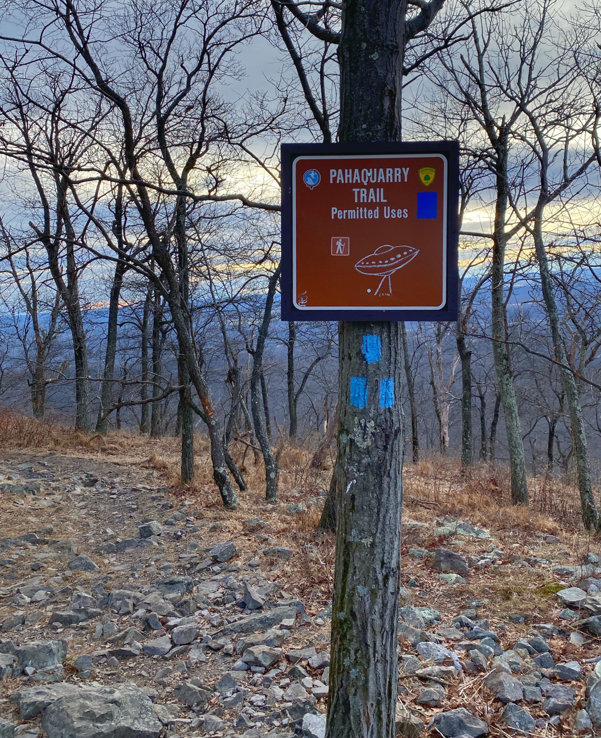
Pahaquarry Trail
Scramble back up to the trail, then follow the blue-blazed Pahaquarry Trail.
After 0.3 miles, you’ll reach a junction.

This trail guide will describe a 10.9 mile loop that continues straight along the Mount Tammany Fire Road. (If you’re not up for such a long hike, this is your last chance to bail out: Turn left, follow the Blue blazes to the green-blazed Dunnfield Creek Trail and then to the white-blazed Appalachian Trail back to the parking lot).
Mt. Tammany Fire Road
We will continue straight along the Mount Tammany Fire Road for 3.1 miles. At the start of the trail is a view facing to the east. For much of the rest of the walk, the views are obstructed by trees unless the leaves have fallen. In the winter, it’s a nice ridgeline walk with views of the valley to the east for most of the section.
The trail is wide, flat, and a pretty easy walk.

Some history on the fire road:
The fire road..is maintained as a firebreak and access road for wildfire suppression efforts by the New Jersey Forest Fire Service. There are three helispots along the fire road used by the Forest Fire Service.
The Mount Tammany Fire Road was constructed as a dozer line created after the 1976 Dunnfield Creek fire on Kittatinny Mountain which consumed over 2,000 acres of forests from April 18 to April 22, 1976.
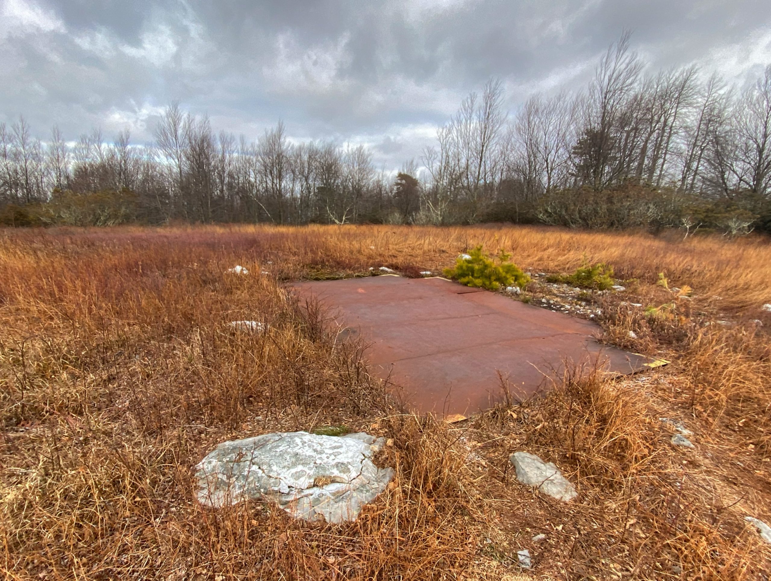
Helispot
Along the way, you’ll pass one of the three helispots, Helispot 2.

Wolves!
Also along the way, you might hear wolves howling. Huh? Your ears aren’t playing tricks on you. And no, there are no wild wolves in New Jersey. But there is a wolf preserve about a mile to the east.
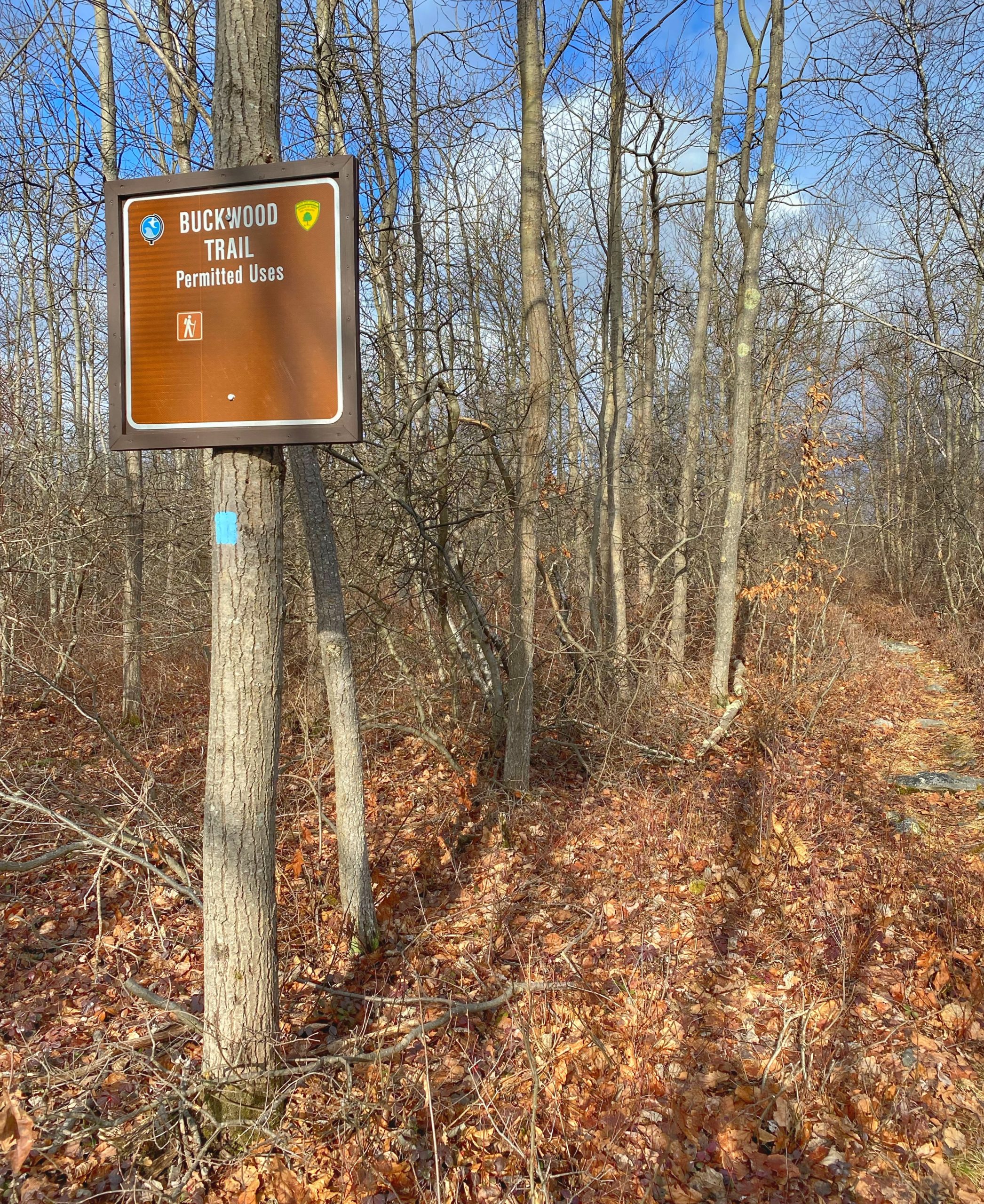
Buckwood Trail
After 3.1 miles, you’ll reach a cairn indicating the junction with the Turquoise-blazed Buckwood Trail (The Buckwood Trail was formerly called the Turquoise Trail, and you may still see signs for the Turquoise Trail)
Continue on the Buckwood Trail as it descends slightly then climbs again. After 0.7 miles, it will reach a junction with the Sunfish Pond Fire Road. Turn left, then continue for 0.3 miles until you reach the next junction, where the trails split again.
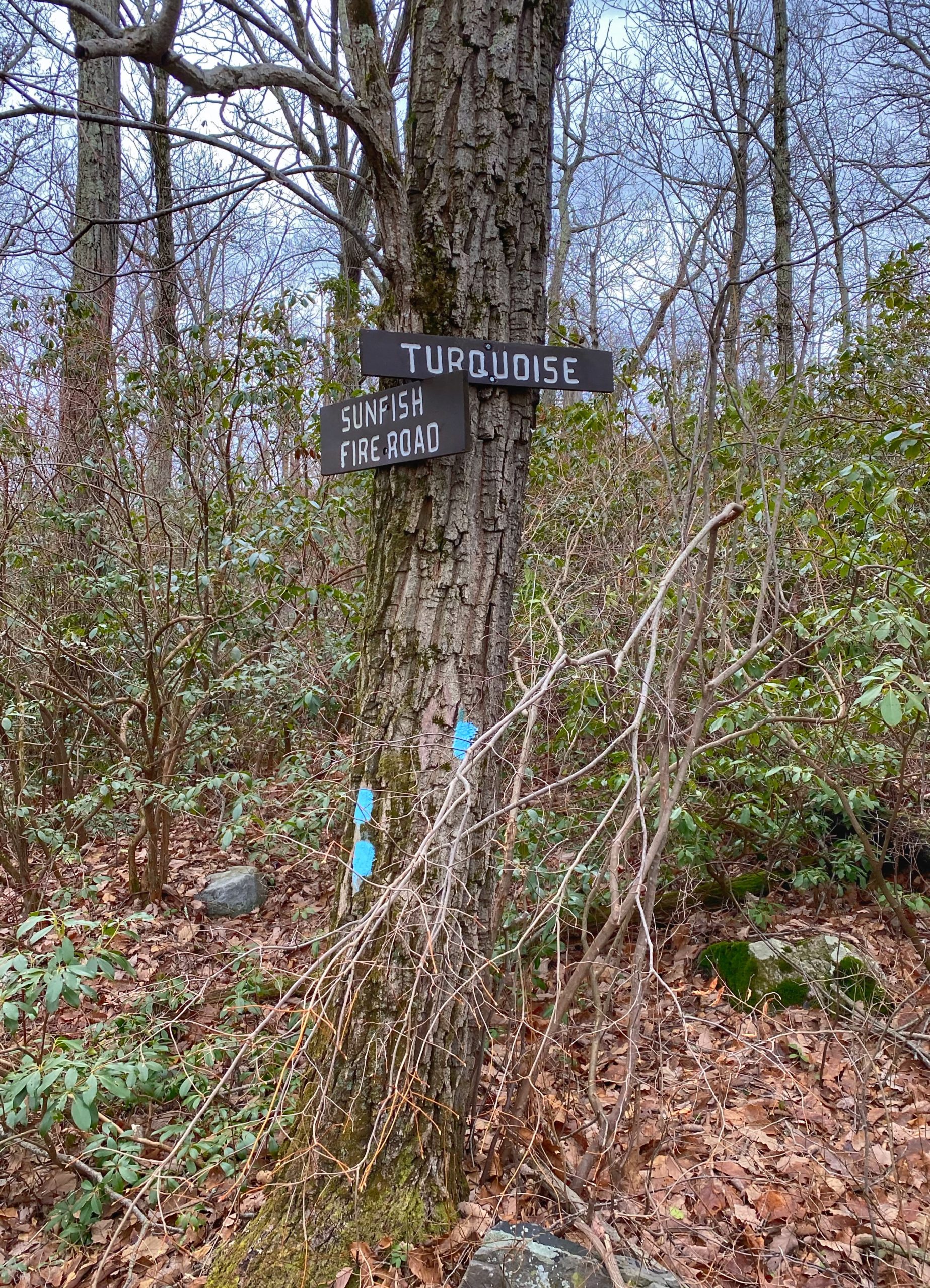
Sunfish Pond Overlook
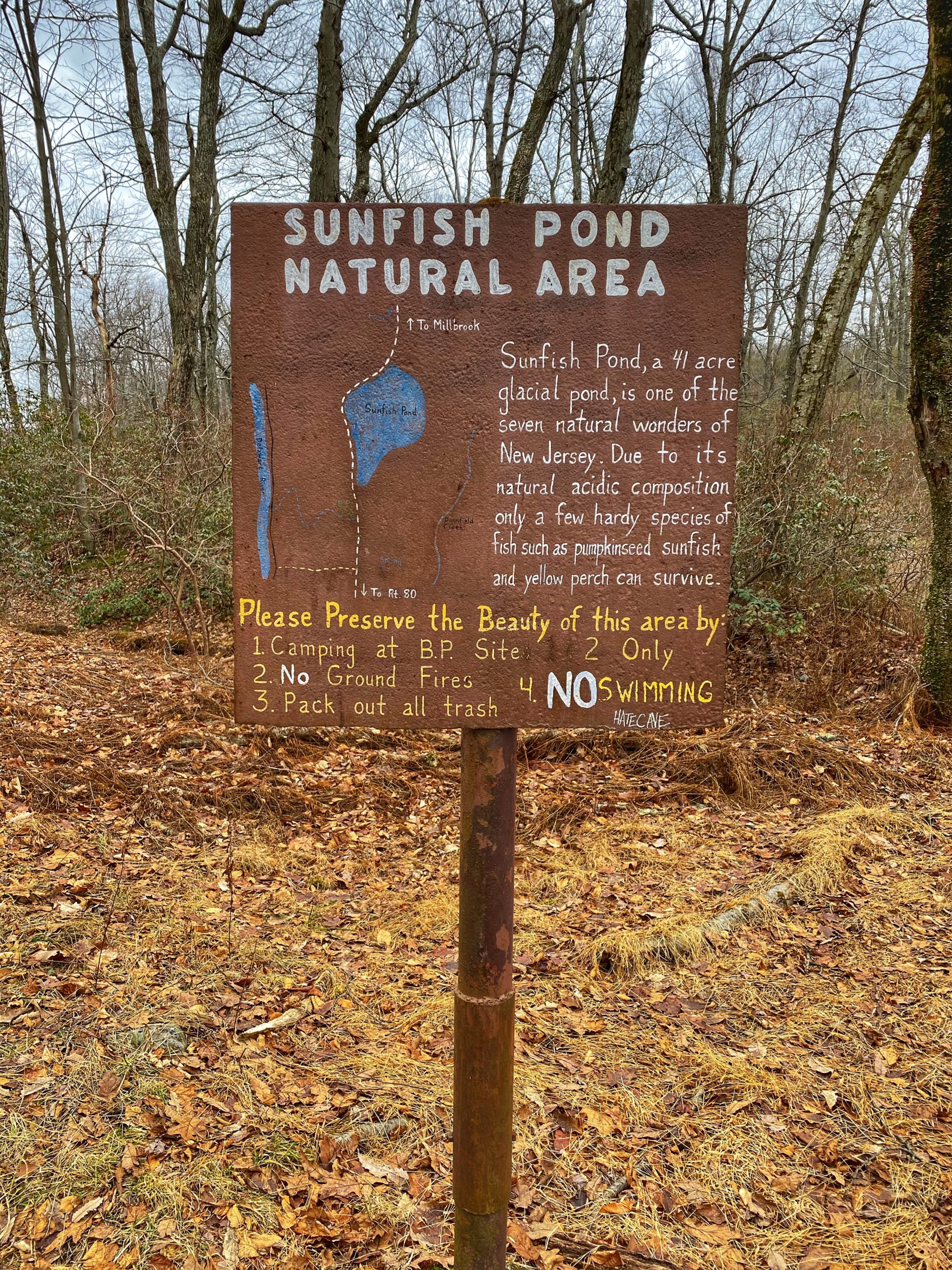
At the junction, make a right to follow the Buckwood (Turquoise) Trail. After about a third of a mile, you’ll reach a bluff on your left offering a panoramic view of Sunfish Pond (learn more about Sunfish Pond, how it was almost destroyed, and the role it played in New Jersey’s environmental movement).
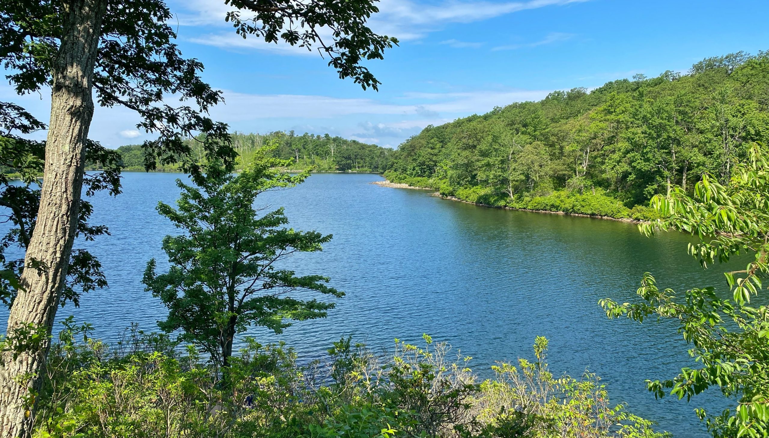

The rocks provide a nice spot to take a break and have a snack. Continue a few hundred feet more to the end of the Turquoise Trail, where it meets the white-blazed Appalachian Trail. We will turn left to follow the AT all the way back to the Dunnfield Creek parking lot.
Appalachian Trail
The AT first passes Sunfish Pond to the west. This part of the trail is extremely rocky.
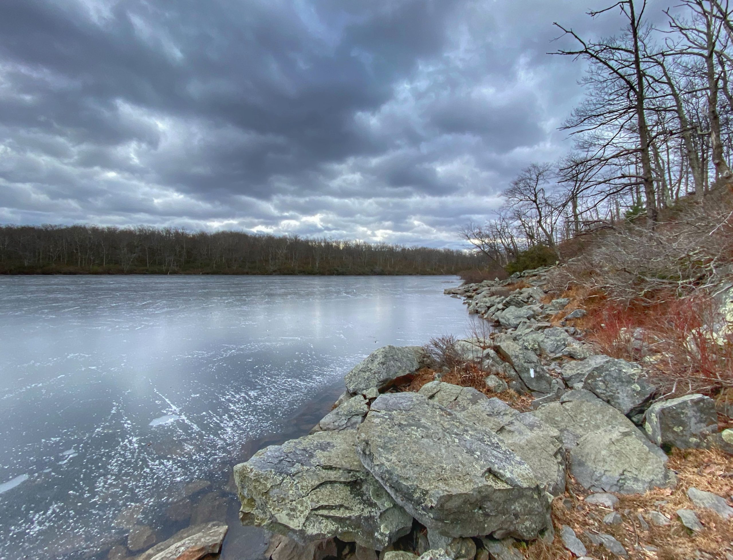
Sunfish Pond is a wonderful place. In fact, it’s one of the 7 Natural Wonders of New Jersey. After 0.75 miles, you’ll reach the south end of the pond, where you can take a break on a bench. Here, the trail intersects the Dunnfield Creek Trail, which forks to the left (note that there are several river crossings that will likely require getting your feet wet). We will stay to the right along the AT.
Worthington Backpacker’s Campground
After another 0.65 miles, we reach a kiosk for the Worthington Forest Backpacker’s Campground, which offers space for dozens of backpackers, bear boxes, and composting toilets.
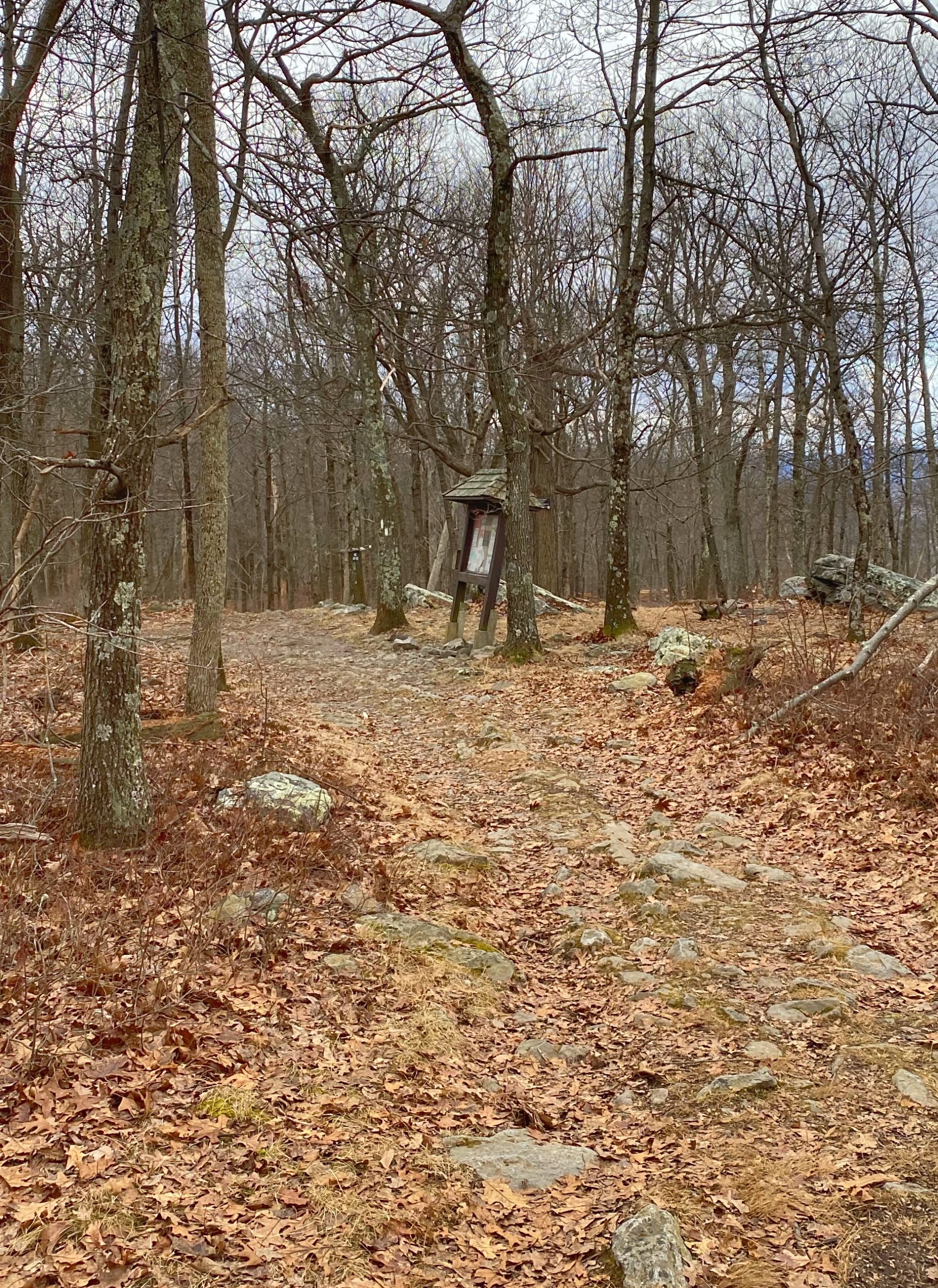
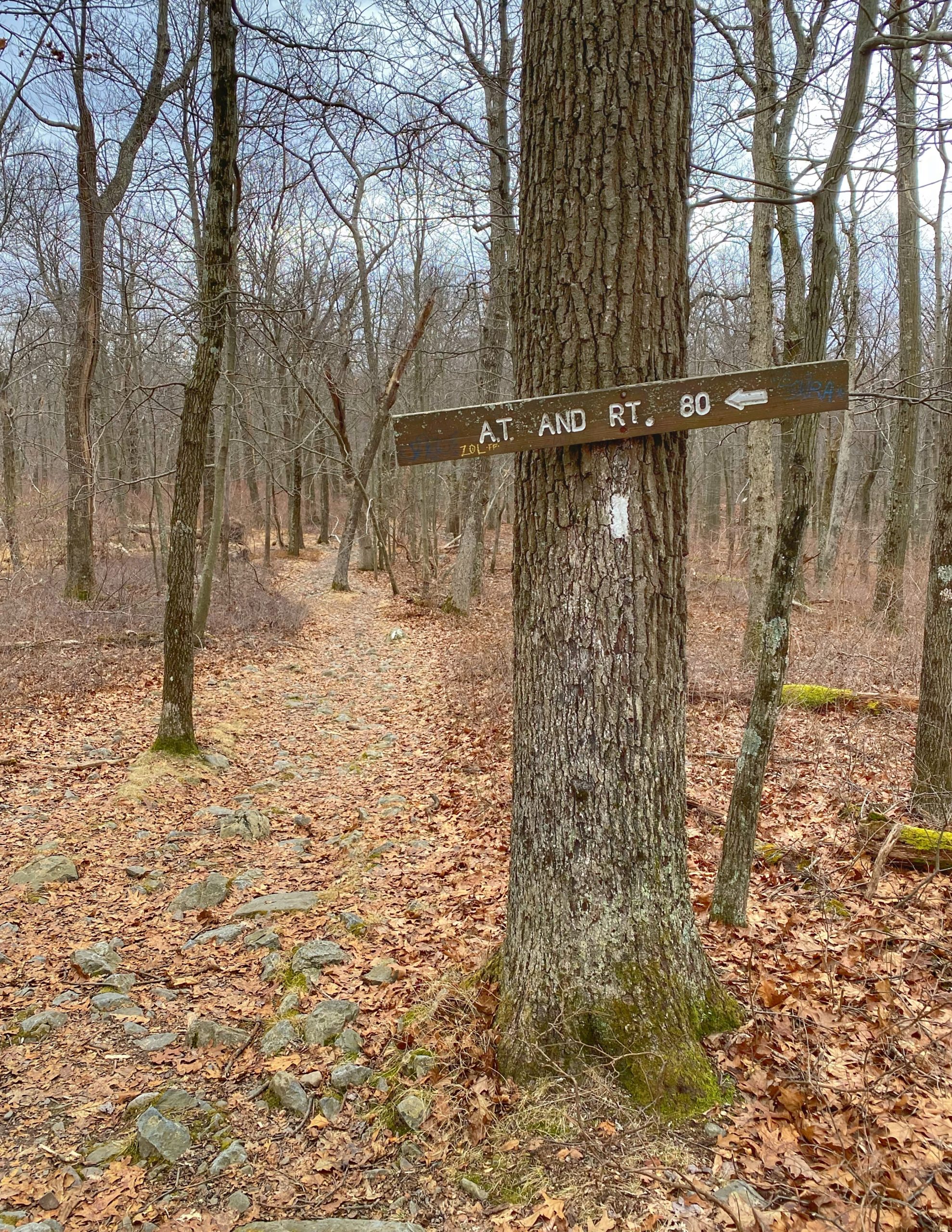
Right after we pass the kiosk for the Worthington Forest Backpacker Campsite, we will reach another junction with the Douglas Trail. A sign clearly indicates to keep left to continue on the AT and I-80.
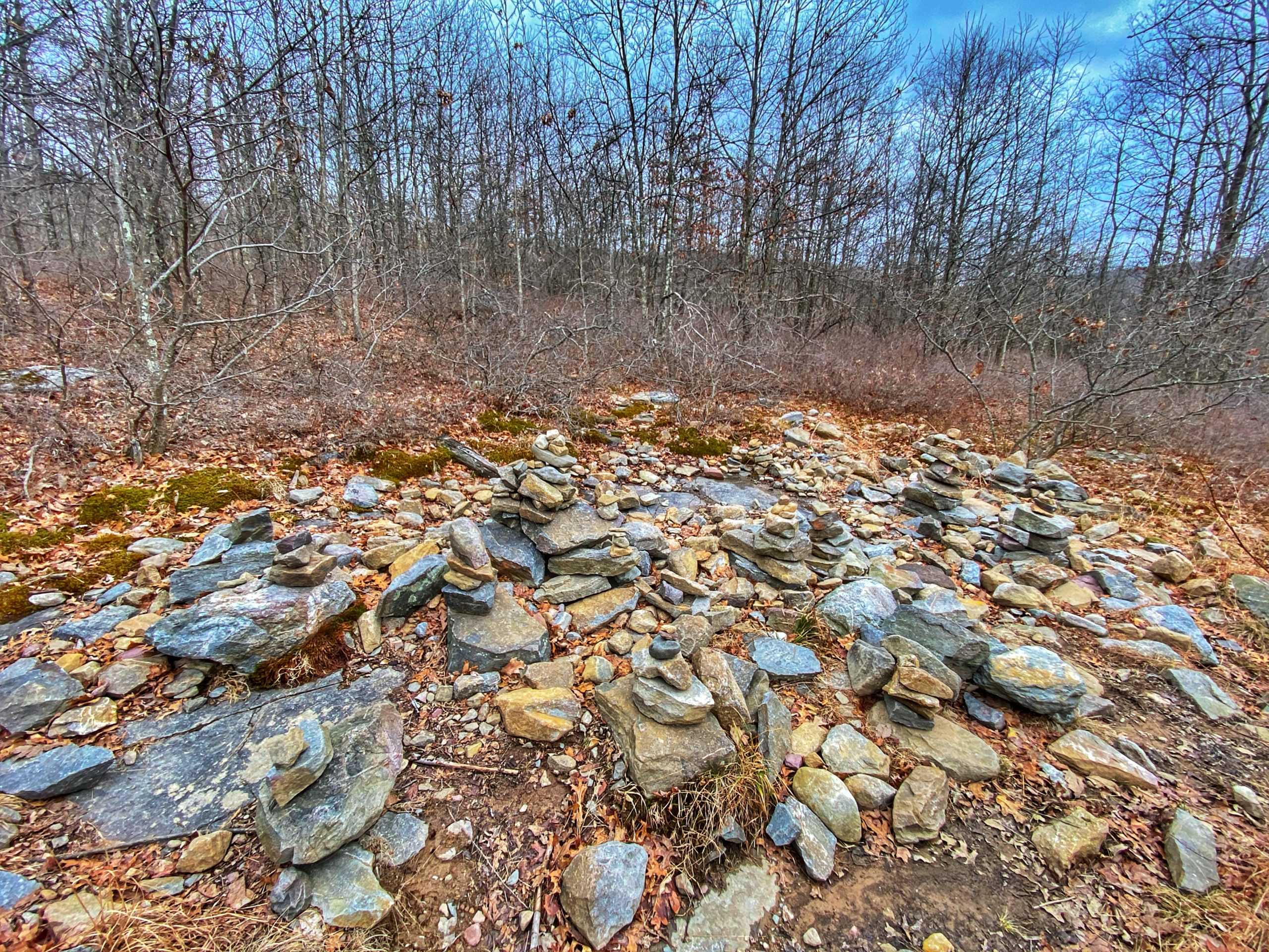
From here, it’s 3.25 miles to the trailhead. Along the way, you may spot a cairn garden in an opening to the left side of the trail.
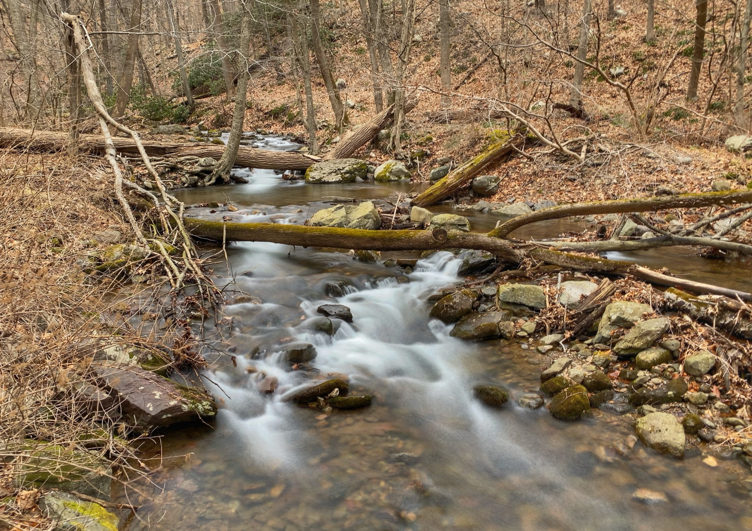
Dunnfield Creek
You’ll pass a junction with the Fairview Trail, and then you will join with the Dunnfield Creek Trail on the left. The cascades from Dunnfield Creek are beautiful and you will find a lot of people on this part of the trail.

Soon, you’ll cross a wooden footbridge over Dunnfield Creek, and the parking lot will be just ahead.