Overview
This hike explores Bradley Mine, the largest and perhaps most interest mine in Harriman State Park. It’s a cavernous, colorful mine that produced iron ore during the Civil War but was abandoned in 1874. The mine is flooded, but depending on the season, it’s possible to venture inside. If you do, we recommend bring a head lamp or flash light. Also note that the last part of the hike up to the mine can be very steep, and needless to say, always exercise caution around mines.
Length: 1.9 miles
Elevation gain: +380 feet

Location: Harriman State Park, NY
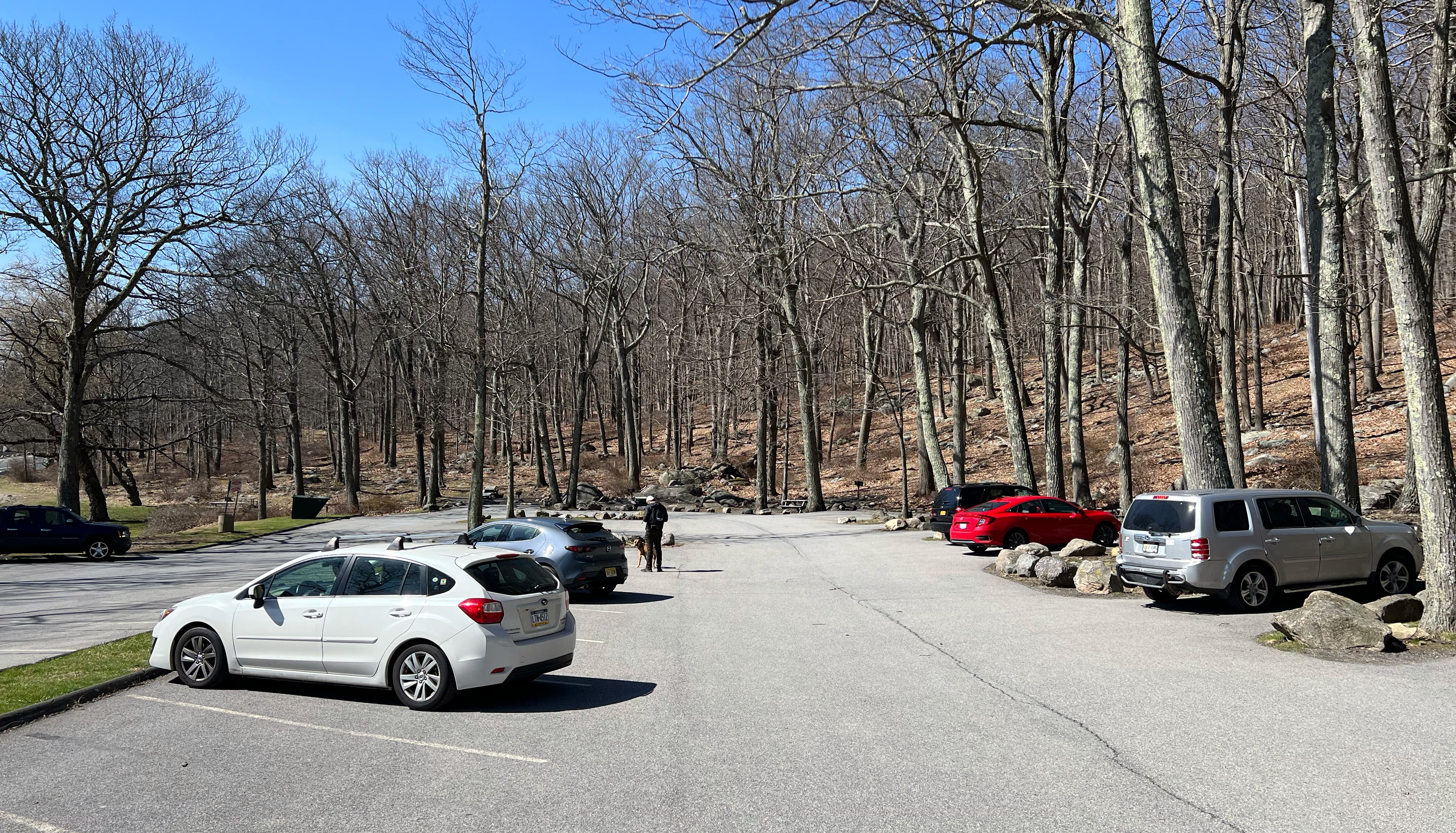
Bradley Mine Parking
Park in the lot for the Lake Tiorati Picnic Area just west of the Tiorati Circle (Google maps link).
Bradley Mine Trail Map
- Harriman-Bear Mountain Trails Map – NY-NJ Trail Conference (print)
- Harriman-Bear Mountain Trails Map – NY-NJ Trail Conference (Avenza)

Bradley Mine History
The following history is from Iron Mine Trails, written by archeologist Ed Lenik:
The Bradley Mine was operated extensively during the Civil War, and its ore was shipped to the Clove and Greenwood furnaces at Arden, New York. During this period, it was owned and operated by Robert and Peter Parrott. The mine ceased operating in 1874.
Trail historian William J. Myles indicates that the mine was named for a man named Bradley who “opened iron mines on the land” sometime during the Revolutionary War. No further information is presently available about this person. Perhaps he was related to Richard Bradley, who was appointed Attorney General for the Colony of New York in 1722. Bradley and his children received several large grants of land in the Highlands region from King George II, including “Richard Bradley Pear Hill Tract” (now part of Bear Mountain State Park) and other tracts in the area. Bradley died in 1749.
Iron Mine Trails
Bradley Mine Hike
There’s no marked trail to get to Bradley Mine, but it’s not that hard to find.
From the parking area we will want to head to Arden Valley Road. Walk there through the parking lot or follow the blue-blazed Lake Tiorati Trail a short distance until it approaches the road. Now, follow Arden Valley Road to the west for 0.9 miles.
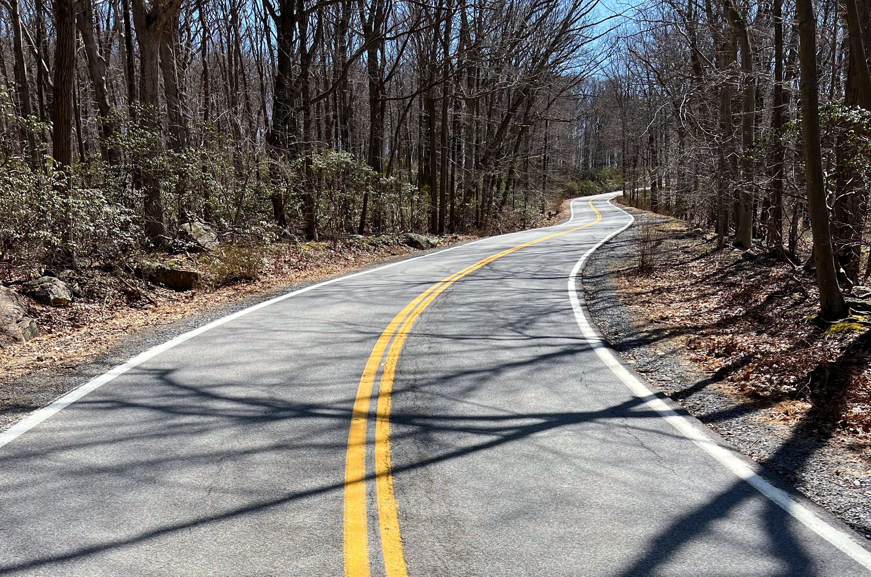
The road heads uphill for a quarter mile, then begins to descend right before the Appalachian Trail crossing. In about 0.6 miles, the teal-blazed Long Path crosses the road.
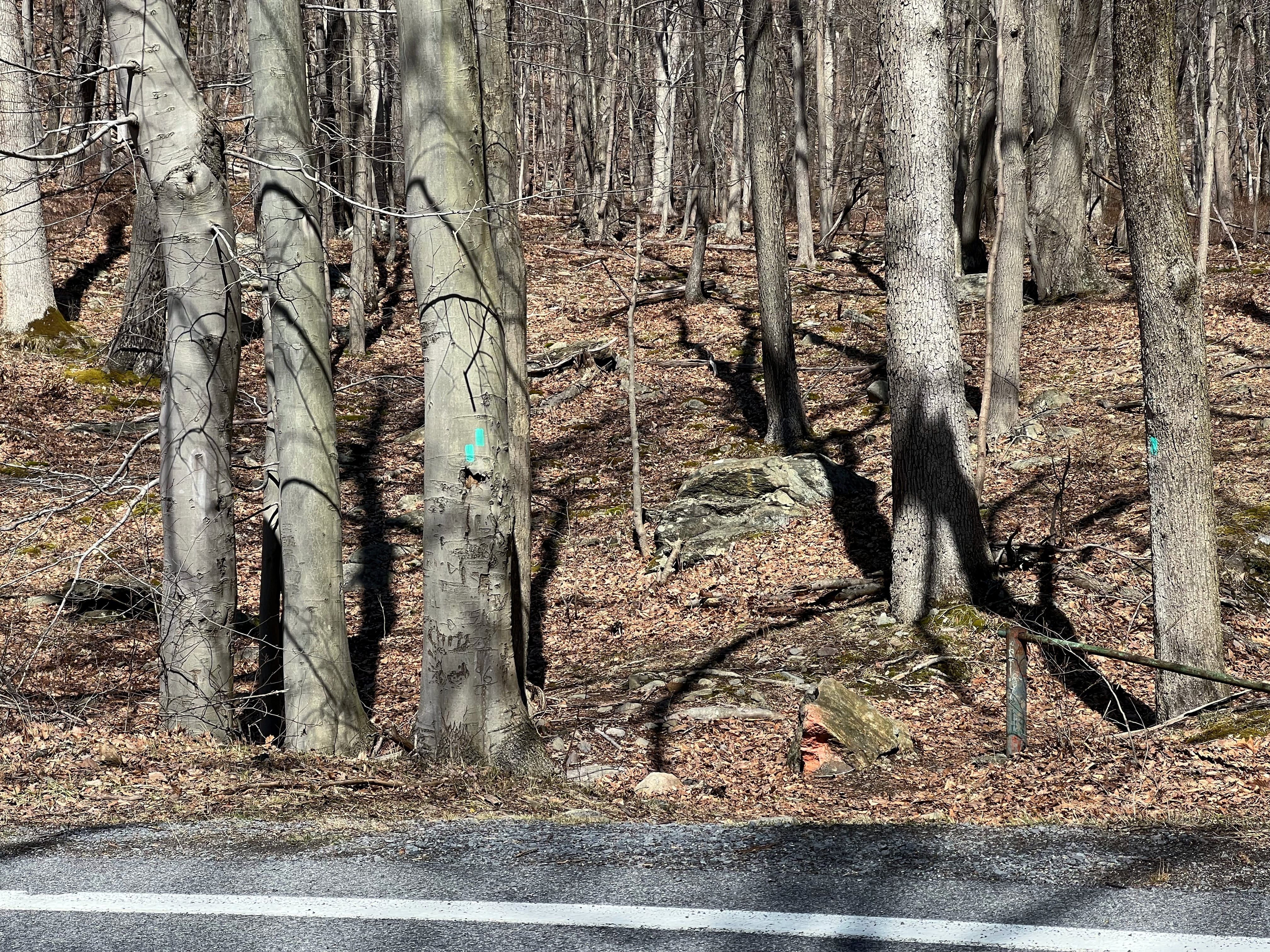
From here, you’ll continue about another quarter mile. Look on the right for a tree with a sign indicating “Restricted Area”.
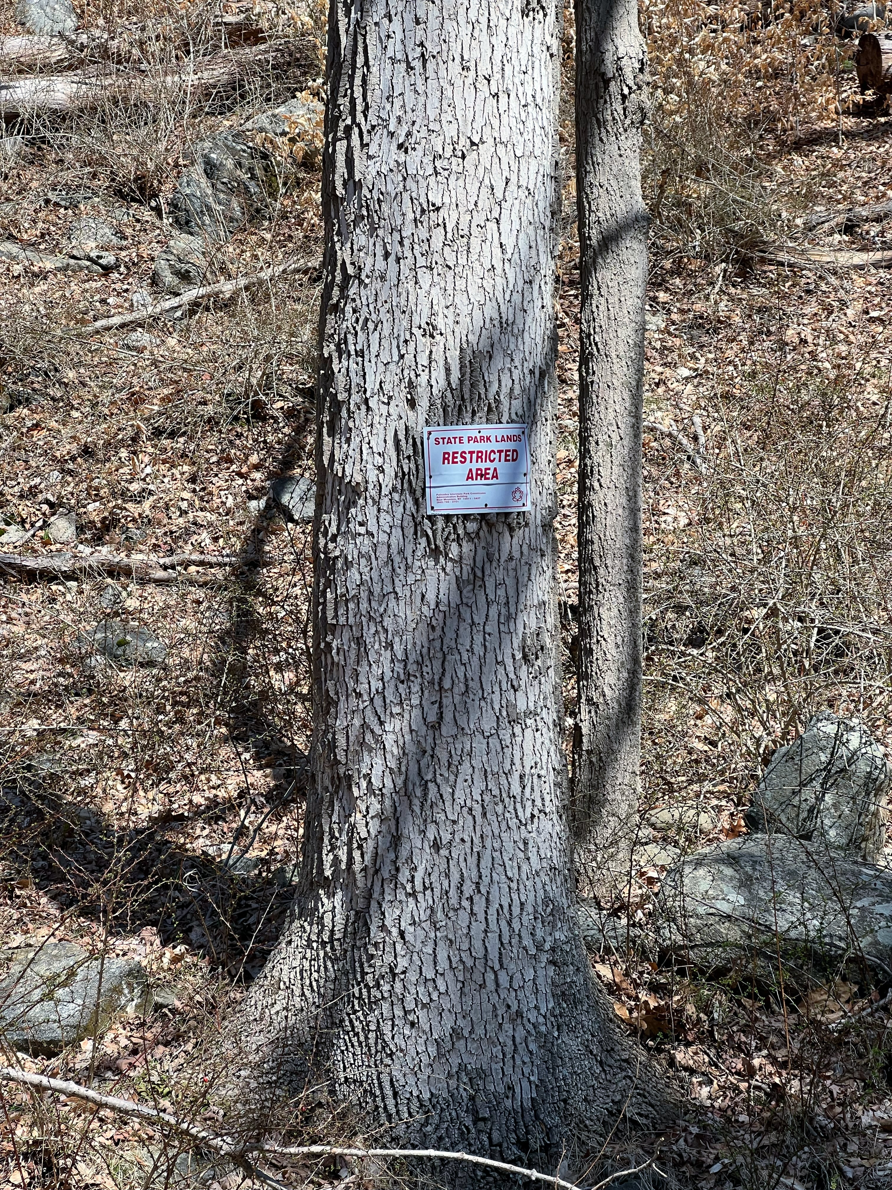
Almost straight uphill from this tree is the mine, which is not visible from the road. You’ll notice a large steep rock ledge straight ahead of you. If you look around, you can find some faint herd paths up the very steep slope to either side of this rock face. Or for an easier approach, continue walking west a few hundred feet further and look for an old unmarked and unmaintained woods road on your right that leads steeply (though less steeply than the herd paths) up the hill towards the mine.
At the top of the woods road you’ll see the mine and the start of an open cut.

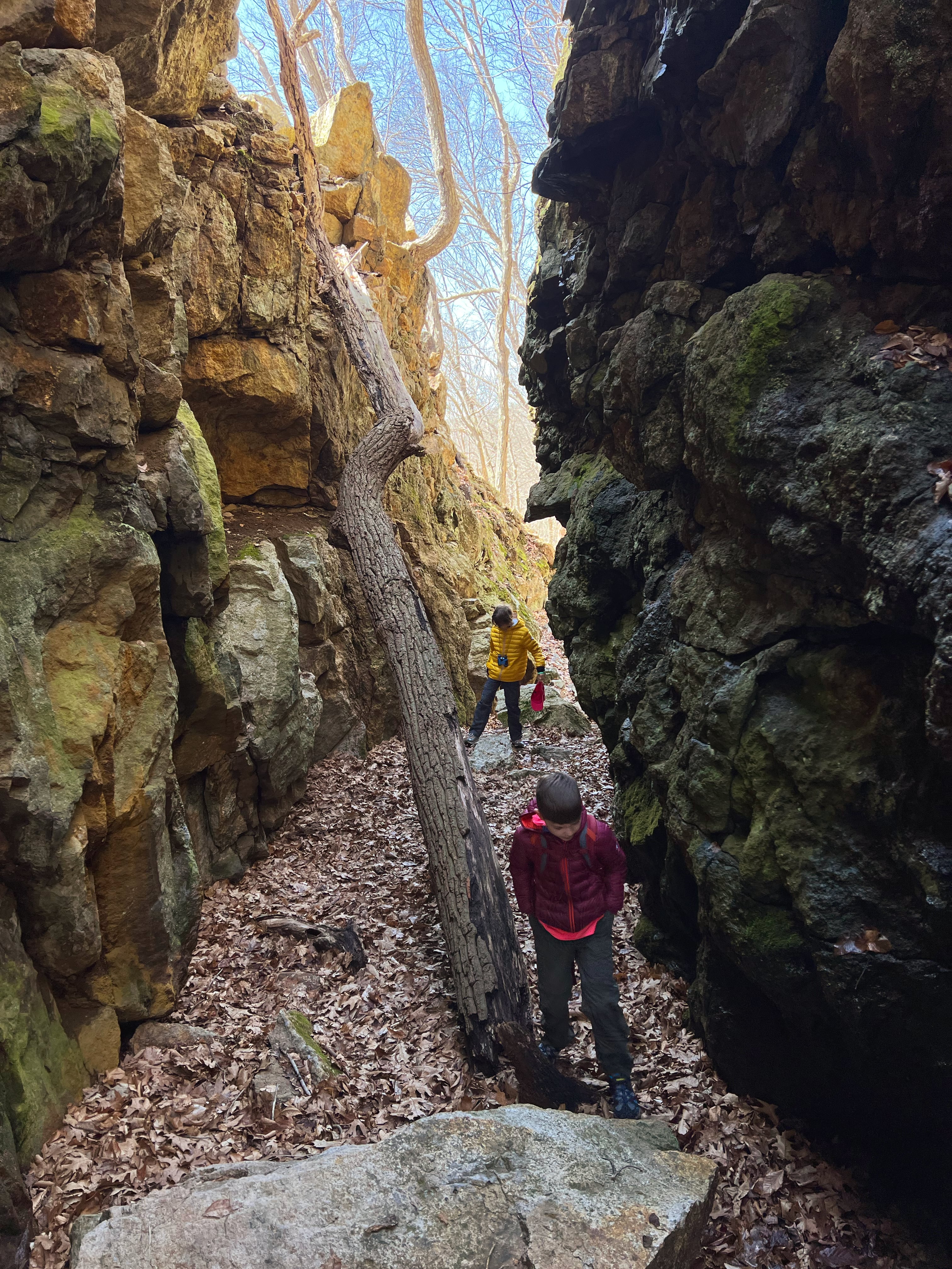
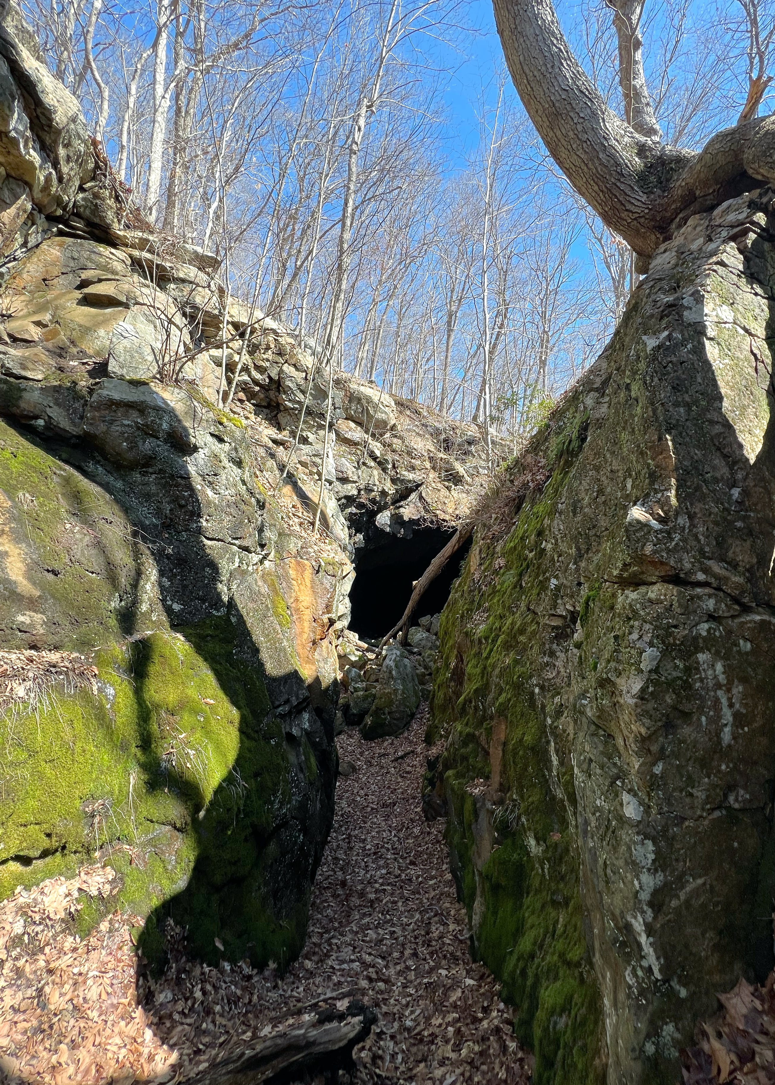
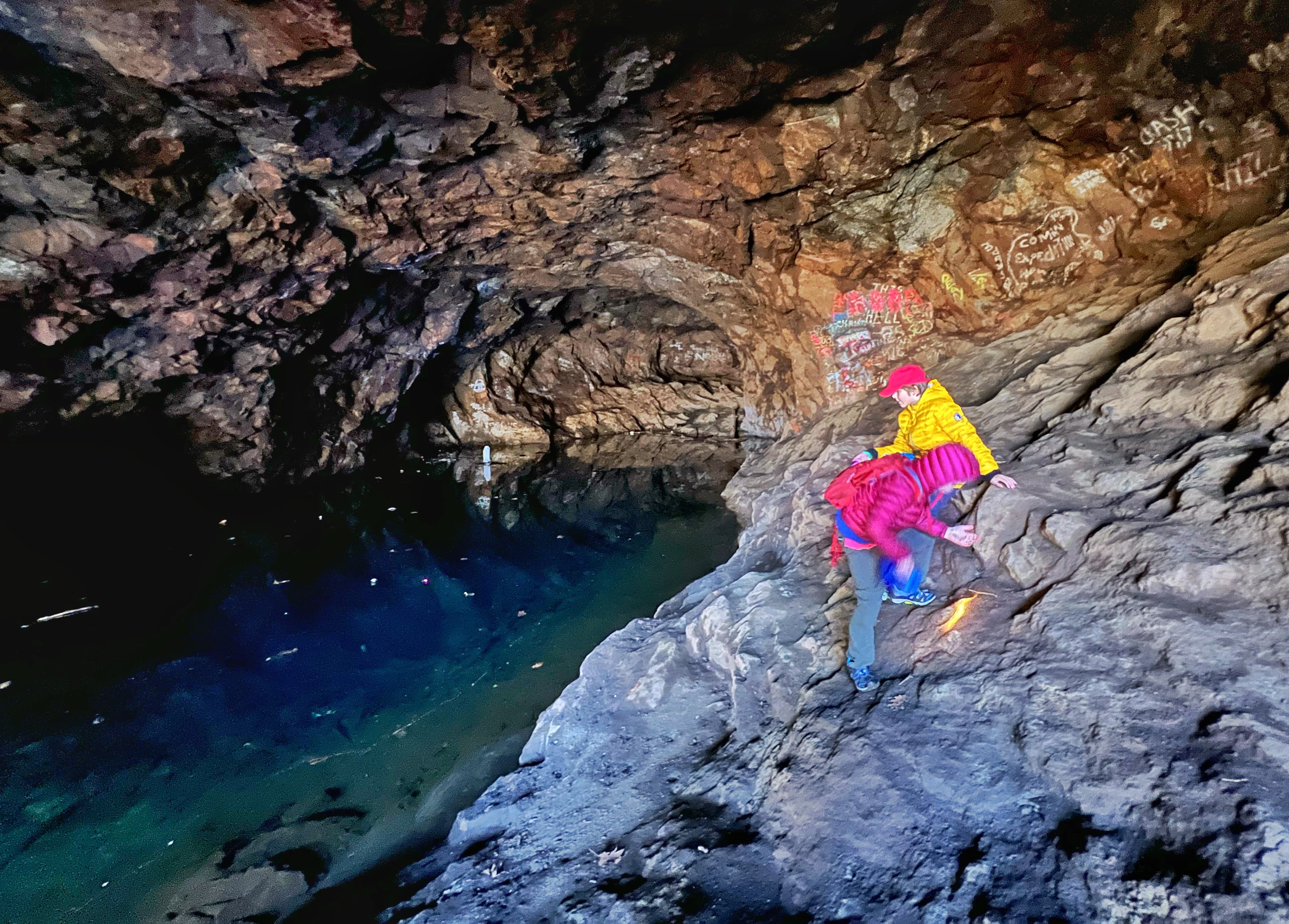
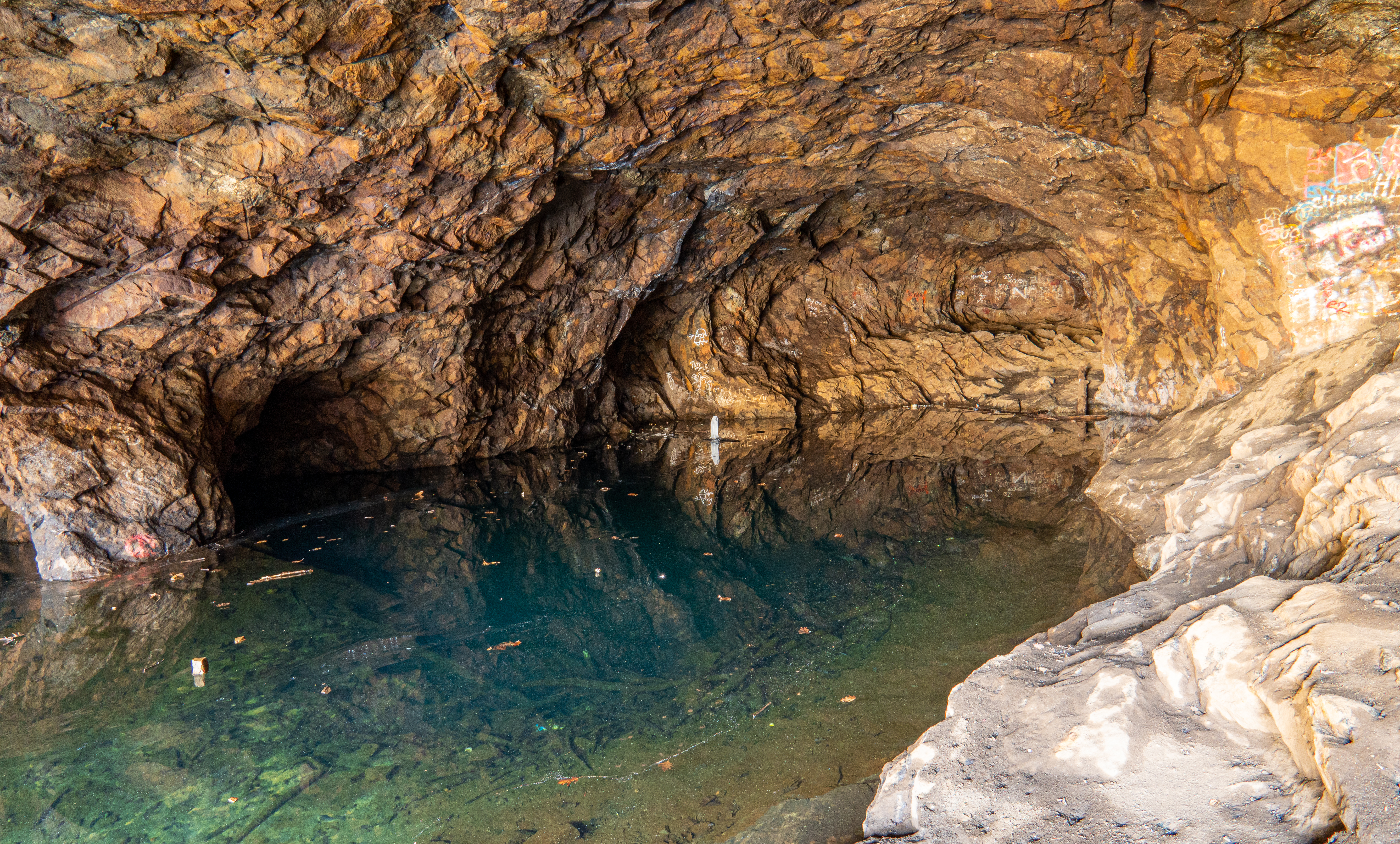
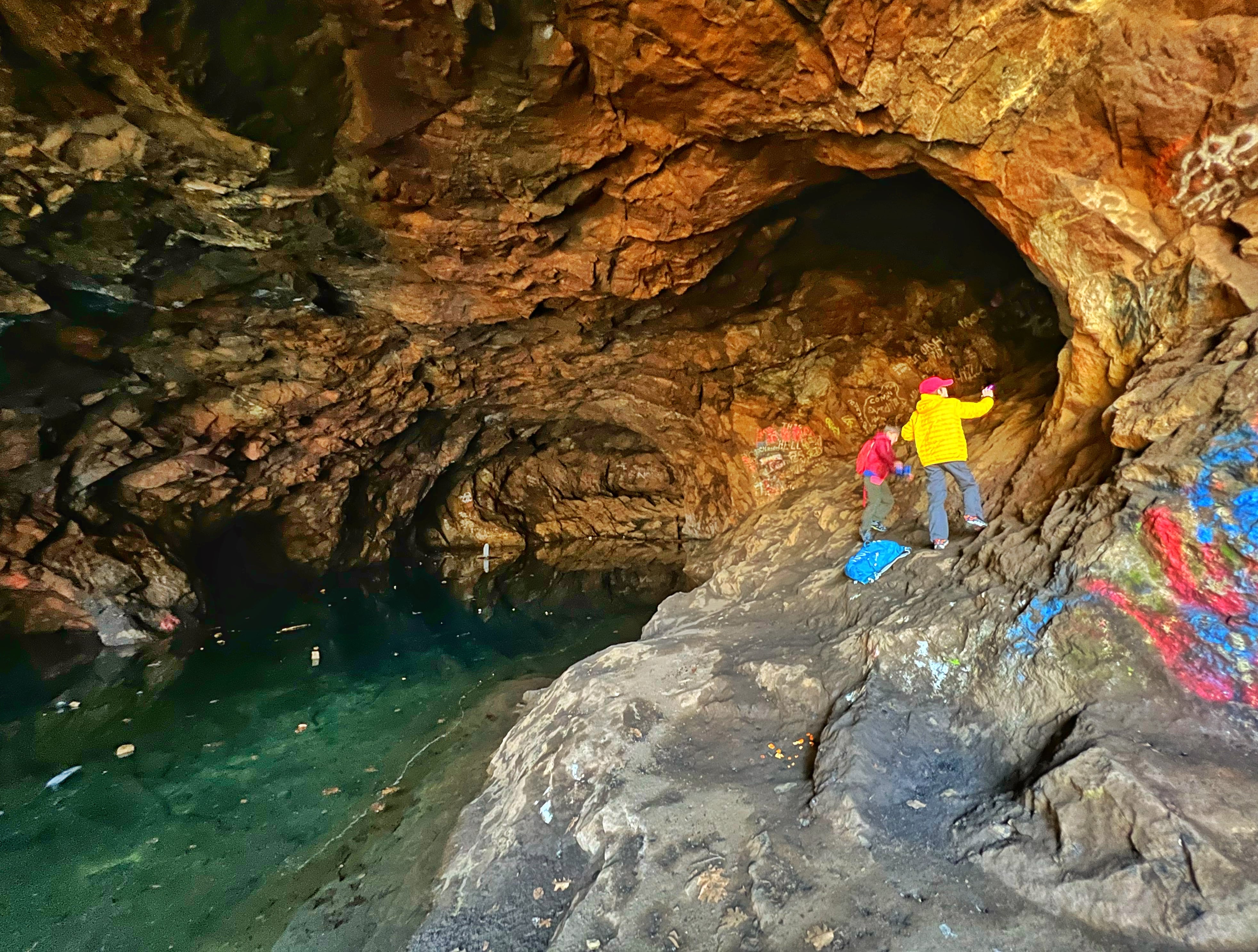
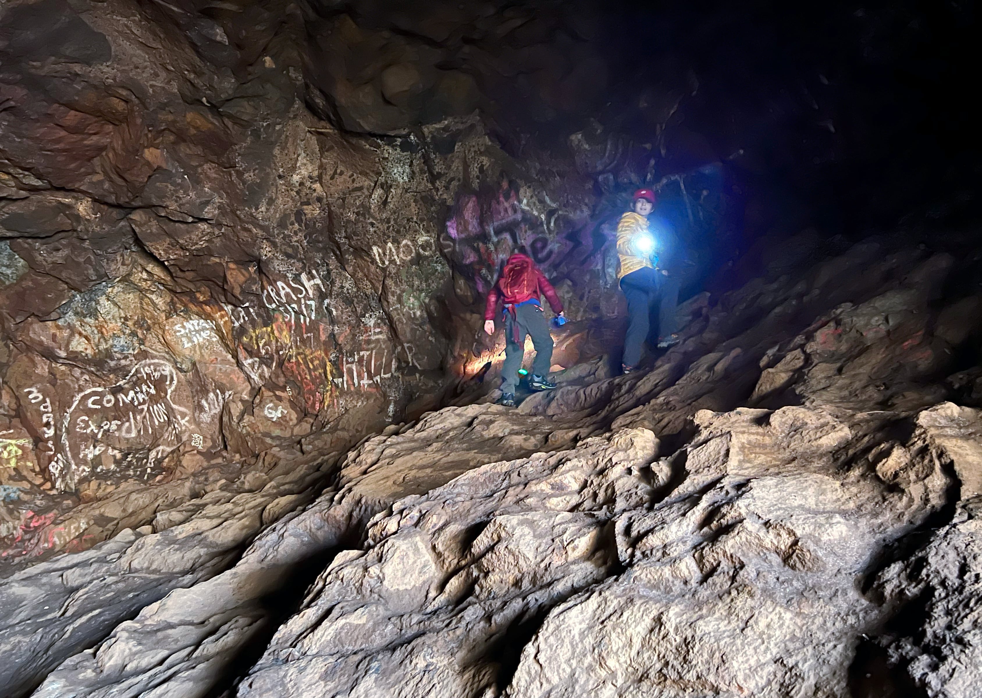
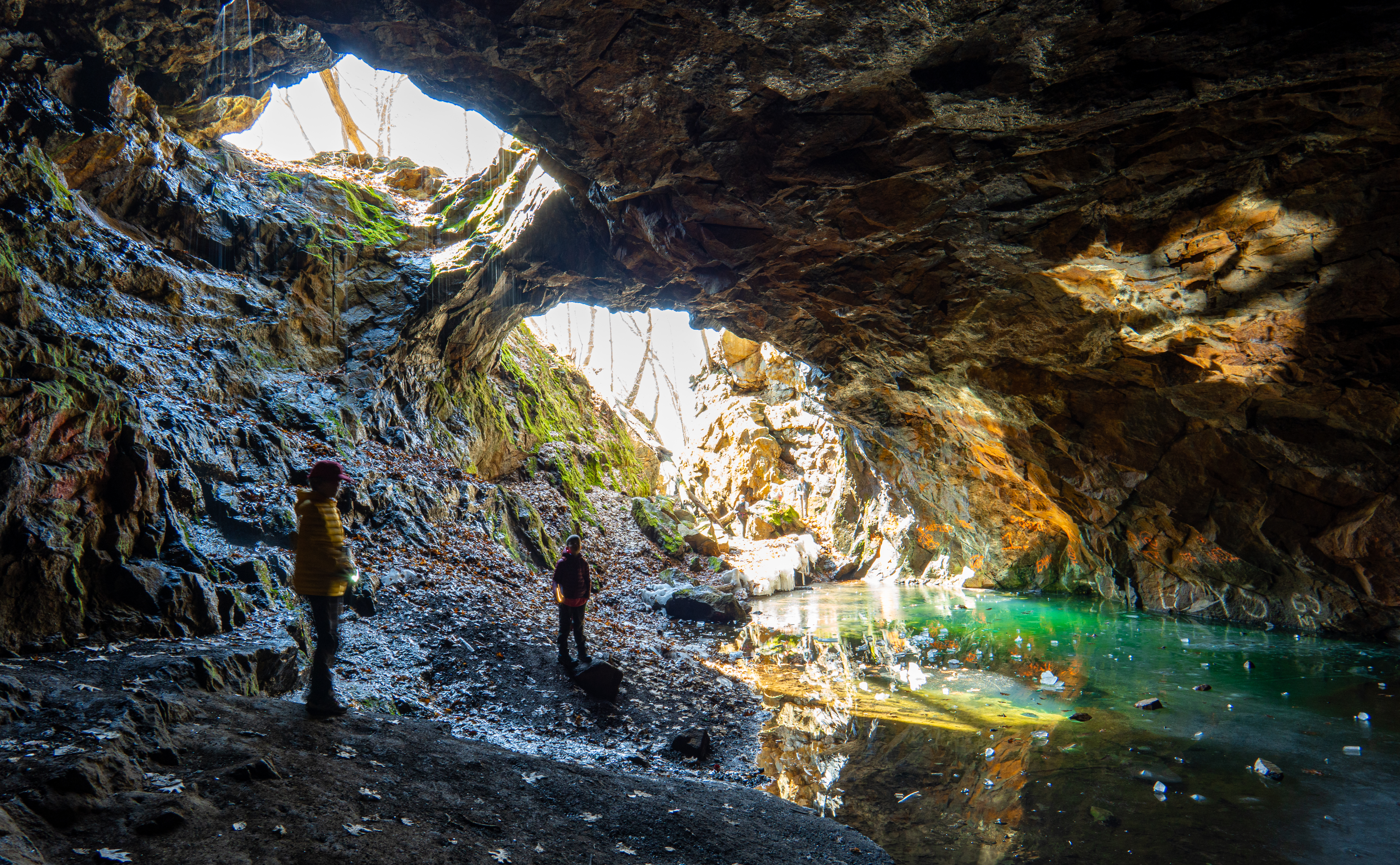
Walk through this open cut, which is about 200 feet long and up to 50 feet deep. At the end of the cut, you’ll see a hole in the side of the hill for the mine shaft which goes into the mountainside.
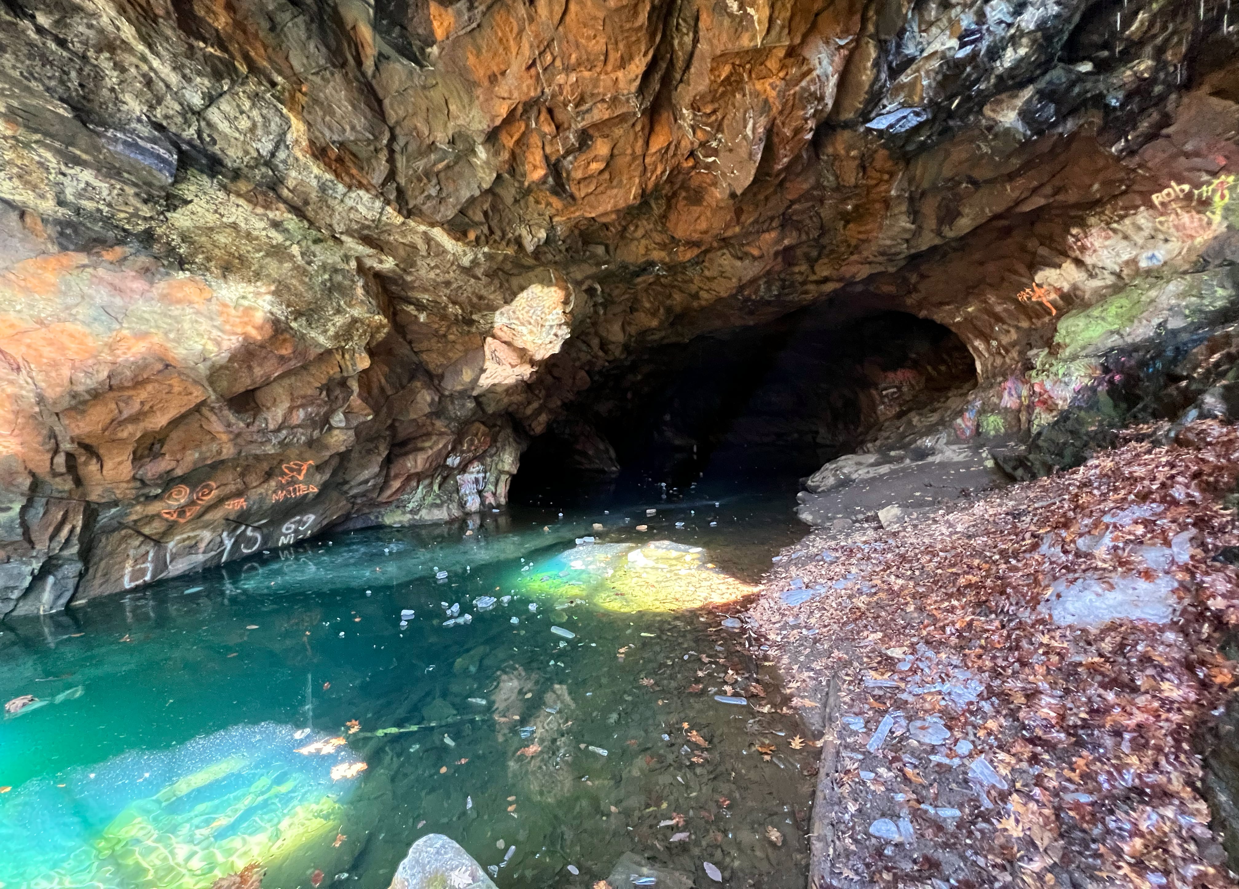
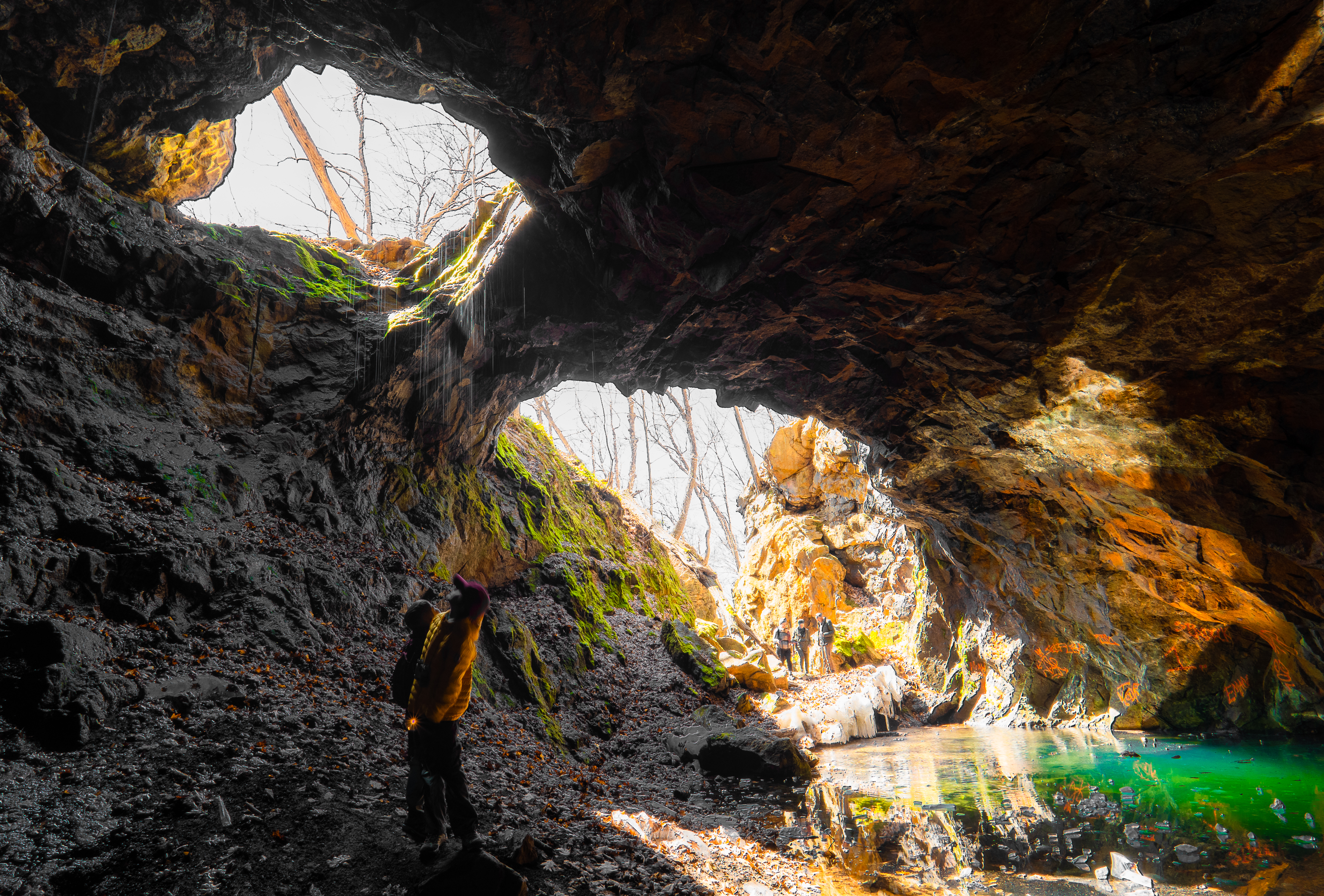
Depending on the season, the mine shaft will have varying levels of water. In the winter, stalagmites and stalactites of ice from dripping groundwater will be hanging from the mine shaft opening. The mine can be muddy and very slippery so be very careful. If you want to go inside, it’s a good idea to bring head lamps or flashlights depending on how far into the cavern you want to go.
The description below of the mine also comes from Iron Mine Trails:
The mine consists of an open cut on the hillside that is about 200 feet long and nearly 50 feet deep near its northerly end. At the north end of the open cut there is a shaft or chamber that extends into the rock hillside. The chamber is cavernous – about fifty feet wide and twenty feet high – and it extends at least 100 feet into the hillside. It is filled with water. This chamber reportedly once contained a rich pocket of ore. An opening, probably an air shaft, is located along the roof of the chamber on its southerly side. Several drill marks can be seen along the walls of the open cut and within the chamber itself. This mine must be approached and viewed with extreme caution….
Iron Mine Trails
If you head back out of the mine to the start of the cut, you can follow the road a little further uphill to get a view of the mine from above.

Retrace your steps back downhill and along Arden Valley Road to return to the Lake Tiorati Picnic Area.


