Overview: This loop hike follows the Appalachian Trail to the top of Mount Minsi and offers dramatic views of the Delaware Water Gap and Mount Tammany. The trail really packs a punch and also features rhododendron tunnels, cascades, a lovely waterfall, and Lake Lenape.
This hike deviates slightly from the most common route for this hike which appears on the AllTrails app. Instead of following a woods road the entire way downhill, it deviates and partially follows picturesque single track trails to explore cascades and a waterfall that are not visible from the woods road (Lake Road).
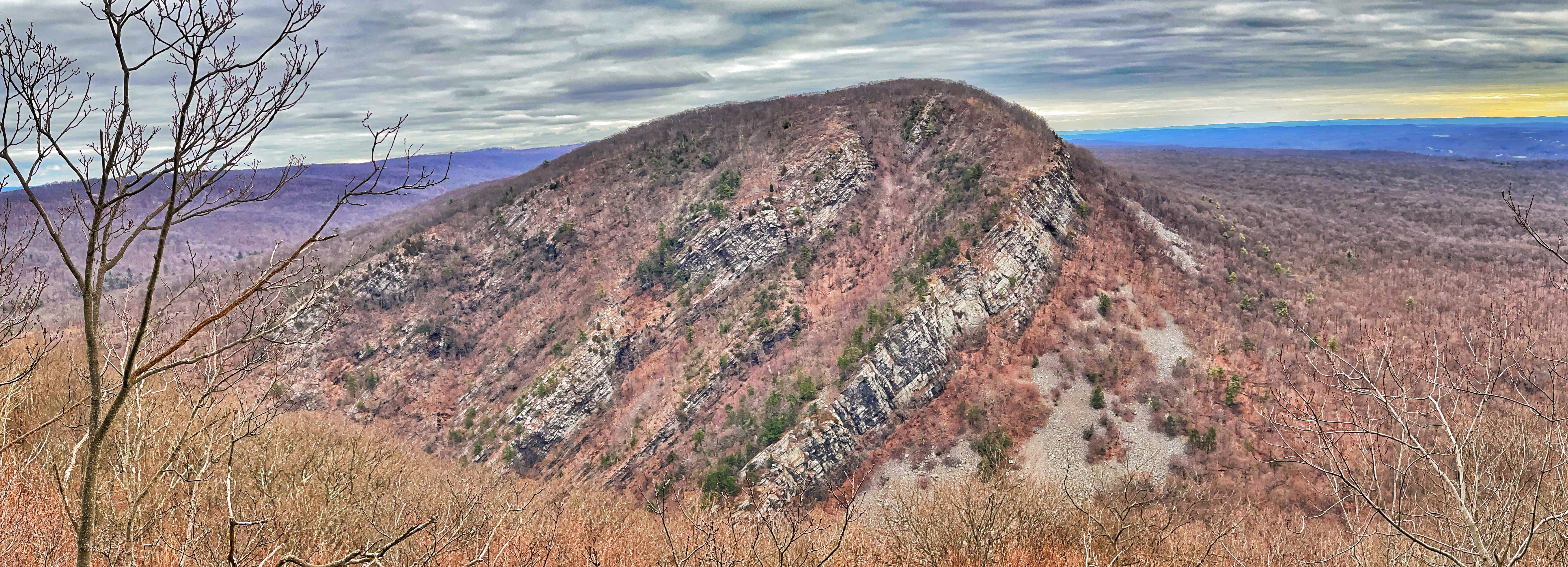
You might also want to check out Mount Minsi’s sister hike on the New Jersey side of the river, Mount Tammany, which offers a spectacular view of Mount Minsi. Some people complete both hikes in one day. For a long hike across the river, consider the Mount Tammany and Sunfish Pond Loop.
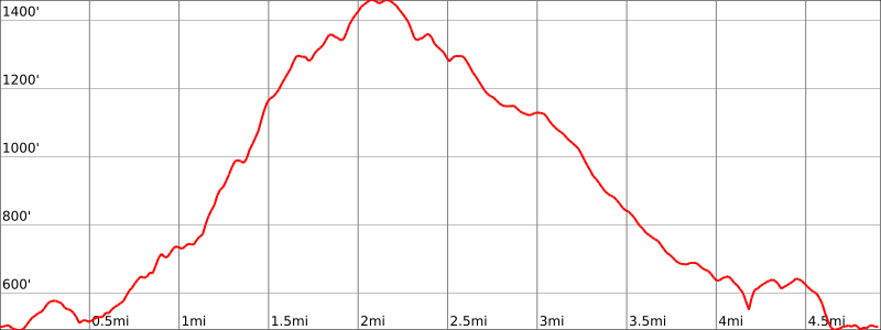
Hike Length: 4.9 miles
Elevation Gain: 1,335 feet
Location: Delaware Water Gap National Recreation Area, Borough of Delaware Water Gap, Monroe County, Pennsylvania
Parking: Park at the Lake Lenape parking lot on Lake Road: Google maps link. Get there early; it fills up quickly.

There is also a small lot that fits a few cars down the road along Mountain Road near the junction with Lake Road (Google maps link).
Maps
- Gaia GPS app (the only map I know of that shows the location of the waterfall)
- Worthington State Forest (NY-NJ Trail Conference)
- Delaware Water Gap and Kittatinny Trails Map #120 (NY-NJ Trail Conference) – paper map
- Delaware Water Gap and Kittatinny Trails Map (NY-NJ Trail Conference) – Avenza
-
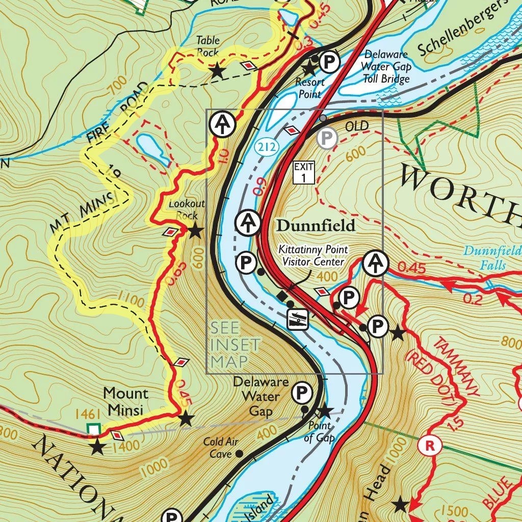
Overview trail map -
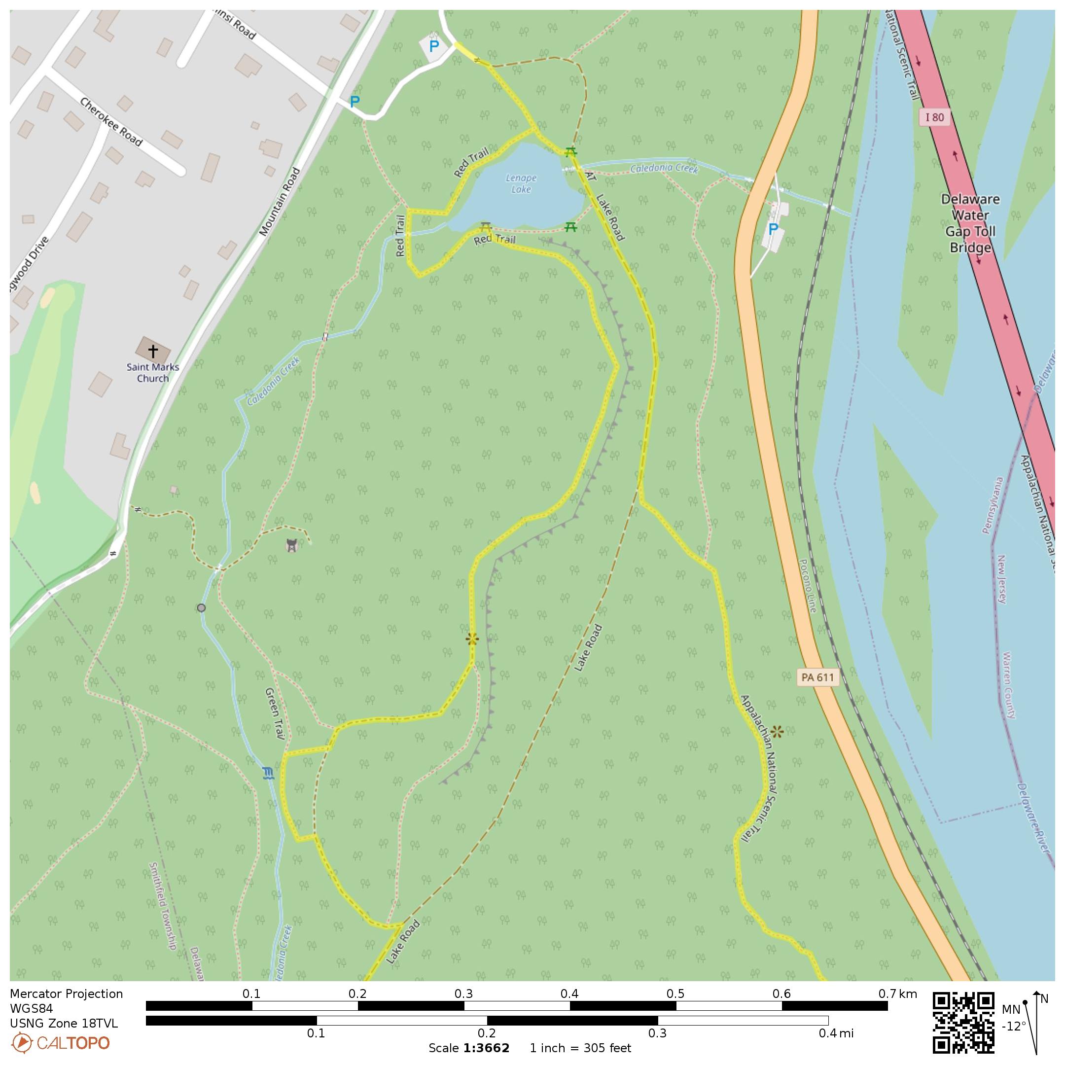
Trail map detail – note the side trail to the waterfall (does not appear in most maps)
Trail Description
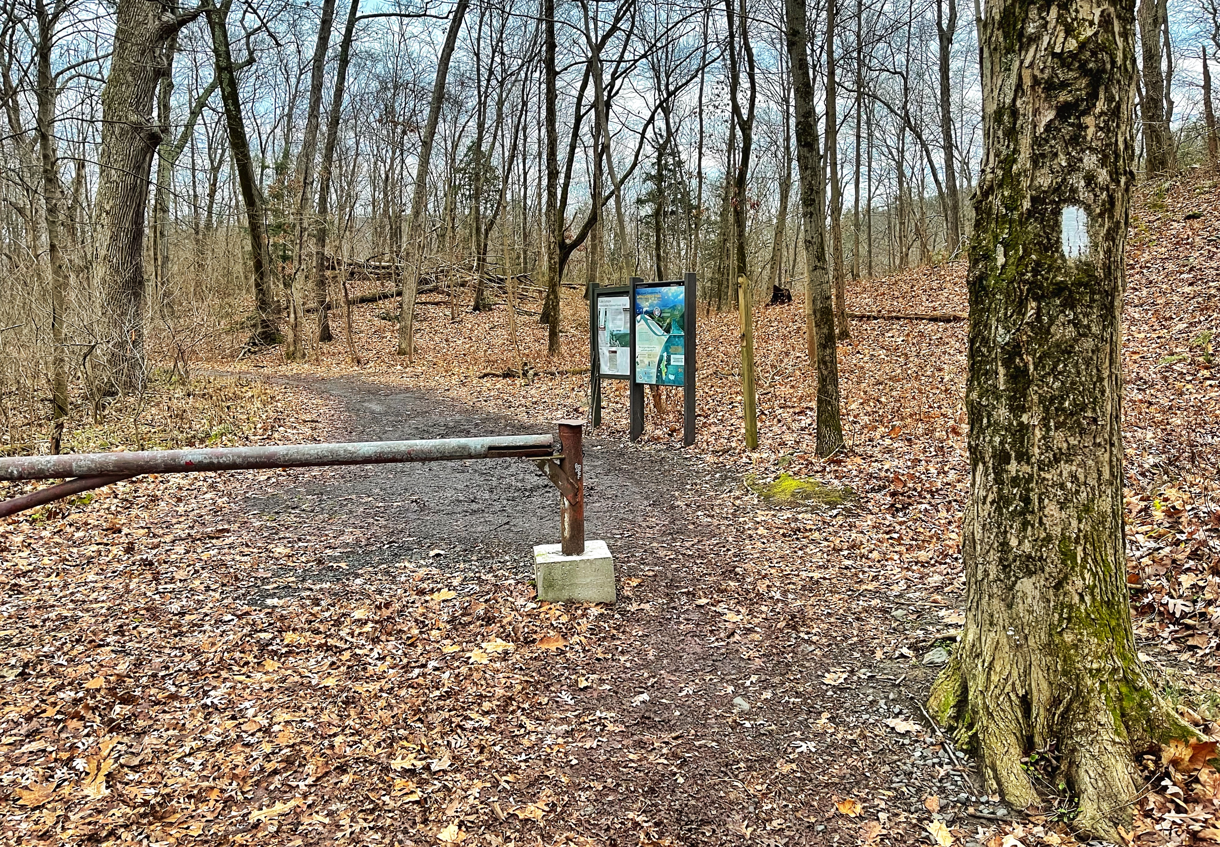
From the parking lot, head towards the trailhead with the gate and begin to follow the woods road. We’ll follow the white-blazed Appalachian Trail to the top of Mount Minsi.
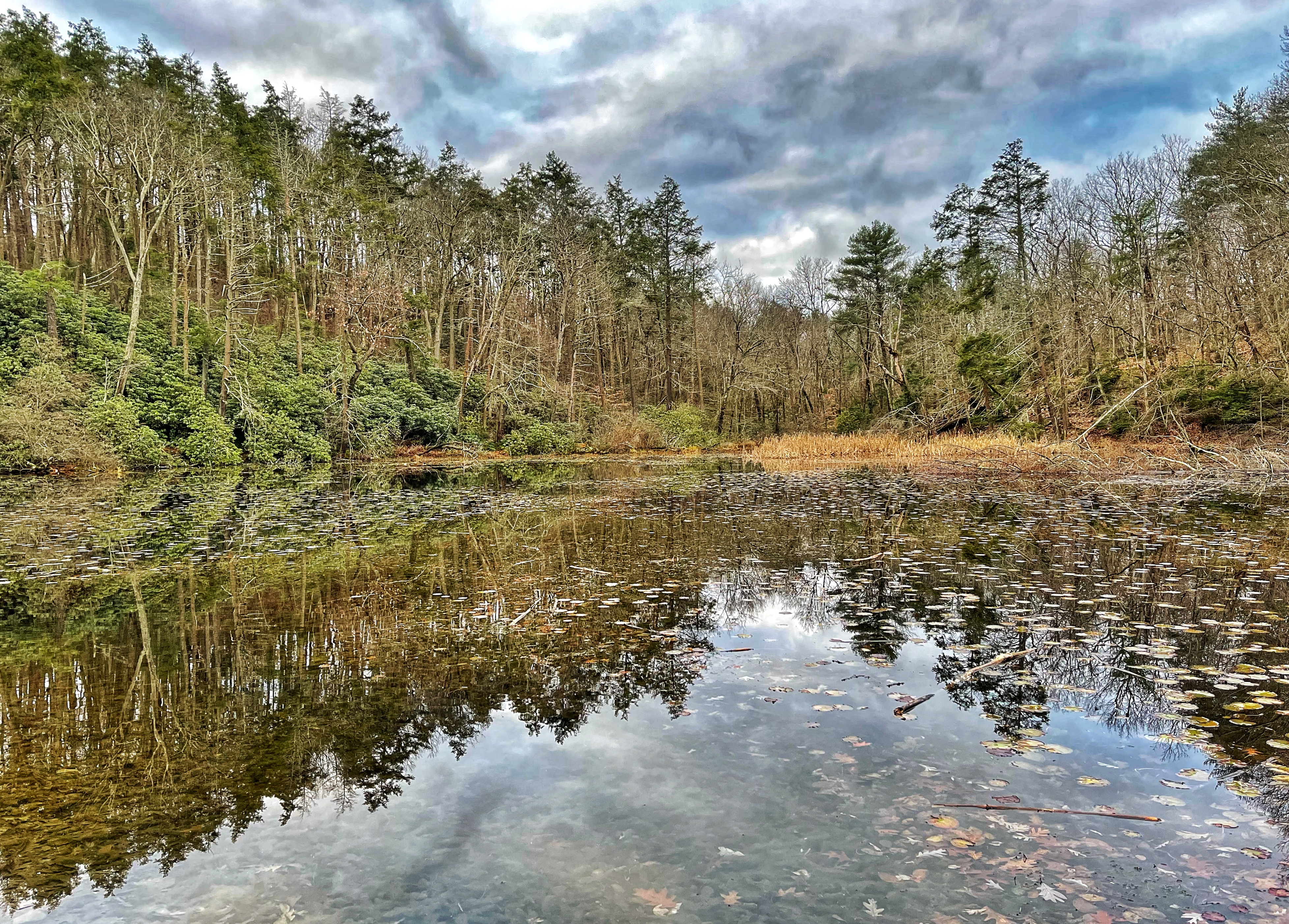
The trail follows a woods road to the left then soon passes to the left of Lake Lenape.
The trail now begins to climb along the woods road.

A short while later, stay left to follow the white-blazed Appalachian Trail along a footpath as the woods road forks to the right.
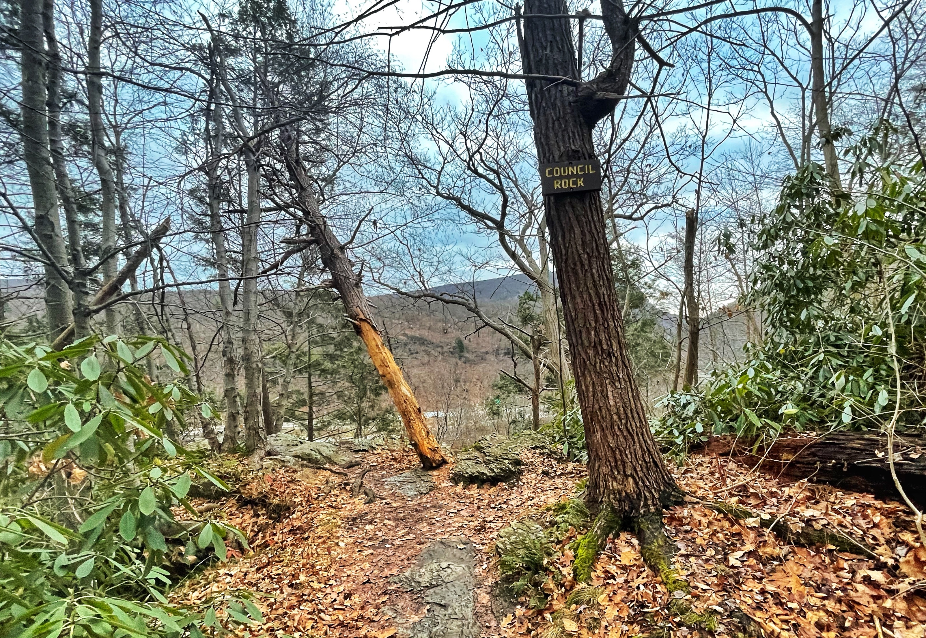
Soon you’ll reach the first viewpoint, Council Rock, although it’s now partially obscured by overgrowth.
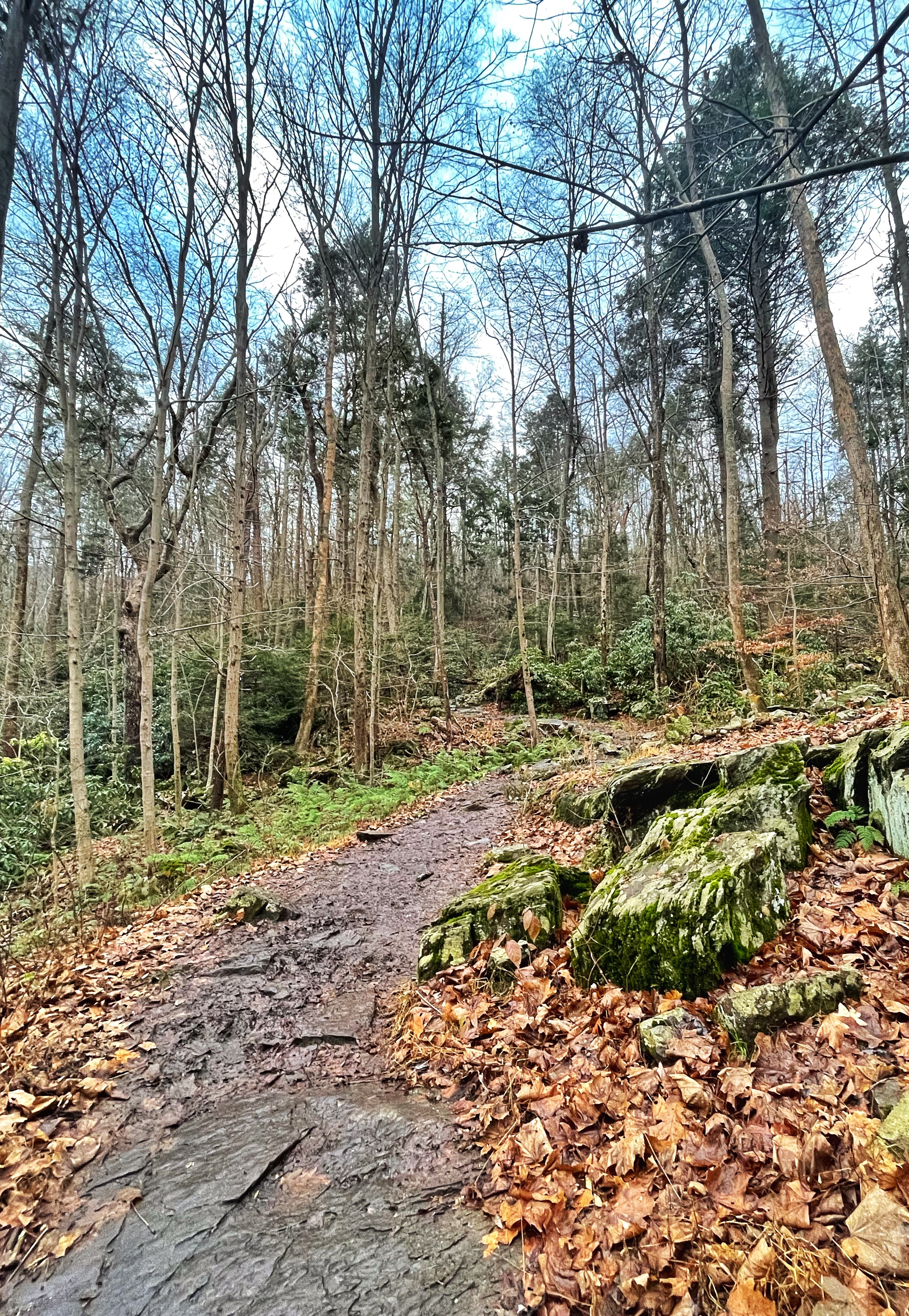
The rocky trail continues to climb.
You’ll reach Eureka Creek featuring a small cascade. Cross the creek on rocks.

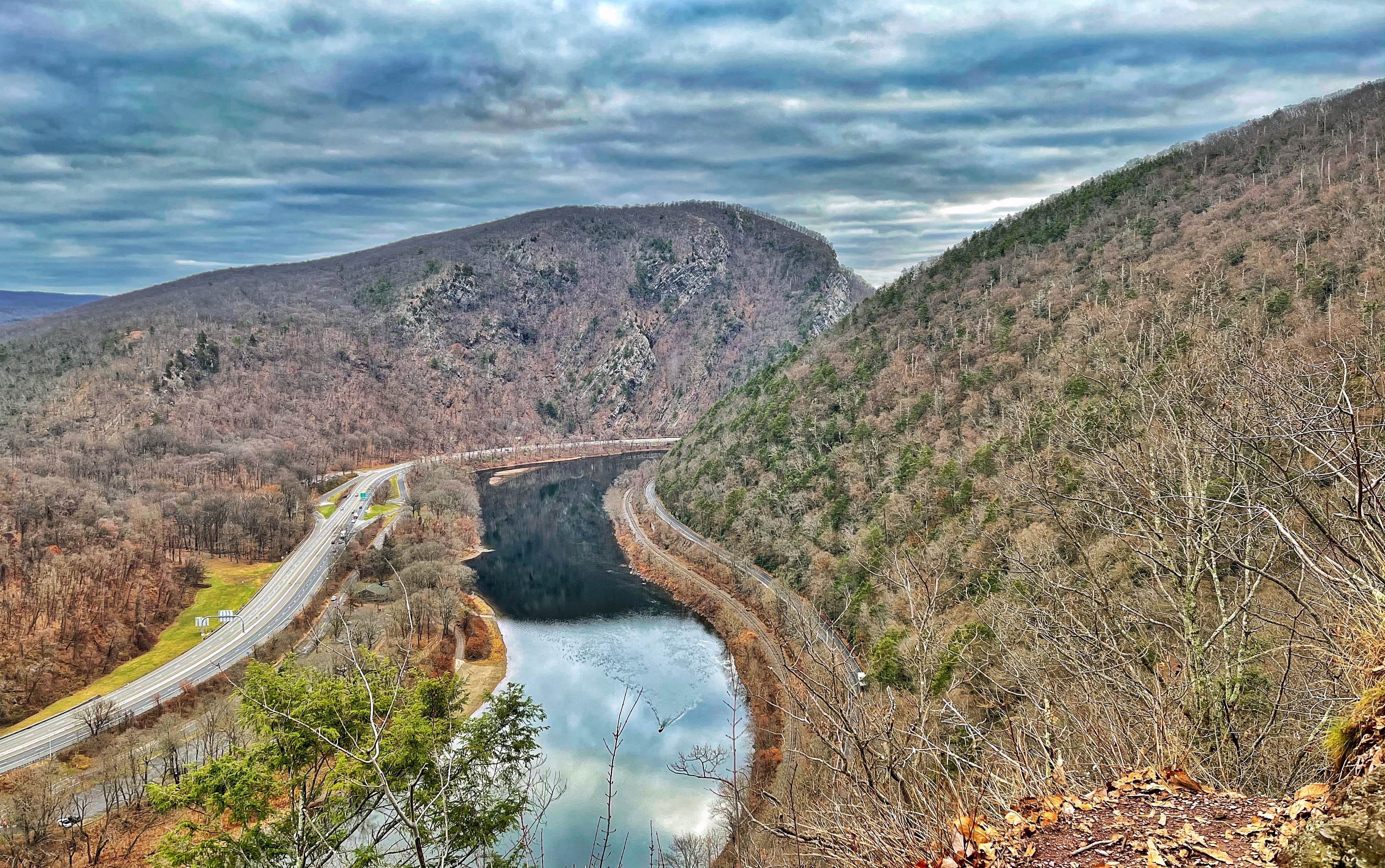
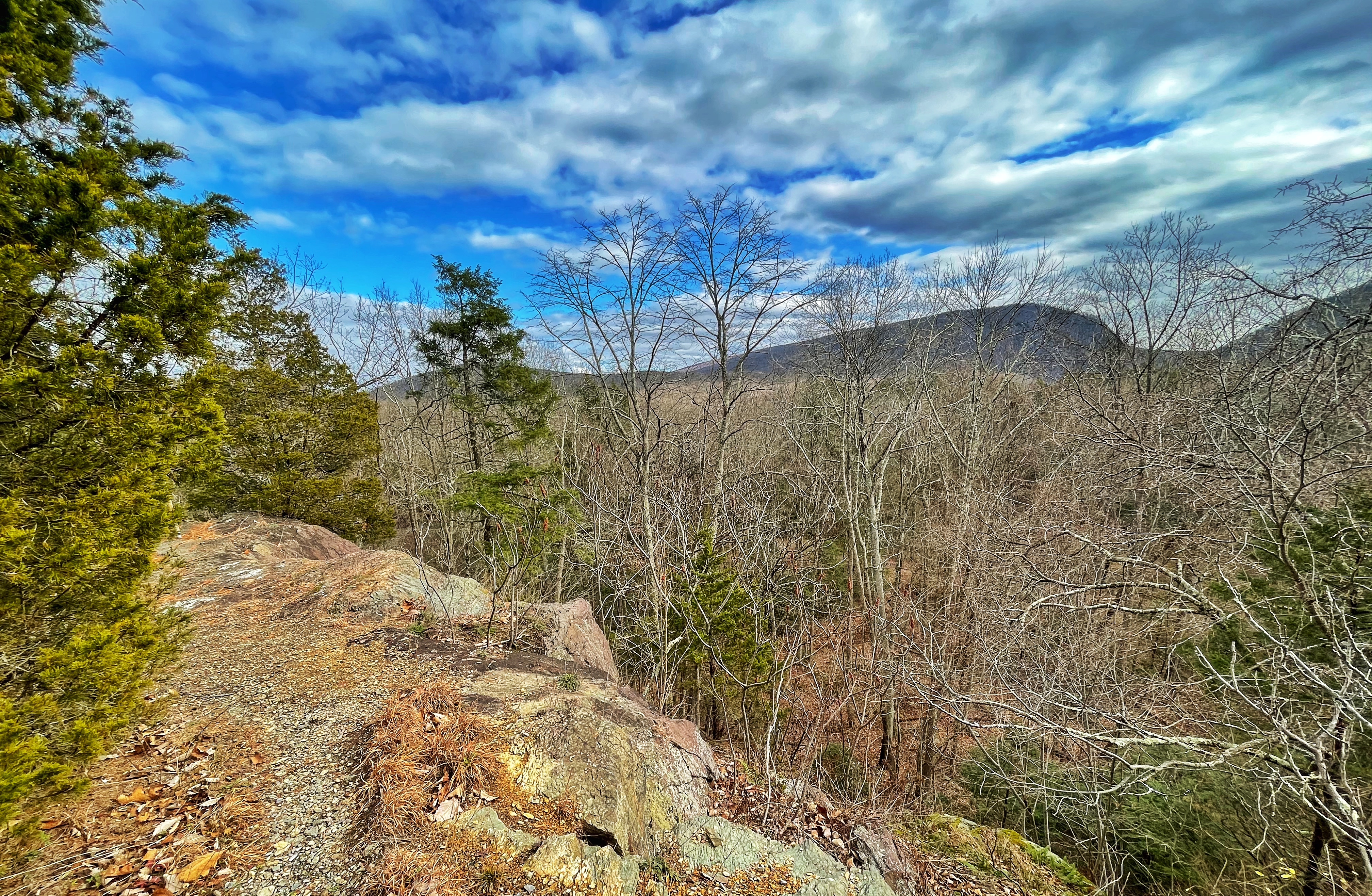
About 500 feet later, the trail makes a sharp turn to the right, but we’ll continue on a short spur to reach Lookout Rock which offers dramatic, unobstructed views of the Delaware Water Gap featuring Mount Tammany on the left and Mount Minsi on the right. I-80 and PA-611 are also visible on either side of the river.
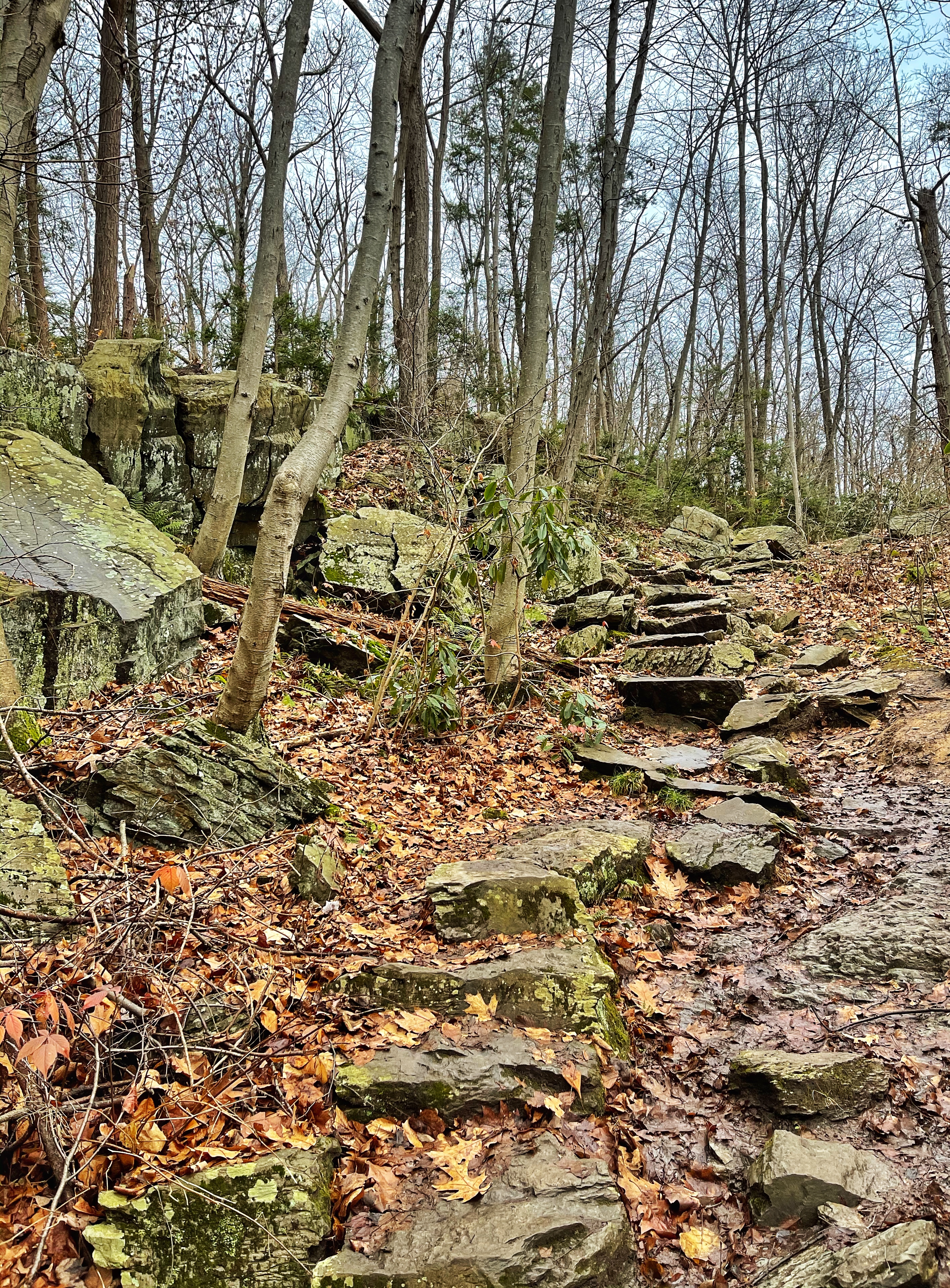
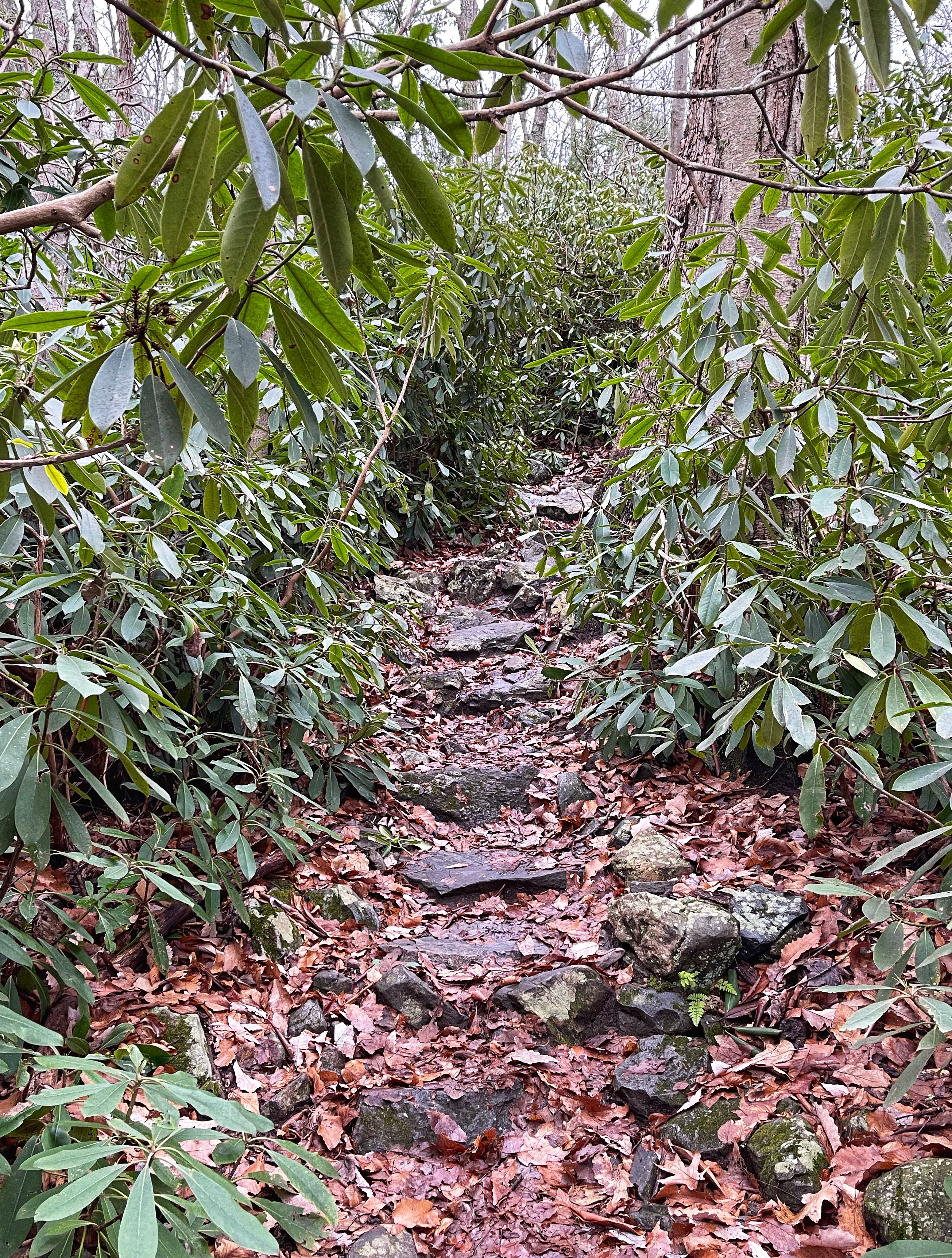
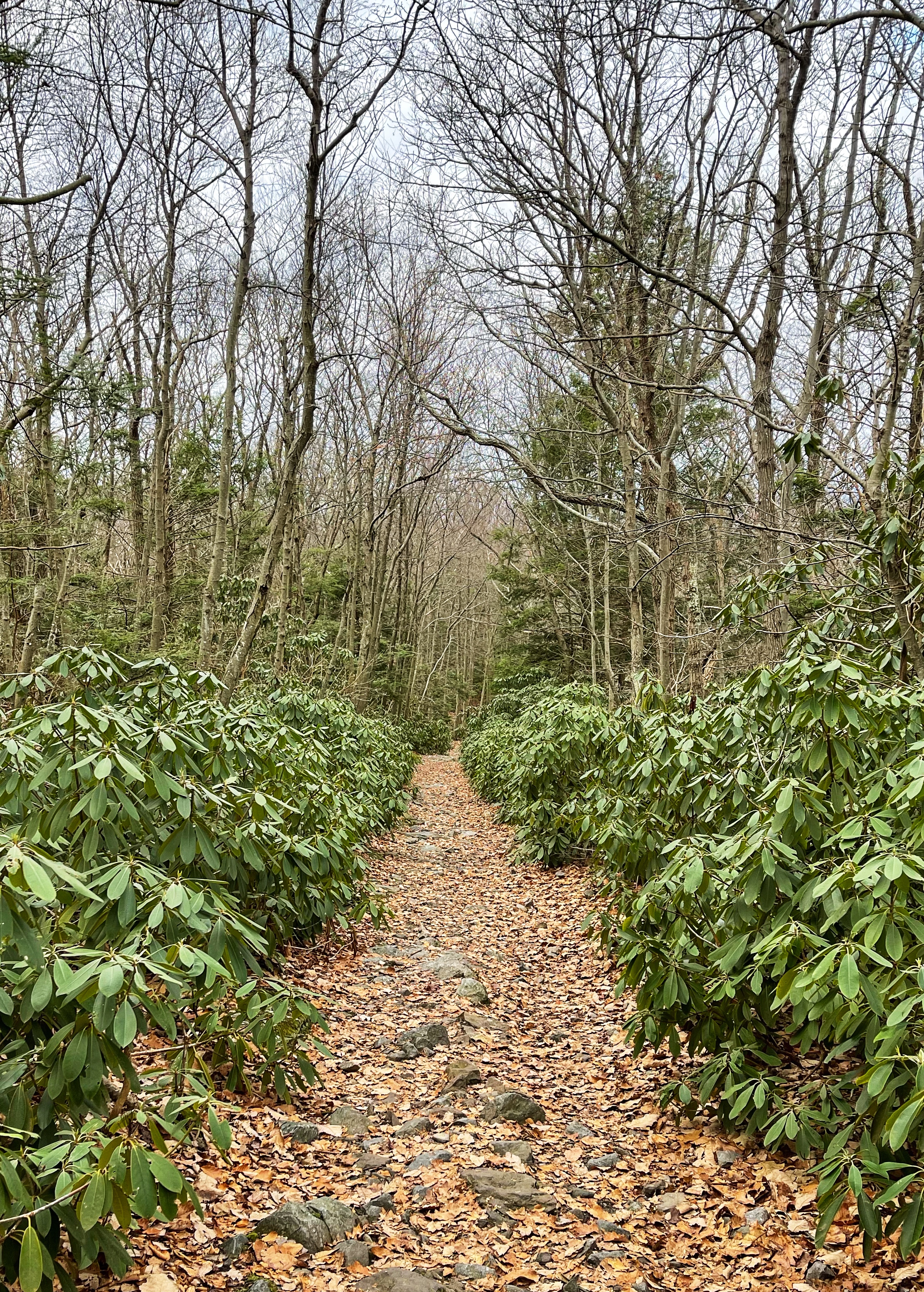
From here, retrace your steps back to the AT or scramble up the rocks to rejoin the trail. The trail continues to climb on rock steps and pass through thick rhododendron forest.
About 2/3 of a mile after Lookout Rock, the Appalachian Trail reaches a junction with a woods road (Lake Road). Note this location – we’ll take Lake Road back on the way down. Stay right to remain on the Appalachian Trail (don’t worry if you go left onto Lake Road – it soon reconnects to the AT where it ends).
The trail now climbs through rhododendron tunnel then reaches Minsi Lookout.
From here, peak through the trees for a look at Mount Tammany across the river. For a clear, unobstructed view, carefully scramble down a few feet to a ledge.
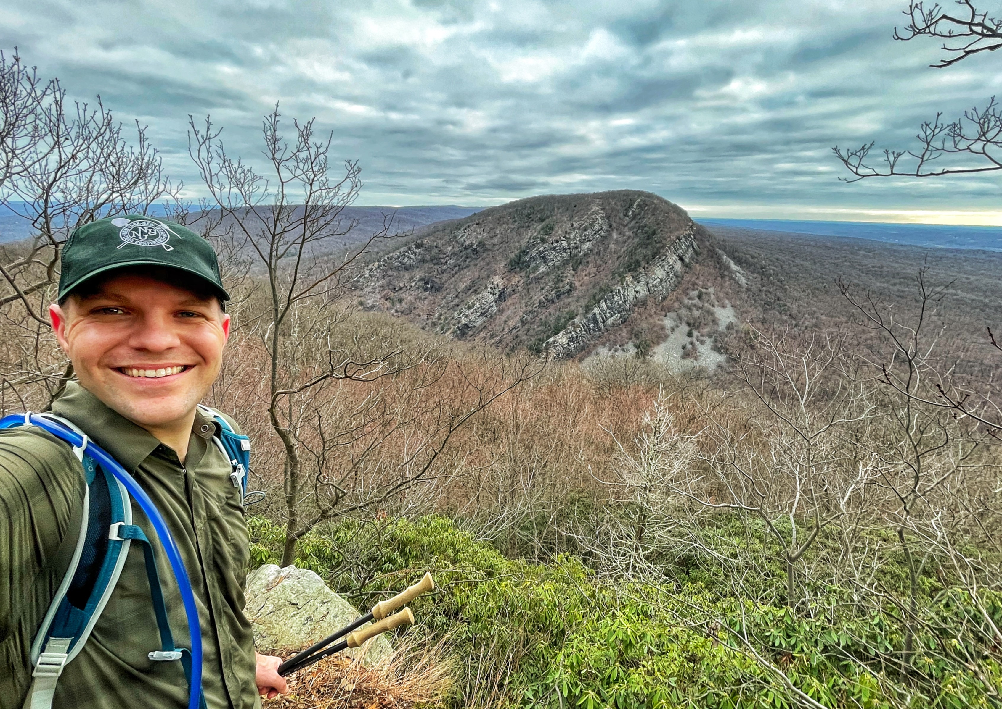
If you’d rather not scramble down for the view, continue just a few steps further to a clearing that provides a nice view of Mount Tammany peaking out through the trees.

From here, you could turn around and head downhill, or you can continue a little further to the actual summit of Mount Minsi and an additional vista point.
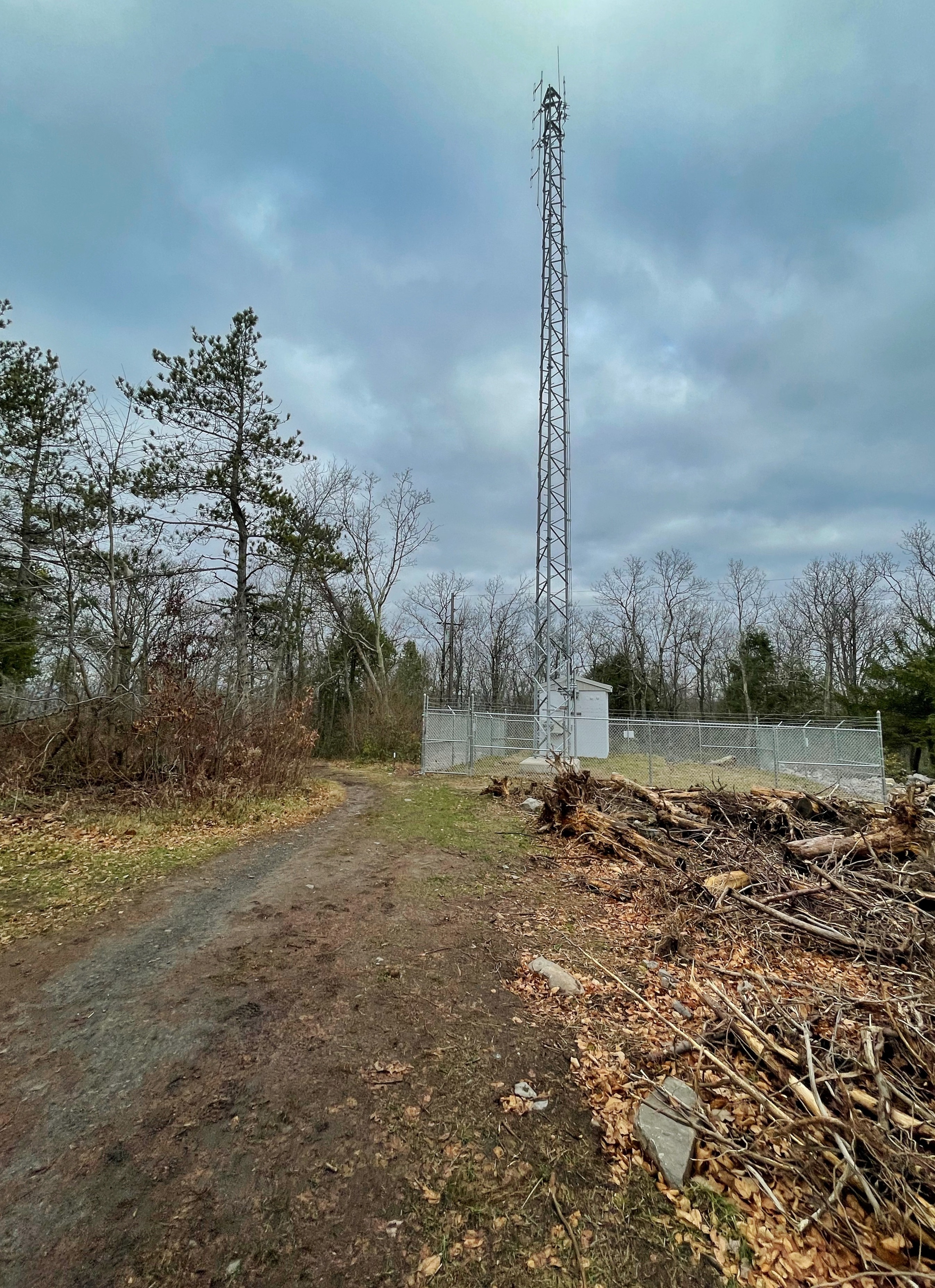
If you choose to continue, the trail will climb some more along a rocky footpath. When you reach the remains of an old fire tower and a fenced in radio tower, you’ve reached the 1,461 foot summit of Mount Minsi.
-
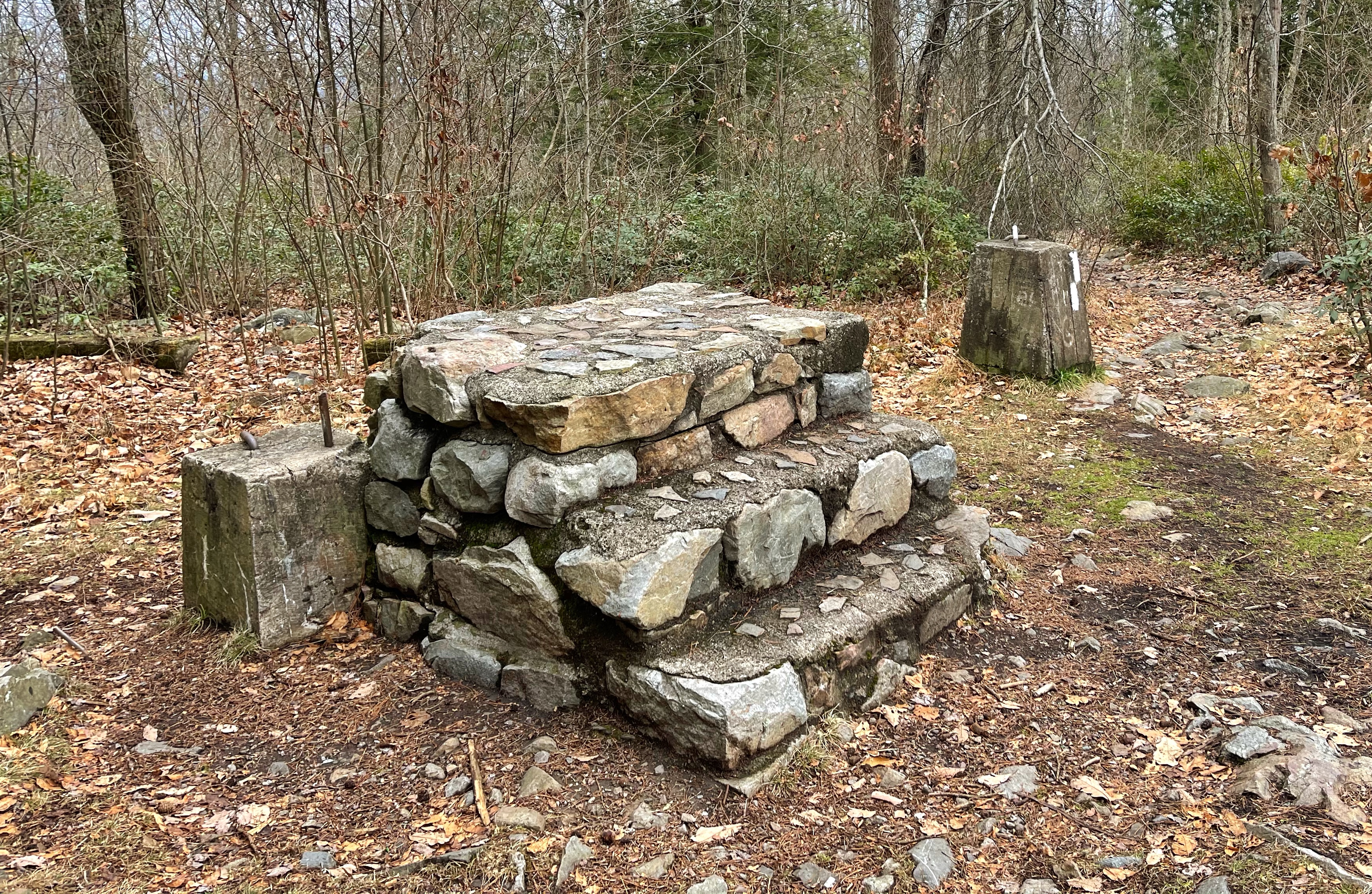
Fire tower remnants -
Now continue along the woods road a short distance until you see a sign on your left for a side trail labeled “Vista.”
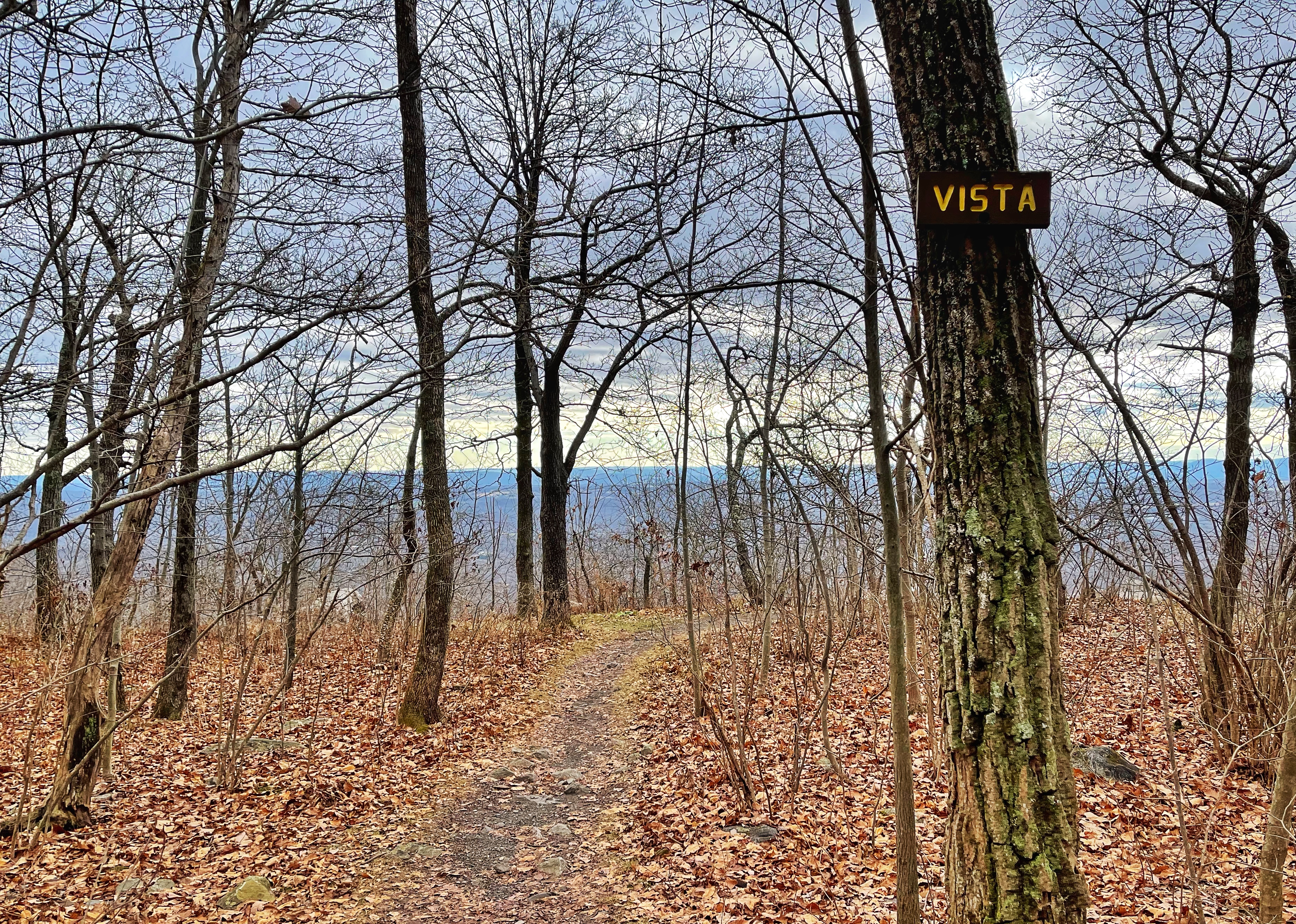
The short trail leads to a…vista.

From here, return to the Appalachian Trail, turn right and retrace your steps downhill to the junction with Lake Road. At the junction, stay left to follow the woods road downhill.
Note that many other trail guides (including AllTrails) suggest returning to the bottom the entire way via Lake Road. That’s a more direct, but pretty boring route.
To follow this route, which passes cascades, a waterfall, and uses a picturesque footpath, make sure you have a detailed map of the area (print out the one below or use Gaia GPS, for example. Neither the NY-NJ Trail Conference maps – print or on Avenza – nor the AllTrails maps have sufficient detail, unfortunately).
About a 1.2 miles down the trail, you’ll reach a junction with an unmarked woods road that makes a sharp left turn. Make a left onto this woods road and continue straight (do not turn on the footpath that’s almost immediately on your right once you start on the woods road).
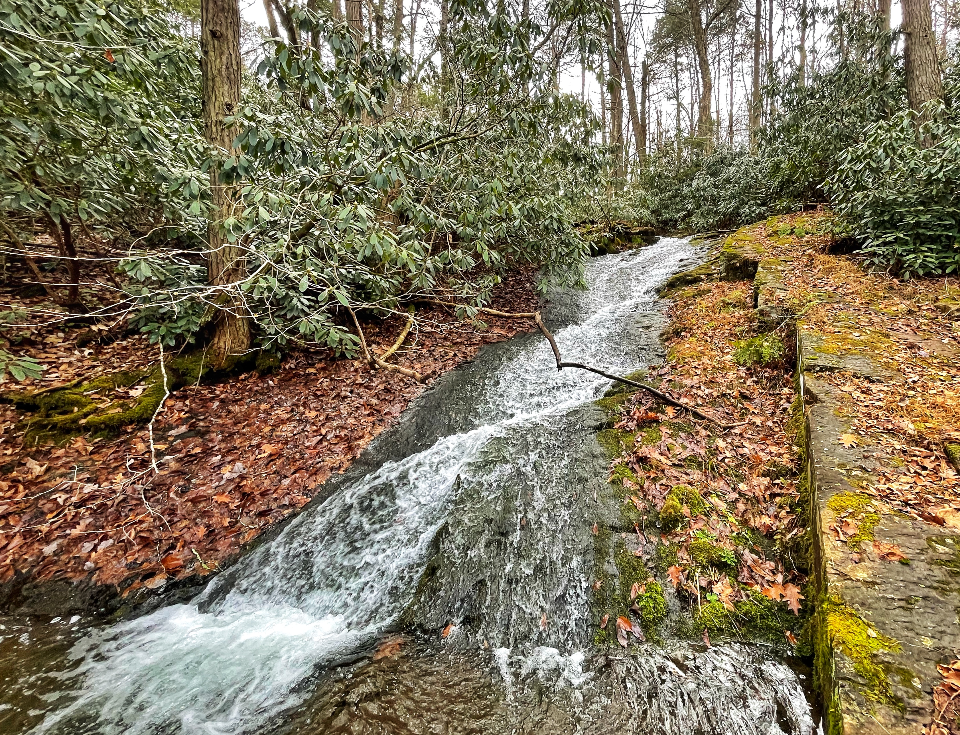
About a tenth of a mile further, you’ll see an unmarked footpath on your left. Turn left and you’ll almost immediately reach small cascades on Caledonia Creek.
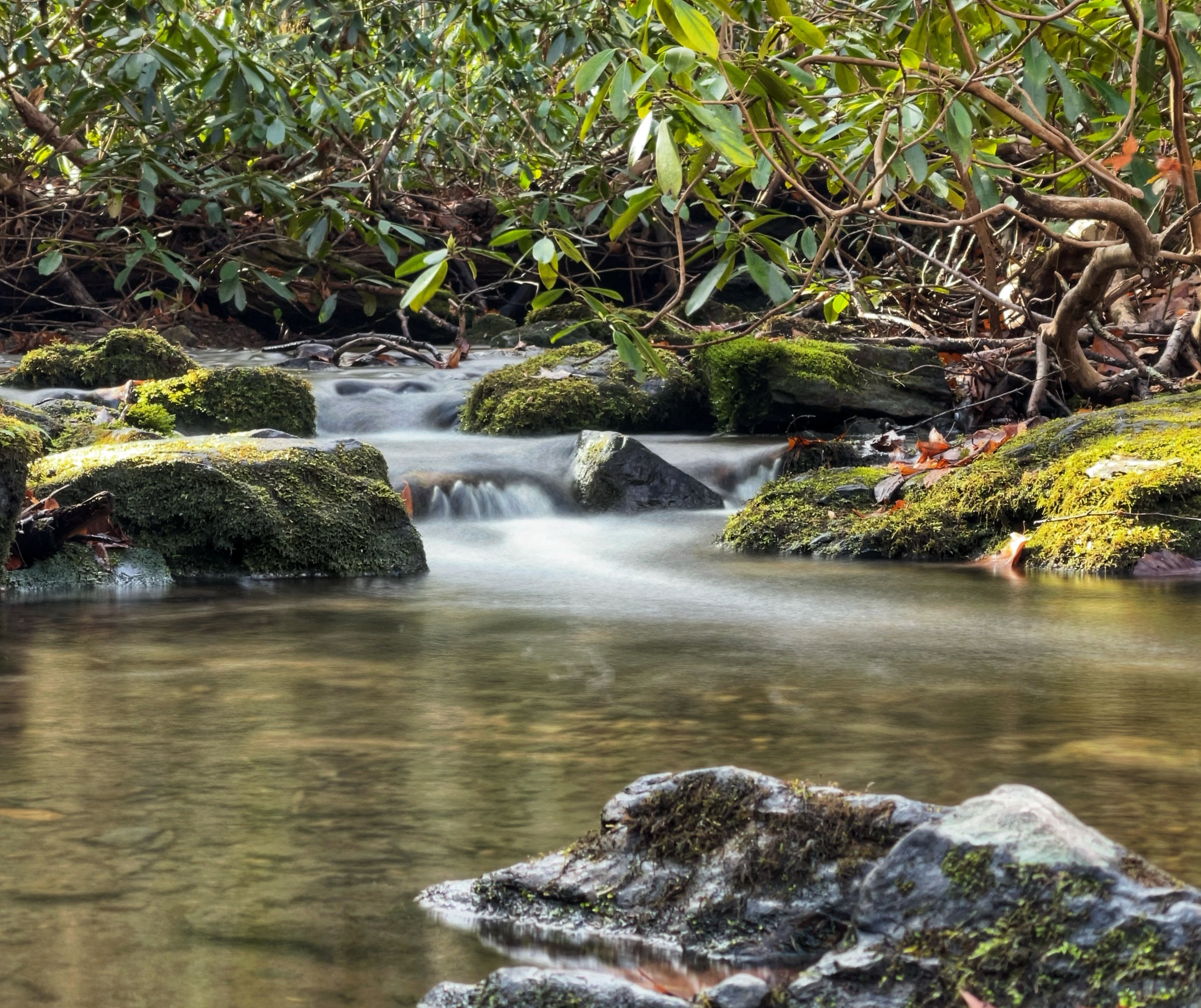
This is just a taste of what’s to come. The cascades will become progressively larger as we continue north.
Turn back from the creek and look immediately on your left for an unmarked trail (labeled Green Trail on the map). Do NOT return all the way to the woods road.
Turn left and follow the Green Trail to the north. About 100 feet north, turn left to view another set of cascades.

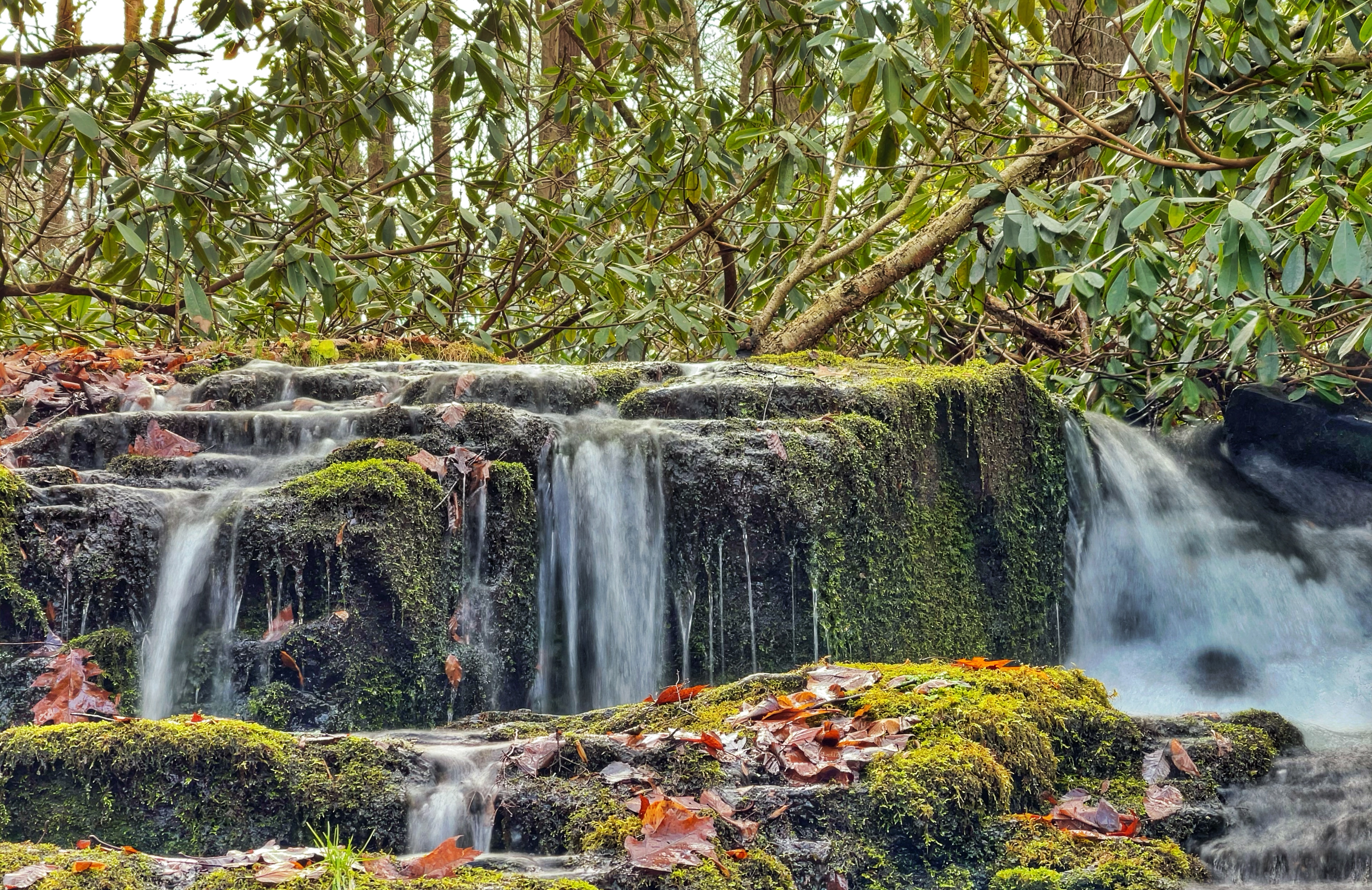
Proceed north another 100 feet and stop to check out more cascades.
Another 50-100 feet north, you’ll reach the pièce de résistance of this section of trail, a legit waterfall.
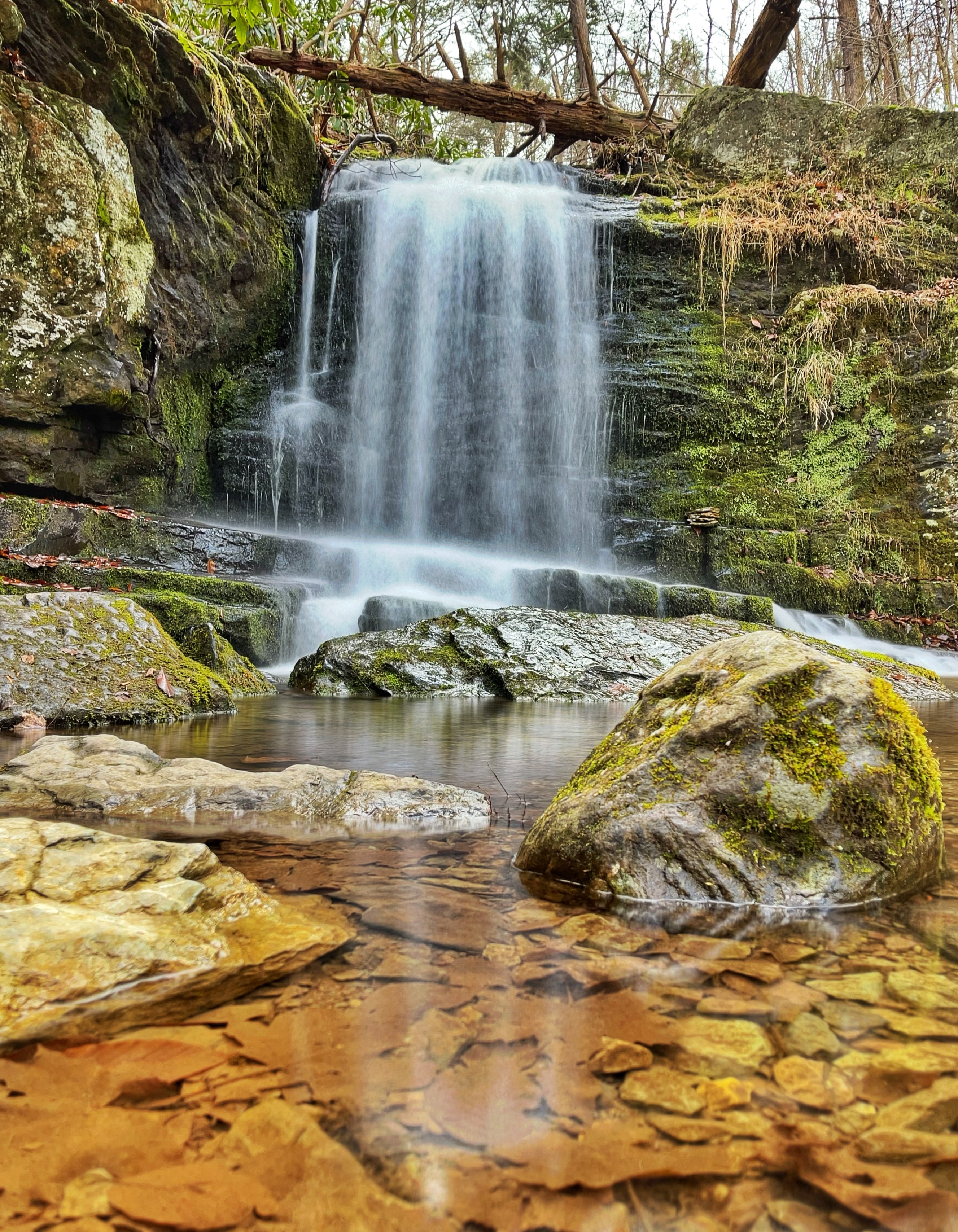
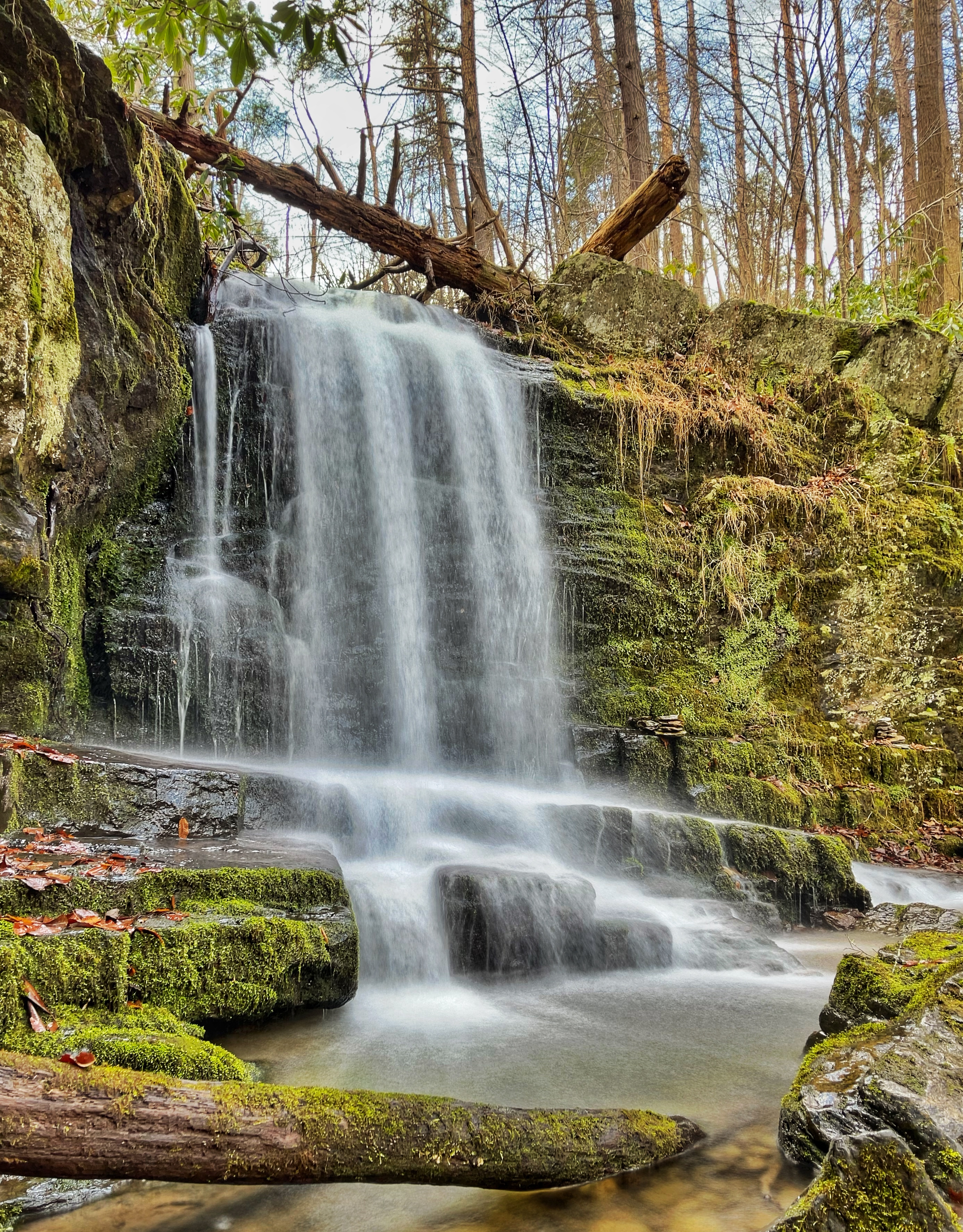
When you’re done exploring the waterfall area, look for the footpath that heads very steeply uphill to the east towards the woods road. When you reach the unmarked woods road, turn left and continue north.
About 500 feet further, you’ll reach Table Rocks, an open exposed rocky ridge.
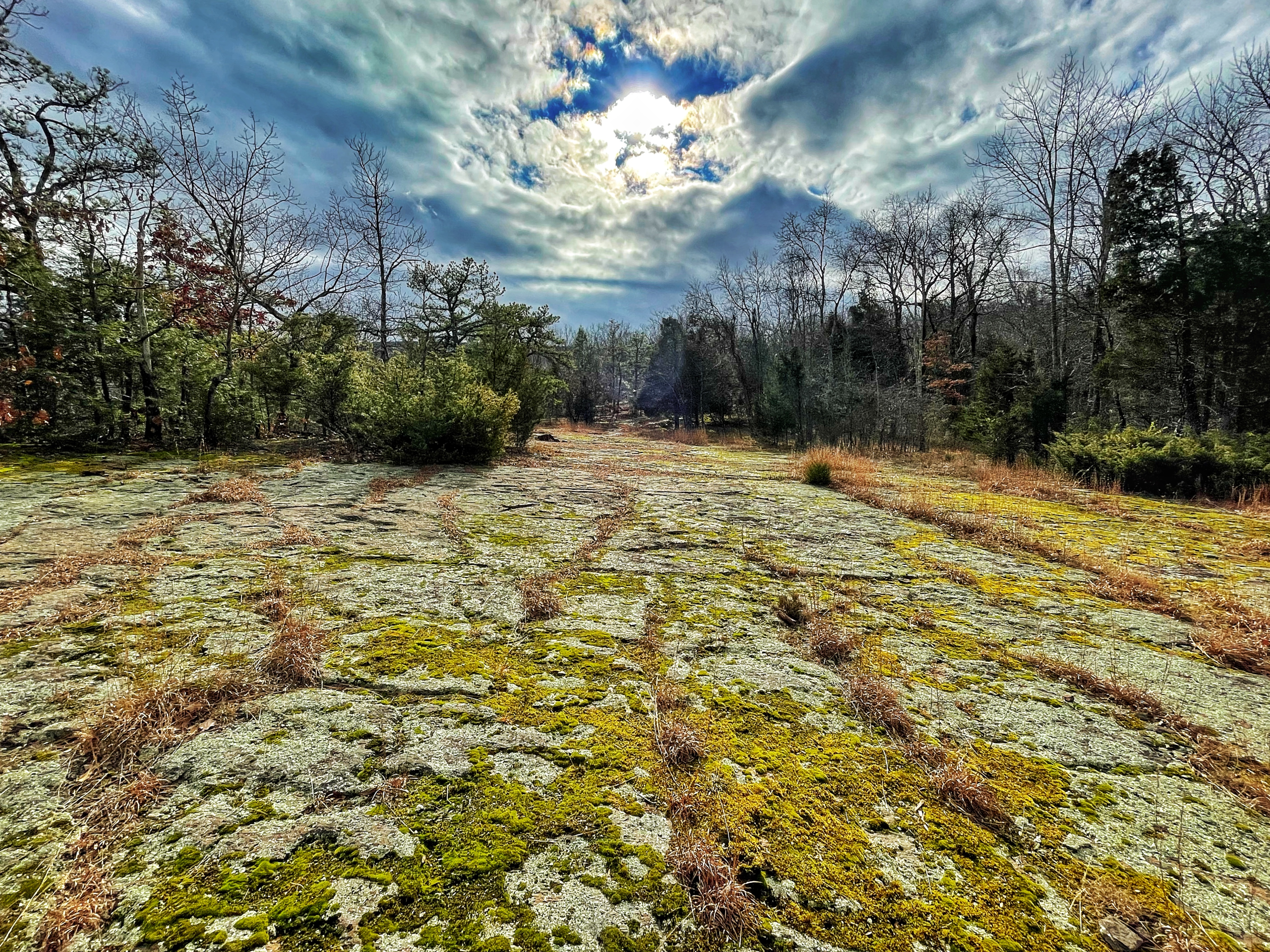
This is a cool area to explore. To the east is fence…apparently to stop people from walking off the cliff? There are some nice partial views (especially if the leaves are down) to the east of Mount Tammany and Mount Minsi.
Continue to follow the unmarked trail, now a footpath, into the woods. This is a beautiful section of trail – much nicer than the boring woods road you could have followed.
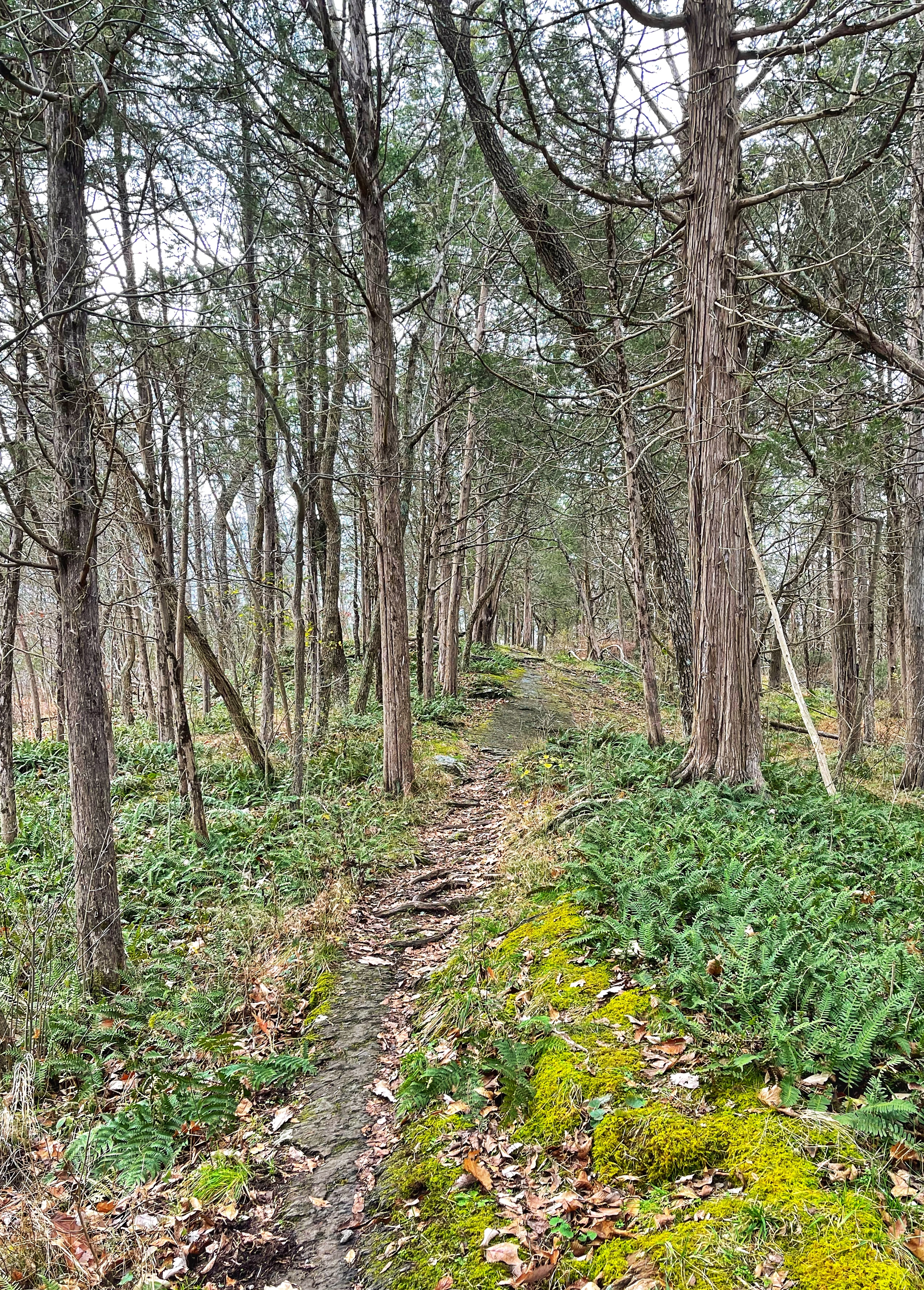
The woods road on your right will be visible below you, and then the trail will begin to quickly descend, offering views of Lake Lenape from above.
The trail finally reaches Lake Lenape and intersects with the Red Trail, which loops around the lake. Follow the Red Trail in either direction (I went left to loop all the way around the lake) and then rejoin the Appalachian Trail. Turn left and follow the white blazes back to the parking lot.


