Take a Hike!
  • Best Hikes in NJ
  • Find a Hike
    • Search/Find a Hike
    • Hike Map
    • Most Popular Hikes
    • NJ Hikes
    • NY Hikes
    • Kid Friendly Hikes
    • Appalachian Trail
    • John Muir Trail
    • Other
      • Barataria Preserve
      • Coconino National Forest
      • Grand Canyon National Park
      • Great Smoky Mountains National Park
      • Inyo National Forest
      • John Muir Trail
      • Shenandoah National Park
      • Yellowstone National Park
      • Yosemite National Park
  • Tips & Essentials
    • Hiking Gear
    • Winter Hiking Tips
    • Hiking apps
    • Pequannock (Newark) Watershed Permits
    • Leave No Trace
  • Contact
Take a Hike!
Of all the paths you take in life, make sure a few of them are dirt. -John Muir
Delaware Water GapNew JerseyTop HikesWorthington State Forest

Mount Tammany Hike – Delaware Water Gap National Recreation Area

by Juan Melli January 21, 2021
by Juan Melli January 21, 2021 2 comments

Mount Tammany Hike Overview

The 3.5 mile hike of Mount Tammany offers perhaps the best view in New Jersey, with a panoramic overlook of the winding Delaware River and Mt. Minsi on the Pennsylvania side. This is one of the most popular hikes in New Jersey. Expect to have a lot of company on this trail. 

Park in the Dunnfield Creek parking lot in the Delaware Water Gap and look for the Tammany Trail sign. Take the Red Dot Trail up and the Blue Trail down for a 3.5 mile hike.

Mountain Tammany makes our list of best hiking trails in New Jersey. To find other great hikes, check out the whole list.

Hike Length:  3.5 miles

Elevation Gain: 1,250 feet
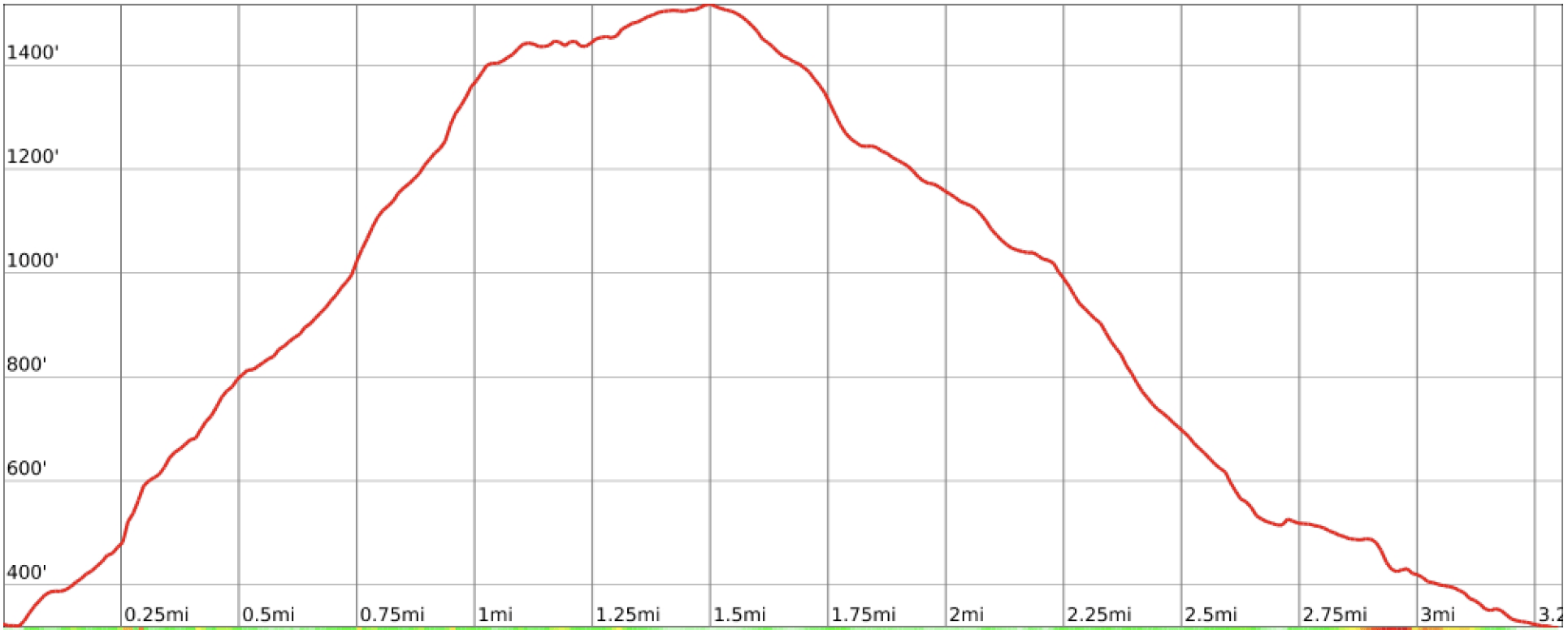
Mount Tammany hike elevation profile

Location: Delaware Water Gap National Recreation Area, Worthington State Forest, Hardwick Twp, NJ

Where to Park for the Mount Tammany Hike 

Park and leave your car at the Dunnfield Creek parking lot. You’ll want to get there early because it fills up quickly. Your best bet is to go on a weekday or early in the morning.

As shown in the map below, there are two parking lots on the east side of I-80 and both provide access to the Red dot trail.
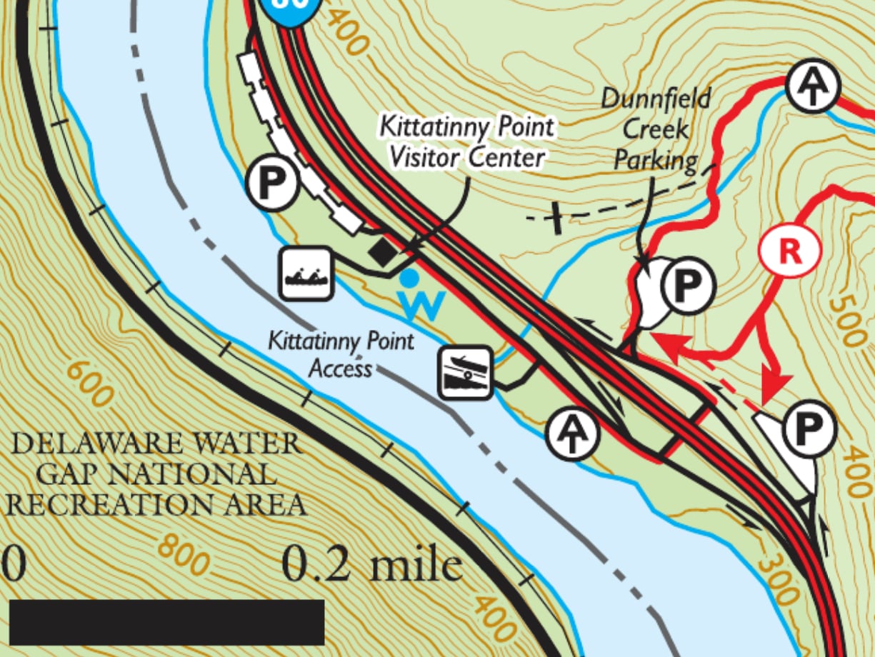
Parking area for Mt. Tammany

When driving west-bound on I-80, look for the sign for the “Dunnfield Creek / Appalachian Trail” exit.
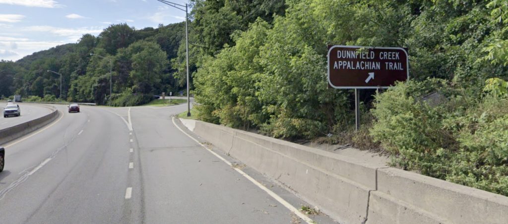
Dunnfield Creek parking area exit

When you exit, stay to the right for the first parking area.
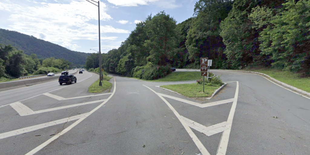
Mount Tammany parking area
First parking area for Mount Tammany off of I-80

If the lot is full, exit the parking area and continue down the road. You’ll pass the junction for the underpass to go under I-80. Continue just past it and then stay to the right to enter the main Dunnfield Creek parking area.
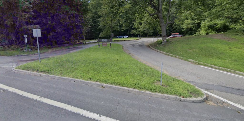
Mount Tammany parking area
Dunnfield Creek Parking Area – main parking lot for Mount Tammany

Note that road connecting the first lot to the second one is one-way. If you drive through the first parking lot, you will not be able to return to it easily without returning to I-80 and making a big loop, so if you find a spot at the first lot, it may be wise to take it, especially if you visit at a busy time (which is most of the time).

Mount Tammany Maps

  • Worthington State Forest (NY-NJ Trail Conference)
  • Worthington State Forest (New Jersey Division of Parks & Forests)
  • Kittatinny Trails Map #120 (NY-NJ Trail Conference) – paper map
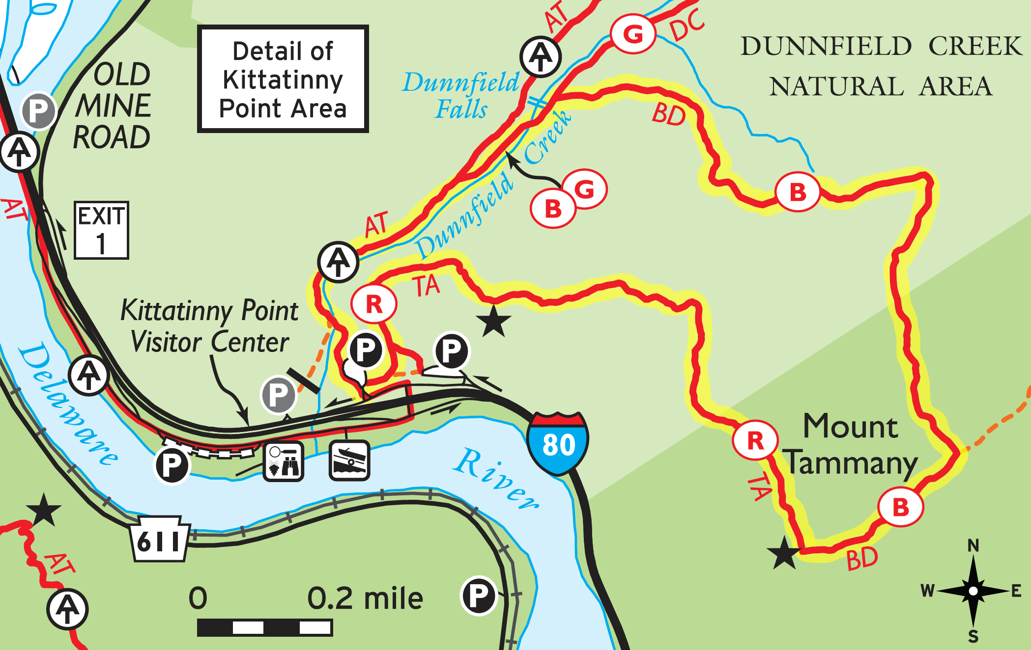
Mt. Tammany Trail map

Mount Tammany Hike Description

(adopted from Hiking New Jersey)

From the main Dunnfield Creek parking lot, look for the sign for the Tammany Trail near the entrance to the lot to the southeast.

Note: The Appalachian Trail continues through the north end of the park. While that is the most visible trailhead in the parking area – and the location of a kiosk with information – it is not the trailhead most people will want to use to hike Mount Tammany. The Mount Tammany Red Dot trailhead is on the opposite side of the parking lot.

0.0 miles: Start at Mount Tammany Trailhead (red blazes; also known as the Red Dot Trail). The path becomes stairs, which leads immediately to a fork. Veer left, following the red blazes. The right fork will lead o the rest area off I-80 that also claims to be Mount Tammany Trailhead.
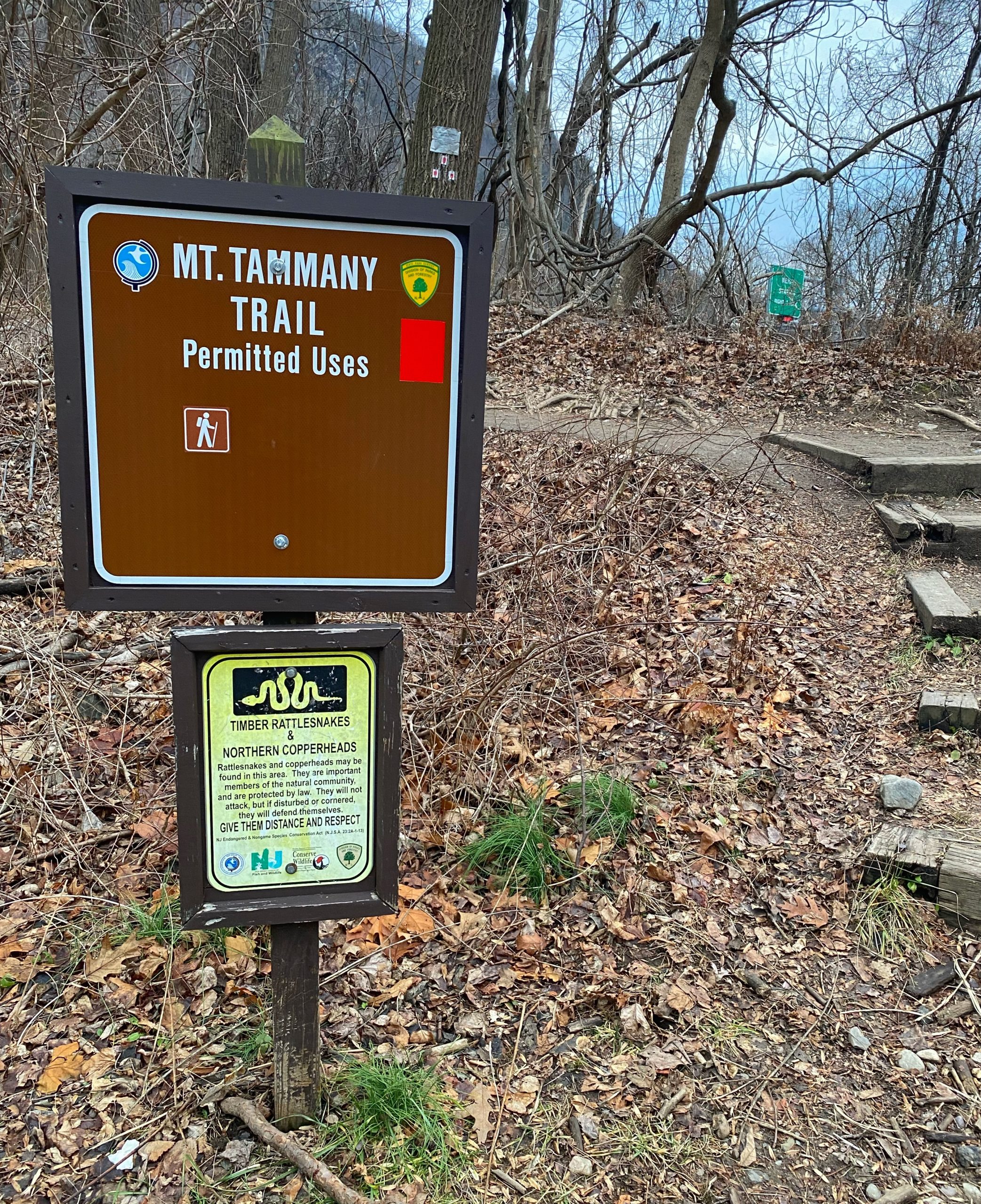
Trailhead for Mt. Tammany Trail
Mt Tammany Trail

0.5 miles: Trail ascends to first vista, looking west over the Delaware River and across at Mount Minsi.
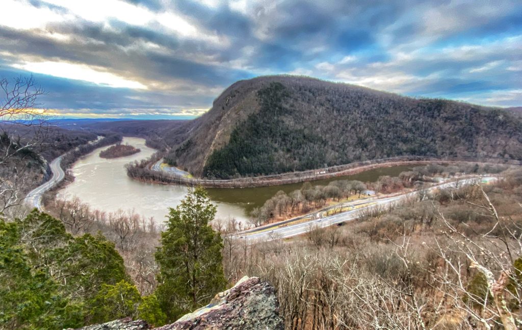
0.6 miles: Trail swings away from the ledges, climbing the shoulder of Mount Tammany, only to meander back to a series of viewpoints.

1.2 miles: Arrive at the crest of the Gap and turn right (west) for possibly the most dramatic view in New Jersey. Mount Tammany Trail ends and the Blue Trail begins. 
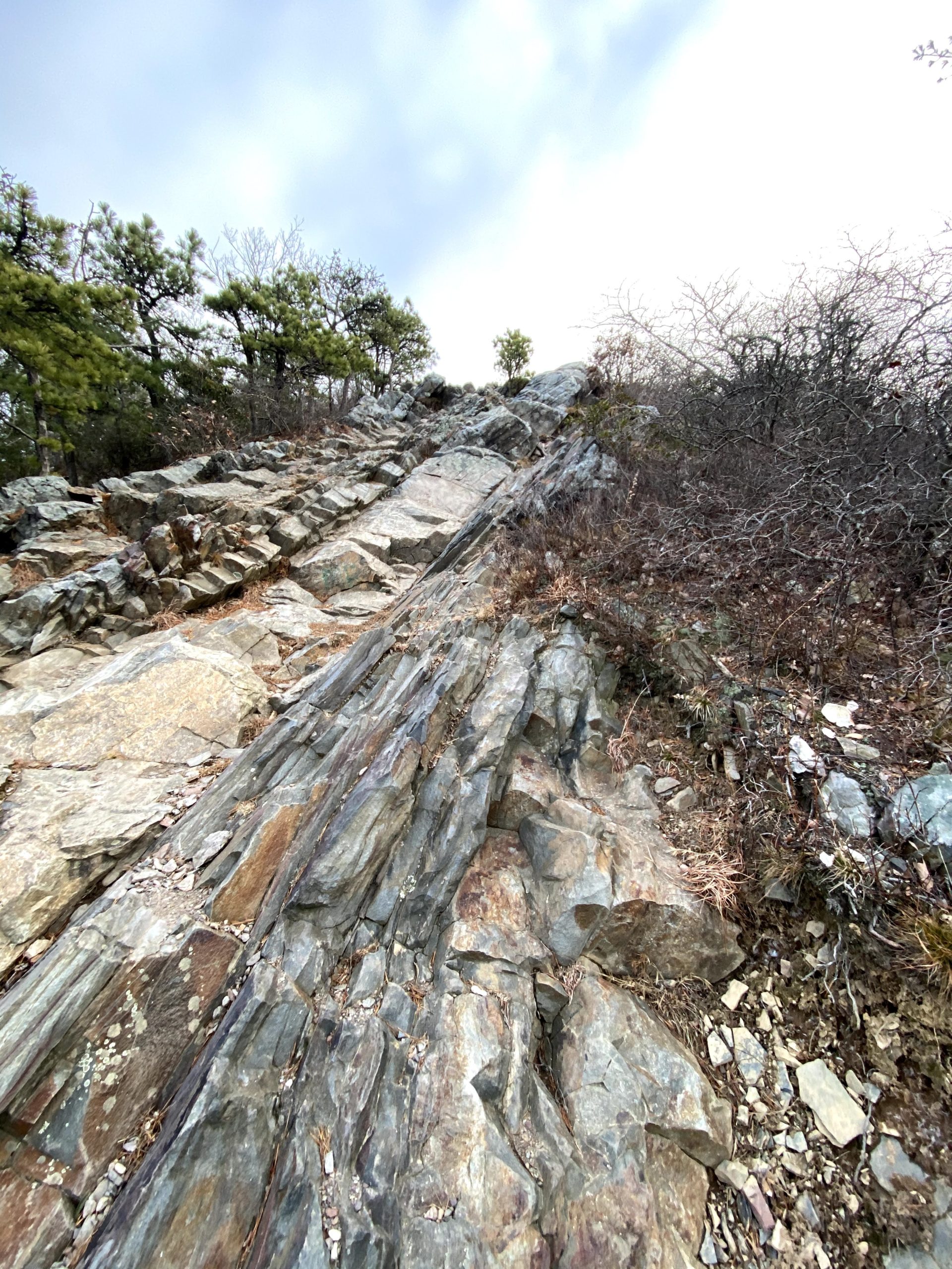
Looking up from near the bottom of the scramble to the west of the trail to get to a better view of the Delaware Water Gap

At the top, scramble down the rocks towards the river as far as you are comfortable to get a view of the Delaware as it winds around Mt. Minsi on the Pennsylvania side.

View of Mt. Minsi and the Delaware River from the top of Mt. Tammany

This is a good place to break for a snack.

Scramble back up and then follow the blue-blazed Pahaquarry Trail (formerly the Blue Dot Trail) down.

1.5 miles: After 0.3 miles, you’ll reach a junction with the Mount Tammany Fire Road, which continues straight. Make a left to follow the (blue) Pahaquarry Trail.

Optional: If you prefer a much longer 11 mile hike, consider going straight along the Mount Tammany Fire road and doing the Mt. Tammany and Sunfish Pond loop (and if you do, learn the story of Sunfish Pond).
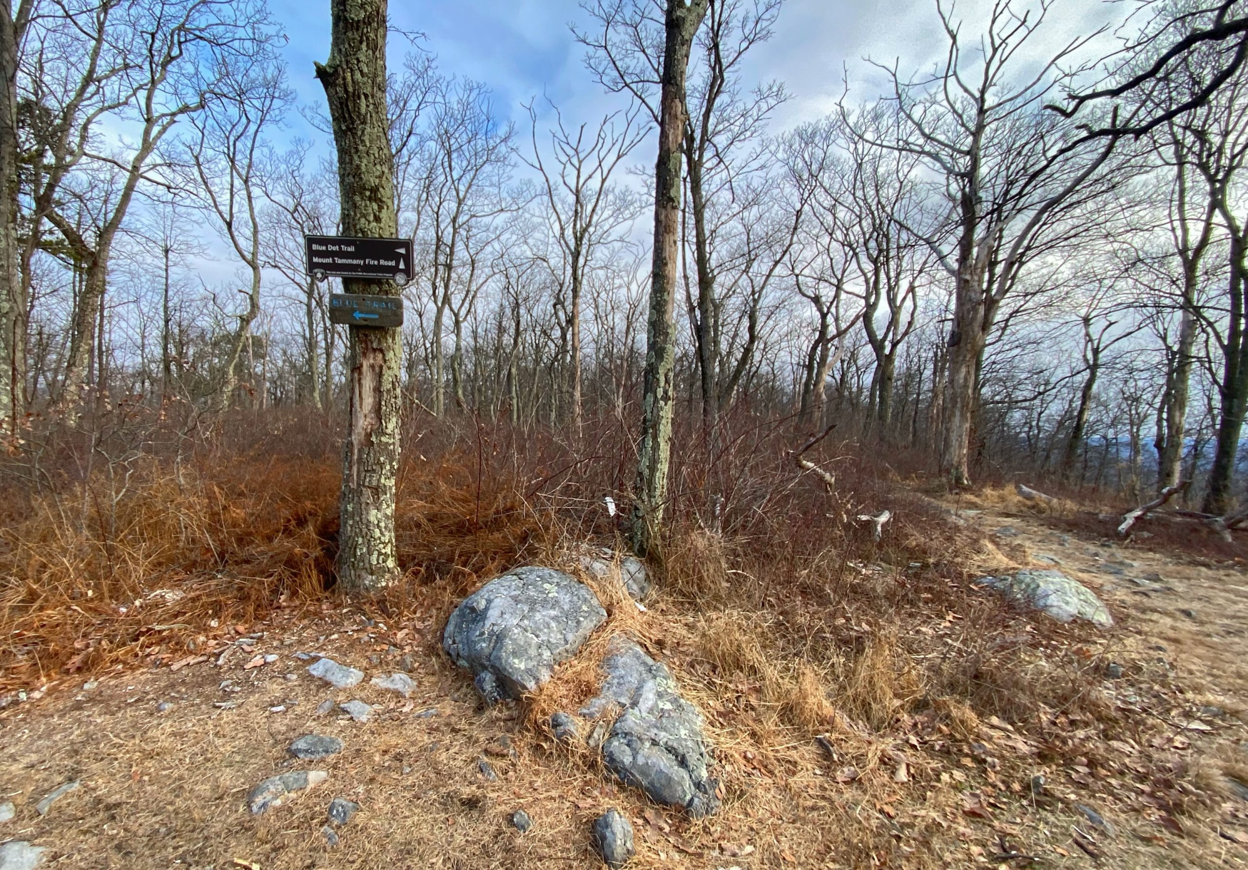
Junction of the Blue Trail and Mount Tammany Fire Road. Turn left to follow the Blue Trail.

 2.85 miles: Reach a junction with the green-blazed Dunnfield Creek Trail. Continue straight.
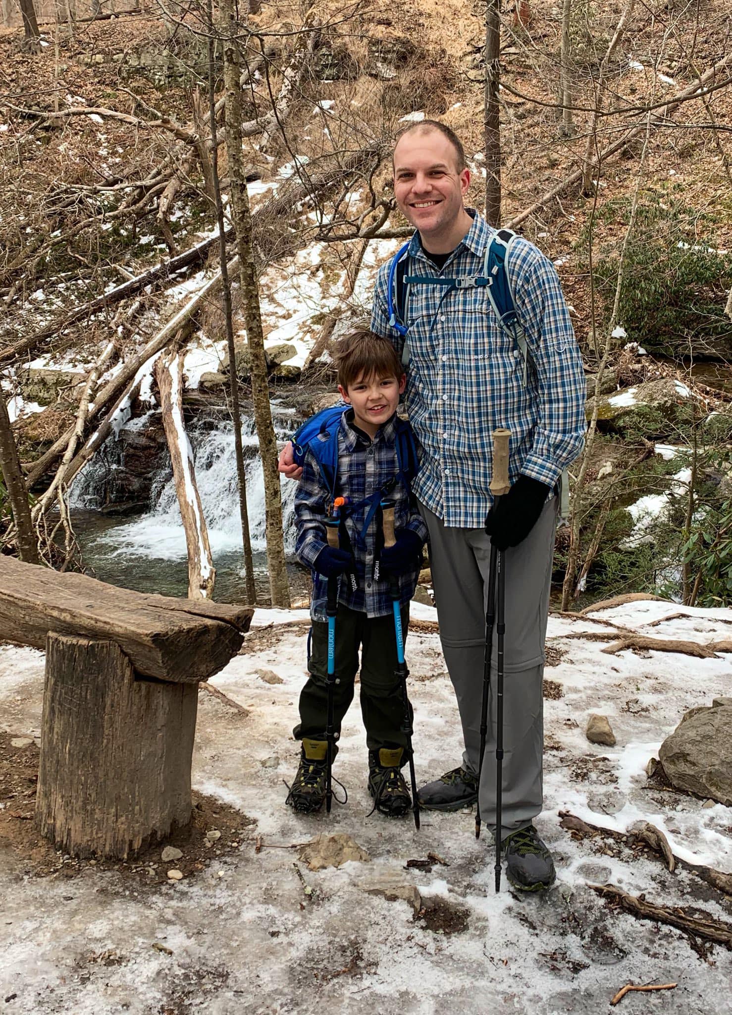
Next to Dunnfield Creek

3.05 miles: The Blue Trail joins the Appalachian Trail (white blazes), which both lead back to the parking lot.

3.5 miles: Reach the Dunnfield Creek parking lot.

Dogs: Keep on a 6-foot leash

Kids: No leash required. Kids can do this, but it is a steep hike, so make sure you know their ability level.

Delaware Water GapMount TammanyMt TammanyRed Dot TrailWorthington State Forest
Share
0
FacebookTwitterPinterestLinkedinEmail
Juan Melli

Juan lives in Hoboken, New Jersey with his wife and two boys. He likes to explore the great Garden State and other equally nice states.

previous post
Mt. Beacon Fire Tower – Hudson Highlands State Park Preserve
next post
Governor Mountain – Ringwood State Park

You may also like

Audubon Overlook – Sparta Mountain Wildlife Management Area

February 28, 2021

Liberty Loop Trail – Wallkill River National Wildlife...

January 30, 2021

Almost Perpendicular, Claudius Smith Den & Elbow Brush...

January 24, 2021

Governor Mountain – Ringwood State Park

January 23, 2021

Wawayanda Swamp Loop

January 16, 2021

Bearfort Fire Tower – Pequannock Watershed

January 2, 2021

Kanouse Mountain – Pequannock Watershed

December 20, 2020

Pequannock (Newark) Watershed Permits

December 18, 2020

Gertrude’s Nose & Millbrook Mountain – Minnewaska State...

December 12, 2020

Mount Minsi – Delaware Water Gap National Recreation...

November 28, 2020

Leave a Comment Cancel Reply

You must be logged in to post a comment.

Search

Top NJ Hikes This Week

  • 1

    Hemlock Falls – South Mountain Reservation

  • 2

    Appalachian Trail – Delaware Water Gap

  • 3

    Caven Point, Jersey City

  • 4

    Sunrise Mountain & Culver Fire Tower – Stokes State Forest

Top NY Hikes This Week

  • 1

    Popolopen Torne Loop – Bear Mountain State Park

  • 2

    Bald Rocks & Hogencamp Mountain – Harriman State Park

  • 3

    Gertrude’s Nose & Millbrook Mountain – Minnewaska State Park Preserve

  • 4

    Liberty Loop Trail – Wallkill River National Wildlife Refuge

About Me

About Me

Juan

I love the outdoors. Over the years, friends would ask me for tips on where to hike, so I started this website as a way to give back and hopefully help others discover nature.

Through the New York-New Jersey Trail Conference, I'm a volunteer maintainer of a section of the Appalachian Trail (Garvey Springs to Kaiser Road) in the Delaware Water Gap.

Questions? Angry Rants? Jell-O recipes? I can be reached by using this form.

Facebook Twitter Instagram Youtube
Gerturde's Nose

Garnet Lake

Mt Tammany

John Muir Trail
  • Facebook
  • Twitter
  • Instagram
  • Youtube