Mount Tammany Hike Overview
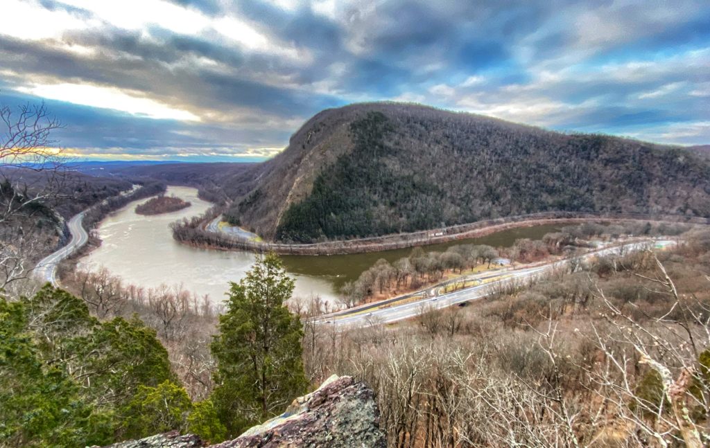
The 3.5 mile hike of Mount Tammany offers perhaps the best view in New Jersey, with a panoramic overlook of the winding Delaware River and Mt. Minsi on the Pennsylvania side. This is one of the most popular hikes in New Jersey. Expect to have a lot of company on this trail.
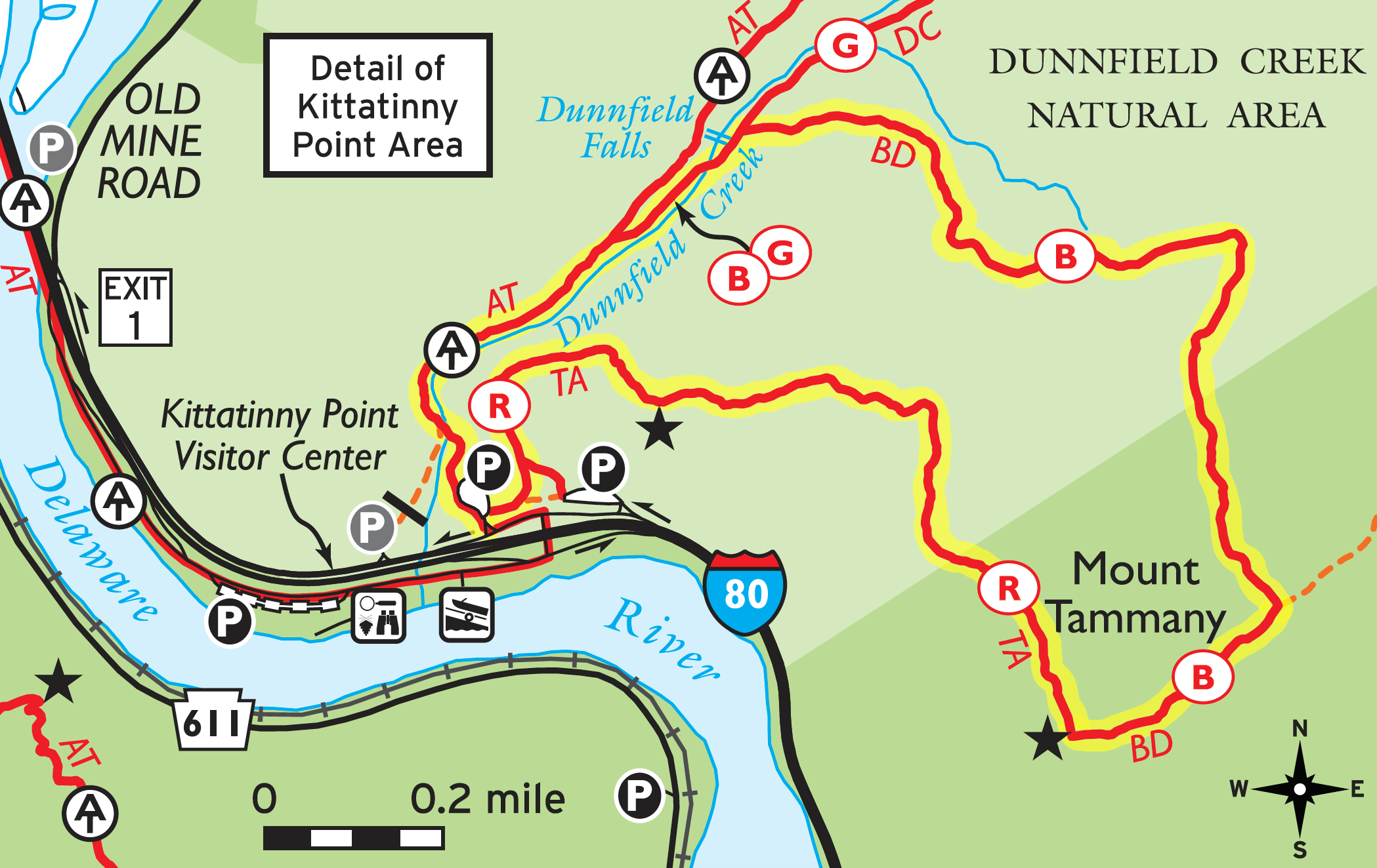
Park in the Dunnfield Creek parking lot in the Delaware Water Gap and look for the Tammany Trail sign. Take the Red Dot Trail up and the Blue Trail down for a 3.5 mile hike.
Mountain Tammany makes our list of best hiking trails in New Jersey. To find other great hikes, check out the whole list.
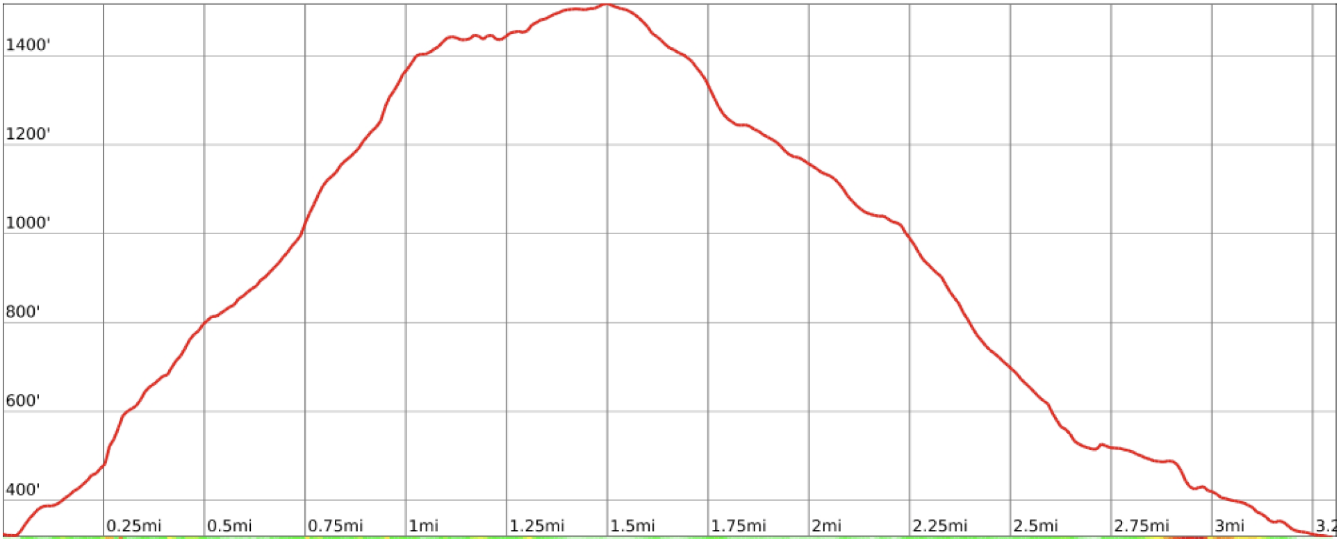
Hike Length: 3.5 miles
Elevation Gain: 1,250 feet
Location: Delaware Water Gap National Recreation Area, Worthington State Forest, Hardwick Twp, NJ
Where to Park for the Mount Tammany Hike
Park and leave your car at the Dunnfield Creek parking lot. You’ll want to get there early because it fills up quickly. Your best bet is to go on a weekday or early in the morning.
As shown in the map below, there are two parking lots on the east side of I-80 and both provide access to the Red dot trail.
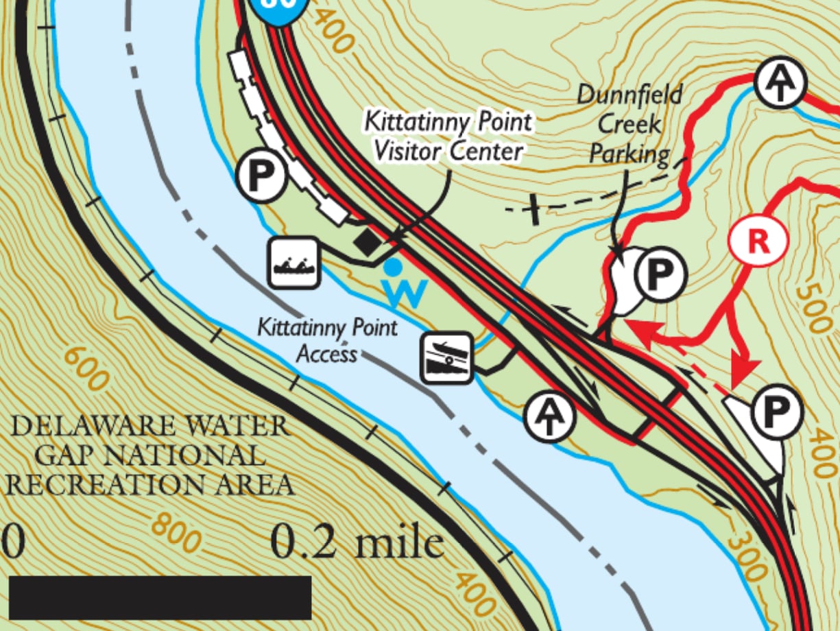
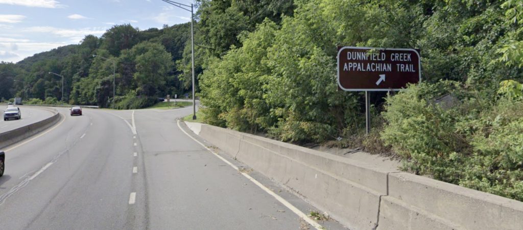
When driving west-bound on I-80, look for the sign for the “Dunnfield Creek / Appalachian Trail” exit.
When you exit, stay to the right for the first parking area.
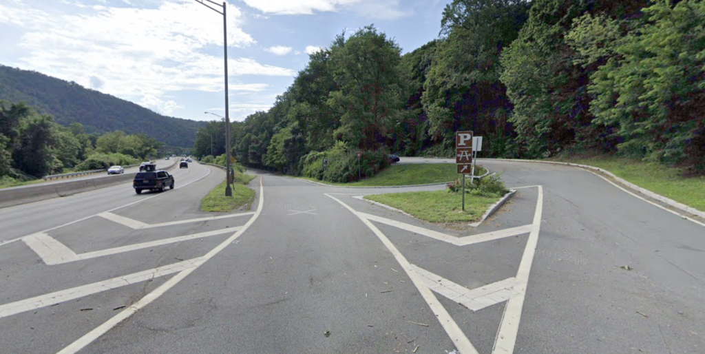
If the lot is full, exit the parking area and continue down the road. You’ll pass the junction for the underpass to go under I-80. Continue just past it and then stay to the right to enter the main Dunnfield Creek parking area.
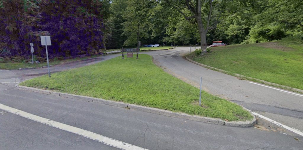
Note that road connecting the first lot to the second one is one-way. If you drive through the first parking lot, you will not be able to return to it easily without returning to I-80 and making a big loop, so if you find a spot at the first lot, it may be wise to take it, especially if you visit at a busy time (which is most of the time).
Mount Tammany Maps
- Worthington State Forest (NY-NJ Trail Conference)
- Worthington State Forest (New Jersey Division of Parks & Forests)
- Kittatinny Trails Map #120 (NY-NJ Trail Conference) – paper map
Mount Tammany Hike Description
(adopted from Hiking New Jersey)
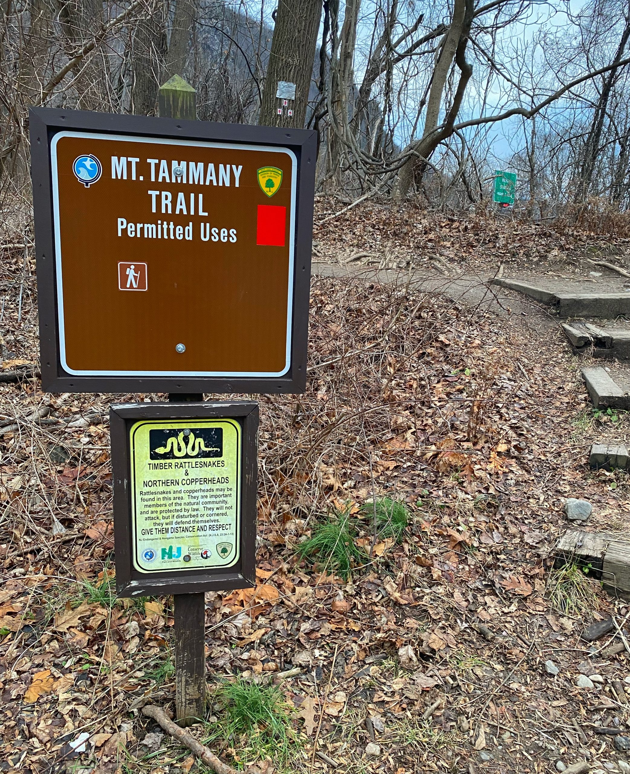
From the main Dunnfield Creek parking lot, look for the sign for the Tammany Trail near the entrance to the lot to the southeast.
Note: The Appalachian Trail continues through the north end of the park. While that is the most visible trailhead in the parking area – and the location of a kiosk with information – it is not the trailhead most people will want to use to hike Mount Tammany. The Mount Tammany Red Dot trailhead is on the opposite side of the parking lot.
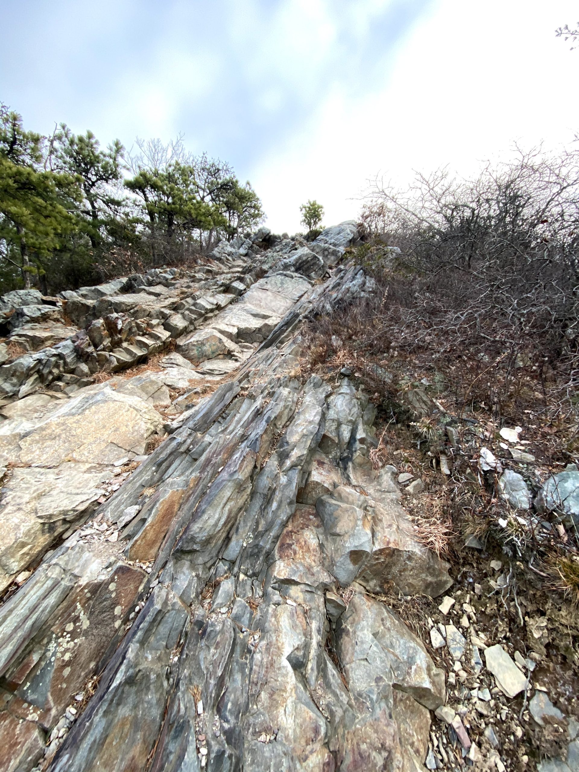
0.0 miles: Start at Mount Tammany Trailhead (red blazes; also known as the Red Dot Trail). The path becomes stairs, which leads immediately to a fork. Veer left, following the red blazes. The right fork will lead o the rest area off I-80 that also claims to be Mount Tammany Trailhead.

0.5 miles: Trail ascends to first vista, looking west over the Delaware River and across at Mount Minsi.
0.6 miles: Trail swings away from the ledges, climbing the shoulder of Mount Tammany, only to meander back to a series of viewpoints.
1.2 miles: Arrive at the crest of the Gap and turn right (west) for possibly the most dramatic view in New Jersey. Mount Tammany Trail ends and the Blue Trail begins.
At the top, scramble down the rocks towards the river as far as you are comfortable to get a view of the Delaware as it winds around Mt. Minsi on the Pennsylvania side.

This is a good place to break for a snack.
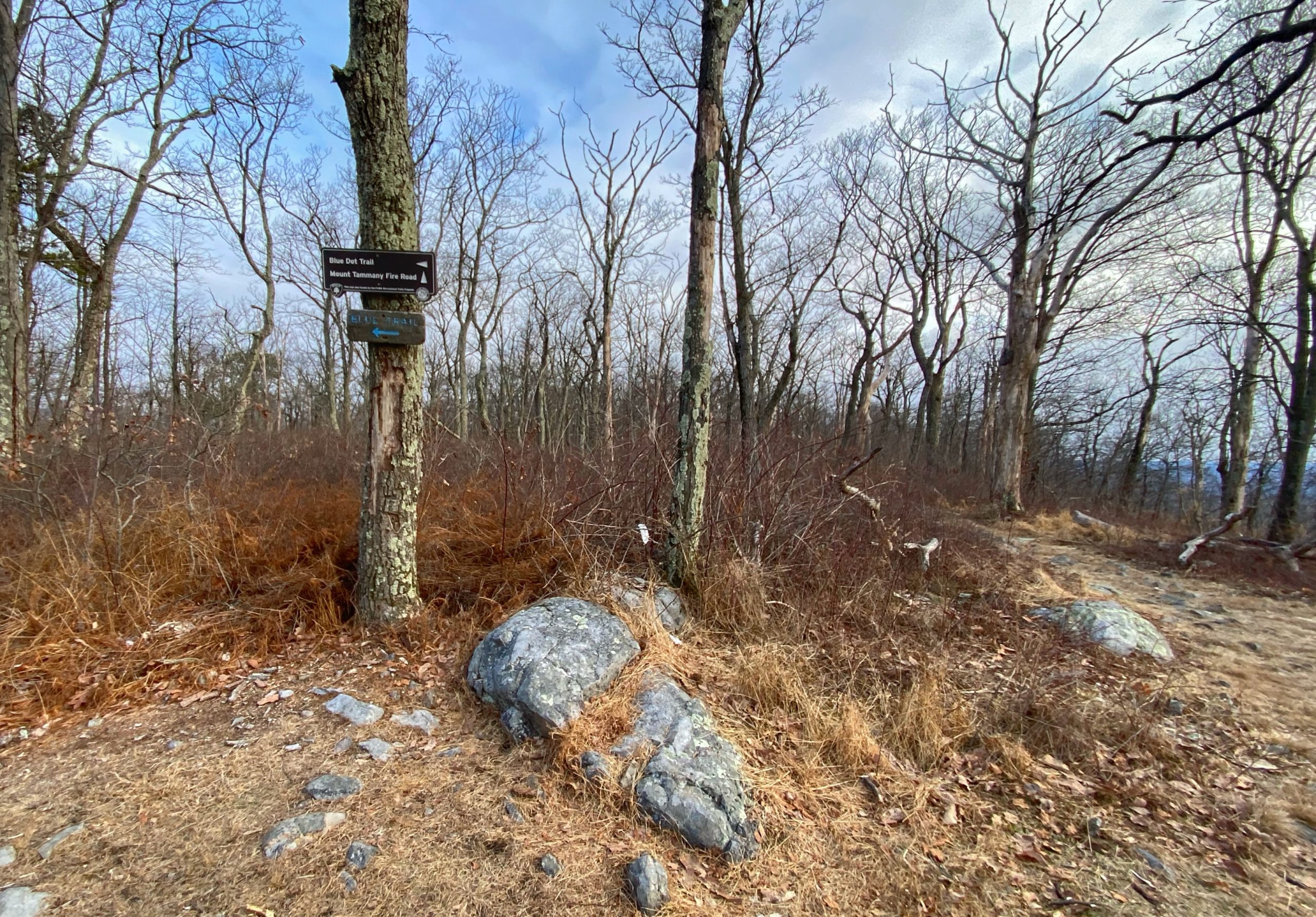
Scramble back up and then follow the blue-blazed Pahaquarry Trail (formerly the Blue Dot Trail) down.
1.5 miles: After 0.3 miles, you’ll reach a junction with the Mount Tammany Fire Road, which continues straight. Make a left to follow the (blue) Pahaquarry Trail.
Optional: If you prefer a much longer 11 mile hike, consider going straight along the Mount Tammany Fire road and doing the Mt. Tammany and Sunfish Pond loop (and if you do, learn the story of Sunfish Pond).
2.85 miles: Reach a junction with the green-blazed Dunnfield Creek Trail. Continue straight.
3.05 miles: The Blue Trail joins the Appalachian Trail (white blazes), which both lead back to the parking lot.
3.5 miles: Reach the Dunnfield Creek parking lot.
Dogs: Keep on a 6-foot leash
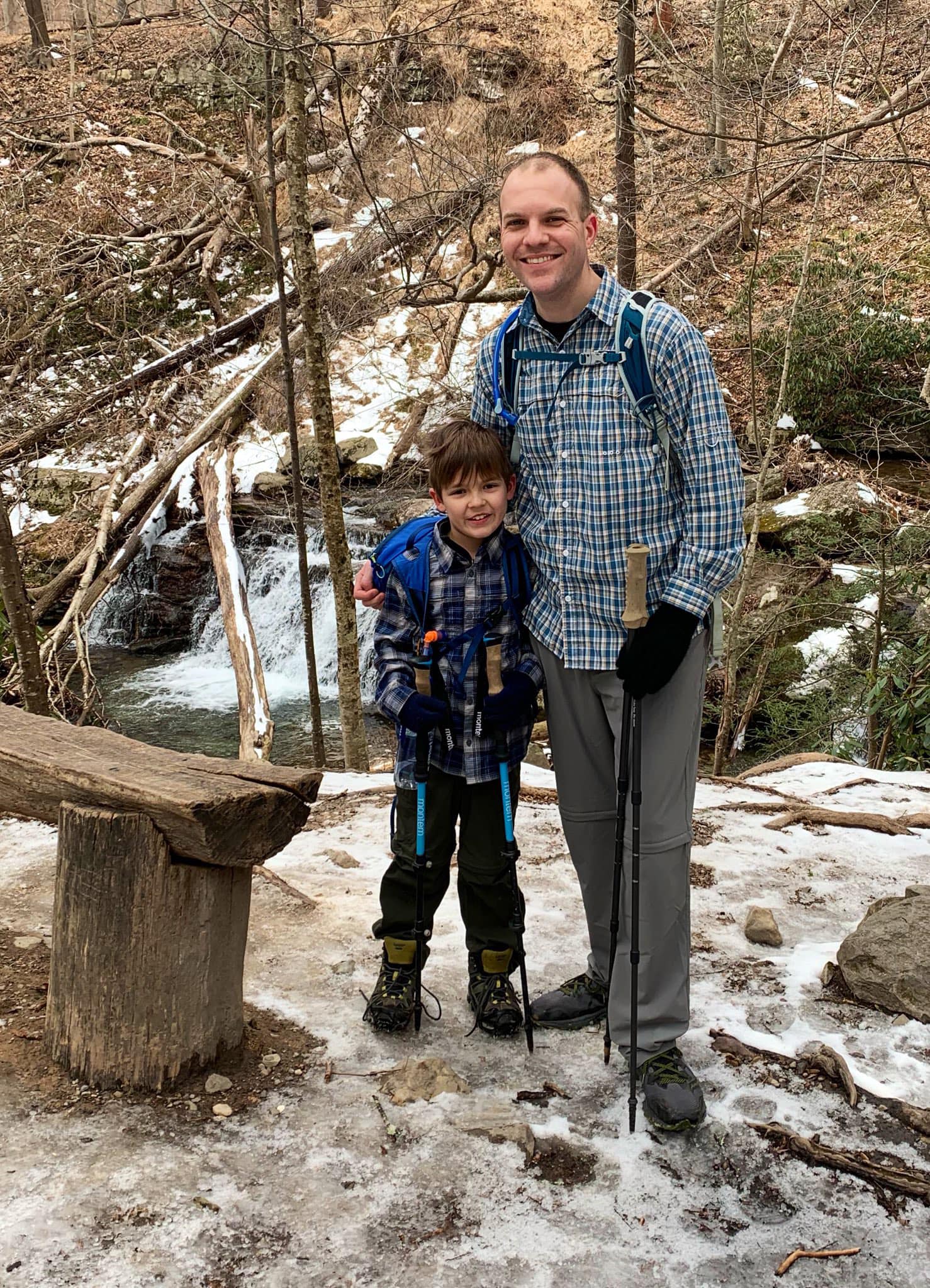
Kids: No leash required. Kids can do this, but it is a steep hike, so make sure you know their ability level.


