Hemlock Falls Overview
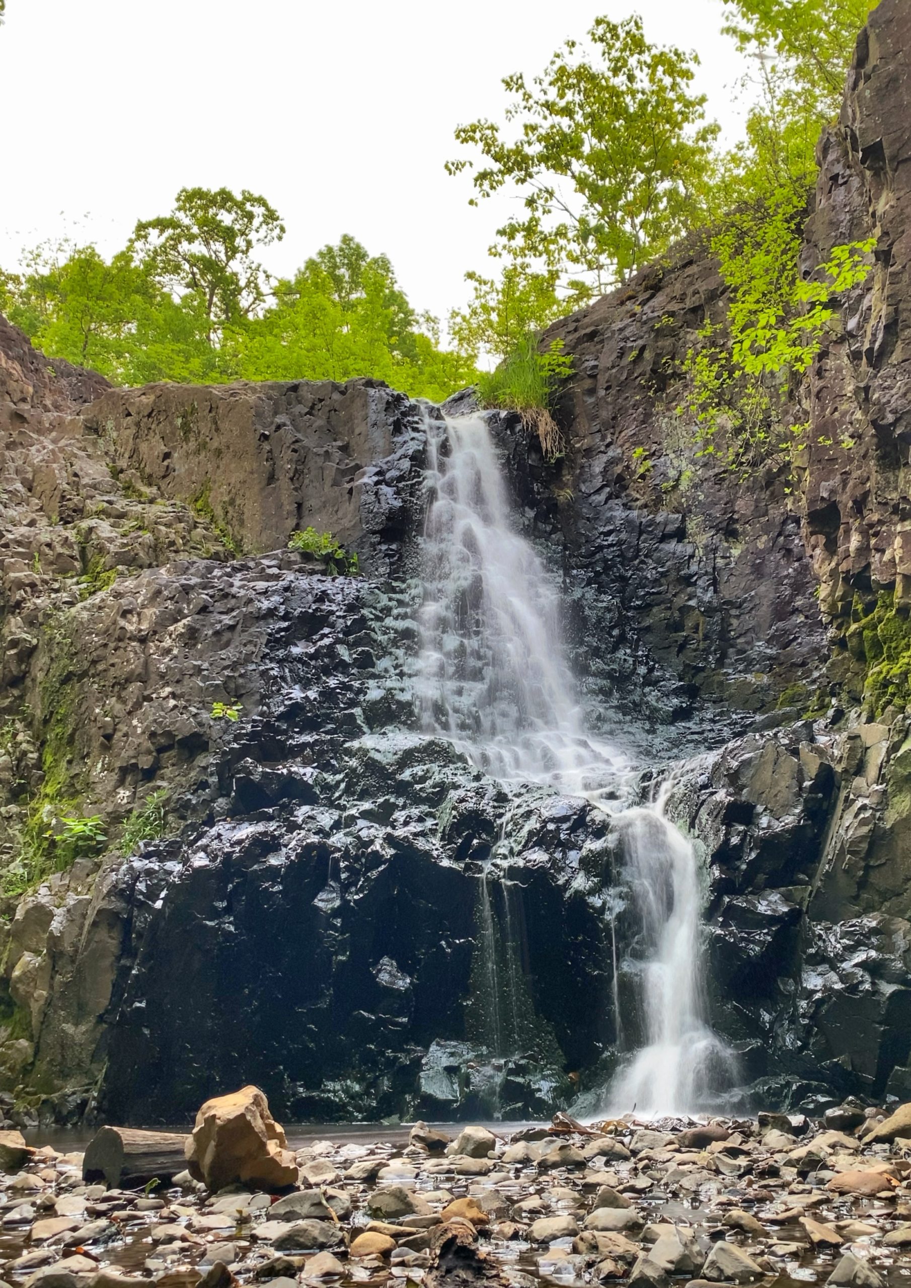
This lovely 1.6 mile hike to the dramatic 25-foot Hemlock Falls in the South Mountain Reservation is one of our Top 10 hikes in New Jersey. Park in the Tulip Springs parking area for a less than 2 mile round trip hike to the falls.
This trail makes our list of best hiking trails in New Jersey. To find other great hikes, check out the whole list.
Length: 1.6 miles
Elevation gain: 300 feet
Location: South Mountain Reservation, South Orange, Essex County, NJ
Hemlock Falls Parking
Park at the Tulip Springs parking area
Hemlock Falls Maps
Free maps:
- Lenape Trail South Mountain (South) – pdf – Not a lot of detail except for the Lenape Trail, but it’s sufficient and this is by far the best free digital map of South Mountain. There is also a South Mount (North) map available for free.
- Essex County provides a black and white online map which is very hard to read.
Paid maps:
- South Mountain Conservancy sells a great color, waterproof map ($7) and trail guide ($15).
- South Mountain Reserve Interactive Map (Android App only) – $4.99
There are a network of trails that criss-cross the area and they’re not all well-marked. In addition to a paper map, I recommend loading Gaia GPS, AllTrails, Avenza, or a similar app on your phone that will display your location on a map using your phone’s built-in GPS.

Hemlock Falls Trail description
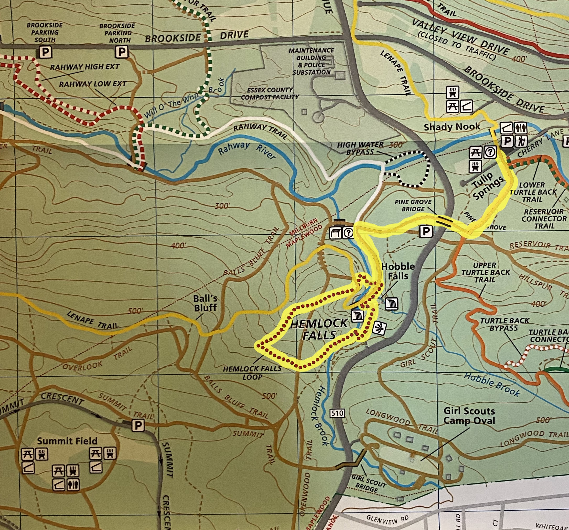
Overview: This is a “lollipop” loop which follows the yellow-blazed Lenape Trail, loops around the red-dot Hemlock Falls Loop, and then retraces your steps back to the parking lot via the Lenape Trail.
(from the Trail Guide to the South Mountain Reservation)
Start at the Tulip Springs Parking Lot
From the Tulip Springs parking lot, follow the yellow-blazed Lenape Trail to the falls. (0.55 miles)
Hemlock Falls Loop
Now, follow the red-dot-on-white-circle-blazed Hemlock Falls Loop (0.6 miles) to circle around the falls.
Facing Hemlock Falls from the bridge closest to it, the trail climbs a flight of stone steps to your left.

This begins the loop in the clockwise direction. At the top of the steps, it turns sharply right onto a macadam path which climbs gradually, passing some benches that overlook the gorge of the brook. (If you continue straight from the top of the stairs, the path becomes unblazed trail U-6. It quickly curves to the left and crosses the brook above Hobble Falls and eventually leads to the nearby parking lot.)
Fairly soon the trail turns off the paved path at a slight angle, while the paved path continues ahead to a dead end. Crossing the stone outcropping above the brook with some rugged footing. It descends into a wooded area and, making a hairpin turn to the right, comes to the bank of the brook and crosses it. After a heavy rain this may be impassable or, if wet, slippery.
On the far shore of the brook, the trail turns sharply left and follows the brook for about 0.1 miles, at which point it turns right and follows along the base of a small cliff. It makes a hairpin turn to pass over the top of those rocks and then, making a second hairpin turn, gradually ascends to the Openwood Trail, a woods road. (An unmarked trail continues along the river beyond these turns, leading to a few small, scenic pools.)
Crossing the woods road, the trail in about 100 yards makes a sharp right turn and descends gradually along the edge of the ravine on the left (the Lenape Trail is on the other side). Bearing right, the trail crosses over the Openwood again. Here it runs along the edge of a chasm whose opposite cliff often presents a beautiful icy appearance in winter. Very soon you will see Hemlock Falls across the chasm, although it is mostly hidden from view when the trees are in leaf. Crossing over the Lenape Trail (yellow blazes) and turning left, the trail makes three hairpin turns as it descends abruptly to a stone footbridge over the brook.
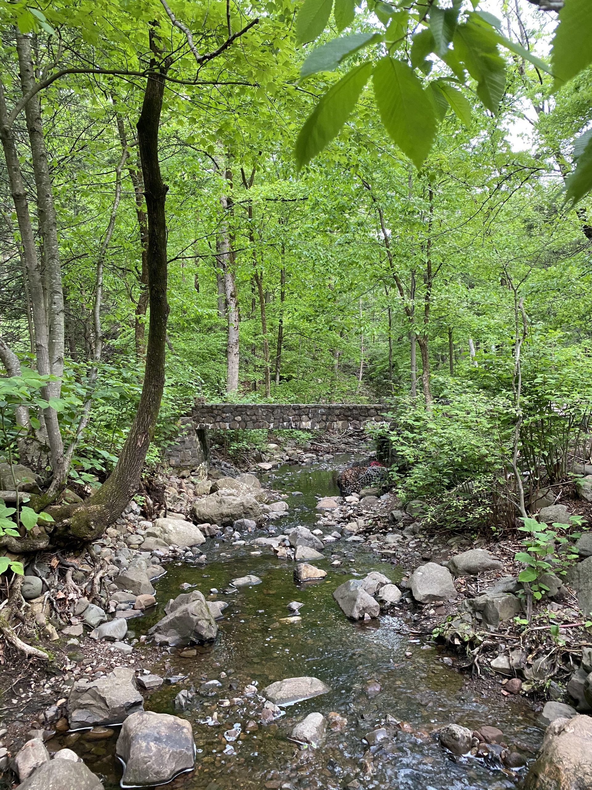
The falls seen straight ahead after this descent are Hobble Falls, not Hemlock. Turning right after crossing the bridge, follow the woods road to the falls and the stone staircase where our description of the trail started.
Return to the Tulip Springs Parking Area
After completing the loop around the falls, we will retrace our steps back to the Tulip Springs Parking Area by by once again following the yellow-blazed Lenape Trail for 0.55 miles.


