Overview
This loop of northern Harriman State Park is jam-packed with views and history, featuring West Mountain, The Timp, Bald Mountain and the historic hamlet of Doodletown and June Cemetery.
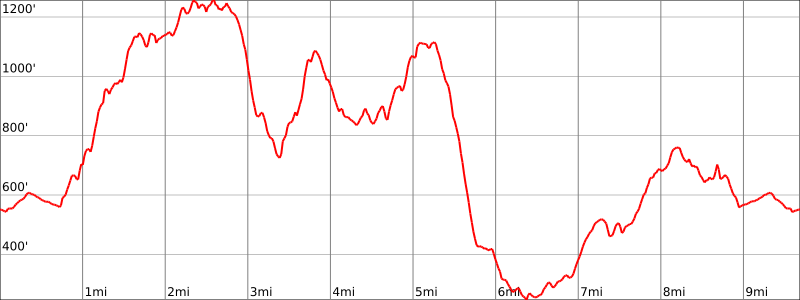
Length: 9.7 miles
Elevation gain: +2,670 feet
Location: Harriman State Park
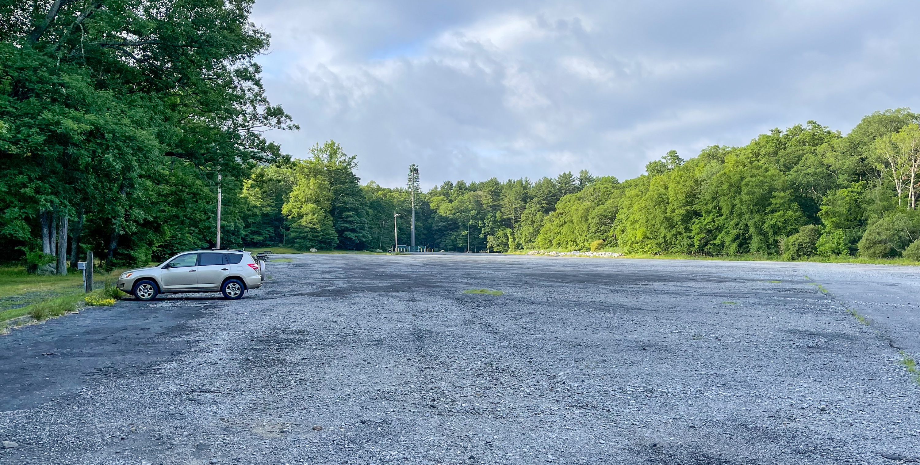
Parking: Park in the Anthony Wayne Recreation Area, located off of Exit 17 on the Palisades Interstate Parkway. Park Park near the north end of the lot.(Google maps link).
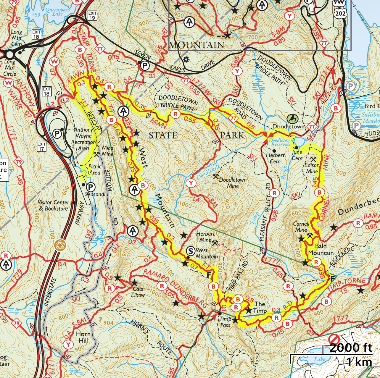
Maps
- Harriman-Bear Mountain Trails Map – NY-NJ Trail Conference (print)
- Harriman-Bear Mountain Trails Map – NY-NJ Trail Conference (Avenza)
Trail description
From the main parking lot, head north and look for the white blazed Anthony Wayne Trail, which you’ll follow uphill to the junction with Beechy Bottom Road. If you parked at the seasonal lot, pass the gate and follow the unmarked trail north until you reach Beechy Bottom Road, which you’ll follow until you reach the junction with the Anthony Wayne Trail and the start of the Fawn Trail.
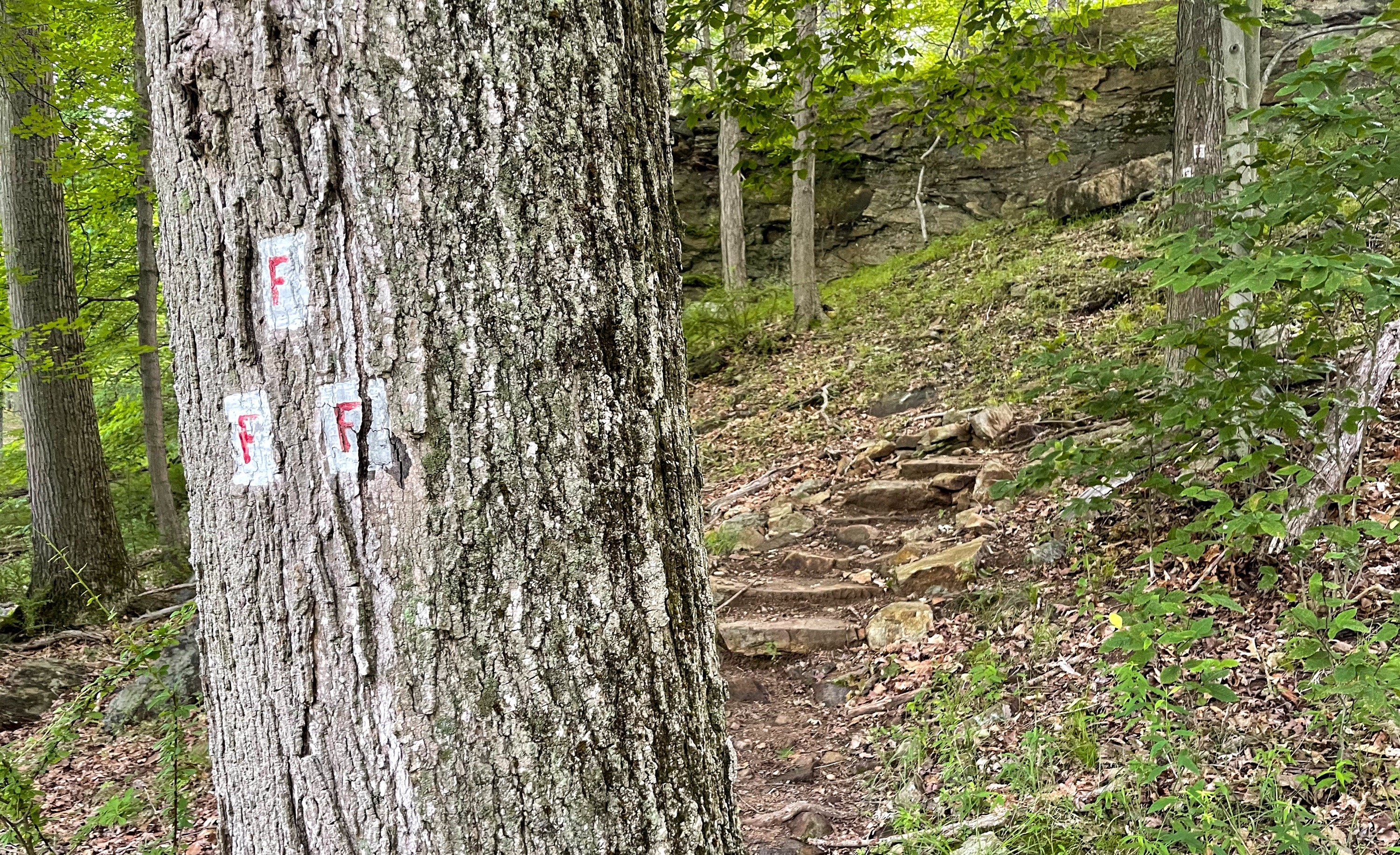
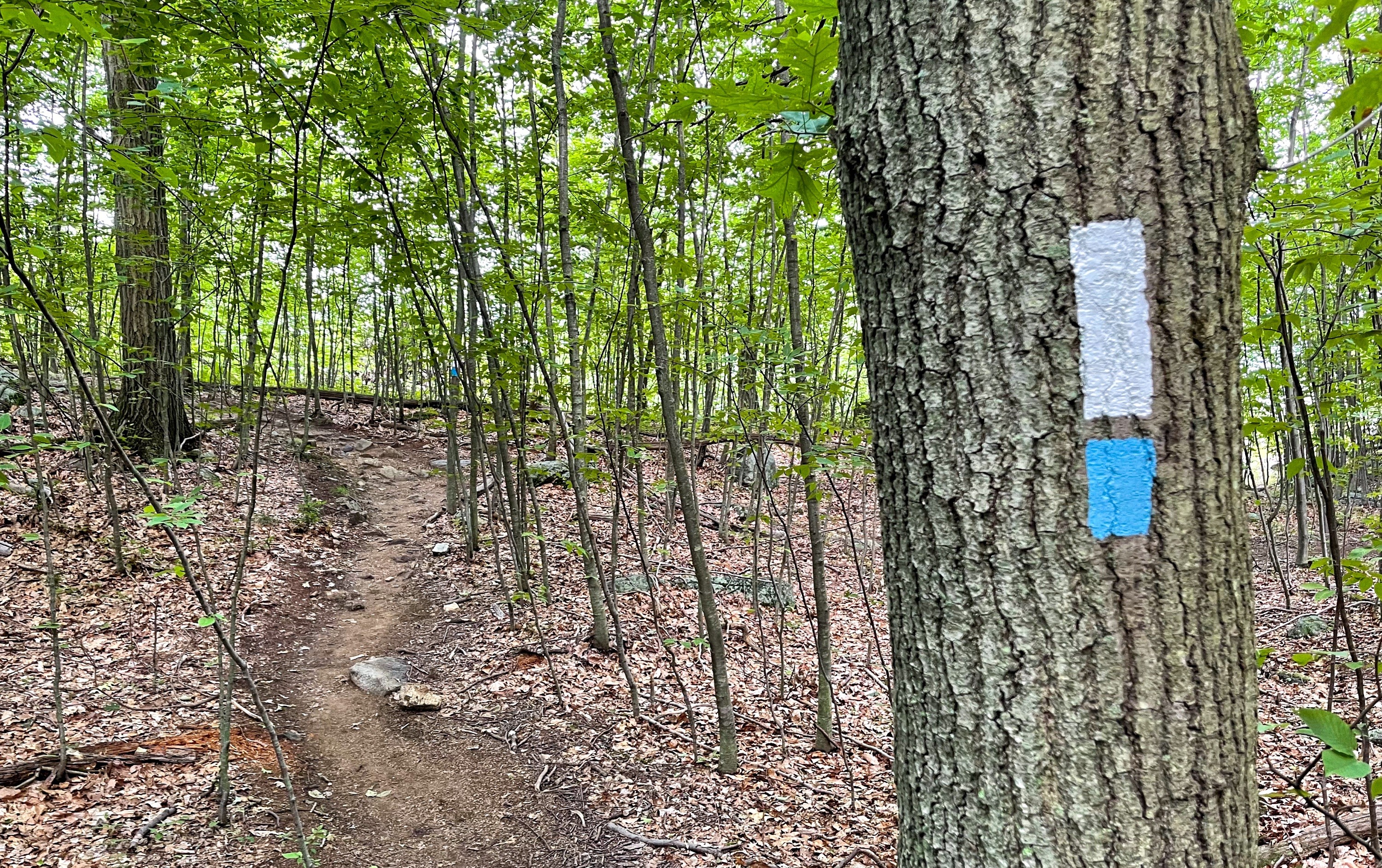
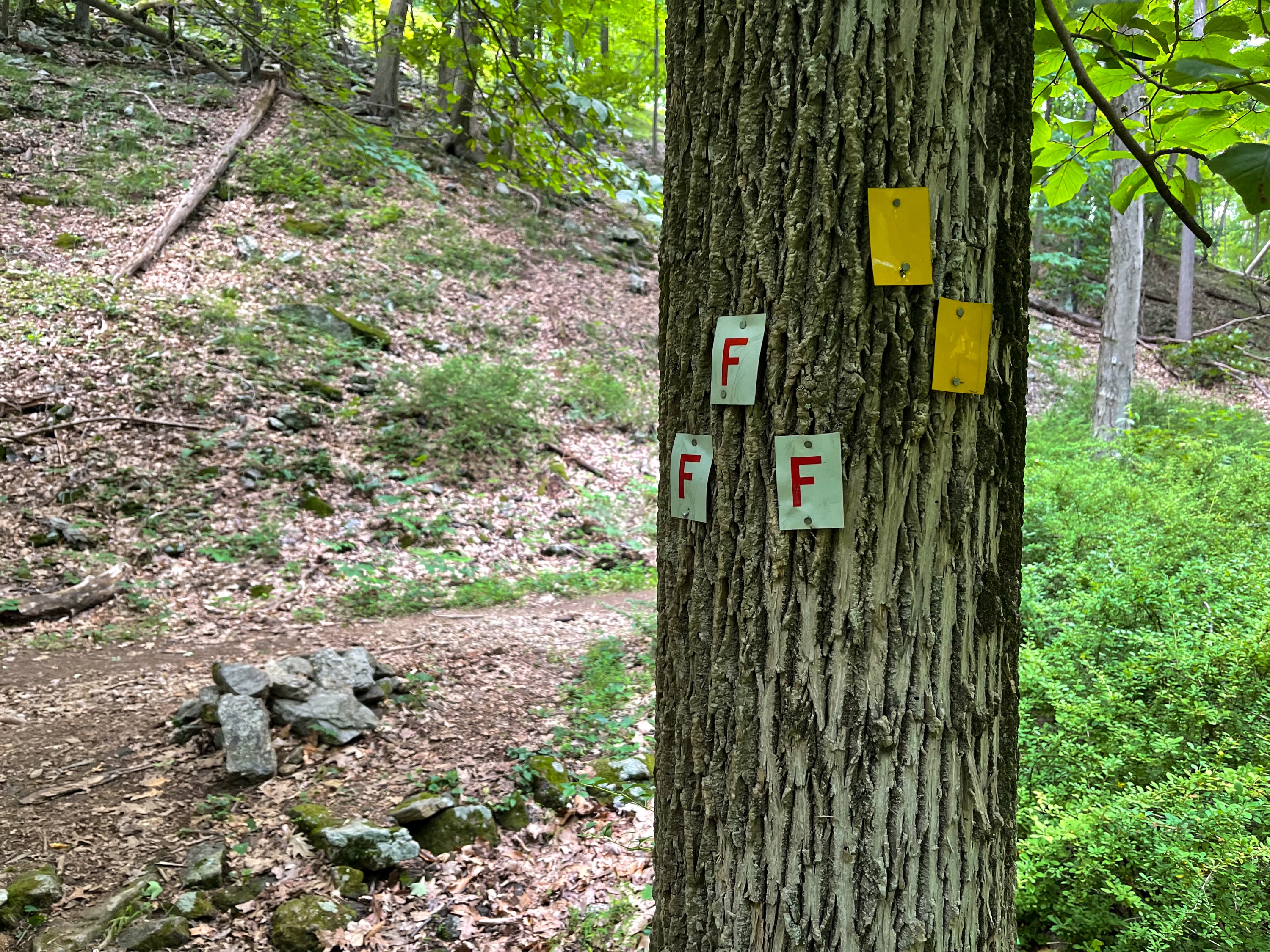
At this junction, the triple red-“F”-on-white blazes marks the start of the Fawn Trail, which we’ll follow uphill for 0.3 miles at which point we reach a junction with the blue-blazed Timp-Torne Trail. Here, make a right.

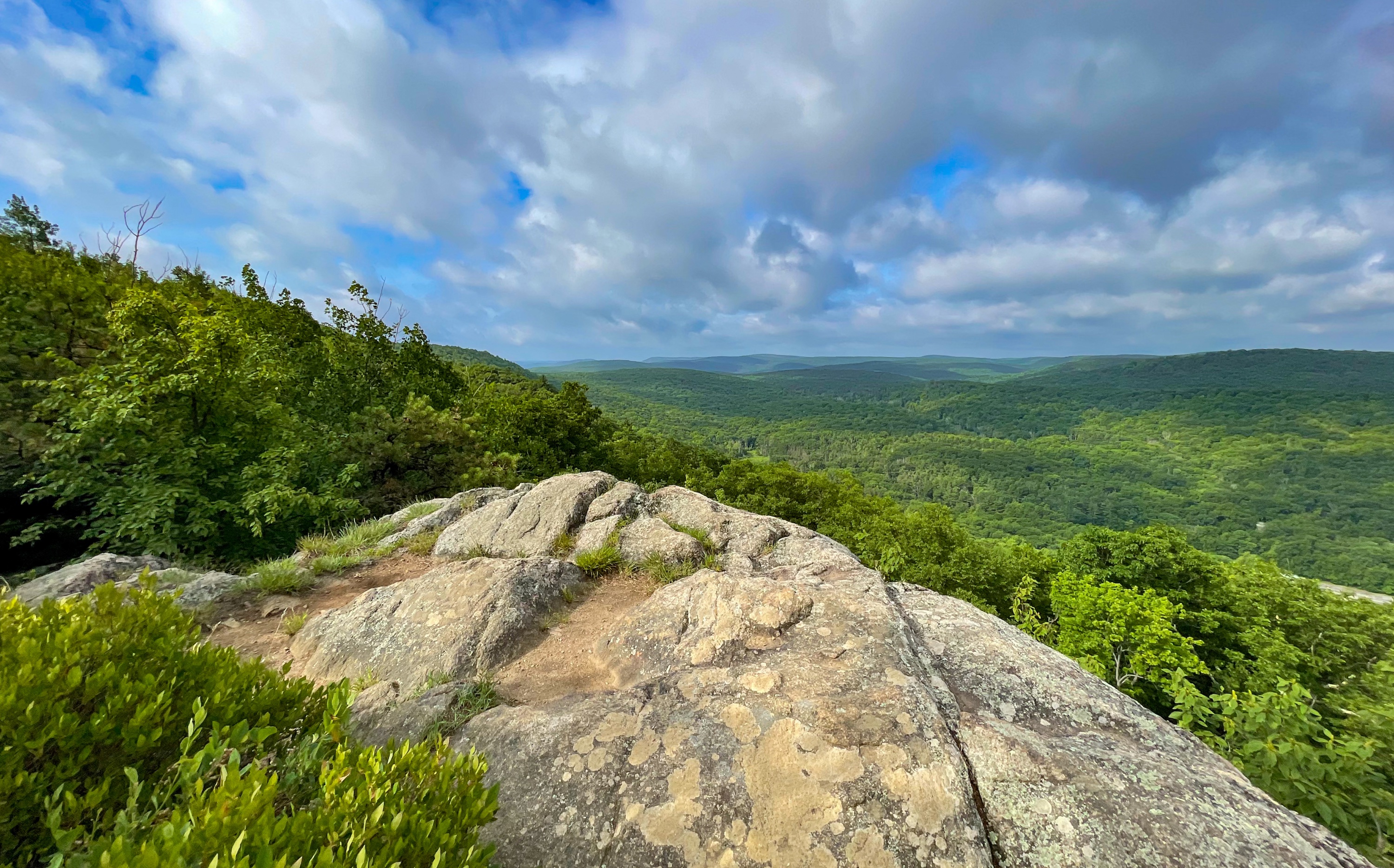
West Mountain
Now follow the blue blazes as you reach the first of what will be a number of great viewpoints along West Mountain.

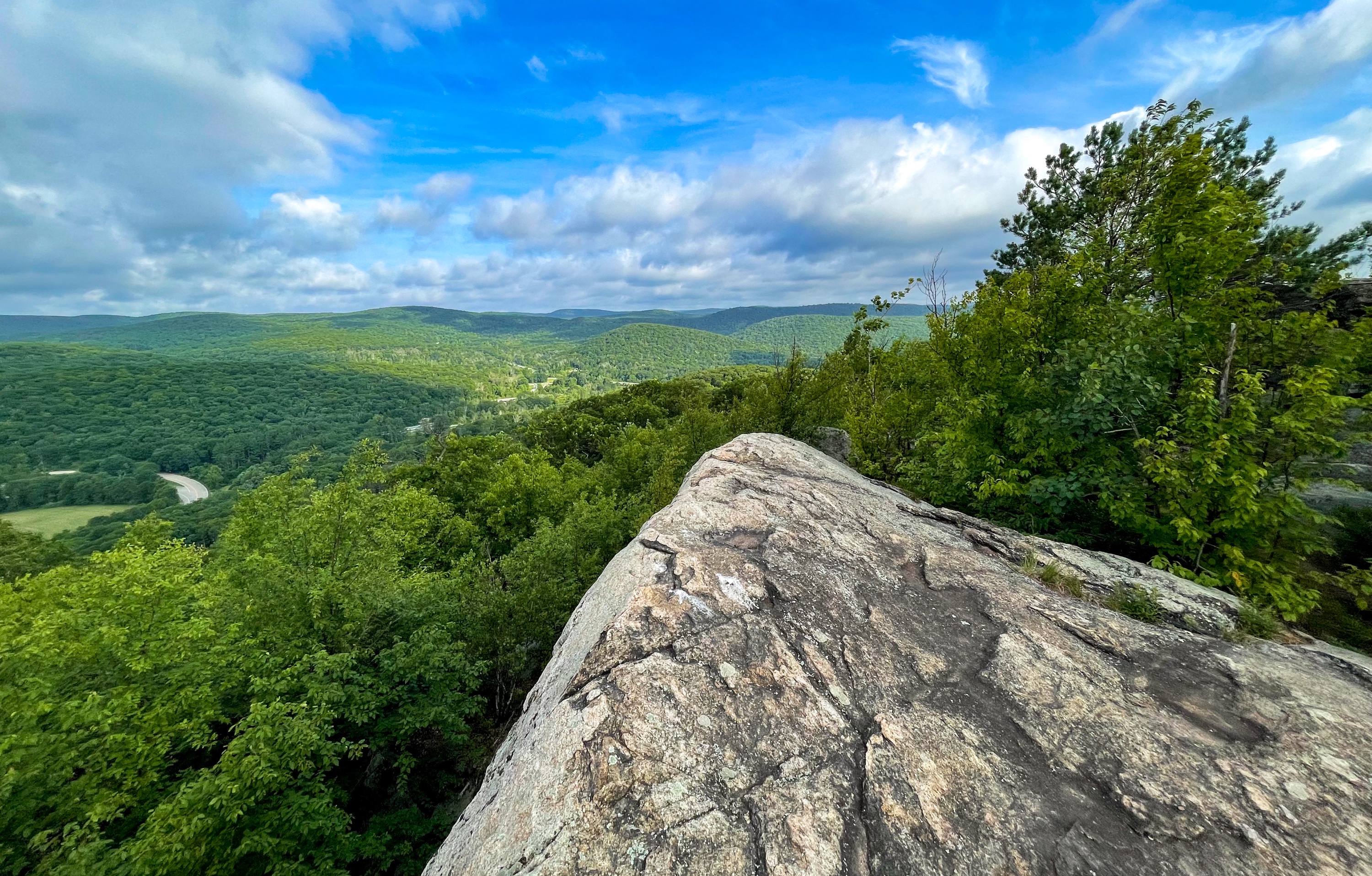
Bear Mountain is visible from this panoramic viewpoint, as is the parking area. The trail continues and eventually follows a crevice in the rock.
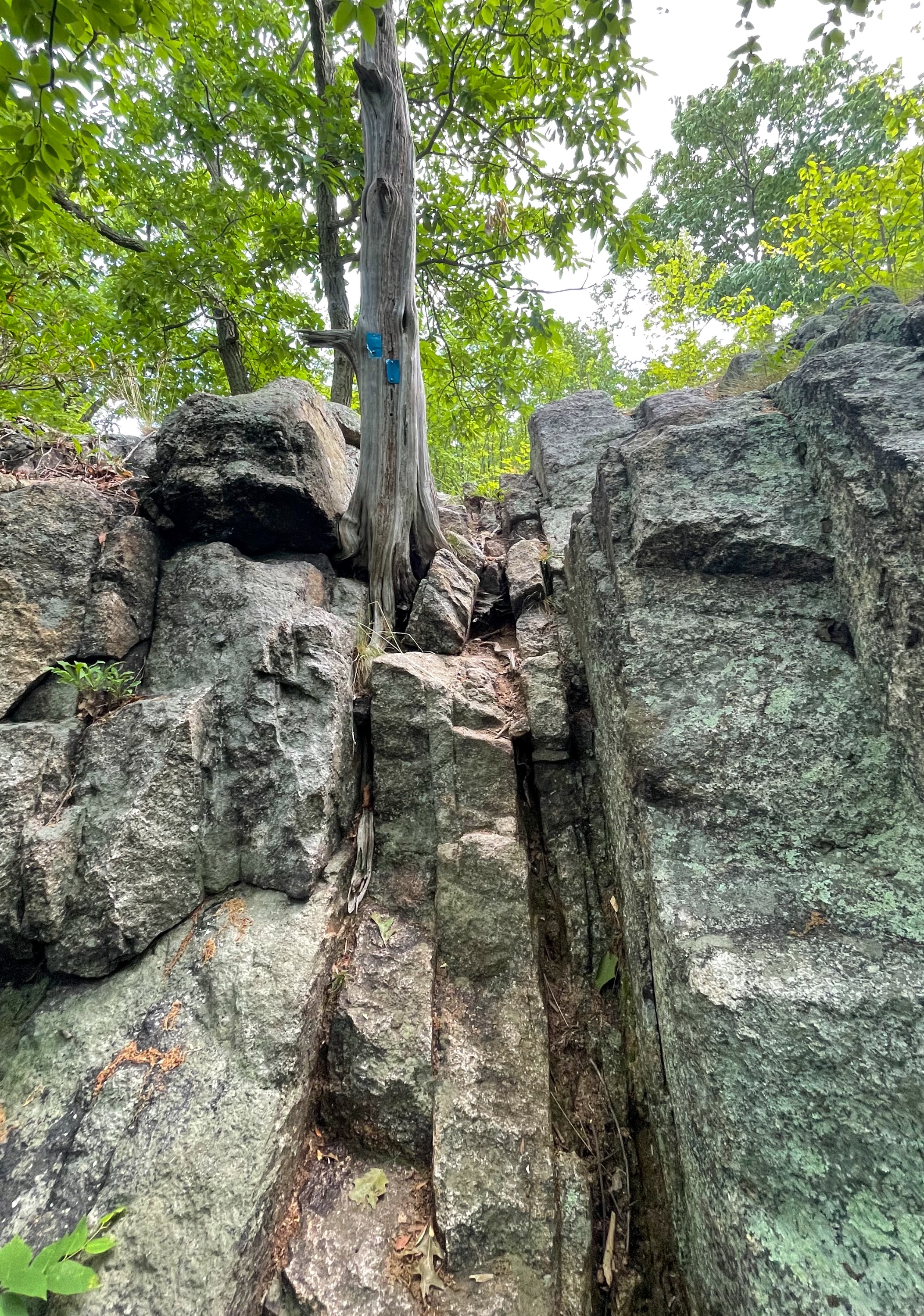

The trail now intersects and is co-aligned with the white-blazed Appalachian Trail.
Follow the white and blue blazes a short distance later to another viewpoint from the west side of the ridge of the mountain.
Another viewpoint is just ahead.
And just beyond that, another one.
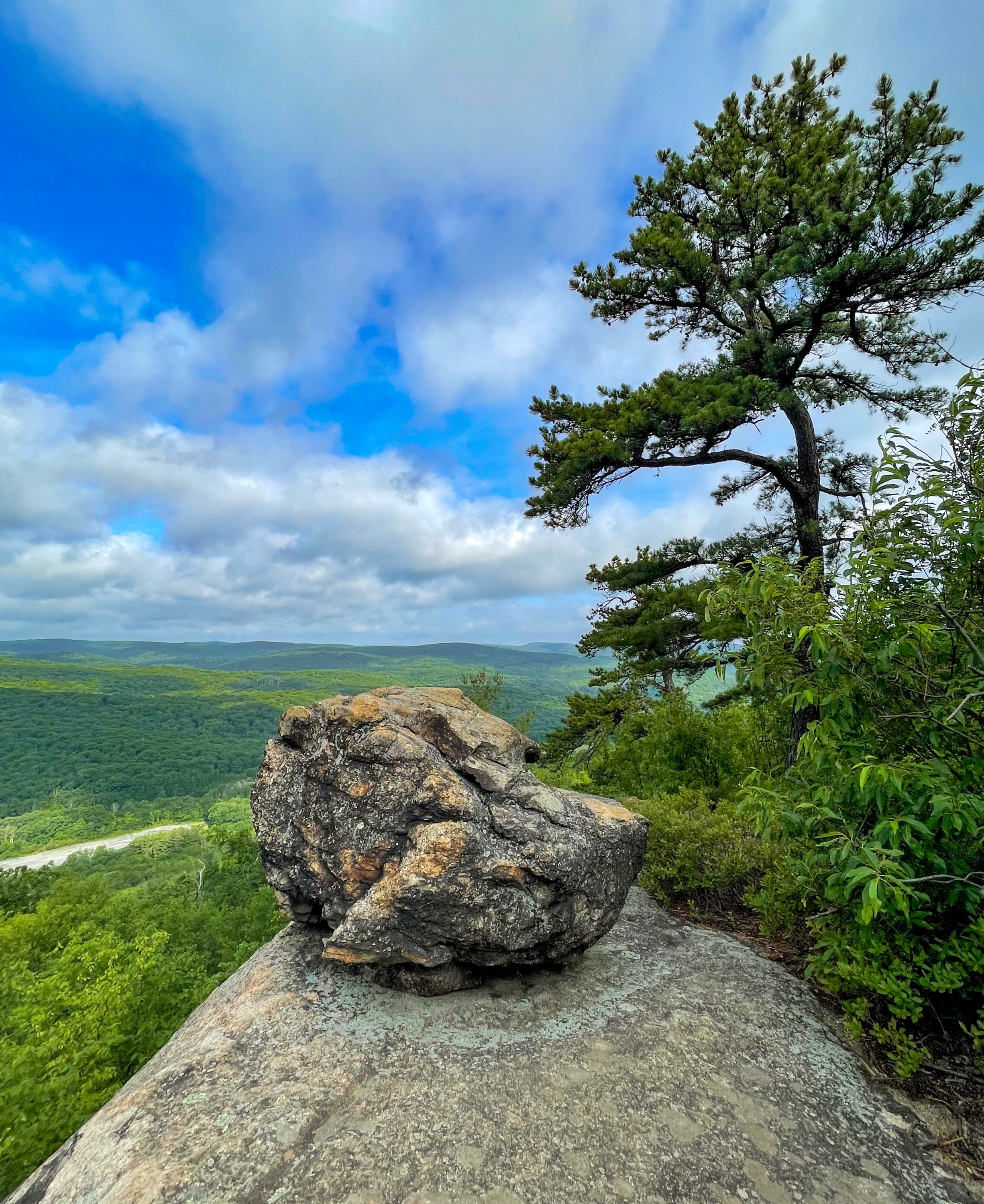
And then – yeah, you guessed it – another one.
Finally, there’s no more viewpoints. Just kidding, there’s another one of course.

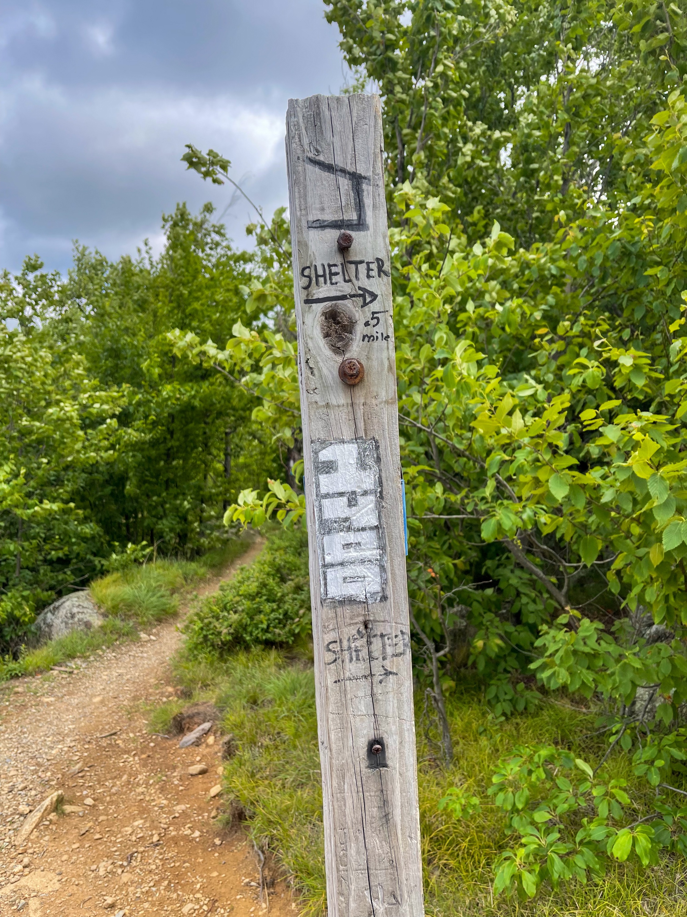
This viewpoint is at a junction where the Appalachian Trail splits away. Note the signpost – located at the 1,400 mile mark of the Appalachian Trail – which points towards the West Mountain Shelter.
Here, we leave the Appalachian Trail and continue to follow the blue-blazed Timp-Torne Trail. After 0.15 miles, you reach a junction with the yellow-blazed Suffern-Bear Mountain Trail and for the next 0.3 miles the trail is co-blazed blue and yellow.

You’ll soon reach a south-facing viewpoint.

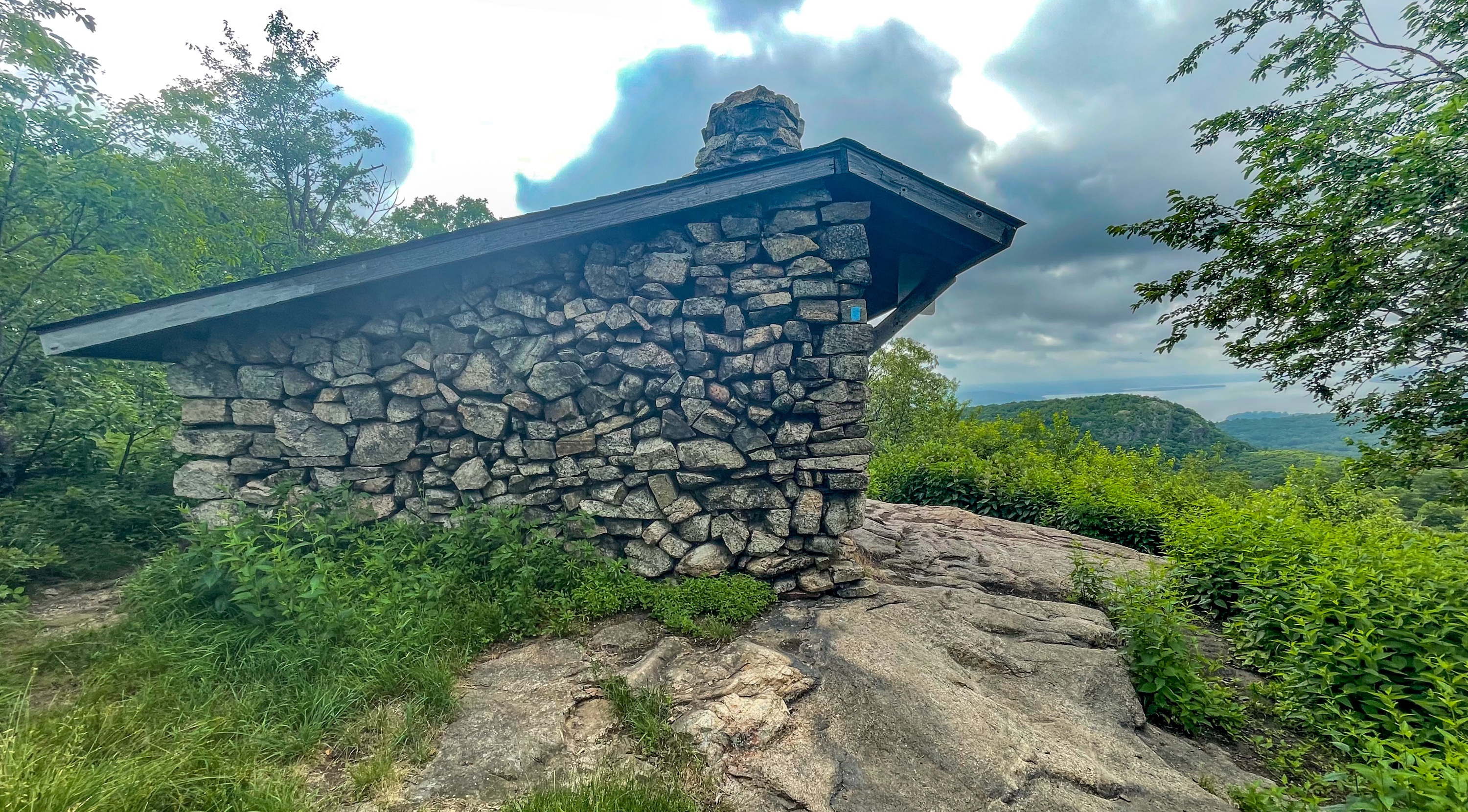
West Mountain Shelter
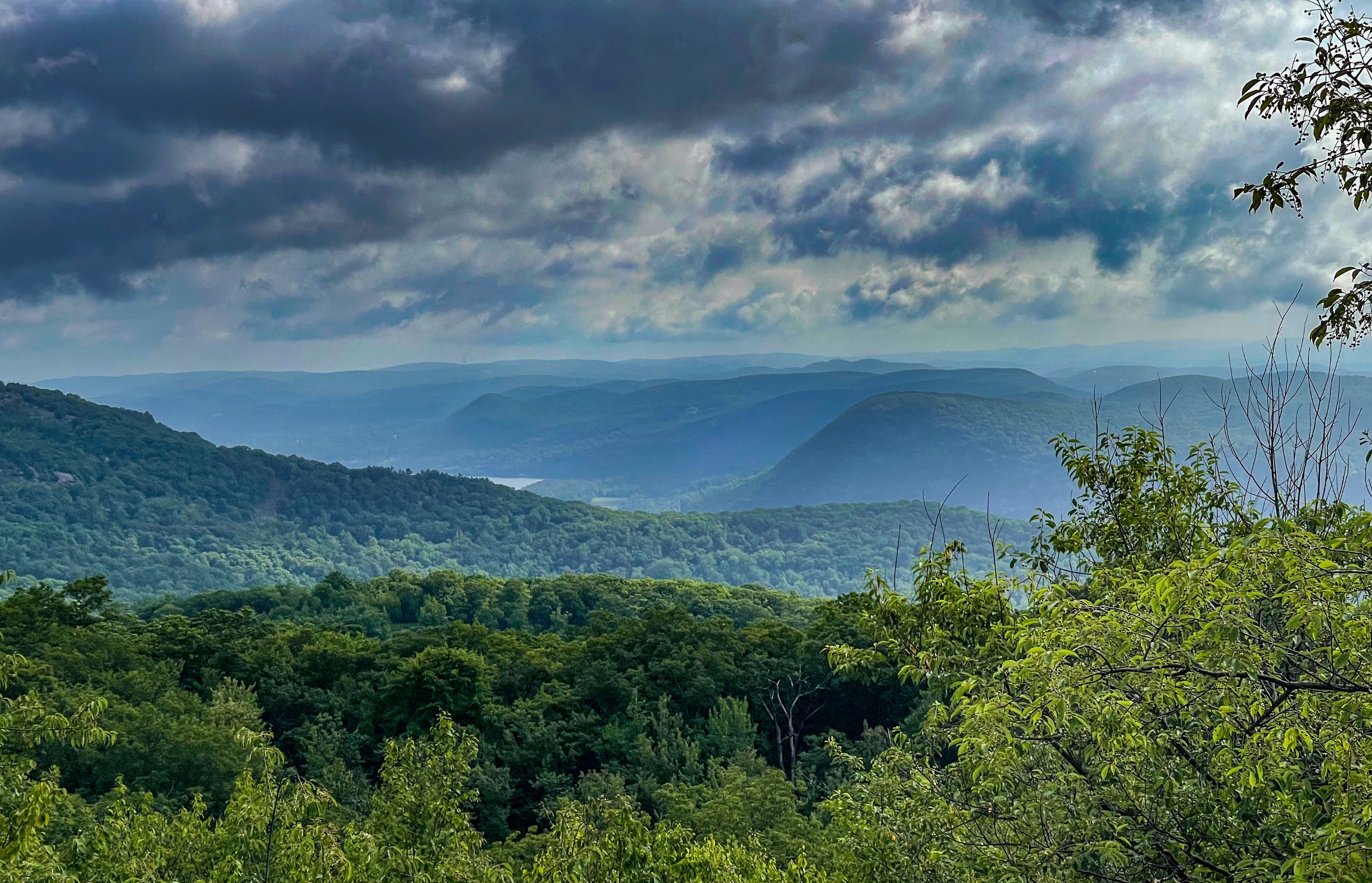
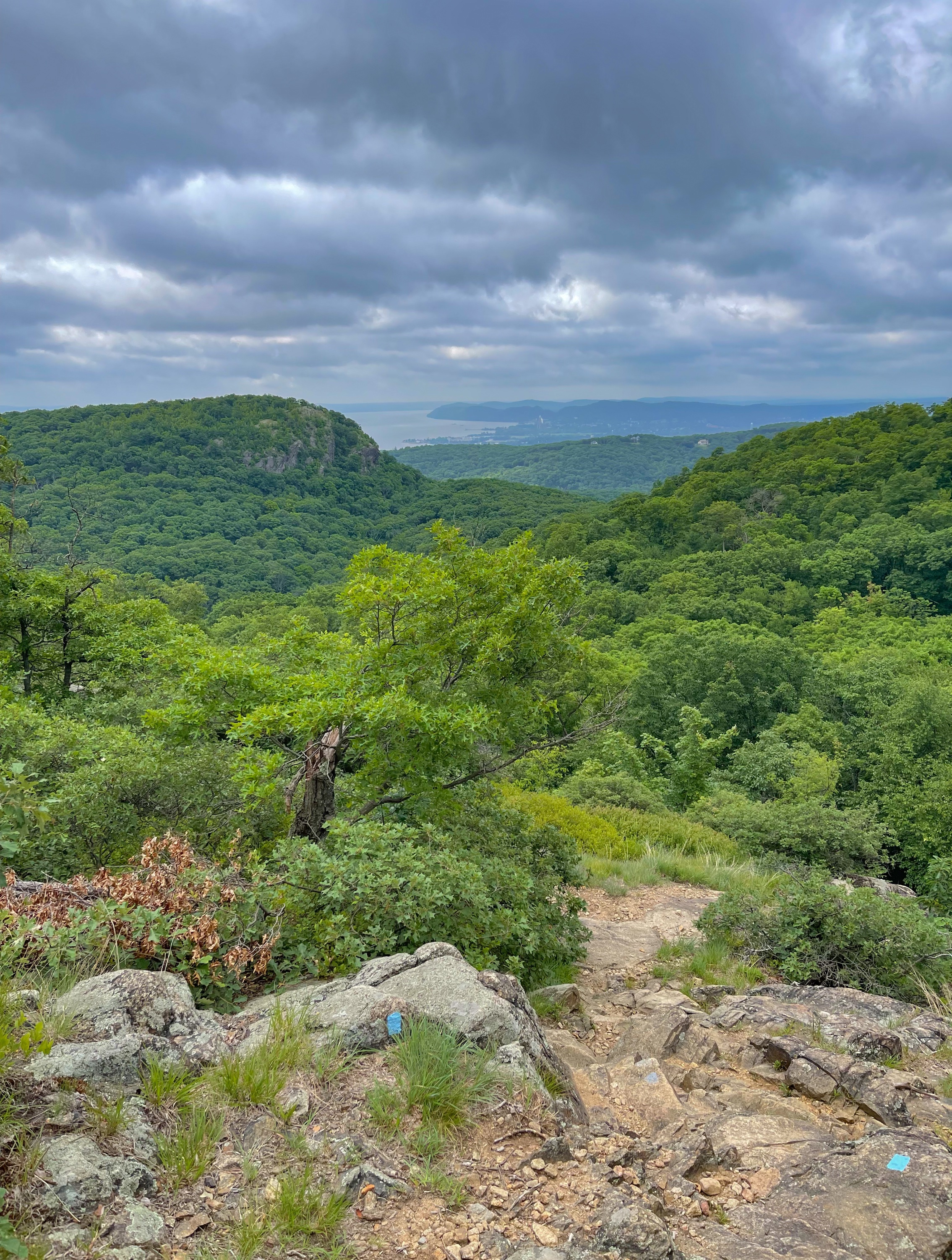
At a junction a short distance ahead, the yellow trail splits off to the left. We will continue to follow the blue blazes. Just ahead you’ll reach the West Mountain Shelter, a great spot to camp if you’re backpacking. The views from here of the Hudson River and the Timp prominently on the left are spectacular.

Continue to follow the blue blazes as the trail begins to descend, with additional views of the Timp ahead of you.
After a descent, the trail reaches a junction with the red-dot-on-white blazed Ramapo-Dundenberg Trail. The blue and red trails are now co-aligned.


A short distance ahead is a really cool rock/tree combination in which the tree has somehow managed to grow around a pointy rock blocking it’s skyward trajectory. Nature finds a way!

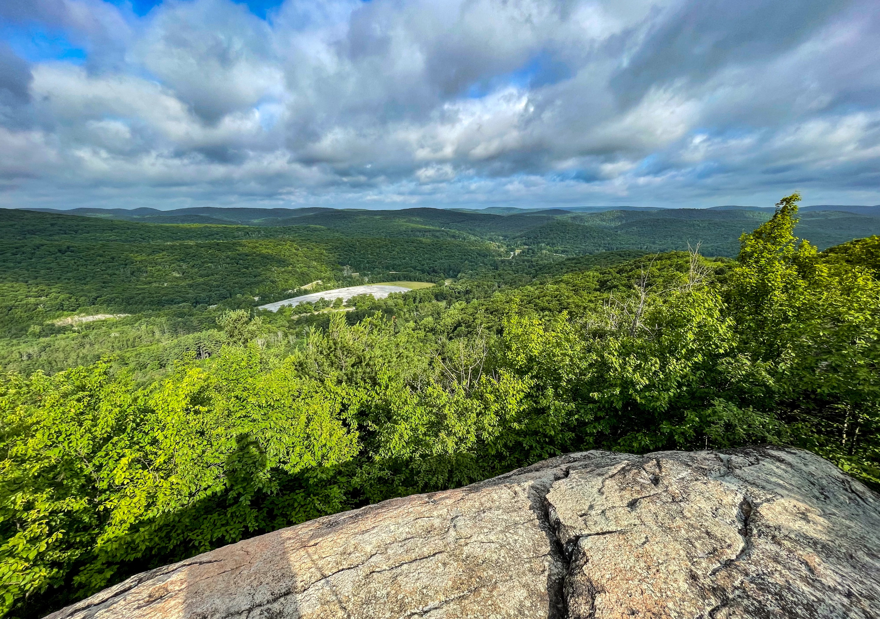
The Timp
About 0.8 miles ahead, you’ll reach the summit of The Timp, featuring spectacular panoramic views. This is a great spot for a break.

A short distance later, the trail splits, and we will stay left to continue on the red-dot-on-white blazed Ramapo-Dunderberg Trail.
In 0.3 miles you’ll reach the junction with the 1777 trail marked with a rock cairn.

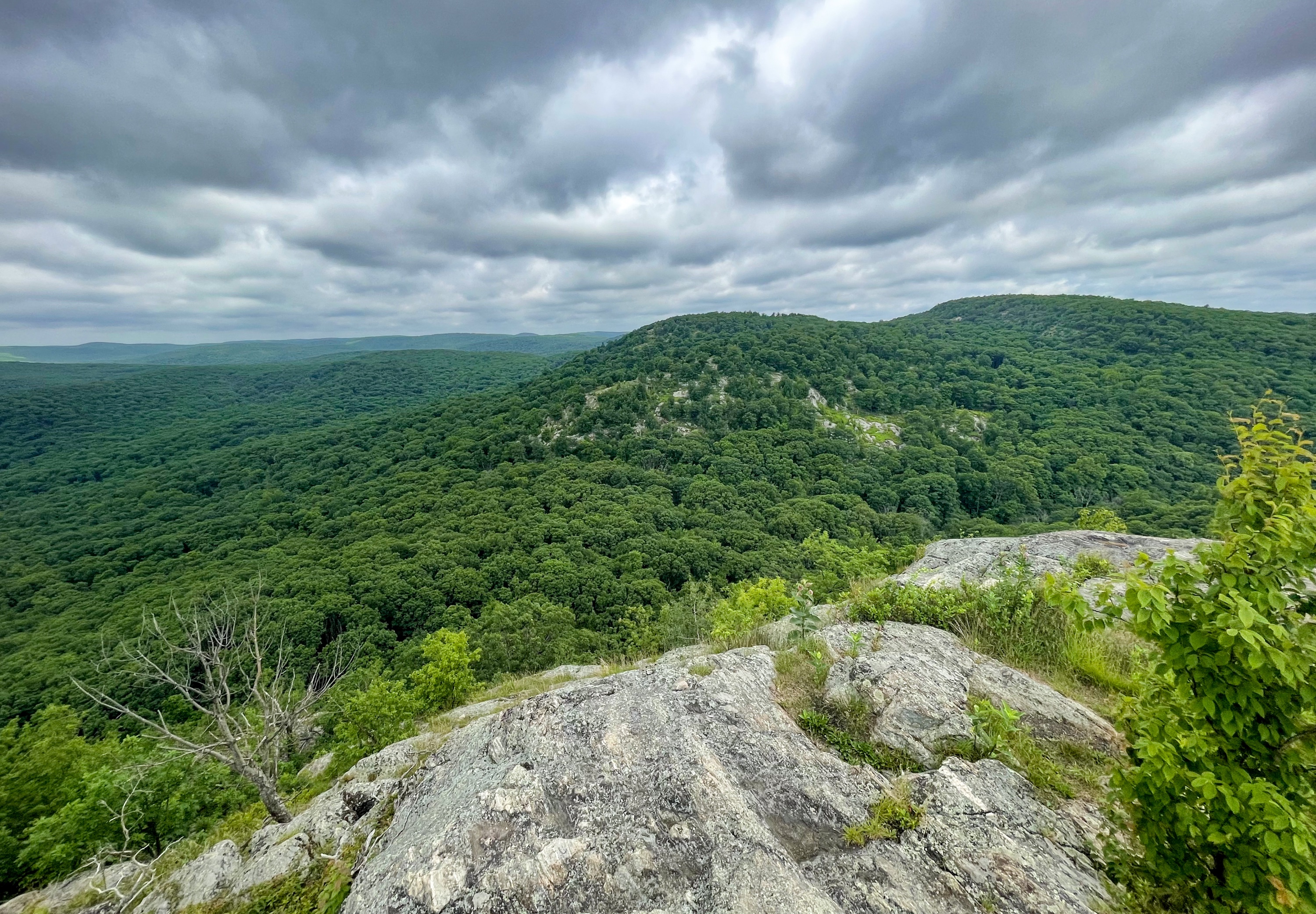
Continue straight on the red-blazed R-D trail. The trail climbs and eventually passes a viewpoint to the west.

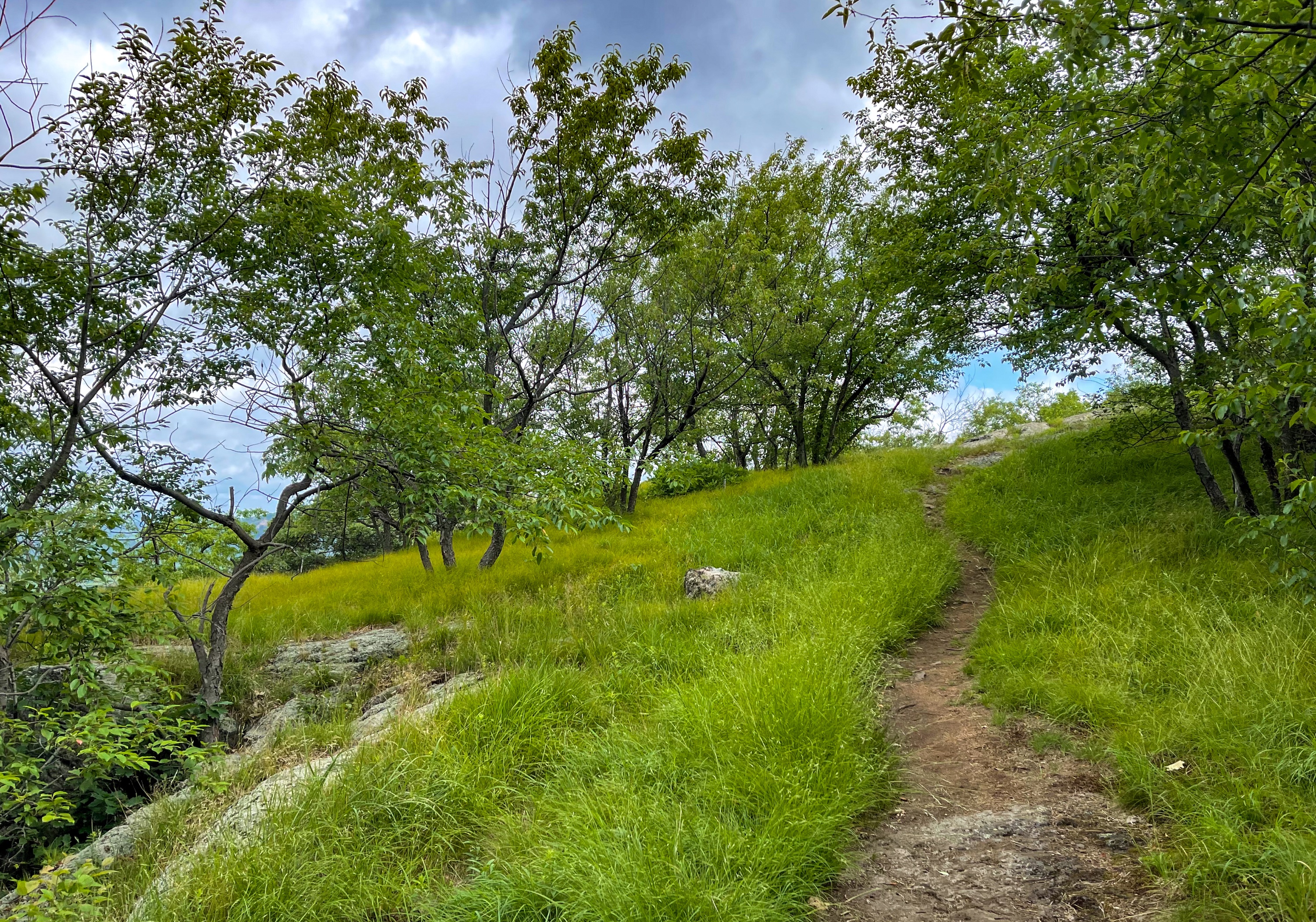
Continue along the R-D trail as it makes a final climb up Bald Mountain through a grassy partial clearing.
Bald Mountain
At the summit of Bald Mountain, enjoy panoramic views of Bear Mountain, Anthony’s Nose, the Bear Mountain Bridge and Hudson River, and Harriman State Park.

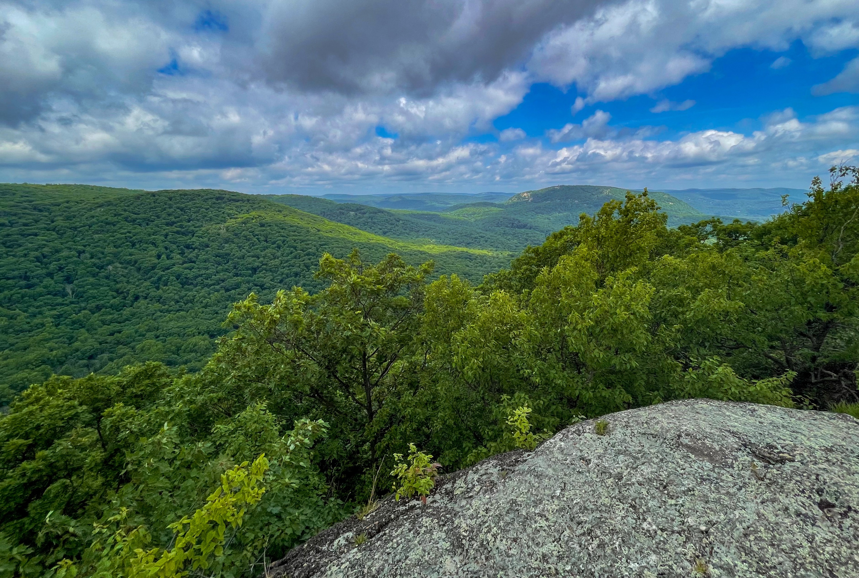

This is another great spot to take a break and enjoy the view. When you’re ready, return to the trail, which makes a sharp 180 degree turn and begins a steep descent downhill.
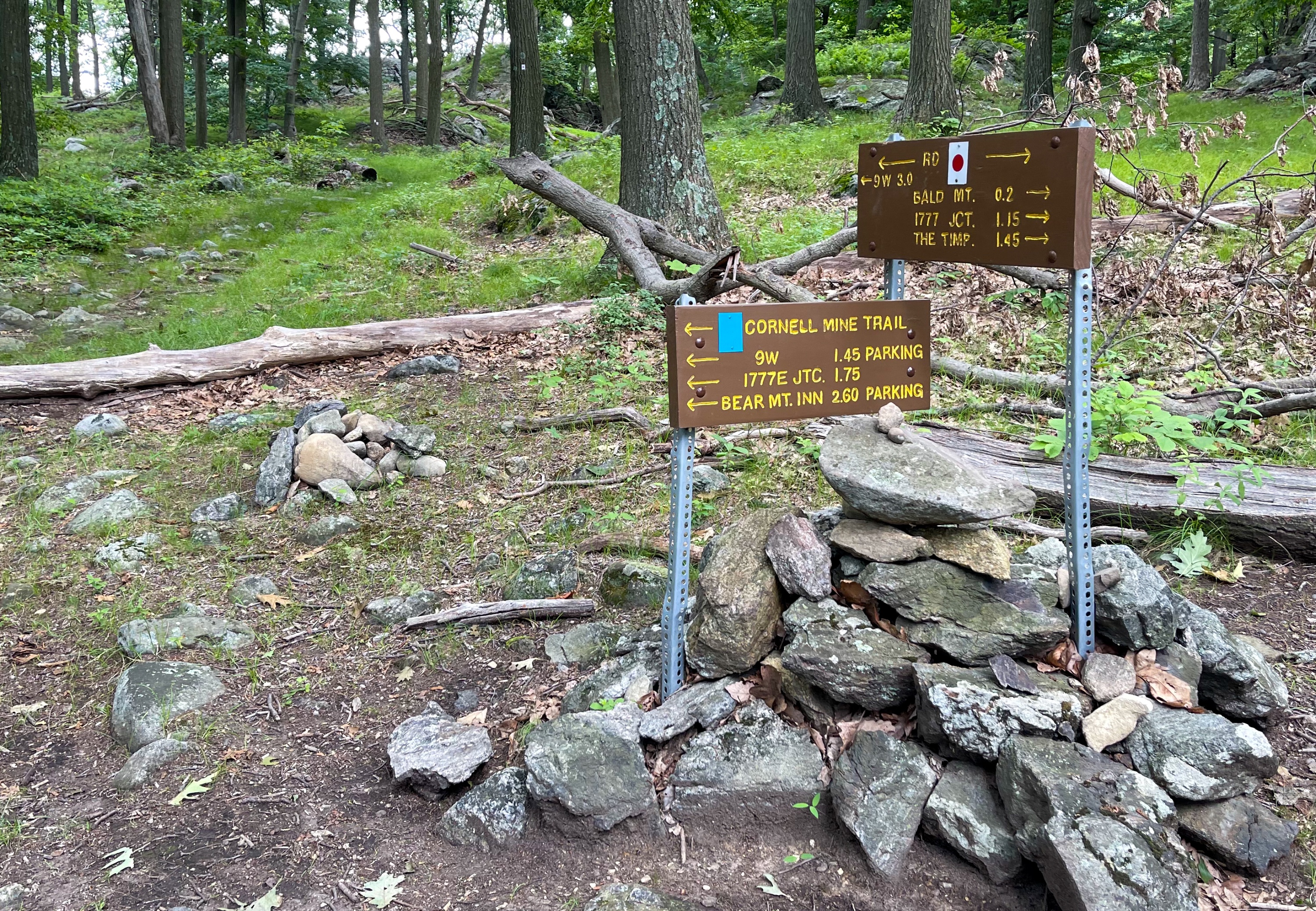
In about a quarter mile, you’ll reach a junction with the blue-blazed Cornell Mine Trail, marked by a rock pile and signage. Make a left and follow the blue blazes as the trail continues downhill.
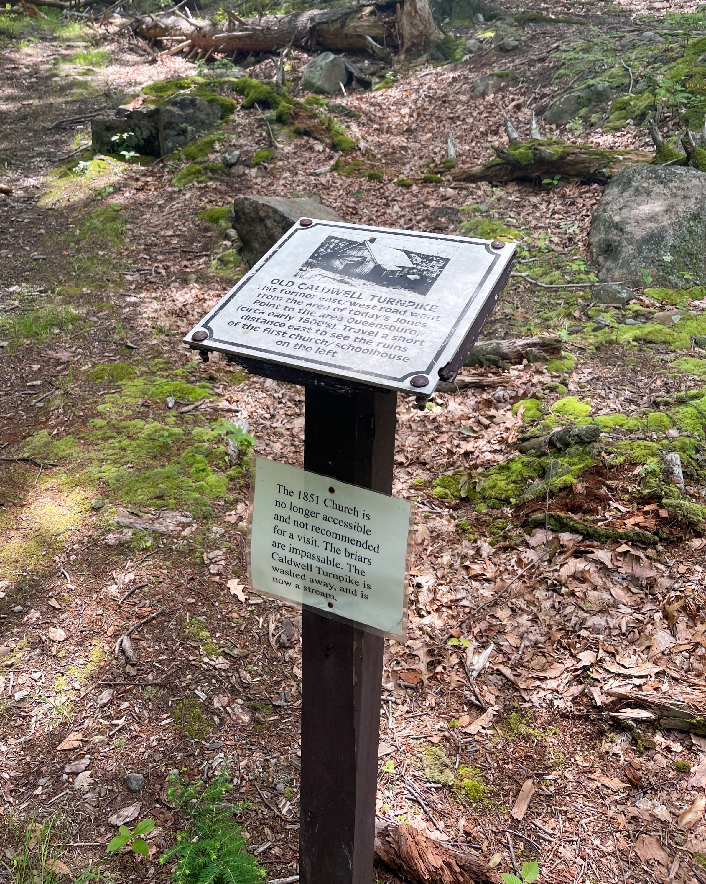
After nearly a mile, look for an unmarked old woods road on your left. Take this trail a short distance until it ends at another unmarked woods road. Near this junction is a sign for the Old Caldwell Turnpike.
Rather than turn left or right onto the woods road, we’ll bushwhack a short distance straight ahead into the woods, heading generally in the direction of the small lake, but slightly towards the left. You’ll descend and cross on some rocks a small stream, Timp Brook, that feeds into the lake.
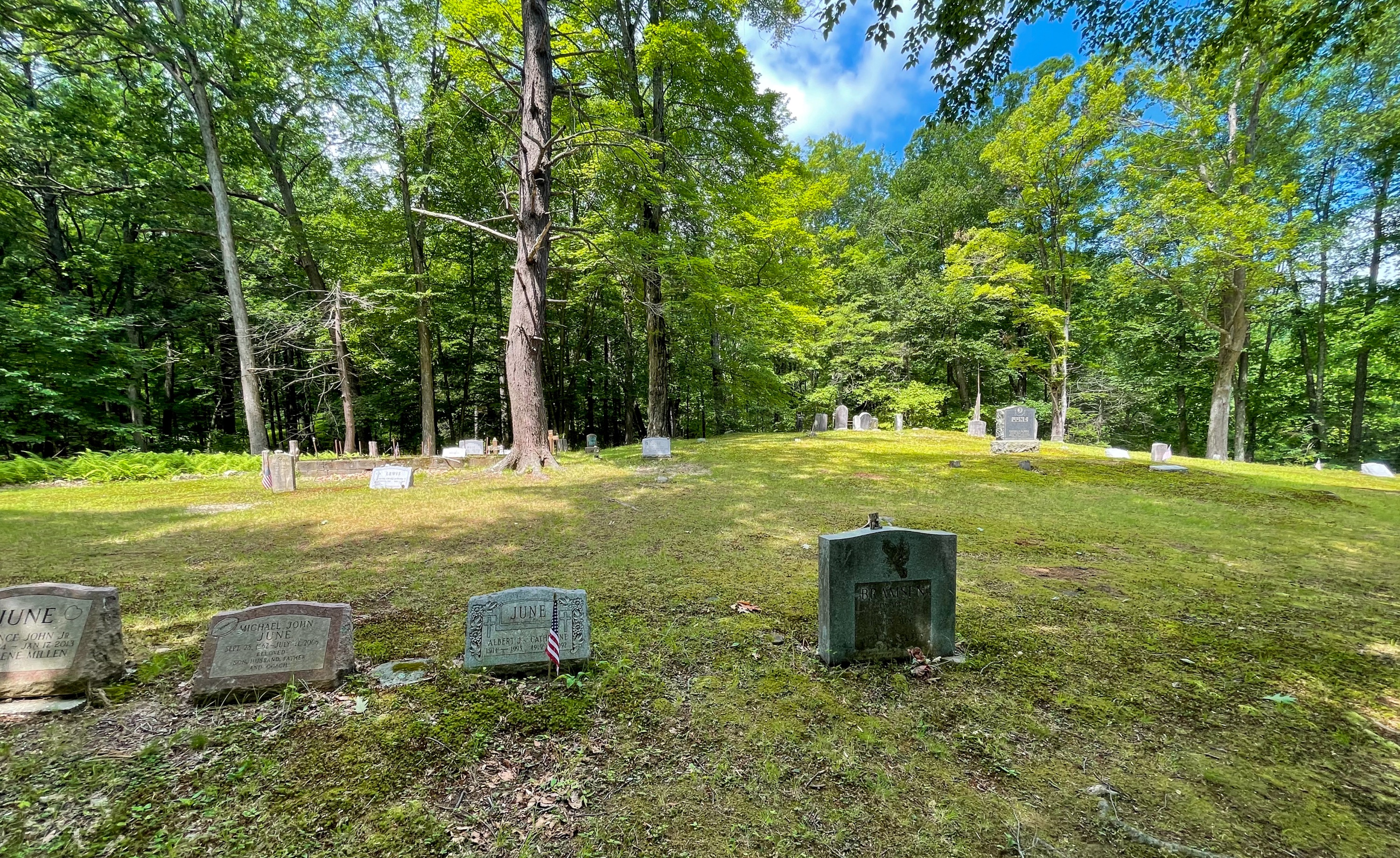
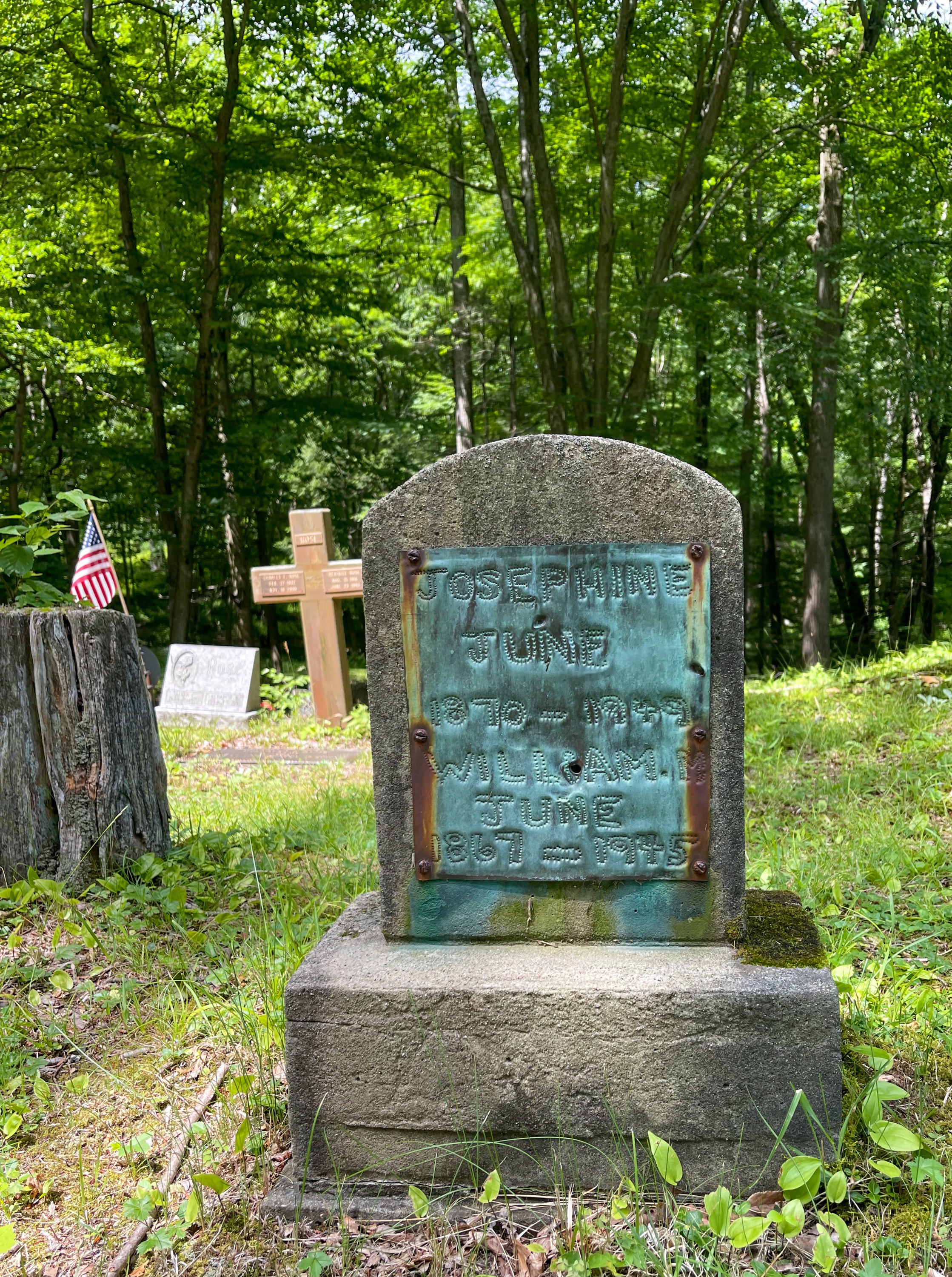
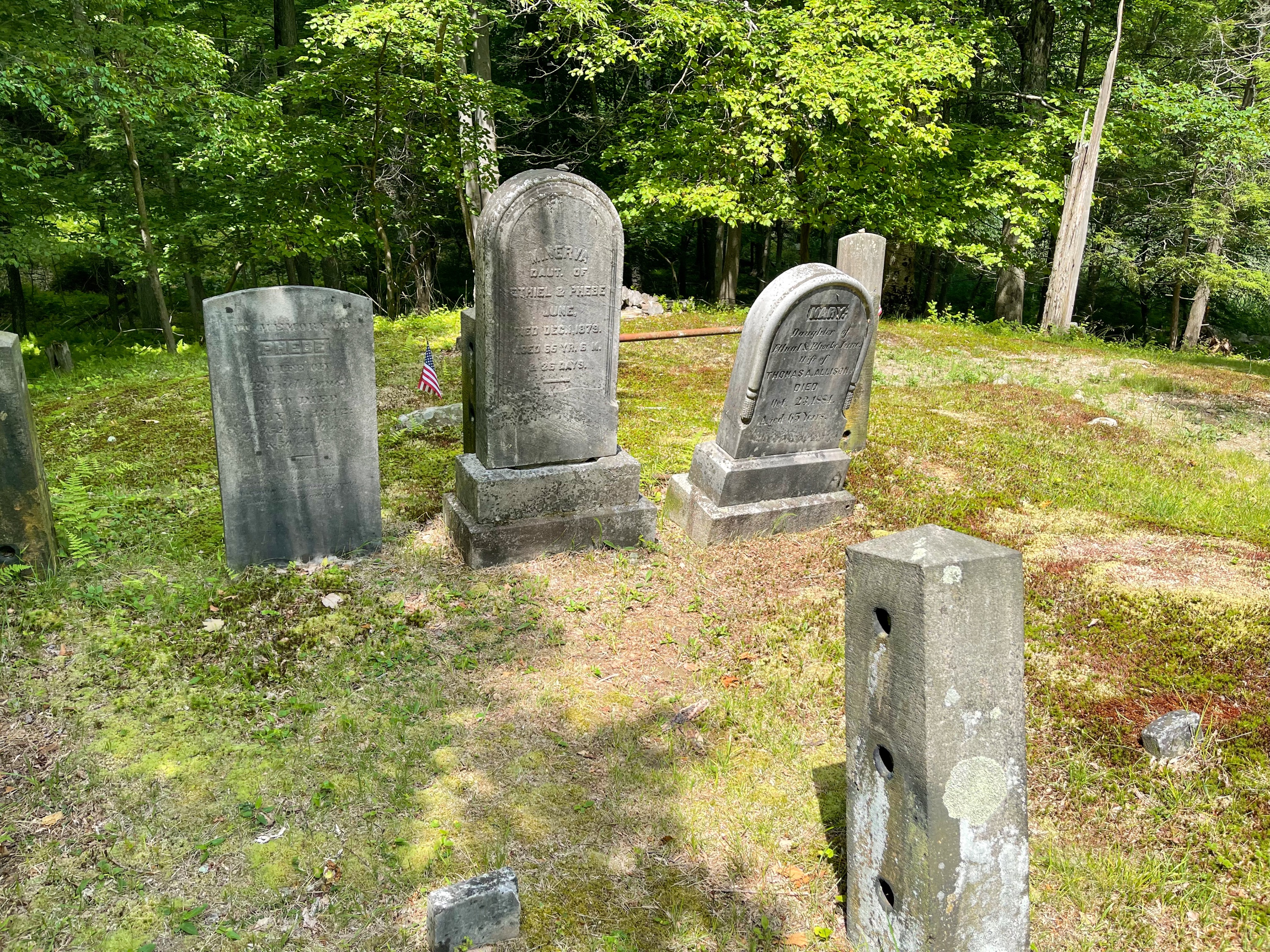
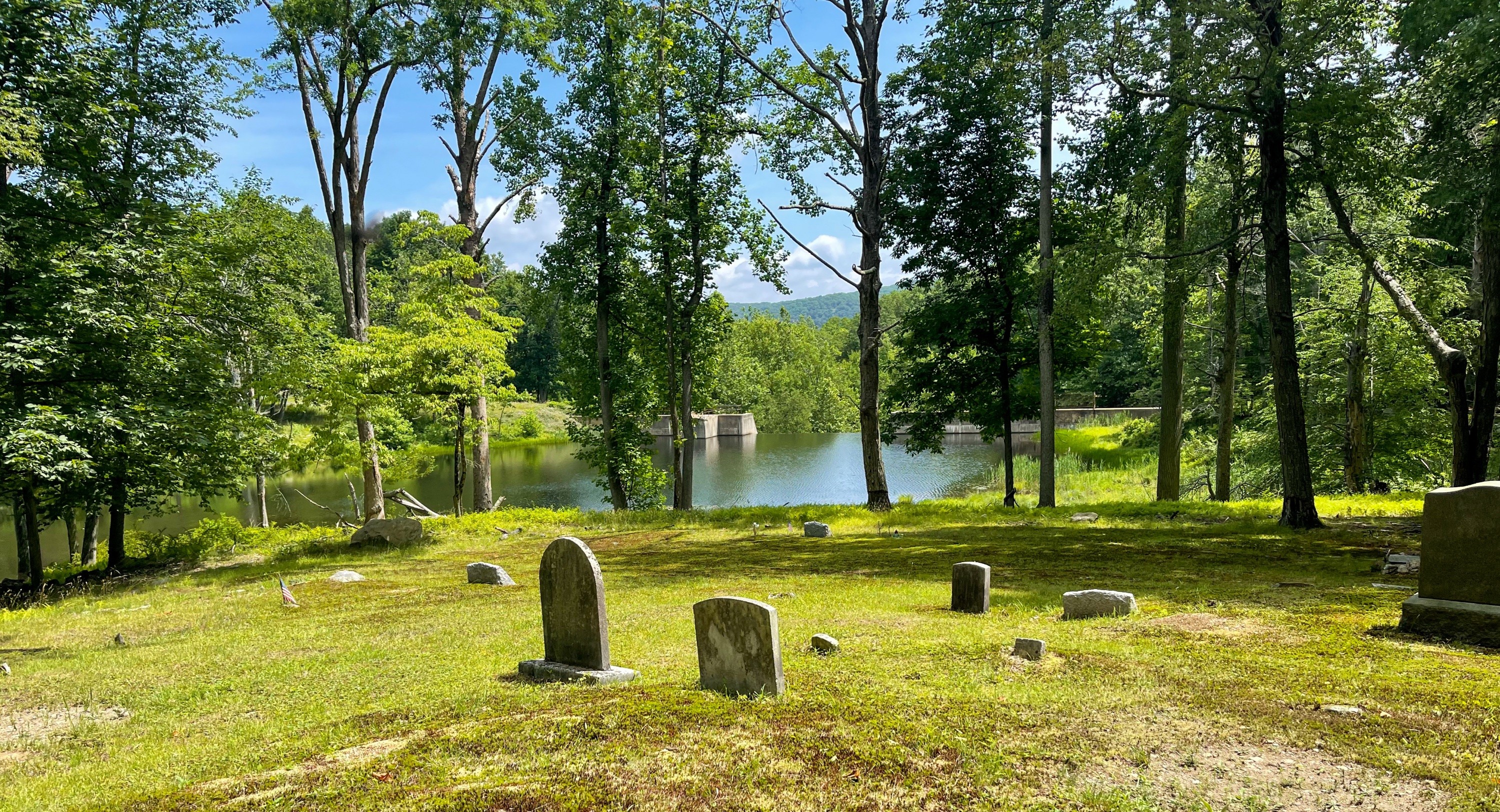
June Cemetary
Head uphill from the stream and you’ll reach the Second June Cemetary. This is private property, so please be respectful.


From here, follow the woods road – Doodletown Road – towards the west.
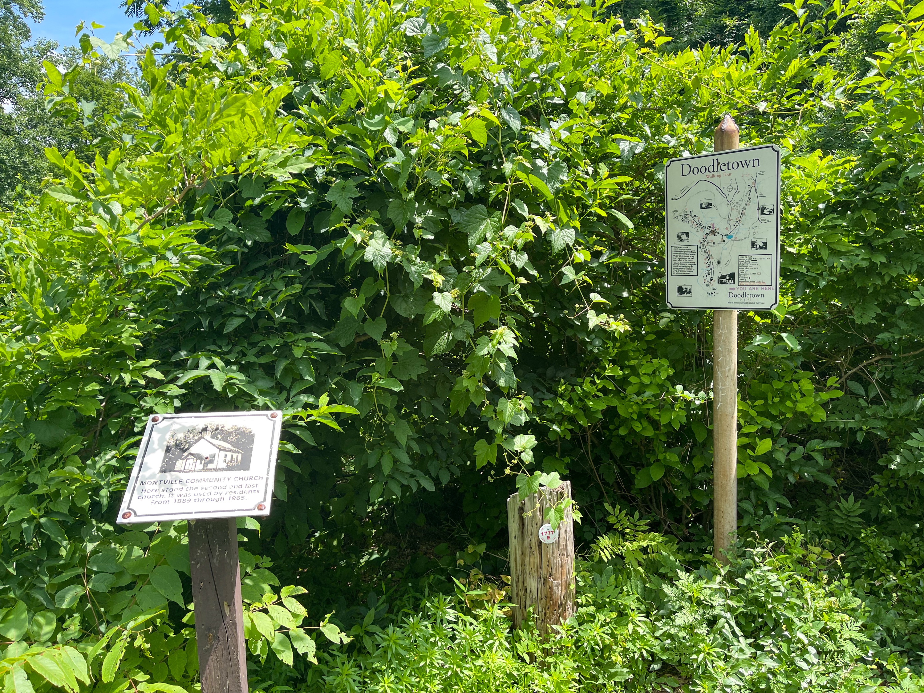
Doodletown
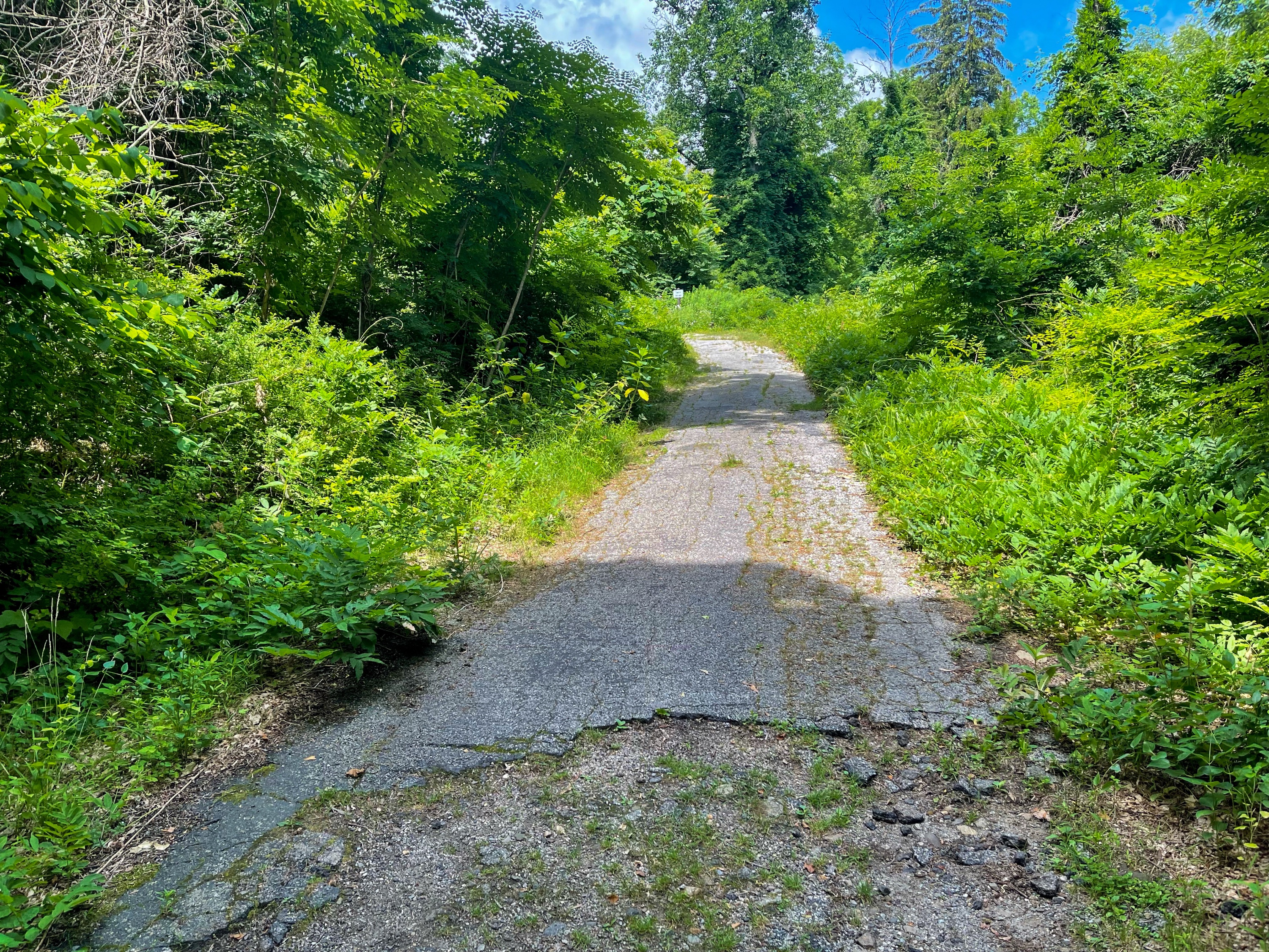
Soon the 1777 Trail will co-align with Doodletown Road, parts of which are still asphalt. The 1777 Trail is the route British forces took for an attack on Fort Montgomery and Fort Clinton.
About Doodletown
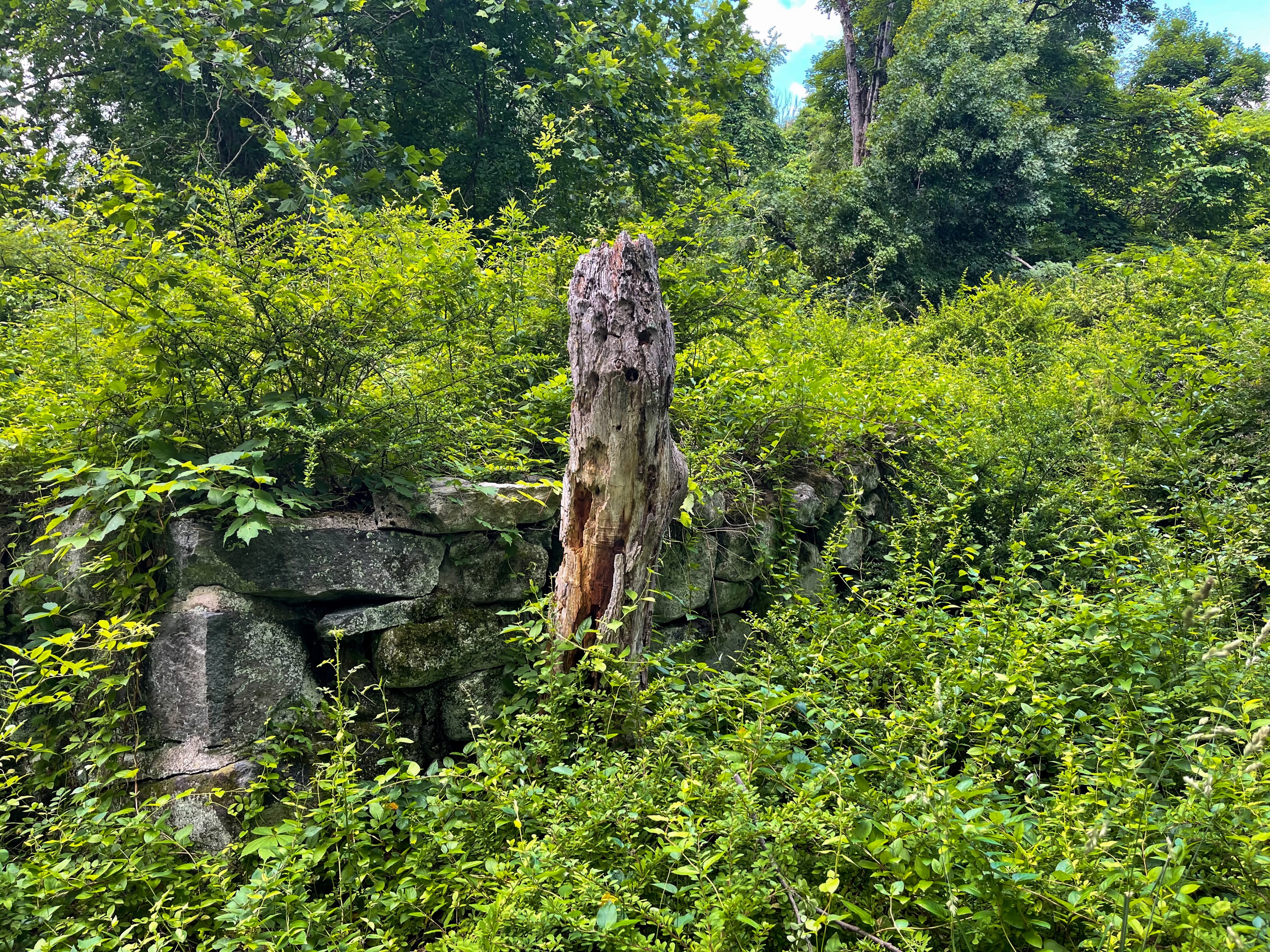
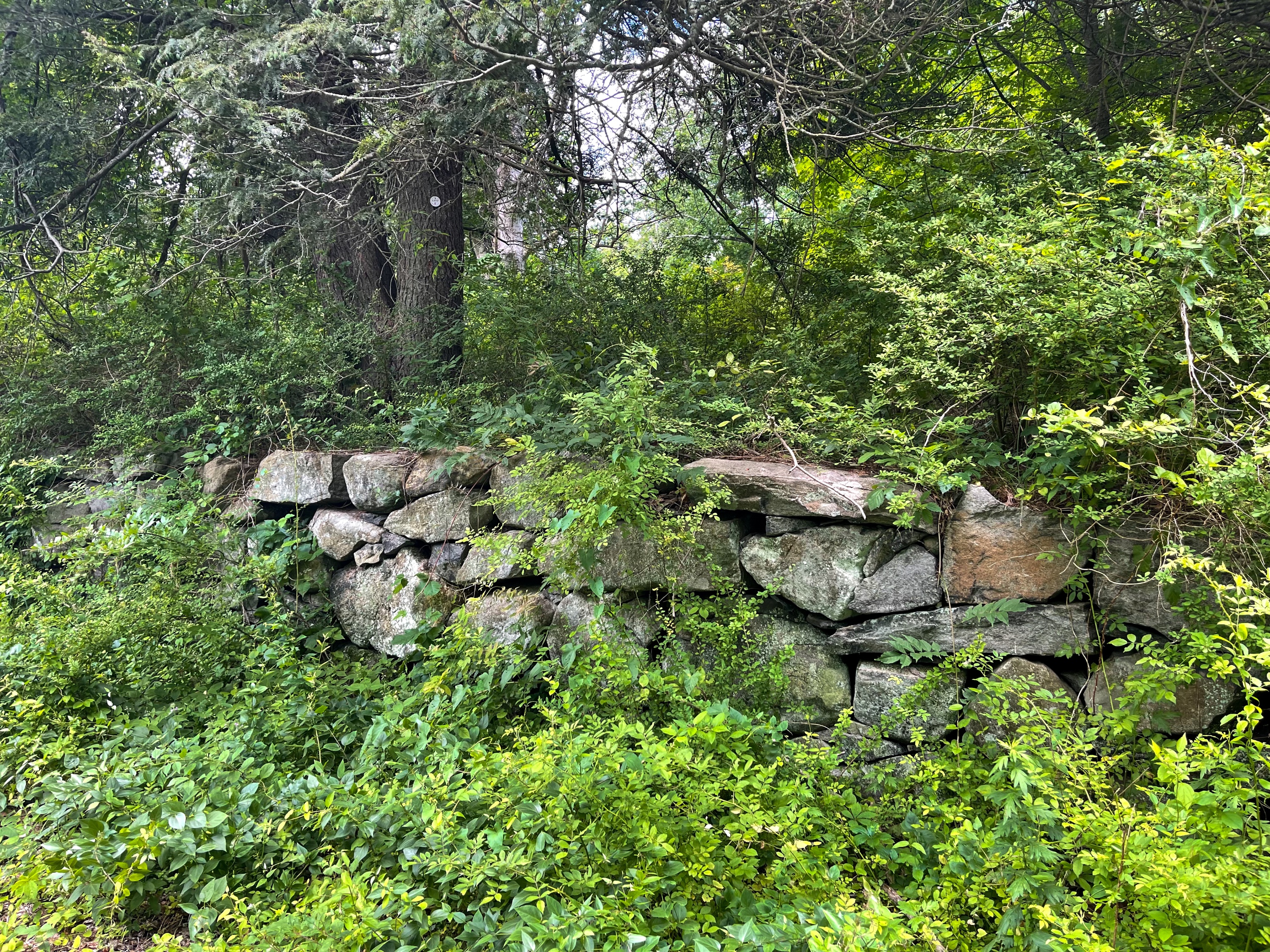
Doodletown is the site of a former hamlet in a picturesque valley which was inhabited at least since 1762, when Ethiel June arrived from Connecticut. Until World War I, only 75 people lived in Doodletown. Between 1917 and 1945, the population of Doodletown increased to about 300. Gradually, the Park bought many of the Doodletown homes. In 1962, the remaining private holdings were condemned and, by 1965, the hamlet was completely vacated. All buildings have been demolished, but some foundations remain, and interpretive signs have been installed. For a description of the various sites in Doodletown (including a detailed map showing their location), see Doodletown: Hiking Through History in a Vanished Hamlet on the Hudson, by Elizabeth “Perk” Stalter (updated ed. 2017).
NY-NJ Trail Conference Harriman Bear Mountain Trails Map


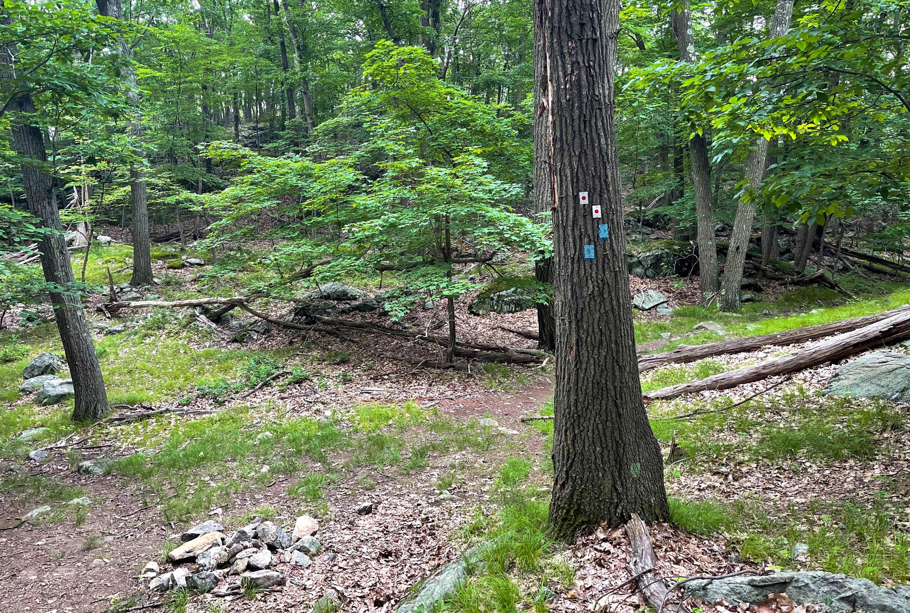
We will follow the 1777 Trail as it forks left off of Doodletown Road and a short distance ahead reaches a junction with a confusing jumble of blazes on a tree. Here, stay on the 1777 Trail.

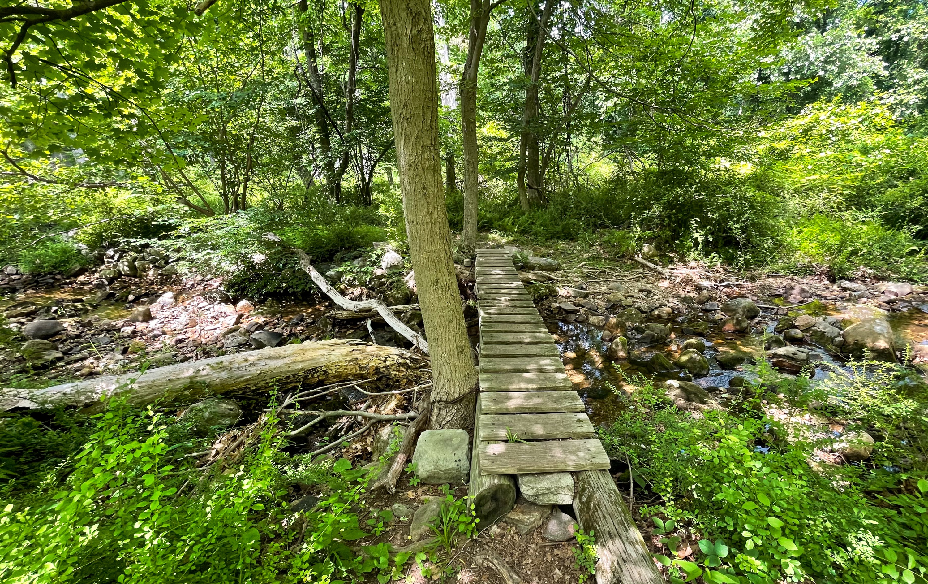
After a half mile, the 1777 Trail reaches a junction with the yellow-blazed Suffern-Bear Mountain Trail. Make a left and follow the yellow blazes south. Soon, you’ll cross a creek on a small footbridge.
Just ahead you’ll reach a junction marking the beginning of the red-F-on-white blazed Fawn Trail.
Follow the Fawn Trail west (to the right) for 0.9 miles. The trail co-aligns with the Doodletown Bridle Path part of the way.

The trail intersects the Appalachian Trail, but we will continue to follow the Fawn Trail. In 0.3 miles, you’ll reach a junction with the Timp-Torne Trail, which we previously turned onto to begin the loop. Continue to follow the Fawn Trail downhill for another 0.3 miles to reach Beechy Bottom Road. From here, depending on where you parked, either continue straight, or turn left and return the way you came back to the parking lot.


