Overview
This relatively flat 9-mile loop takes you through the Wawayanda Swamp Natural Area. Highlights include a boardwalk through white cedar swamp on the Cedar Swamp trail, rhododendron thickets and mountain laurel groves, and two lakes, swamps, and streams.
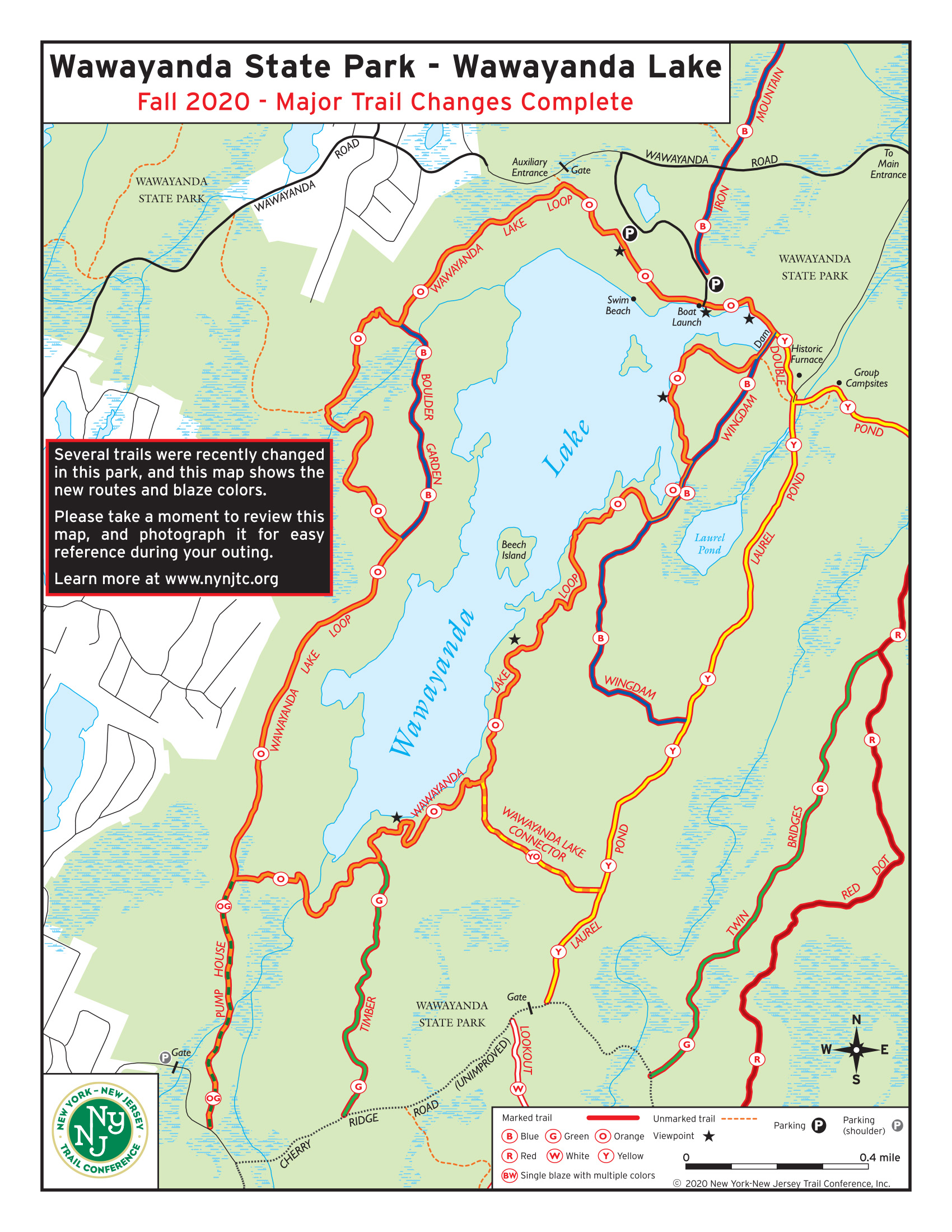
There are many unmarked trails in the area that do not appear on most maps, including the official Wawayanda State Park maps. Make sure you use the NY-NJ Trail Conference maps for this hike.
Wawayanda Swamp Natural Area: This 2,167 acre natural area features an Atlantic white cedar swamp, mixed oak-hardwood forest and a glacially formed spring-fed lake and is habitat for the red-shouldered hawk, barred owl and great blue heron.
Hike length: 8.9 miles
Elevation gain: 530 feet
Location: Wawayanda State Park, Vernon, NJ
Parking: Park at the Wawayanda Lake Boat Launch parking area (Google Maps)
Maps
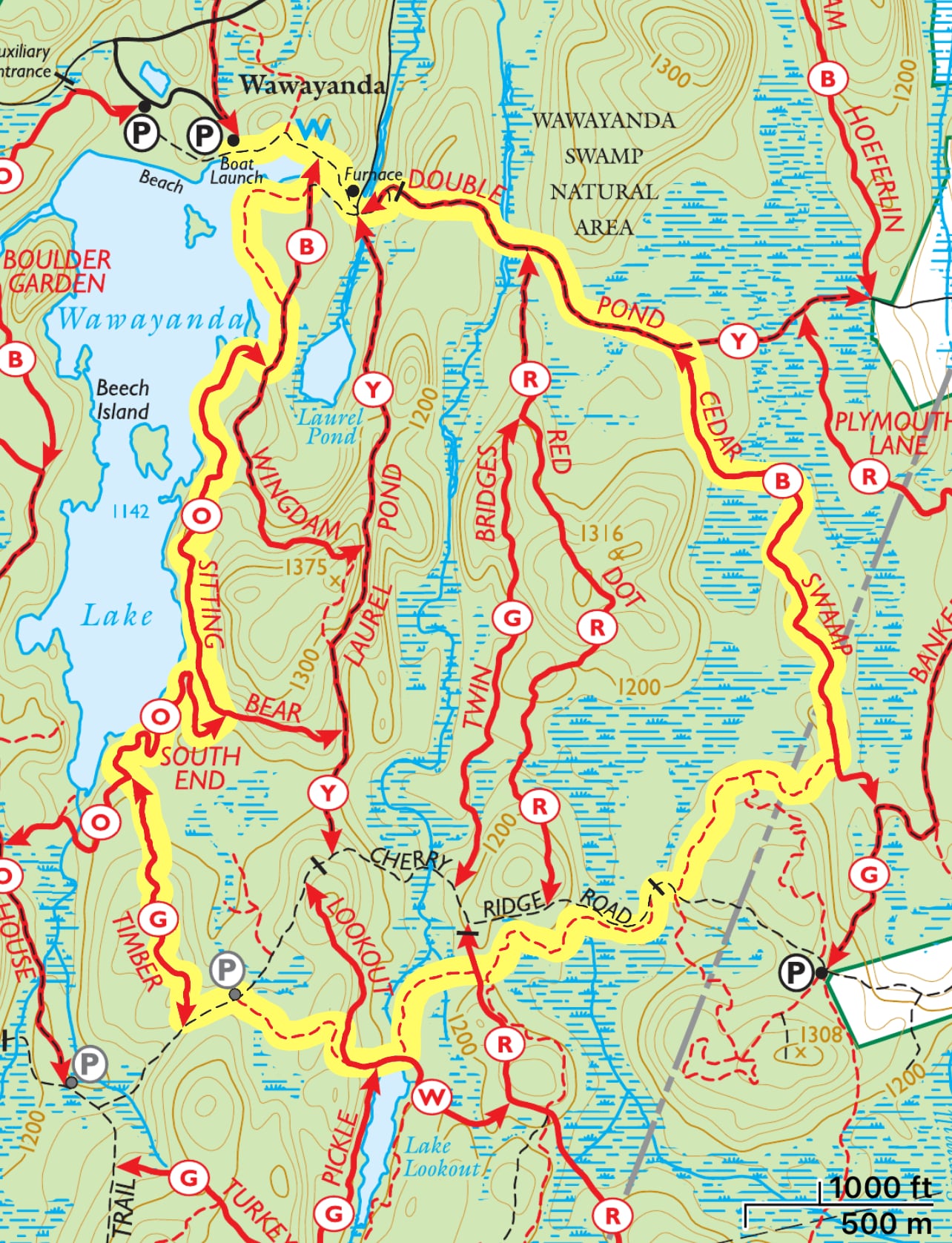
NOTE: This loop incorporates several unmarked mountain bike trails. The paid NY-NJ Trail Conference North Jersey print and Avenza maps are the most complete maps of the area and the ones we recommend (shown above). The free maps listed below are pretty good, but not as complete as the paid maps and do not show at least one of the unmarked trails used in this loop. The official Wawayanda State Park map does not show many of the unmarked trails in the park and we do not recommend using that map for this particular hike.
Paid
- NY-NJ Trail Conference Jersey North Jersey Trails Combined map (Avenza) – most recommended
- NY-NJ Trail Conference North Jersey Trails maps #116 (print) – most recommended
Free
- NY-NJ Trail Conference Wawayanda State Park map (pdf) – acceptable but incomplete
- NY-NJ Trail Conference Wawayanda State Park & Abram S. Hewitt State Forest Maps (Avenza) – acceptable but incomplete
- NJ-NJ Trail Conference Wawayanda Lake Trail Changes, Fall 2020 – only shows trails near Wawayanda Lake
- Trailforks – Wawayanda State Park area
- Wawayanda State Park map – not recommended
Trail description
Beginning from the parking area and facing south towards the lake, turn left to follow the orange-blazed Wawayanda Lake Loop trail – an old mine road in this section – to the east. The trail passes a viewpoint of the lake on the right.
Next, you’ll reach a dam on your right at the northeast end of the lake. We will complete our loop from the right, but for now, continue straight to follow the yellow-blazed Double Pond Trail.
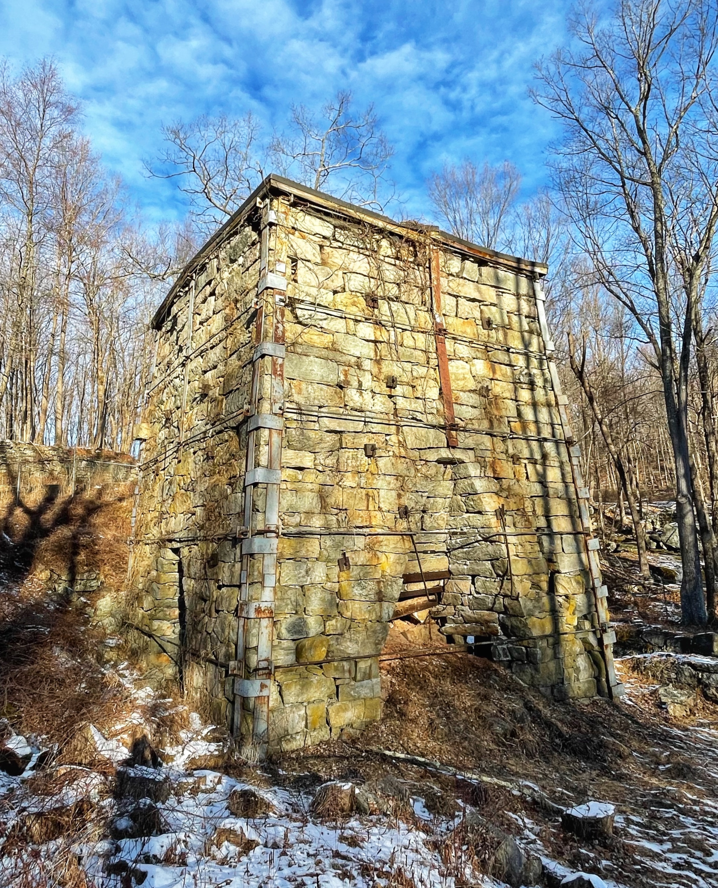
About 500 feet later, you’ll pass the remains of a furnace stack which was used to smelt iron ore from local mines between 1846 and 1857.
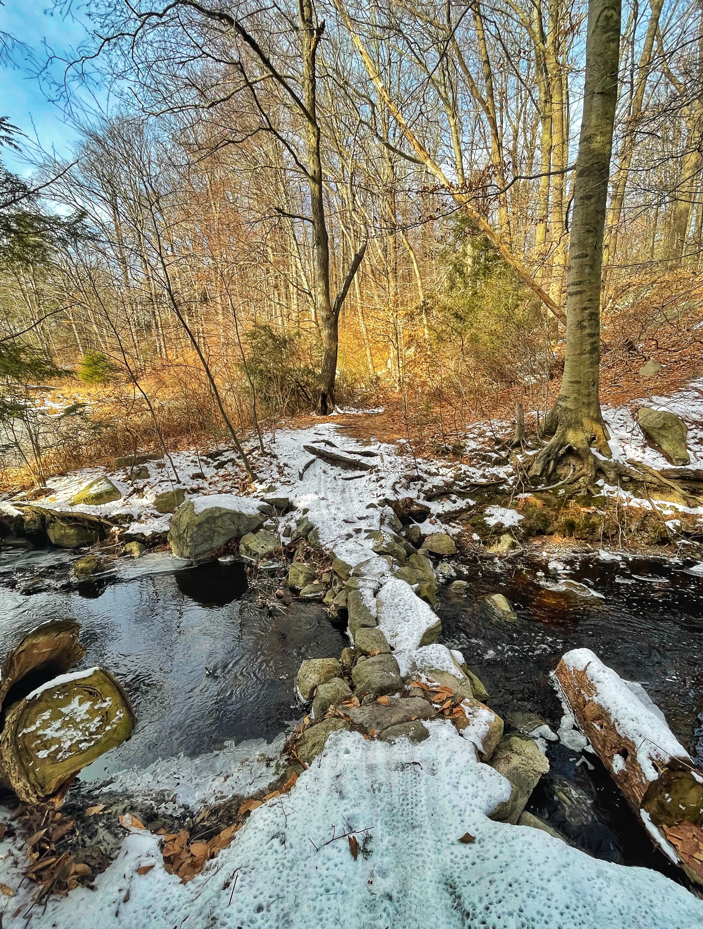
Just ahead, you’ll reach the junction with Laurel Pond Trail. Turn left, pass two composting toilets on your right, and cross a stream on a bridge as you continue to follow the Double Pond Trail.
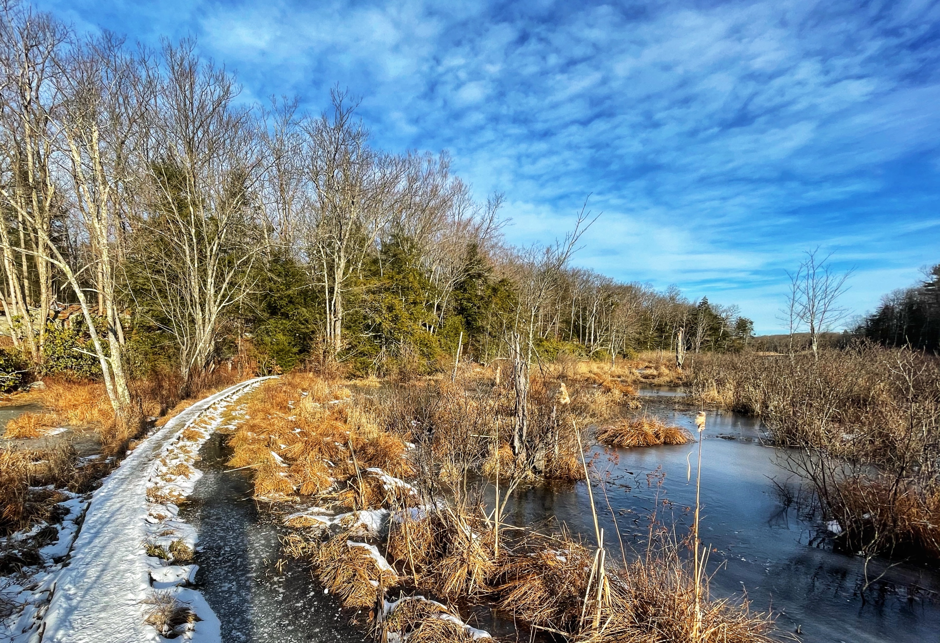
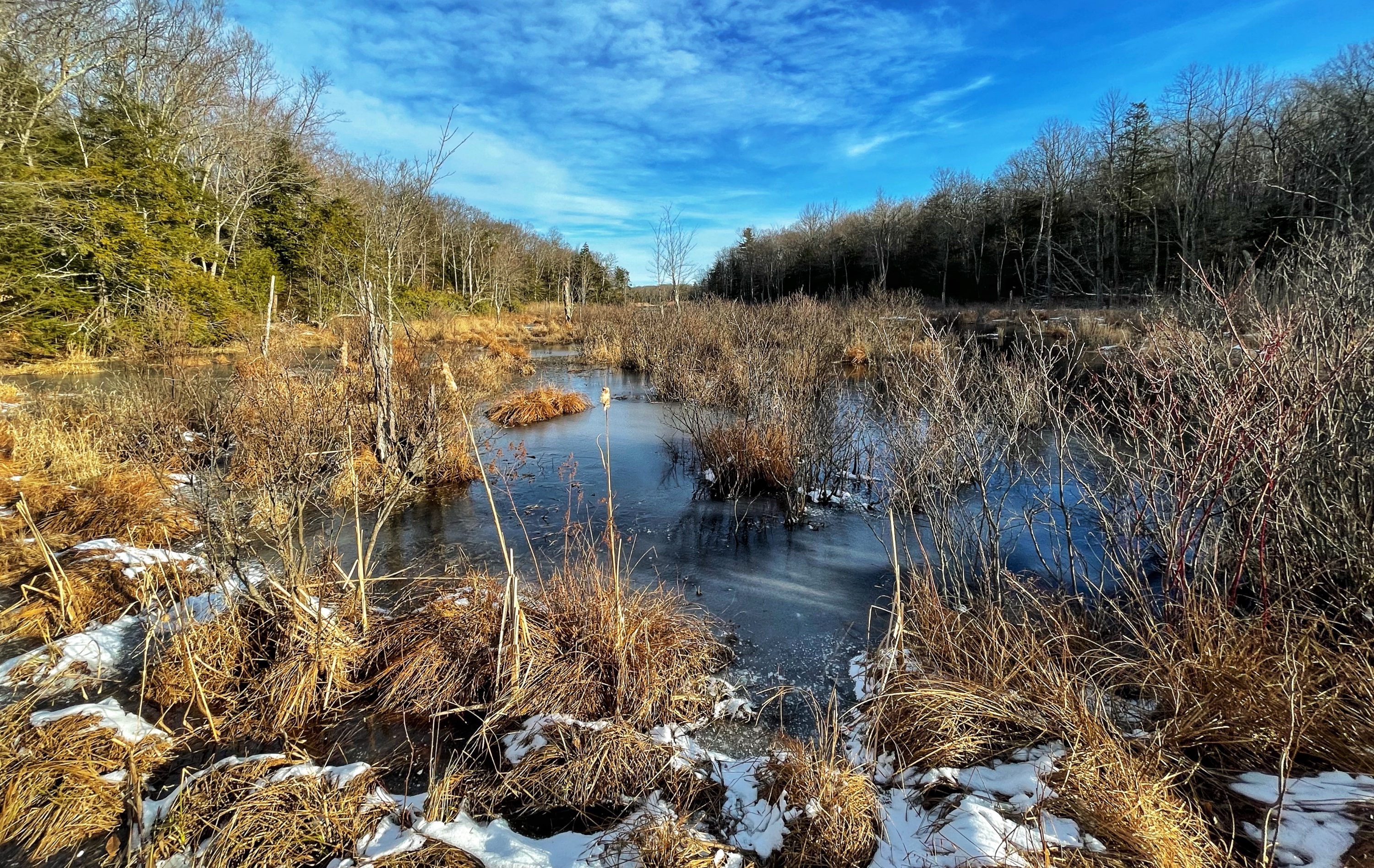
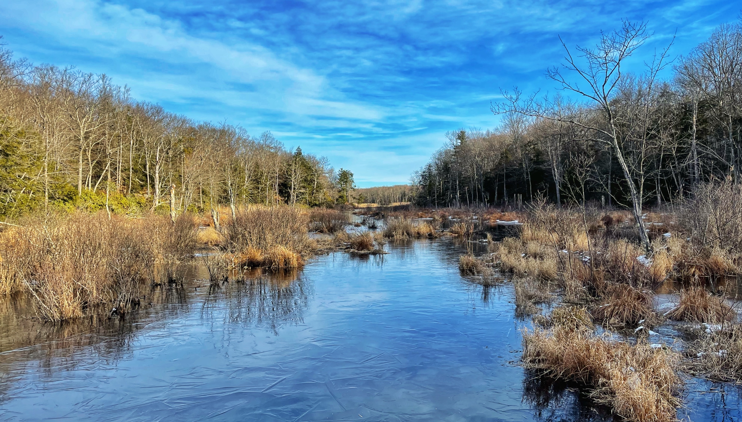
A short distance ahead is a section of boardwalk crossing a swampy area with views in both directions.
-
-
-
-
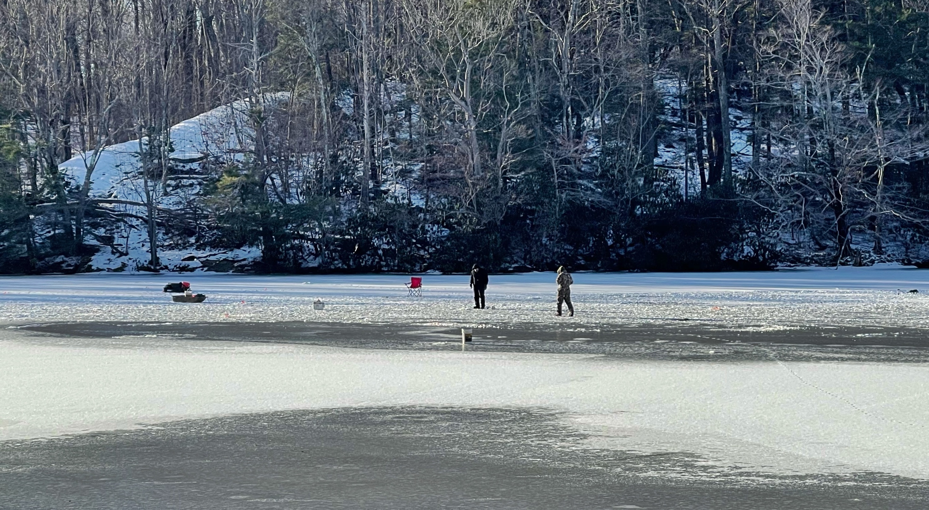
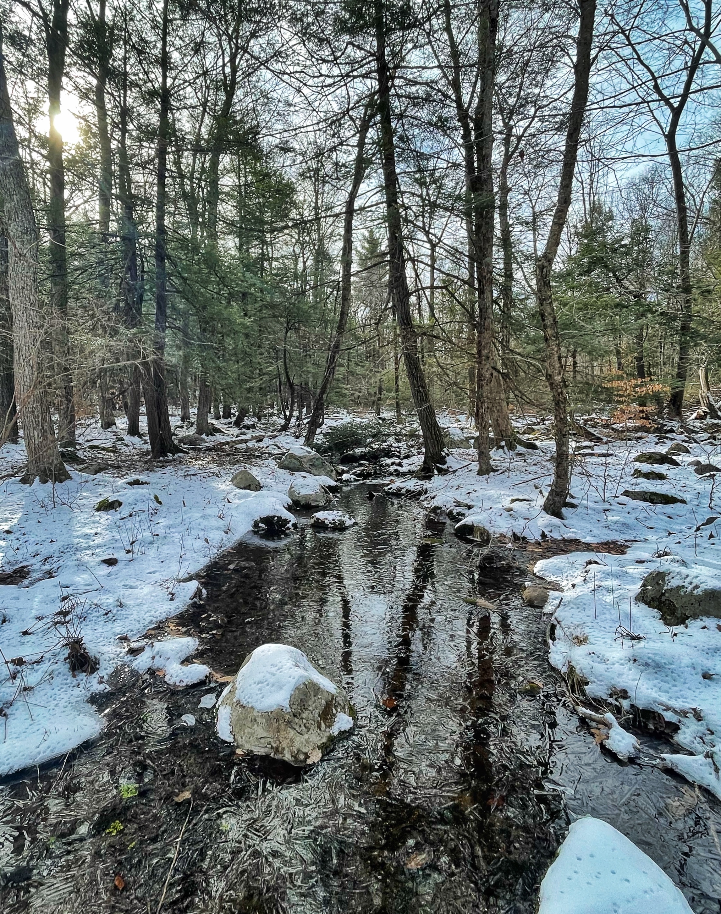
Wawayanda Swamp
Just after this section, continue straight as you pass a junction on your right with the Red Dot Trail.
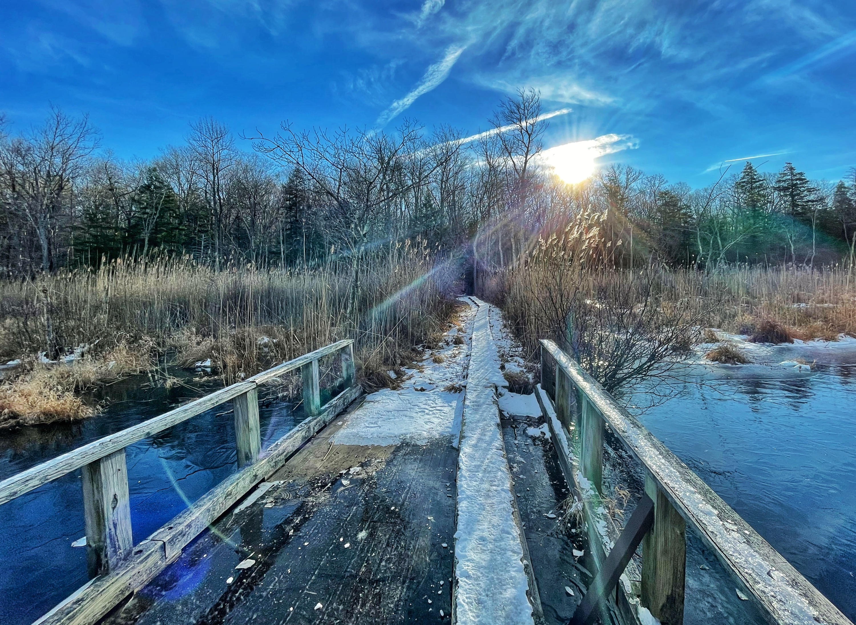
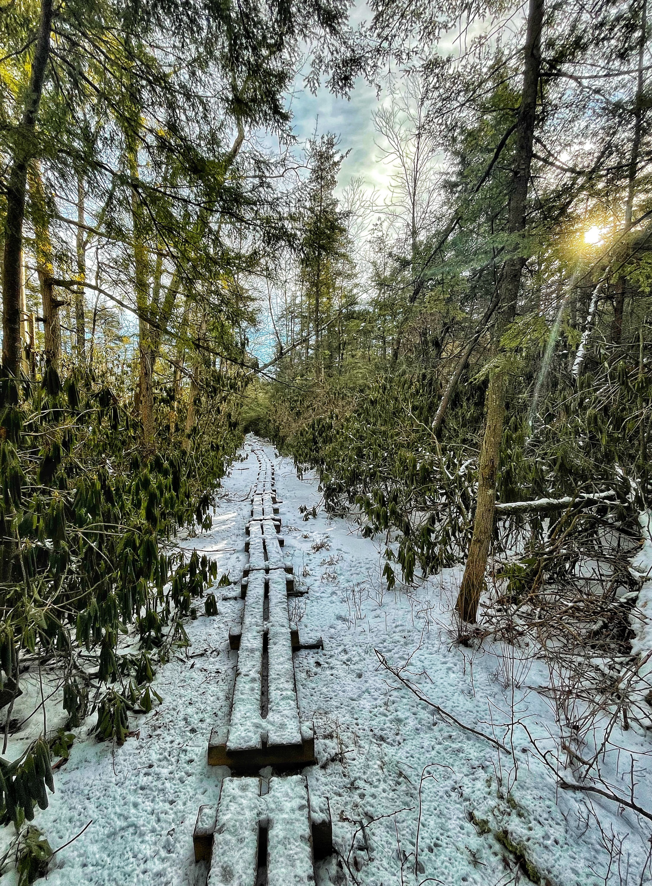
Another 2,000 feet further, the trail forks at a junction with the blue-blazed Cedar Swamp Trail. The highlight of this beautiful trail is a section of boardwalk lined with rhododendron thickets that passes through the middle of Wawayanda Swamp area, a unique Atlantic white cedar swamp.
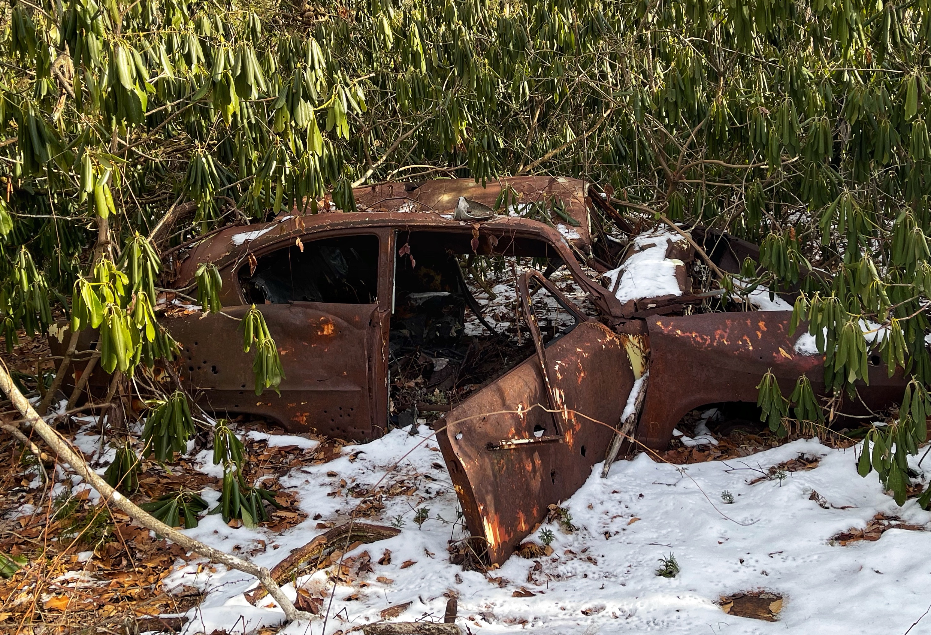
Not long after the boardwalk section ends, you’ll pass an old rusty car on your left. Of course.
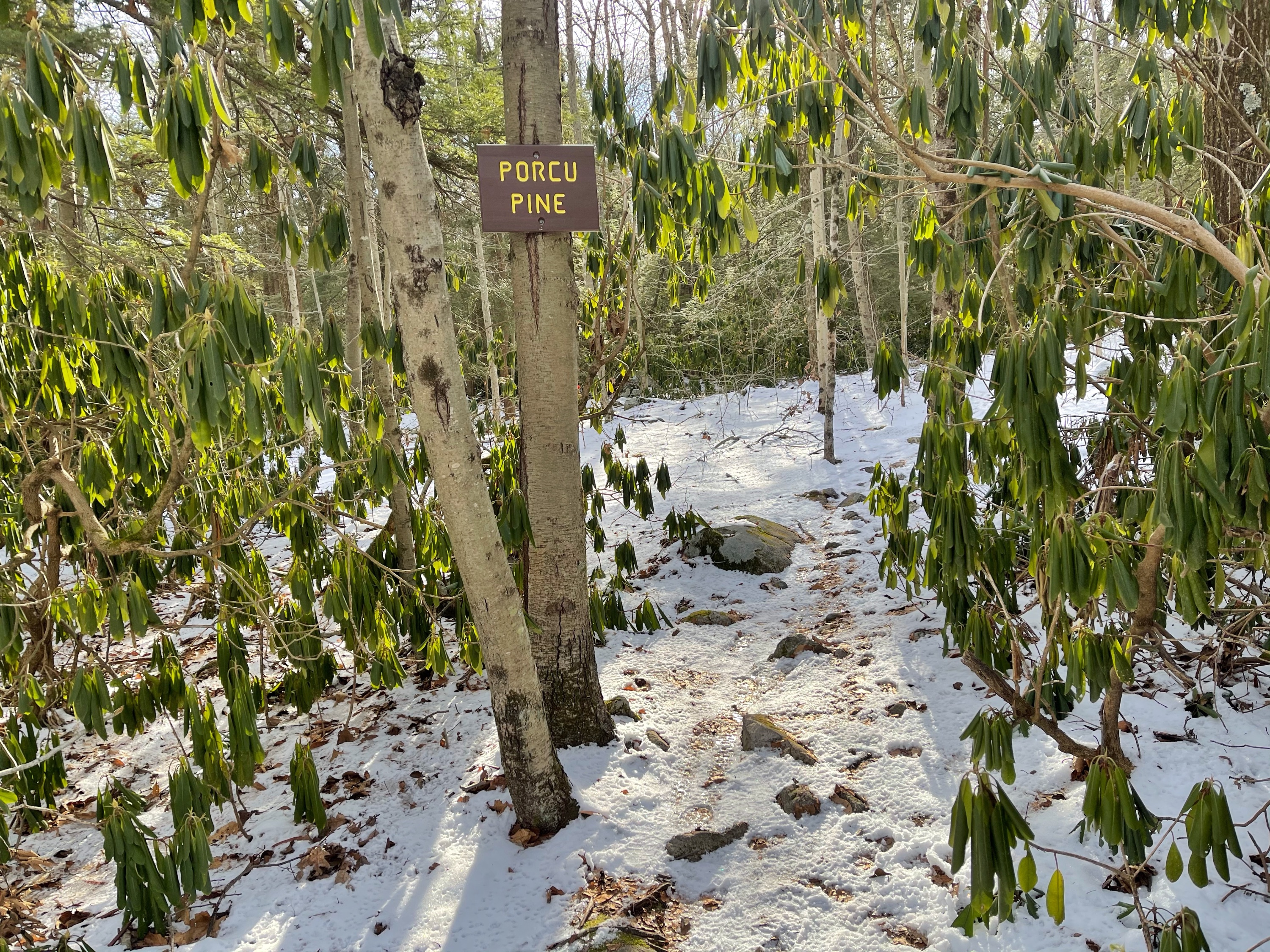
About 1,000 feet before the Cedar Swamp Trail ends, look for an unmarked mountain bike trail known as Rockadendron that heads into the woods to the right. A bit further, you’ll pass the junction for Porcupine, another mountain biking trail, before reaching Cherry Ridge Road, a gravel road.
Make a right onto Cherry Ridge Road and soon reach a gate.
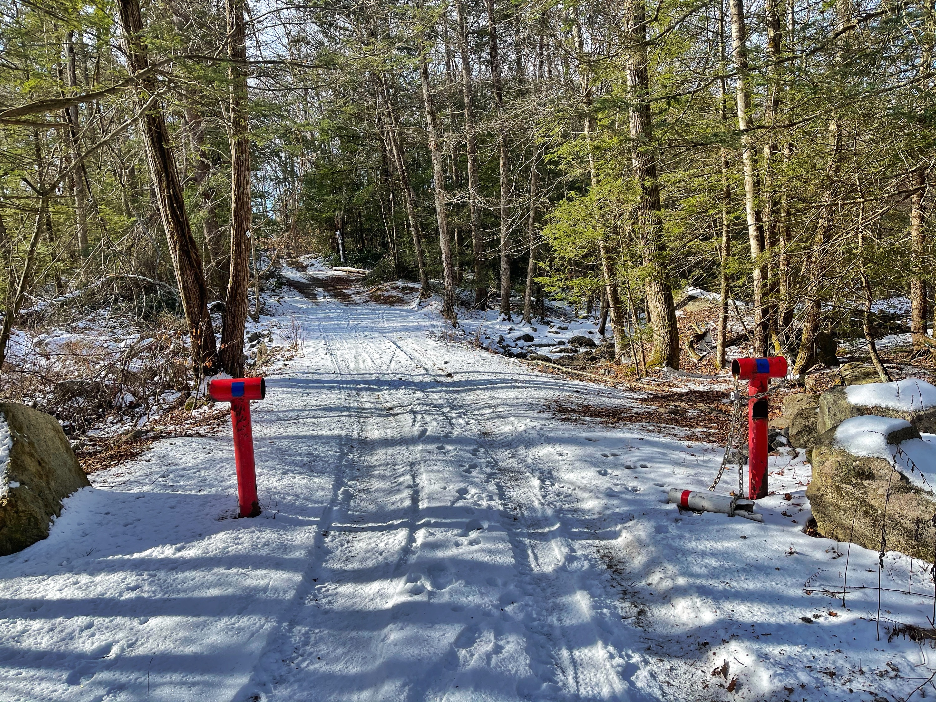
Immediately beyond the gate, look on your left for an unmarked single track trail (known to mountain bikers as the Mojo Swamp Trail) that heads into the woods. Follow this trail, which closely parallels Cherry Ridge Road for a while. The trail offers views of the swamp to your left.
The trail then crosses an outlet on rocks and soon reaches a clearing on the left with more views of the swamp.
The trail now drifts away from Cherry Road and oscillates. At one point as the trail heads northwest, it forks and appears to continue straight, but stay left to head southwest. As the trail approaches the red-blazed Old Coal Trail, either bushwhack or look for another unmarked mountain bike and cross-country skiing trail (Mojo Swamp/Pond Connector).
Follow this trail across Old Coal Trail and soon cross a creek on rocks.
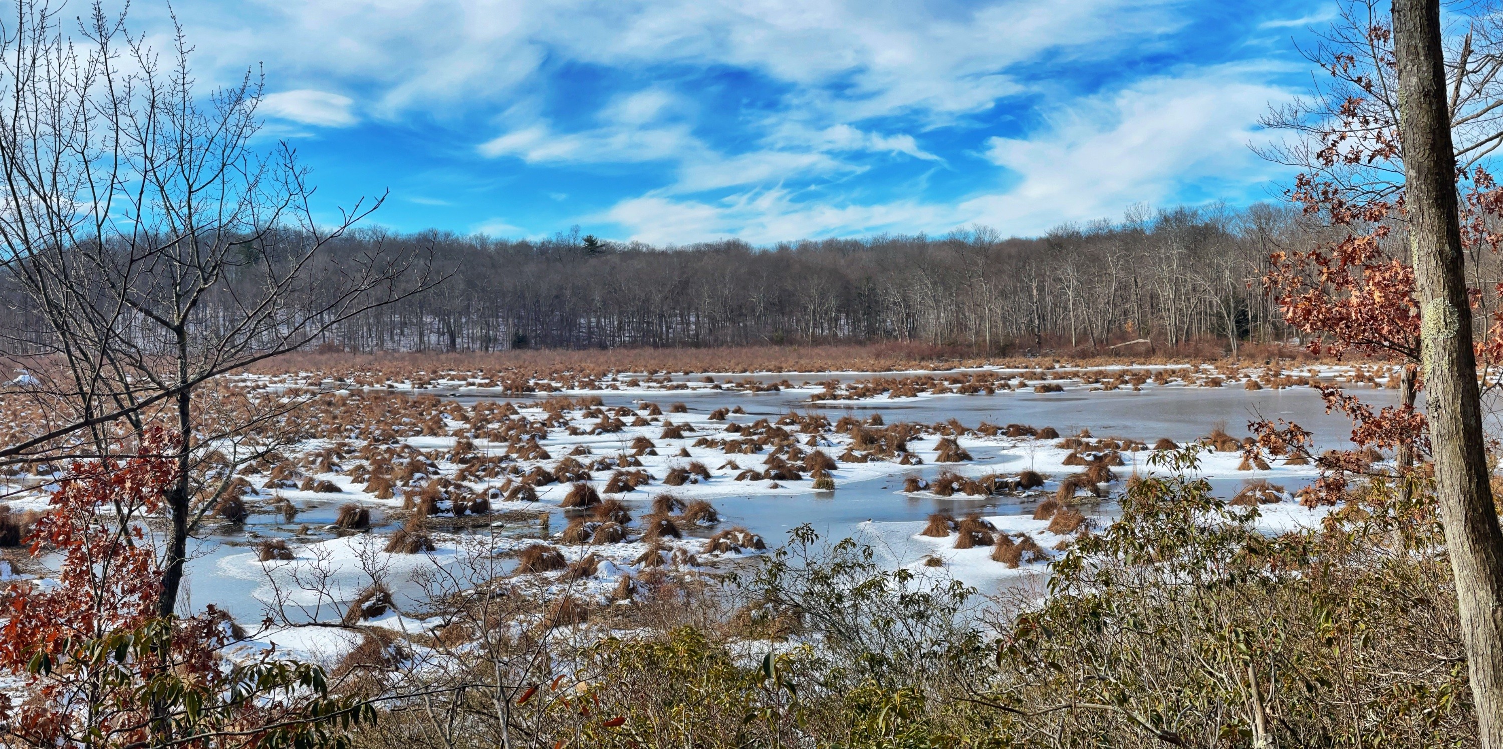
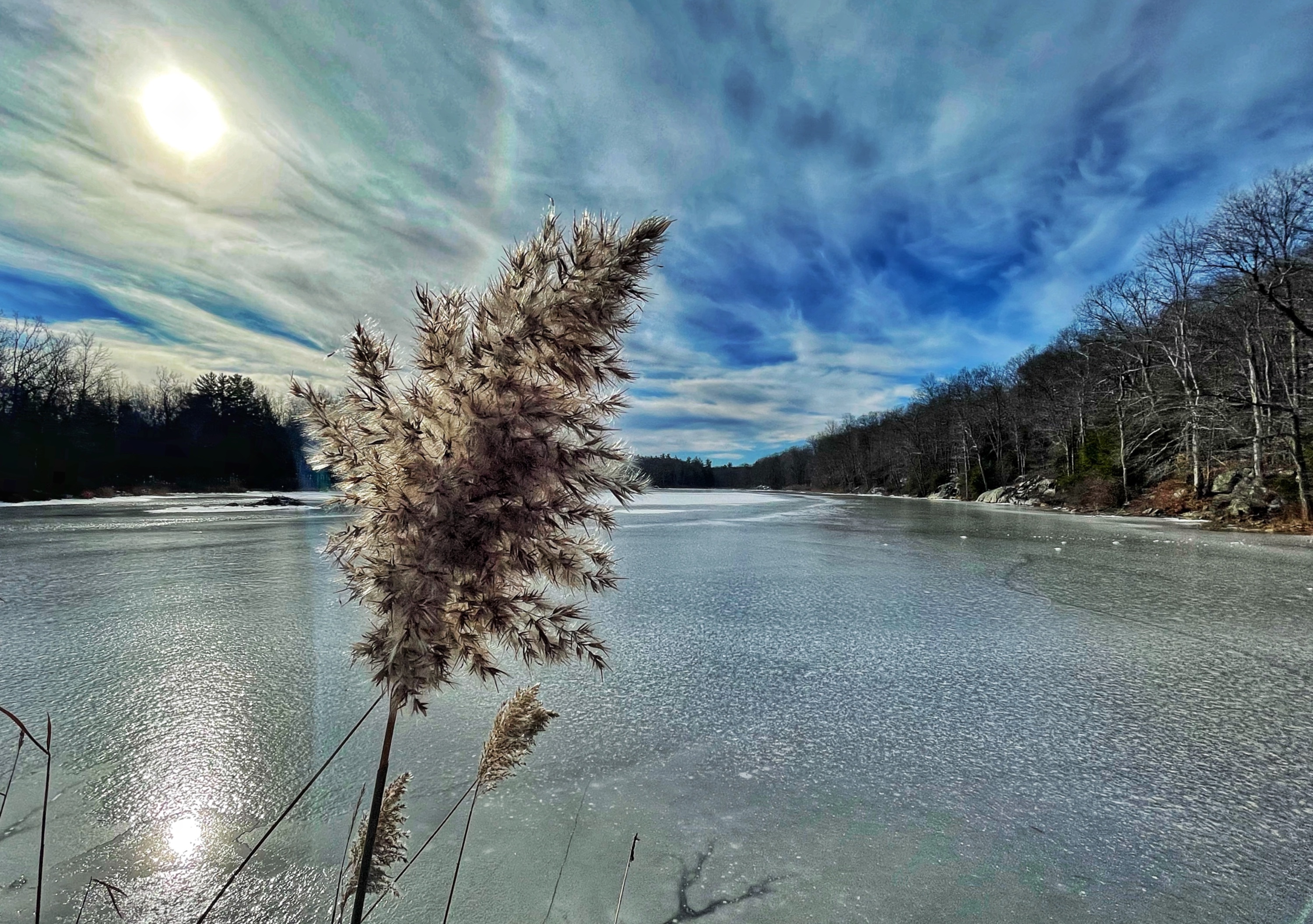
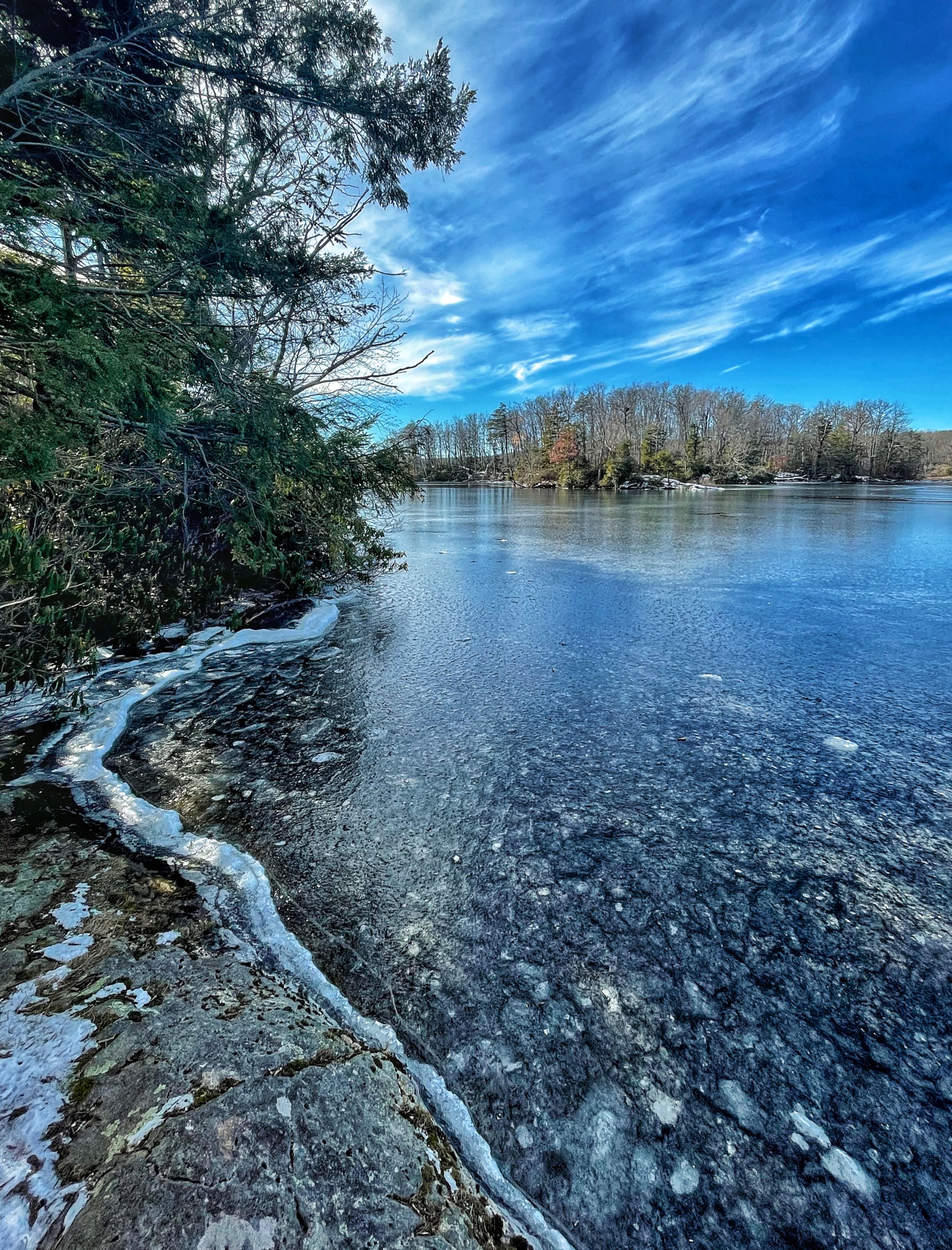
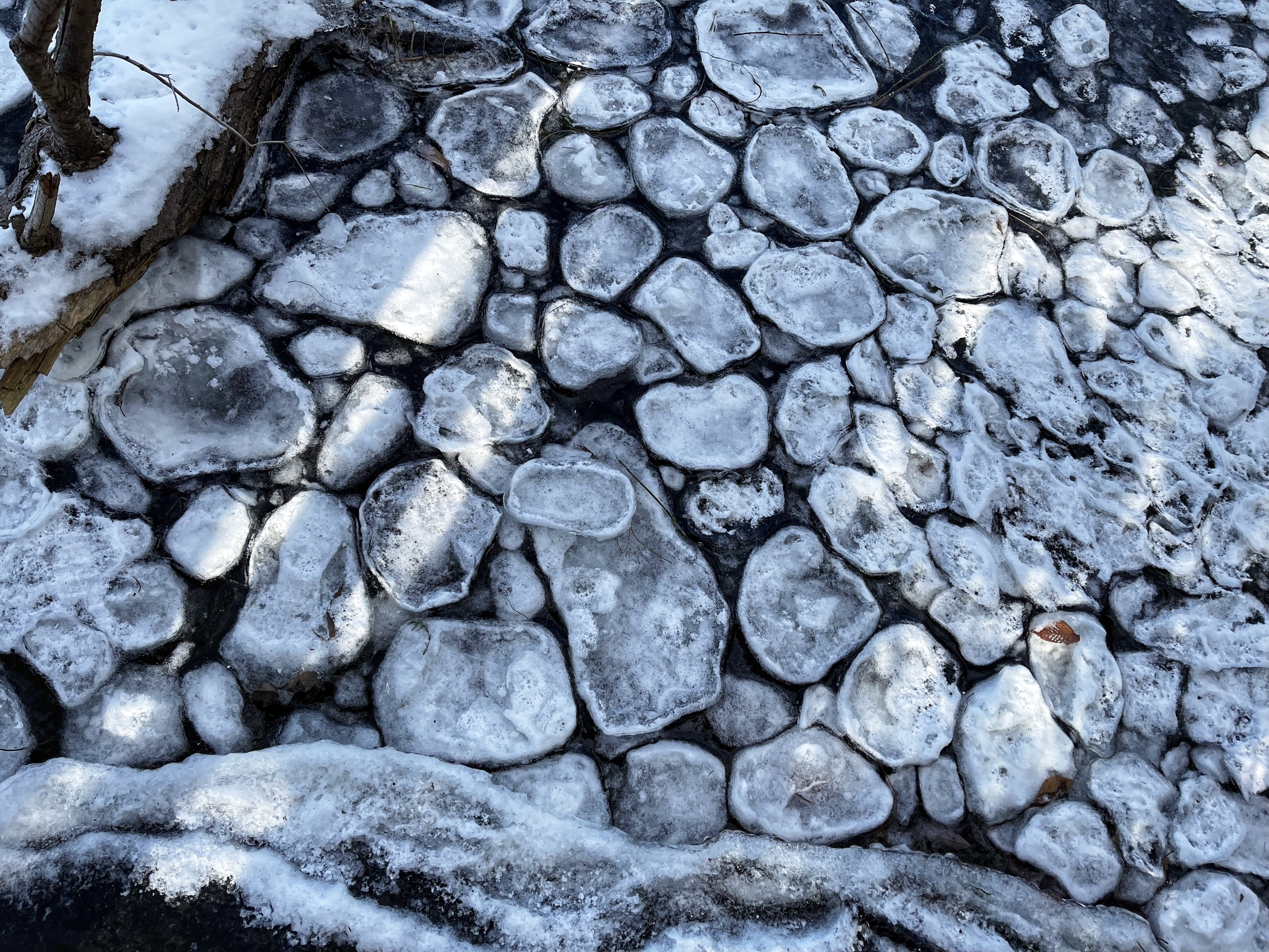
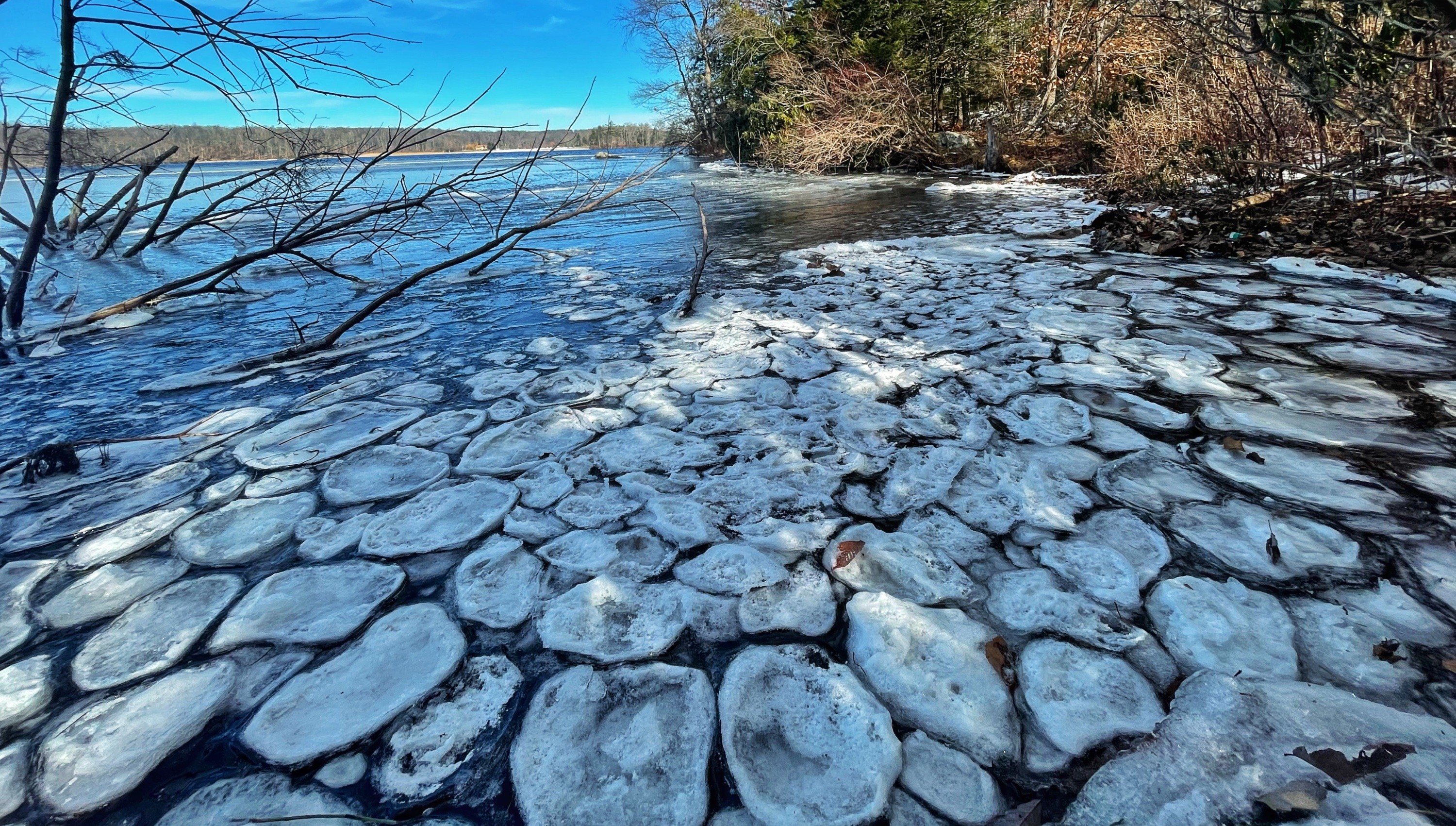
At the end of the trail, it reaches the white-blazed Lookout Trail. Make a right onto Lookout Trail and immediately reach the picturesque Lake Lookout, featuring a large beaver lodge near the north end. Follow the white blazes along the north edge of the park.
-
Lake Lookout -
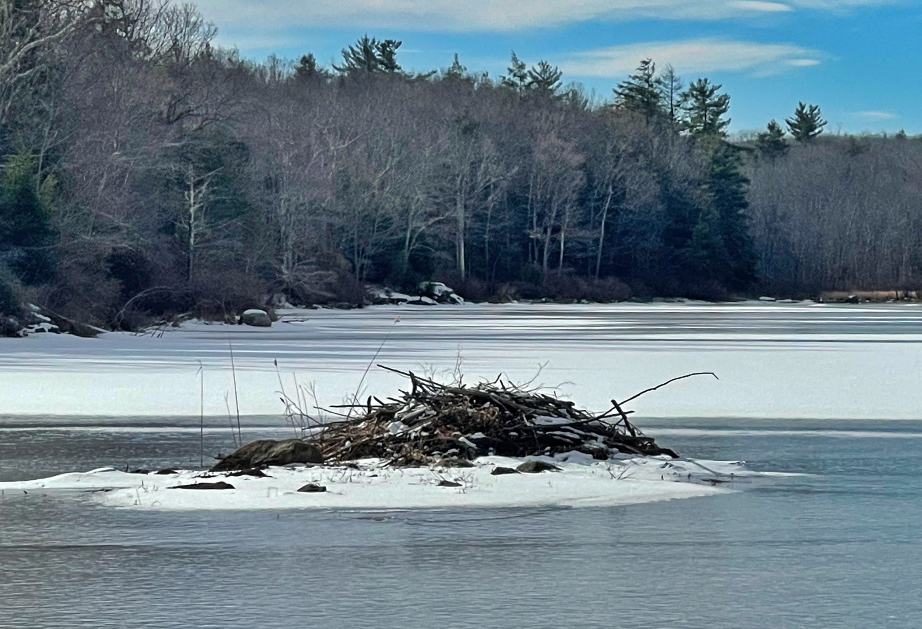
Beaver lodge
At the northwest end, the trail reaches a partial clearing that’s a great spot to stop for a break and snack.
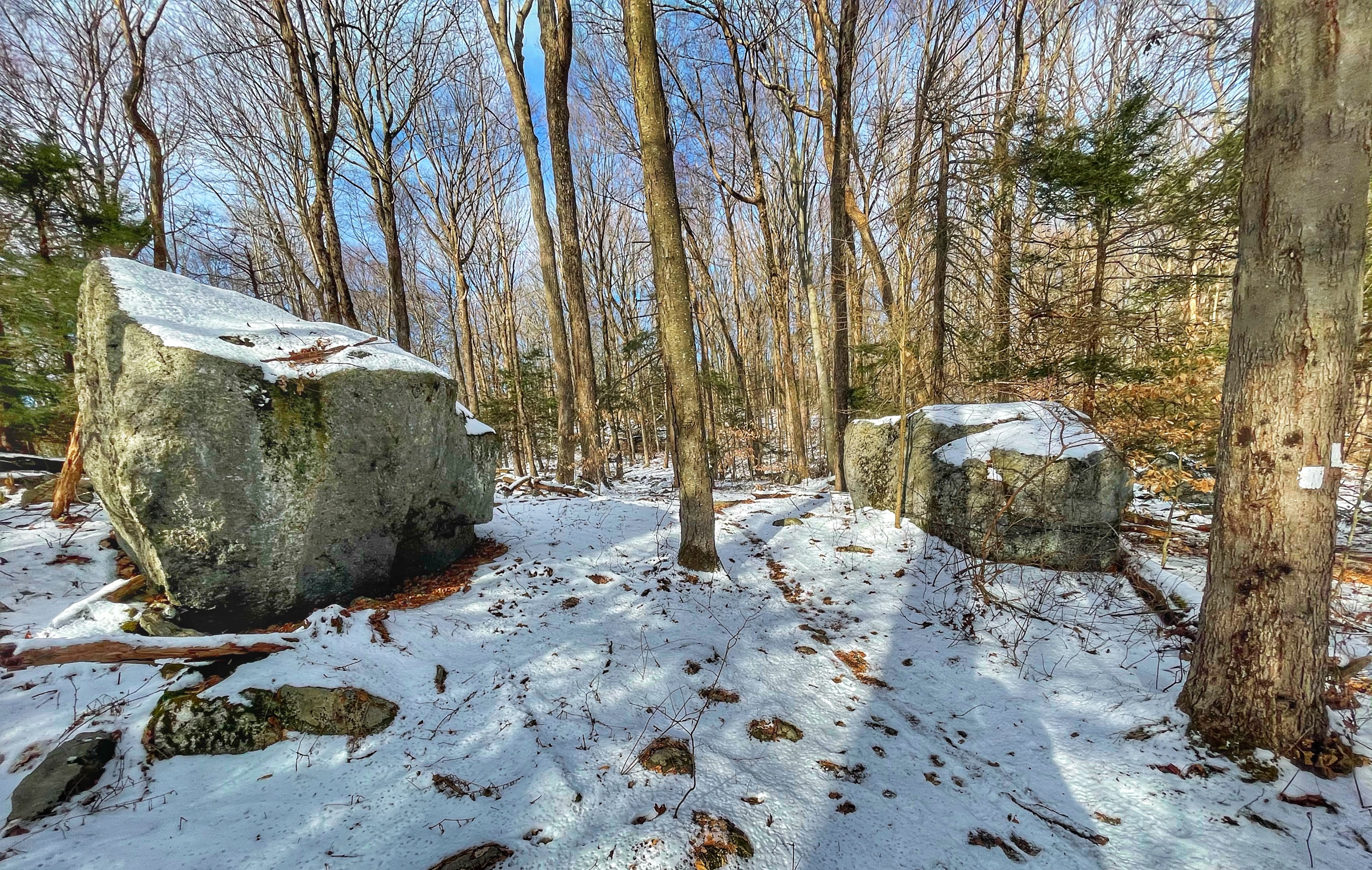
Continue to follow the white blazes away from the lake and uphill. When you reach two large glacial erratics (boulders), the Lookout Trail forks to the right, but we will stay left here and continue between the boulders to follow the unmarked White Trail (not to be confused with the white-blazed Lookout Trail).
A short distance later, the trail again reaches Cherry Ridge Road. Turn left onto the gravel road and soon look on your right for the start of the green-blazed Timber Trail. Follow the green blazes until you reach a junction with the orange-blazed Wawayanda Lake Loop trail (recently blazed as a loop in the Fall 2020).
Turn right onto the loop trail. We will continue to follow the orange blazes as the trail skirts the east side of the lake. There are several nice views of the lake along the trail.
The trail joins the blue-blazed Wingdam Trail, then splits to the left towards the lake before rejoining and crossing the dam. After crossing the dam, turn left to follow the orange blazes a short distance back to the parking area.


