Overview
A 4 mile hike through forest and swampy areas that features Tripod Rock, a 180-ton boulder that appears almost impossibly balanced on three smaller boulders, and several other interesting large glacial erratics.
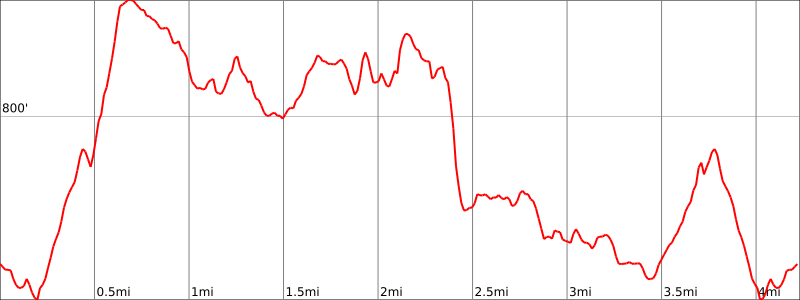
Hike Length: 4.2 miles
Elevation gain: +910 feet
Location: Pyramid Mountain National Historical Area, Montville, Morris County, NJ
Parking
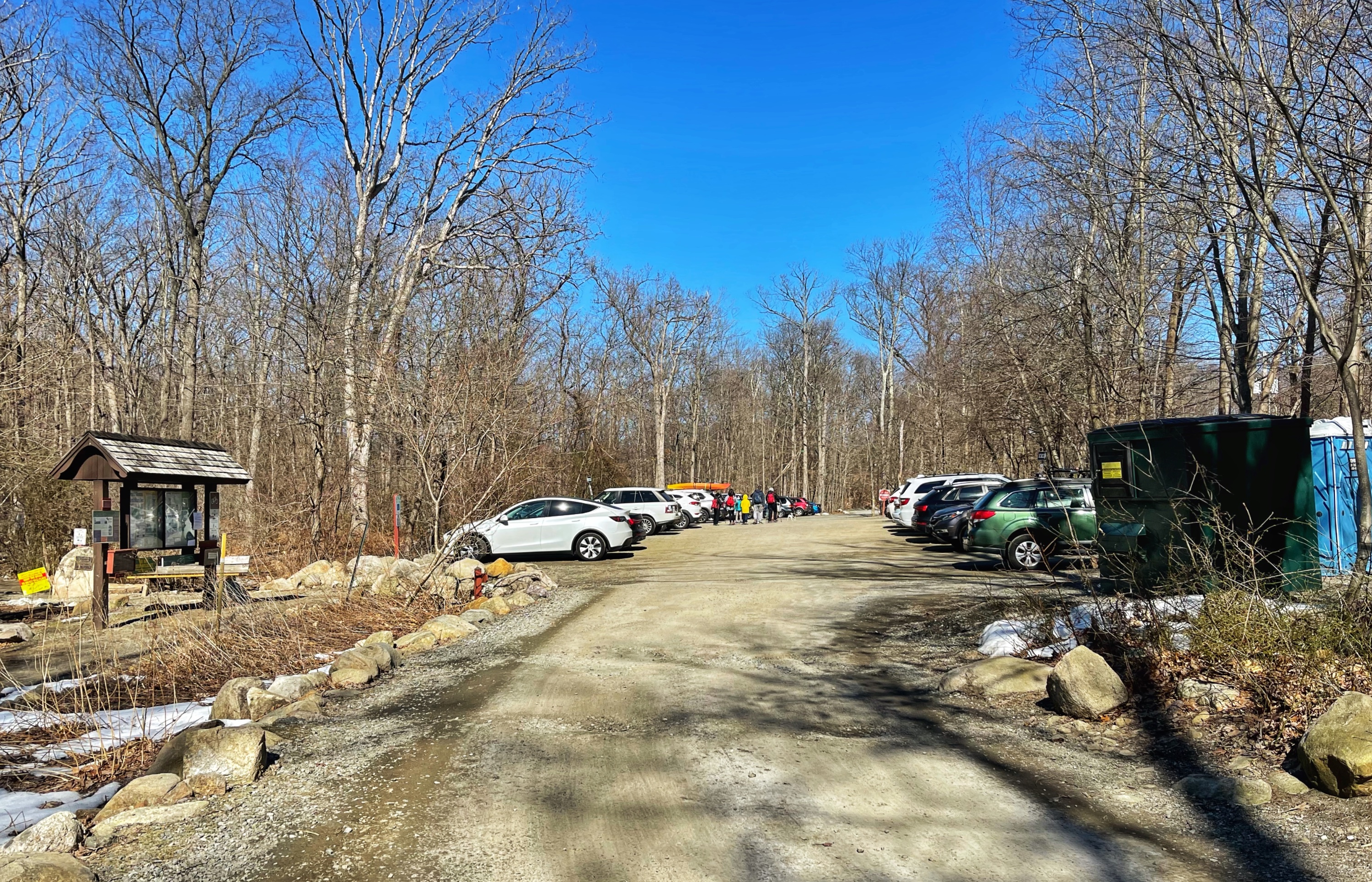
Park in the parking lot for Pyramid Mountain National Historical Area. Address: 472 Boonton Ave, Montville, NJ. If the lot is full, park on the shoulder of Boonton Avenue.
Maps
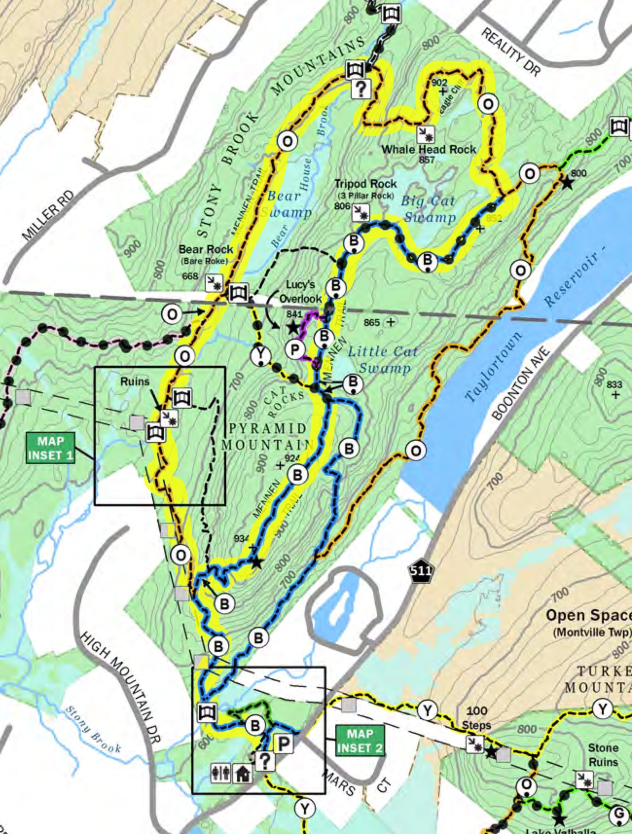
- Pyramid Mountain Natural Historical Area (map with colors) – Morris County Park Commission (pdf)
- Jersey Highlands Trails combined (Avenza)
- Jersey Highlands Trails Map #125 – NY-NJ Trail Conference (print)
Trail description
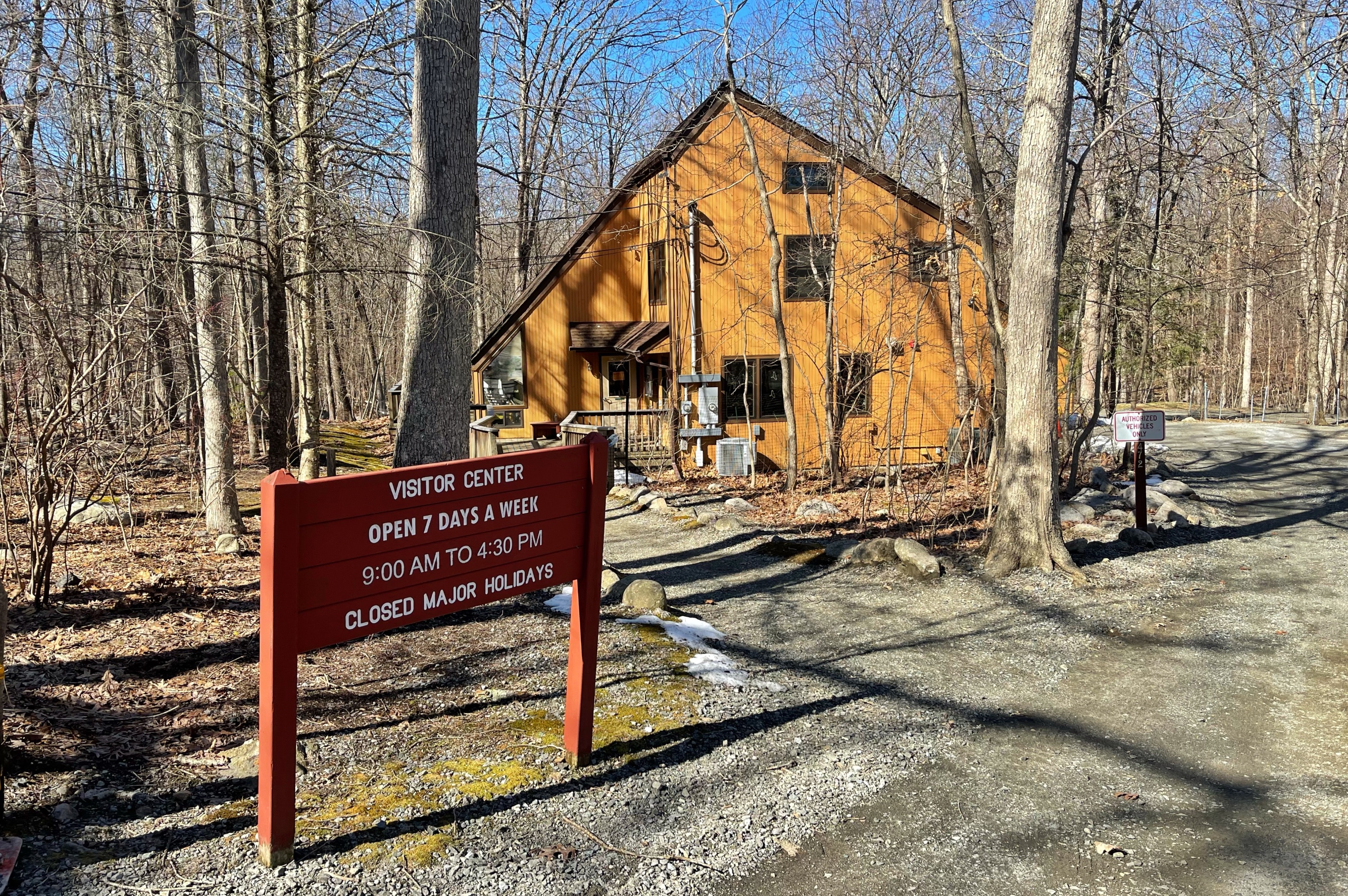
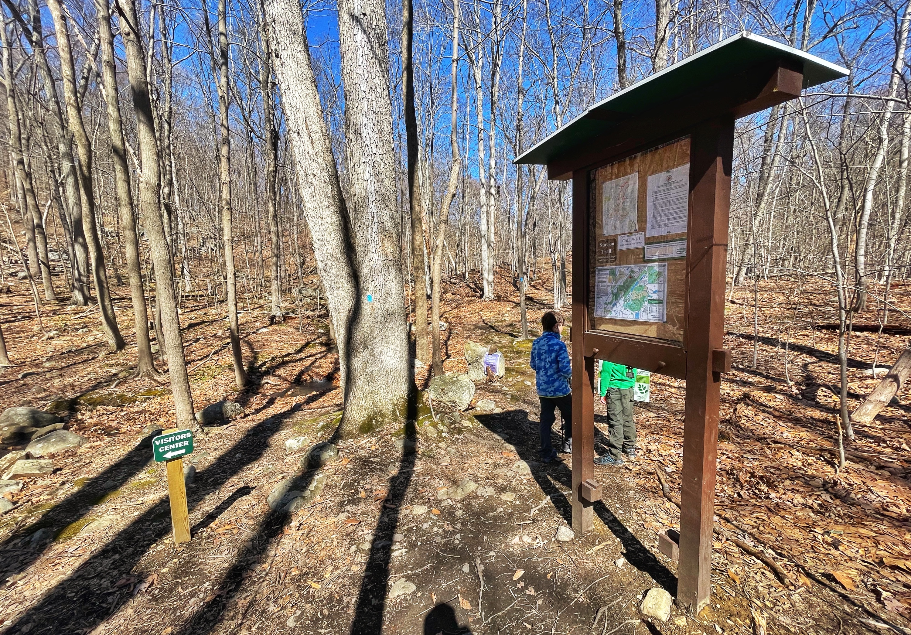
At the far end of the parking lot is the Visitor Center, which has some nice exhibits on wildlife and the history of the area.
From the parking lot, find the trailhead for the blue-blazed Mennen trail next to the kiosk. The trail begins with a level section lined with stones.
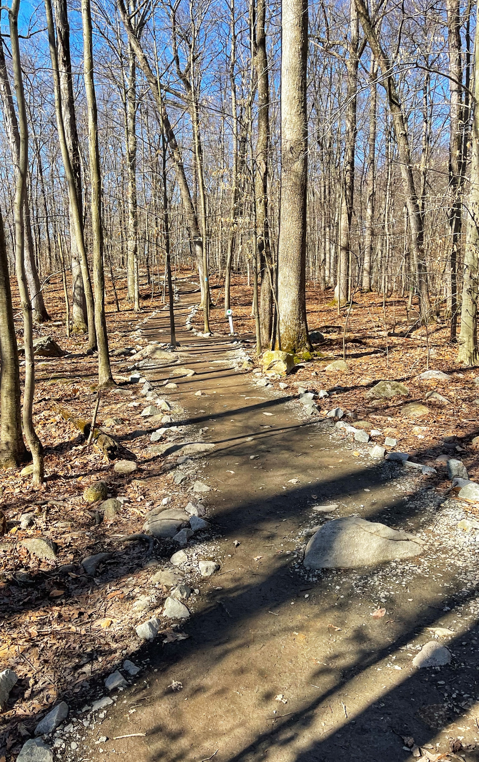
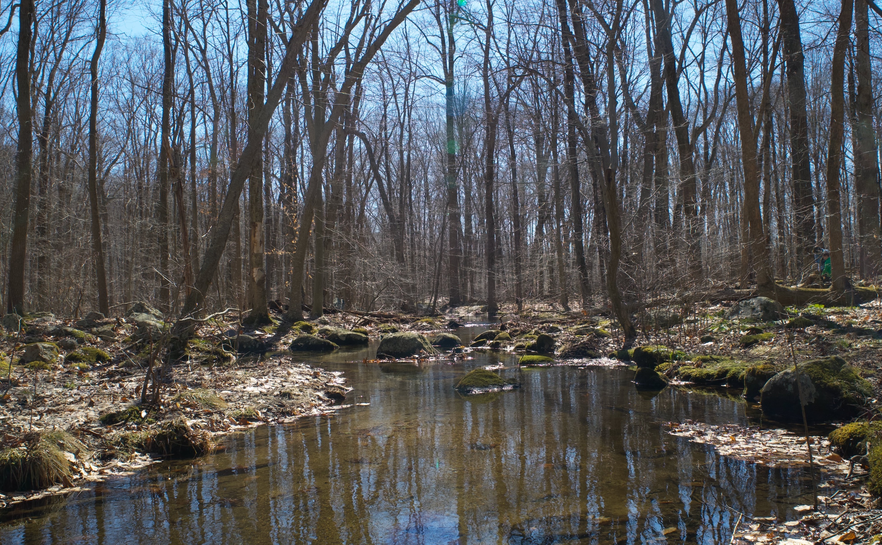
Follow the blue trail across a footbridge over Stony Brook.

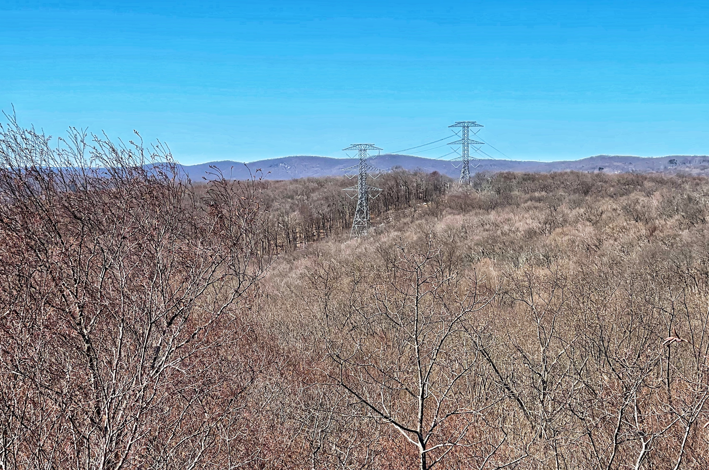
Shortly after the bridge, the trail forks – with blue blazes in both directions. You can go either way, but we will go left. The trail climbs steeply up Pyramid Mountain, crossing under power lines along the way. You’ll reach a junction with the orange trail – turn right to climb even more steeply uphill. Once the trail levels off, you’ll see signs for a viewpoint.

The Manhattan skyline can be seen in the distance.
Return to the trail, which gently descends and reconnects with the other fork of the blue trail. Now, the trail turns into the blue dot trail. A short distance later you’ll see a sign for Lucy’s Outlook, named for conservationist Lucy Meyer, the leader of the Committee to Save Pyramid Mountain and a successful preservation effort. Follow the purple blazes to the overlook, which includes power lines cutting through the Stony Brook Mountains.
Continue to follow the purple blazes back to the blue trail. At the junction is a sign pointing to Tripod Rock.
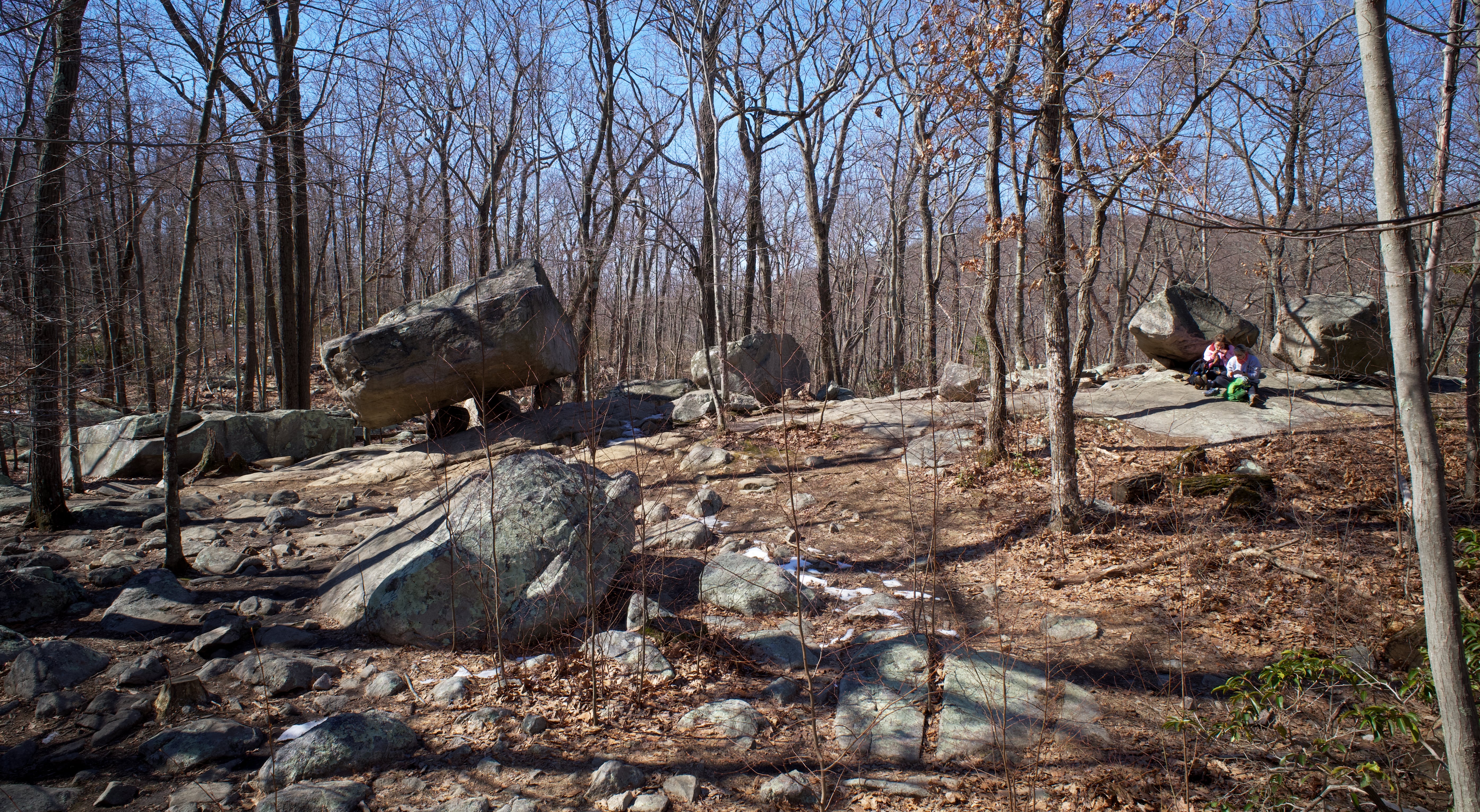
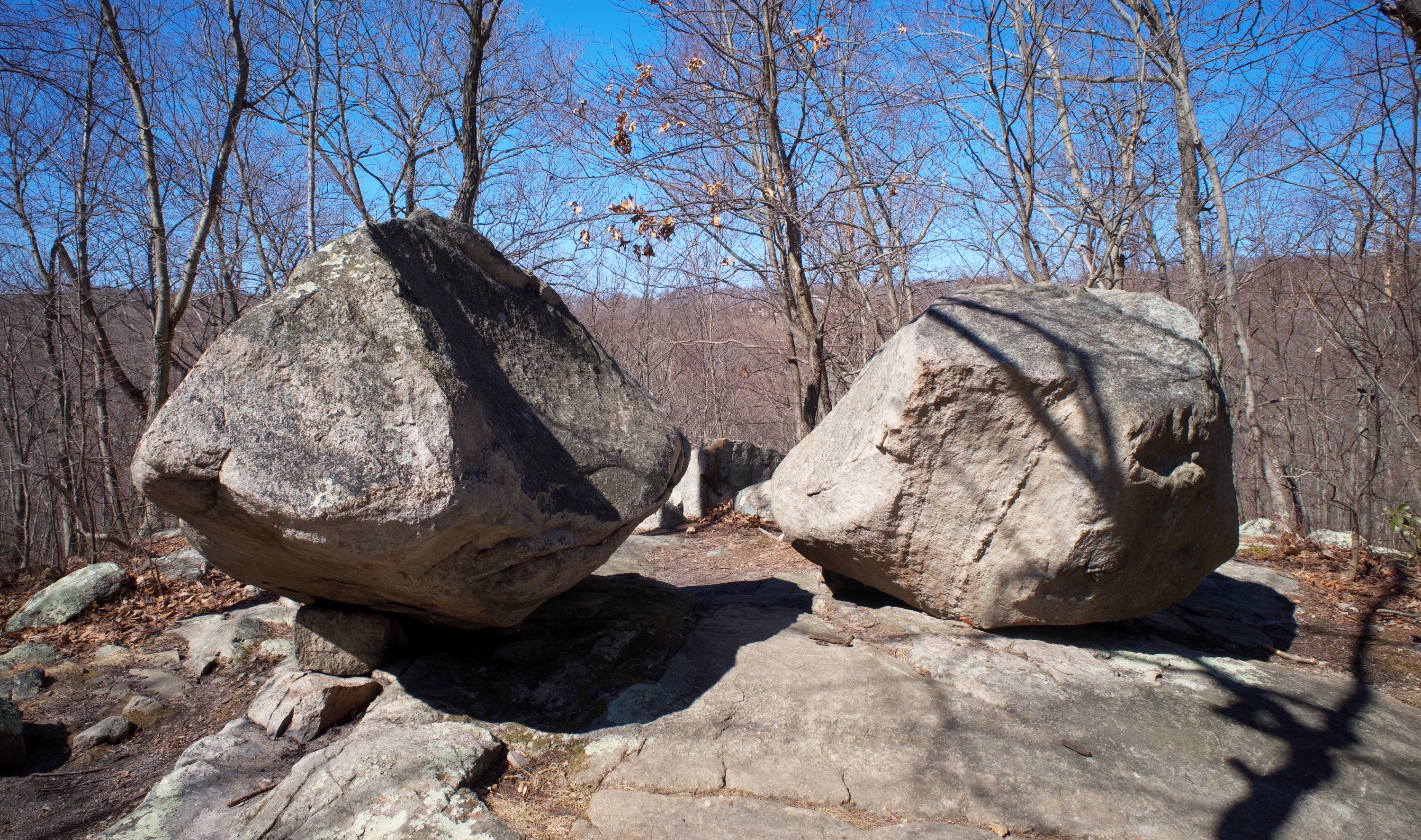
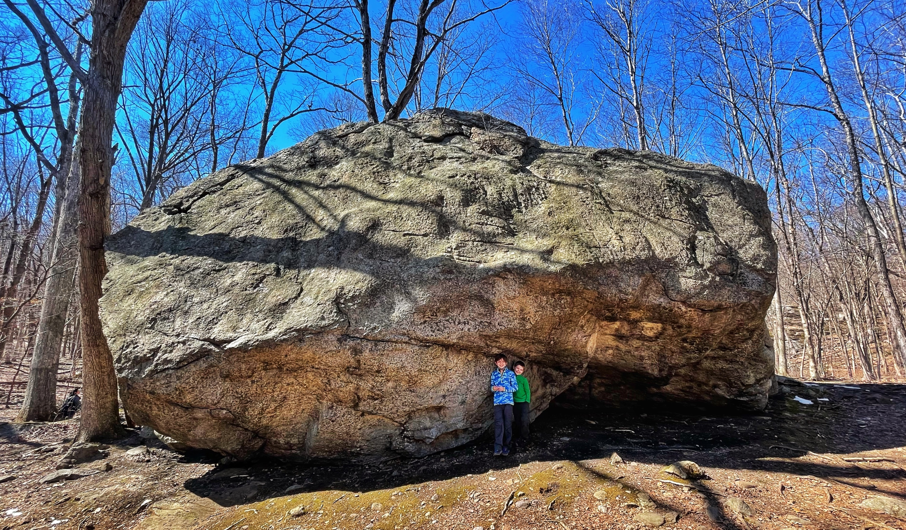
Turn left and continue to follow the blue blazes. After crossing a wet area, you’ll reach the famous glacial erratic called Tripod Rock – a 180-ton boulder that appears to be impossibly balanced on three smaller stones.
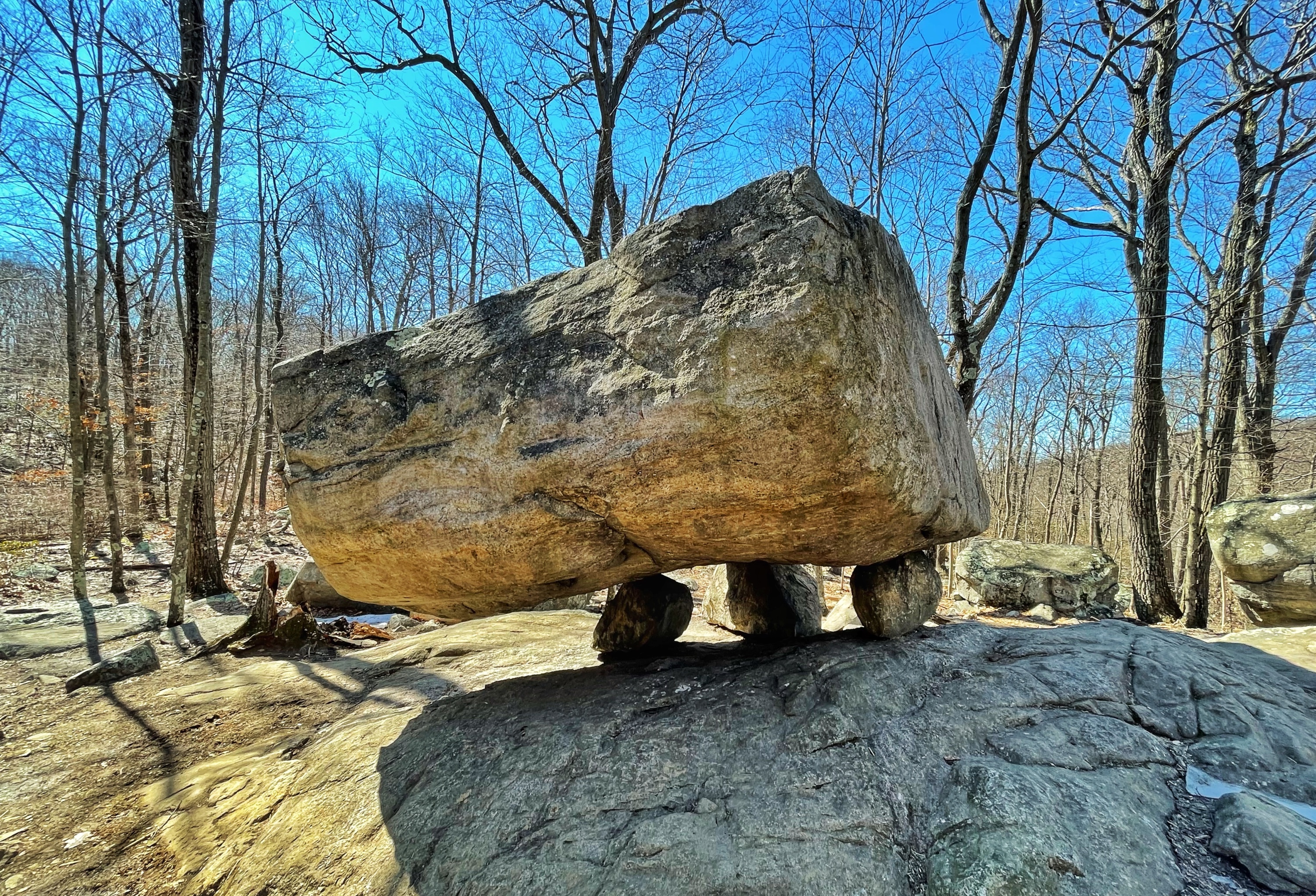
The boulder was deposited by the Wisconsin Glacier over 18,000 years ago. This is a great place to take a break and/or pose for some fun pictures.

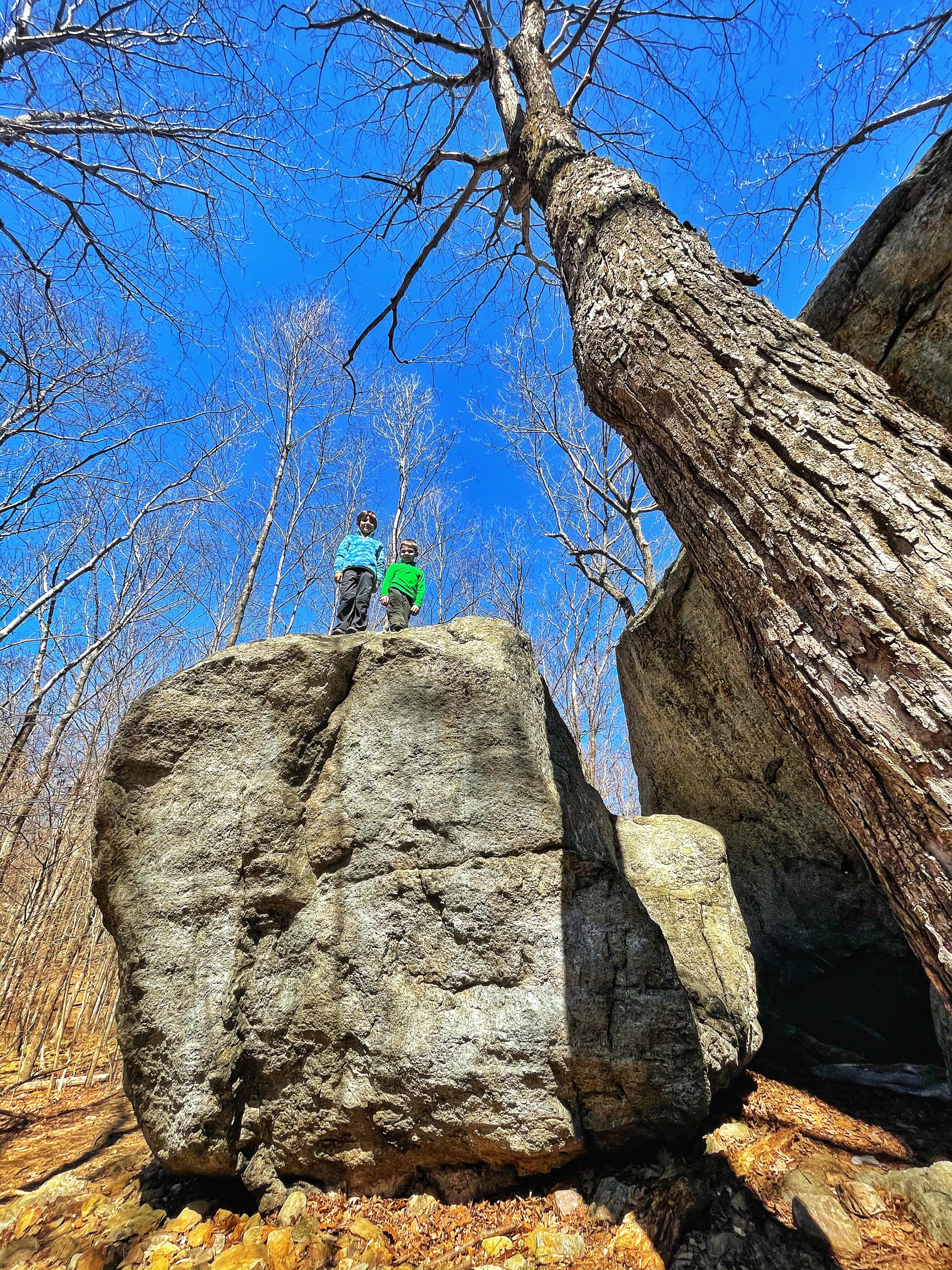
Also near Tripod Rock are another set of boulders – the “Solstice Stones” – which may have been used as a ceremonial site by Native Americans.

Drawing by Bruce Scofield, CC BY-SA 3.0, via Wikimedia Commons
About 12 m (39 ft) northwest of Tripod Rock are three boulders that appear to form a triangle. The two larger boulders are balanced partially on smaller stones (see diagram). The apex rock is about 3 m (9.8 ft) away to the northeast. Sighting from a bedrock outcrop near Tripod Rock through the two large boulders, the apex of the triangular configuration points to the next ridge on the horizon to the west. This line of sight is toward the setting point of the sun on the summer solstice. During the early 1980s, Tripod Rock and the stones near it were surveyed. The place on the ridge where the sun sets on the summer solstice was visible due to gypsy moth defoliation.[1] A large boulder was visible on the ridge at the place of the summer solstice sunset. Within a year of the survey, a home was constructed on that site and the boulder was displaced by earth-moving machinery. The summer solstice sunset is presently observable near the edge of that residence, and is only partially visible.
Tripod Rock, Wikipedia
Continue to follow the blue dot blazes as it skirts the edge of Big Cat Swamp. You will eventually reach a junction with the orange trail. Turn left at the junction and follow the orange blazes as they descend and then climb to Eagle Cliff. There are no views here, but there is a large glacial erratic.
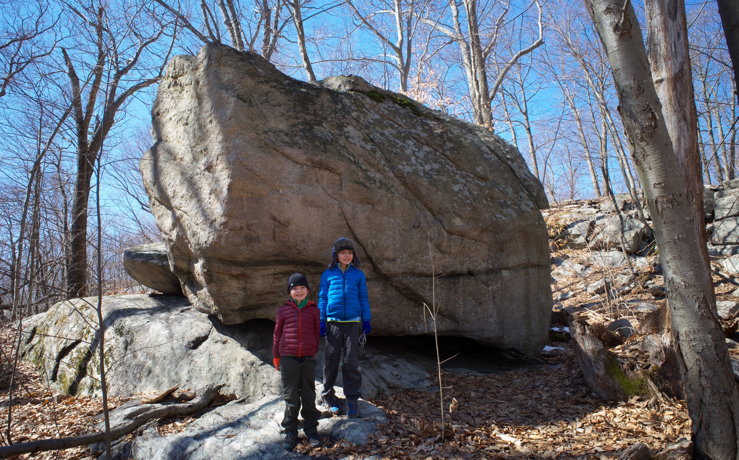
While this large boulder somewhat resembles a whale’s head if you squint, this isn’t Whale Head Rock. Keep going a bit further – the trail climbs steeply for little while – and then you’ll reach Whale Head Rock.
From here, the trail descends quite steeply.

At the bottom, the trail levels off before reaching a junction with the white dot trail and a kiosk.
Turn left to stay on the orange trail and cross a small footbridge over Bear House Brook.

The trail passes along the side of Bear Swamp.
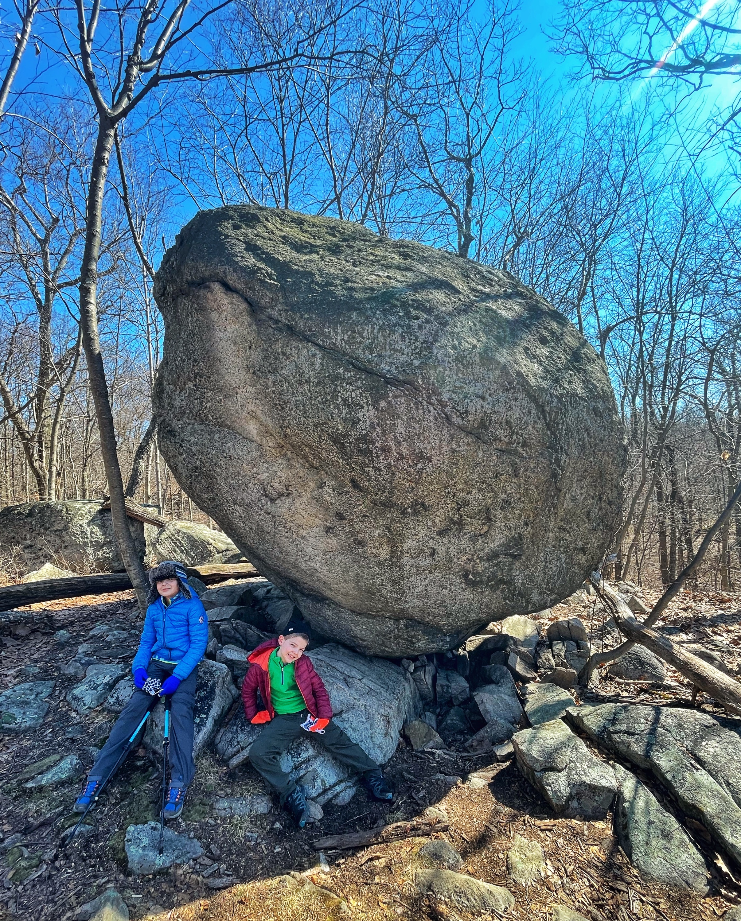
You eventually reach Bear Rock – one of the largest glacial erratics in New Jersey.

This massive glacial erratic, which can be said to resemble a giant bear, has been a local landmark for centuries. It was probably used as a shelter by Native Americans, and today it marks the boundary between Kinnelon Borough and Montville Township.
NY-NJ Trail Conference
At Bear Rock is the junction with the yellow trail. You could take this trail to return to the visitor center, but we will continue to follow the orange trail. A short distance ahead you’ll pass the junction with the pink dot trail on your right. Continue ahead, pass another junction with a footbridge to a trail on your left, and soon reach the “Ruins of the Morgan Place,” which doesn’t look like too much more than the foundations of an old cabin.
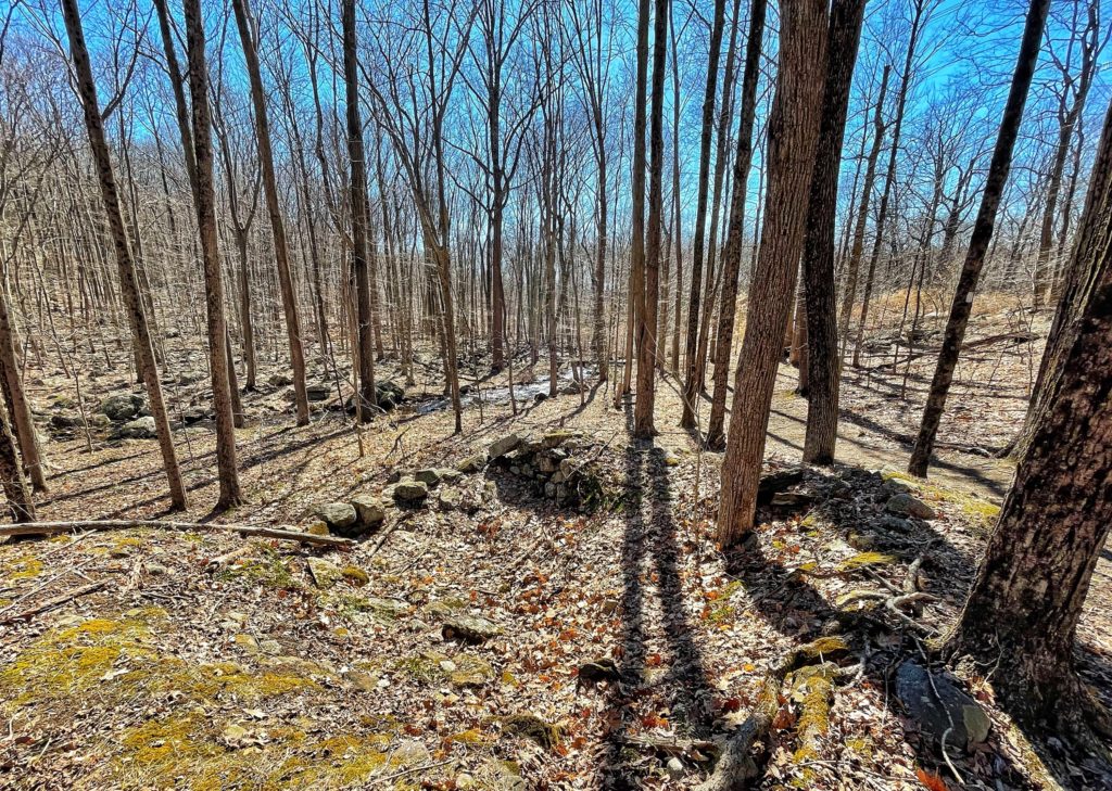
For years, this property, part of what was once known as the Great Boonton Tract, some of it surveyed by William Penn, remained an open secret. In the 1800s legend has it, Boonton outlaws (or just plain troublem akers) called the Morgan brothers hid out/hung there. The “Ruins of the Morgan Place”, stone remnants of their cabin, linger by a trail on the western side of the park
Skylands Visitor
Just before reaching a power line, the trail makes a sharp left turn and crosses a stream on a foot bridge.

Here the trail begins to climb as it briefly exits the forets, follows the power line cut, then returns into the forest. After the trail reaches a crest, it descends and reaches the junction with the blue trail which we passed earlier. Retrace your steps along the blue trail back to the parking lot.


