Overview: This is a great beginner one-night backpacking trip or a 7 mile out-and-back hike along the Appalachian Trail that features excellent views, including from the Sunrise Mountain Pavilion and Culver Fire Tower. This is a heavily-trafficked trail.
Length:
- 5 miles (one-way from Sunrise Mountain to Culver Gap parking lot)
- 7.1 miles (out-and-back Sunrise Mountain to Culver Fire Tower)
Elevation gain:
- +512 feet (one-way from Sunrise Mountain to Culver Gap parking lot)
- +1001 feet (out-and-back Sunrise Mountain to Culver Fire Tower)

Location: Stokes State Forest, Sussex County, New Jersey
Parking:
- For an out-and-back hike, park at the Sunrise Mountain overlook.
- For an easy one-way overnight trip, leave a car at the Culver’s Gap parking lot (2 Vansickle Road, Sandyston, NJ) and take a shuttle to Sunrise Mountain overlook.
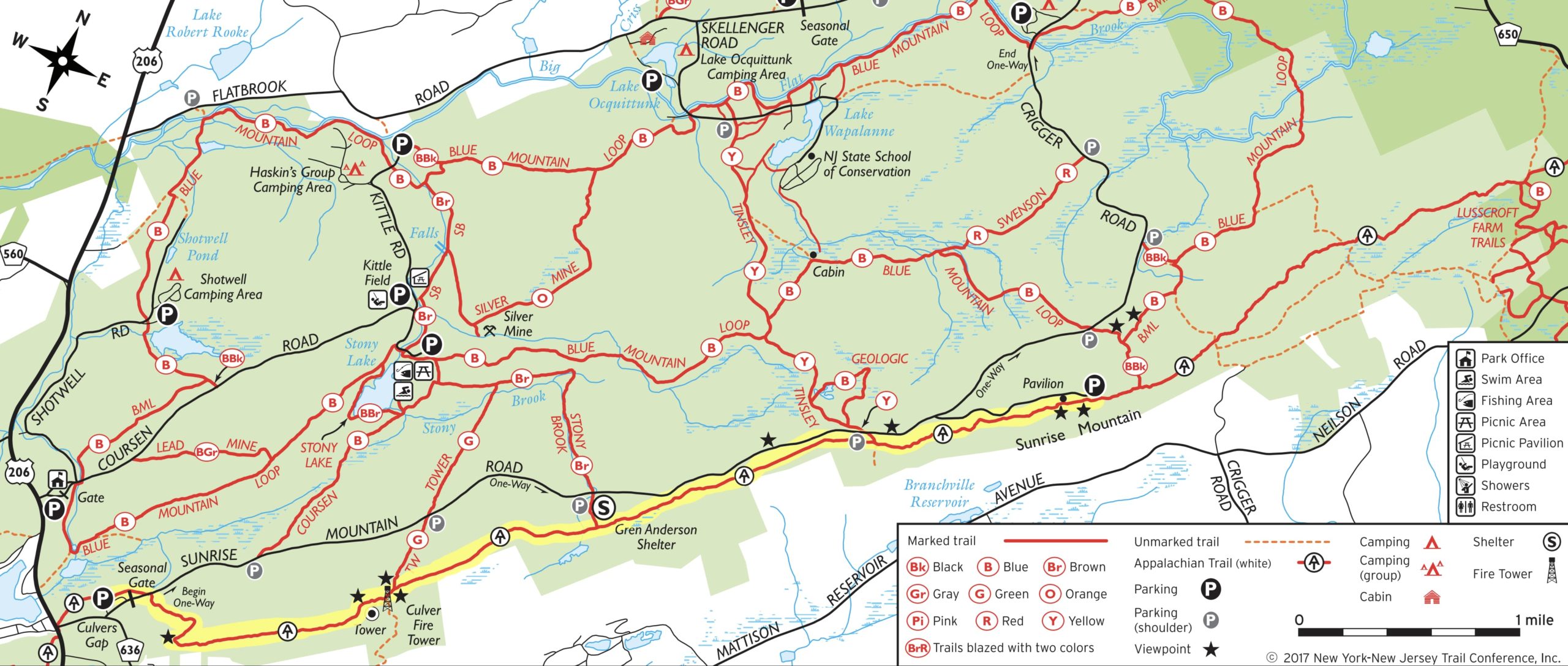
Map:
- NY-NJ Trail Conference Kittatinny Trails Map #122 (best option)
- NY-NJ Trail Conference Stokes State Forest North web map (free pdf); Stokes State Forest South web map (pdf) also available if you plan to continue your trip further south.
- NJ Parks & Forests – Stokes State Forest Trail map
Trail description:
This hike begins at the Sunrise Mountain Overlook/parking area, which requires taking the one-way Sunrise Mountain Road which is closed in the winter and only open seasonally (so check before you go). There are bathrooms at the north end of the parking lot.
The hike goes southbound and can be done as an out-and-back to the Culver Fire Tower (7.1 miles) or as a beginnger-friendly overnight backpacking trip ending at the Culver’s Gap parking lot (5 miles). There is one shelter along the section (Gren Anderson Shelter), which is the only legal camping spot along this stretch.
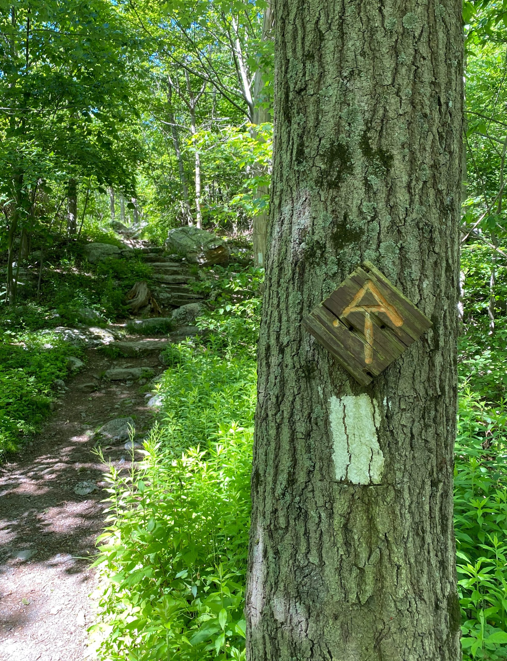
From the south side of the Sunrise Mountain Overlook parking lot, enter the white-blazed Appalachian Trail. You’ll soon reach a nice stone steps.
Walk south about 0.2 miles until you reach the Pavilion at the summit of Sunrise Mountain.
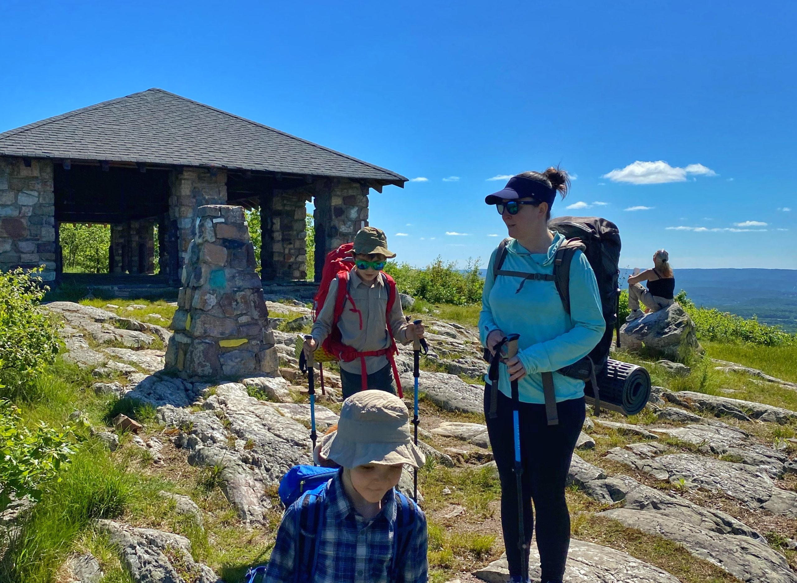
At an elevation of 1,650 feet, it is one of the highest peaks in New Jersey. The pavilion was built in the late 1930s by the Civilian Conservation Corps.
Sunrise Mountain Pavilion [is] one of the state’s best areas for watching eagles, hawks, kestrels, falcons, vultures and other raptors soar and glide as they head south during the fall migration. In North America, birds migrate in north-south routes called flyways; this particular spot, on the Kittatinny Ridge, is on the Atlantic Flyway.
Volunteers are out during the migration season (late August to early November) monitoring and recording the passing raptors. Their counts assist scientists in studying migration patterns. Up to 18,000 raptors have been spotted in a single day.
NJ Monthly
Stay to the left and follow the white blazes to reenter the forest. After approximately 1.1 miles, just to the west of the trail (on your right) is a rocky outcrop with excellent views to the northwest. (Note that most maps don’t indicate this spot as a viewpoint, although they do indicate a viewpoint at a similar location along Sunrise Road). Although the trail largely follows the ridgeline, this is one of the few views along this section.
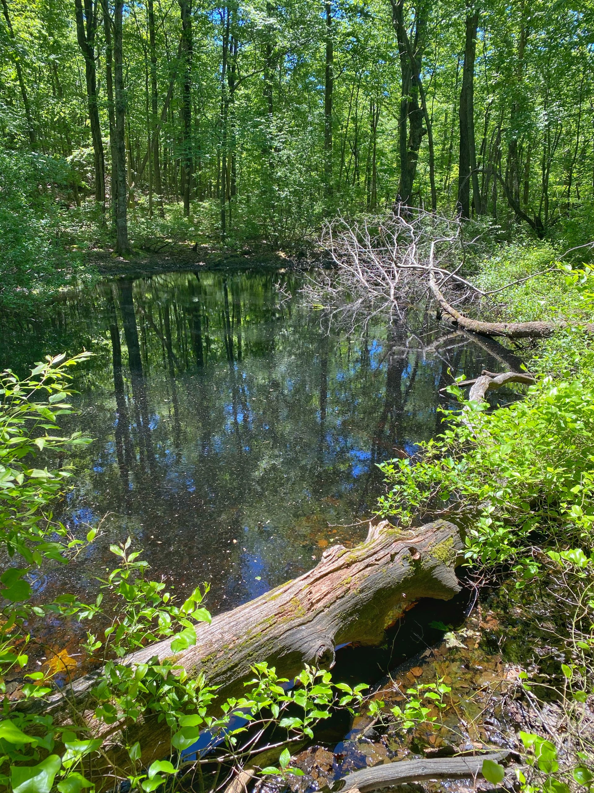
After another 0.9 miles, you’ll reach a stagnant pond on your left. It might be full of tadpoles or frogs. In a pinch, you could filter water here, but there is a better water source less than a half mile ahead.
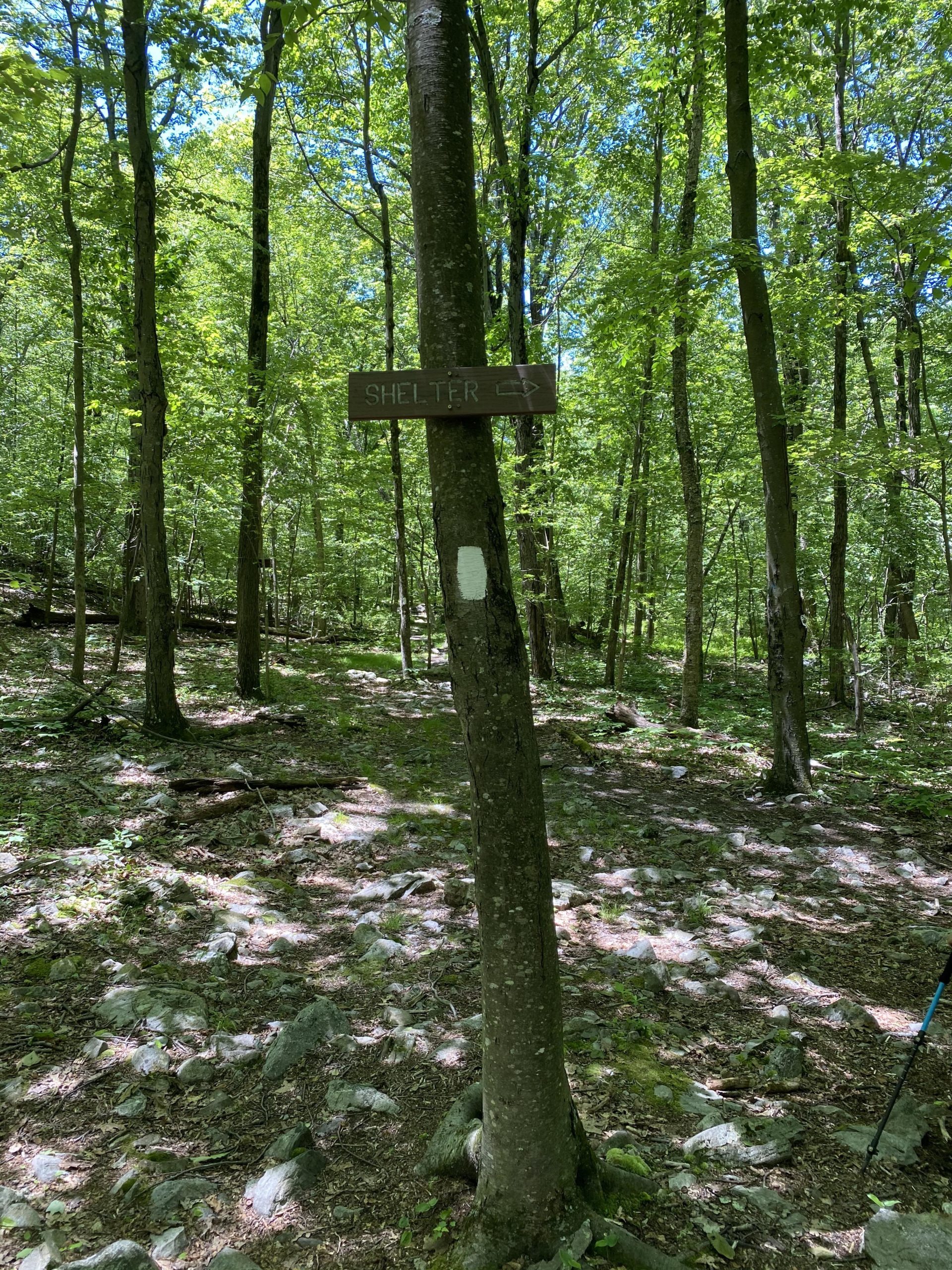
Continue for 0.4 miles to reach signs pointing towards the Gren Anderson Shelter. The shelter is the only legal overnight camping spot along the AT in this section of the park. About 0.1 miles down the trail is the Gren Anderson Shelter, an old shelter built in 1958 by the Green Mountain Club with space for about 6-8 people. The best tent sites are along the side trail before reaching the shelter. Nearby is a privy (one of the cleanest and well-maintained!) and a bear box. Water is available from a spring to the left of the shelter, but it may be easier to fill up at the stream about 0.1 miles south of the shelter along the AT.
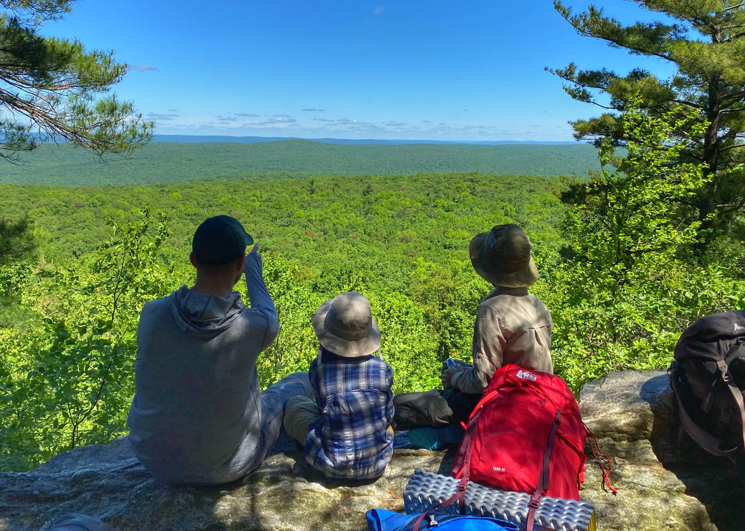
Continue south along the trail another 0.1 miles to reach a stream, which is usually flowing. This is good spot to filter water. Continue for another mile to reach the junction with the green-blazed Tower Trail. You could make a very short detour to the right along the trail to get a viewpoint to the west.

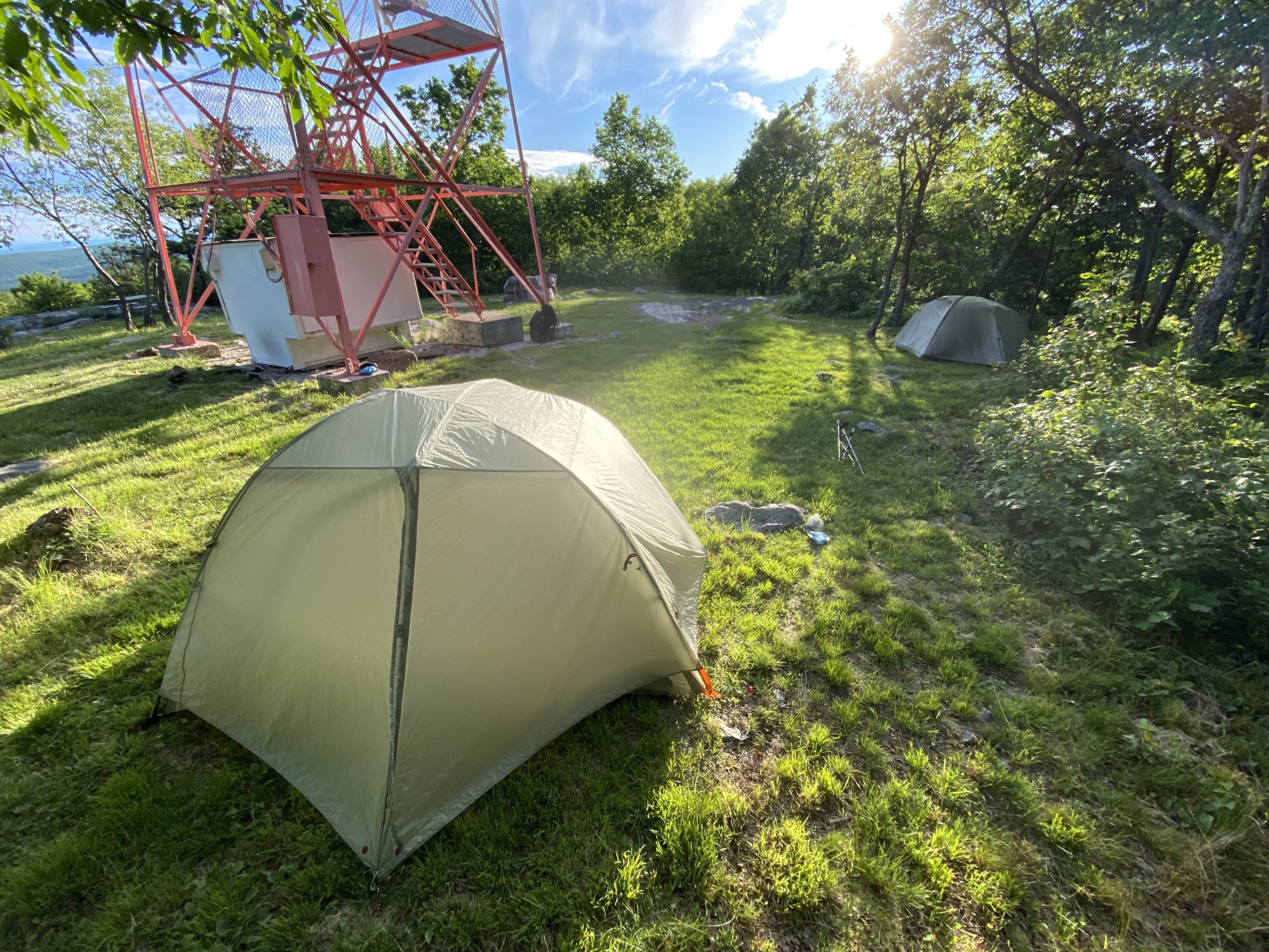
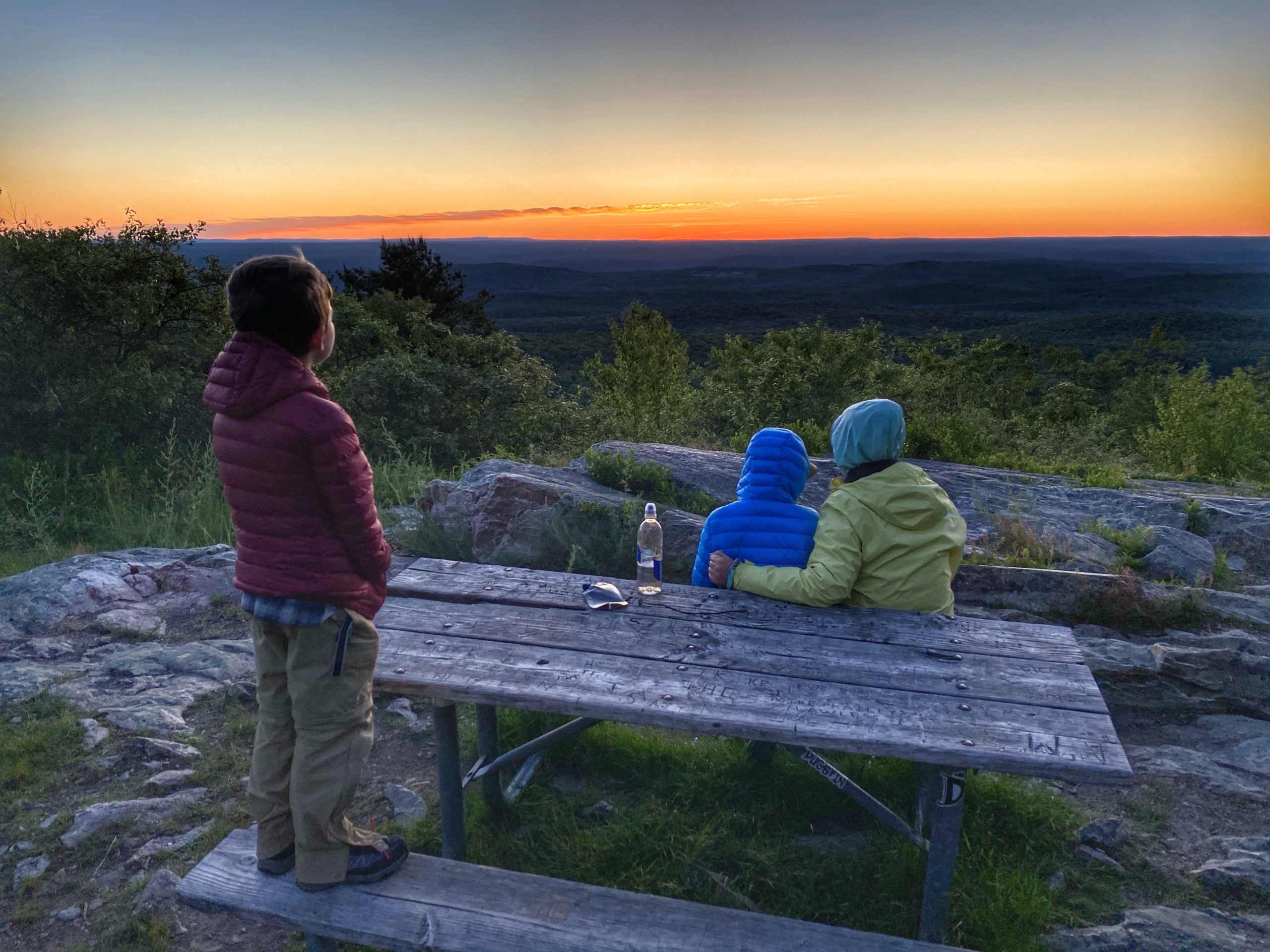
Now continue back along the AT and you will almost immediately reach a clearing with the Culver Fire Tower, a picnic table, and great views to the west.


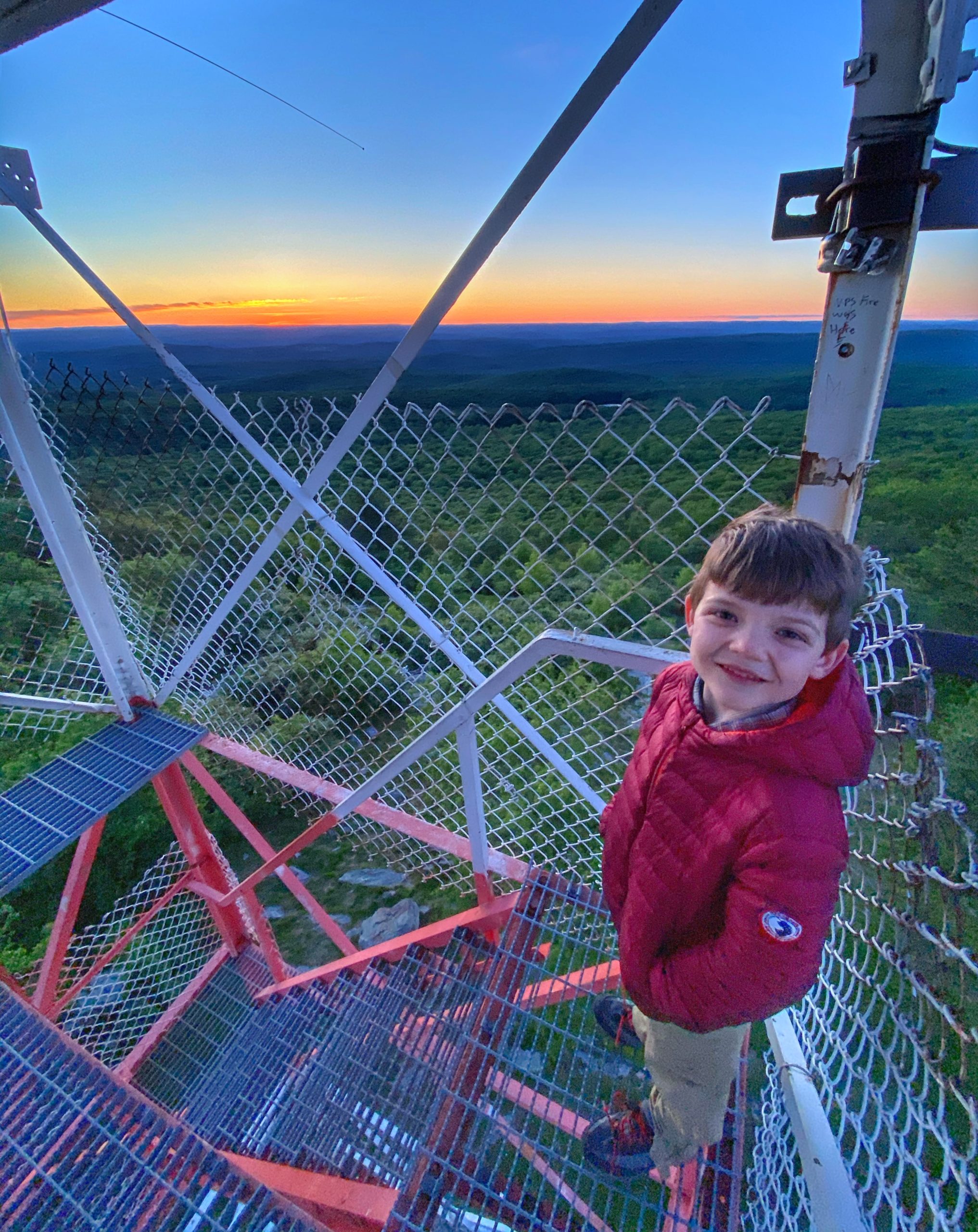
The Culver Fire Tower is in active use to watch for fires during fire season.
Culvers Lookout was originally established in 1908 and the site was first known as Normanook Fire Tower. In 1918, a steel tower was constructed and was staffed by a state observer. The present Aermotor 47′ tower, with a 7’x7′ cab, was erected in 1933.
New Jersey Forest Fire Service
In fact, while we were here, the forest fire observer staffing it was nice enough to give our two boys some glow sticks and buttons.
Climb the 6 levels to the top of the tower for 360 degree views of the surroundings.
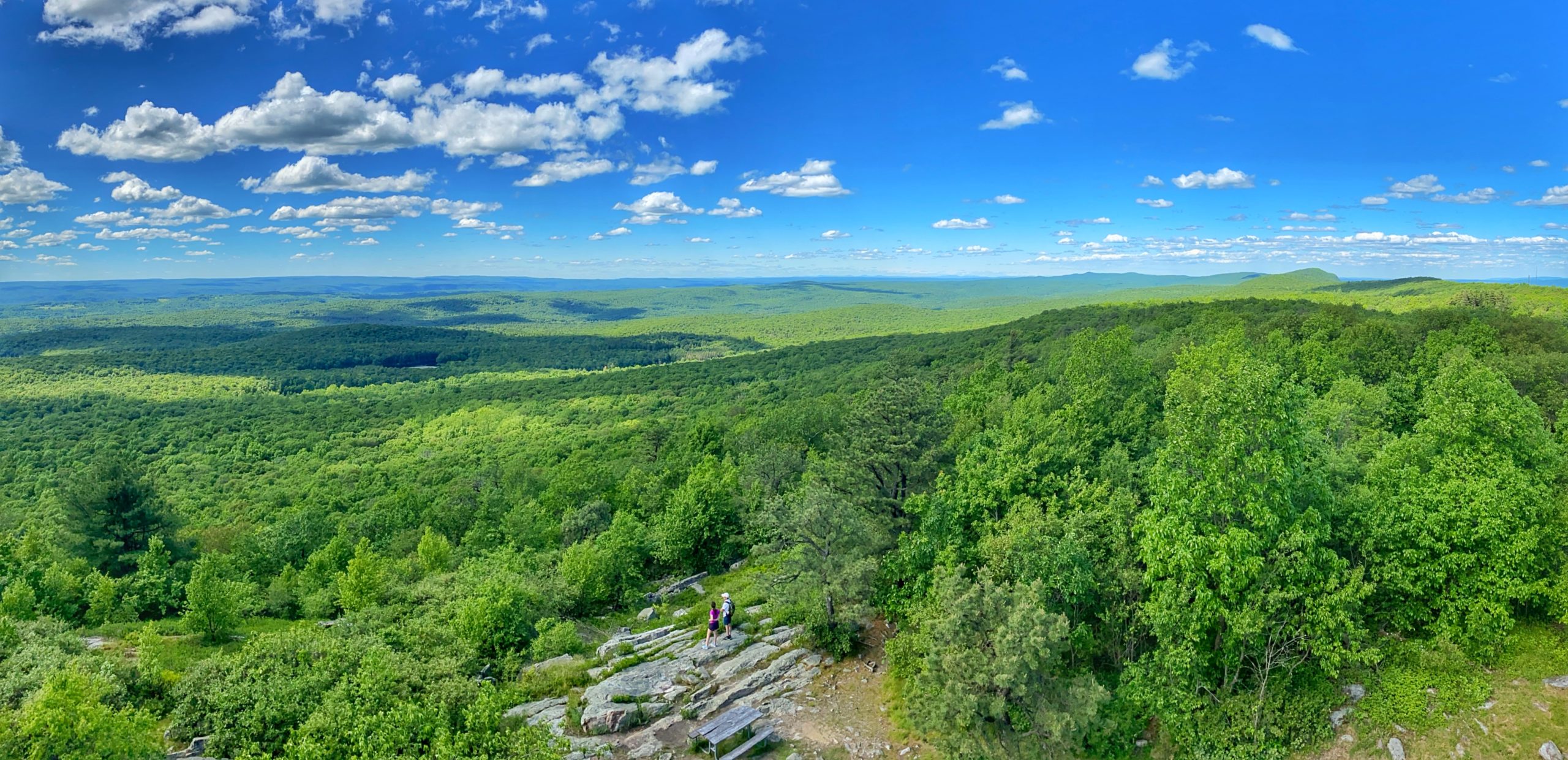
We chose to tent here for the night (note: camping anywhere except designated shelters is technically prohibited within the Stokes State Forest section of the AT). The views were too good to miss.

If you’re out for the day, you’ll turn around here (or after the next viewpoint a mile further south) and head back north to Sunrise Mountain. If you’re doing this as a point-to-point hike, continue south through the forest.
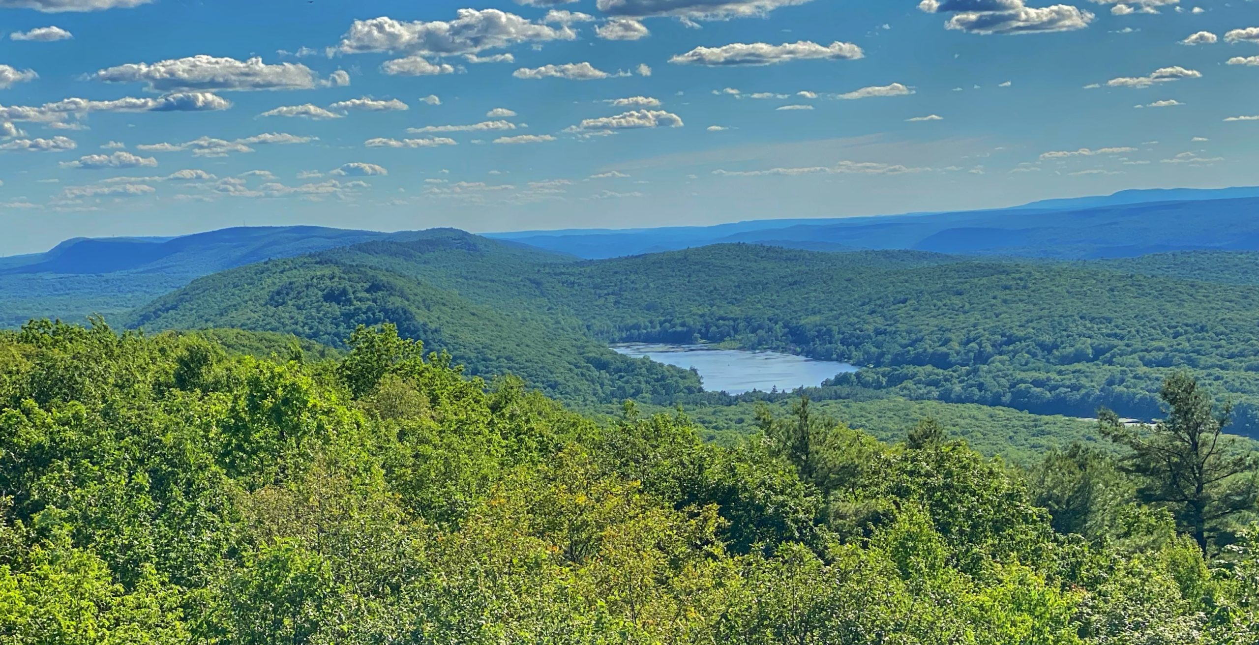
After 1.1 miles, you’ll reach a partially open area of a ridge with nice views to the southwest toward the Acropolis and as far back as Pocono Ski Resort. There may be space here for one small tent.

After another half mile, you’ll reach Sunrise Mountain Road. Turn left, walk a few paces, and reenter the woods on your right. In another 0.1 mile or so, you’ll see the Culver Gap parking lot on your left, where hopefully your car is waiting for you.


