Planning a hike of the John Muir Trail can involve a lot of planning and logistics, especially if you have time constraints. I found the books, guides, apps, and websites below to be the most useful resources for planning a John Muir Trail backpacking trip. I purchased and read/used them all to plan three hikes along the John Muir Trail. You can read the trip reports:
- Part 1: Reds Meadow to Yosemite Valley
- Park 2: Duck Pass to Bishop Pass
- Park 3: Bishop Pass to Mt. Whitney
John Muir Trail: The Essential Guide to Hiking America’s Most Famous Trail
5th Edition by Elizabeth Wenk
This is the Bible for planning a John Muir Trail hike. It has everything you need to plan a hike, plus a great narrative of the history, geology, and fauna of the trail. It’s by far the best resource available. You might not want to carry the book with you on the trail, but for planning purposes, it can’t be beat.

South-to-North John Muir Trail: The Essential Guide to Hiking America’s Most Famous Trail
Digital-only for Kindle. By Elizabeth Wenk.
The description in Elizabeth Wenk’s guide is written for those hiking the traditional” north-to-south direction. It’s easy enough to reverse engineer it, but if you’re hiking from south to north, there is a digital-only south-to-north version of the guide available for the Kindle.

John Muir Trail Data Book
By Elizabeth Wenk
The John Muir Trail Data Book is a condensed version that contains only the data sections of the guide but leaves out the trail descriptions, history, and other narratives. Some people choose to carry the data book on the trail, although I did not.

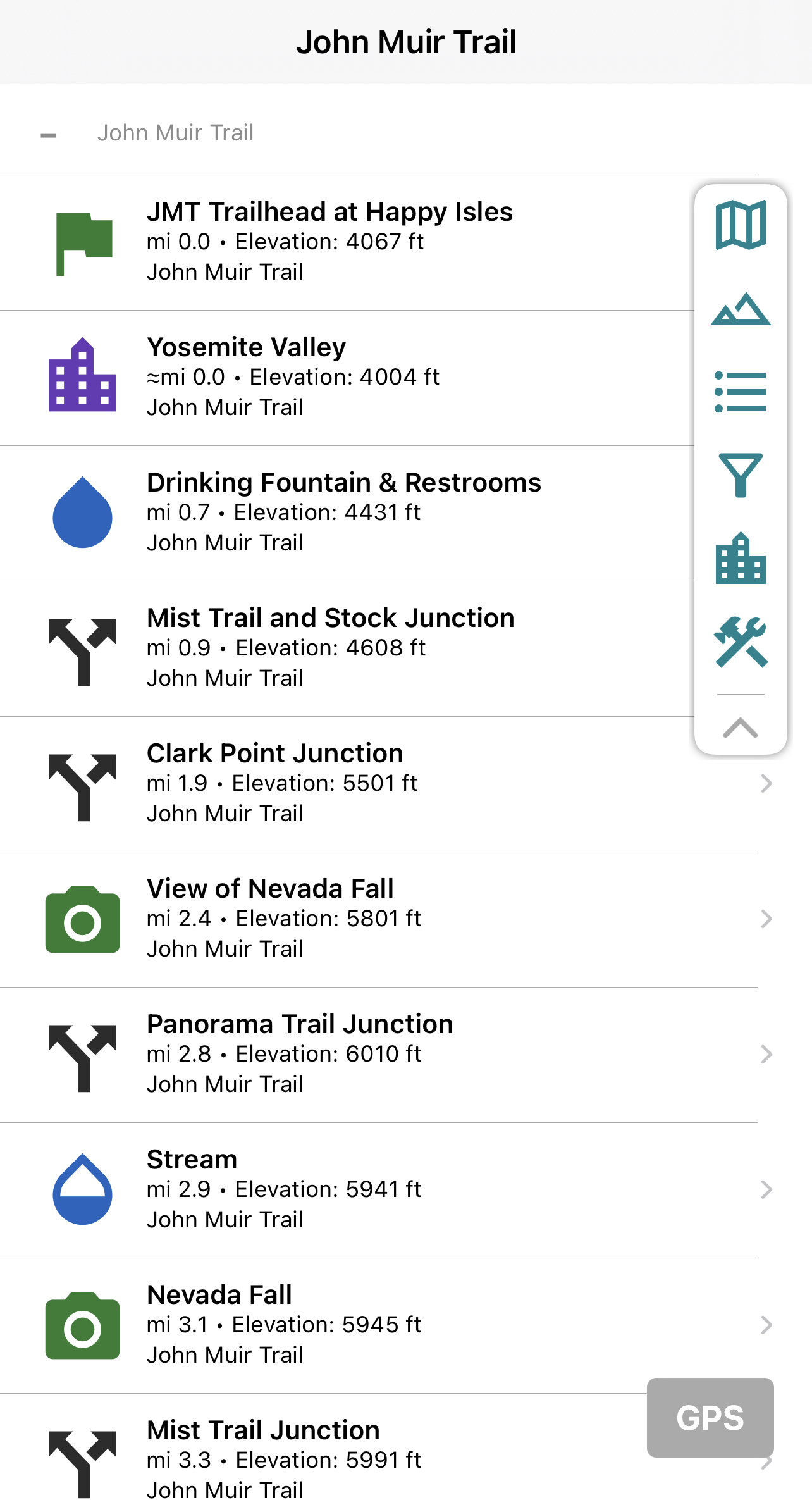
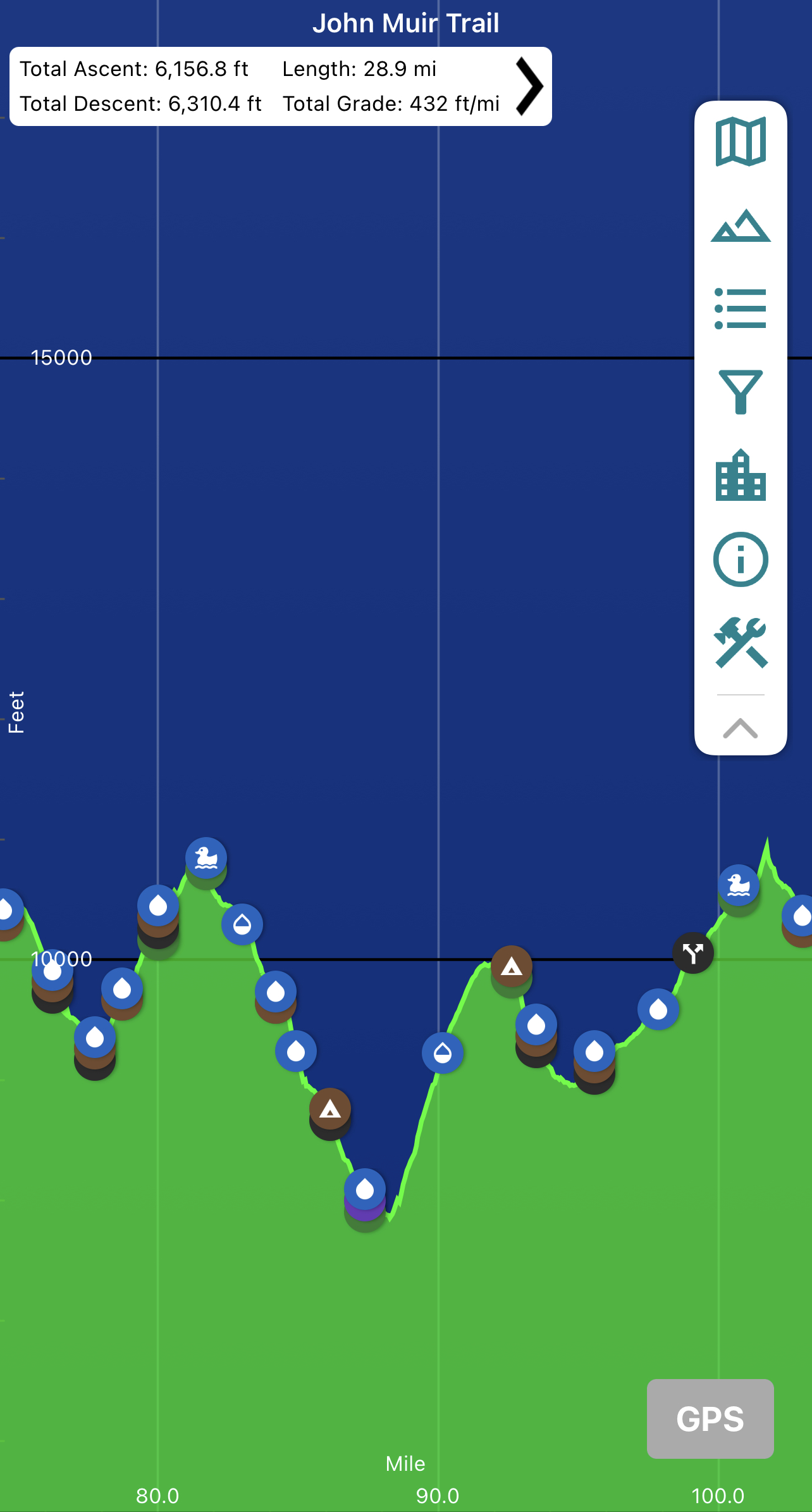
FarOut Guides (aka Guthook)
John Muir Trail Guide
For on-trail navigation and planning, nothing beats the Guthook app, renamed FarOut Guides in 2021. Using your smartphone’s GPS, the app knows your location and will show you the distance and elevation gain to water sources, tent sites, passes, and other locations.
Yes, you could hike trail without it, and if you want to experience the outdoors without electronics, you can, but I found it to be an indispensable tool both on-trail and for planning.

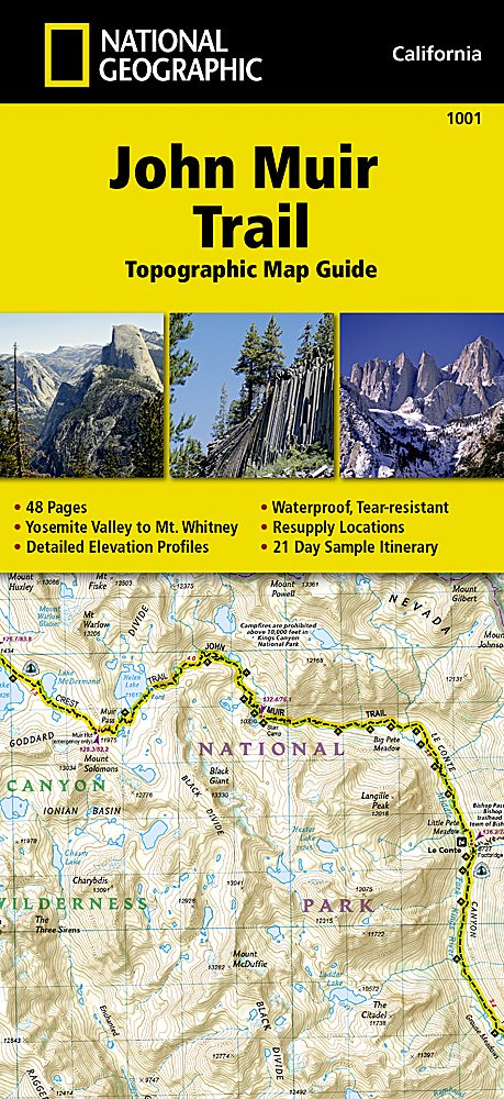
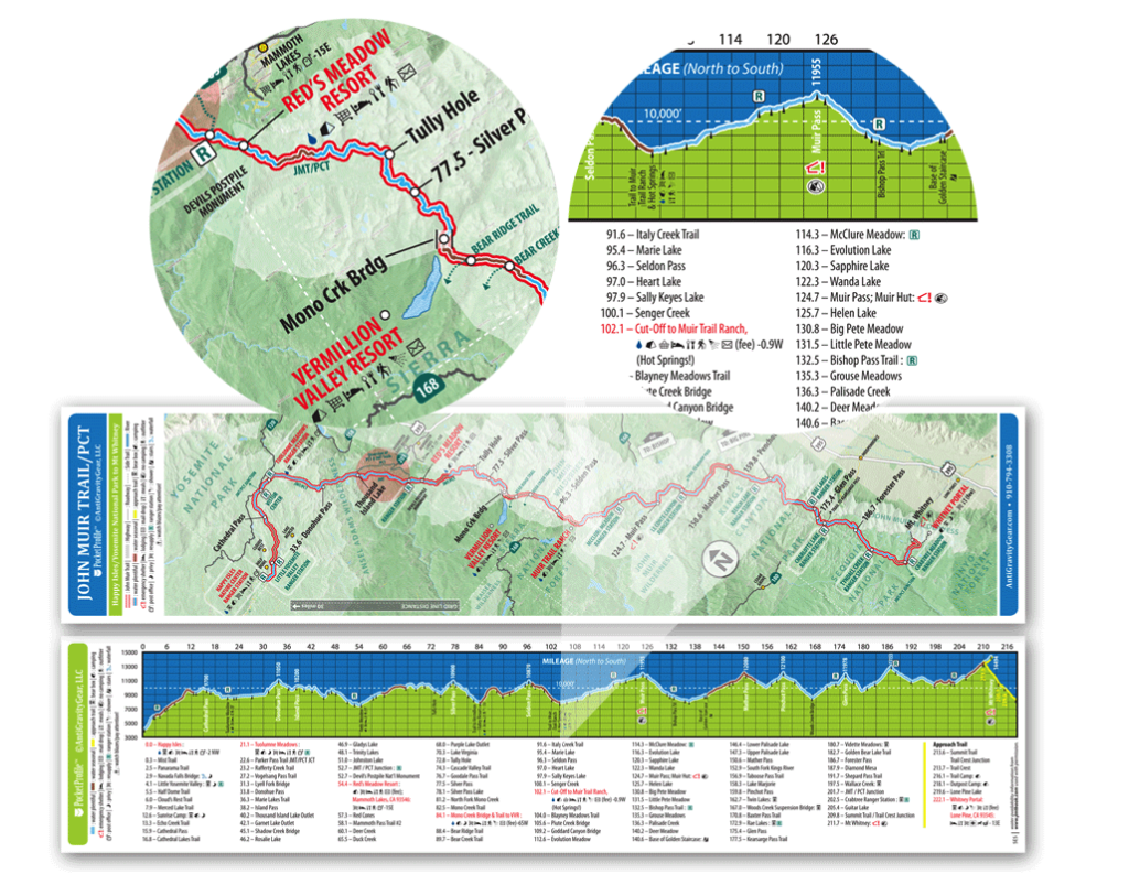
National Geographic John Muir Trail Map
There are a bunch of trail maps available, but I liked the National Geographic John Muir Trail map the most. This is what I carried with me on the trail. The map is waterproof and tear proof at a scale of 1:63,360 with dimensions of 4.25″ x 9.25″ and weight of 3.3 ounces.
The booklet format was great since it could easily slip into your pocket and just flip to the page you need instead of having multiple loose pages to have to sort through. The maps are very easy to read and have a good amount of useful detail.


JMT/PCT Elevation Profile Pocket Map
By AntiGravityGear
It’s nowhere near as detailed as the National Geographic map, but the AntiGravityGear’s pocket profile map is great both for big picture planning and for seeing at a glance on-the-trail whether you’ve got a big climb or descent ahead of you.
I tried to plan most days to include a climb over a pass in the morning and to camp before the next pass the next day so being able to see the elevation profile of the entire trail was very helpful at figuring out a rough game plan. And at just 4.5 grams, how can you not carry this map?
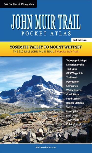
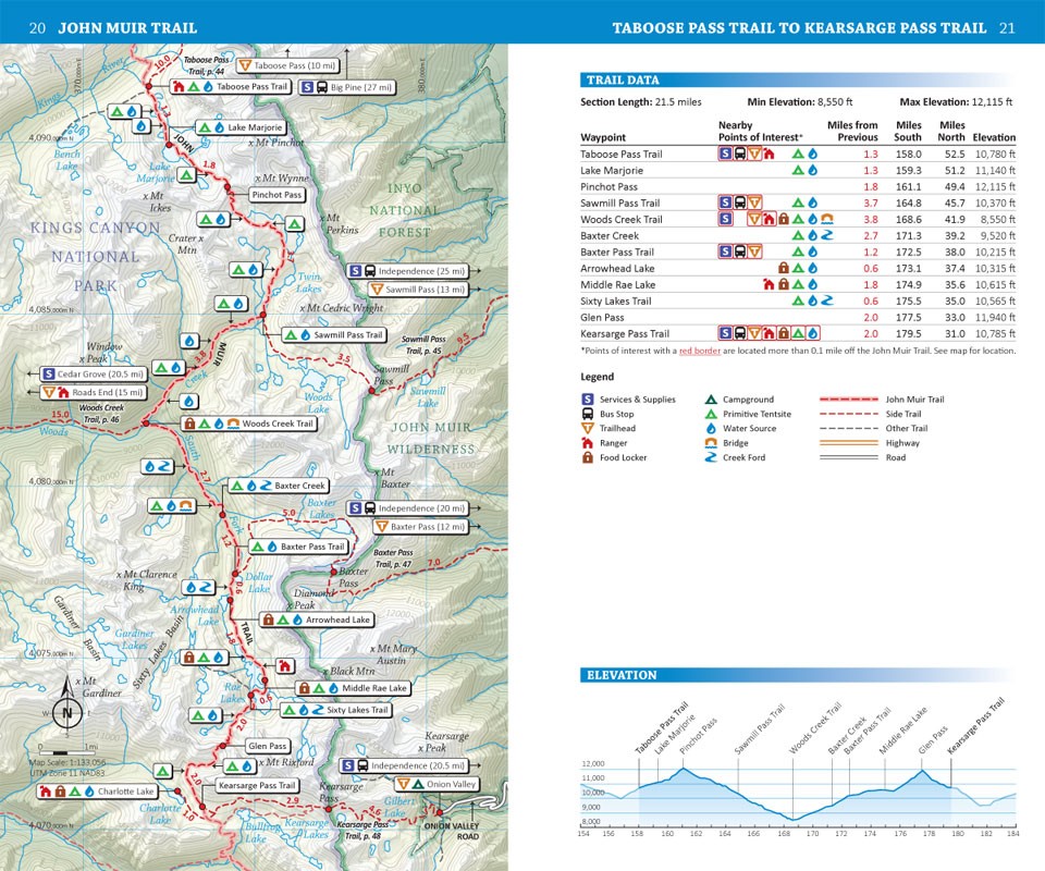
Erik the Black’s John Muir Trail Pocket Atlas
3rd Edition
Erik the Black’s John Muir Trail pocket atlas is another great guide that helped me with planning. I did not carry it on the trail with me, but at 4.5″ x 7.5″ and weighing 3.1 ounces, it could easily fit in your pocket.
The pocket atlas map scaled varied from section to section, but generally it was around 1:130,000. I liked the more detailed, larger scale National Geographic maps. Still, the scale was sometimes helpful in planning, since it allows you to see more of the trail. The maps also had some locations labeled that other maps did not.
Facebook Groups and Online Forums
One of the best resources for planning my trips were Facebook groups, including the annual Facebook group that is created for each class of JMT hikers, which tends to be the most active group at any time. Even though the older groups aren’t active, they still can serve as a valuable resource if you search through old posts.
- John Muir Trail – This is the largest group with over 40,000 users
- John Muir Trail Hikers 2022
- John Muir Trail Hikers 2021
- John Muir Trail Hikers 2020
- John Muir Trail Hikers 2019
Other good online sources include:
- John Muir Trail Groups.io email list – an email list with several thousand people – the successor to the Yahoo John Muir Trail Group
- JMT Hiker Survey reports and Facebook page – great statistical data based on annual hiker surveys conducted by John Ladd
- Wenk shared resources – A collection of data sources derived from Elizabeth Wenk’s book, including waypoint files, lists of stream crossings and bailout routes, and more.
- Permitting guide – a great resource created by Inga Aksamit
- The r/JMT subreddit – not super active, but sometimes it has good information
Books for Inspiration
These books aren’t key for planning purposes, but I found that my hikes have more value when I know the history and context of the place I’m hiking.
History of the Sierra Nevada
From the Native Americans to its modern day recreation use, this book provides a fascinating history of the Sierra Nevada.
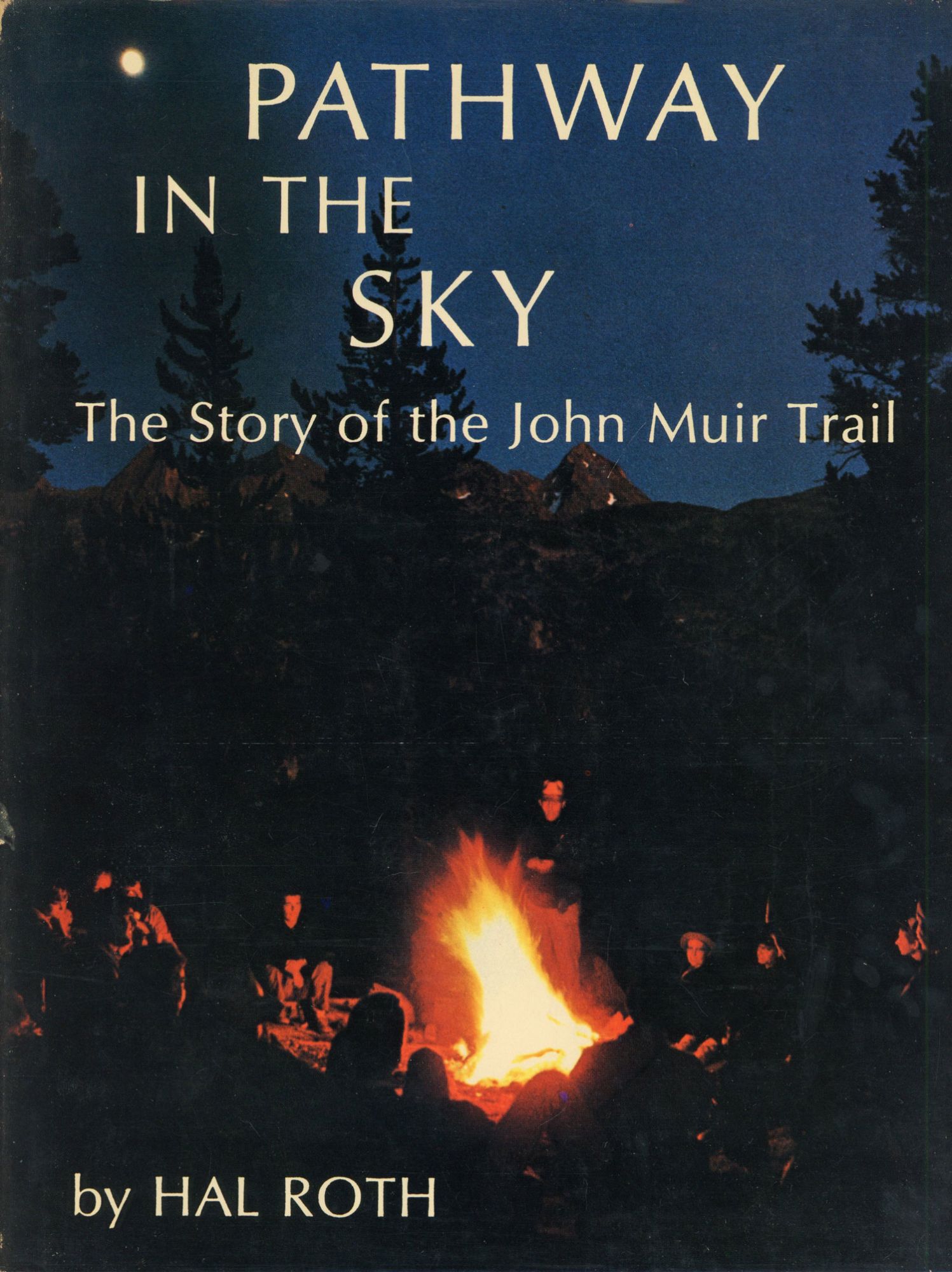
Pathway in the Sky – The Story of the John Muir Trail
The history of the John Muir Trail – from the area’s early explorers, to geology, wildlife, the people who preserved the land, and how the route was scouted and built – this may be the most comprehensive book on all aspects of the John Muir Trail.
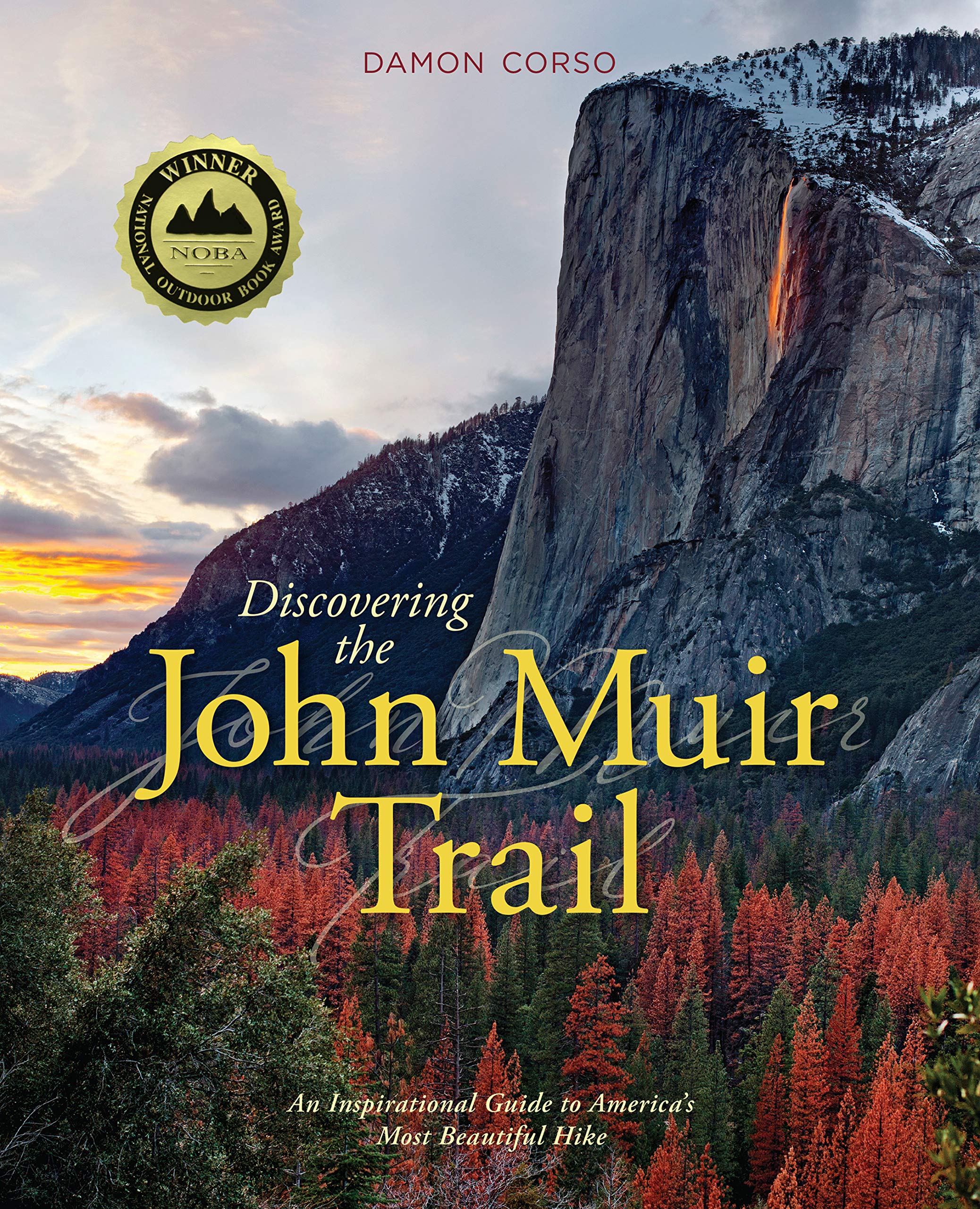
Discovering the John Muir Trail
This book has history and information for planning a thru hike, but more than anything, it’s pure eye candy with full color photos of the John Muir Trail that are sure to provide the visual inspiration you need for your trip.