Overview
This hike of Hawk Mountain features some truly amazing views, an Ice Age era boulder field, and a chance to see rattlesnakes. Although it’s under 5 miles, this is a tough hike that involves very rocky terrain with a lot of scrambling that will require the use of your hands, so give yourself plenty of time. As an alternative, the 2 mile out-and-back hike to North Lookout along the Lookout Trail gets you all the best views (South Lookout and North Lookout) and a much easier, kid-friendly hike. Admission fees are charged to access trails.
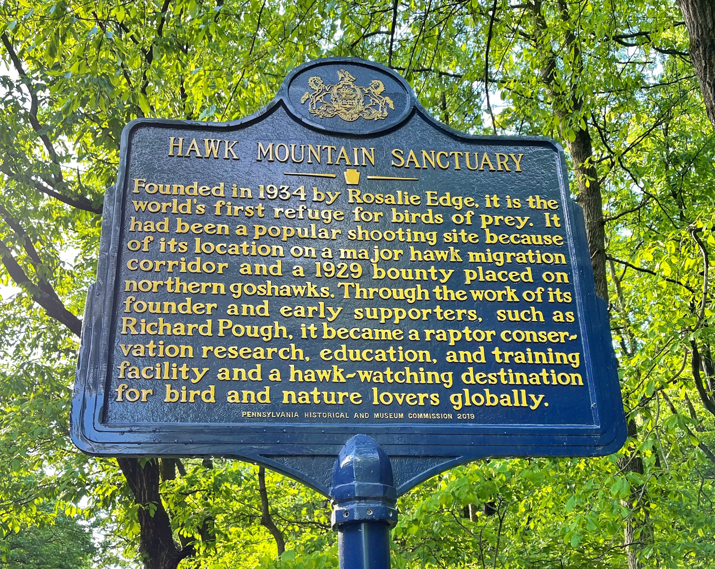
About Hawk Mountain Sanctuary
Hawk Mountain Sanctuary is not a state or national park or even public land at all – it is a private, member-supported, non-profit conservation organization. Trails are open 8am to 5pm daily, but tickets must be purchased for admission. Once a popular site for shooting hawks, the 2,600 acre property is the world’s first refuge for birds and has been designated a National Natural Landmark.

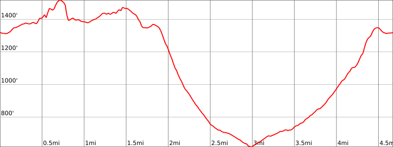
Hike Length: 4.7 miles
Elevation gain: +1,160 feet
Location: Hawk Mountain Sanctuary, 1700 Hawk Mountain Rd. Kempton, PA
Parking:
Park in the parking lot next to the visitor center and trailhead. Use the address 1700 Hawk Mountain Rd, Kempton, PA for directions.
Maps
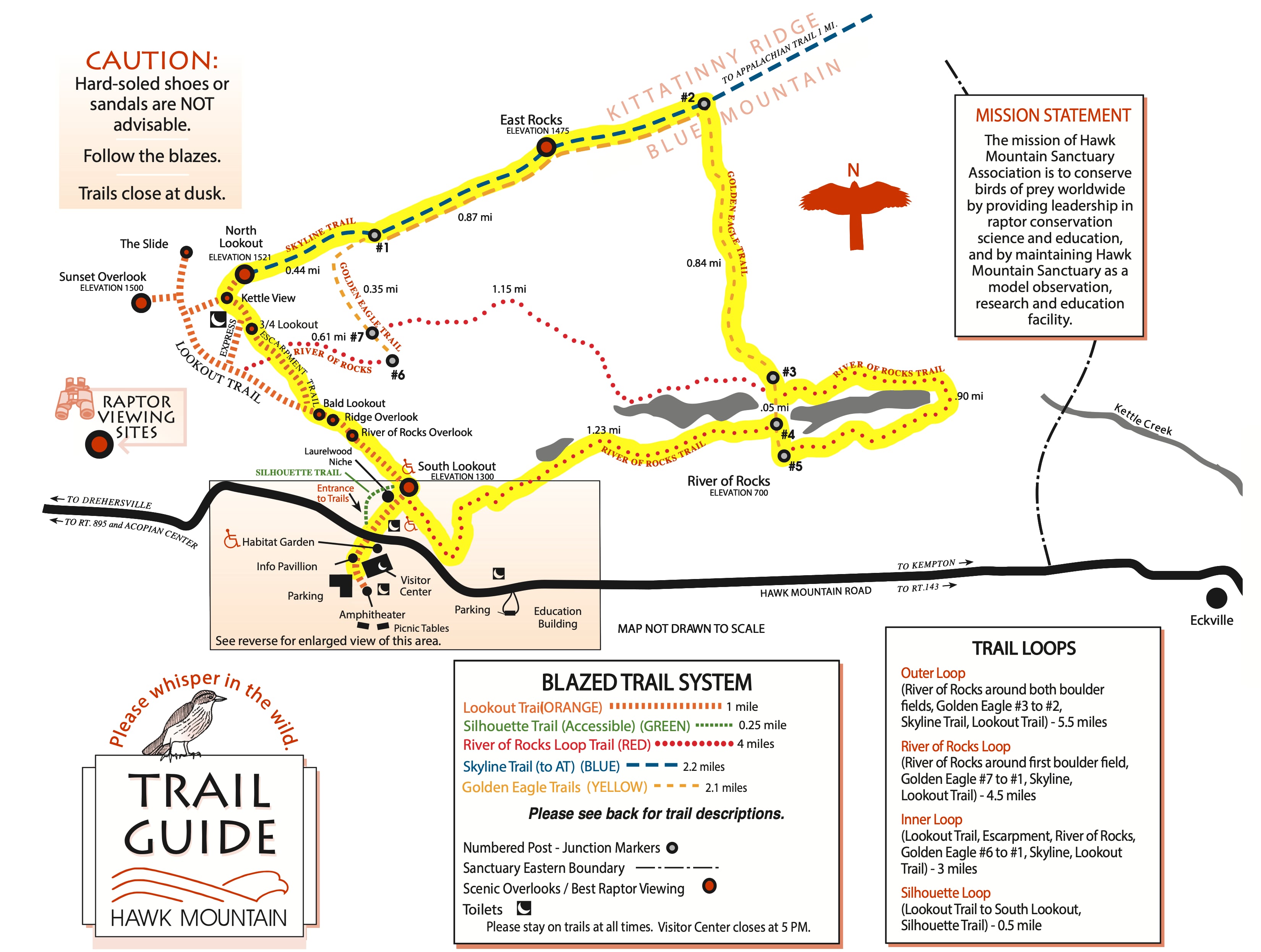
Trail description
From the parking area, head north towards Hawk Mountain Road. Cross the street and pass through the Entrance Gate. The trail begins as a wide, flat gravel path that climbs gently uphill. As an alternative, the green Silouhette Trail is wheelchair accessible with a grade that does not exceed 8.3%.
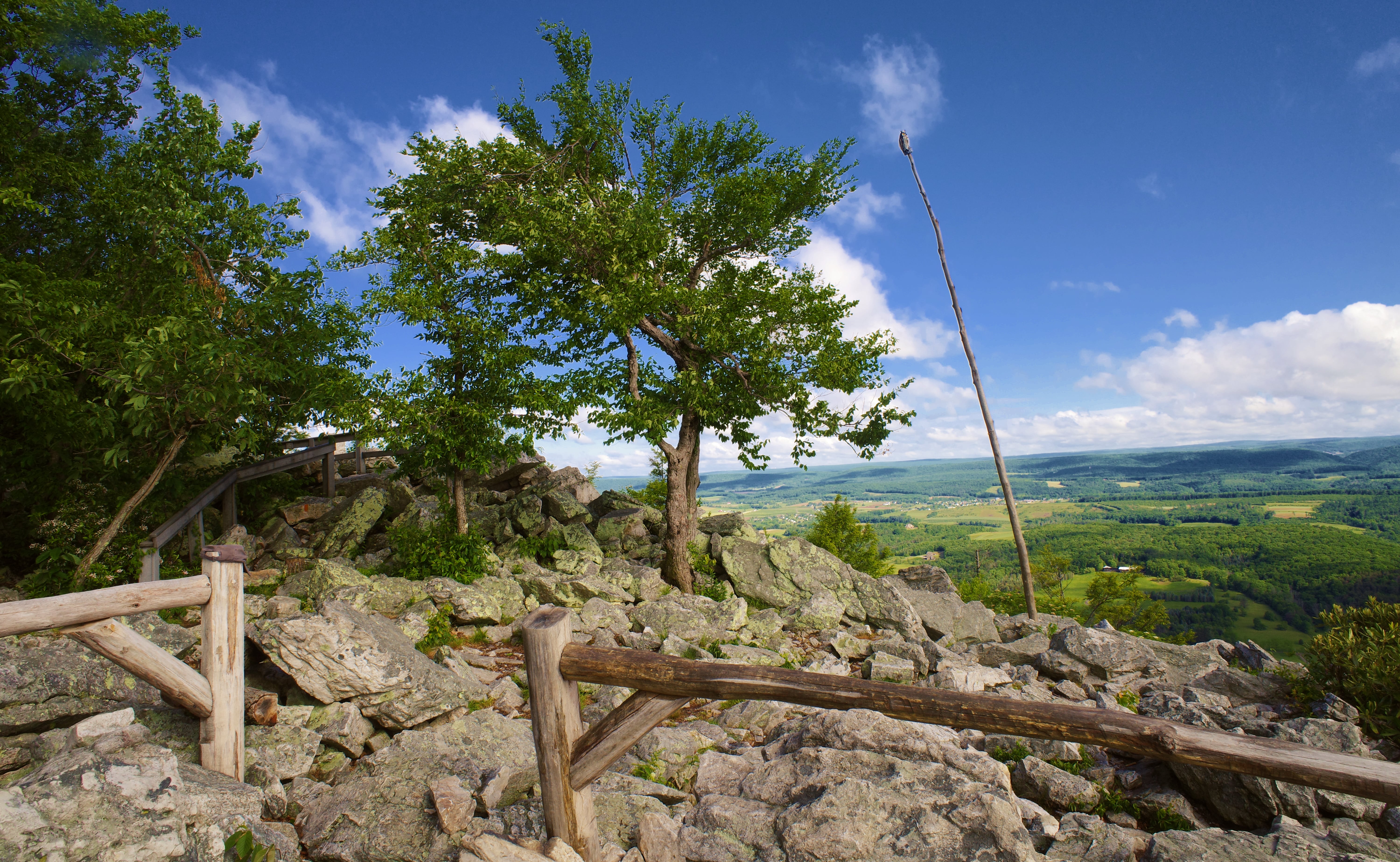
South Lookout
About 500 feet the Entrance Gate, you’ll reach South Lookout – the kind of spectacular viewpoint that usually requires much more effort to reach.
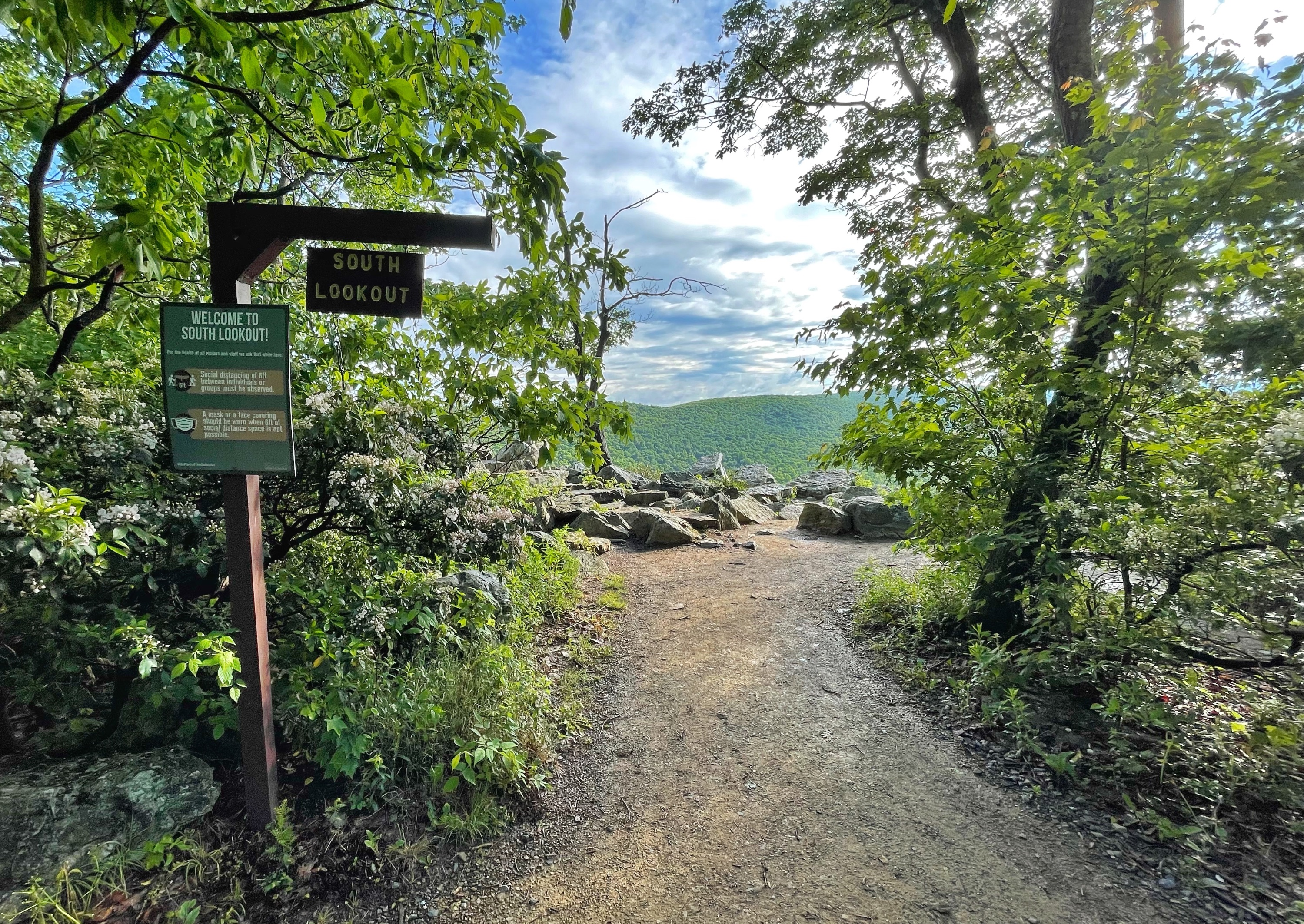
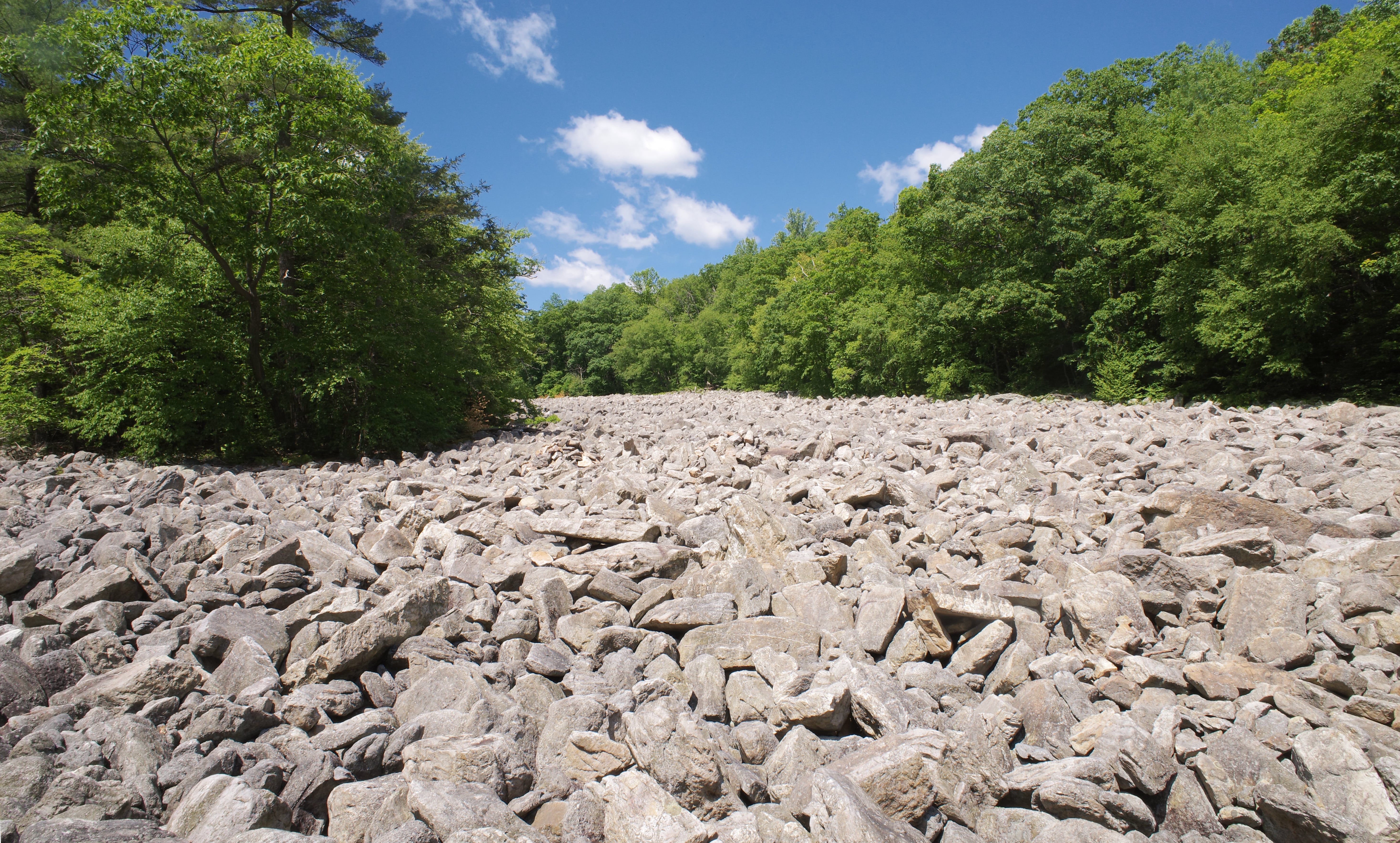
Straight ahead and below South Lookout you’ll see a few patches of forest that are missing trees. This the River of Rocks, an Ice-Age boulder field, which we’ll pass later as part of the loop.
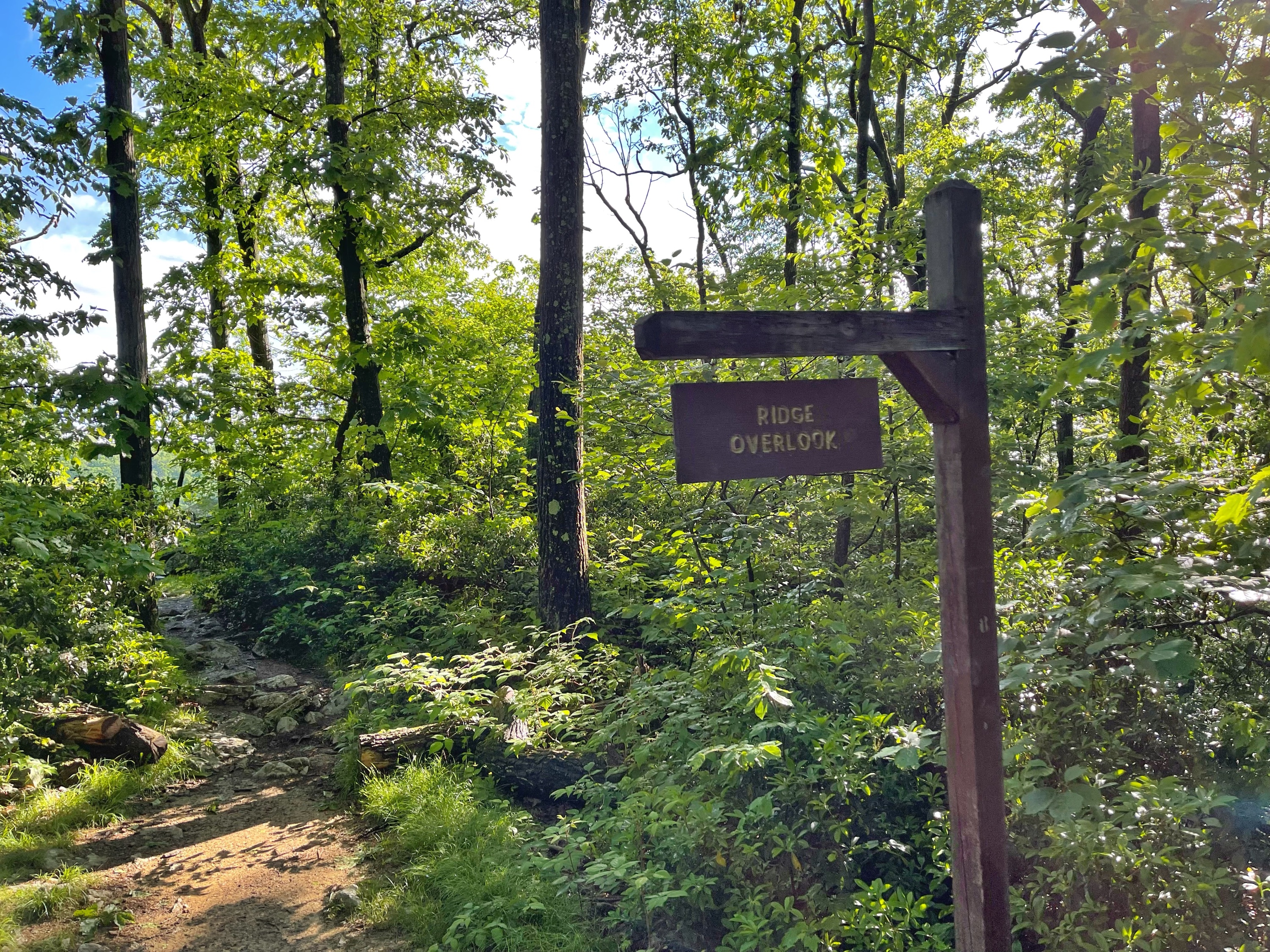
Return back to the trail and head northwest to follow the orange-blazed Lookout Trail. Along the way, you will pass a series of lookouts in quick succession.
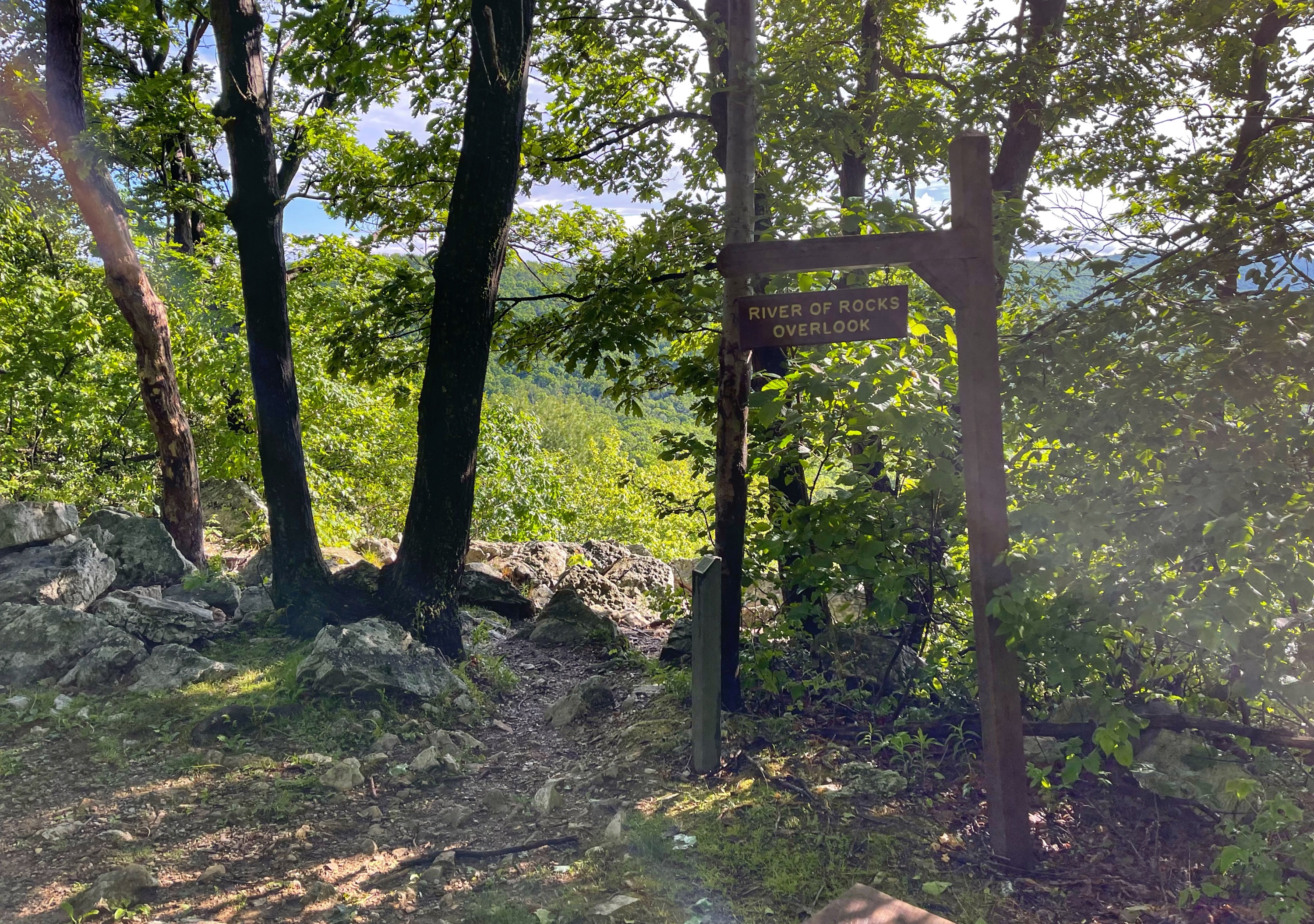
River of Rocks Overlook

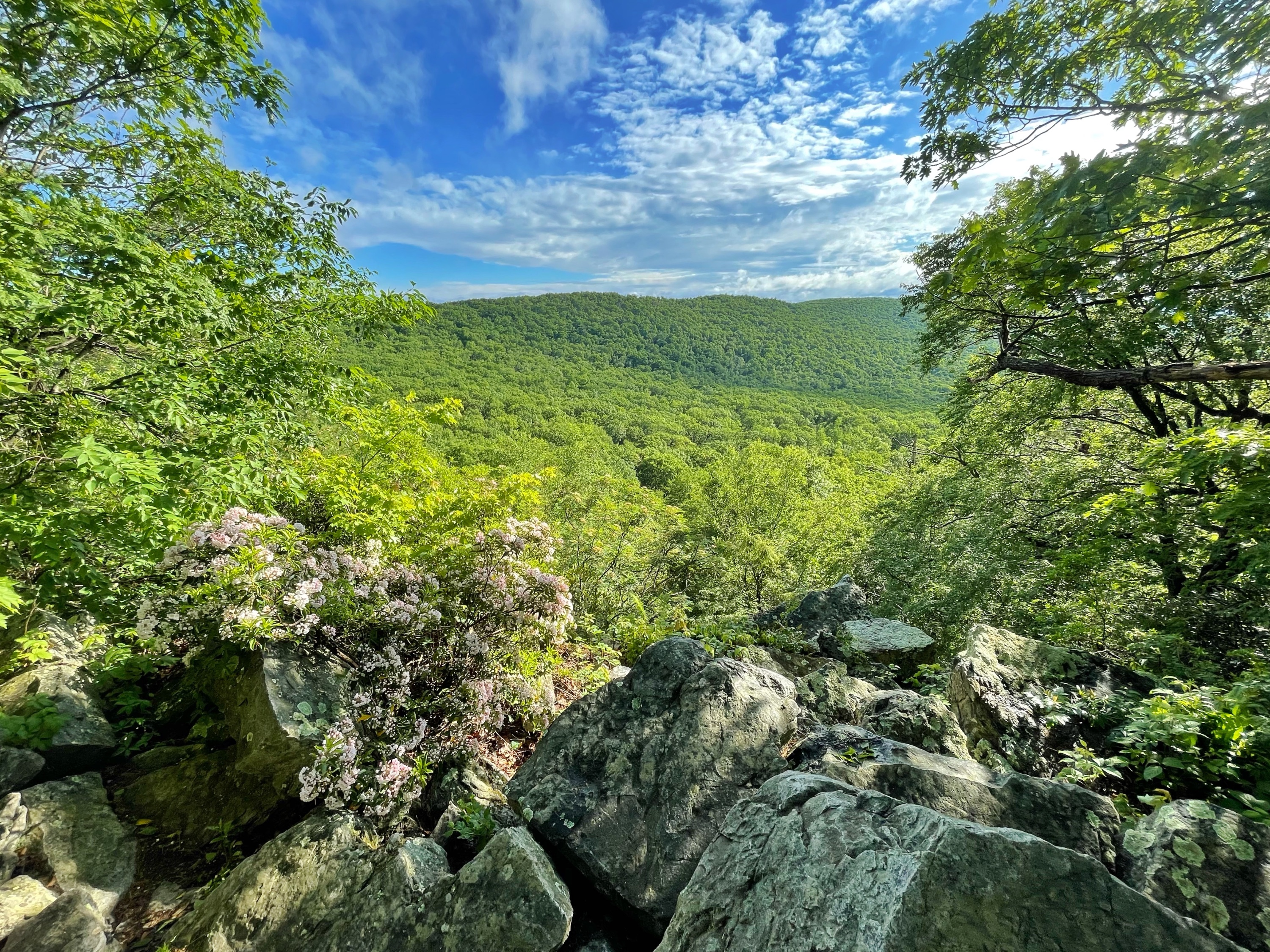
Ridge Overlook
Bald Lookout
After Bald Overlook, the trail splits. Stay left to follow the Lookout Trail for the easiest path to North Lookout. Or, go right to follow the Escarpment Trail which follows the ridge (which is what we did).
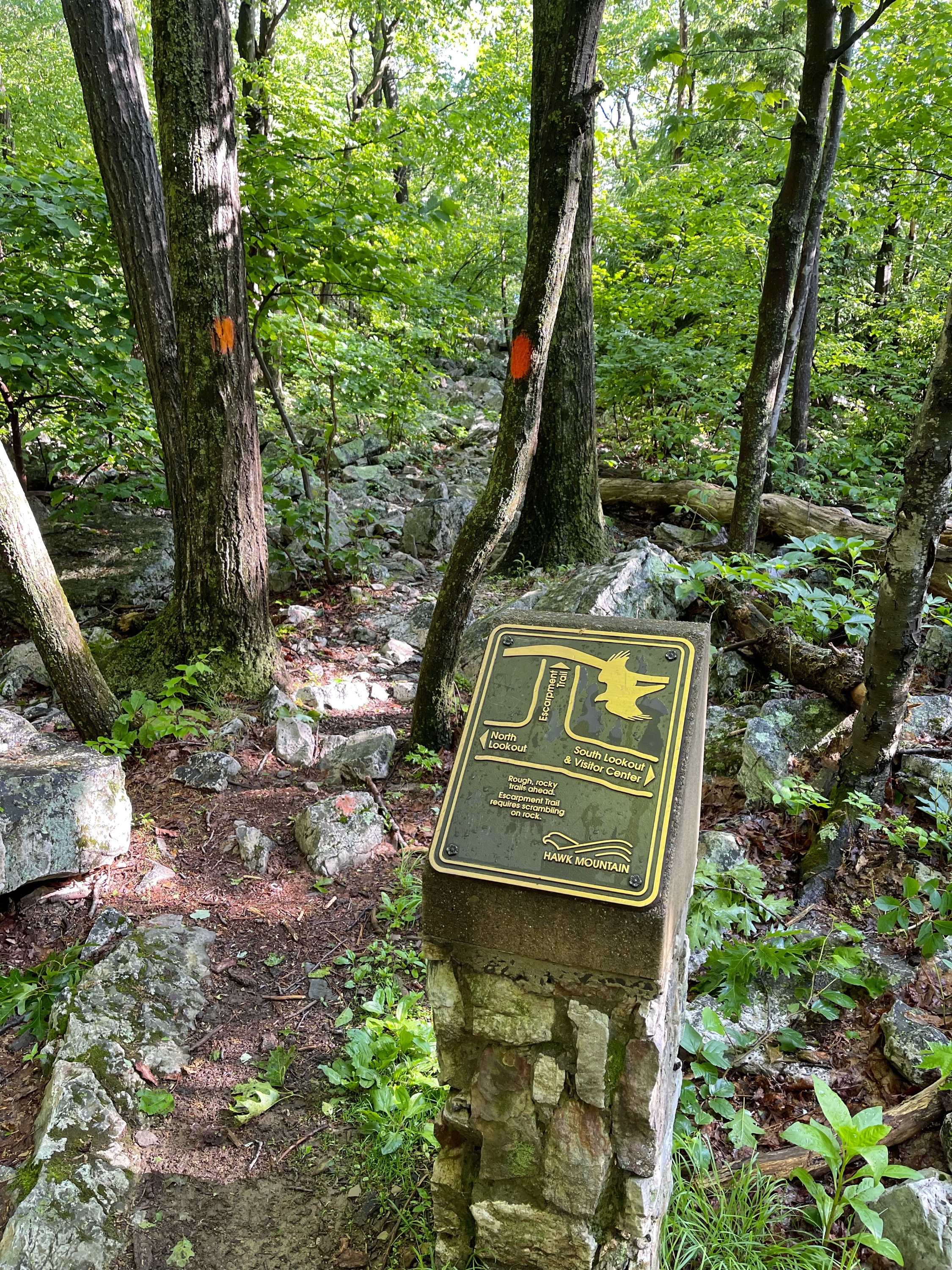
The Escarpment Trail is very rocky and requires some scrambling and use of your hands. I wouldn’t go this way if the rocks are wet.

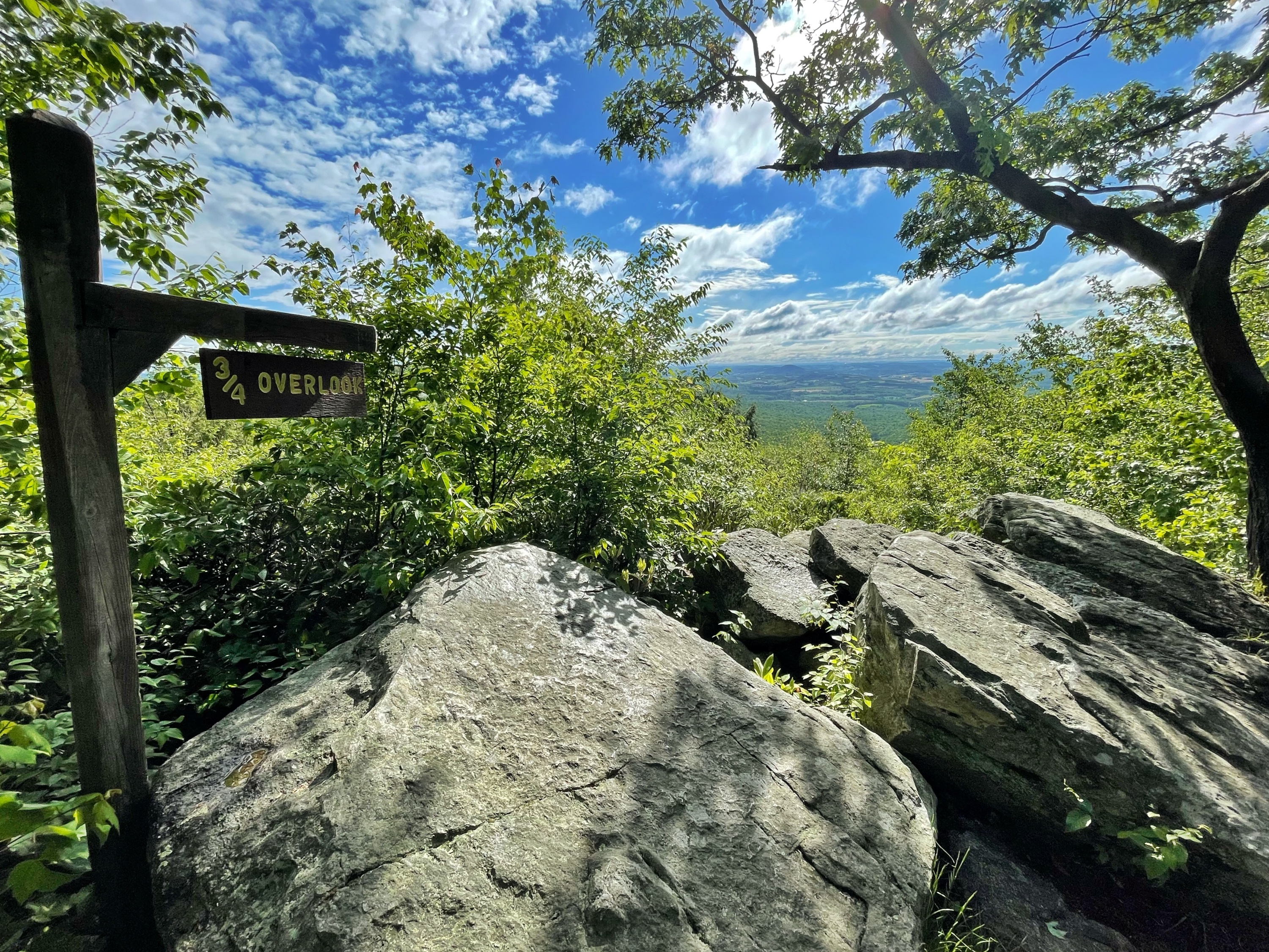
3/4 Overlook
The Escarpment Trail passes the 3/4 Overlook, which given all the tree overgrowth in the way is being kind of generous. If we’re being honest, it’s more like 1/2 Overlook.
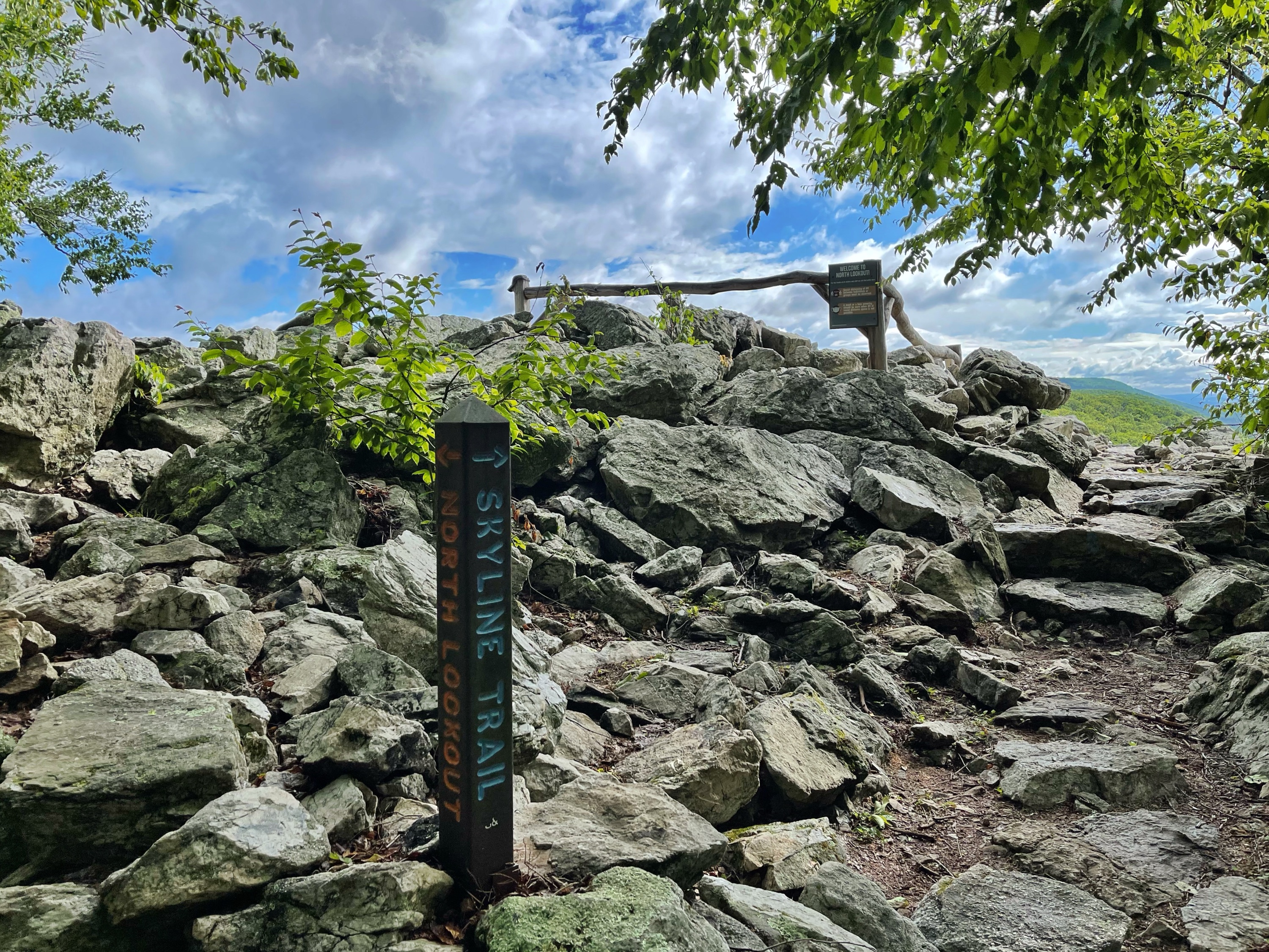
The trail rejoins the Lookout Trail at a junction with “Kettle View” which, has basically no view. Keep going a bit further and you’ll see a post indicating you’ve reached North Lookout.
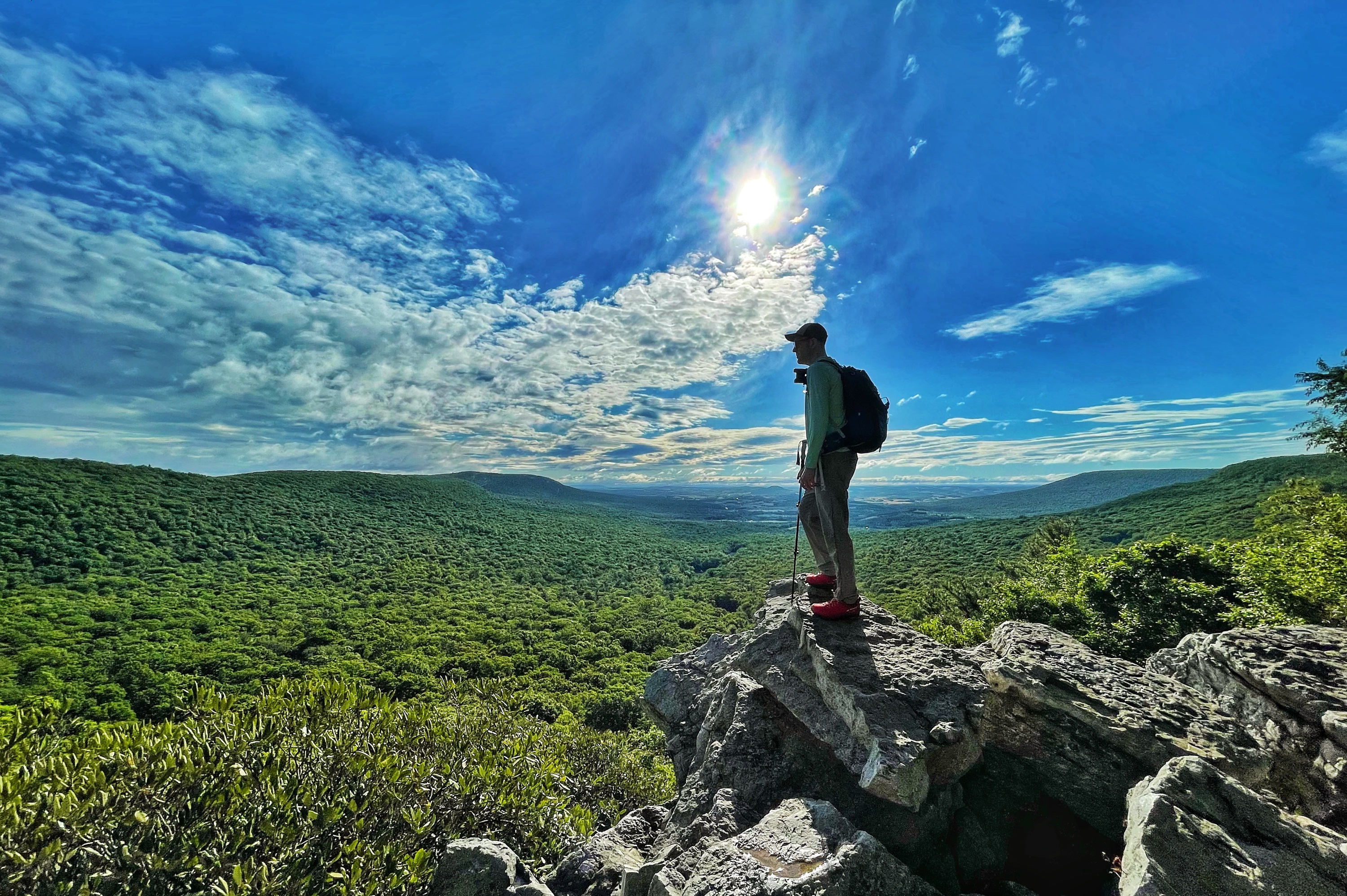
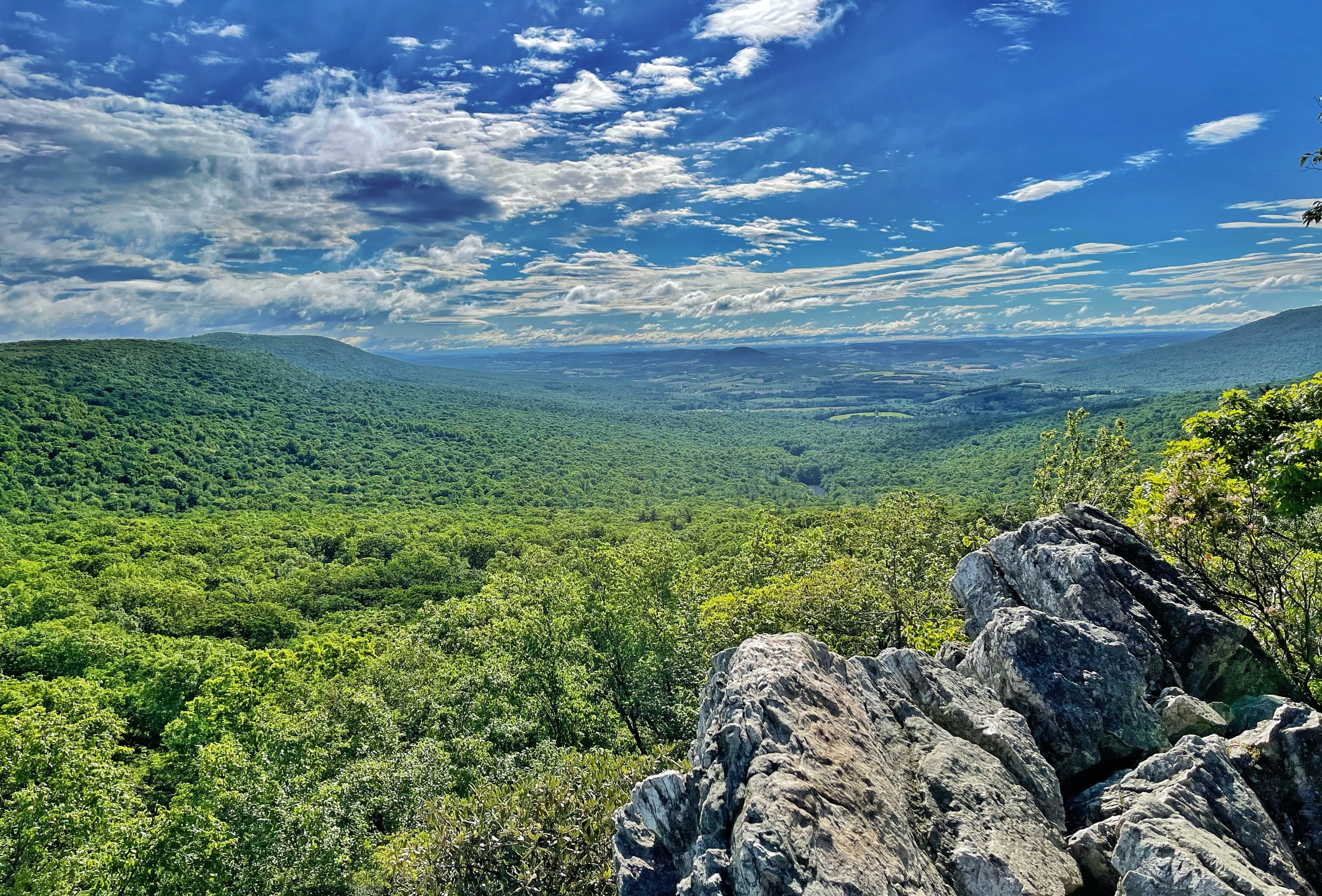
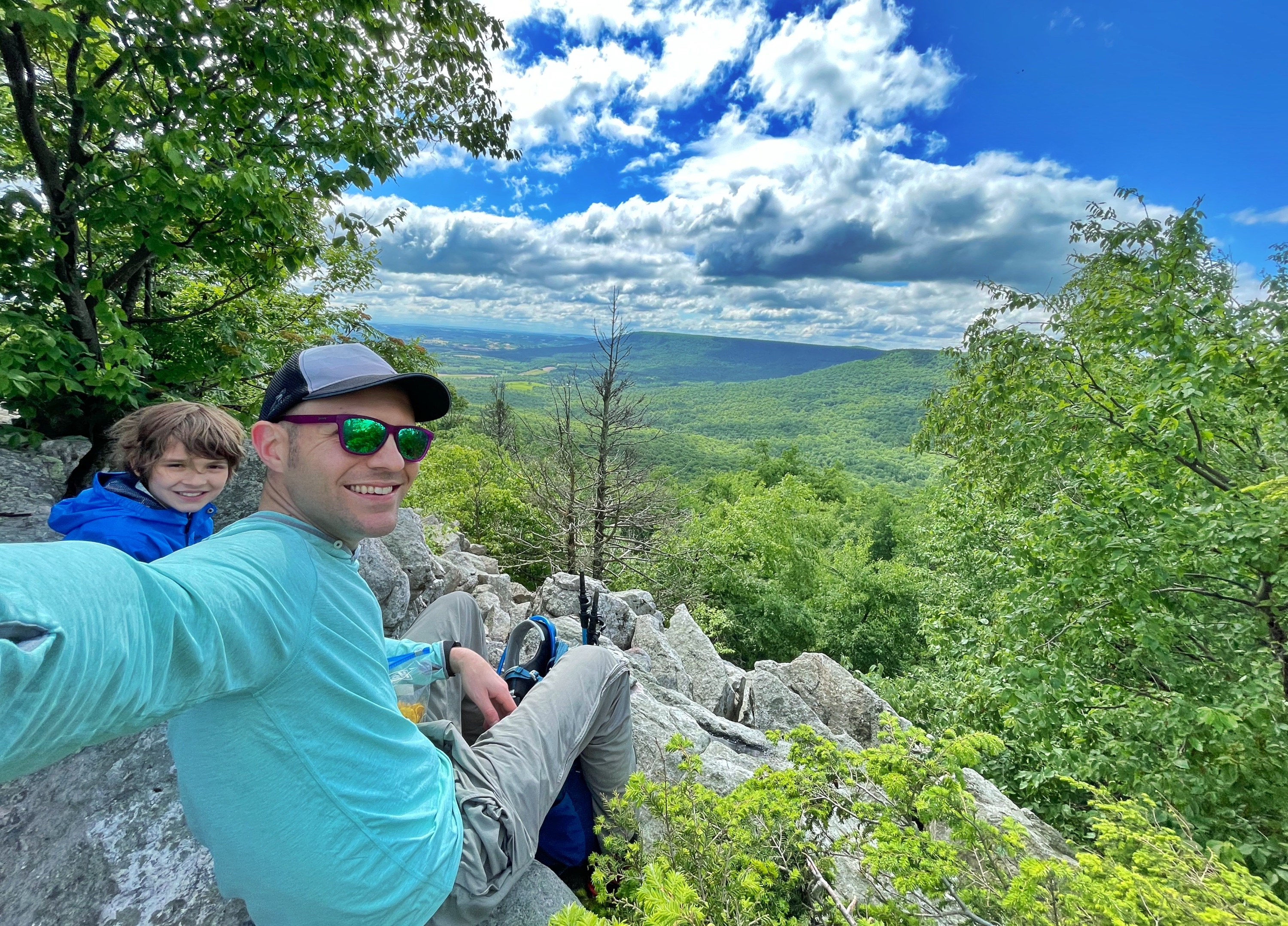
North Lookout
Brace yourself. You’re about to be treated, in my very humble opinion, to one of the best views – at least on the east coast.
-
-
Looking towards Kittatinny Ridge -
Fake owl
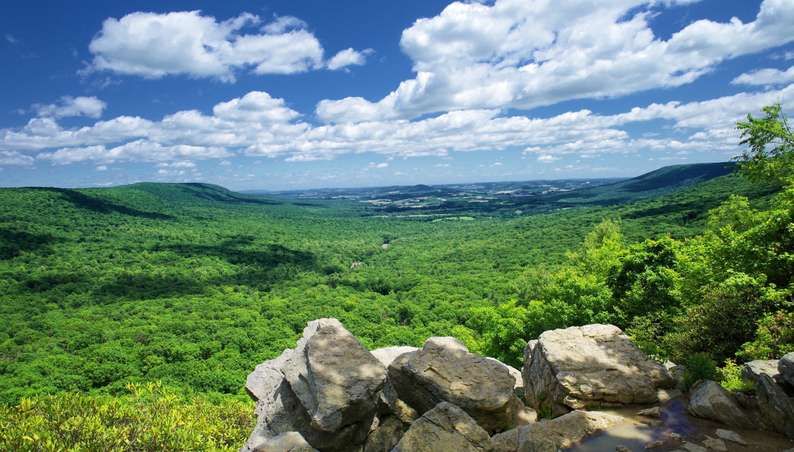
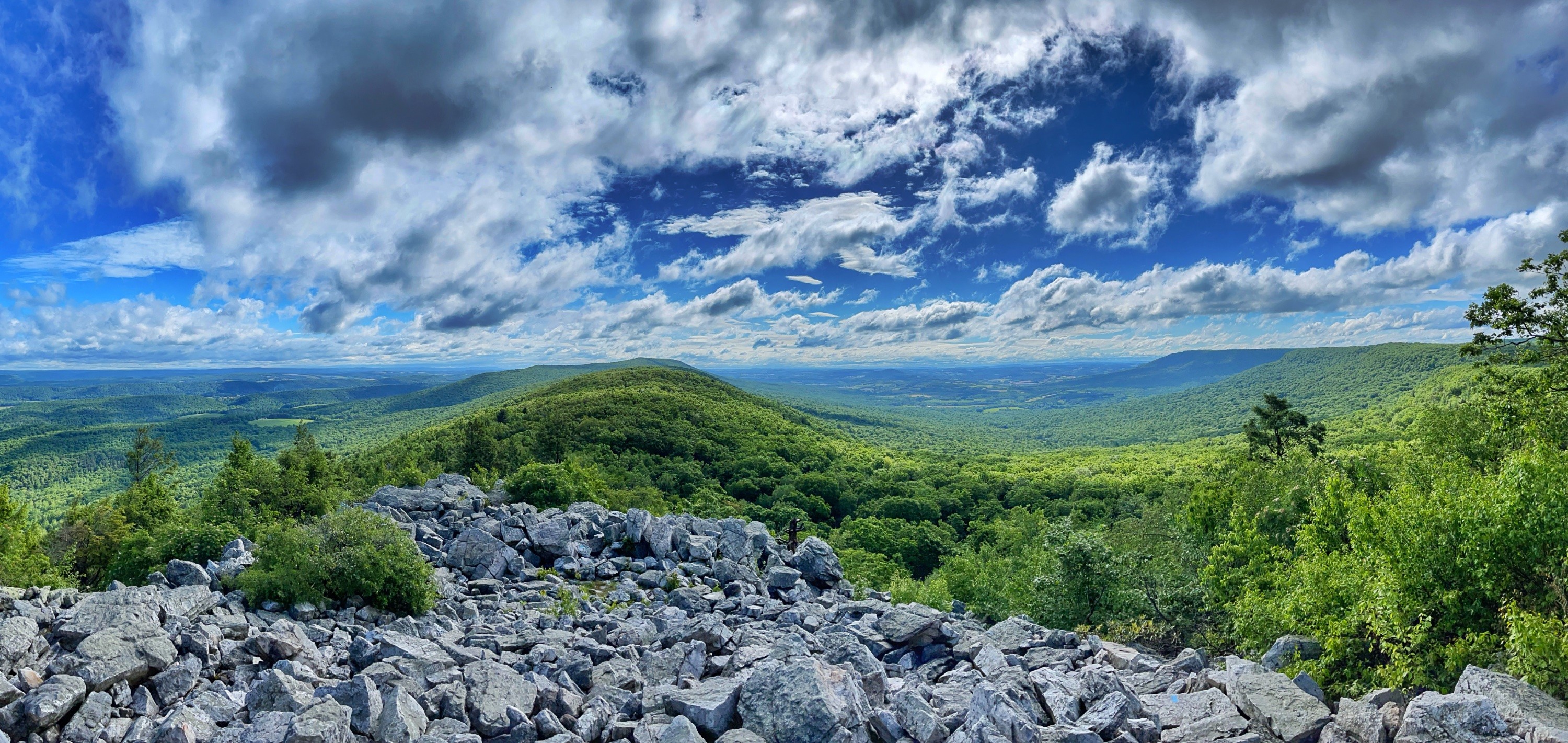
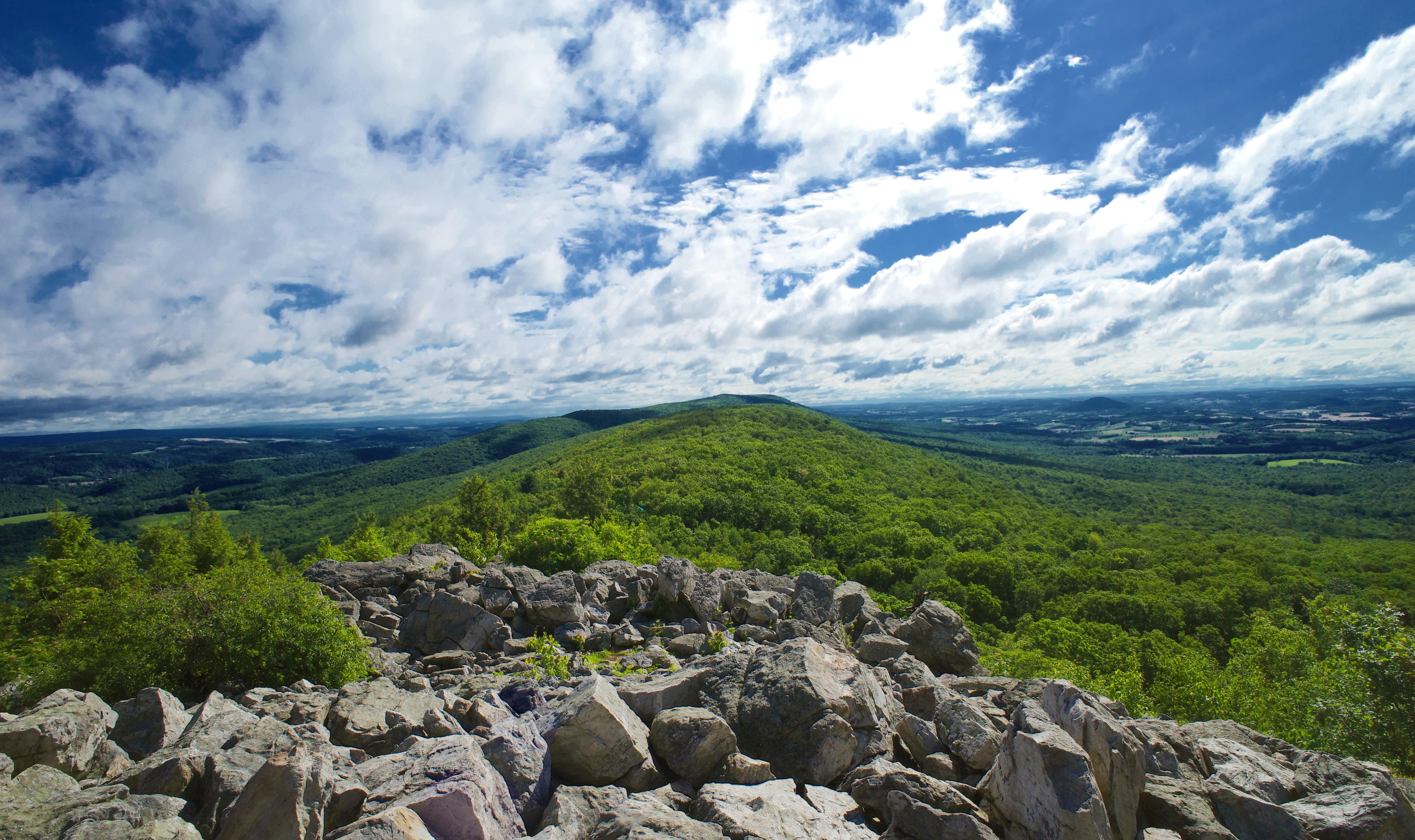
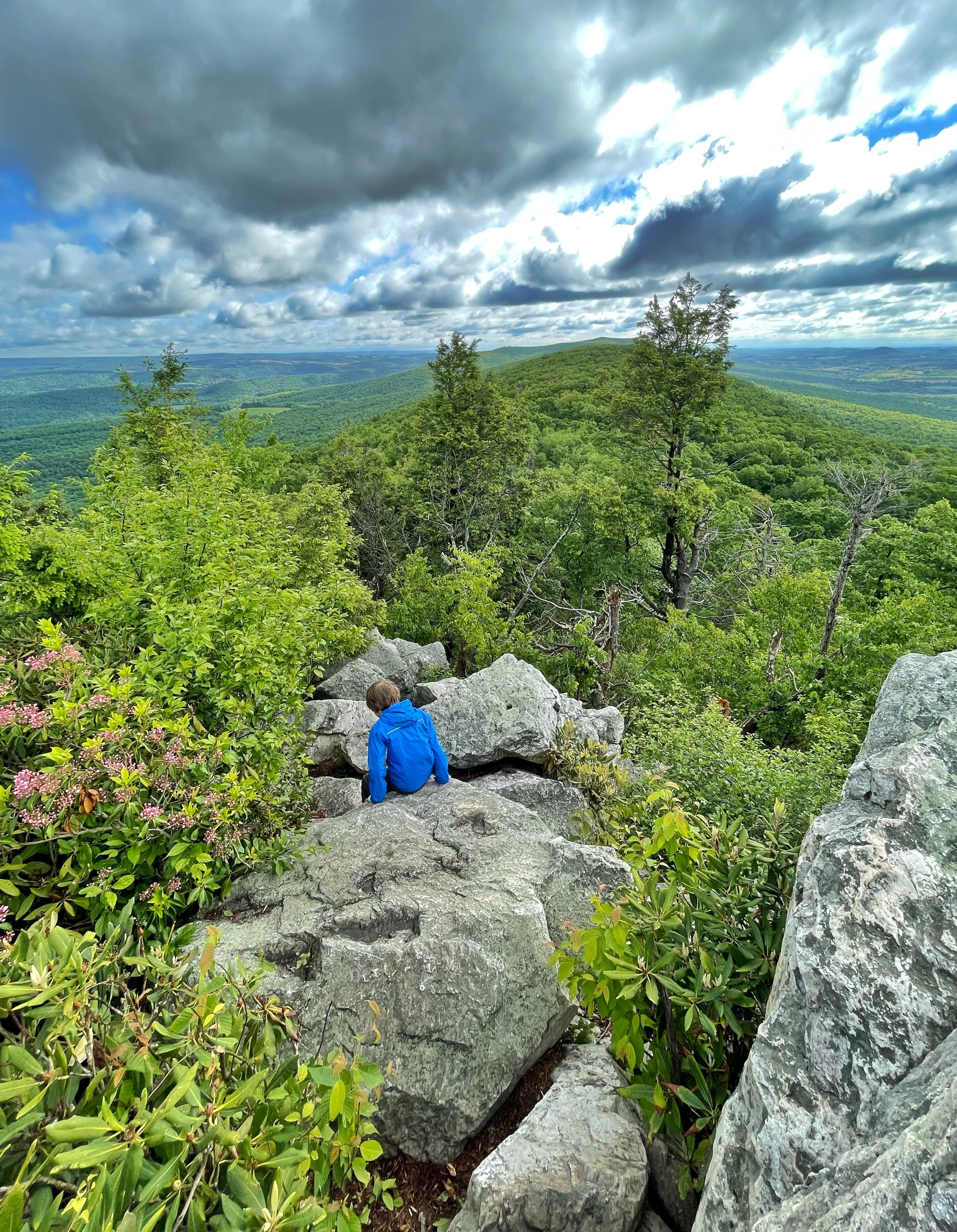
The North Lookout is an area covered in large boulders. To the north east are expansive views of the Kittatinny Ridge. On a clear day, the 200° panoramic view extends 70 miles. The series of folded mountains and valleys to the northwest is the Ridge-and-Valley Province of the central Appalachians. The Kittatinny is its most southeasterly ridge.
You may notice an owl perched atop a tall, limbless tree trunk. That’s not a real owl – it’s a decoy designed to attract raptors. After all, this is a prime raptor-watching spot and that’s why most people come here and why this place exists. But you’re here to hike it, so let’s carry on.
But first – a word of caution.
The trail ahead beyond this point is very rocky and not kid-friendly unless your kids are experienced hikers. If you took the Escarpment Trail to North Lookout, it’s similar to that. There are sections where scrambling and the use of both hands will be needed. In some parts – including at the very beginning – there are particularly steep drops. It will be slow going in parts and the next few miles will take longer than a regular hike. If the rocks are wet, they will obviously be slippery and I would not recommend it for most people.
If the warning above dissuaded you, this is a good spot to turn around and head back to the car. For most people with young kids, that’s probably the right choice. Otherwise, let’s carry on, and head straight ahead and slightly downhill along the boulders towards the big ridge ahead of you. Behind some large boulders you’ll find a sign for the blue-blazed Skyline Trail.
Skyline Trail
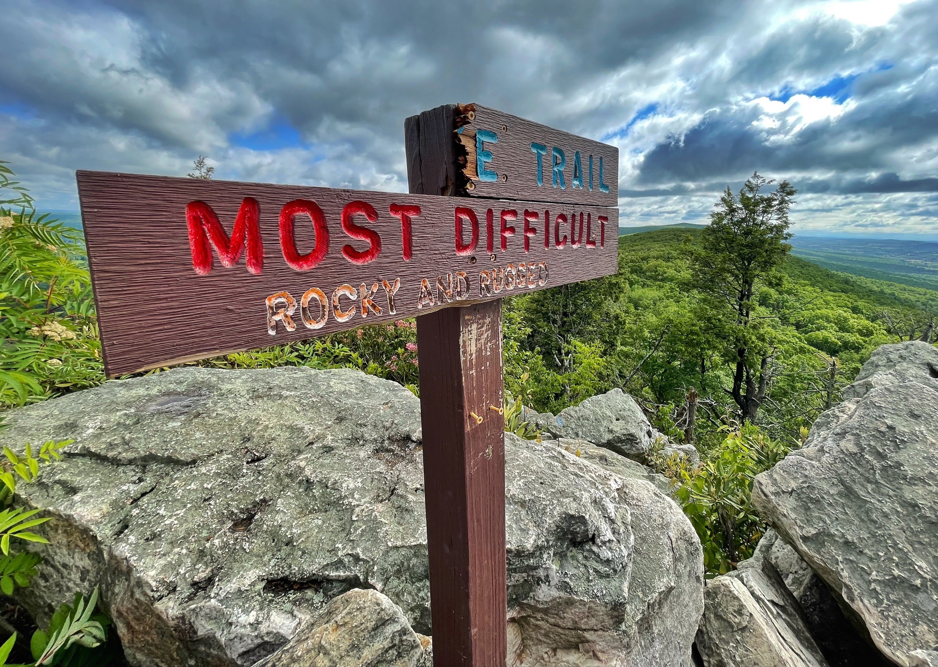
The sign warns that the trail is rocky and rugged – and it is. Immediately beyond this point, the trail goes steeply downhill and drops about 30 feet along these boulders. You’ll need to use your hands to get down.
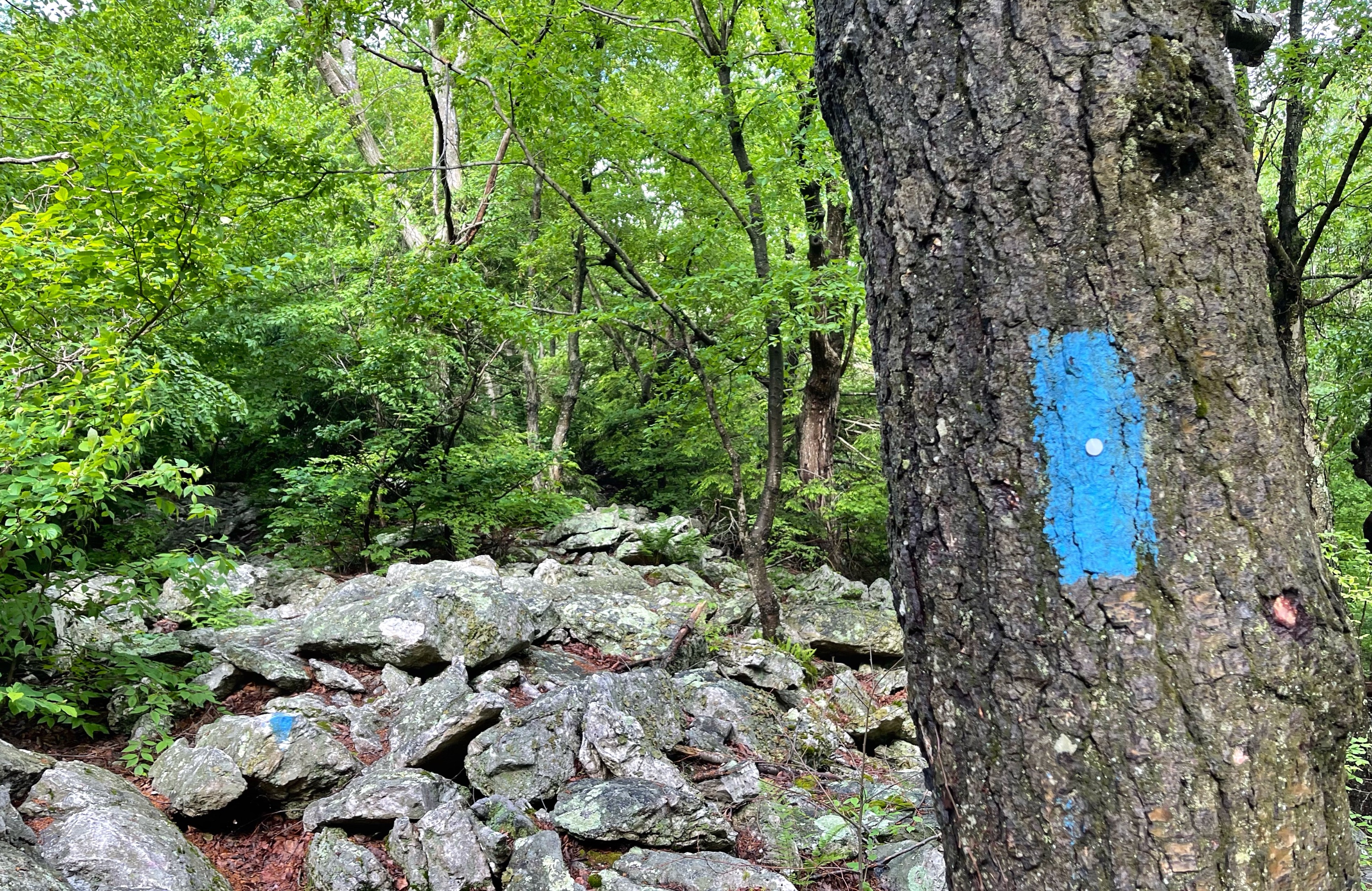
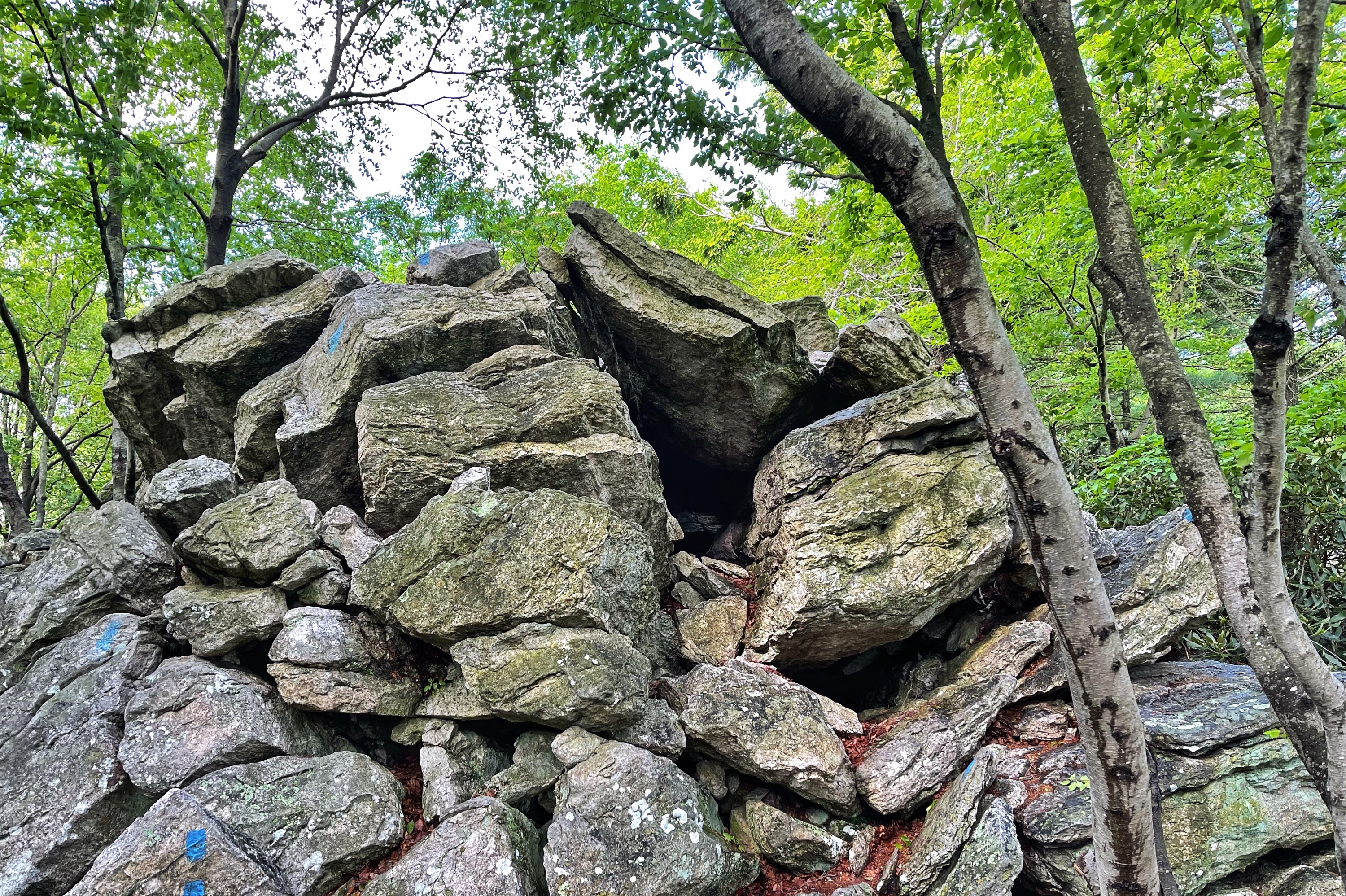
You’ll follow the blue blazes as the rocky trail descends. Along the way you’ll pass a cave-like pile of rocks.
After 0.44 miles, the trail reaches a junction where it’s joined by the yellow-blazed Golden Eagle Trail.
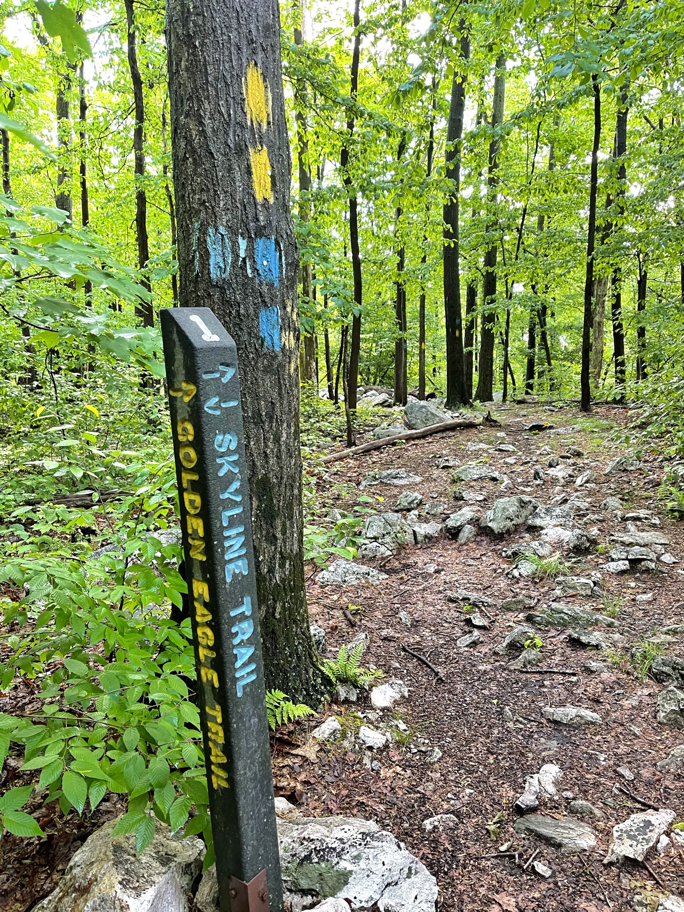
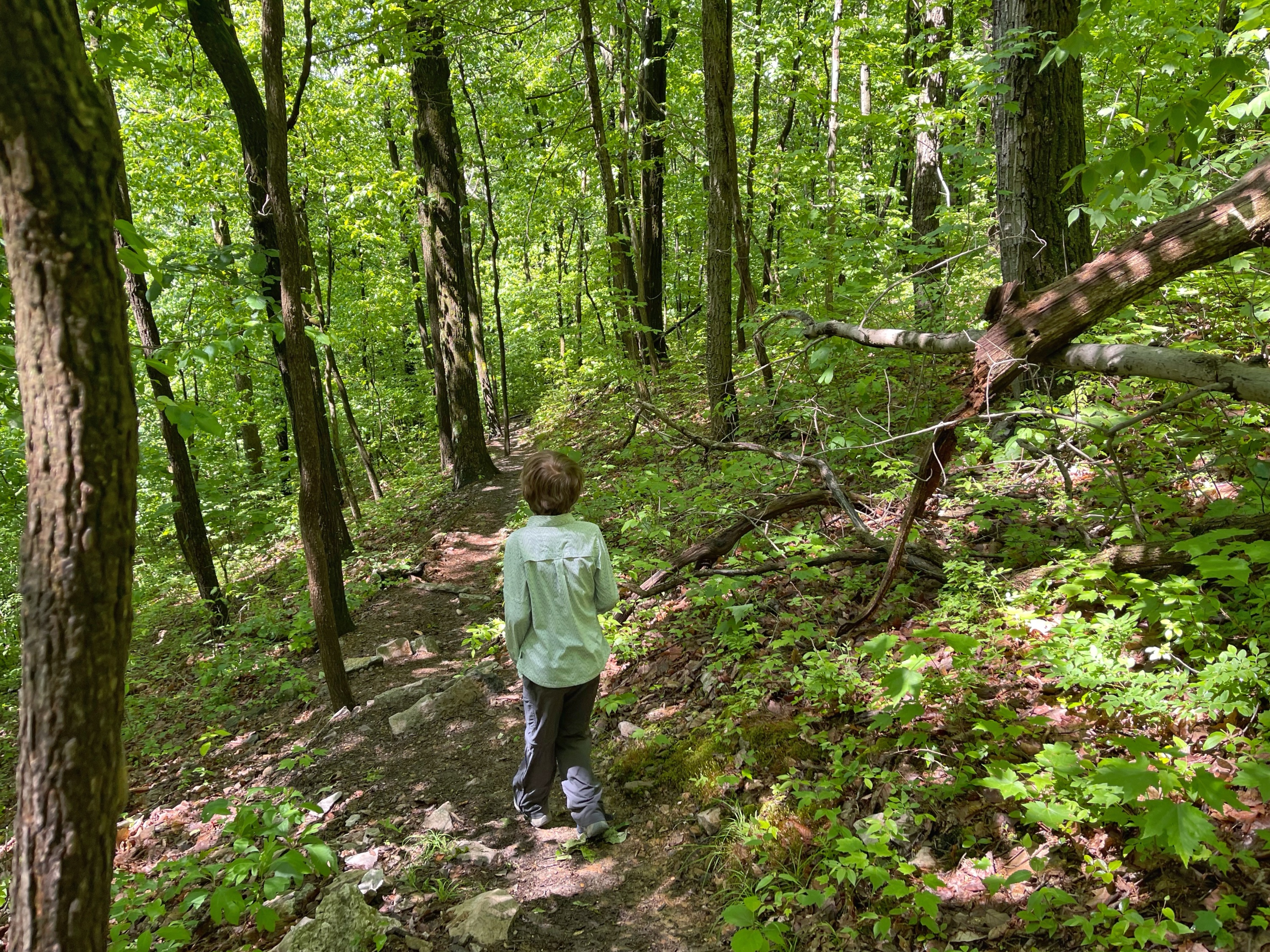
From here, the trail is co-blazed blue and yellow for the next 0.87 miles as it continues through forest and rocky sections.
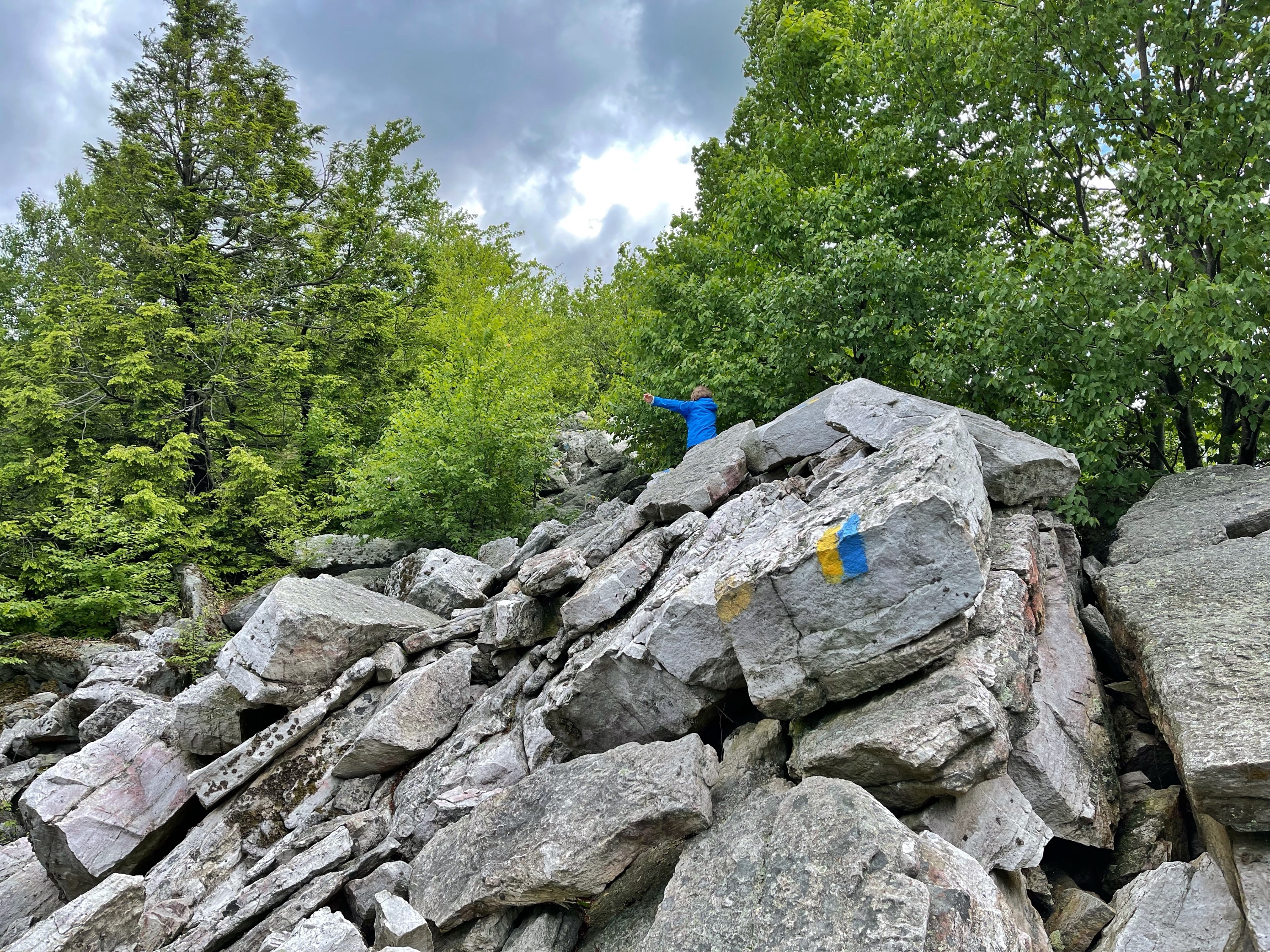
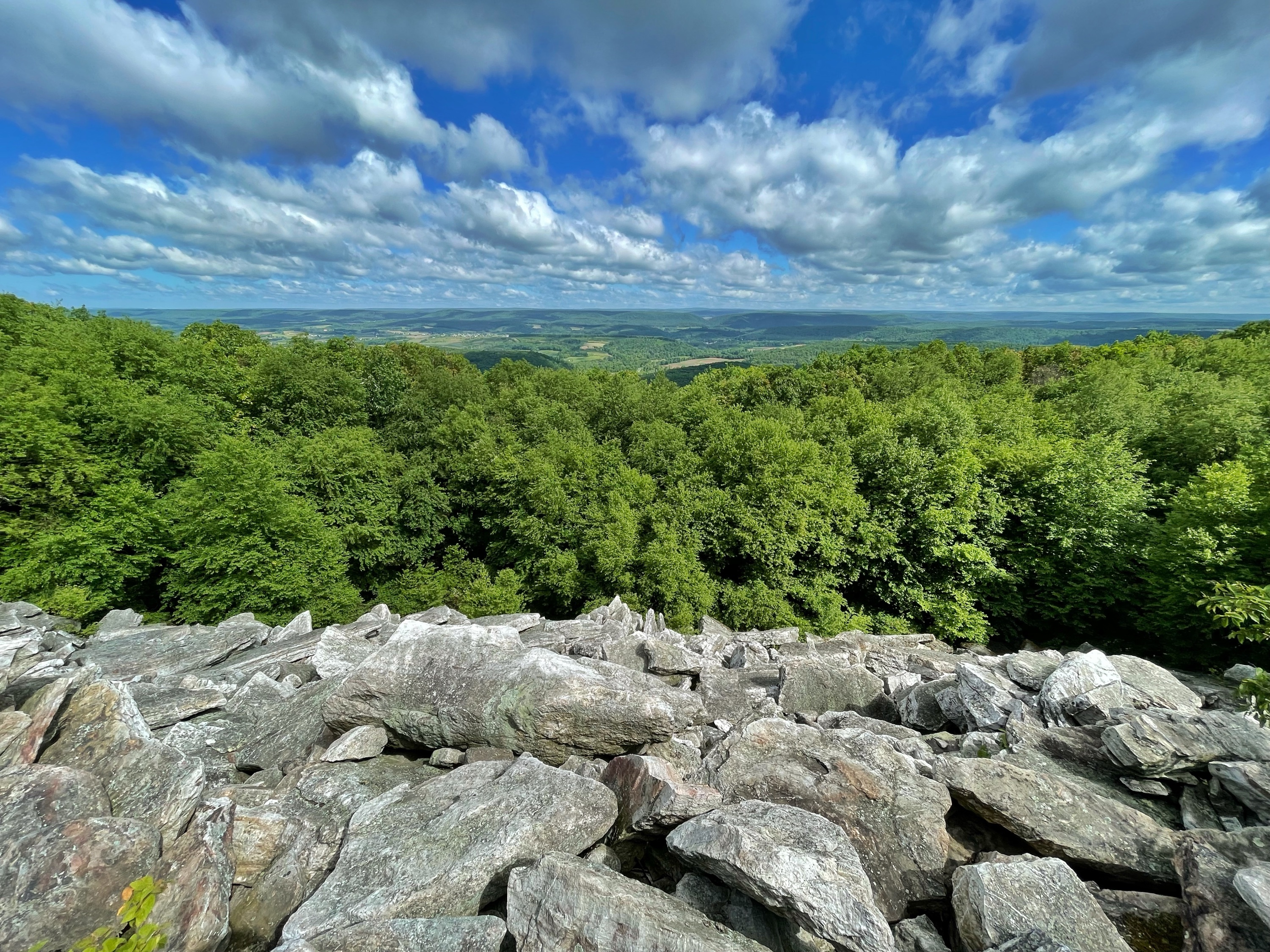
East Rocks
About half way through this section, you’ll reach East Rocks, a rocky ridgeline with alternating views to both sides of the ridge. This is a nice spot to take a break.
East Rocks is a sister summit of the beautiful and famous Hawk Mountain…This ridge is mostly Class 2 with some very interesting and uncommon Class 3 sections that make life fun. The ridge is mostly a large knife edge of talus strewn slopes that continue on for about a mile.
SummitPost
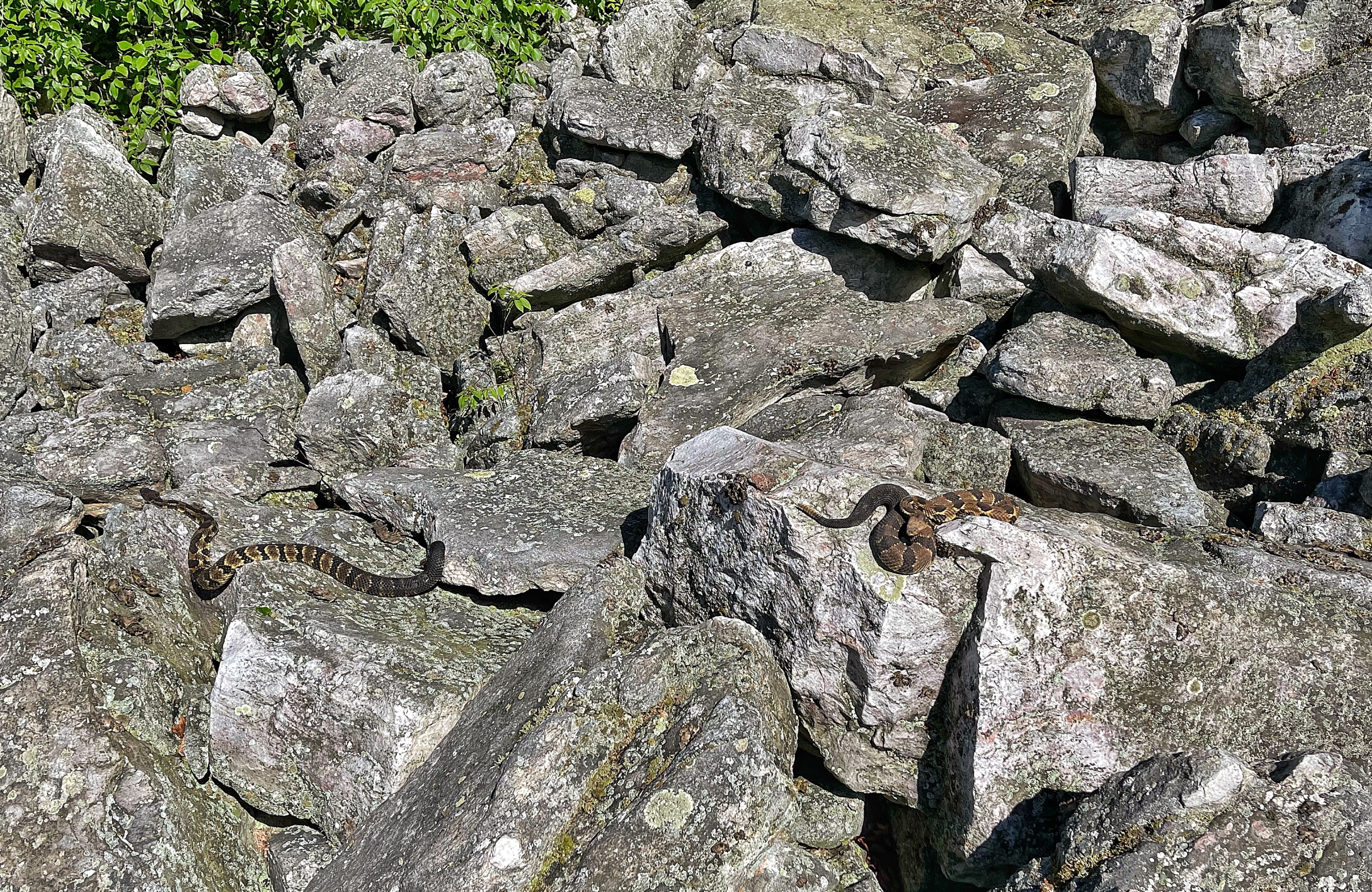
Rattlesnakes at East Rocks
We had heard that the area around East Rocks is prime timber rattlesnake habitat so we kept our eyes out – especially since we were using our hands a lot to navigate the boulders. Sure enough, when we reached East Rocks, just off the side of the trail was an area of boulders with no trees. A snake was lying on the rocks, soaking in the sun. Upon closer inspection, it was indeed a rattlesnake. And just a few feet to the side was a second rattlesnake, also sunbathing.
-
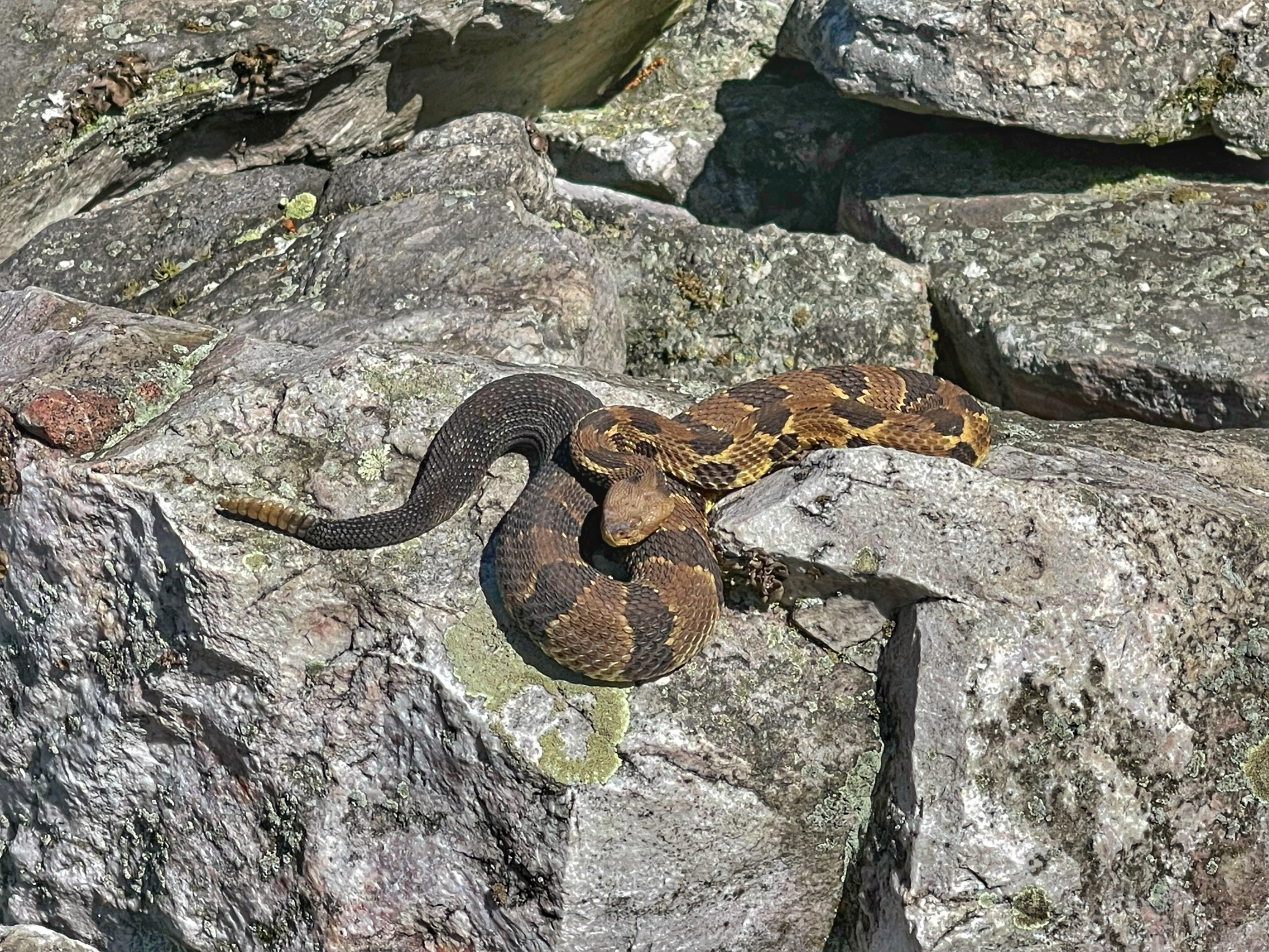
One rattlesnake -
Two rattlesnakes!
I then noticed a third snake off to the side, which turned out to be a copperhead.
If you see rattlesnakes, leave them alone. They’re generally docile and won’t bother you unless they feel provoked.
Golden Eagle Trail
About a half mile beyond East Rocks, the trail reaches a junction where the Golden Eagle Trail splits off to the right as the Skyline Trail continues straight. Turn right here to follow the Golden Eagle Trail.

The trail descends steeply through forest towards the valley.
After 0.83 miles, you’ll reach a junction with the River of Rocks Trail.
River of Rocks

Note: this is not the River of Rocks Trail – the trail goes around the River of Rocks
Turn left onto the River of Rocks Trail – a very rocky trail – to make a 0.9 mile loop around the River of Rocks – an Ice-Age boulder field. Although it’s not visible, a small stream (Kettle Creek) – which can be heard if you listen closely – flows under it in spring from snowmelt.
The River of Rocks lies in the valley below South Lookout. The field is a mile long, 30-400 feet wide, and lies at a gradient of 3-12 degrees. The field formed during the last Ice Age. During this time, local vegetation was sparse and extreme climate conditions resulted in repeated freeze and thaw cycles. Under periglacial conditions, water seeped into fractures in the rocks and expanded upon freezing. Eventually the cracks enlarged and broke up the Tuscorora sandstone into large boulders. These boulders alowly slid wit h mud and ice downslope to their present position by a process known as solifluction. This process occurs when boulders slide on a water-logged surface underlain by perfanently frozen ground (permafrost). With time some of the boulders became covered with debris and plant life. A small stream under the rocks has removed finer particles leaving areas of bare rock exposed. The materials being washed away are being deposited in the ocean and may be the source of materials for another mountain building period.
Hawk Mountain Geology
The trail goes around but doesn’t actually go through the River of Rocks. At a few points, it comes close to it, and the River of Rocks is visible from the trail. You’ll need to step off-trail a short distance to actually reach the River of Rocks.
After a 0.9 mile loop, the River of Rocks Trail reaches a junction with the Golden Eagle Trail. Turn right, follow the Golden Eagle Trail for a few feet, and then turn left to follow the River of Rocks Trail west again. The trail continues to skirt the side of River of Rocks. As you go further west, there are some easier access points to the River of Rocks.
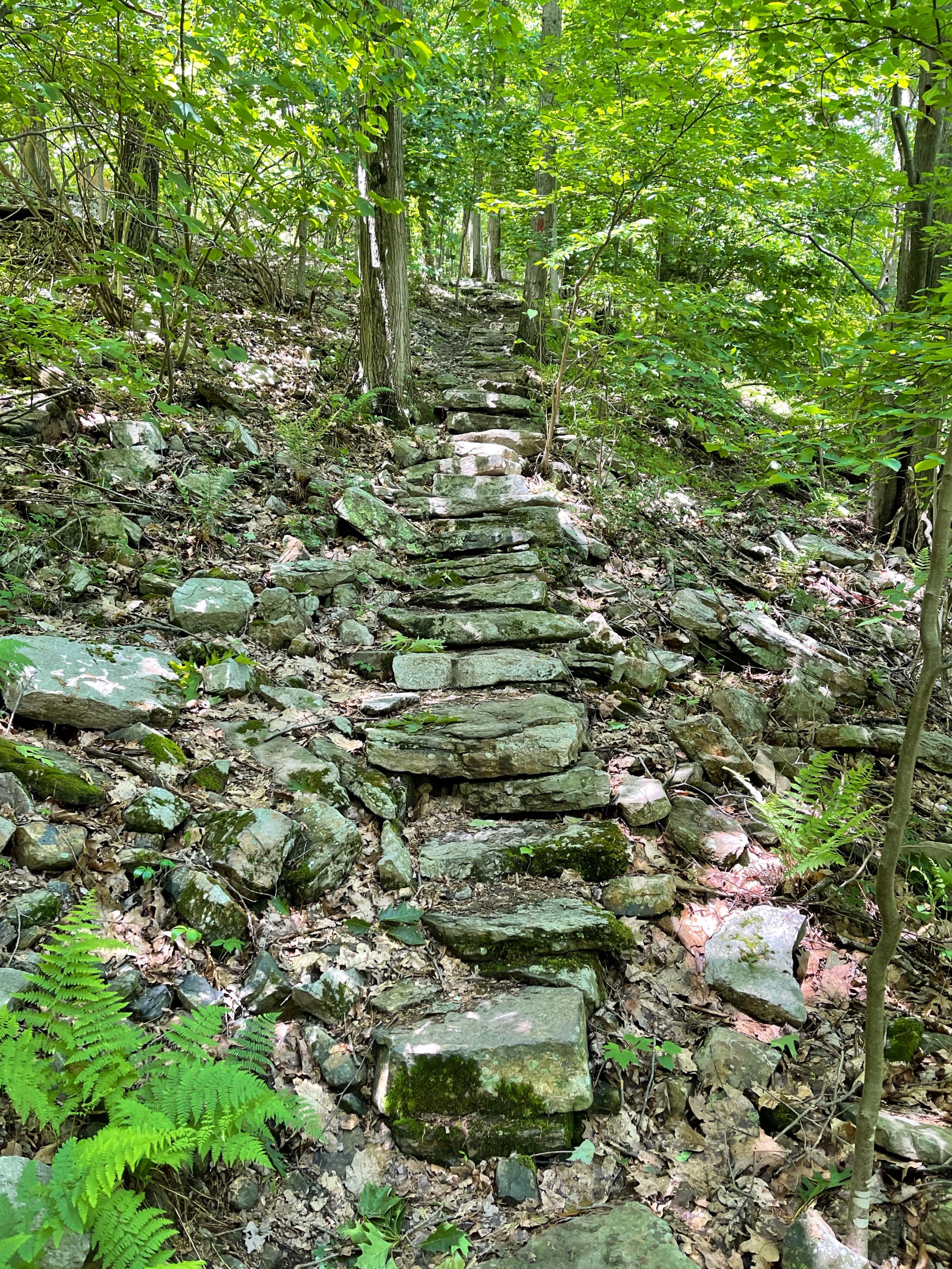
Finally, the River of Rocks Trail will climb -at first gradually and then more steeply – as it makes its way up the mountain and back towards South Lookout. Once you reach a part of the trail with stone stairs, you are close to the top.
The trail finally reaches South Lookout, at which point you should turn left to follow the well-groomed Lookout Trail down the hill and back to the parking area.


