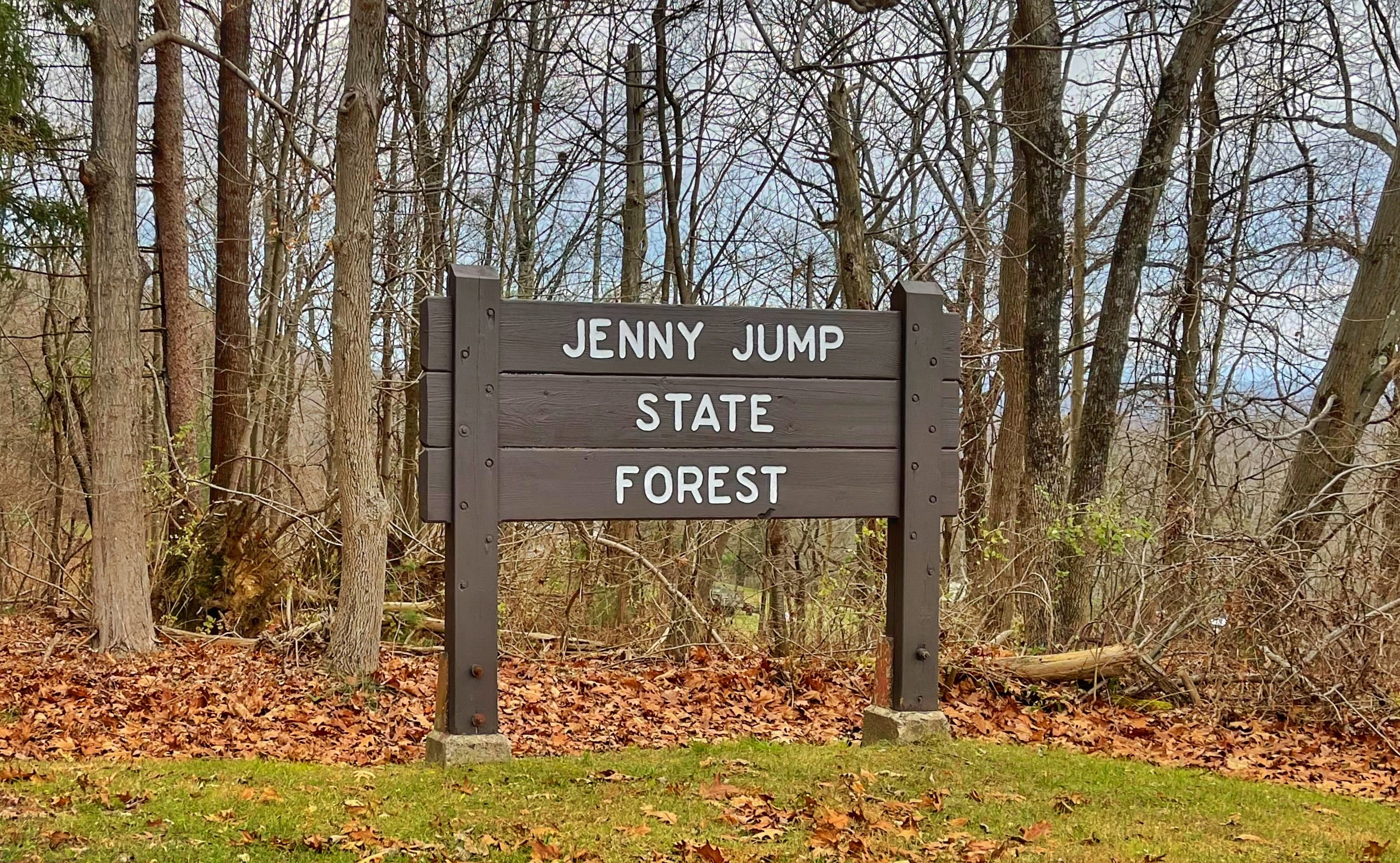
Overview: Featuring panoramic vistas along rocky outcroppings, glacial erratics, a lake, and caves, this hike in Jenny Jump State Forest is full of views, legend, and history.
Note: The full 5-6 mile hike may be difficult for most kids, but it can be shortened by going out-and-back as far as you want. If you’re interested mainly in the lake and cave, park at the parking lot on Shade of Death Road.
Jenny Jump? What’s up with the name?
The Legend of Jenny Jump: The area around Jenny Jump State Forest was inhabited by the Minsi (Wolf) tribe of the Lenni Lenape (the People). These American Indians were hunter-gatherers who lived in a woodland culture. Though relatively peaceful compared to their Iroquois neighbors to the north, the Lenape were known to have conflicts with the European settlers. The conflicts were usually the result of perceived wrongs by either the settlers or the Lenape.
It is in this environment that the legend of the Jenny Jump grew. Perhaps entirely myth, perhaps based on some fact, the legend was recorded by Swedish missionary Sven Roseen in 1747. According to the legend, Jenny, who was gathering strawberries, jumped off the ridge when her father saw Indians approaching and yelled to her to jump.
Some versions say she died, others that she survived. However, it is also possible that the name “Jenny Jump” is the anglicized version of a Lenape name of the mountain and that the legend is sprung up to explain it afterwards.
NJ Division of Parks & Forests Handout
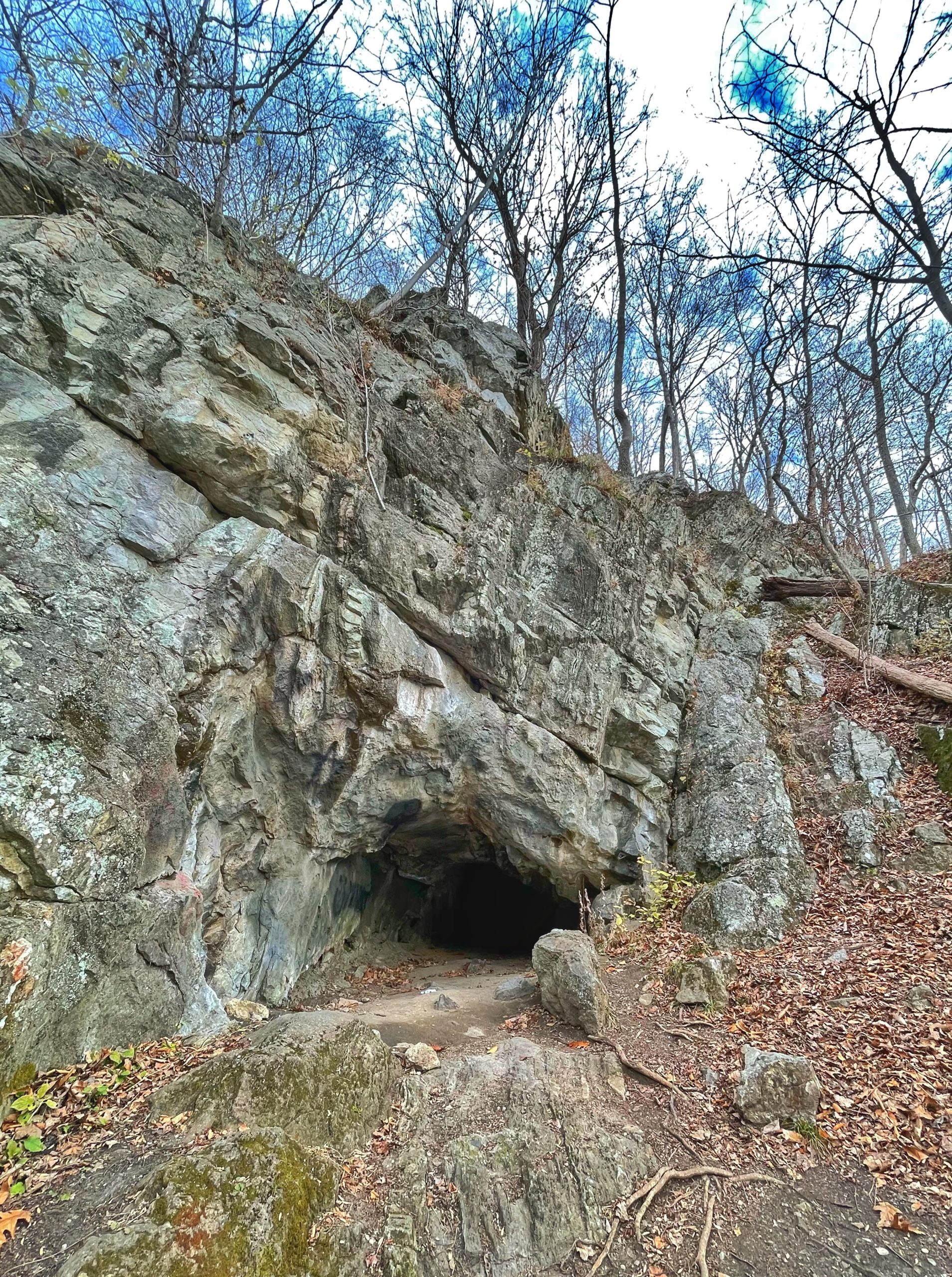
About the Fairy Hole cave (aka Faery Hole Rock Shelter/Faery Hole cave)
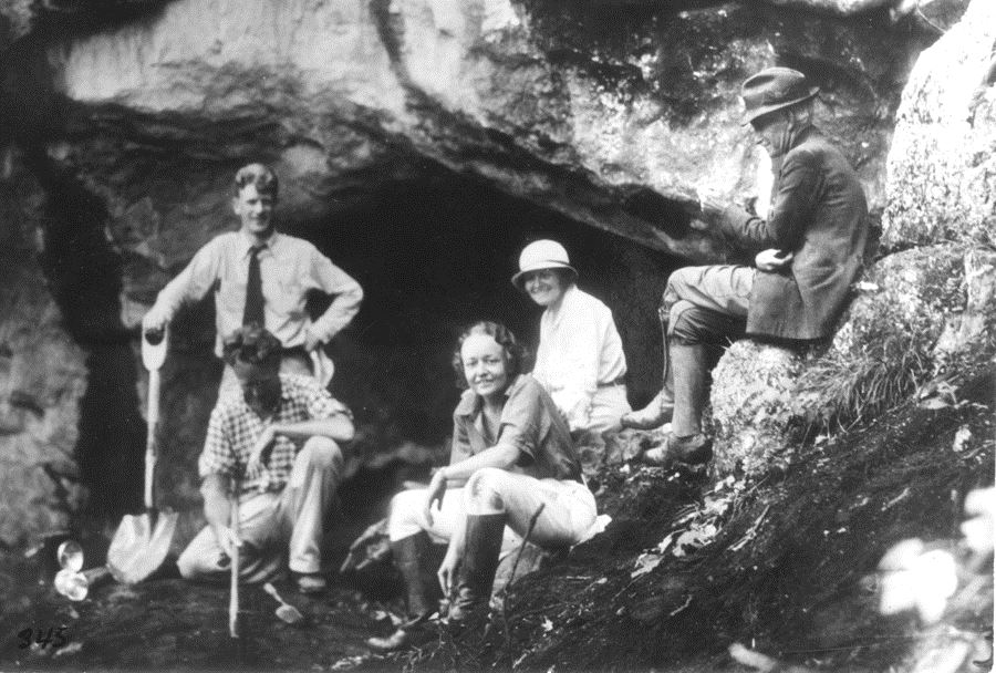
at Faery Hole Rock Shelter, 1936.
In 1936, archeologist Dr. Dorothy Cross led the excavation of the “Faery Hole Rock Shelter” and surrounding area as part of the Indian Site Survey of New Jersey. They not only found Lenape Indian artifacts and other evidence of their occupation, but also uncovered thousands of bones and fragments representing 23 mammal species, including a tooth of the massive extinct Castoroide (Giant Beaver).
Cave Description:
“It is 15 feet wide, 30 feet long, and 6 feet high at the entrance which is roughly semi-circular. It narrows considerably about 15 feet from the entrance; and 24 feet from the entrance it makes practically a 90° turn to the right where it terminates by two shafts running upward at angles of 45° and 70° respectively.
Bulletin of the National Speleological Society, Issue 7, December 1945
Hike Length: 5.1 miles to Ghost Lake (extra 0.8 miles out and back to Fairy Hole cave)
Elevation gain: +1,212′

Location: Jenny Jump State Forest, Warren County, NJ
Parking: Park at the parking trailhead parking lot for the Summit and Swamp trails (Google maps). There are public restrooms here, too.

Maps:
-
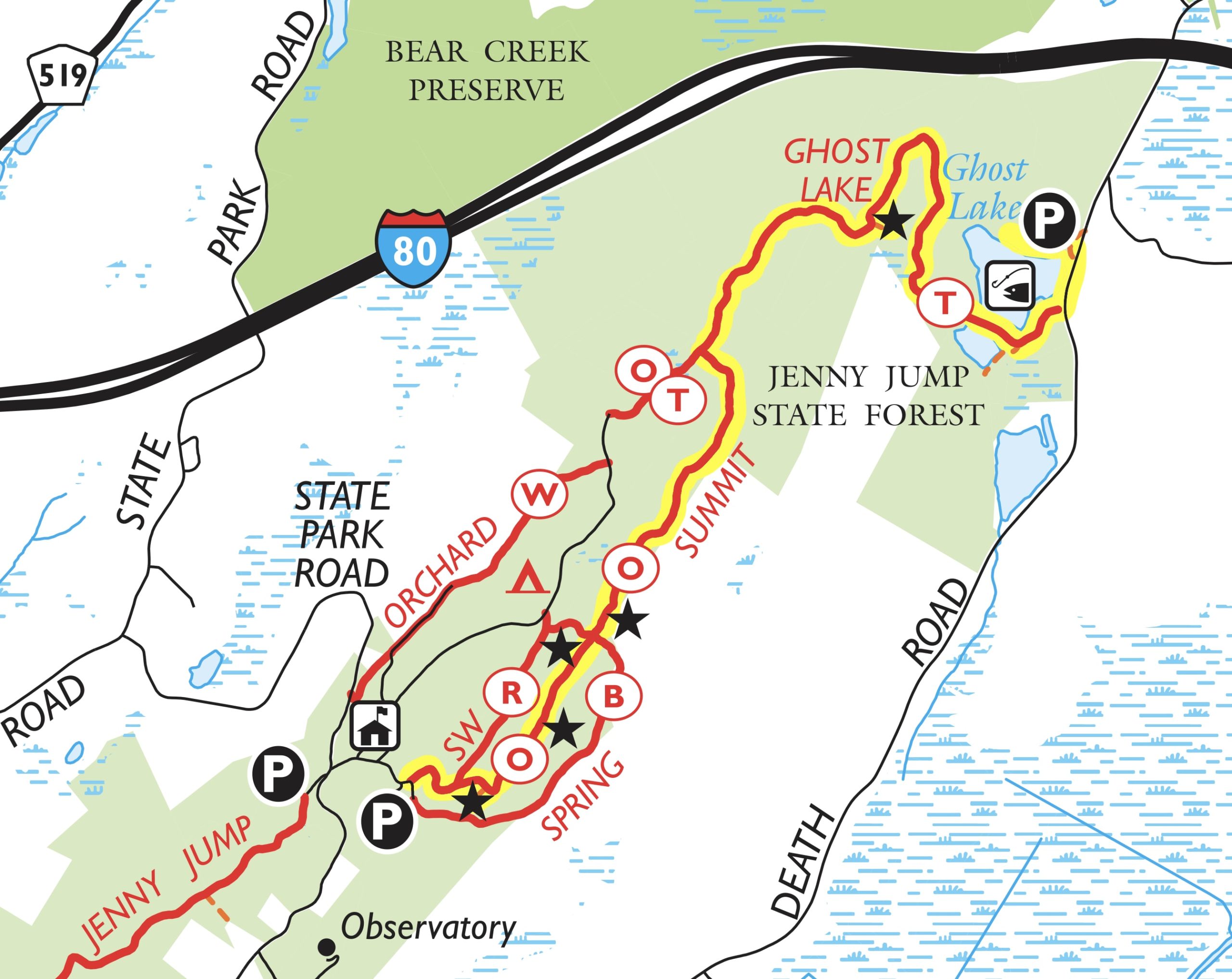
Overview trail map -
Detail of Summit Trail
- Jenny Jump State Forest – NY-NJ Trail Conference – (pdf, best map)
- Jenny Jump State Forest – NY-NJ Trail Conference – (Avenza – free)
- Jenny Jump State Forest – NJ Division of Parks and Forestry (pdf)
Trail description:
(partially borrowed from Daniel Chazin’s description for the NY-NJ Trail Conference)
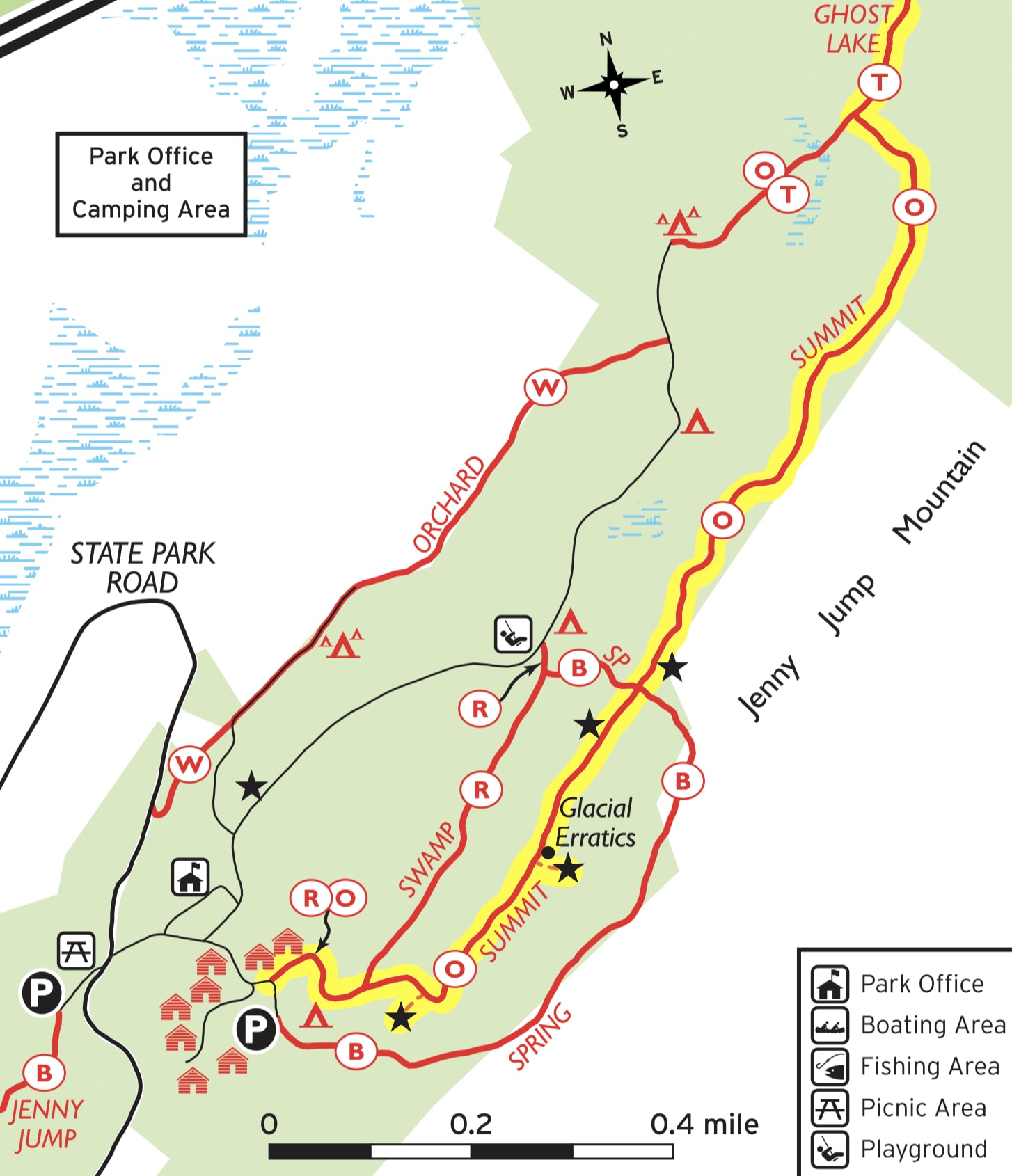
From the parking area, look for the sign marking the trailhead of the Summit and Swamp Trails.
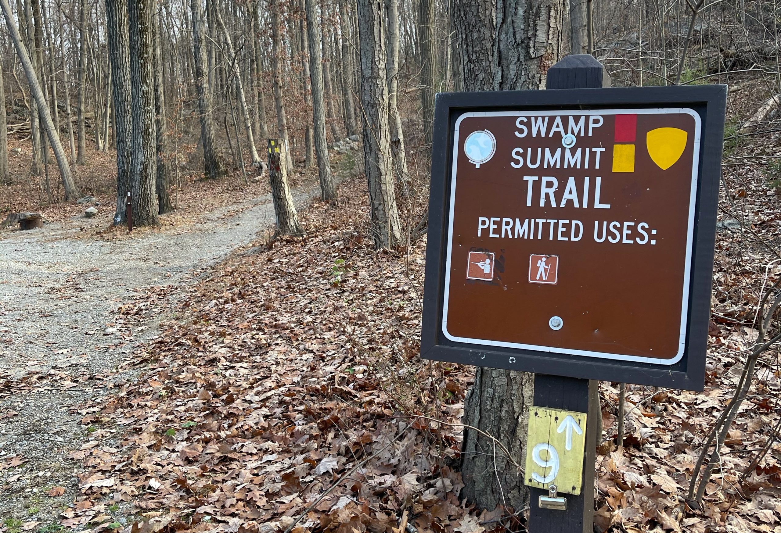
Follow the yellow and red blazes along a woods road, passing two cabins (designated by the park as “camp shelters”) to the left. Just beyond, the road begins to climb and bears right at a fork.
After passing Campsite #9 to the right, you’ll come to a junction (marked by a signpost). Here the red-blazed Swamp Trail forks to the left.
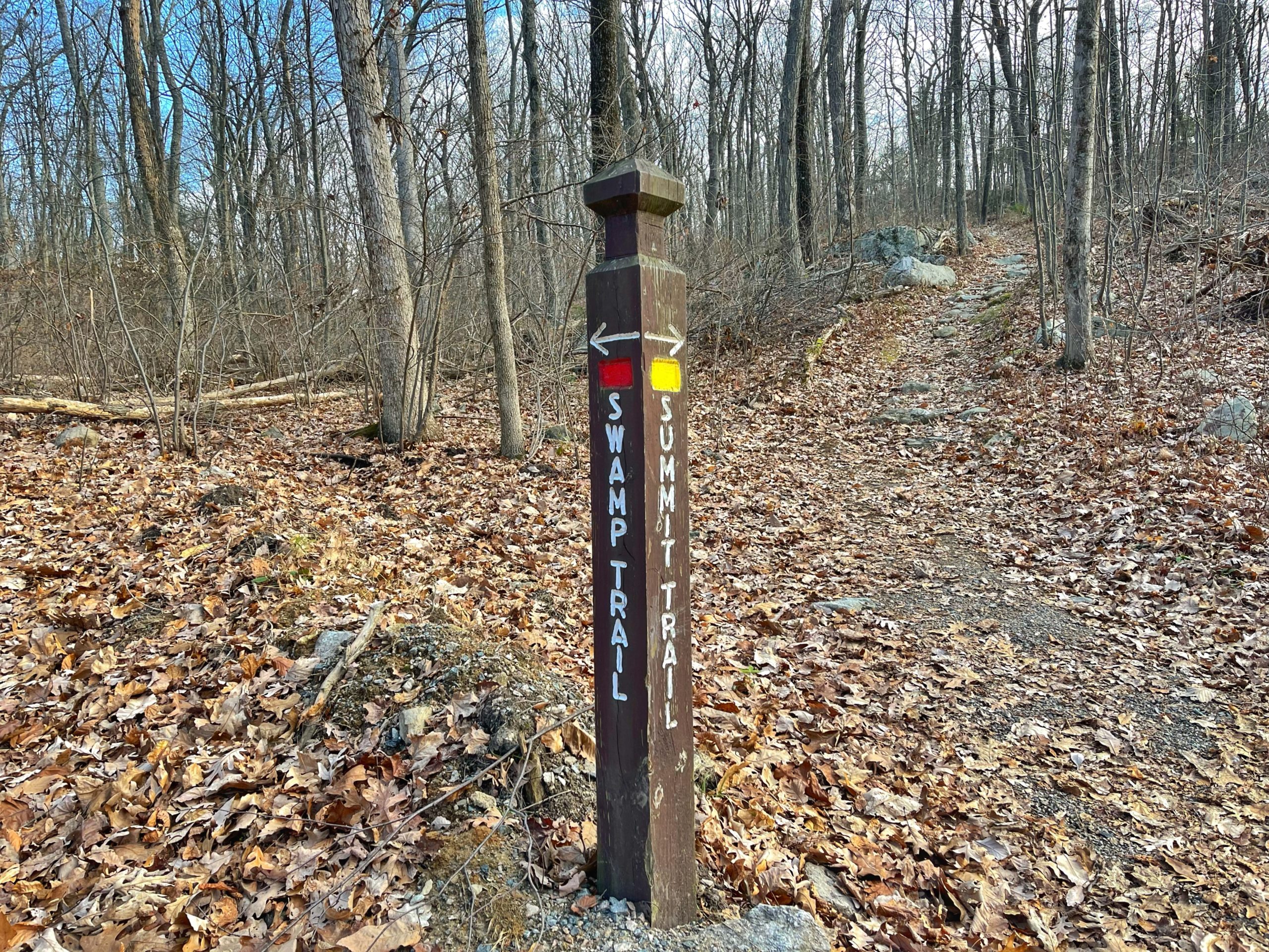
Bear right to continue on the yellow-blazed Summit Trail, which soon resumes its climb.
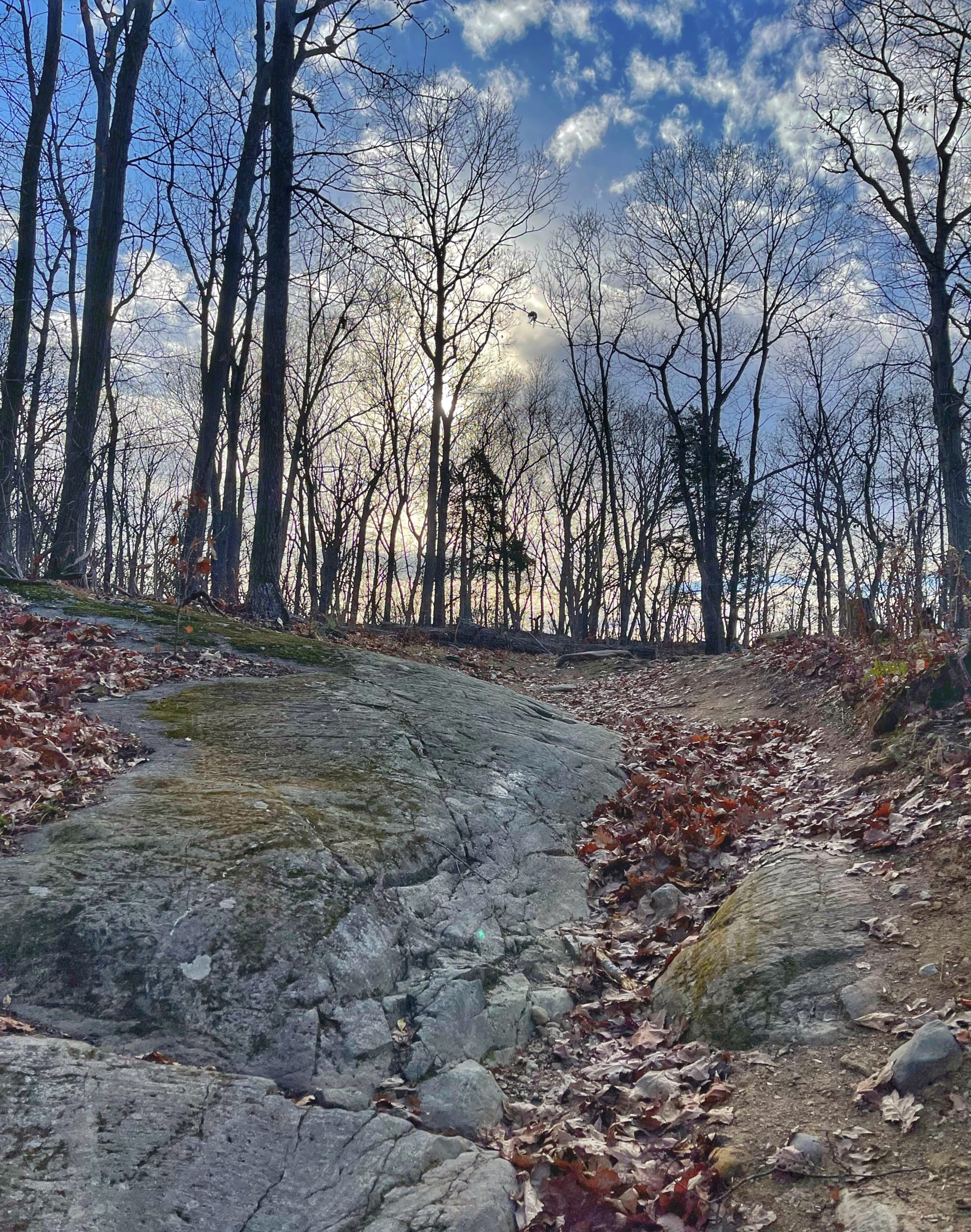
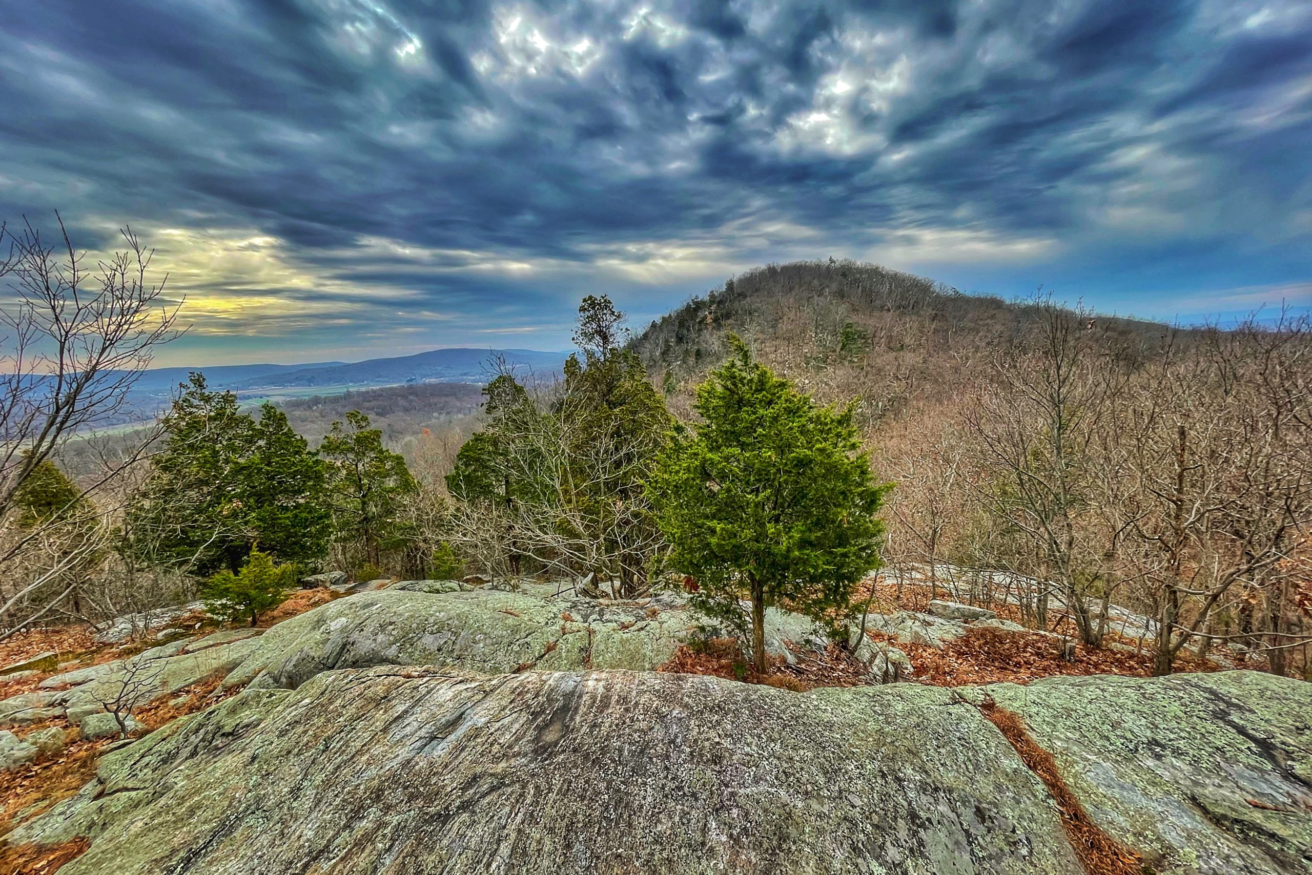
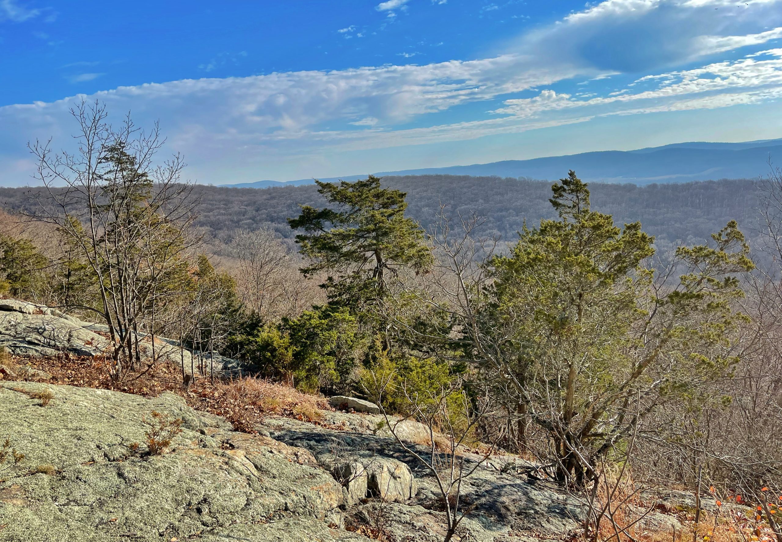
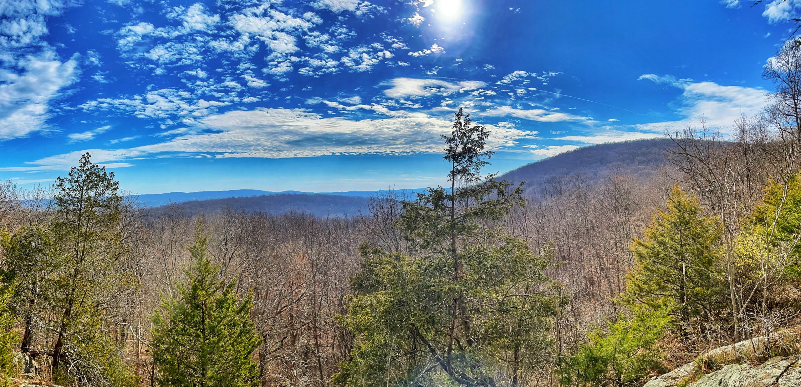
The Summit Trail continues to ascend, soon reaching a flat rock along the trail. Here, a side trail to the right leads over open rocks to a panoramic viewpoint amid cedars, with farmlands of the Great Valley to the left, the cone-shaped mountain known as The Pinnacle directly ahead. Glacial striations are clearly visible on the surface of the rock outcrop at the viewpoint. You’ll want to pause here to enjoy the spectacular view.
When you’re ready to proceed, return to the Summit Trail and turn right. Where the trail bears left, there is a short unmarked side trail to a viewpoint on the right with views of the Great Valley.

Keep an eye out for similar side trails to viewpoints as you continue and the trail follows along the ridge of Jenny Jump Mountain.
In another five minutes, a wide side trail on the right leads downhill to a southeast-facing viewpoint, which includes both forest and the fertile fields of the Great Valley.
After taking in the view, return to the Summit Trail and turn right.
In another 100 feet, the trail passes two large glacial erratics in an open area.
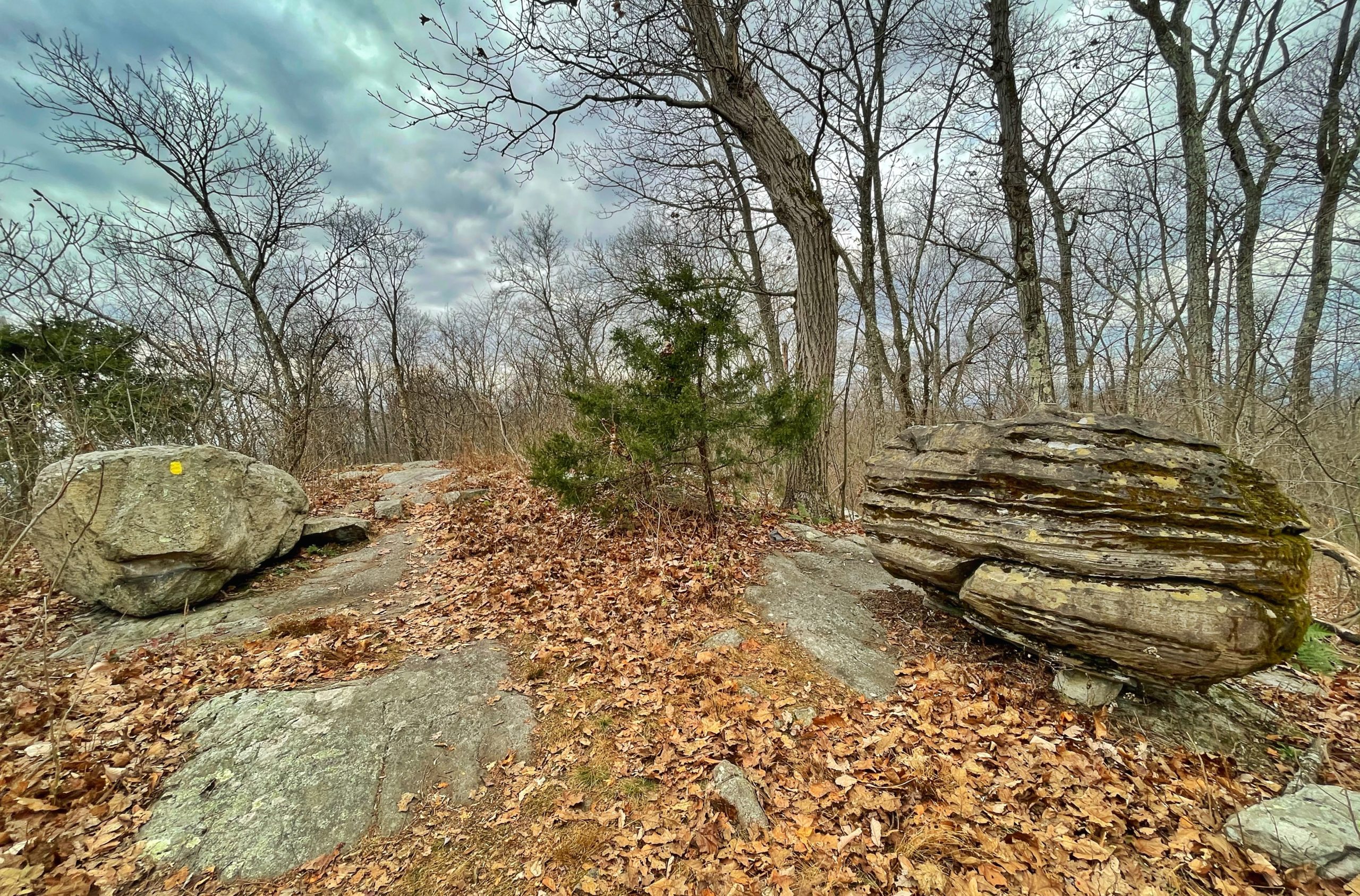
These boulders were carried here by the Wisconsin Glacier about 15,000 years ago. The one on the left is formed of limestone, which is very different from the underlying bedrock, composed of Precambrian granite gneiss.
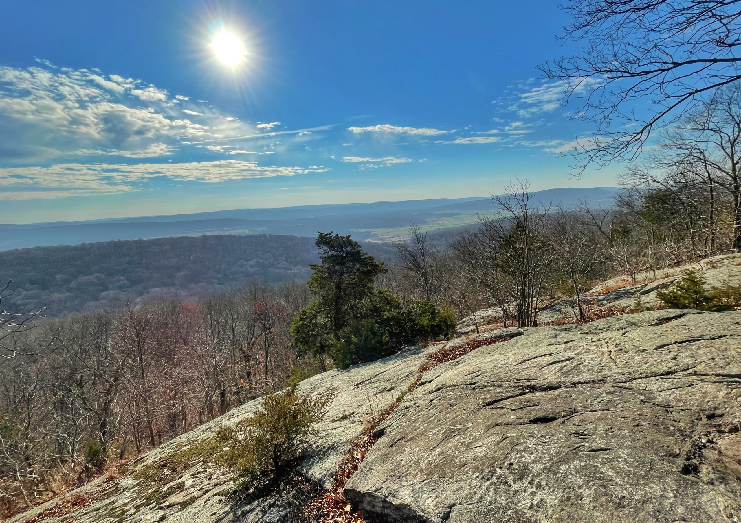
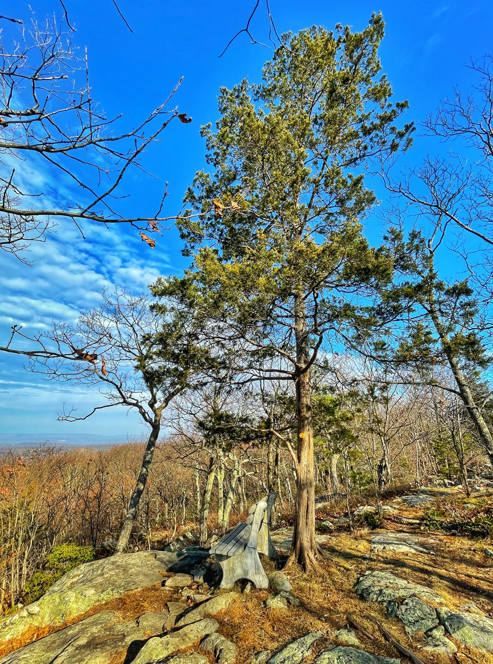
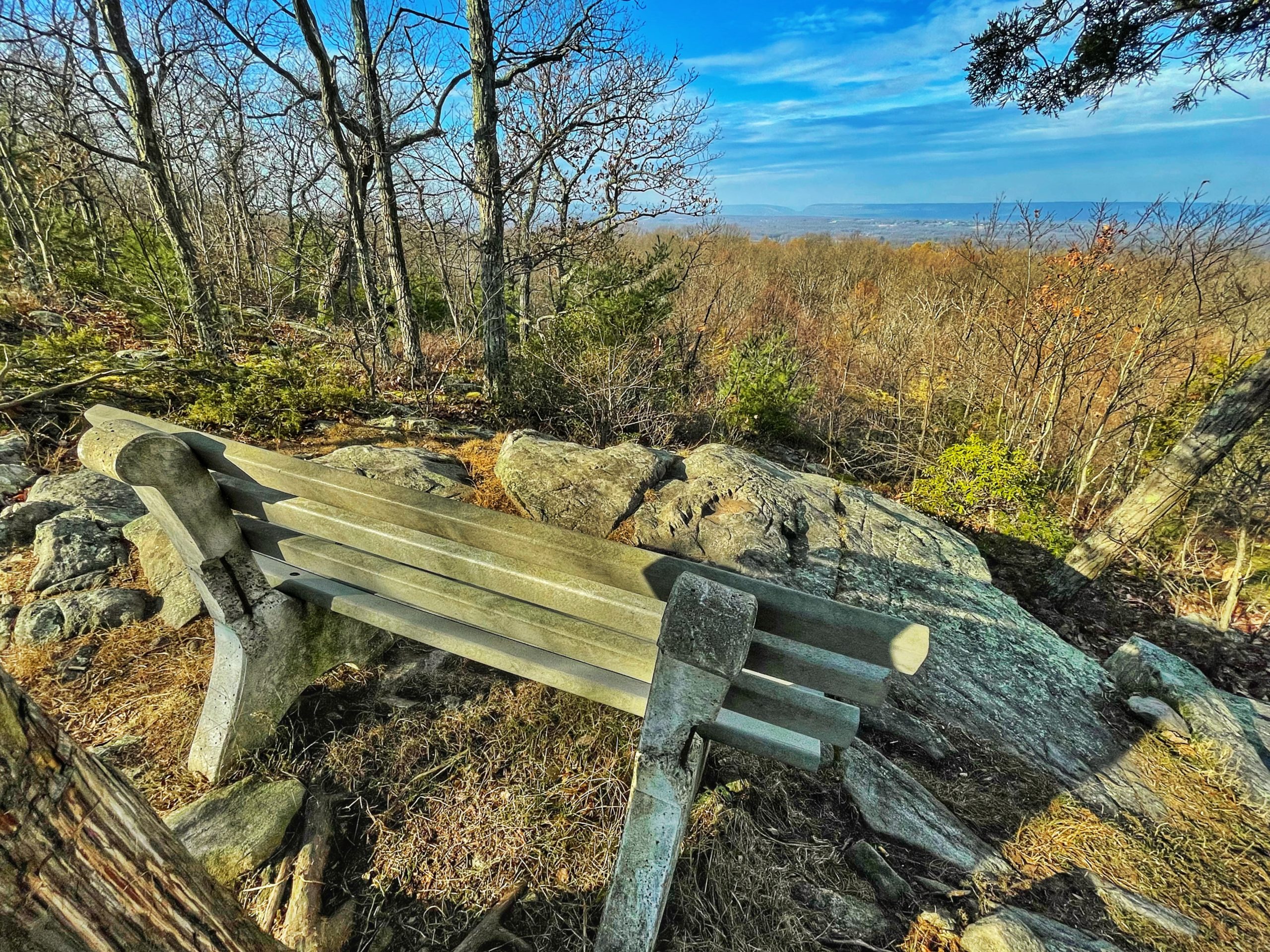
The trail continues to a rock outcrop on the left side of the ridge where a bench offers hikers the opportunity to rest and enjoy unobstructed view of the Delaware Water Gap and Kittatinny Mountain.
-

-

-
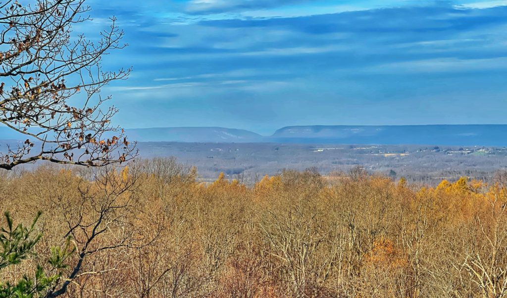
The Delaware Water Gap visible in the distance

The Summit Trail now descends over rocks, steeply in one spot. At the base of the descent, a signpost marks an intersection with the blue-blazed Spring Trail, but you should continue straight to follow the Summit Trail along the ridge.

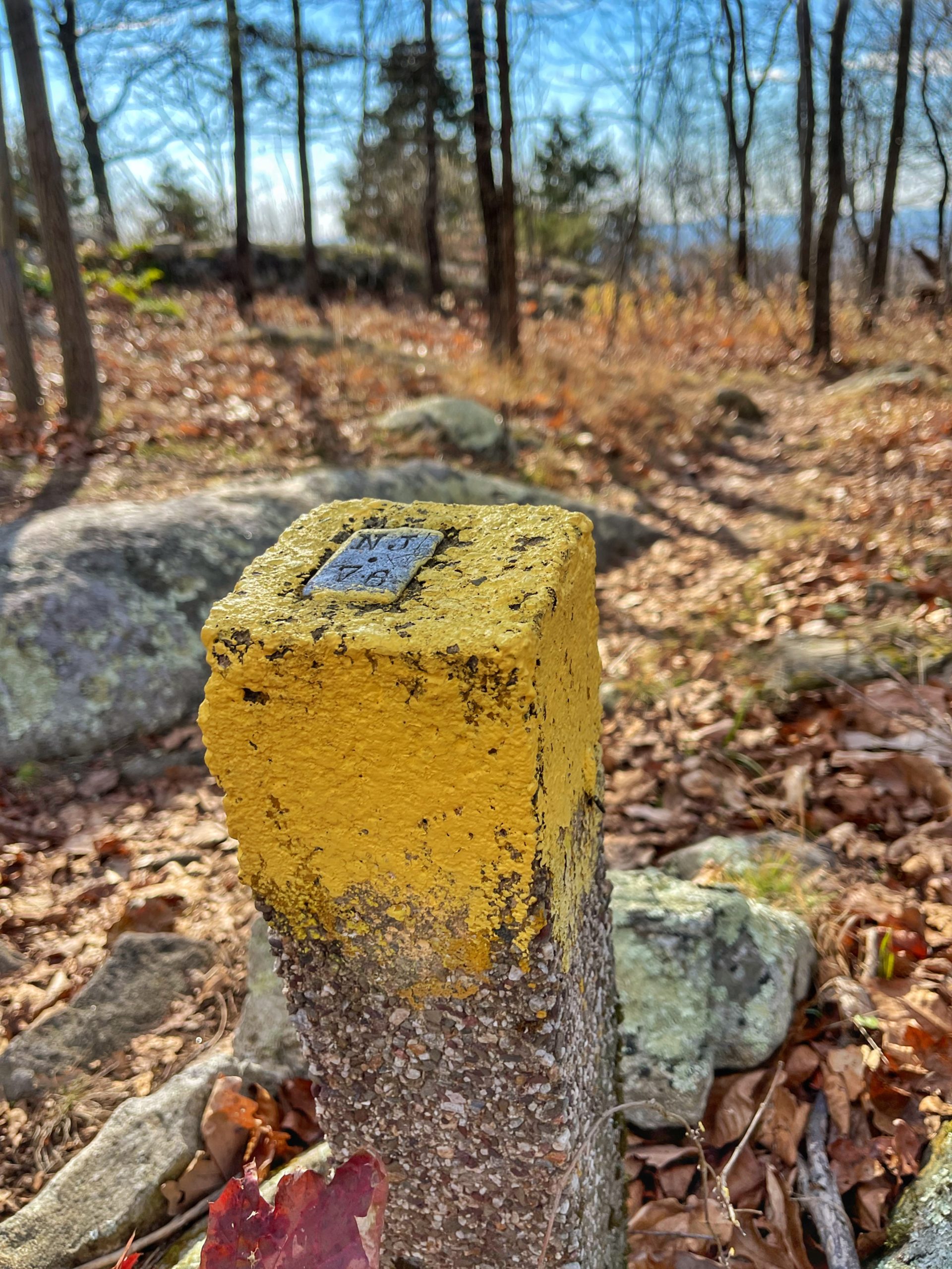
A short distance beyond, you’ll notice a yellow-tipped concrete survey marker, with the notation “NJ 78” on the top.
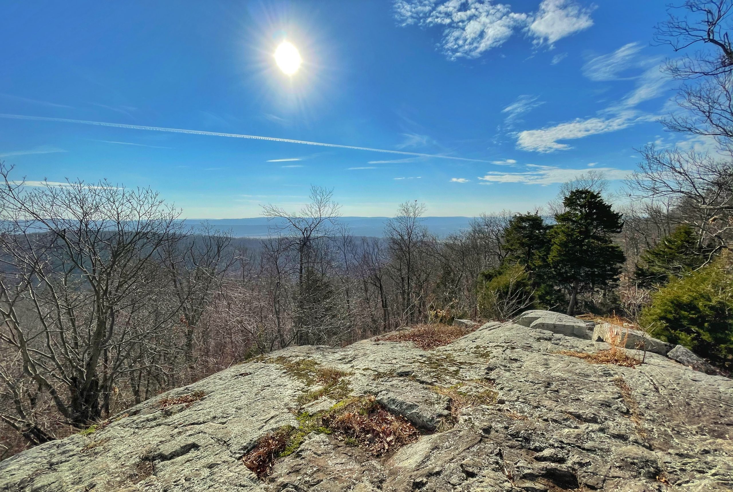
Here, a side trail leads right to another southeast-facing viewpoint from a rock outcrop.
Continue along the Summit Trail, which now descends. After a brief climb, it levels off. In about a quarter mile, the trail bears left and climbs to a high point on the ridge. The highest point in the park (elevation 1,134 feet) is a short distance to the right of the trail.
From this high point, the trail descends steadily. Near the base of the descent, it bears left, and after a short level stretch, it reaches a T- intersection.
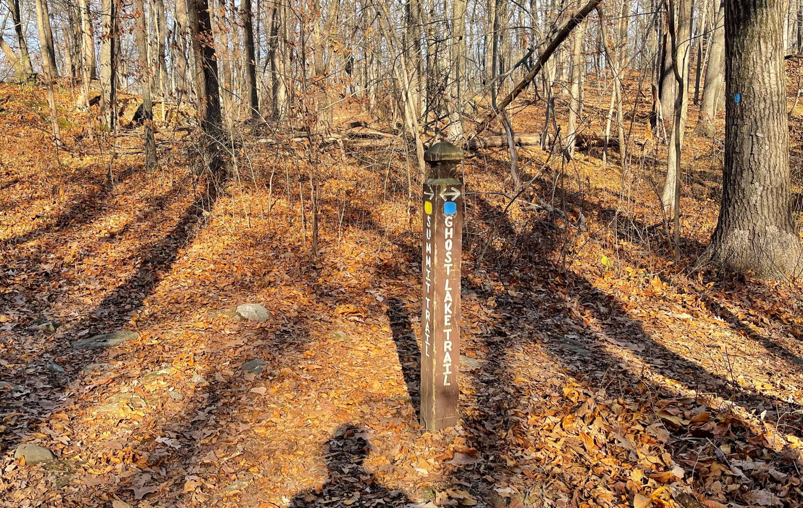
Here, make a right to follow the blue-blazed Ghost Lake Trail.
The trail climbs a rocky forest and you’ll pass a sign on for Neptune on your left. The sign is the last part of a one mile scale model of the solar system which starts at the Orchard Trail parking area with the Sun and ends on the Ghost Lake trail with Neptune. Each planet is represented with a sign of interesting facts.

The trail now descends as it bends to the right. After a turn to the left, look for a side trail on your right leading to an east-facing scenic overlook at the remains of an old building.
-
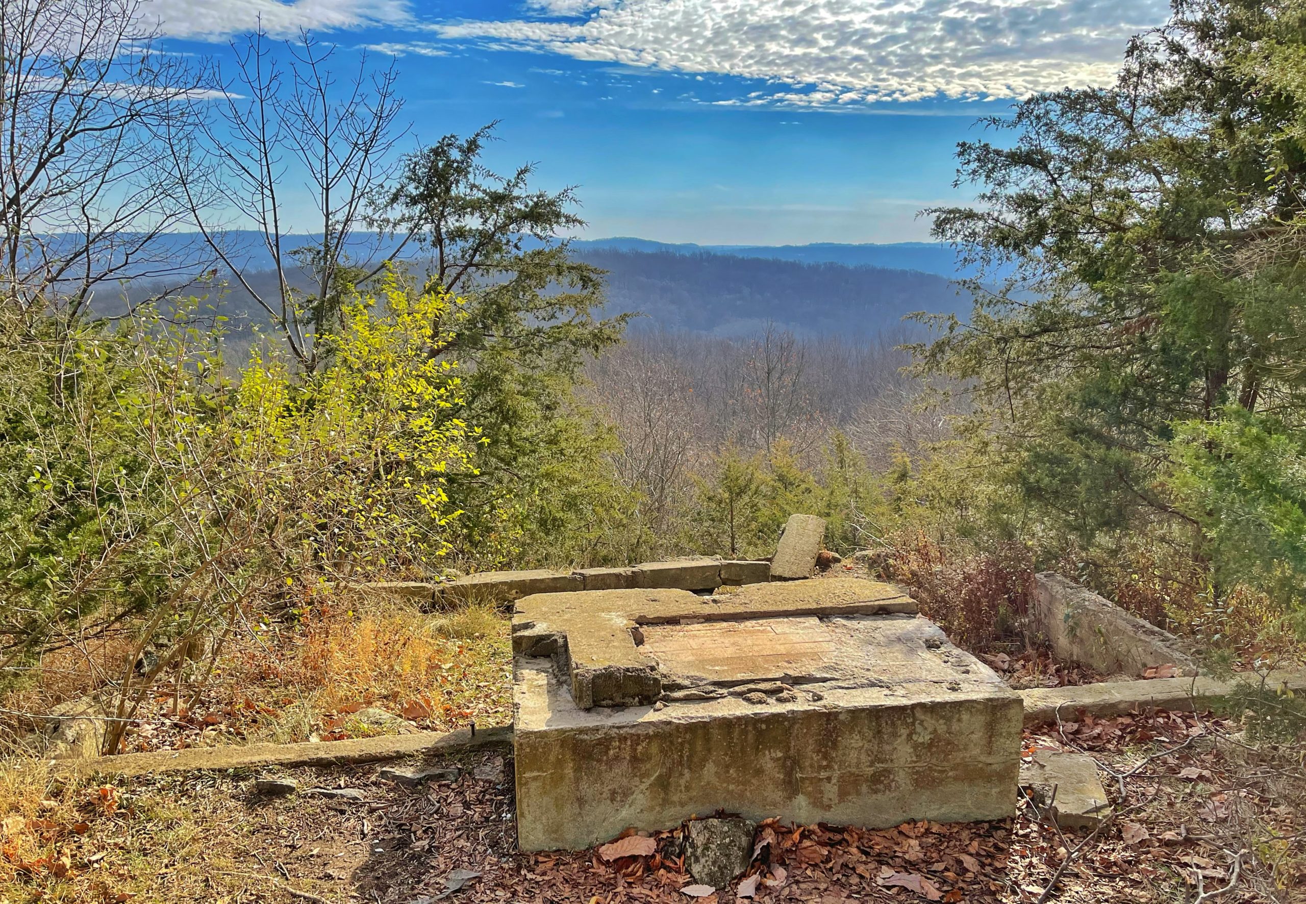
-

Frederick J. Dando (FJD), was a firebrick manufacturer in Irondale, Ohio -
Viewpoint from the remains of an old building
Return to the Ghost Trail and continue to follow the trail as it makes a sharp bend to the right to descend the hillside. The traffic from I-80 can be heard (and seen) at this point. The trail now flattens for a quarter mile through hardwood trees and large boulder piles.

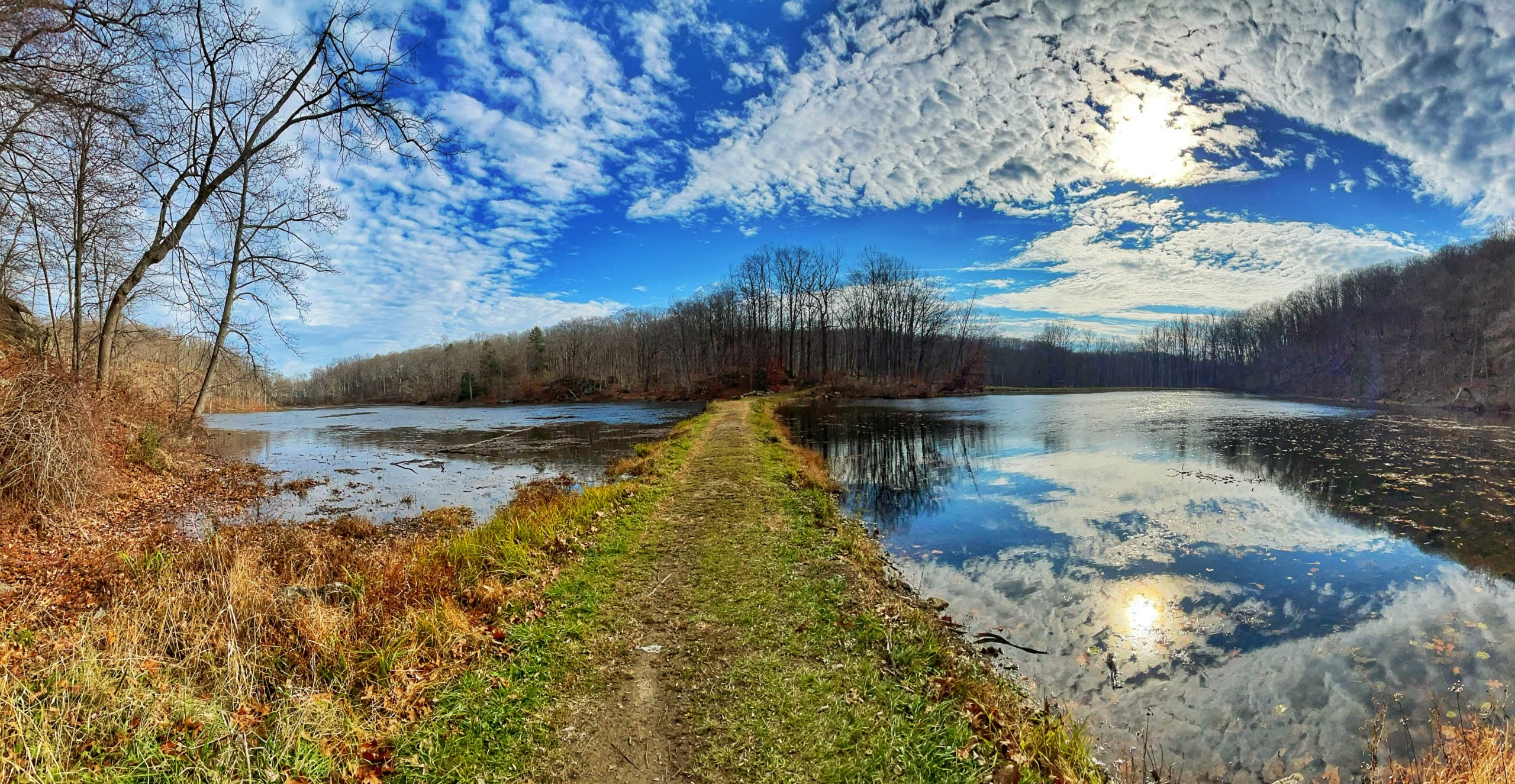
It then turns left and descends downhill towards Ghost Lake, which it crosses on an earthen dam.
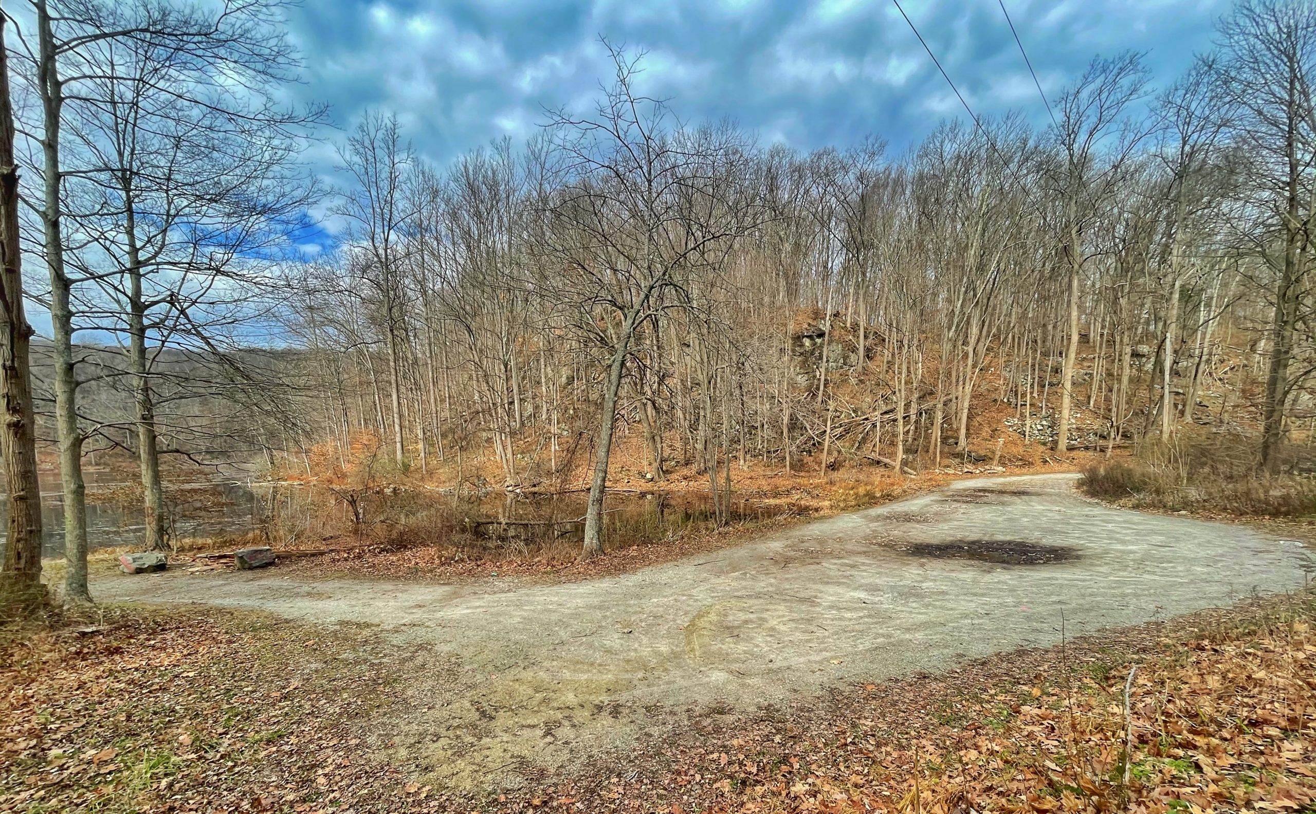
You could stop here and turn around. Or you could extend your hike by an additional 0.8 mile round trip to the Fairy Hole cave.
If you want to continue towards the cave, the trail now curves to the north along the south side of the lake. The Fairy Hole cave is visible across the lake as you round the south side of the lake.

The trail continues on a gravel road and ends at a parking pull-off on the west side of Shades of Death Road.
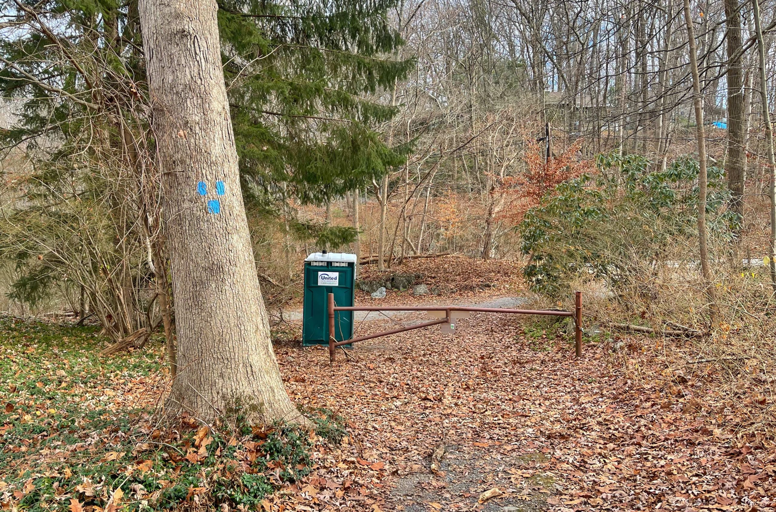
Proceed past the gate at the end of the trail and make a left to follow the parking pull-off.

Follow the pull-off to the end and turn left on Shades of Death Road, where you can squeeze by behind the guardrail.
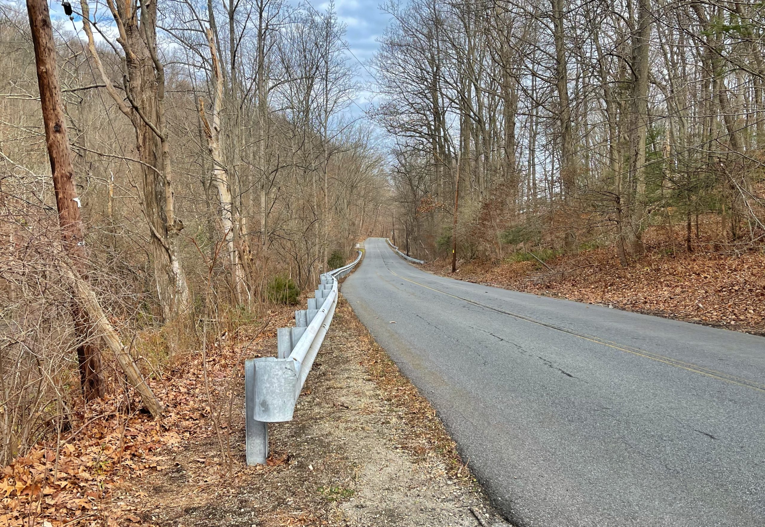
Very soon you’ll reach the parking area on the west side of Shades of Death Road.
Near the entrance to the lot, look for an unmarked but well trod trail to the right of a tree.

After you follow the trail for about 500 feet, the cave will be a short 20 foot scramble above you.

When you’re done exploring the cave, you could search for two other nearby caves – “Fairly Low” and “Fairy Tube” which can be found by scrambling up the steep hillside next to the cave (there is also an easier route up from the parking area).
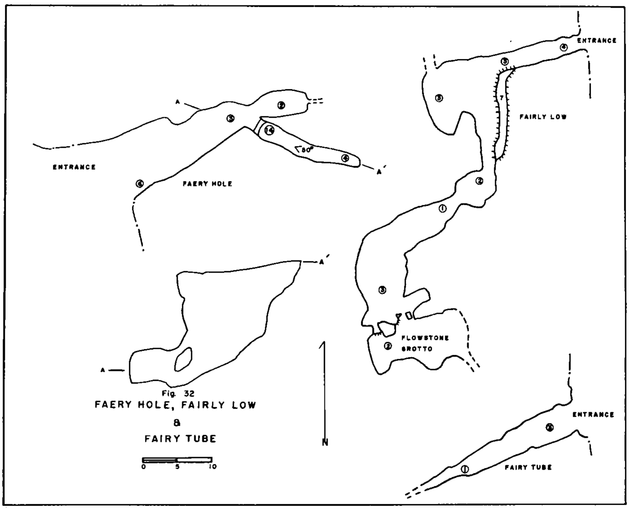
The three caves are described in “Caves of New Jersey” (1976), Bulletin 70 of the New Jersey Geological Survey along with accompanying diagrams:
Faery Hole 40°55.4’N;74°53.7’W, 580, Blairstown Quadrangle, PR, Leon Hull
Faery Hole (Fig. 32 is reached by following the Shades of Death Road about two miles northeast from its intersection with the Hope-Great Meadows Road. The entrance to the cave is about halfway up a hill on the northeast side of a small lake, to the left of the road. It is about 30 feet long and is formed in the Franklin Marble.
The cave is very important for its yield of Indian artifacts and other material. In 1936, a major excavation was carried out by Dr. Dorothy Cross, of the New Jersey State Museum. More than ten thousand bones and fragments from 23 different species of mammal were recovered. The most important single find was a tooth from an extinct giant beaver never discovered elsewhere in New Jersey. The cave is reported in detail by Schrabisch.
Fairly Low 40°55.6’N;74°53.6’W, 620, Blairstown Quadrangle, PR, Leon Hull
Fairly Low (Fig. 32) is located several hundred yards northeast of Faery Hole, in the back wall of a small cirque. It is a series of low rooms connected by lower crawlways. Flowstone is abundant and the floor is covered with dark brown silt. The total length of this cave, in the Franklin Marble, is 160 feet.
Fairy Tube 40°55.6’N;74°53.6’W, 620, Blairstown Quadrangle, PR, Leon Hull
A single passage 20 feet long in the Franklin Marble is near Fairly Low Cave (Fig. 32).
Caves of New Jersey
When you’re done exploring, retrace your steps all the way back to the trailhead parking lot.


