Overview: The hike to Gertrude’s Nose is hands down one of the best hikes in the region, with beautiful footpaths and dramatic views along gleaming white cliffs.
(Hiked on November 3, 2019)
Gertrude’s Nose? “An odd name for a unique place, the Nose is a great wedge-like mass of conglomerate left between Palmaghatt Ravine and the main cliff scarp south of Millbrook Mountain.” – Scenes and Walks in the Northern Shawangunk
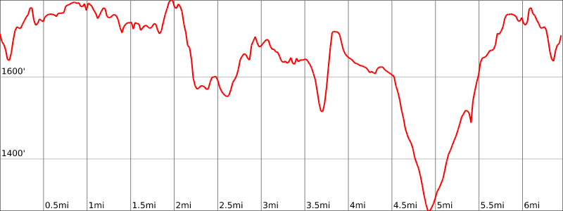
Hike Length: 7.0 miles
Elevation gain: 1,500 feet
Location: Minnewaska State Park Preserve, 5281 Route 44-55, Kerhonkson, NY 12446
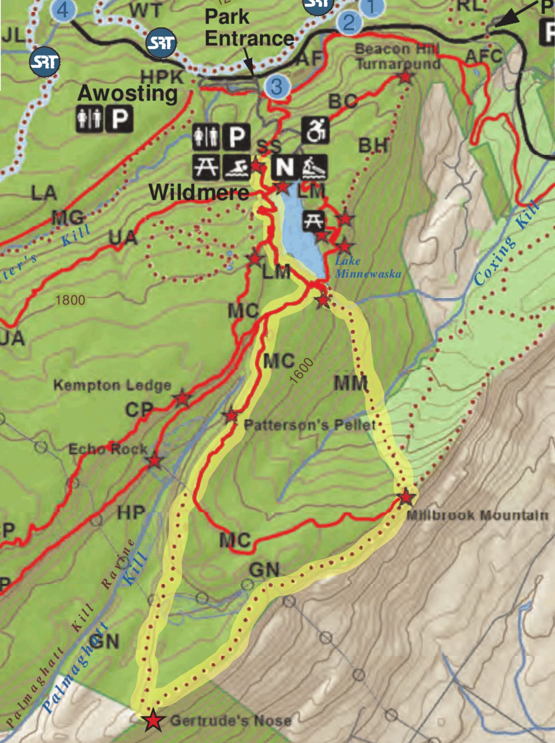
Parking: Park at the Upper Awosting Lot. Note: There is a $10 fee to enter and park. The park has gates and does not open until 9:00am.
Map: NY-NJ Trail Conference Shawangunk Trails (Trail Map #104). Minnewaska State Park Preserve Trail Map
Trail Description
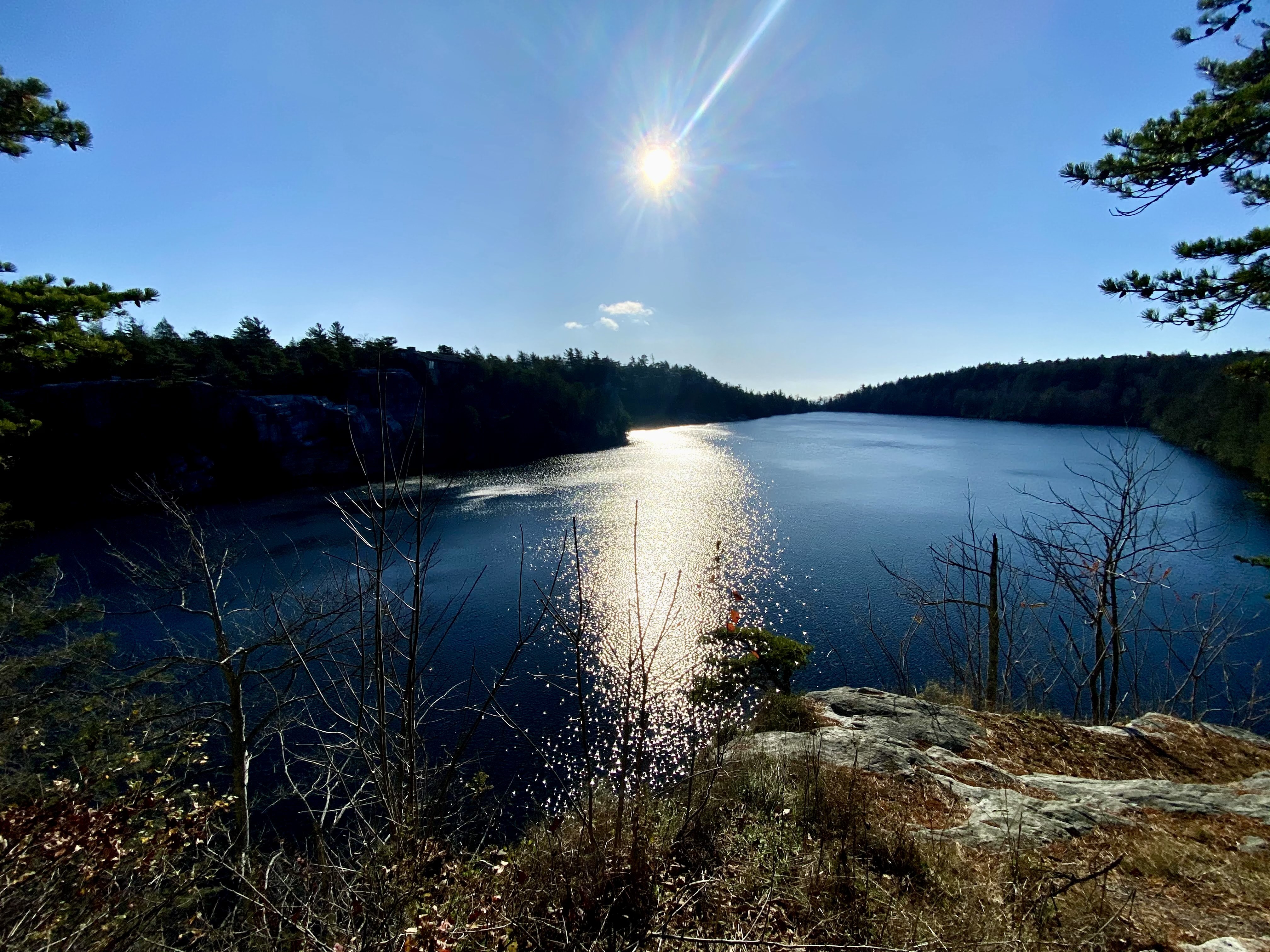
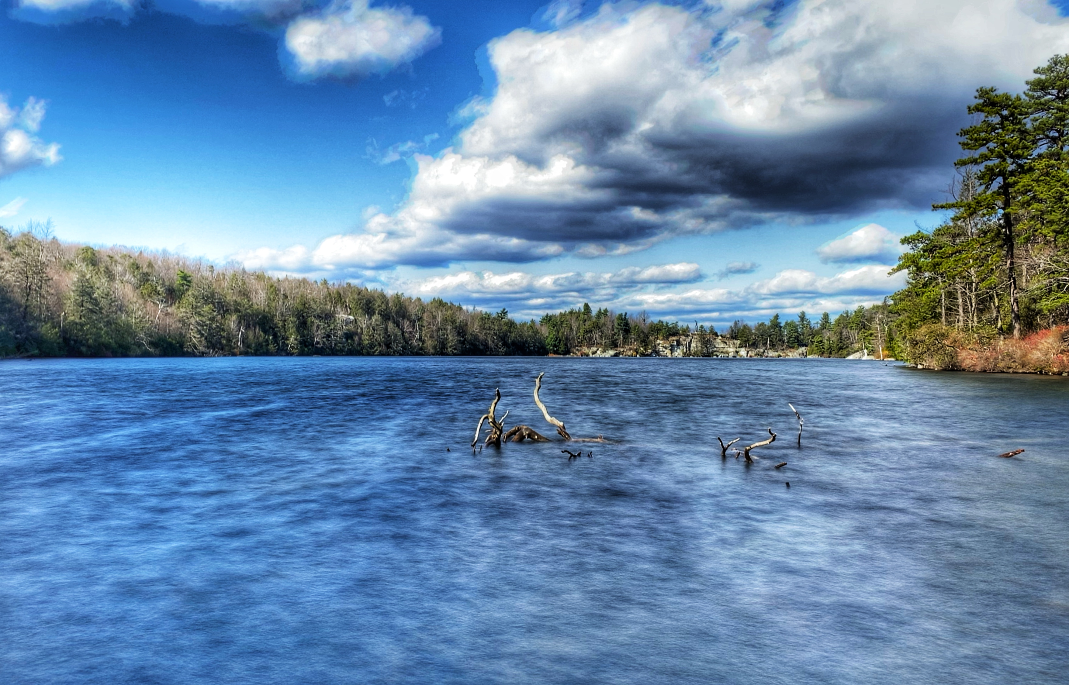
From the parking lot, you’re just steps away from a viewpoint from above looking south at Lake Minnewaska.
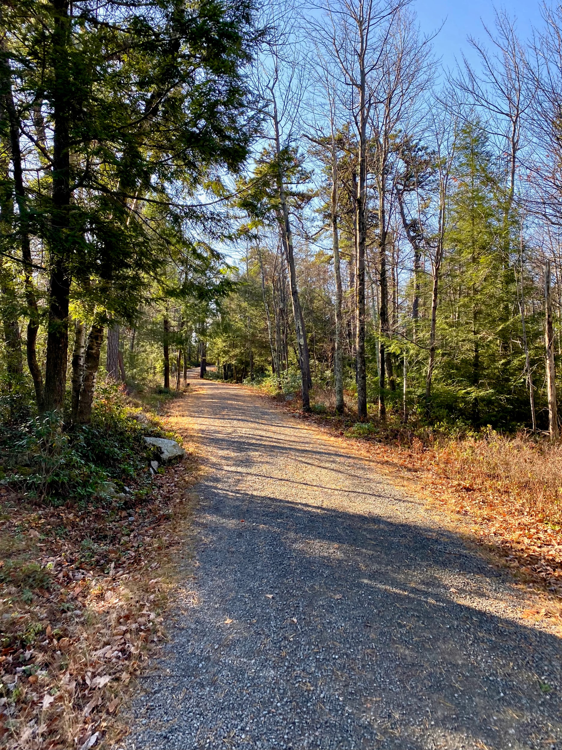
Follow the red Lake Minnewaska Carriage Road. After 0.1 miles you will pass a set of composting toilets. After another 0.3 miles you’ll come to a junction at which the blue Castle Point Carriage Road forks to the right. Stay left to follow the red road for another third of a mile until you reach a fork where you should turn right to follow the yellow Millbrook Mountain Carriage Road.
After a quarter mile, you will reach another fork at the head of the Palmaghatt Ravine. At this point, the Hamilton Point Carriage Road begins to the right, but we will stay left to continue on the Millbrook Mountain Carriage Road which follows the edge of low cliffs bordering the ravine.
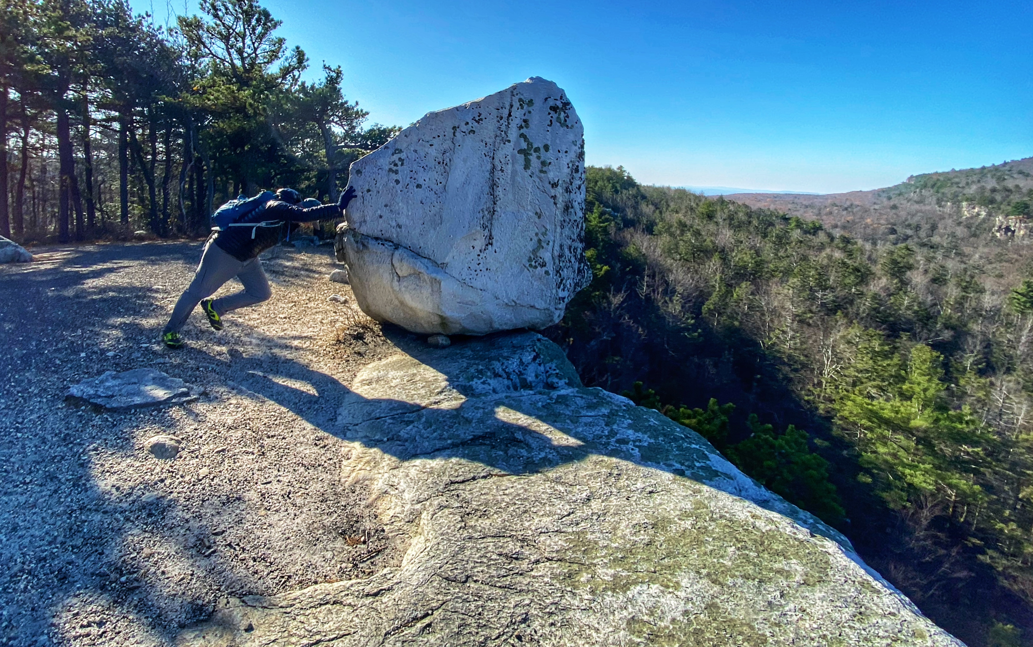
About a quarter mile further, you’ll reach an opening with a large boulder – a glacial erratic resting precariously just feet from a cliff edge – which was left there when the glaciers retreated at the end of the last ice age.
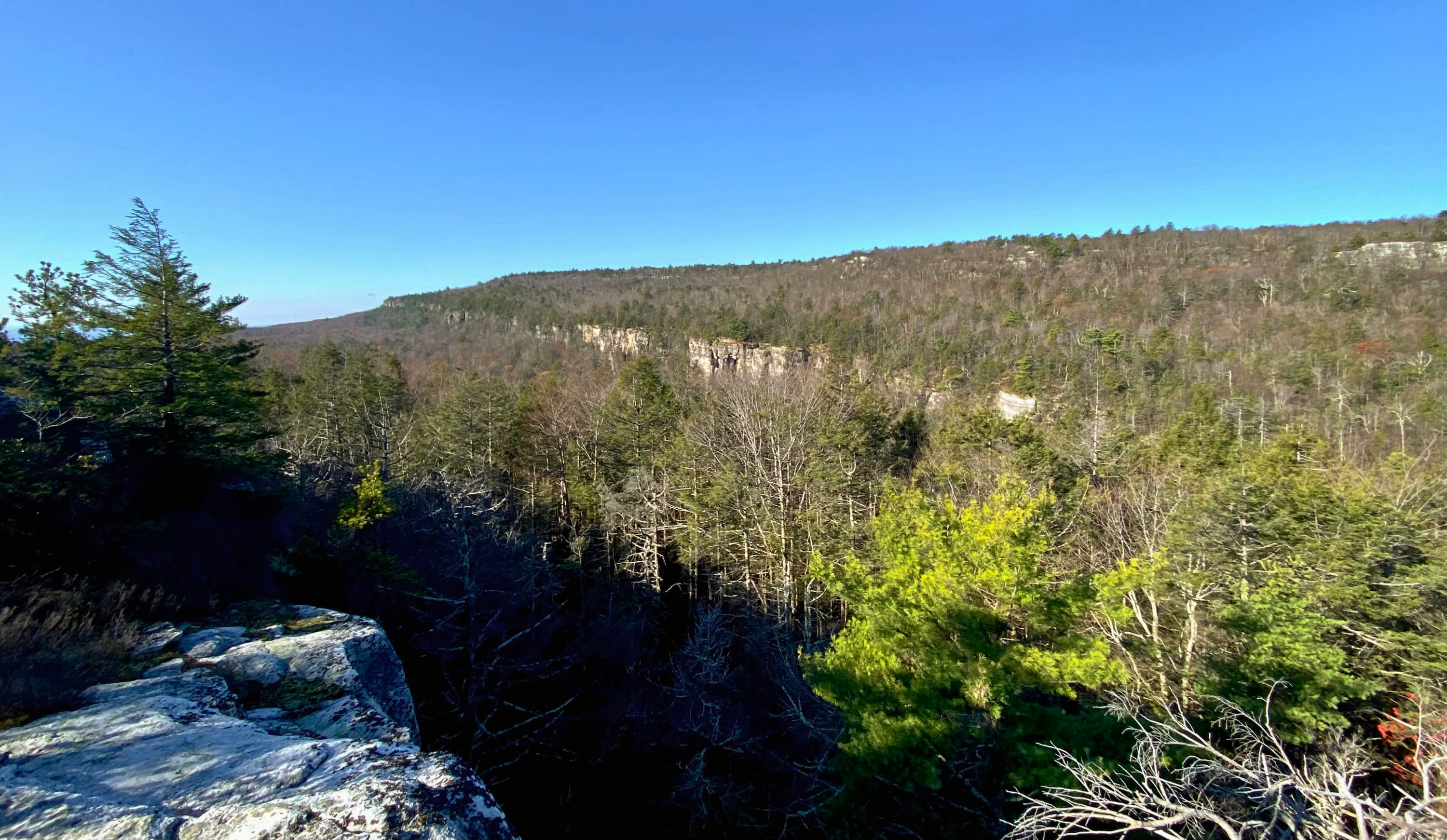
About a quarter mile further you’ll reach another opening with views to the north of the Palmaghatt Ravine.
Palmaghatt Ravine below is the head of a long valley that cuts through the Shawangunk Conglomerate and deep into the Ordovician shales. In earlier times, several trails followed precarious routes into its depths. Rarely explored today, the Ravine is a region of massive talus boulders, waterfalls, and dense hemlock forest.
Scenes and Walks in the Northern Shawangunks
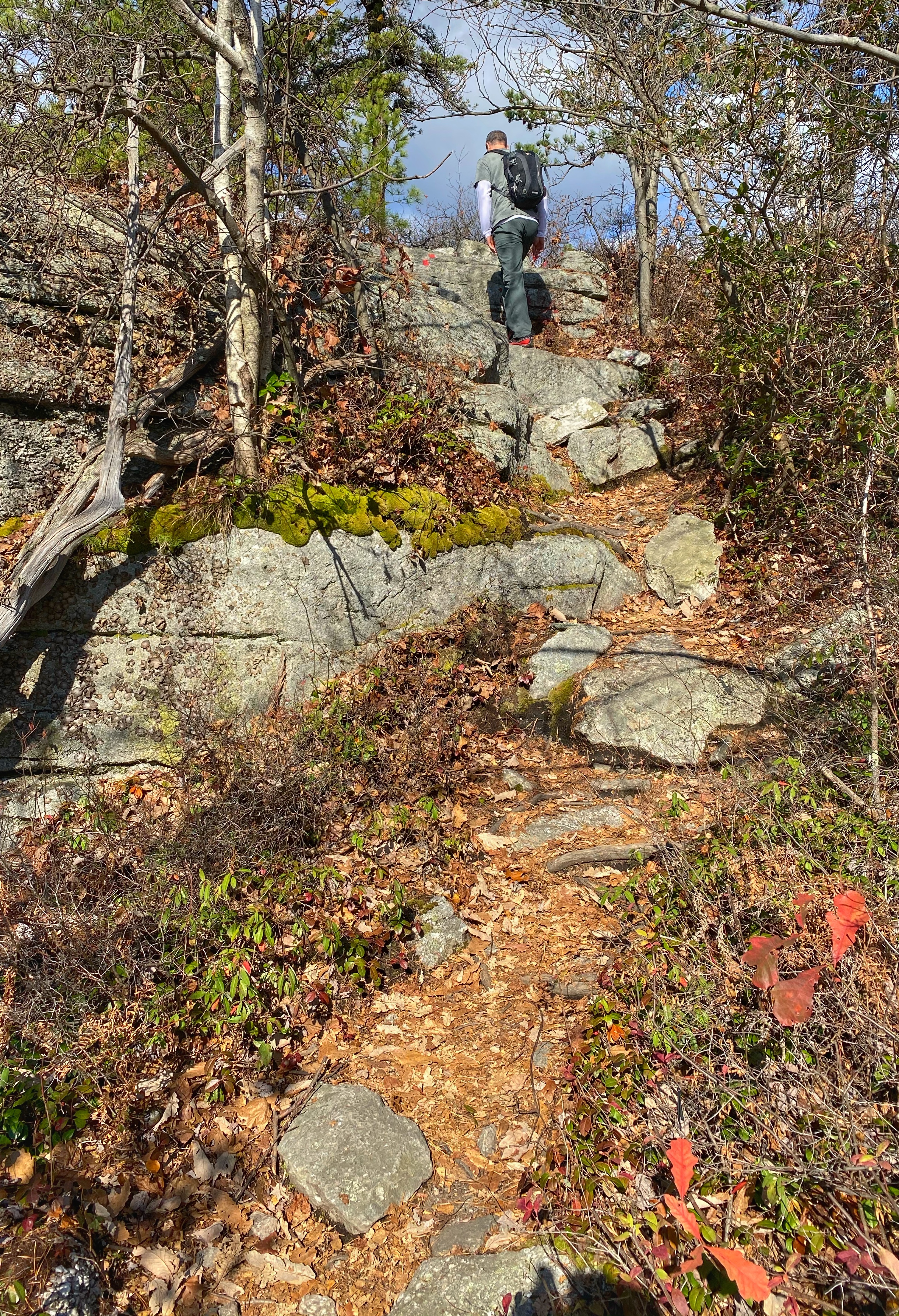
The road passes some more glacial erratics, and then about a quarter mile further, you will reach the junction with the red Gertrude’s Nose Trail, which we will follow as it goes off to the right into the woods.
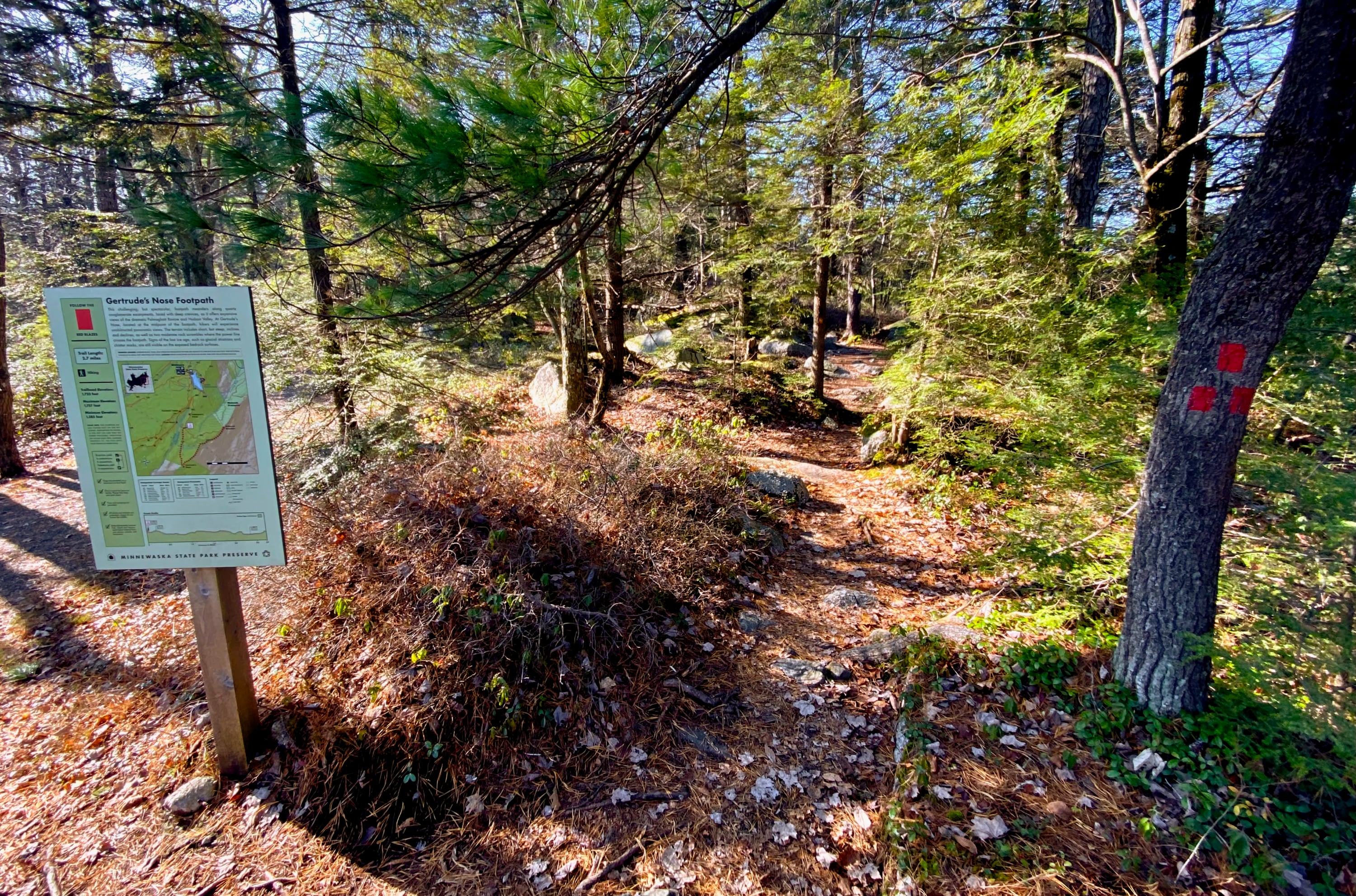
The sign for the footpath reads:
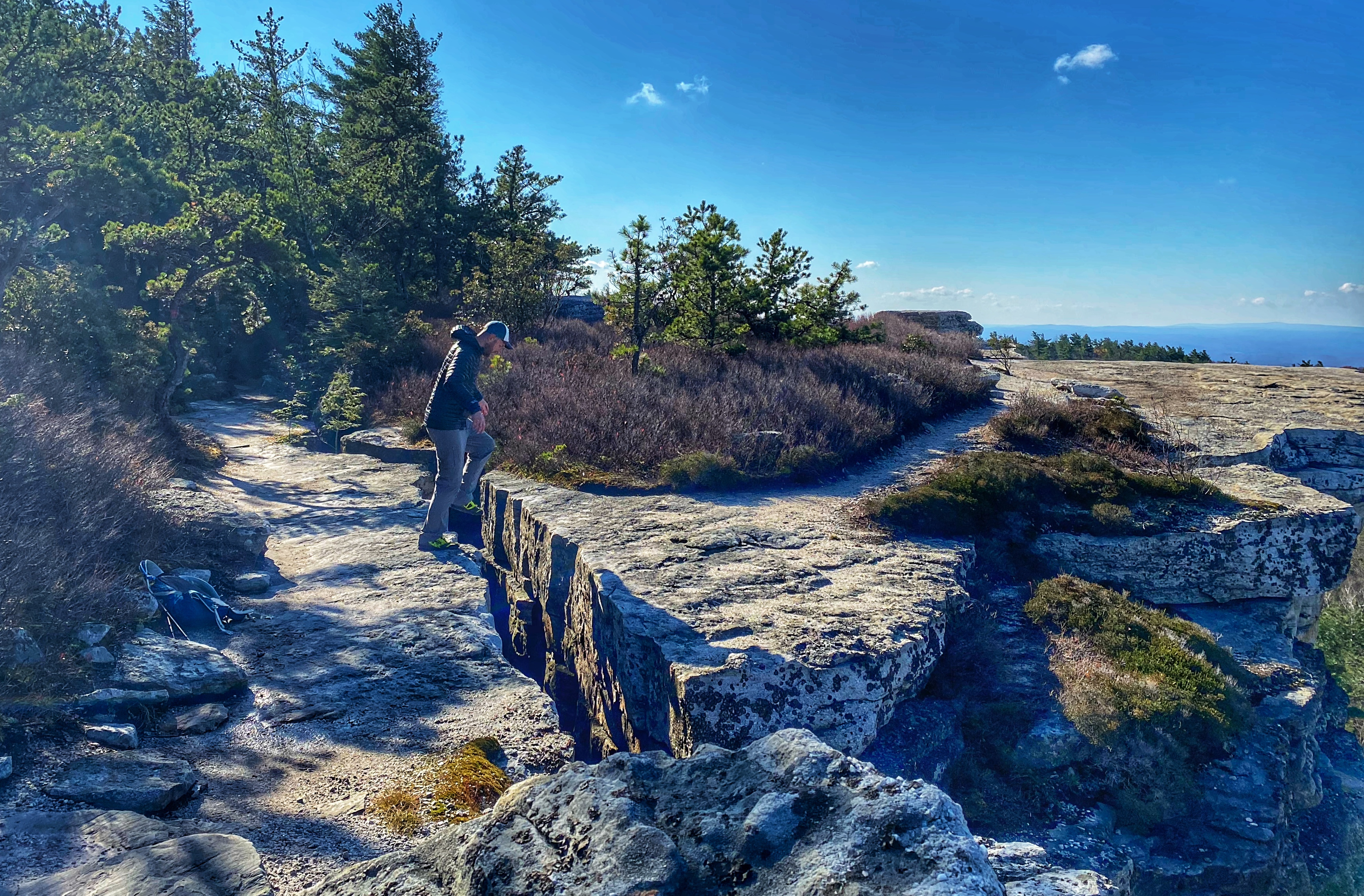
This challenging, but spectacular footpath meanders along quartz conglomerate escarpments, laced with deep crevices, as it offers expansive views of the dramatic Palmaghatt Ravine and Hudson Valley. At Gertrude’s Nose, located at the midpoint of the footpath, hikers will experience unobstructed panoramic views. The terrain includes short, but steep, inclines and declines, as well as two moderate rock scrambles where the power line crosses the footpath. Signs of the last ice age, such as glacial striations and chatter marks, are still visible on the exposed bedrock surfaces.
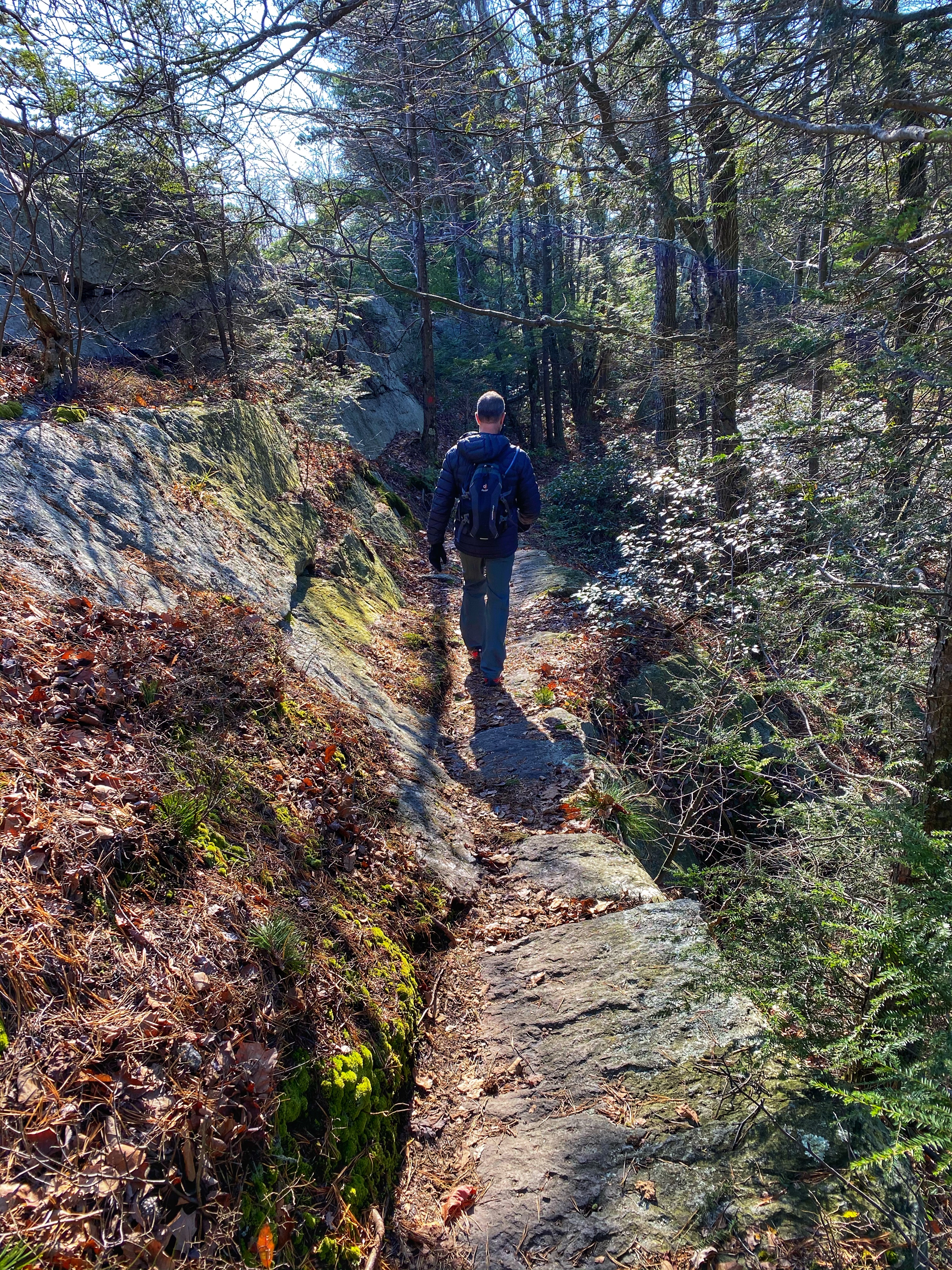
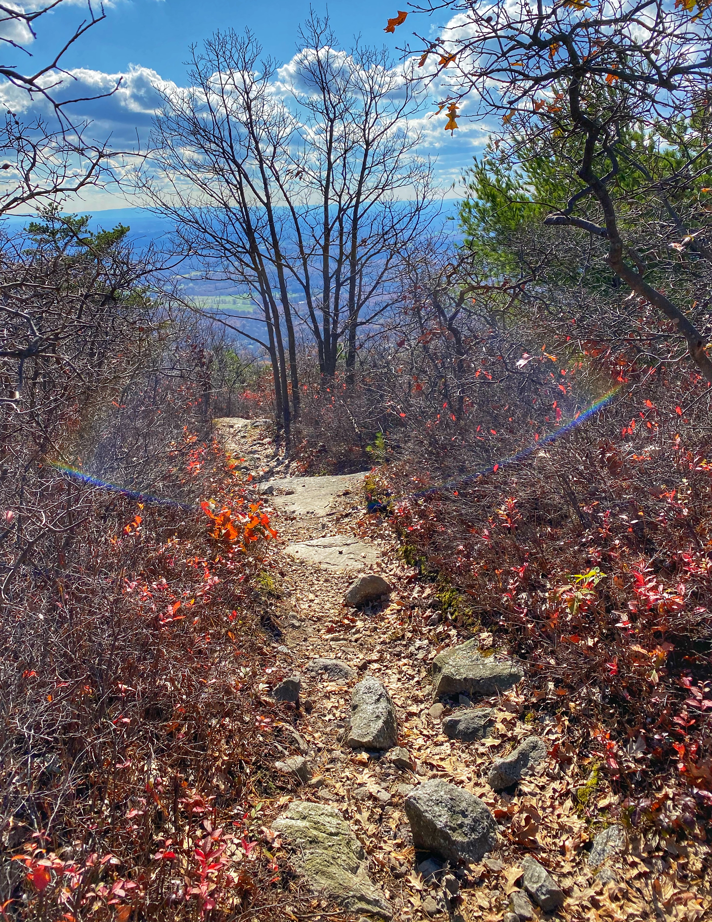
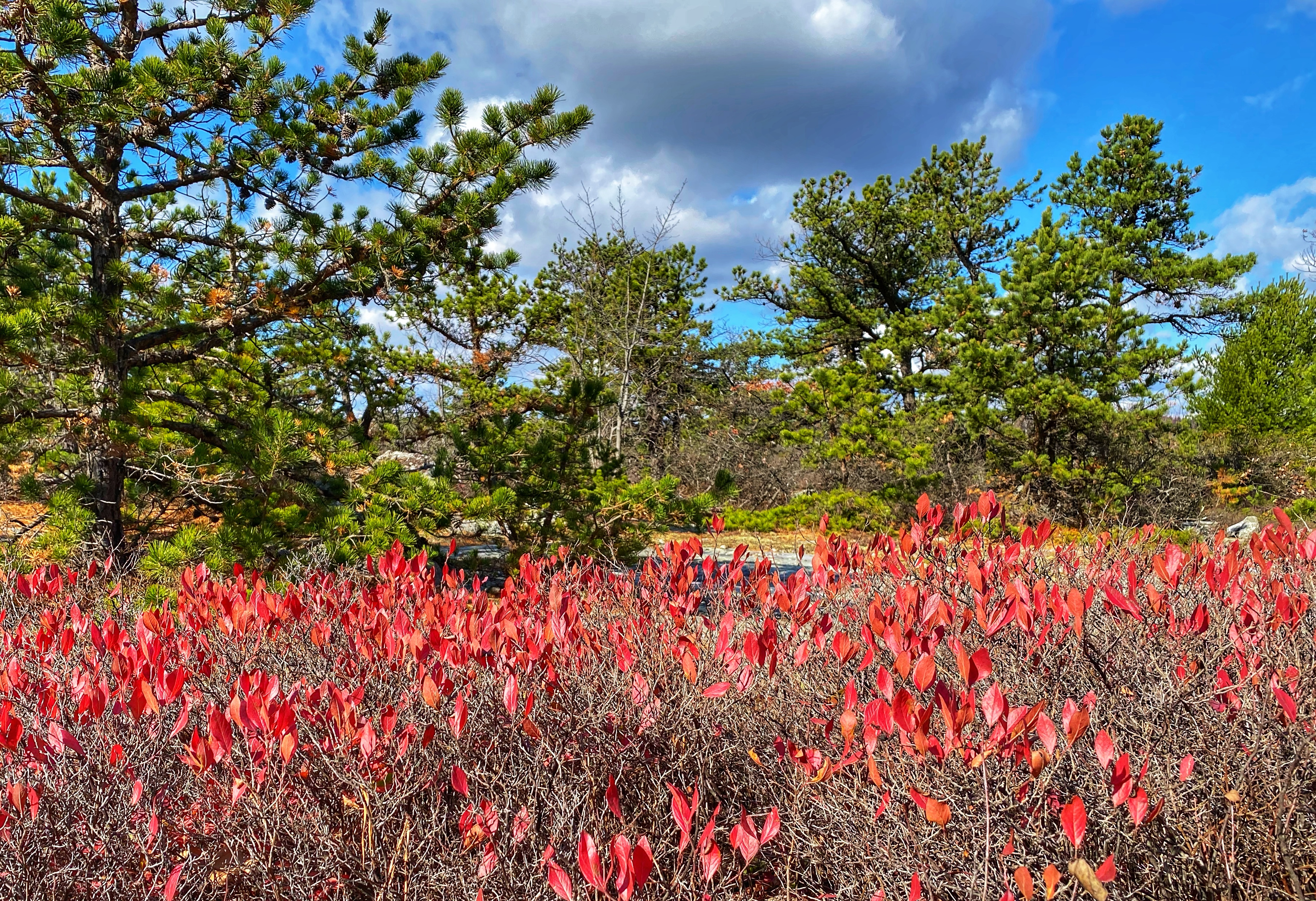
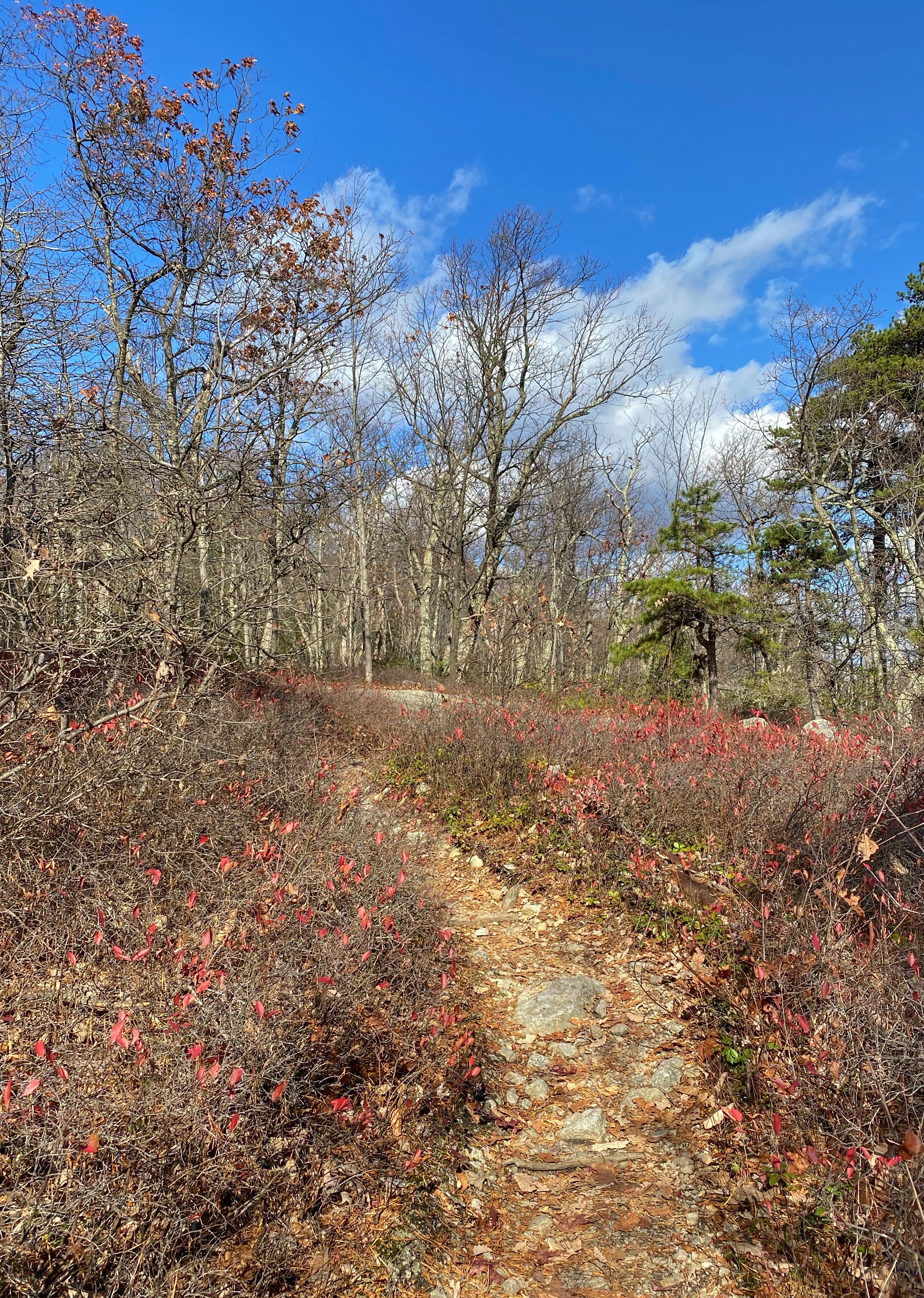
From this point on, you will follow red blazes for the rest of the hike until you return to the parking lot. During the next 1.2 miles, the footpath weaves in and out of a beautiful forest with views that become more and more dramatic.
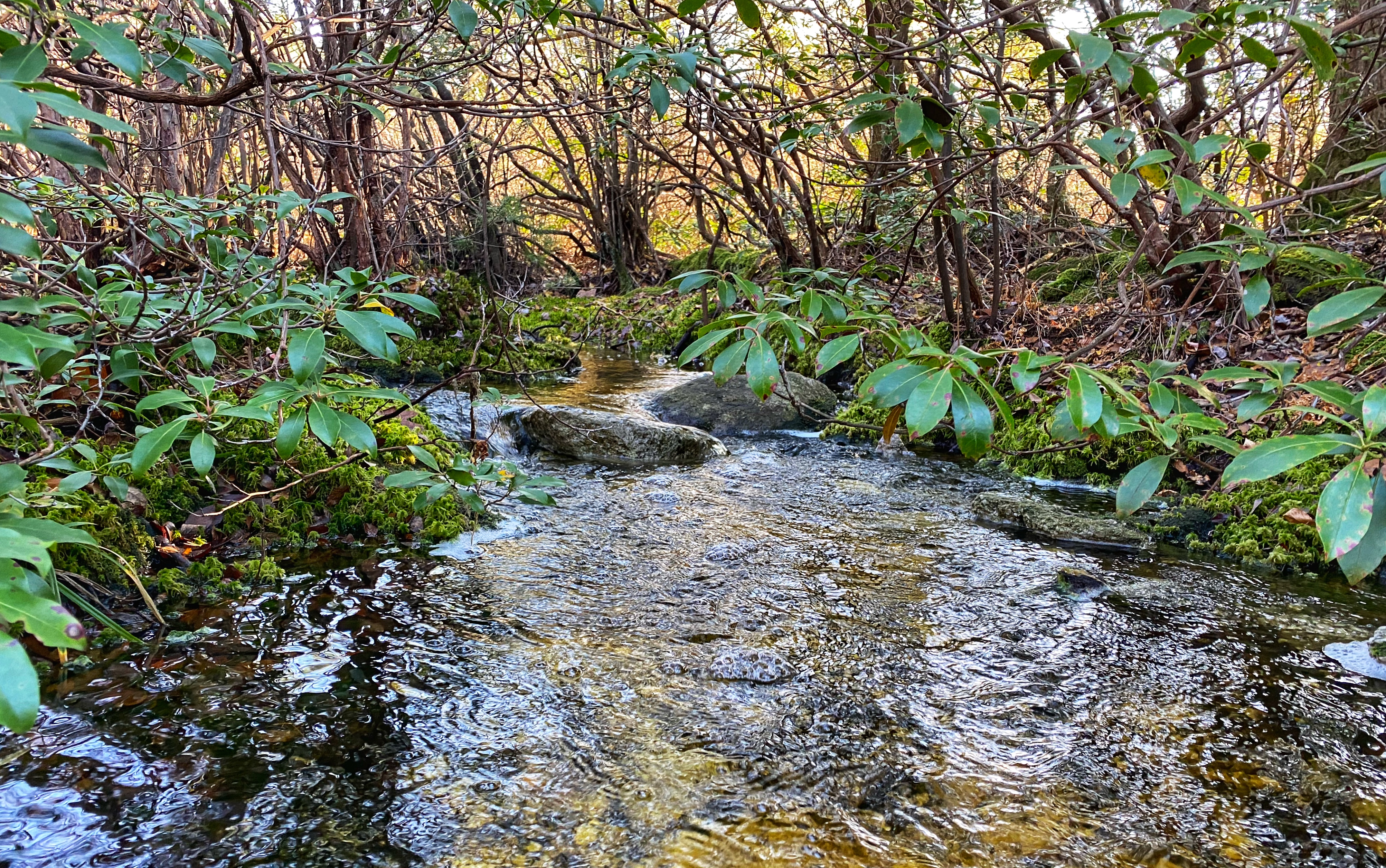
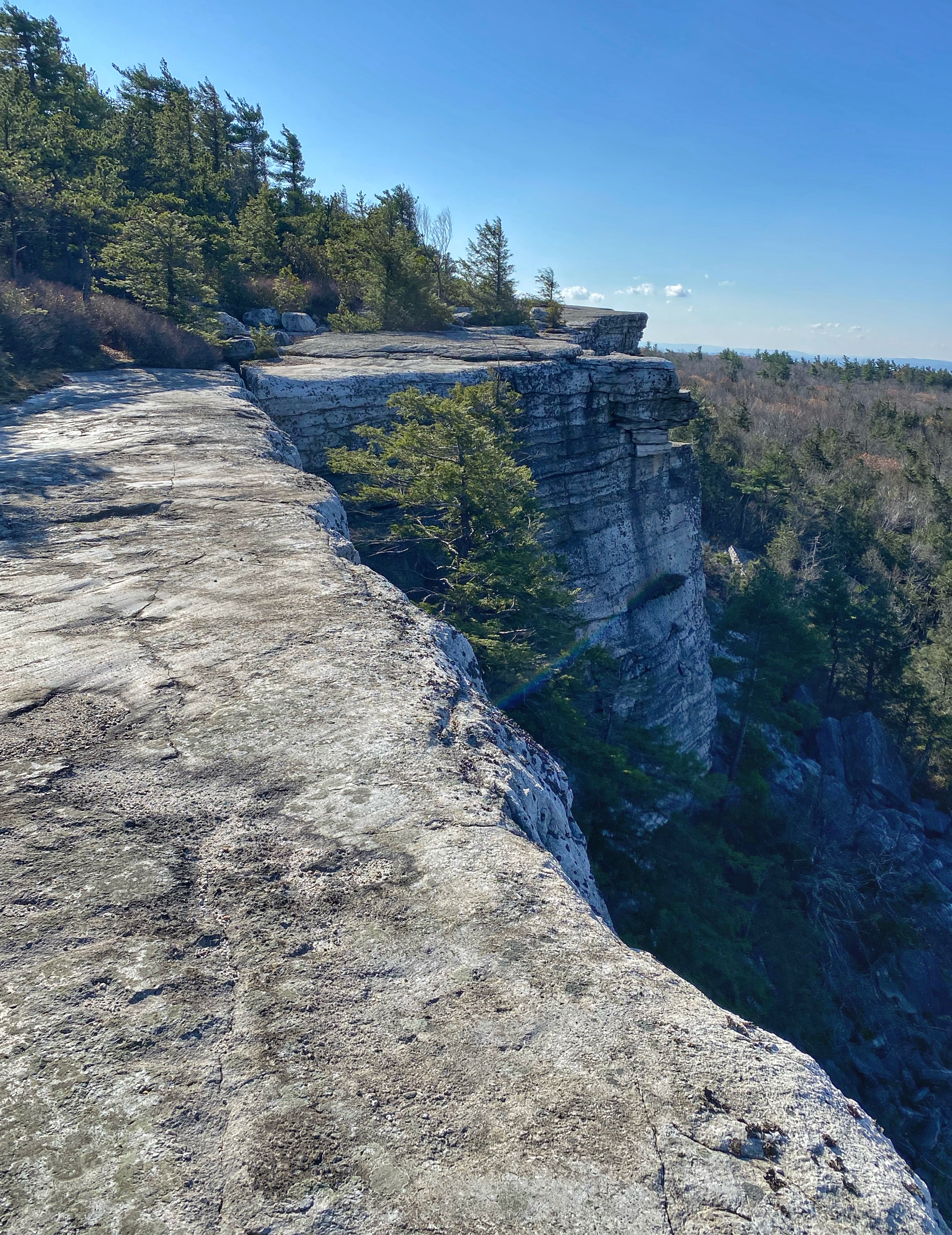
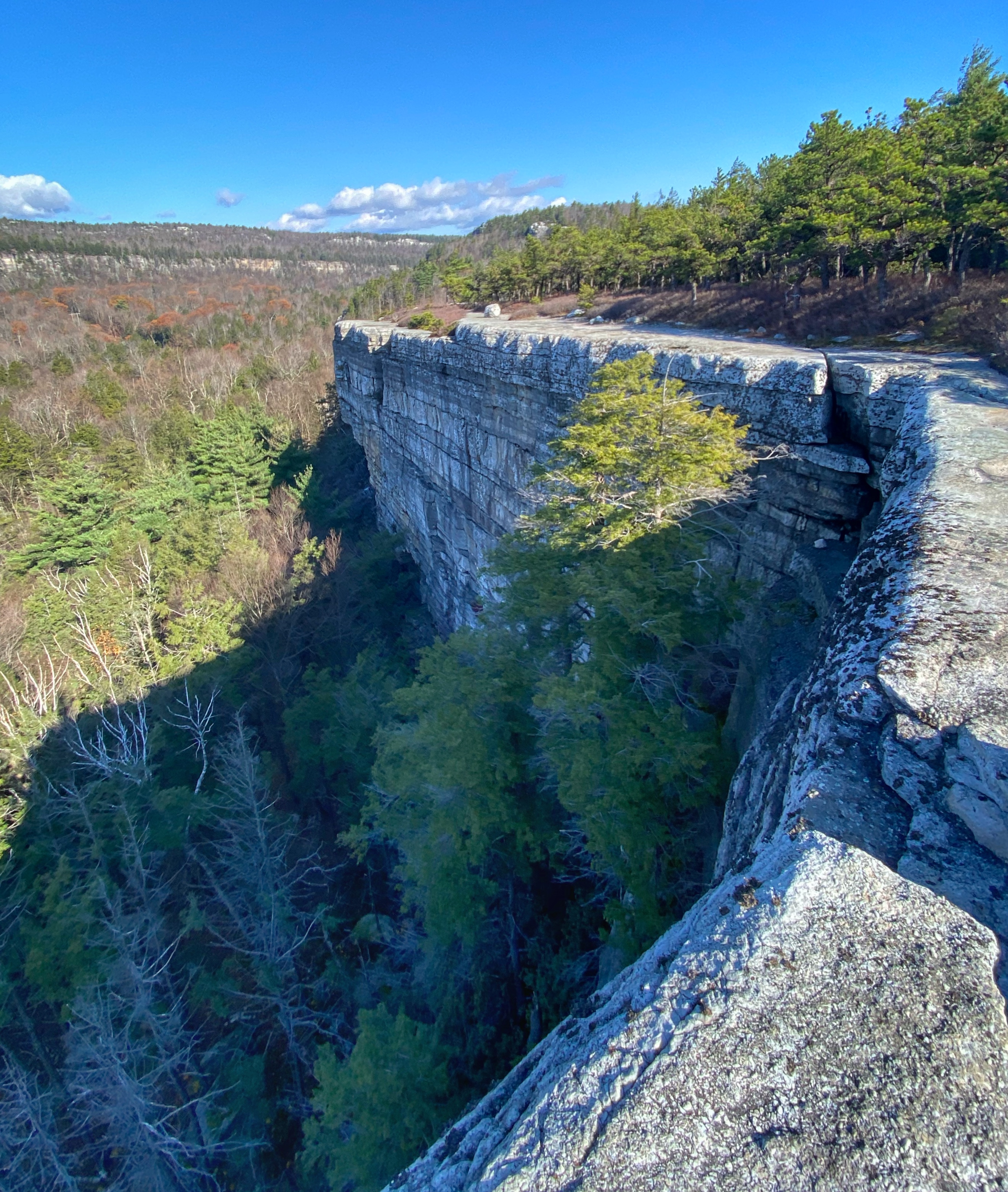
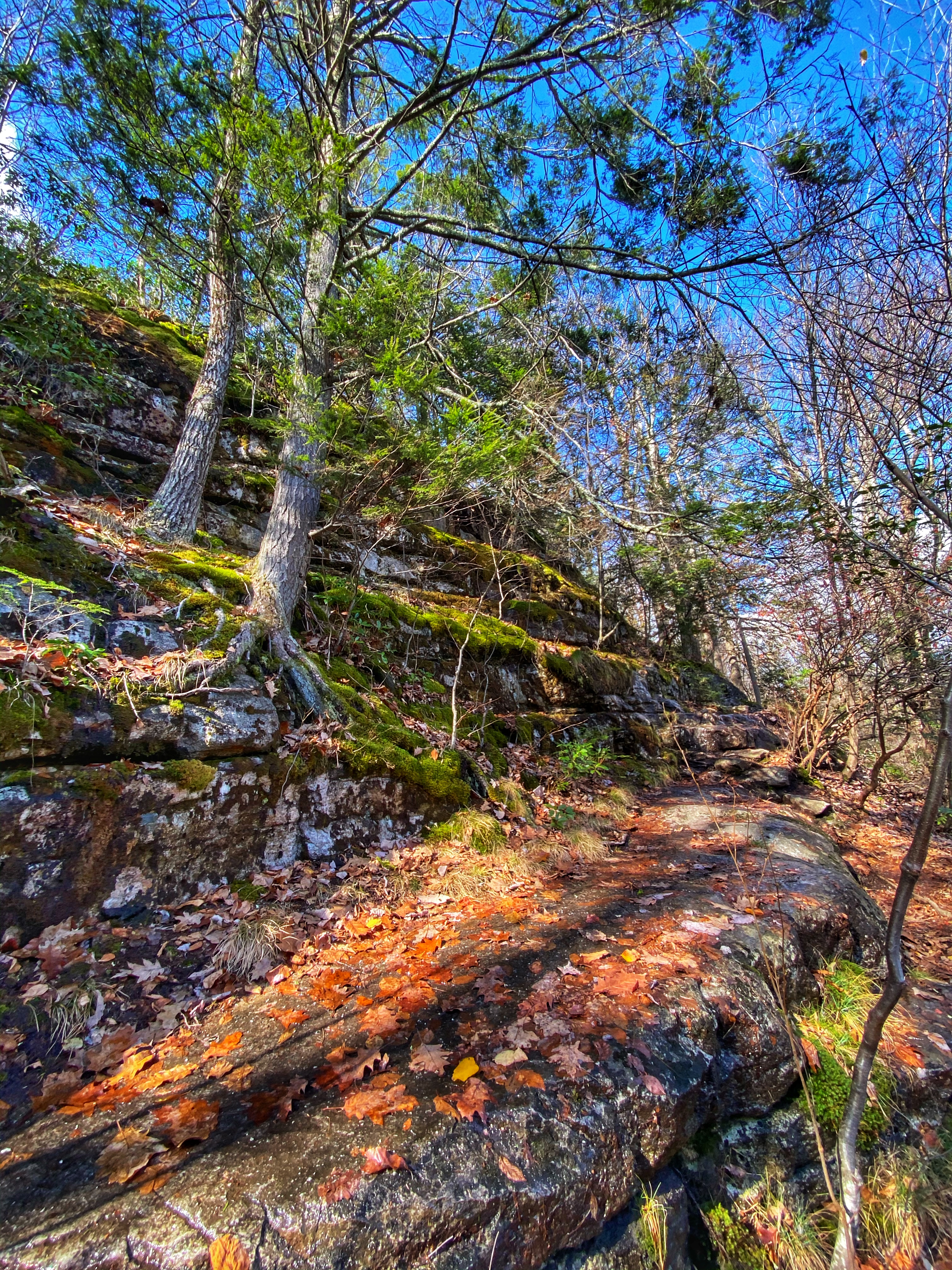
The trail heads south near the cliff edge through a dense growth of hemlocks and down a steep slope to cross a small stream that drains into Palmaghatt Ravine. Power lines are overhead here. The trail then climbs along the edge of the spectacular cliffs that bound the Ravine. Intricate joint cracks widen into deep intersection crevices. Huge blocks of conglomerate lie at random angles below the cliffs.
Scenes and Walks in the Northern Shawangunks
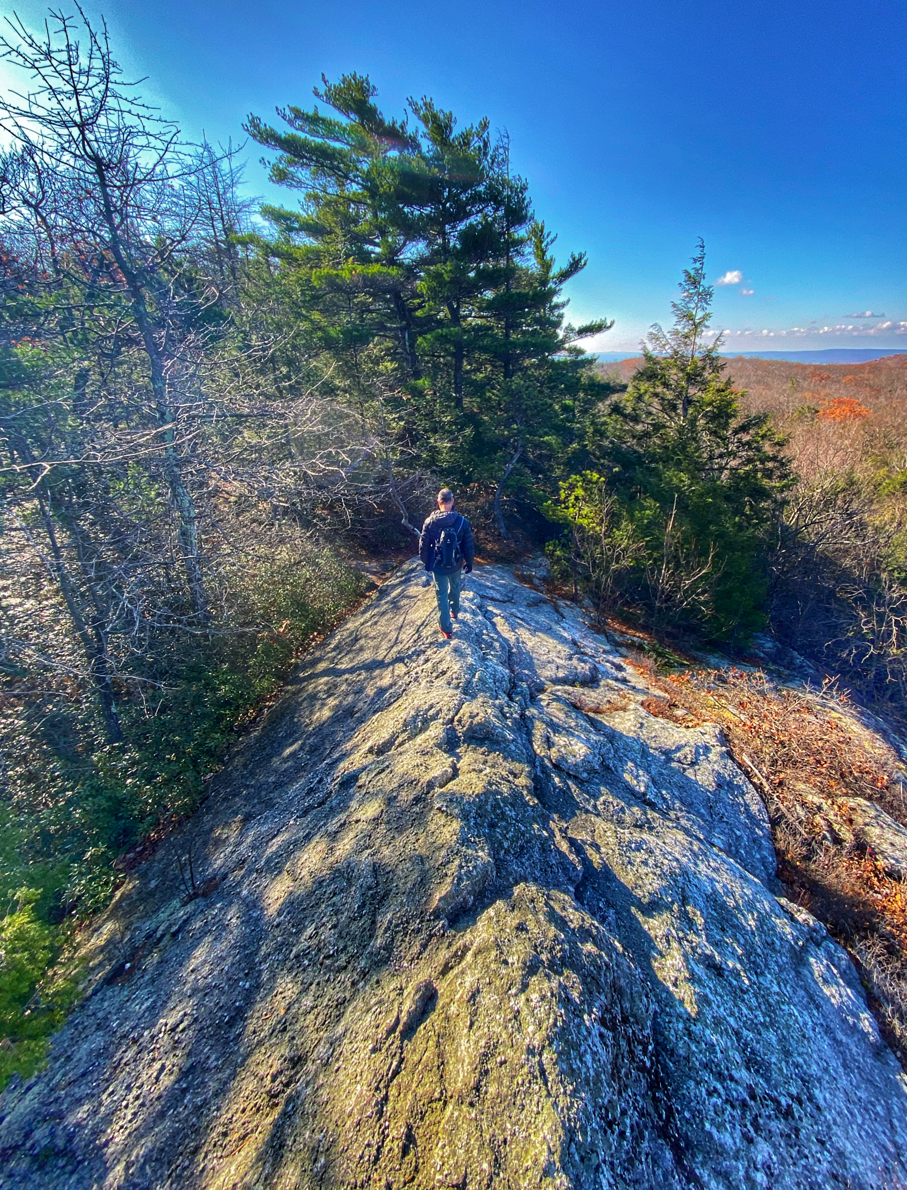

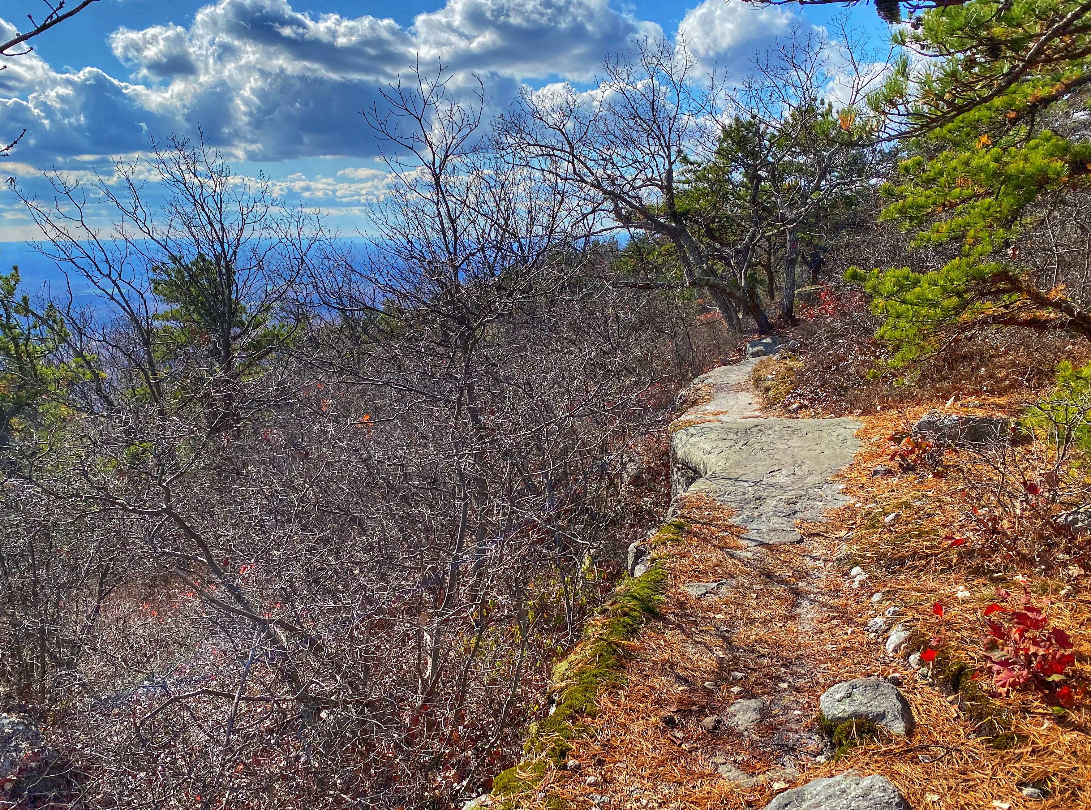
Finally after 1.2 miles, you’ll reach Gertrude’s Nose, a dramatic bright white escarpment with steep drop-offs.


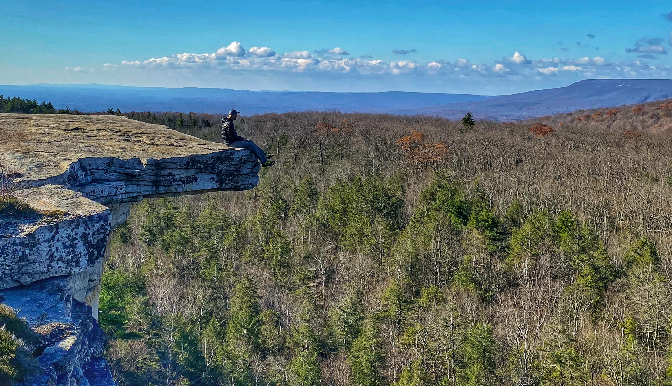
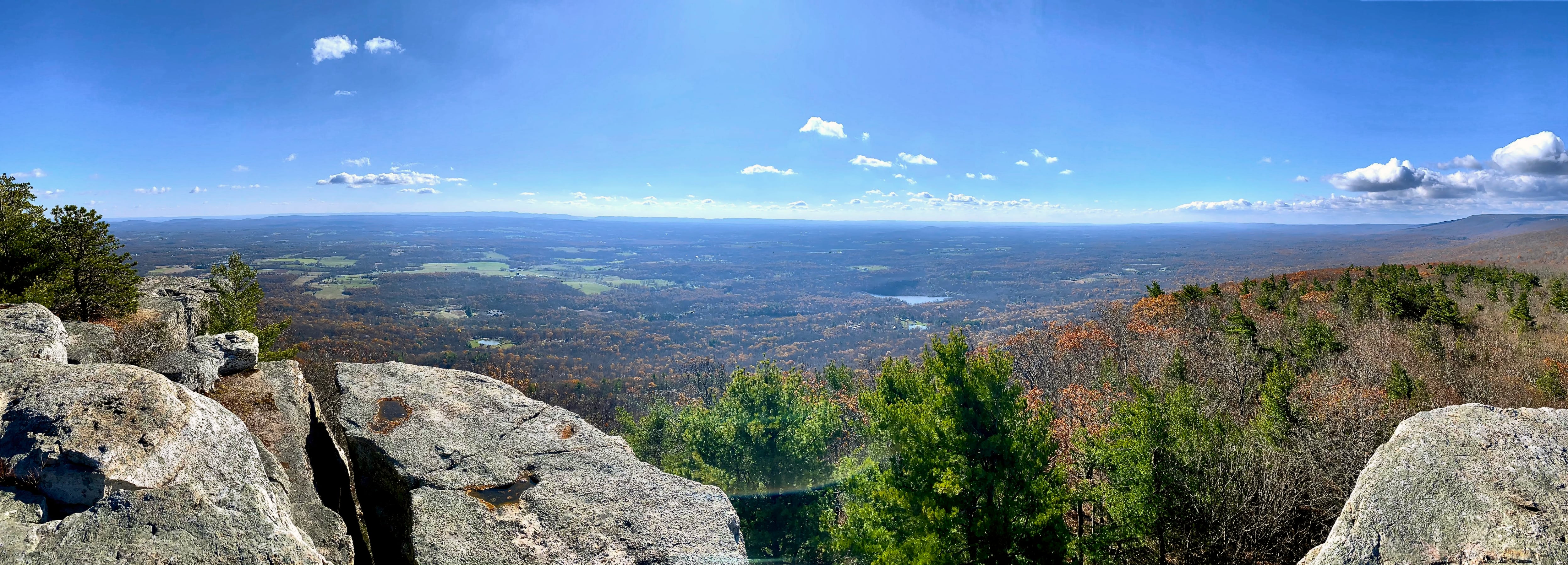
From Gertrude’s Nose you also get an unobstructed view of the Hudson Valley to the south.
Continue to follow the red blazes. While not as dramatic as the first half of the hike, it’s a beautiful trail.
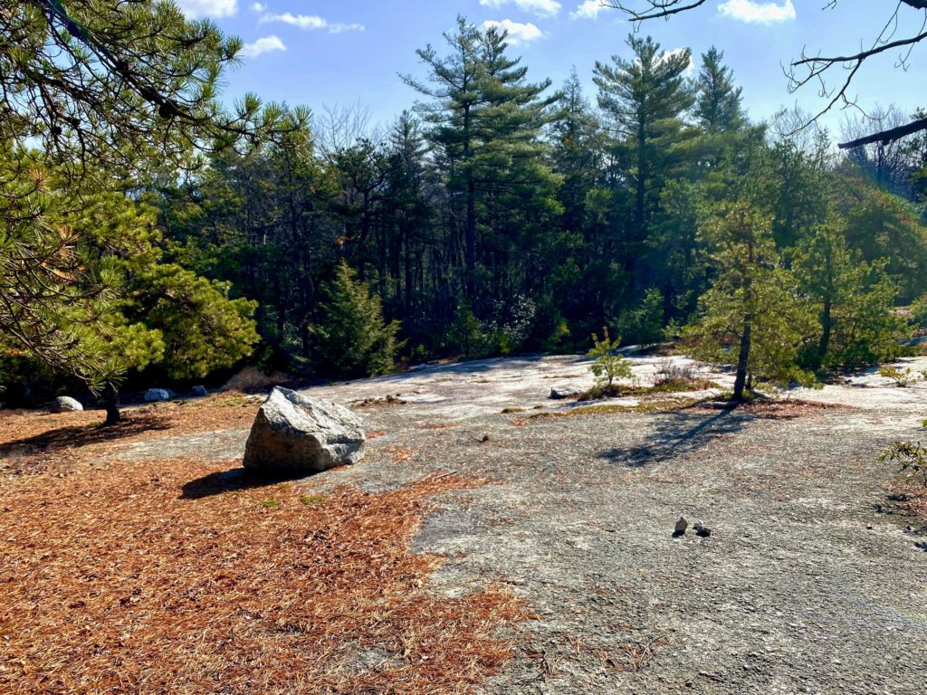
After crossing the power line again, the trail rises to a large exposed rock surface with pines. Look for cairns to help you follow the trail.

A short distance later, Millbrook Drive angles in and will be visible from the left. After a total of 1.75 miles from Gertrude’s Nose, the red blazes end at a junction just below the summit of Millbrook Mountain.
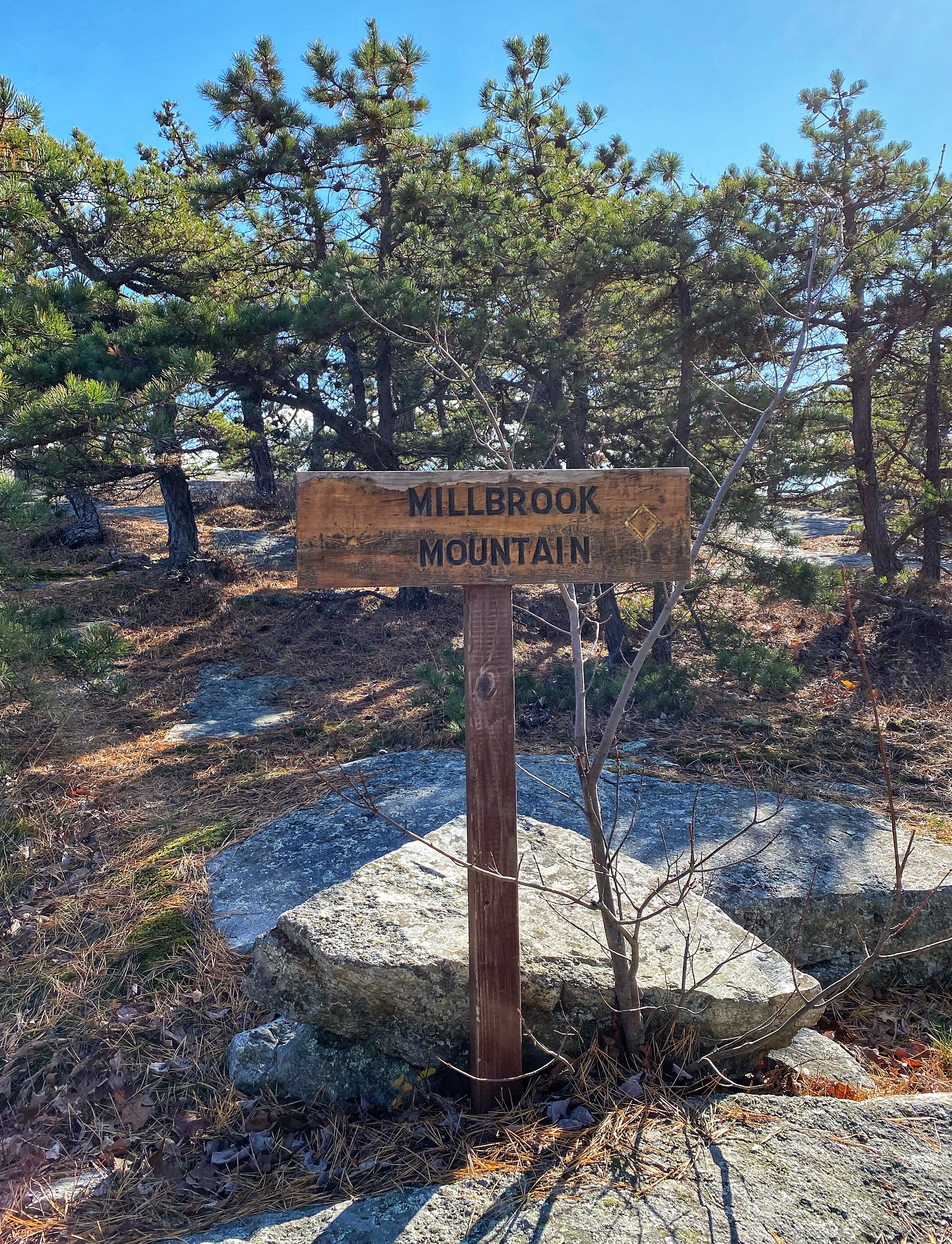
Make a left to go north and follow the red Millbrook Mountain Trail (not to be confused with the blue Millbrook Ridge Trail to the east or the yellow Millbrook Mountain Carriage Road to the west), which connects Millbrook Mountain to Lake Minnewaska.
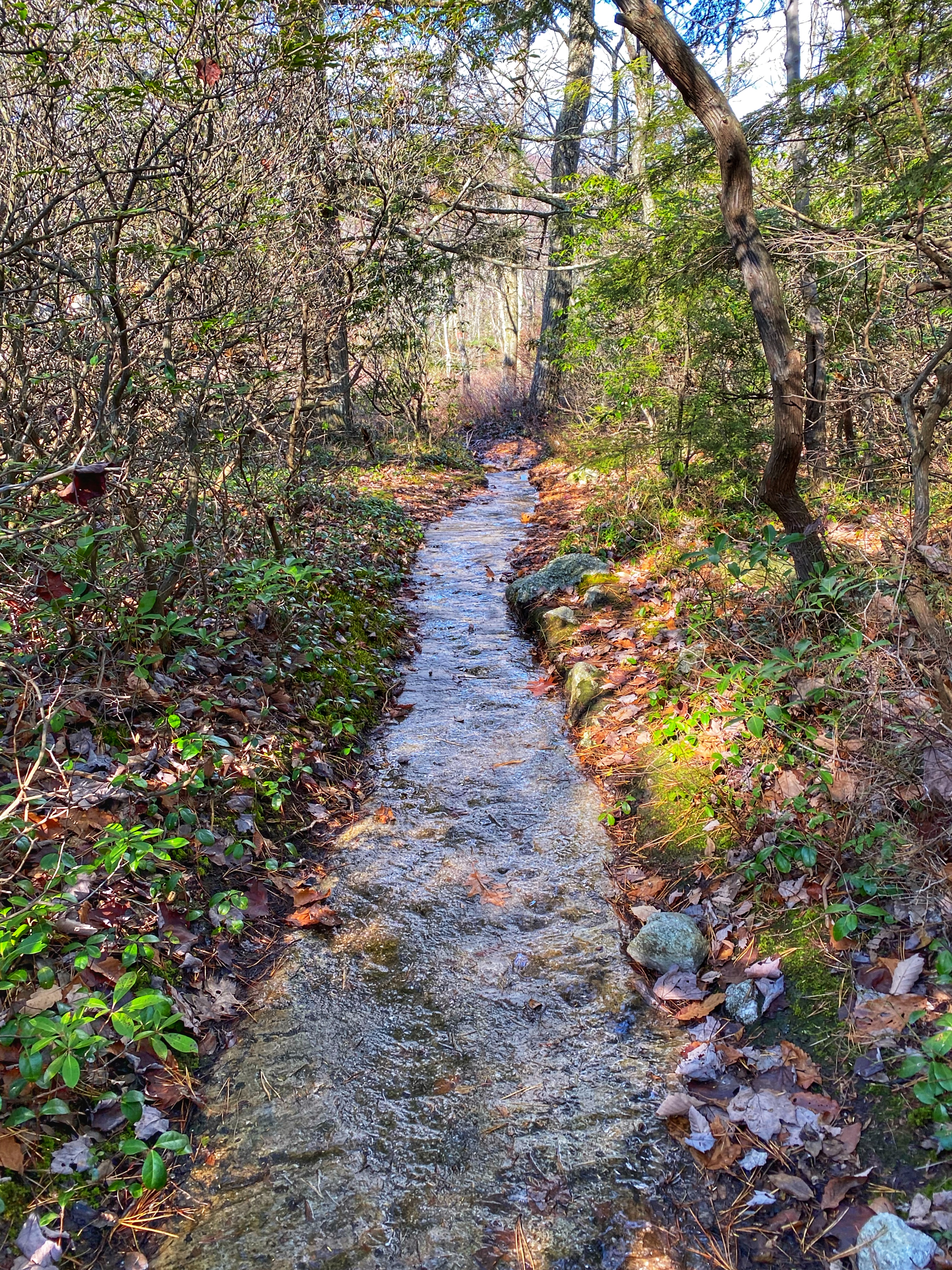
The trail now descends steeply – with parts of the trail practically a stream. Be careful – the trail can be slippery and hazardous, especially when icy. After 0.2 miles you’ll pass a junction with the Coxing Trail on your right. Continue to descend until you cross Coxing Kill.

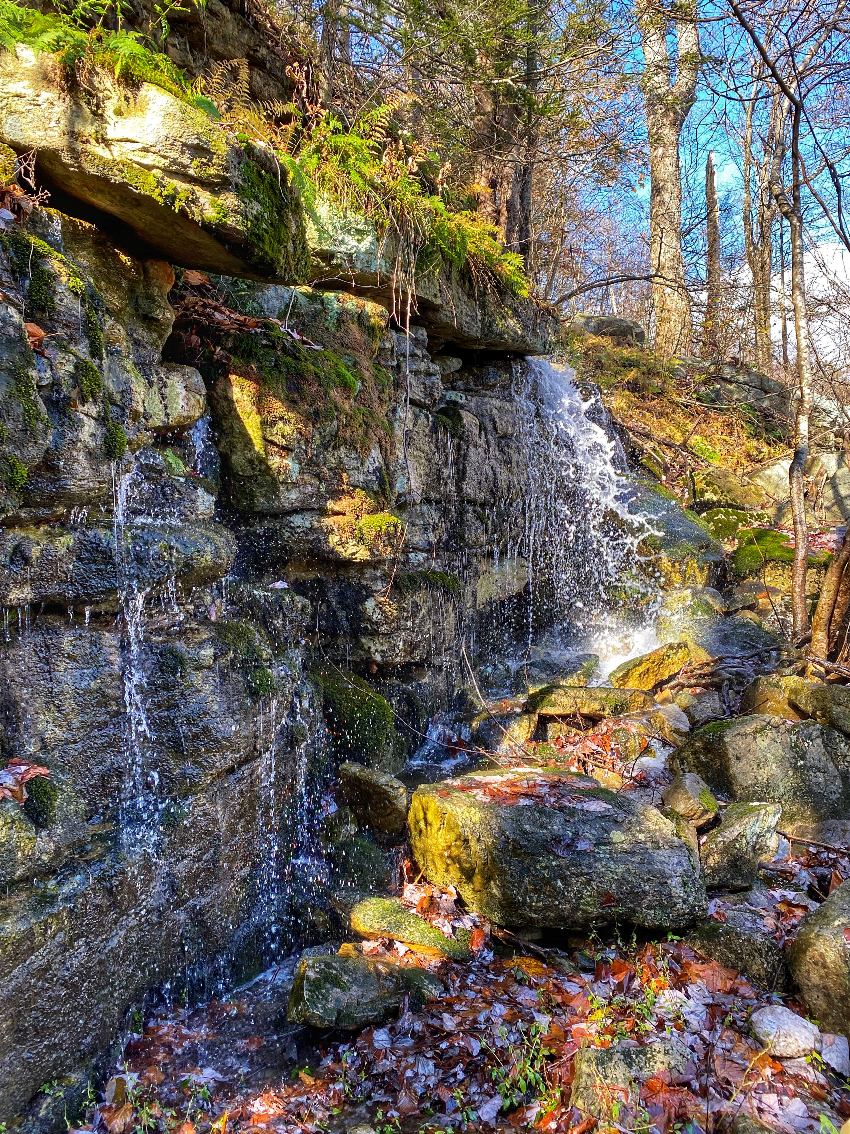
After crossing the stream, the trail climbs steeply. Along the way, a branch of the Coxing Kill, the outflow from Lake Minnewaska, flows through a mossy glen.
After a total of 1.2 miles from Millbrook Mountain, you again reach the Lake Minnewaska Carriage Road and views of the lake from the south facing north.
Turn left and follow the red-blazed road for a mile until you return to the parking lot.


