Overview: The 3.9 mile Castle Loop trail visits the Van Slyke Castle ruins and Ramapo Lake and provides great views of the Ramapo and Wyanokie Mountains. The shorter out-and-back hike to the ruins is a kid-friendly favorite.
Van Slyke Castle is one of our Top Kid-Friendly Hiking Trails in New Jersey.
Hike Length: 2.6 miles (to Van Slyke Castle ruins and back) / 3.9 miles (full Castle Loop)
Elevation gain: 720 feet (to Van Slyke Castle ruins and back) / 900 feet (full Castle Loop)

Location: Ramapo Mountain State Forest, Bergen and Passaic Counties, NJ
Nearby: Vista Loop Trail, Ramapo Valley Reservation
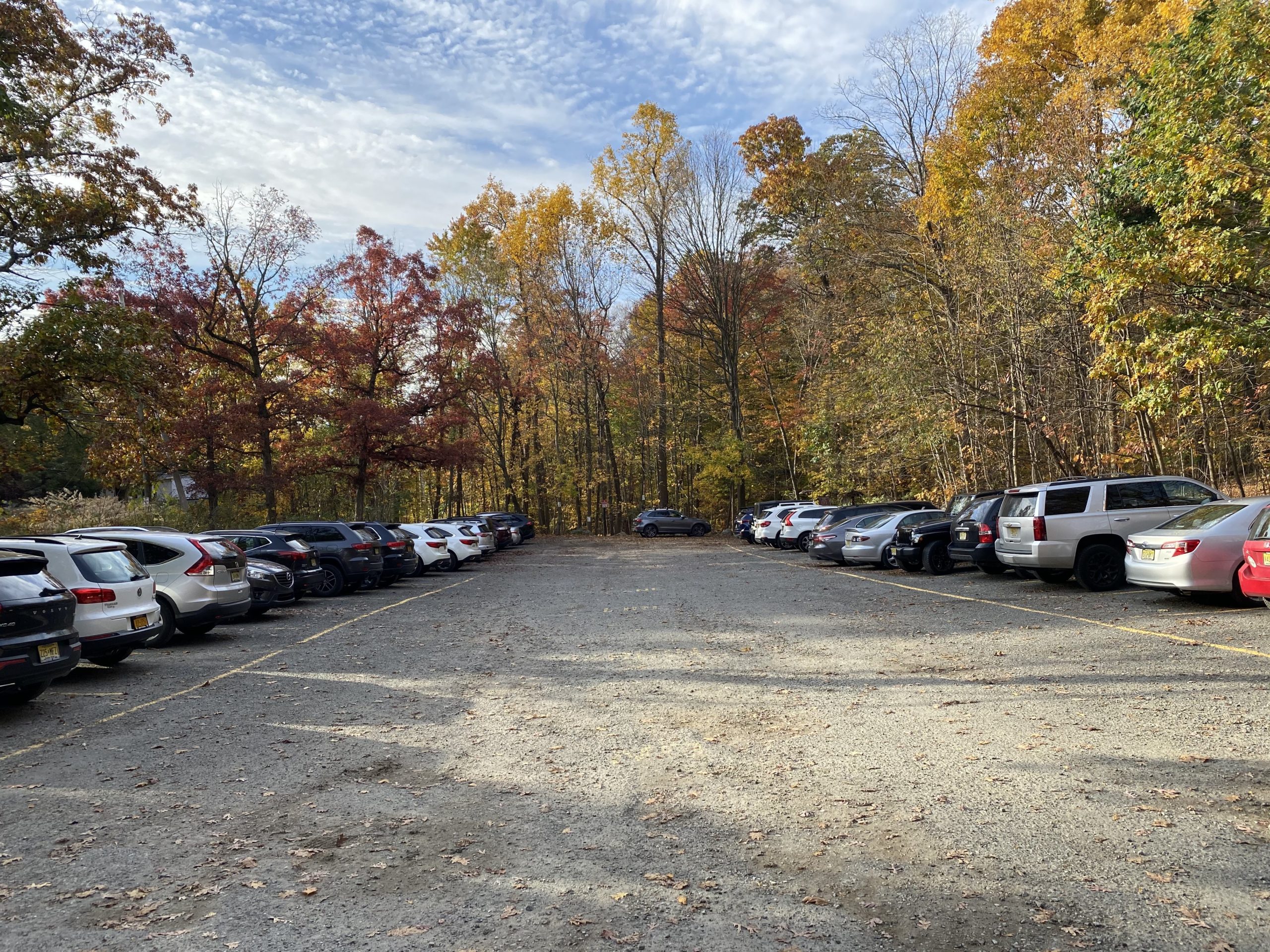
Parking: Park in the Lower Parking area on Skyline Drive shortly after you get off I-287. The trailhead for the blue-blazed Ramapo Lake Spur is at the end of parking lot. The parking lot often fills quickly early in the morning, especially on weekends.
Maps:
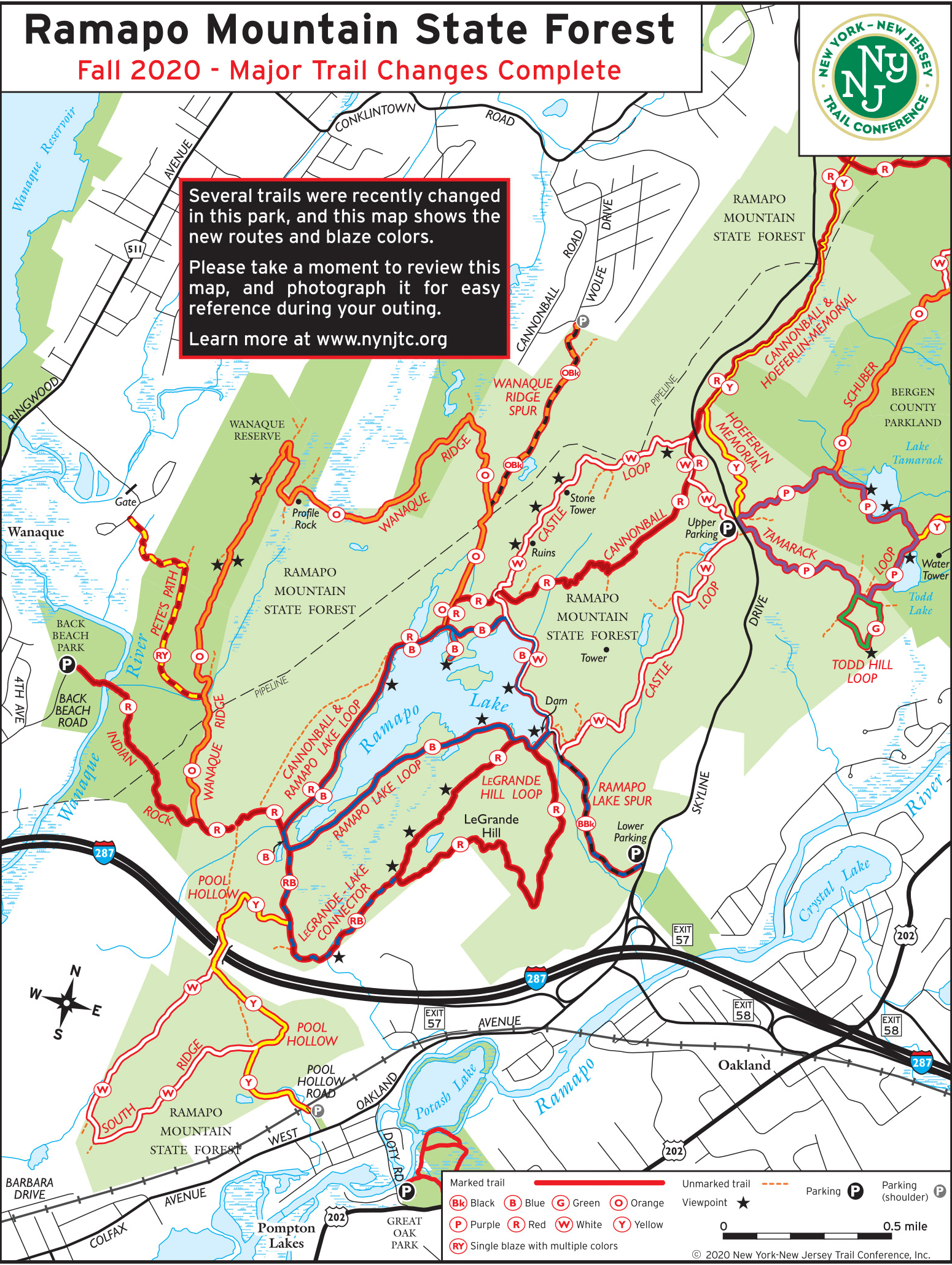
NOTE: The white-blazed Castle Loop, along with other trail changes, were instituted in 2020 as a series of trail improvements in Ramapo Mountain State Forest. Older maps below do not reflect the new blaze colors.
- NY-NJ Trails Conference North Jersey Trails Map #115
- NY-NJ Trail Conference Ramapo Mountain State Forest map
- NJ Parks & Forests Ramapo Mountain State Forest map
Trail description:
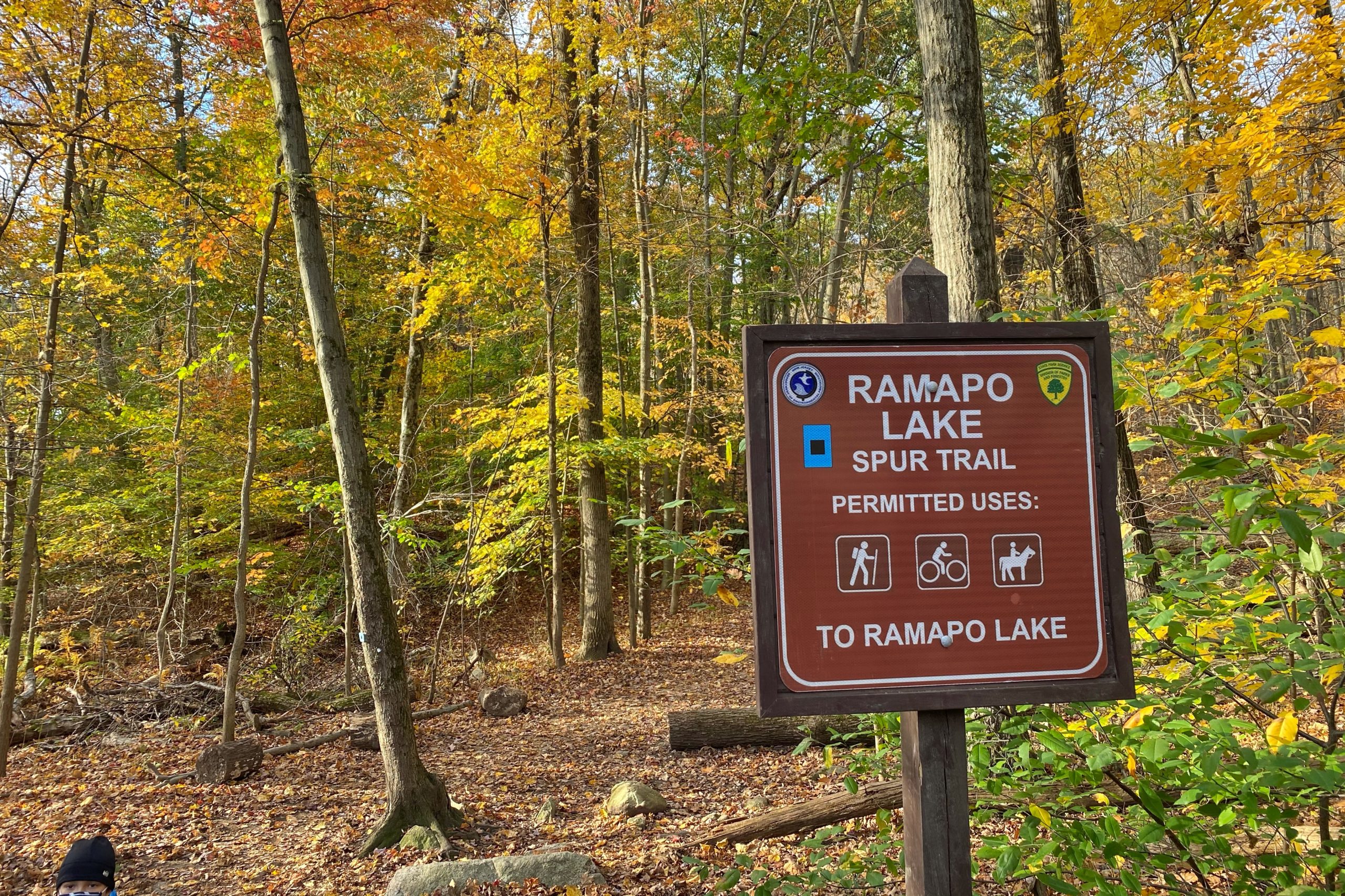
From the parking lot, follow the black-on-blue blazed Ramapo Lake Spur Trail trail which heads west.
The trail climbs a steep and rocky creek that comes from Ramapo Lake.

The trail levels out after 0.25 miles and winds through forested ridges. As the trail reaches Ramapo Lake (the dam to the lake is to the left – do not cross it), it becomes a gravel road along the lakeshore.
-
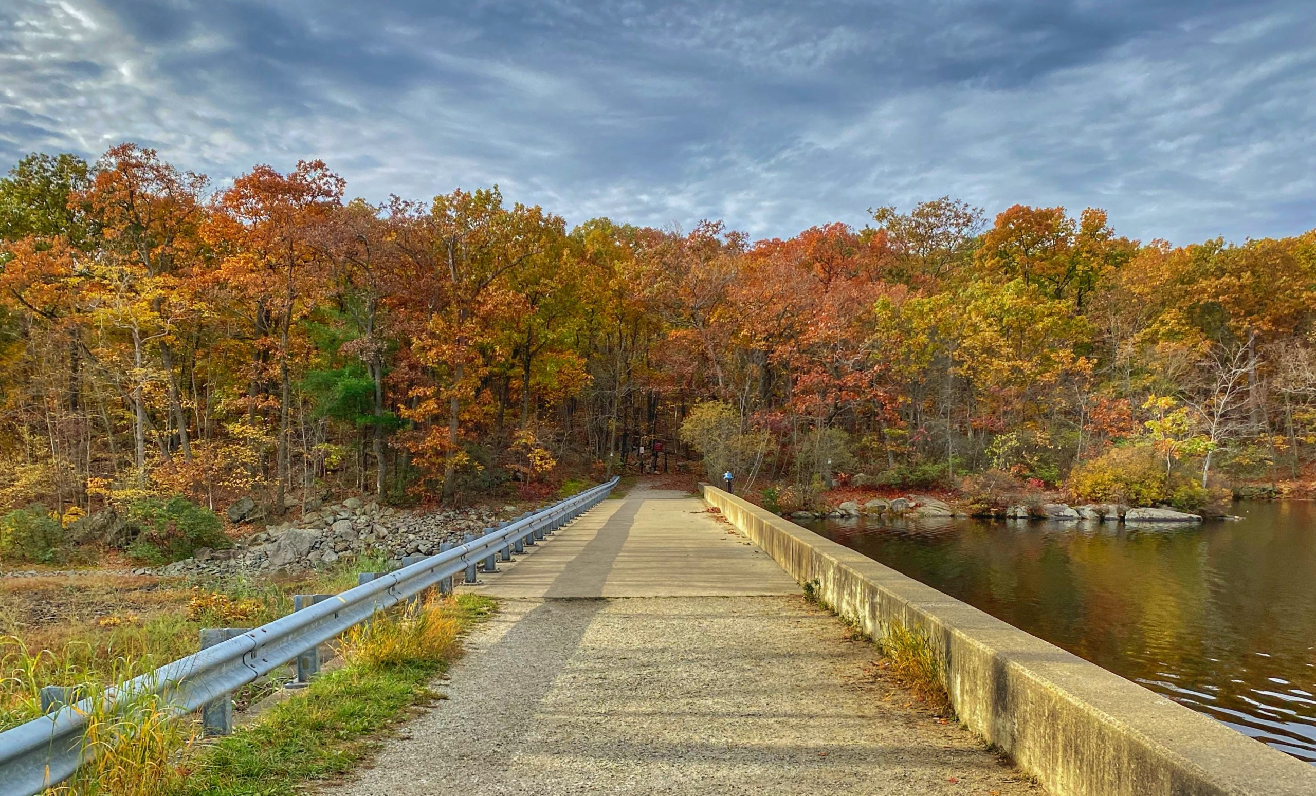
Dam at Ramapo Lake -
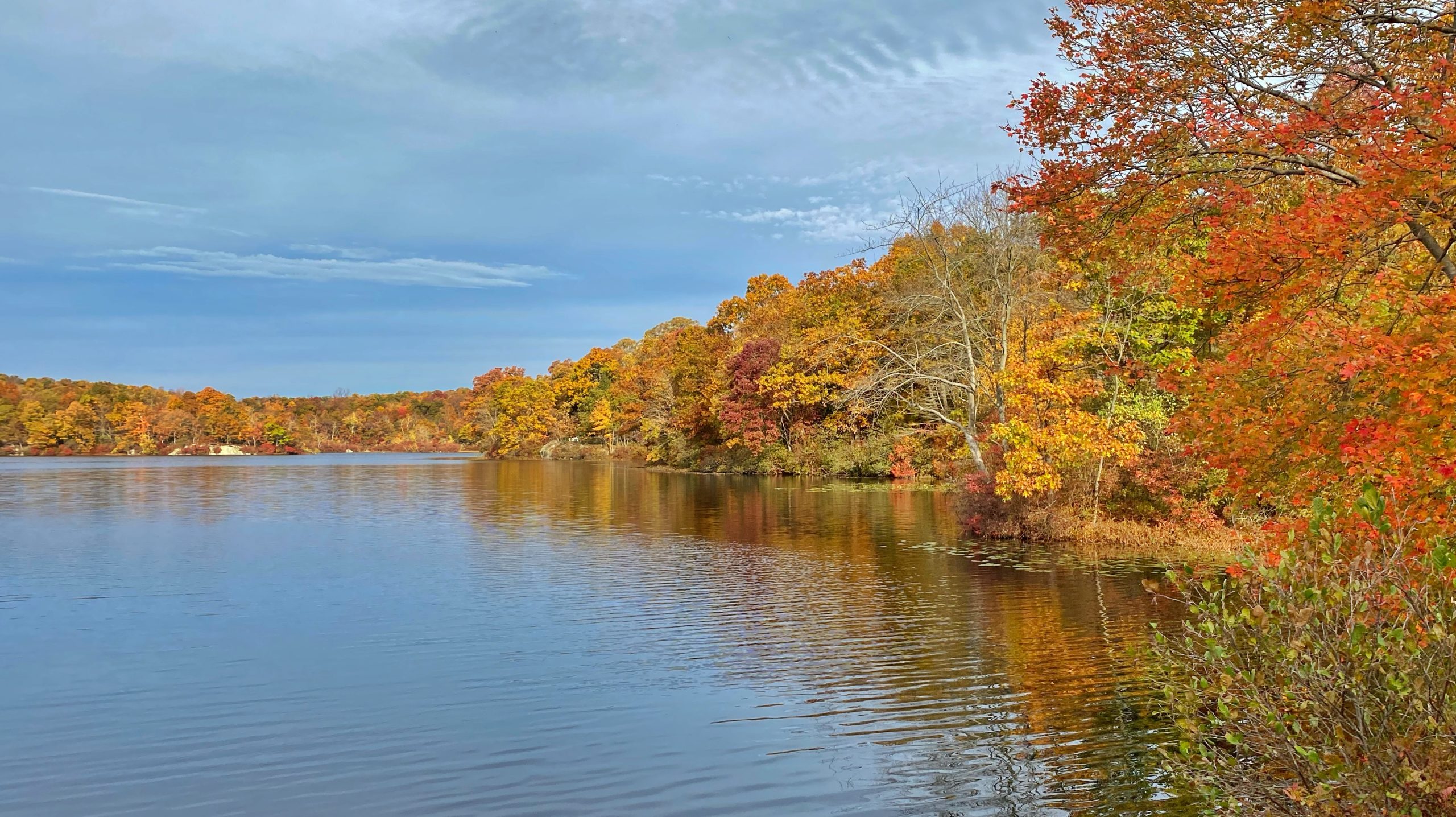
Ramapo Lake -
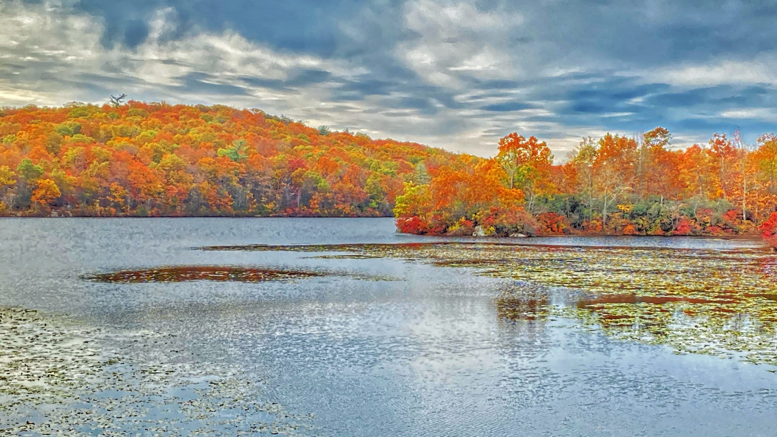
Ramapo Lake
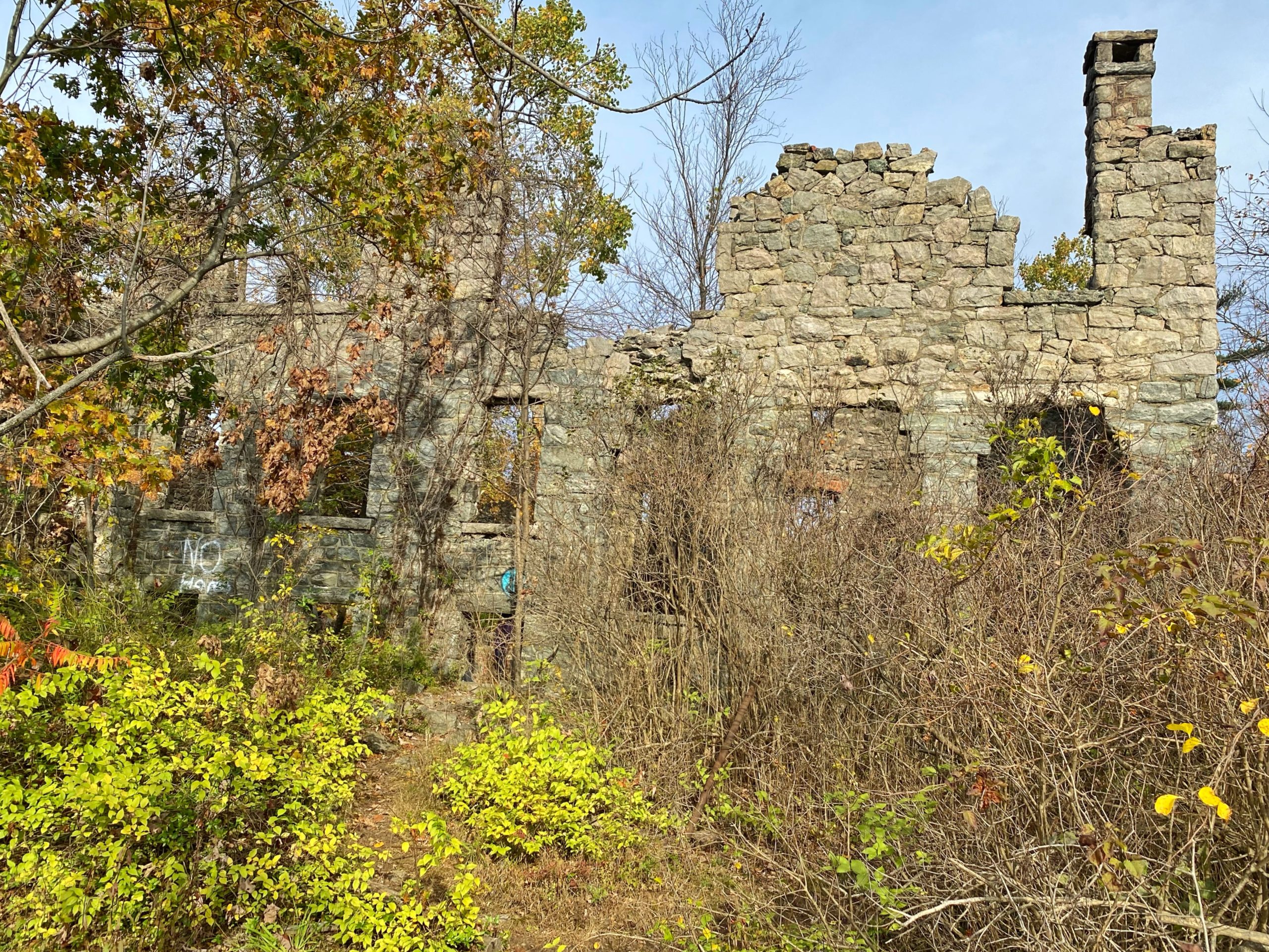
You’re now on the white-blazed Castle Loop. Continue north along the Castle Loop, which travels along a short ridgeline with ruins of a stone mansion overlooking Ramapo Lake. Right before you arrive at the mansion, there are several nice viewpoints on the left side of the trail.

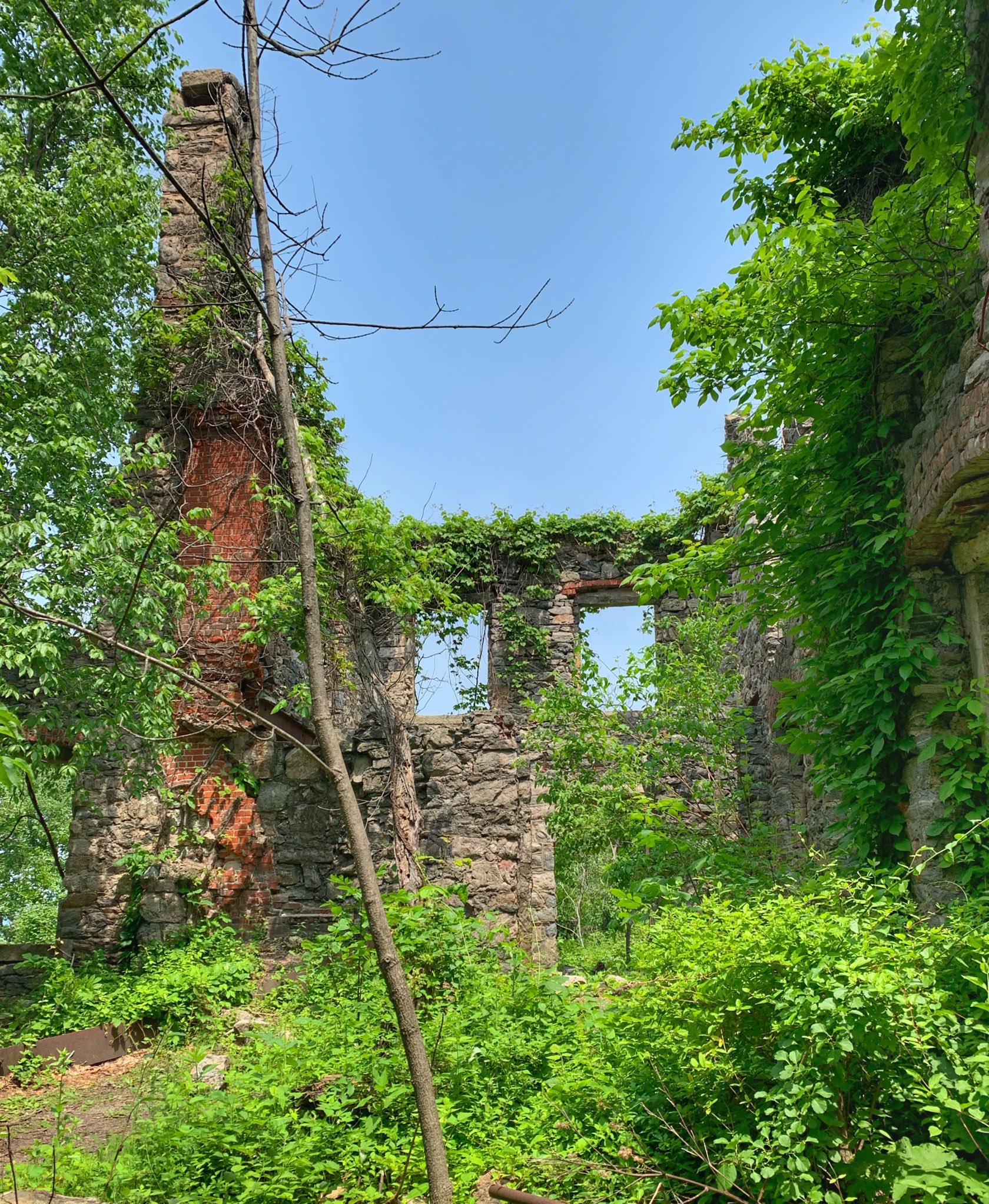
This is a good spot to stop and enjoy the view. The castle, known as Foxcroft or the Van Slyke Castle, was the family home of William Porter. It was built in 1910 and occupied until 1940, when it fell into ruin (a little further north along the trail are the ruins from a pool and water tower).


On clear days, you can also get views of the New York City and Jersey City skylines.

North of the ruins, the trail sees much less foot traffic. Turn around here for a shorter hike or continue north for the full loop.
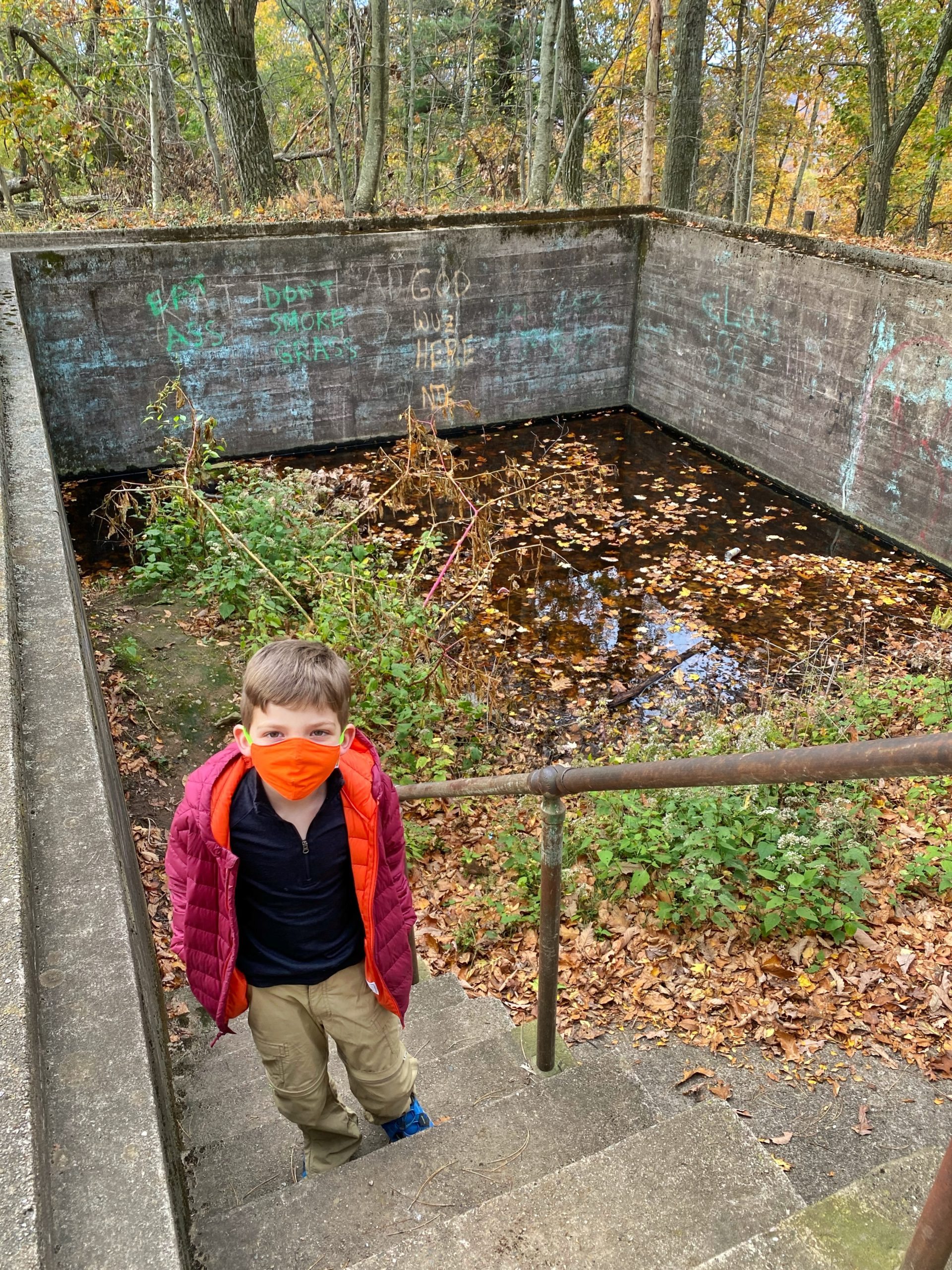
The ruins of a pool are just north of the mansion.
A little further north on the left side of the trail is a clearing with west facing views.

Continue north and you’ll soon reach the ruins of a water tower at the highest point on the hill. The pipe to carry water down to the mansion is still visible in parts.

(trail description for remainder of the new loop by Daniel Chazin, NY-NJ Trail Conference)
Just beyond, there is another view from an open rock ledge to the left of the trail over the Wanaque Reservoir to the west. The trail now begins to descend.
Watch carefully as the Castle Loop briefly turns left onto a woods road, then immediately turns right onto a footpath before reaching the route of a gas pipeline. It turns right again onto a woods road, turns left onto a footpath before reaching a wide gravel road, then turns right and follows the gas pipeline for 350 feet. After turning right and leaving the pipeline, the trail crosses a stream and climbs, first gradually, then rather steeply through mountain laurel, to a rock ledge with a broad view. From the ledge, you may be able to see the stone tower you passed about half a mile back.
A short distance beyond, the Castle Loop reaches a paved road, with Skyline Drive just to the left. Turn right onto the road, also the route of the Cannonball Trail (white-“C”-on-red blazes). The trails follow the road for 200 feet, then turn left onto a footpath through the woods. Soon, you’ll reach a junction where the two trails diverge. Turn left and follow the white-blazed Castle Loop along a footpath roughly parallel to Skyline Drive until you reach the Upper Parking area.
Continue to follow the white blazes, then bear right onto a footpath parallel to a gravel road. After passing a small pond on the right, follow the white blazes as they briefly turn right onto the road (this portion of the road is paved), then turn left onto another woods road. After passing an interesting rock outcrop on the right, you’ll come to a Y-intersection, where the white-blazed trail bears right and begins to descend.
Soon, the gravel road briefly reappears on the right, but bear left to stay on the white-blazed trail, which follows a rocky woods road over undulating terrain. The road eventually narrows to a footpath and crosses an intermittent stream. After descending on a winding route and once again briefly approaching the gravel road, the Castle Loop heads down to a woods road – the route of the black-square-on-blue-blazed Ramapo Lake Spur.
Turn left, and follow the black-square-on-blue blazes back to the Lower Parking area where you started.


