Overview
If you’re looking for a challenging hike in New Jersey, this 15.5 mile, 4,200+ foot elevation gain hike more than delivers. Think of it as a more challenging version of the Stonetown Circular Trail in Ringwood. Building on Stonetown Circular loop, this hike adds an extension through Long Pond Ironworks and the northern part of Norvin Green State Forest that climbs an additional three more mountains for a heart-pounding series of ups and downs.
If you’re here because you’re looking for a challenging hike in New Jersey, also consider the 11 mile Splitrock Reservoir Loop.
Wyanokie Traverse?
Stone Circular Plus? Super Stonetown? This loop doesn’t have a real name as far as I can tell, but it traverses a good chunk of the Wyanokie Mountains, so I’m going with that.
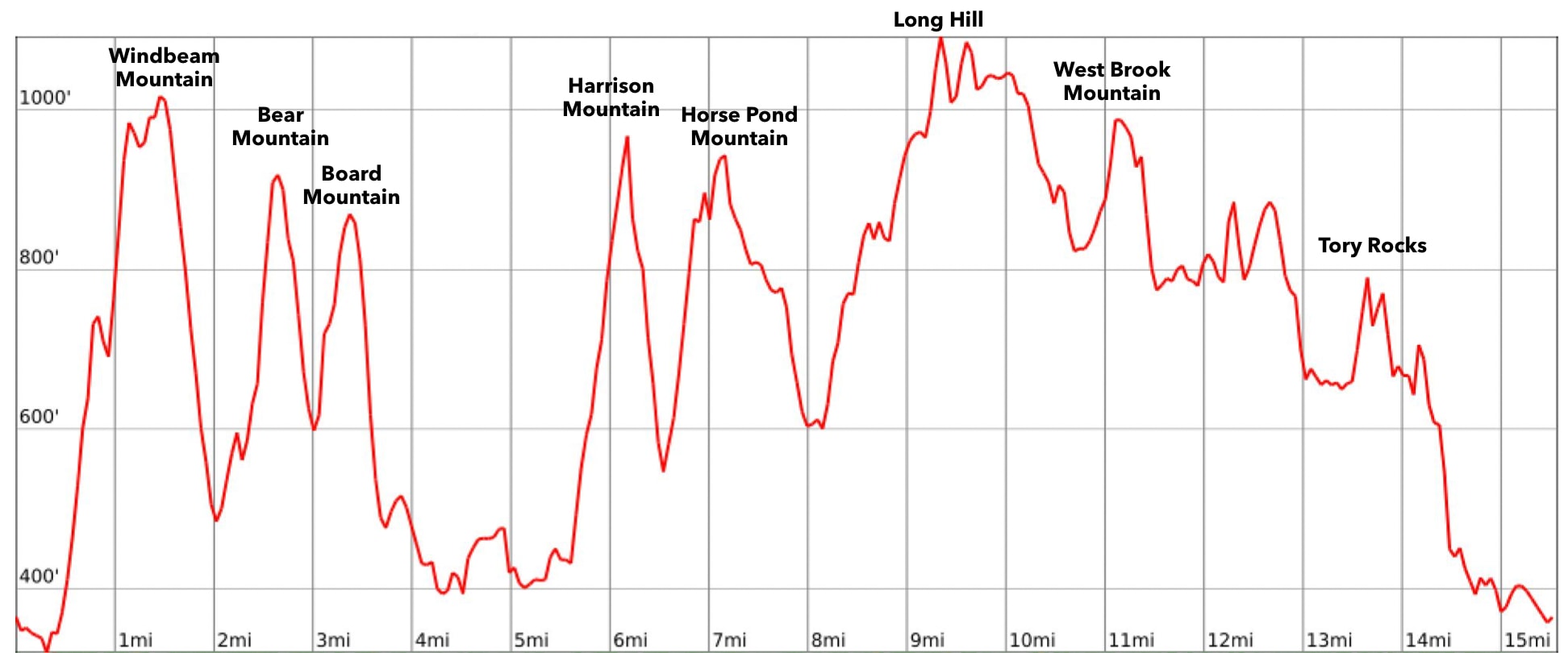
Length: 15.5 miles
Elevation gain: 4,200 feet
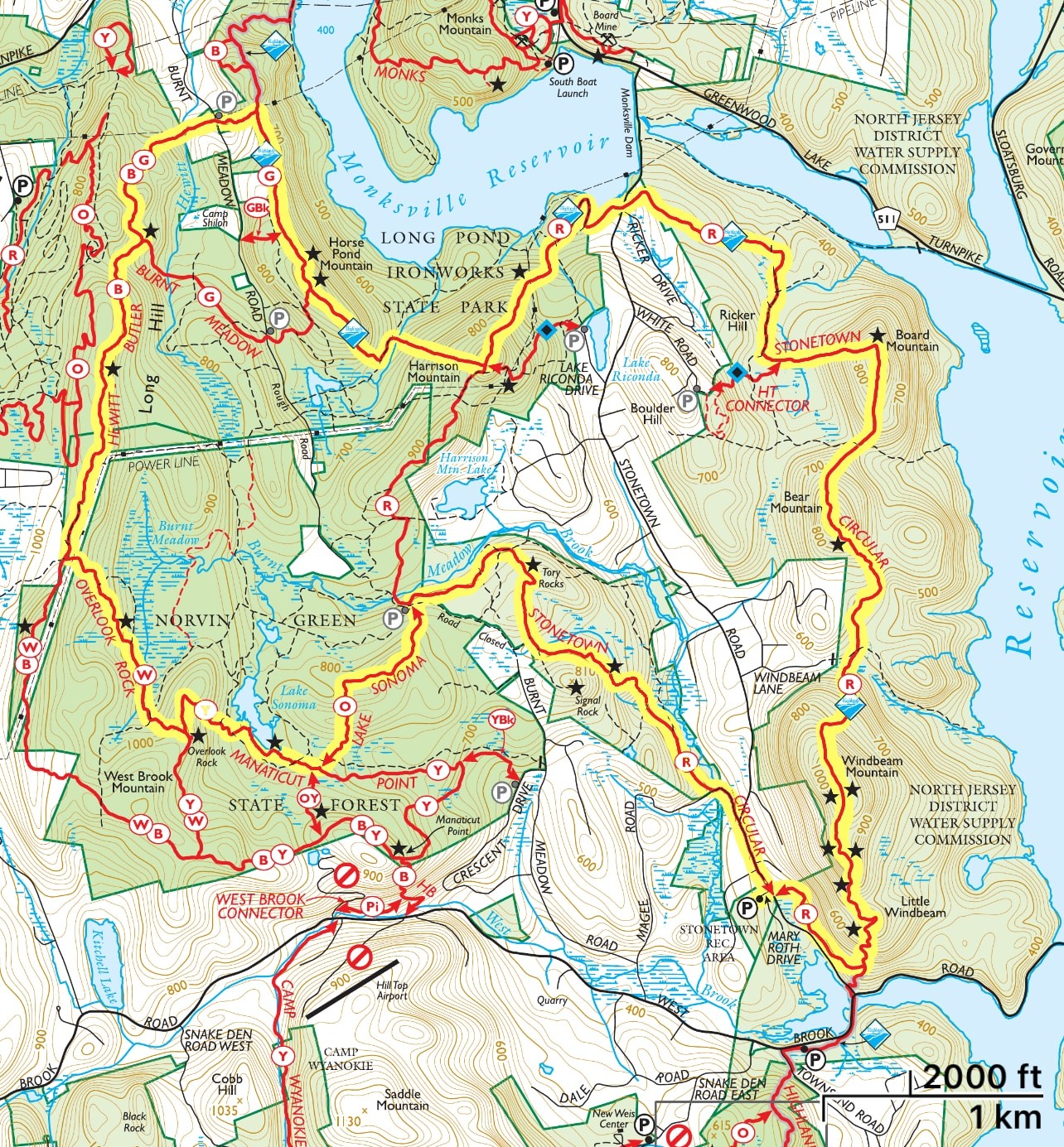
Location: Ringwood, NJ. The trail passes through land managed by the North Jersey District Water Supply Commission, Long Ponds Ironworks State Park, Norvin Green State Forest, and the Passaic River Coalition.
Parking: Park in the Stonetown Recreation Complex parking lot located on Mary Roth Drive.
Maps:
- NY-NJ Trail Conference North Jersey Trail Map #115 (print)
- NY-NJ Trail Conference North Jersey Trails Map (Avenza)
- Most of the trail is visible on the top right of the Norvin Green State Forest Map.
- The northern part of trail loop can be seen in the NJ DEP Norvin Green State Forest-North Map.
Trail description
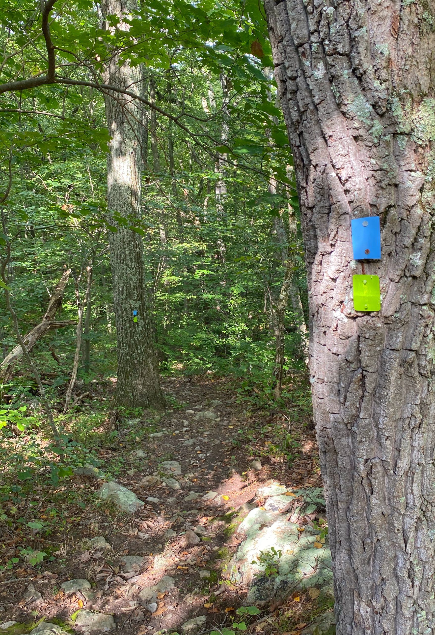
Walk out of the parking lot to the right and soon find the red-triangle-on-white blaze in the woods on your left. You will follow the red triangle on white blazes for much of the way.
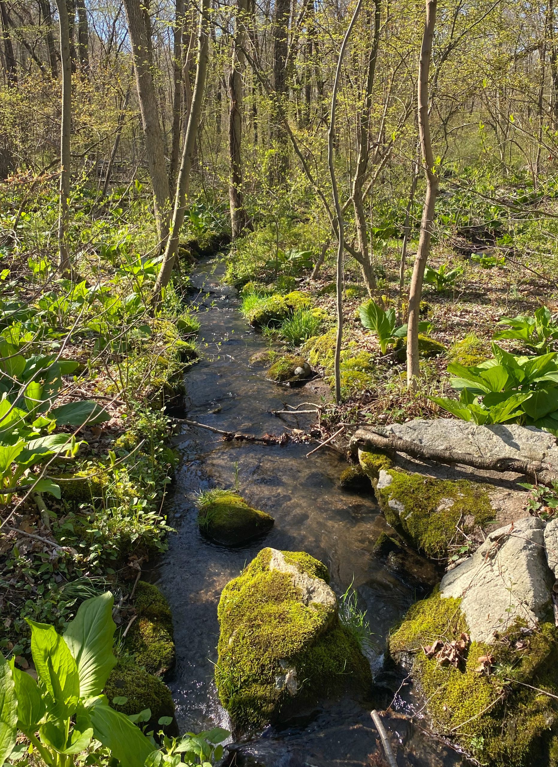
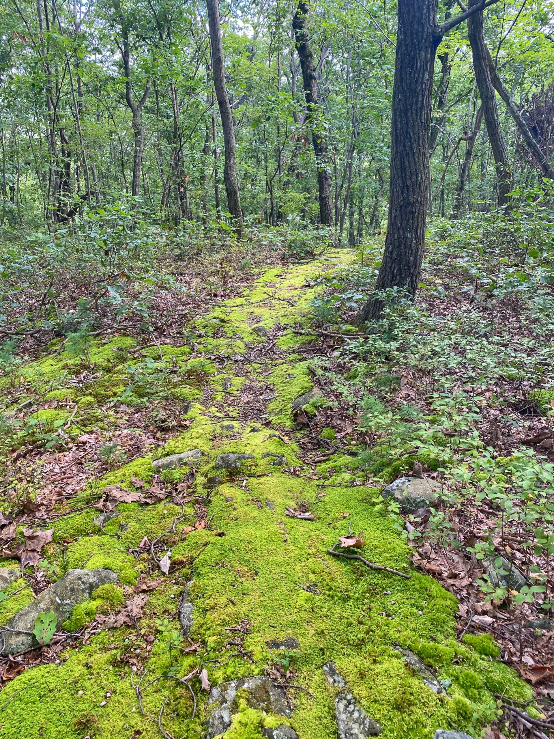
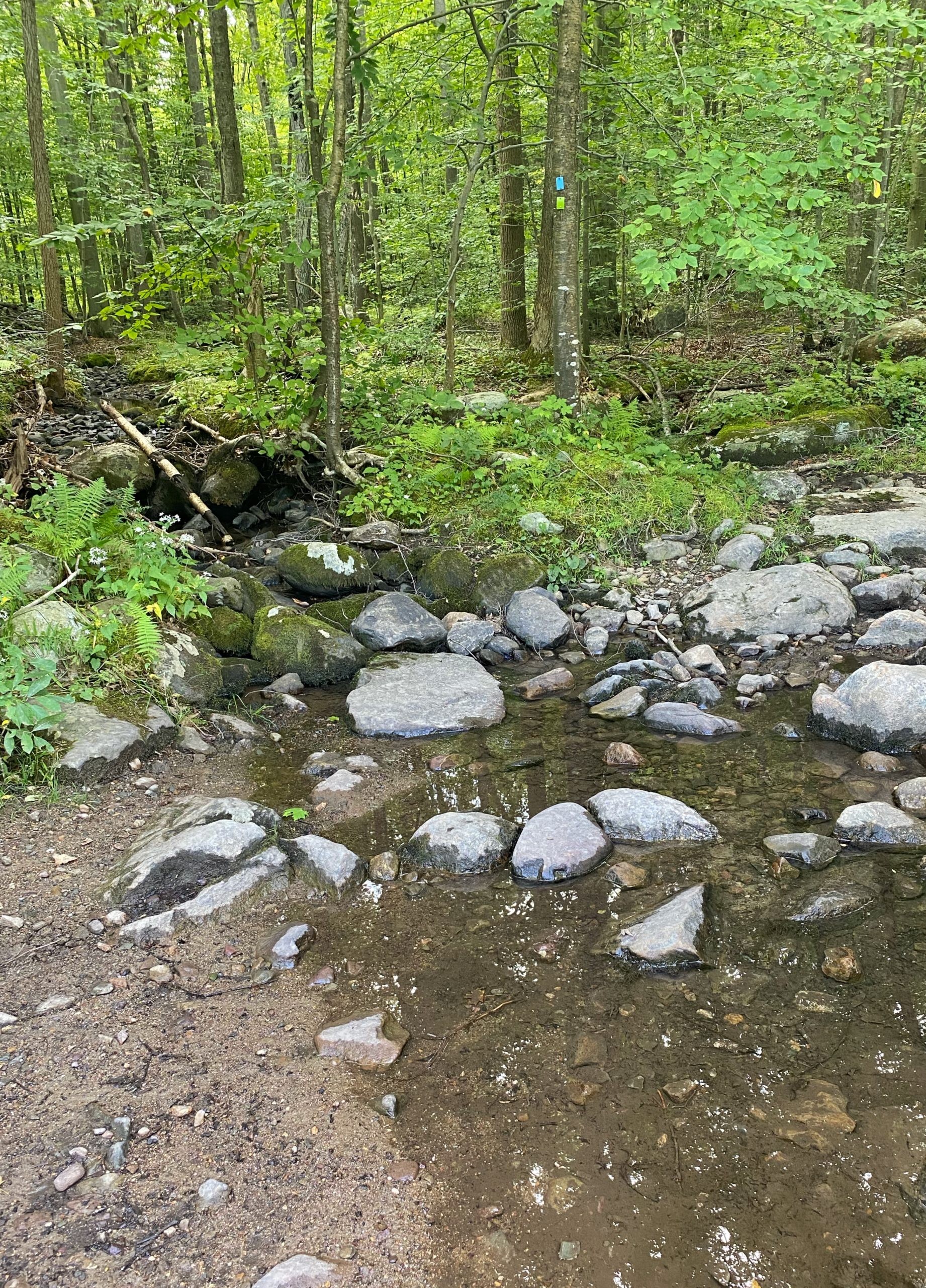
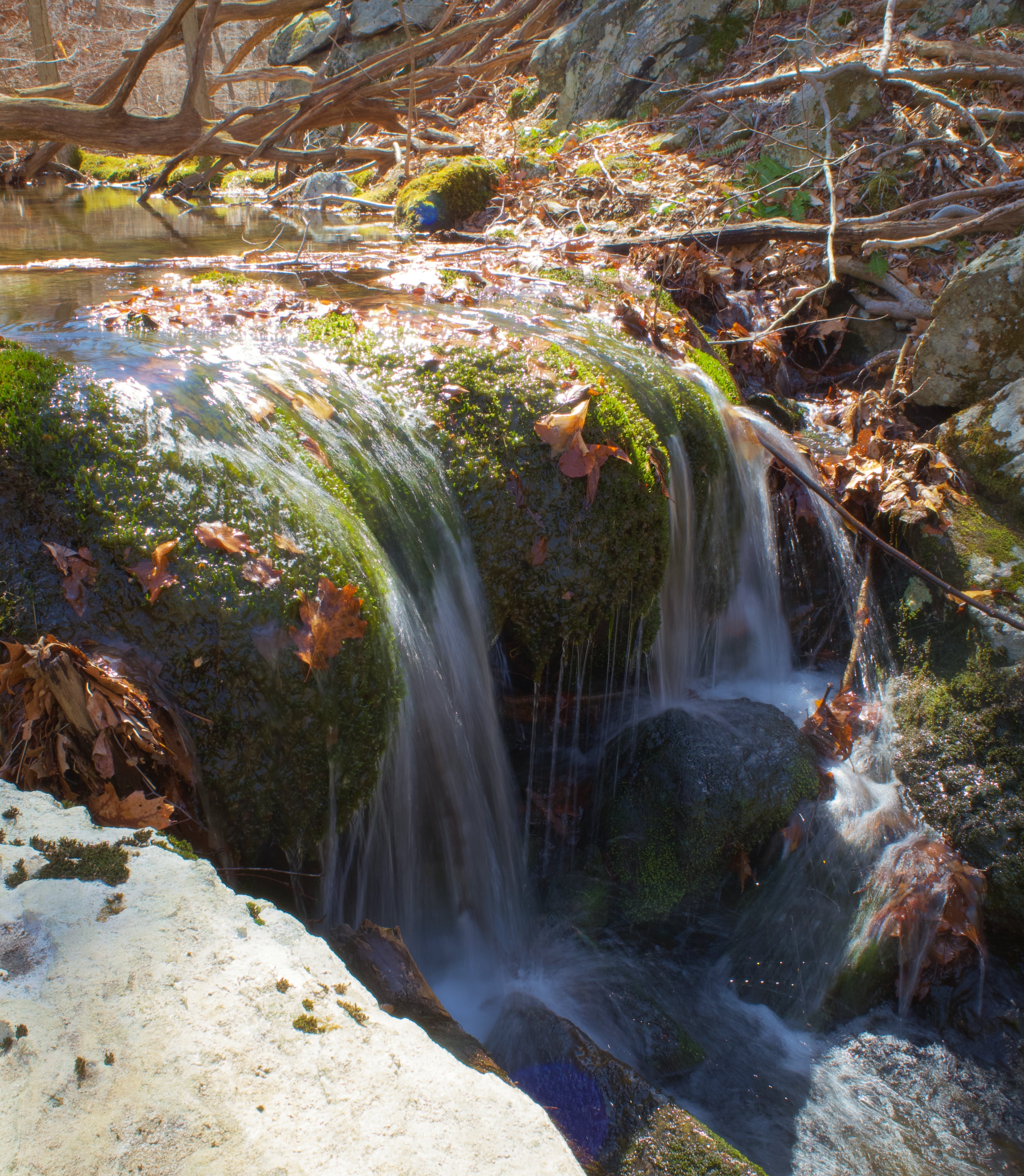
You’ll soon cross a small stream as the trail passes through a wet area.
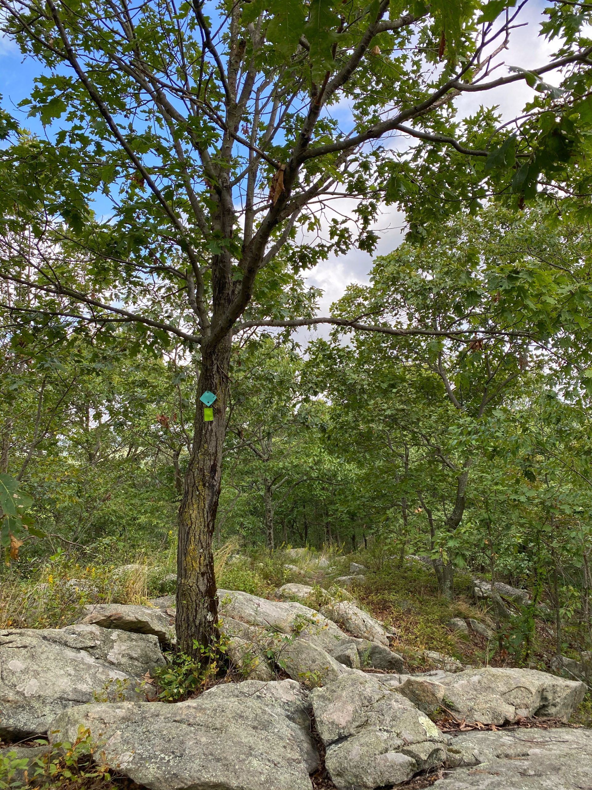
Soon, you’ll connect with the Highlands Trail (teal diamond) – the eastern half of the Stonetown Circular Trail coincides with the Highlands Trail – and you’ll begin the first of several steep uphill climbs up Little Windbeam.
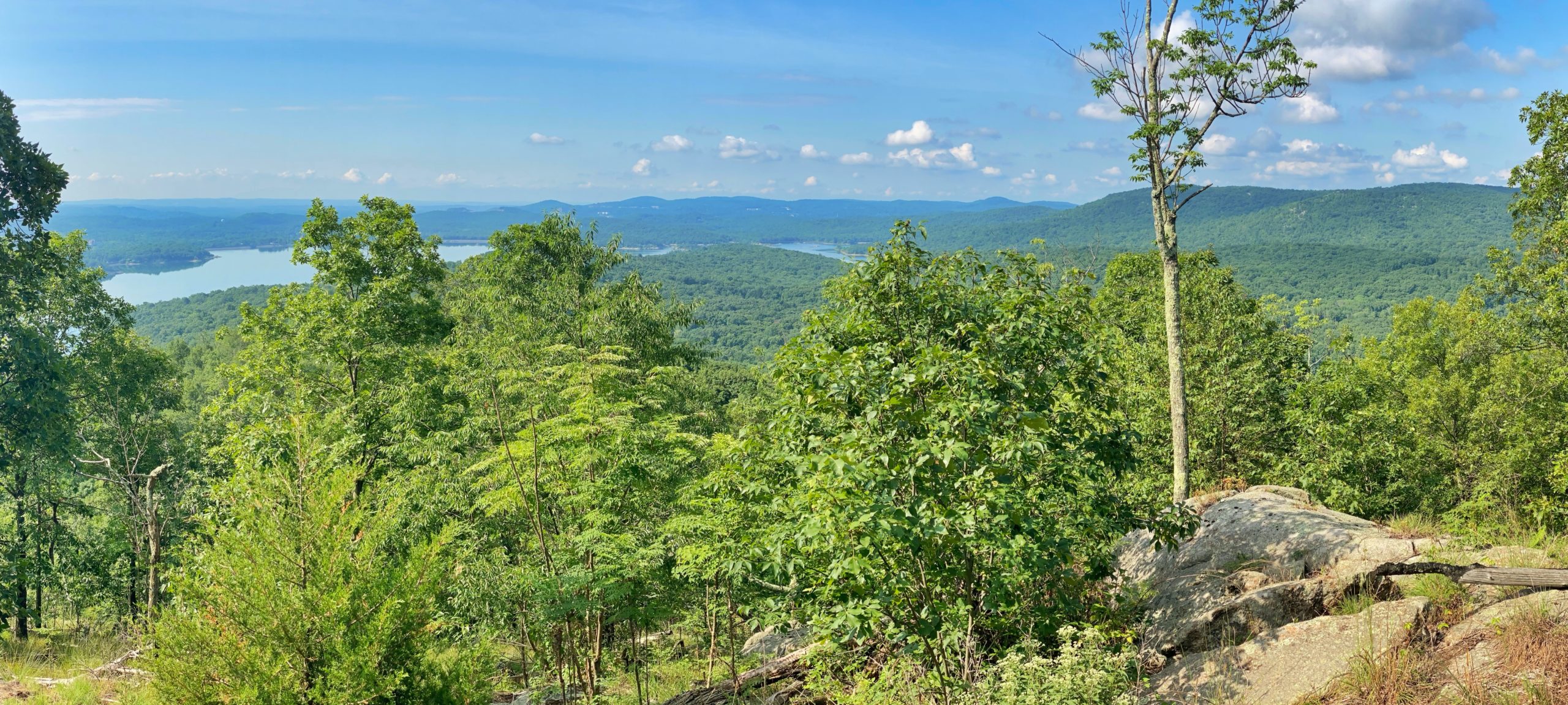
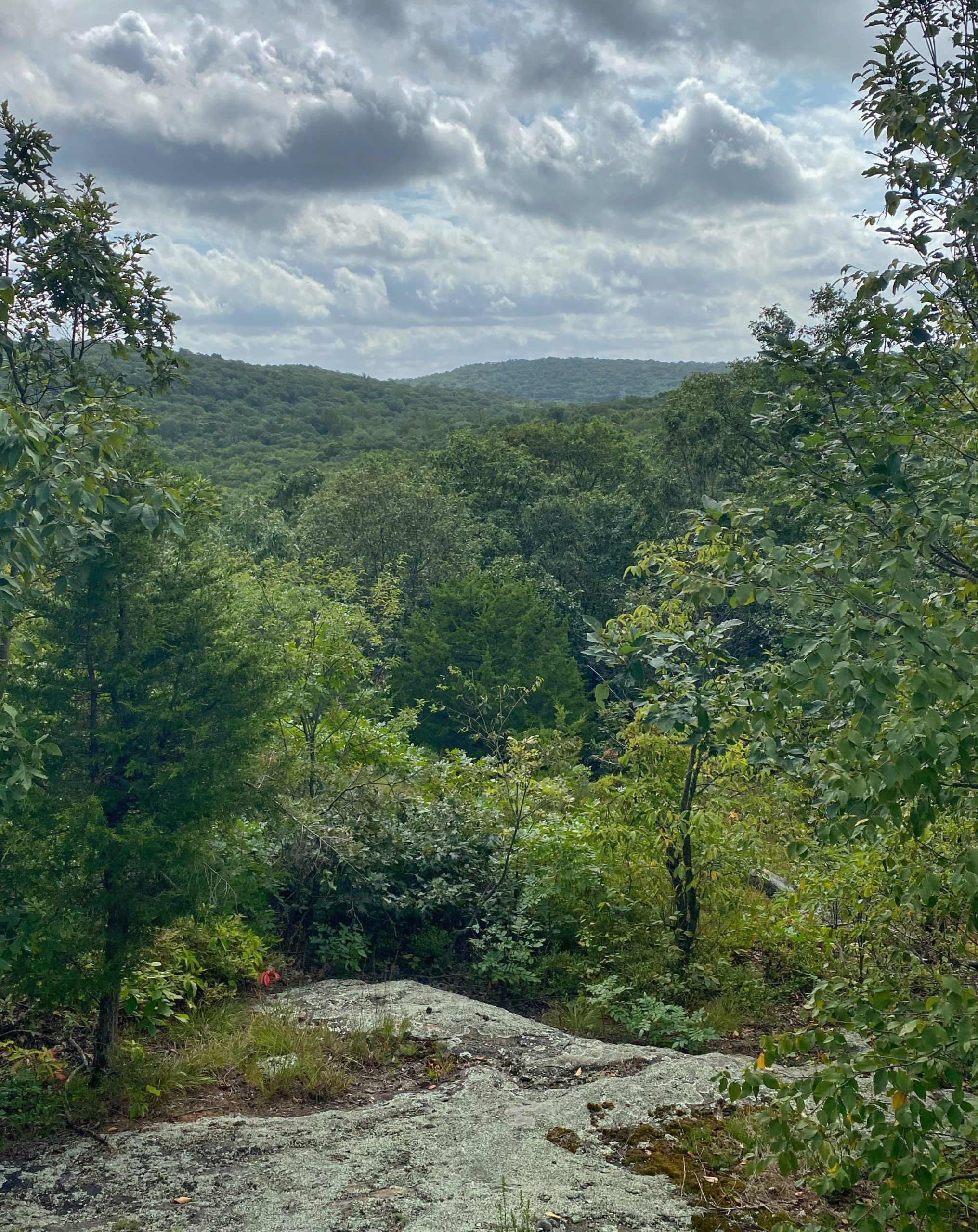
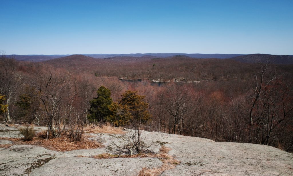
Most of the best views along the Stonetown Circular Trail are near the start of the hike on Little Windbeam and Windbeam Mountain. Keep an eye out to both sides of the trail for unmarked side trails and clearings that will provide great views.

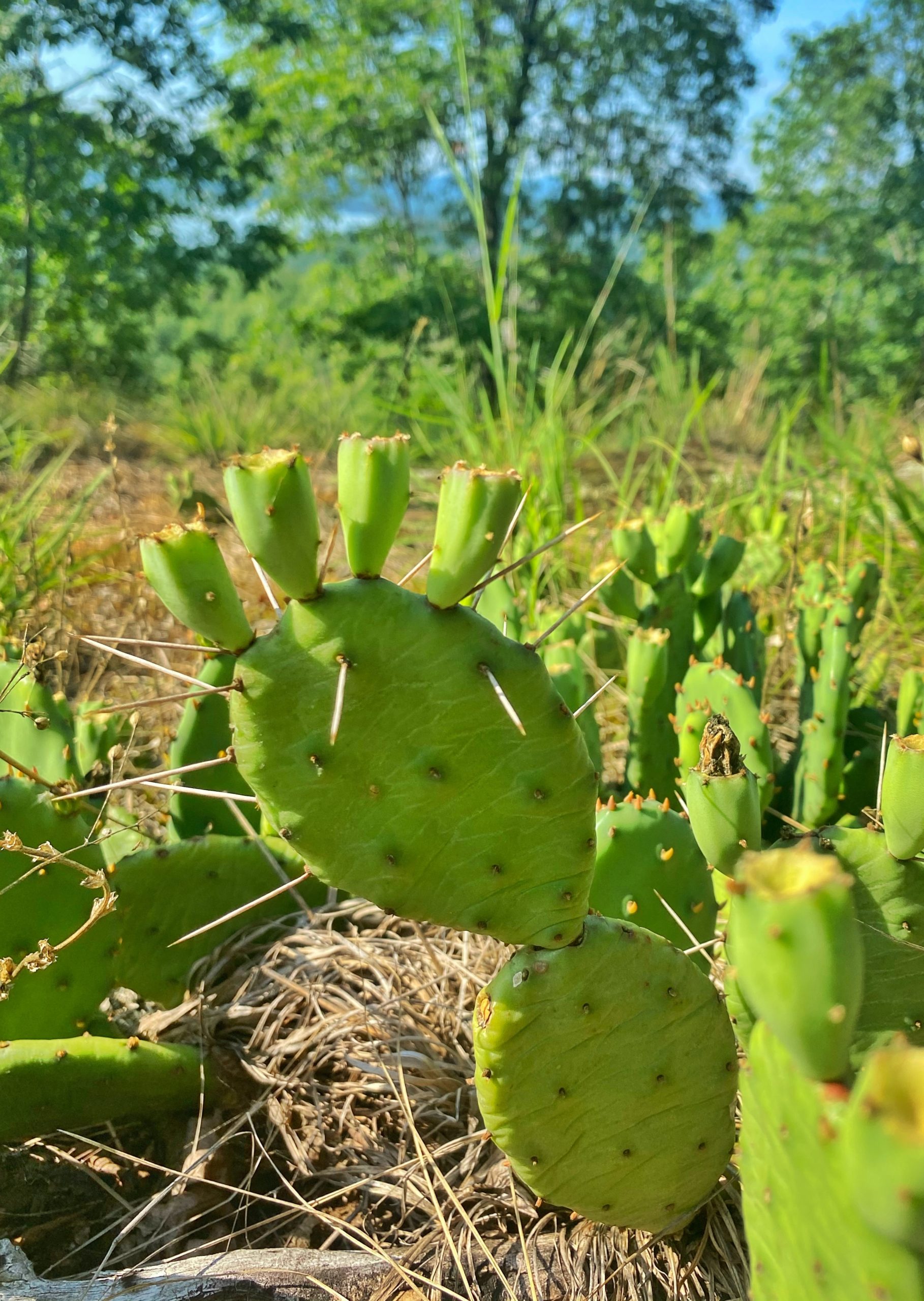
To the right off the trail is a faint path leading to a clearing that offers views to the south/southeast. The exposed area provides a good habitat where you’ll find Prickly Pear cactus growing, so watch out for the thorns.
After Windbeam Mountain, you’ll climb Bear Mountain (no, not that one) followed by Board Mountain.
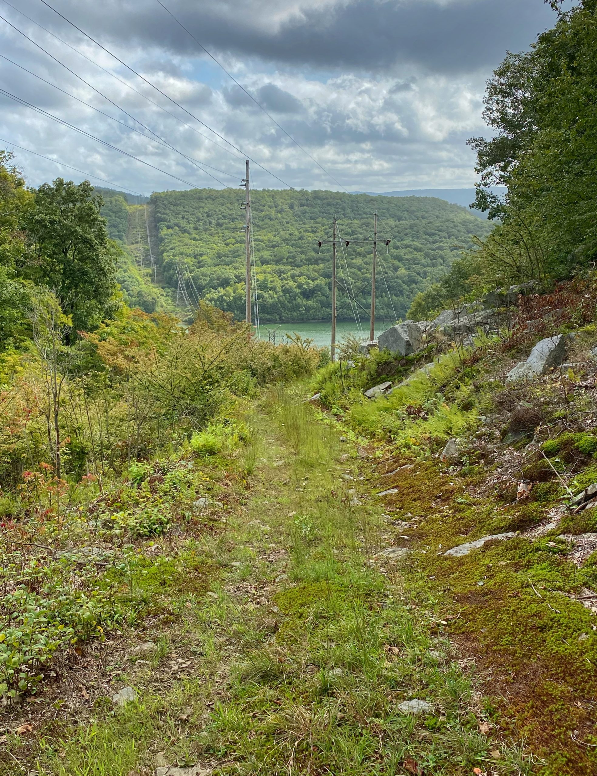
After Board, you’ve done the hardest part of the hike, but there’s still lots more climbing ahead. After you descend Board, you’ll eventually cross Stonetown Road then reenter the woods and follow a woods road. Pay attention – you will need to make a left into the woods while the woods road continues to skirt the reservoir and straight towards a power line cut.
The trail soon goes under the power line cut then reenters the woods and begins a climb up Harrison Mountain. At the top of Harrison Mountain, we will leave the Stonetown Circular Trail and follow the teal diamond-blazed Highlands Trail as it steeply descends and reaches a stream.
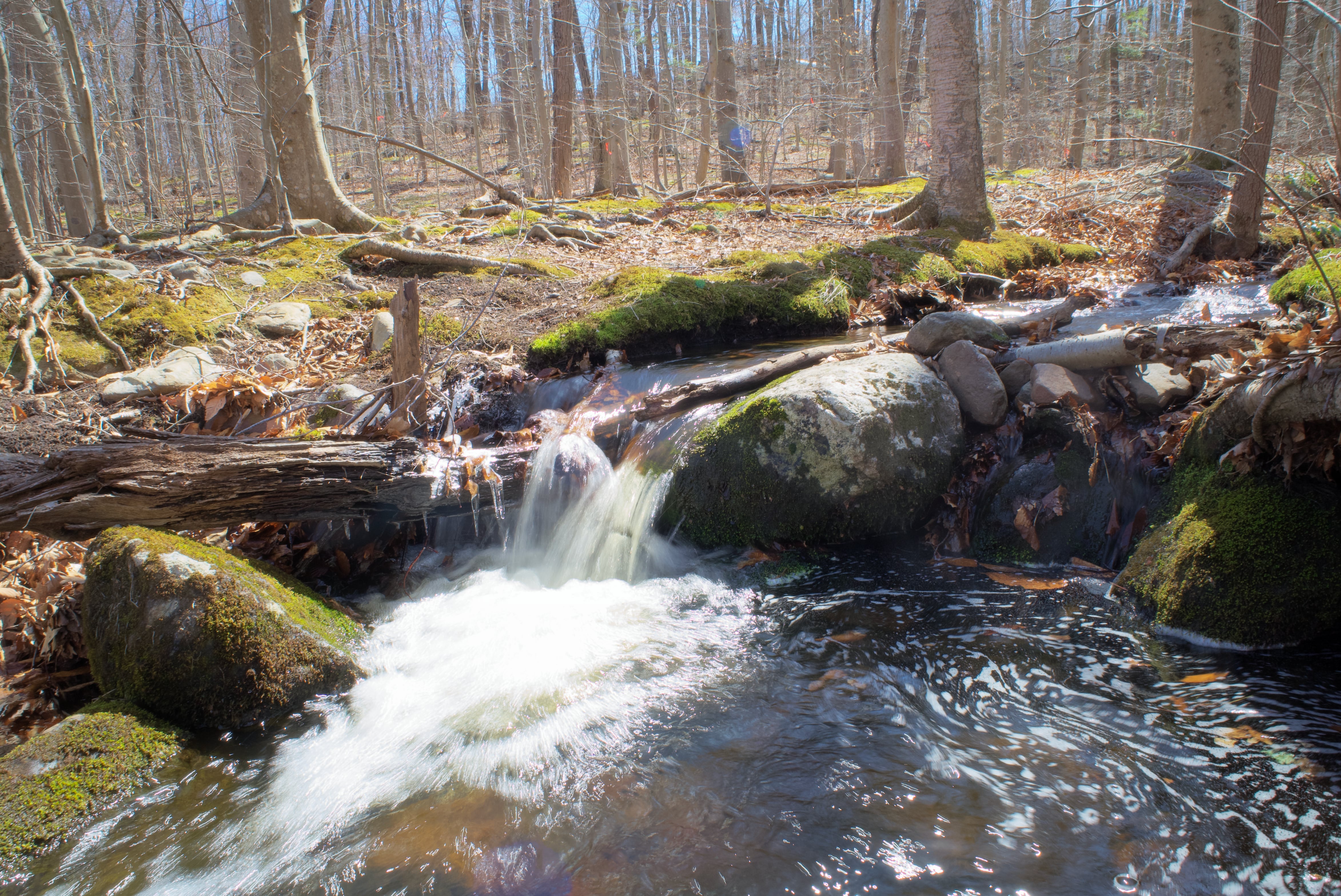
After crossing the stream with some small cascades, the trail begins to climb again, this time up Horse Pond Mountain. At the top, you’ll reach the junction with the green-blazed Burnt Meadow Trail.
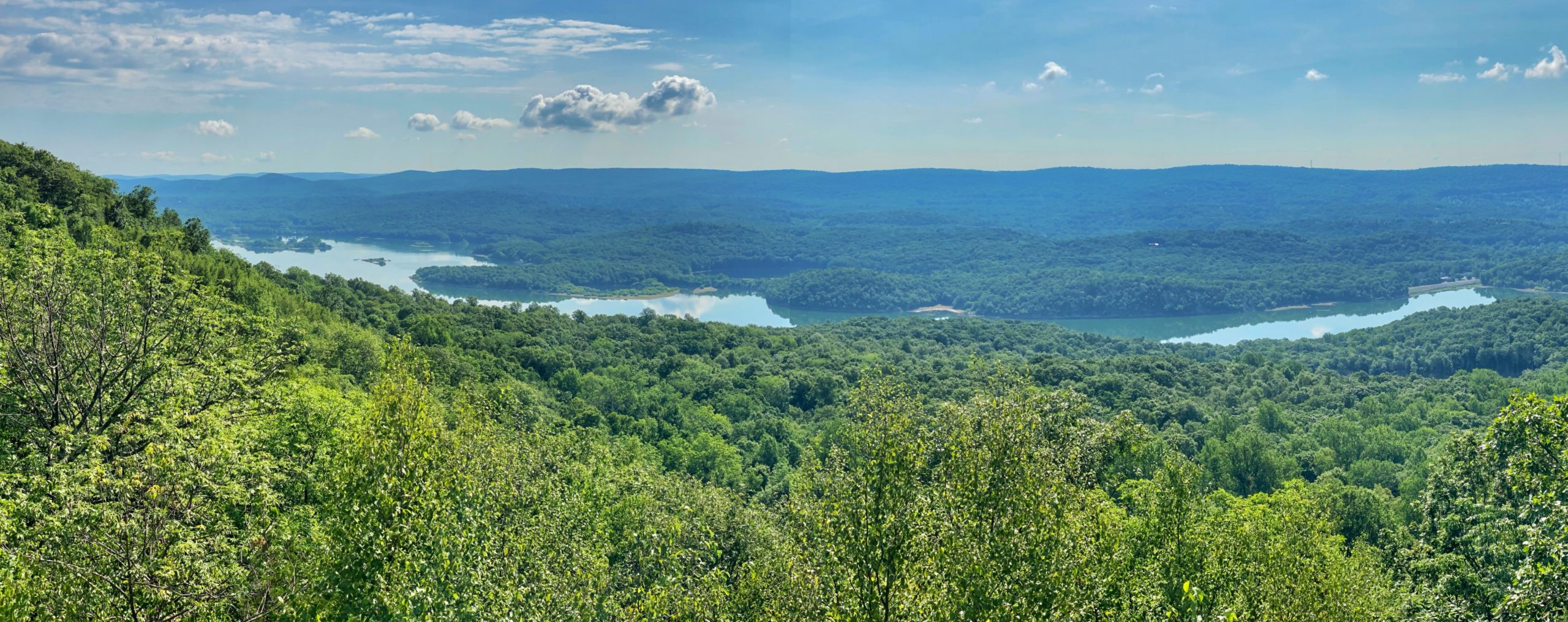
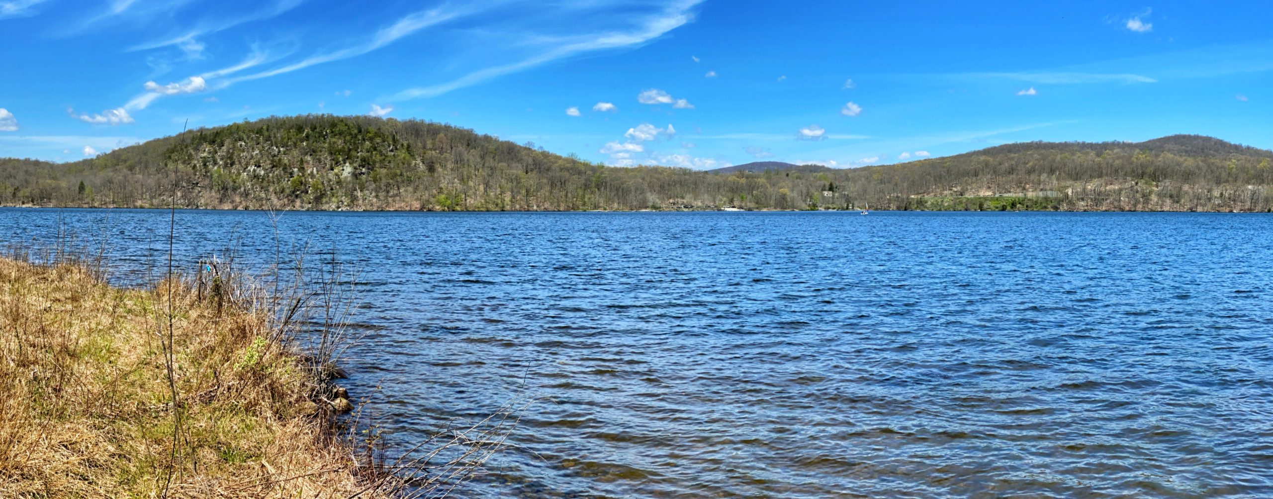
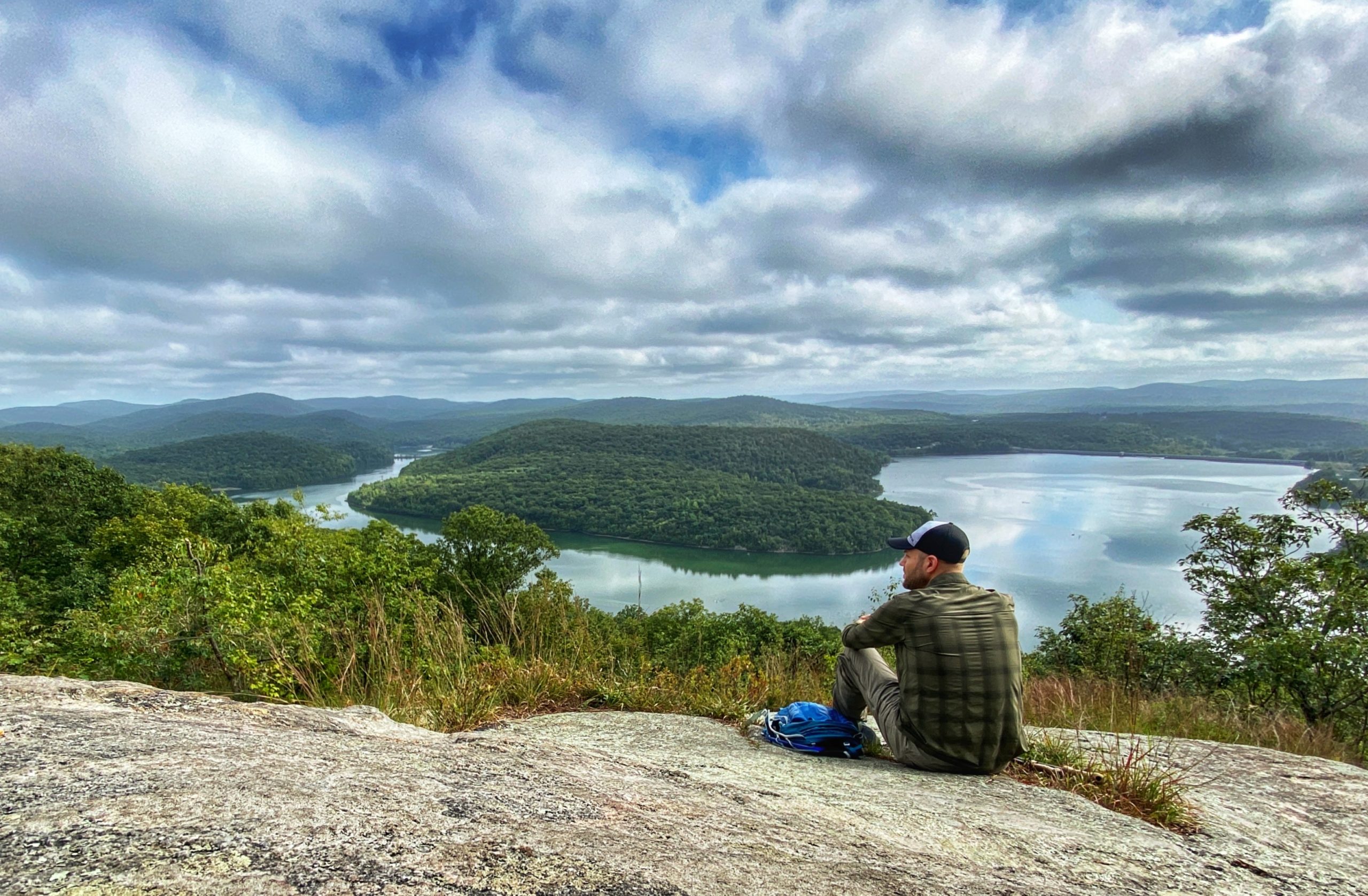
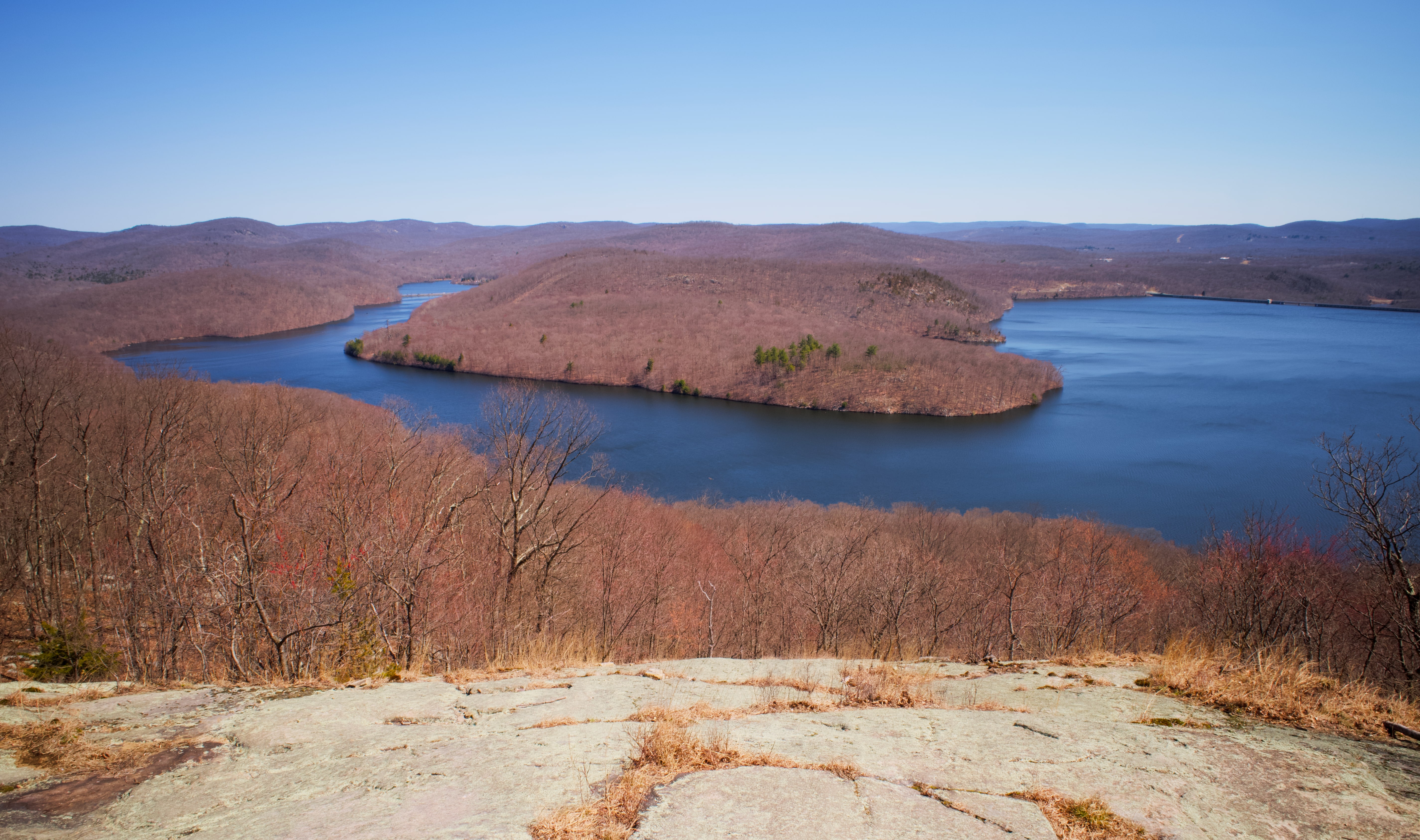
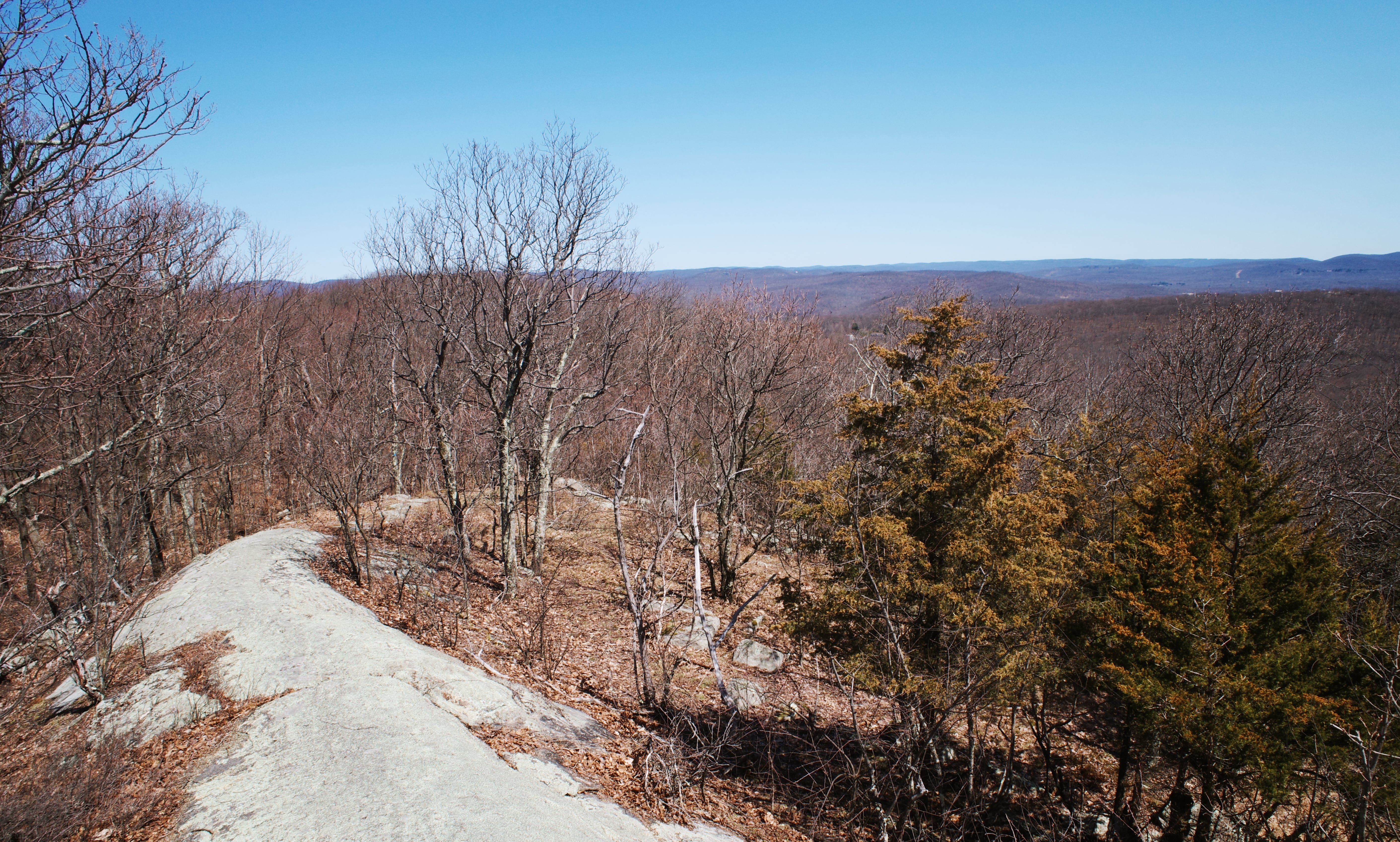
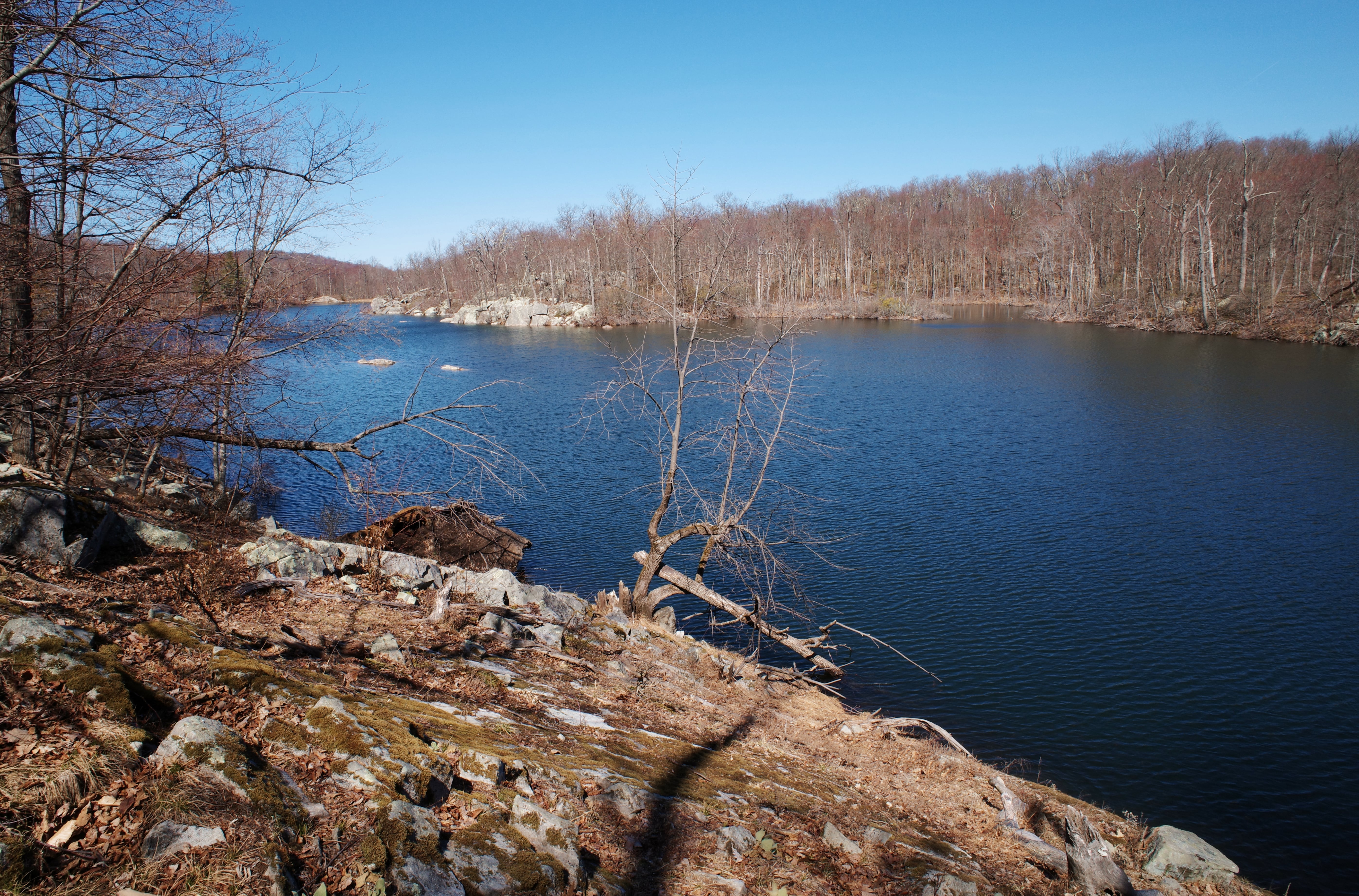
Continue a little further and you’ll reach an exposed clearing providing a spectacular view of the Monksville Reservoir and the Wyanokie Mountains, including Monks Mountain. This is one of the best views in the state. It’s a great spot to take break here and enjoy the view.
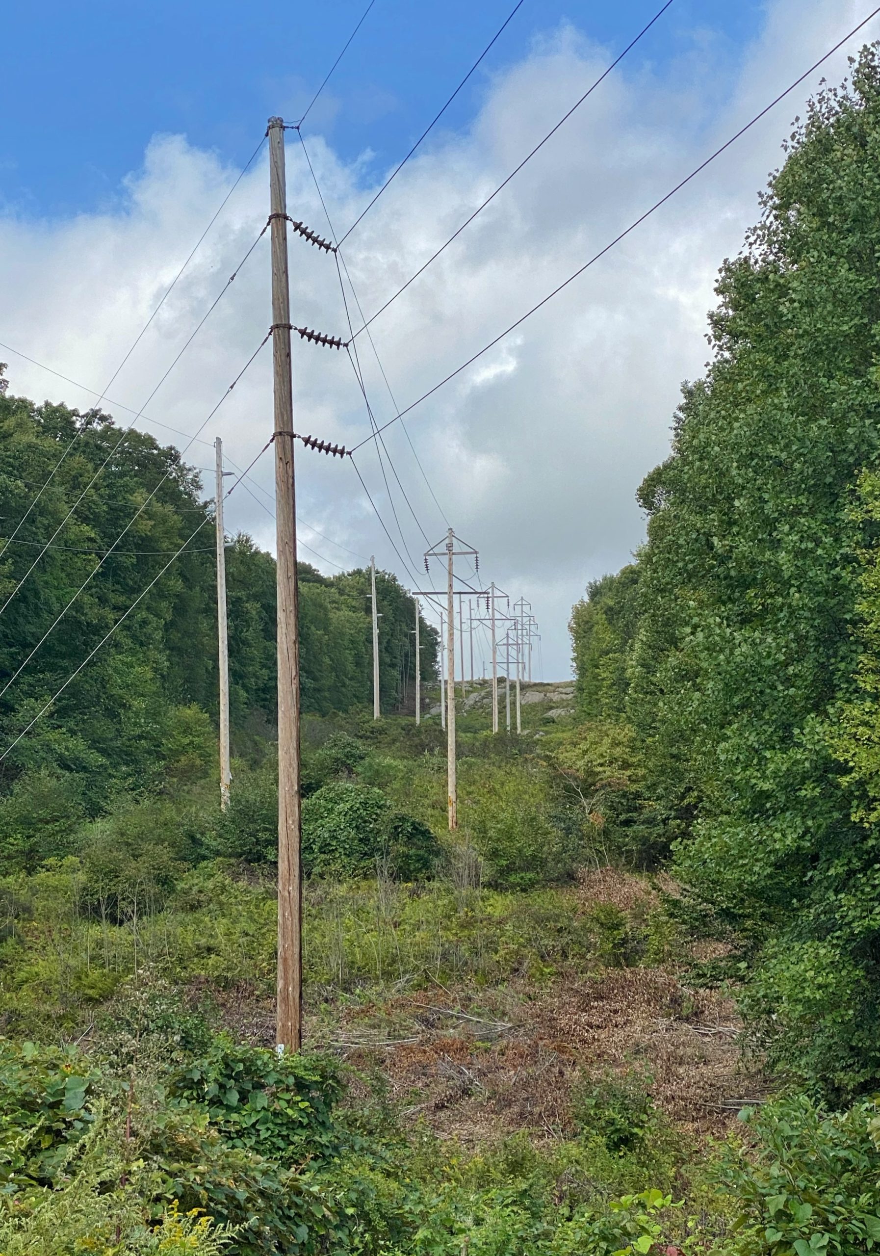
When you’re ready to continue, follow the teal and green blazes until just before you reach the power lines.
Power Lines on the Highlands Trail. If you got here, you went a bit too far.
If you reached the power lines, you went just a bit too far. Backtrack a few feet and then turn to continue to follow the green blazes to the west.
The trail now follows and is co-blazed with the blue Hewitt-Butler Trail and will descend through a valley.
You’ll soon cross Burnt Meadow Road. Upon crossing, the trail will parallel the power lines for a few hundred feet.
The trail now turns left away from the power line cut and reenters the woods, immediately crossing Hewitt Brook.
The trail now climbs Long Hill and reaches a junction where the Hewitt-Butler Trail and the Burnt Meadow Trail split. From this point, there is a partial view to the east.
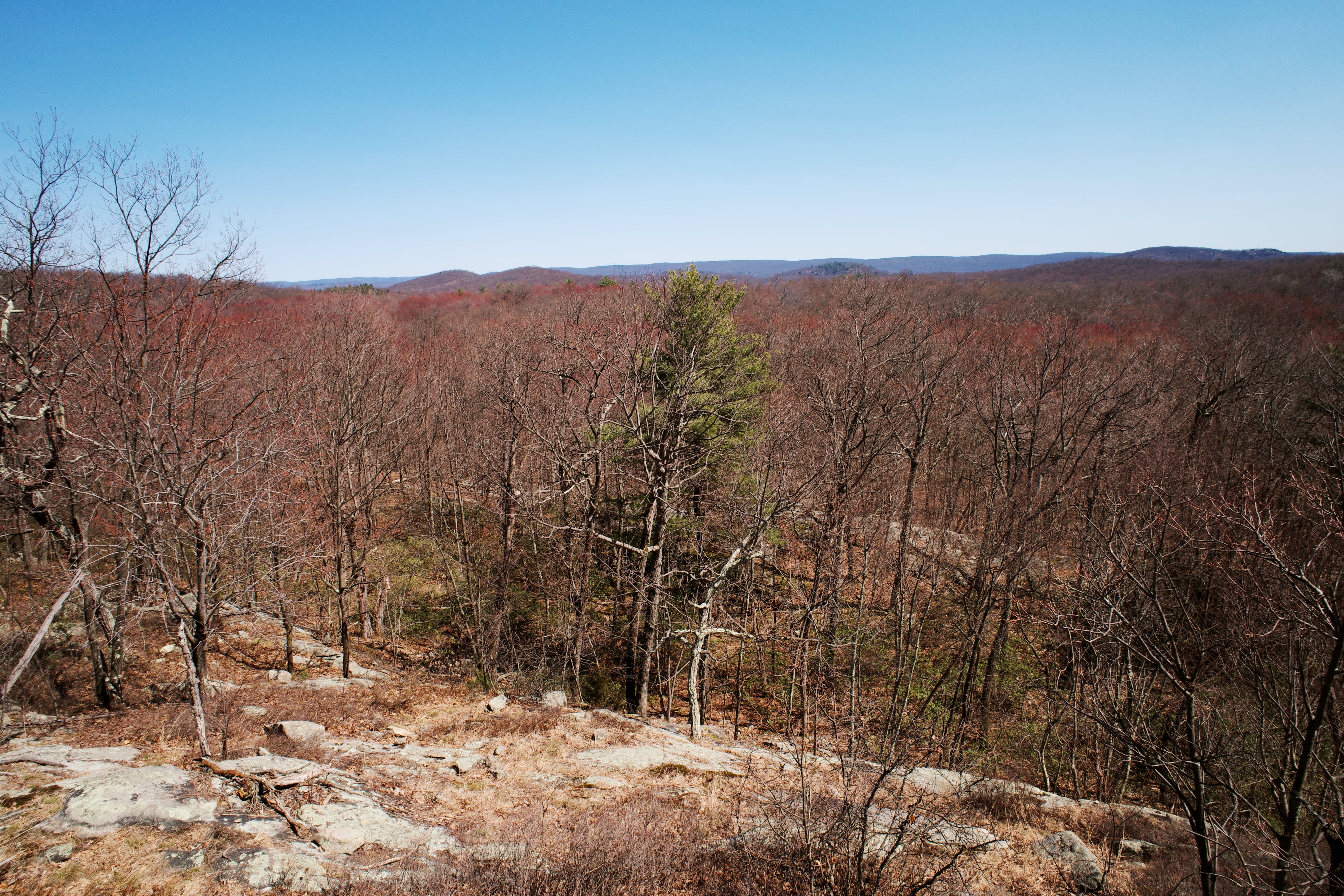
Turn right and follow the blue-blazed Hewitt-Butler Trail into the woods. The trail will climb and then reach a rock outcrop with views of the surrounding area.
Continue to follow the blue blazes along the ridge until you reach a junction with the white-blazed Overlook Rock Trail. Make a left to follow the white blazes. The trail descends and you’ll soon reach a partial viewpoint.
The trail continues to descend, then begins to climb as it reaches the junction with the orange-blazed Lake Sonoma Trail. Straight ahead at the junction is a rock outcropping – Overlook Rock – with great views to the east.
Head back to the trail and follow the yellow blazes north. You’ll soon cross a stream that feeds Sonoma Lake.
Here, the yellow Overlook Trail now becomes co-blazed with the orange-blazed Lake Sonoma Trail. Follow the yellow and orange blazes, and you’ll soon reach two viewpoints from the south side of Lake Sonoma.
Follow the yellow and orange blazes until you reach a junction. Here, turn left (north) to follow the orange blazes. The trail climbs a hill and then descends. You’ll reach Burnt Meadow Road, which marks the boundary of Norvin Green State Forest. Cross the road and look for the triangular red blazes to rejoin the Stonetown Circular Trail.
Next you’ll reach Tory Rocks with views of the hills to the west.
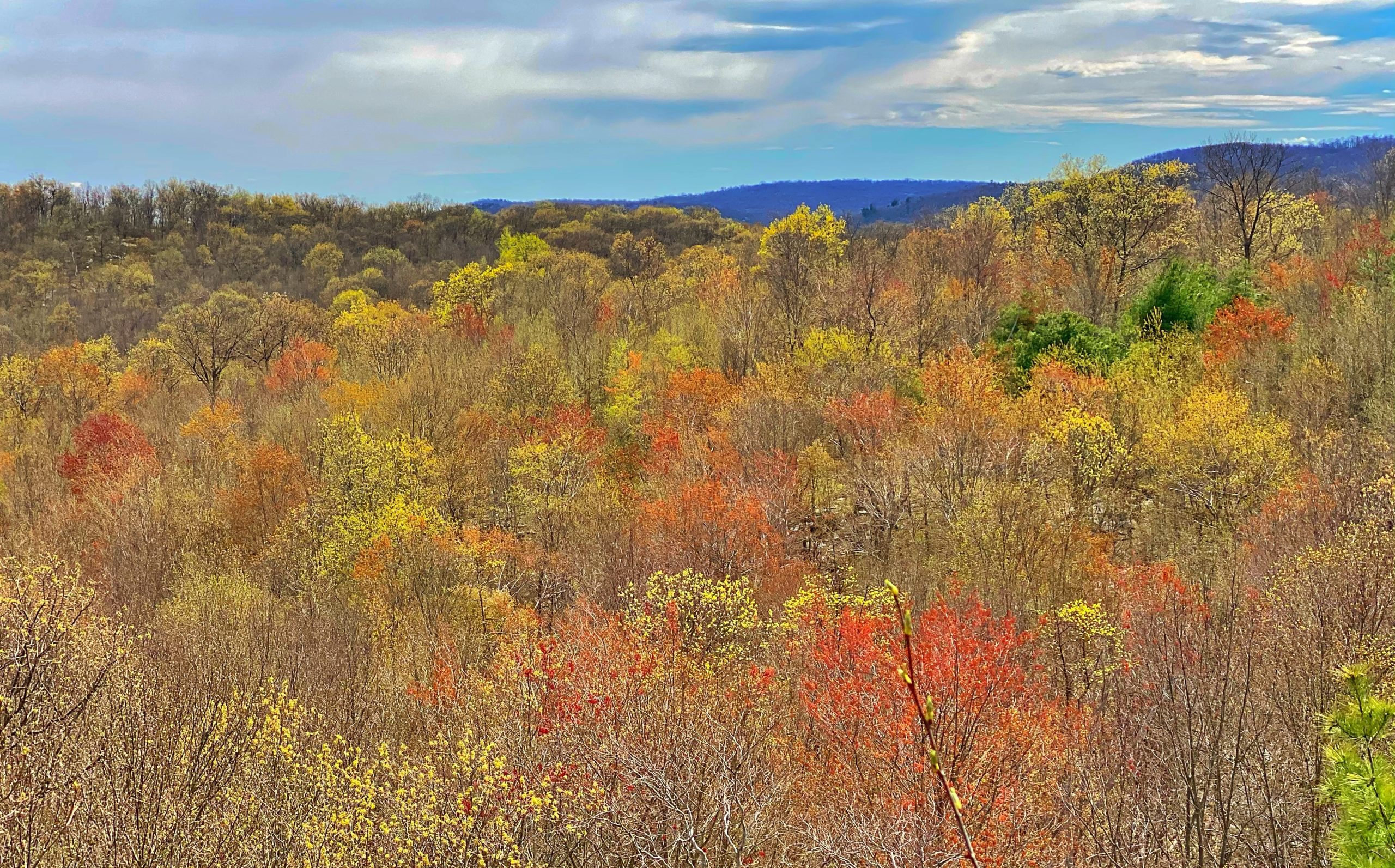
Continuing about a half mile further, the official trail will follow to the right at a fork with an unmarked parallel side trail, but if you stay to the left you’ll soon be rewarded with panoramic views to the east of the hills you climbed earlier in the day.

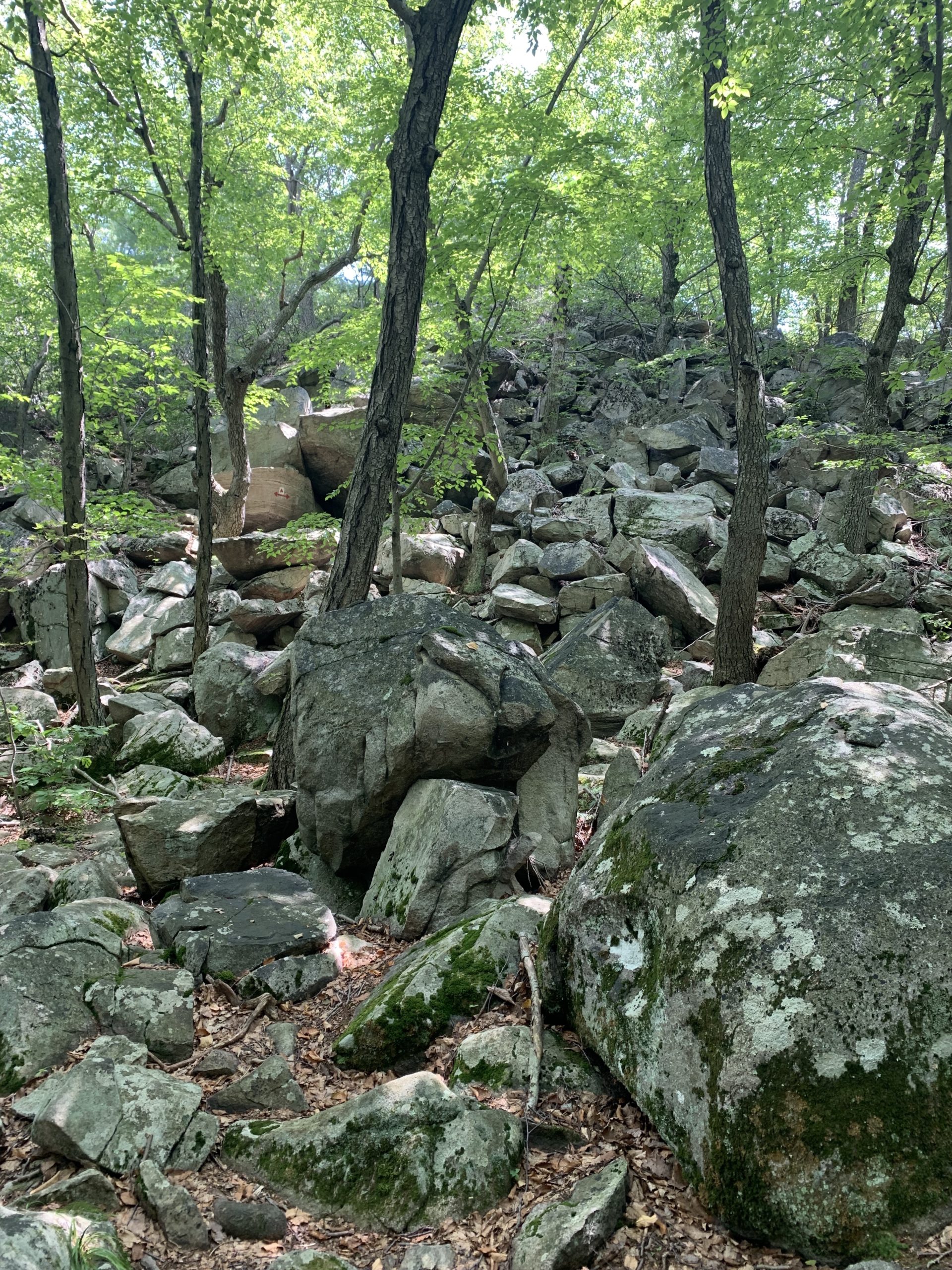
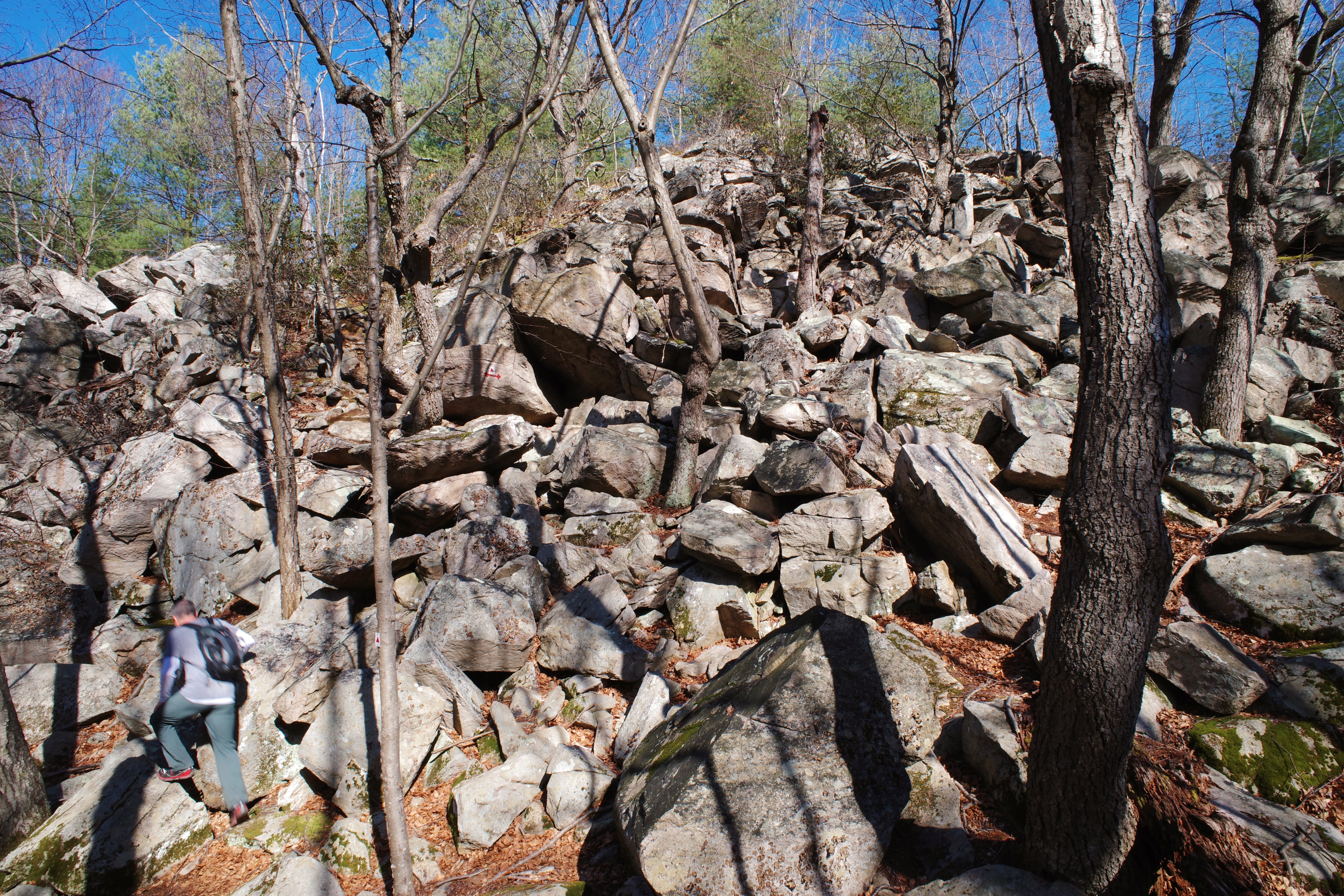
As you’re nearing the end of the trail, you’ll reach a pile of boulders that you’ll need to scramble up. Arrows on the rocks indicate that you can go left or right. Left is easier.
Finally, the trail ends at Magee Road near a house. Turn left and follow Magee Rd until it ends at Stonetown Rd. Walk along the shoulder of Stonetown Rd. back to the parking lot. The total roadwalk is about half a mile.


